Mt Tsuchi (599m), Takahagi City, Ibaraki Prefecture, Saturday, April 12, 2025

I wanted to do another hike on the Abukuma Plateau in northern Ibaraki, as it had been more than one year since my last visit. Looking at my guidebook, I found a suitable mountain north of the Hitachi Alps. The trail went up and down the same way, but I didn’t mind since the summit had an observation tower with an unobstructed view on the south side. It was also a long way to travel for a relatively short hike, but again, I was happy to explore a new place in a little-visited part of Japan. Finally, I could combine it with a visit to the nearby Hananuki Gorge with its suspended bridge and waterfalls.

For subscribers, read this Post on Hiking Around Tokyo for a better viewing experience and the latest updates

Hiking in the Abukuma Mountains

阿武隈高地

I’d ride the Hitachi limited express from Ueno to Mito, and there, switch to a share car since no buses ran to the start of the hike. I’d drive along the Green Furusato line, allowing me to stop for a pre-hike soba lunch at Iriyoma. For the return, I’d use the faster Joban Expressway. While waiting for the train for Ueno, I could sample some local sake inside Mito station. The weather was supposed to be sunny but cooler than Tokyo, 100km to the south. Looking at online reports, I saw that it had snowed there less than 3 weeks ago, and so I wondered if by now the new green of spring had arrived.

Find Japan Hiking Maps on Japanwilds and subscribe to our newsletter

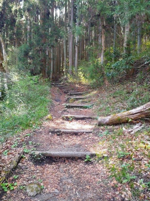
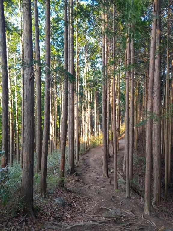
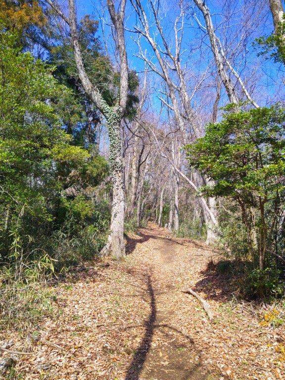
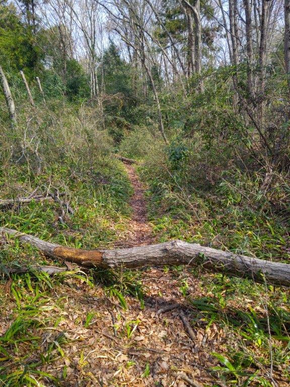
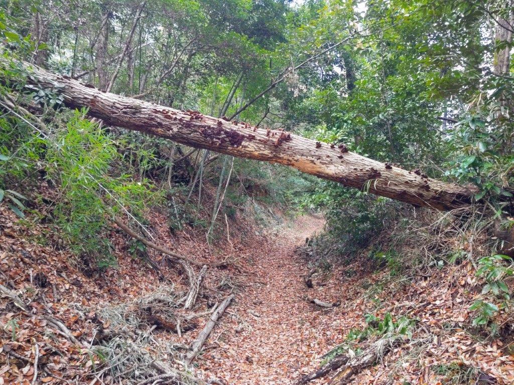
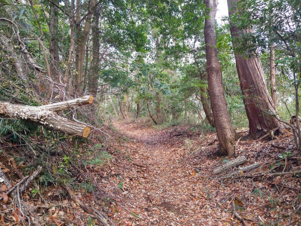
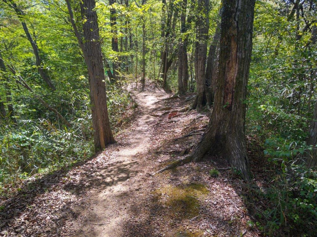
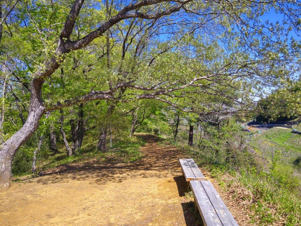
Start of the Hike (left) Entering the forest (right)

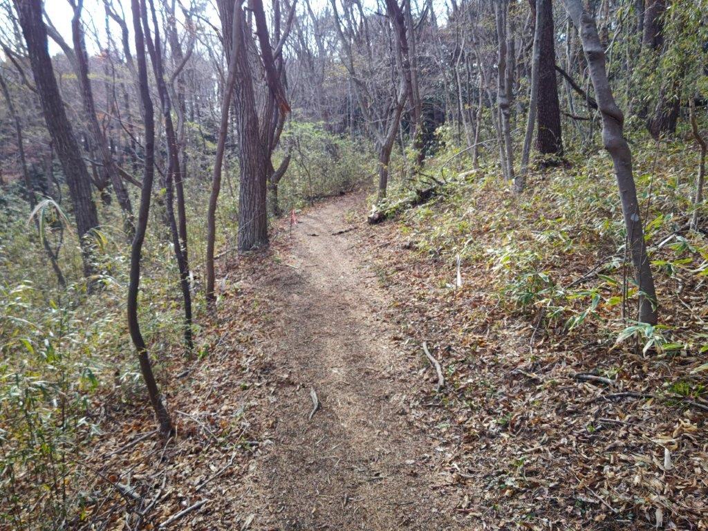
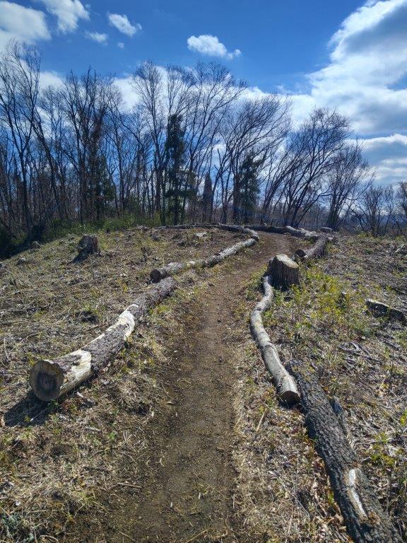
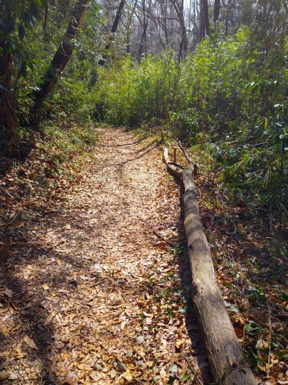
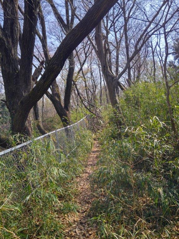
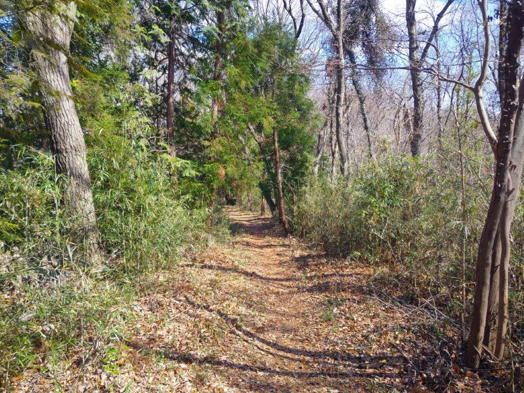
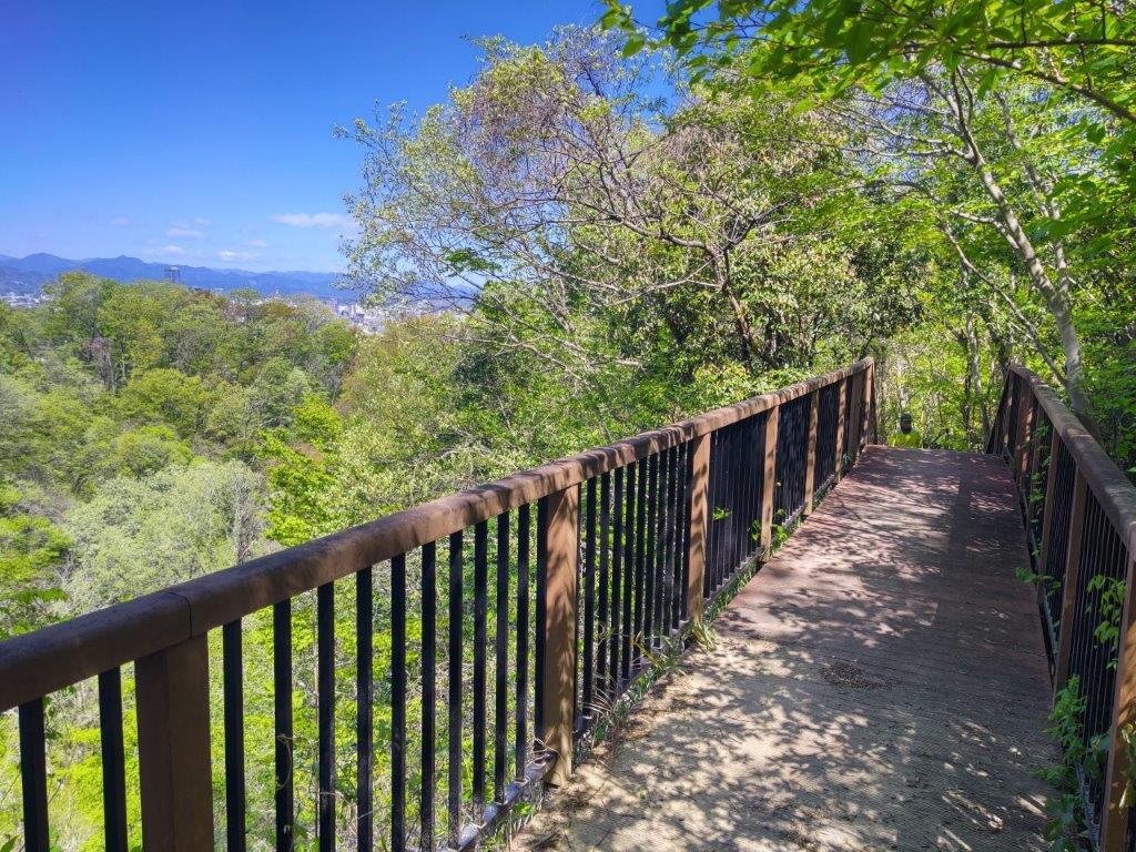
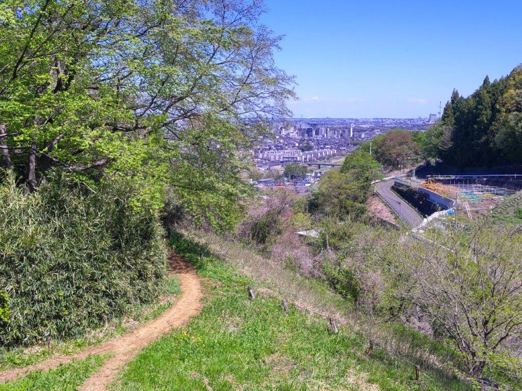
Walking the Top Ridge (left) Heading Down in the Late Afternoon (right)

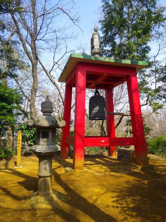
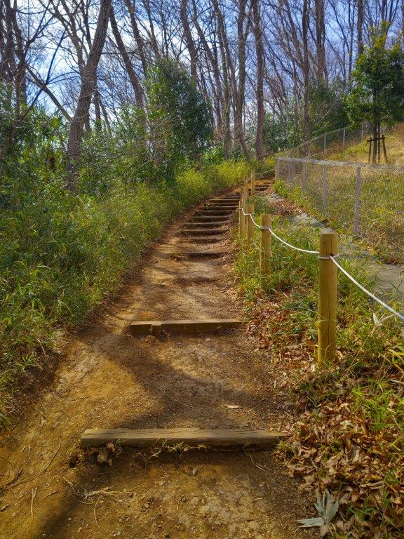
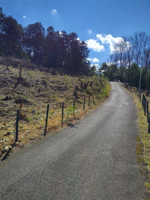
I arrived at the Iriyoma Soba around noon only to find out that there were ten groups ahead of me. While waiting, I popped over to the nearby Oiwa Shrine 御岩神社 to check out its 50-meter high, three-trunk giant cedar (see slideshow at the bottom of the post). I got back to the restaurant just as my name was being called, and after a satisfying meal of cold soba noodles and an enormous “kakiage“, I continued my drive, arriving at the parking for the free Kotakizawa Campground 小滝沢キャンプ場 at 2pm. Half an hour later, I started up a wide trail bathed in the early afternoon sunshine.

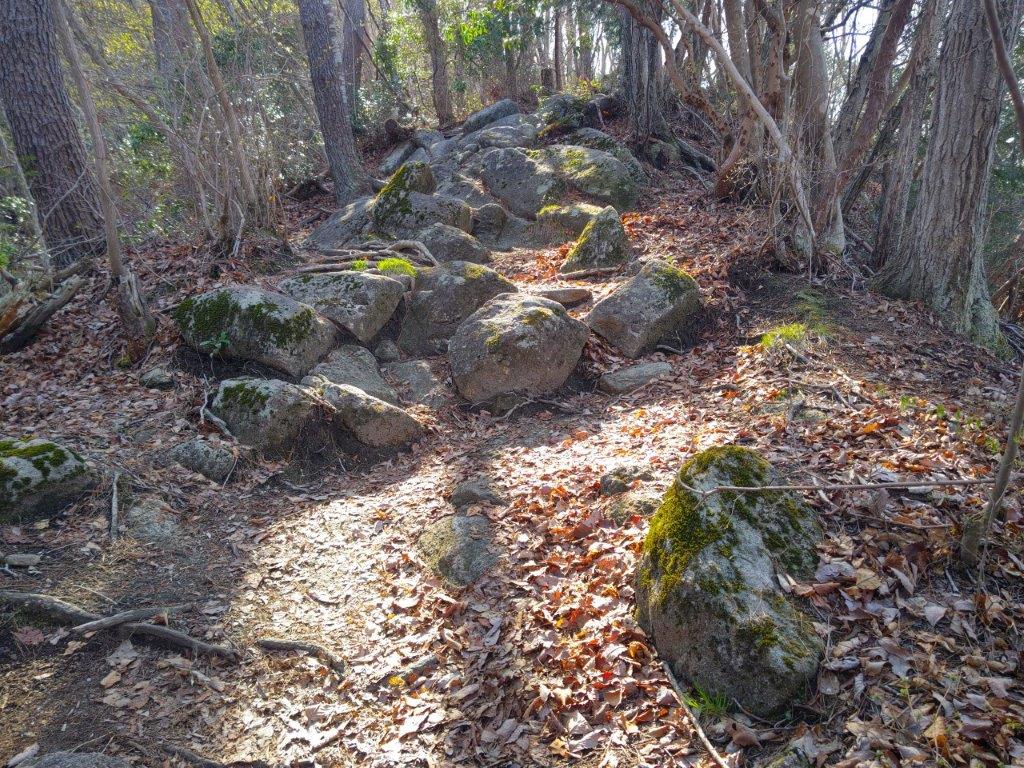
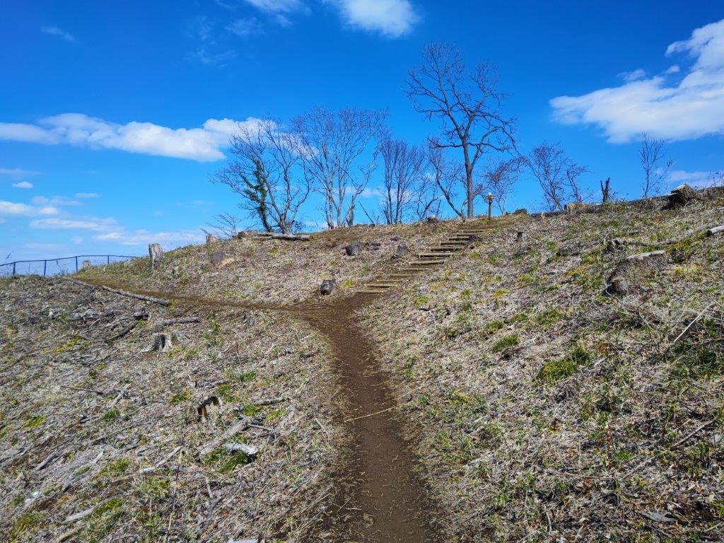
Midway up the Steep Climb in the First Half of the Hike

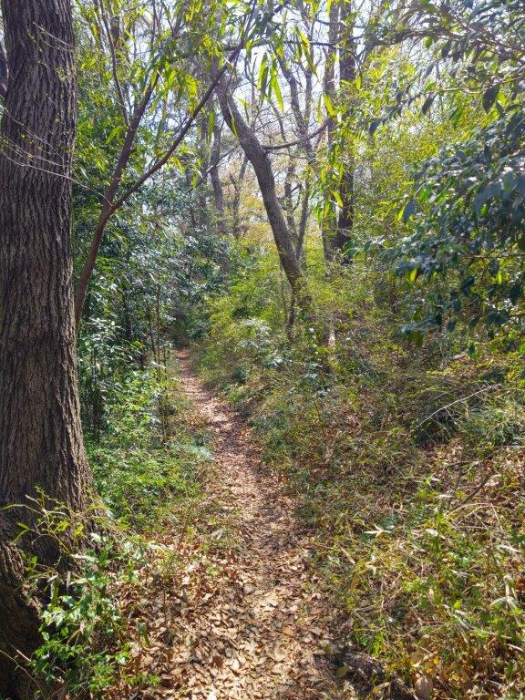
Trail past Nanatsuiwa

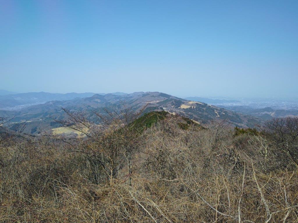
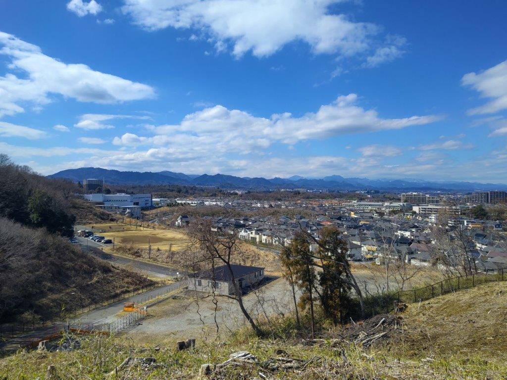
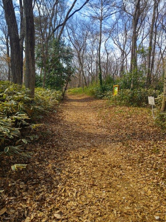
I soon entered a dark cedar forest, and after a couple of turns, reached the base of a steep, straight climb. I cautiously made my way over the huge rocks embedded into the higher part of the slope, one rocky bit even had an attached rope for safety. A little past 3pm, I reached the top ridge, from which point the path was mostly level, save for a short up and down section. I soon arrived at the turnoff for Nanatsuiwa (七ツ岩), a spot with several moss-covered boulders and a view on the east side of Takahagi city and the Pacific ocean through the still bare tree branches.

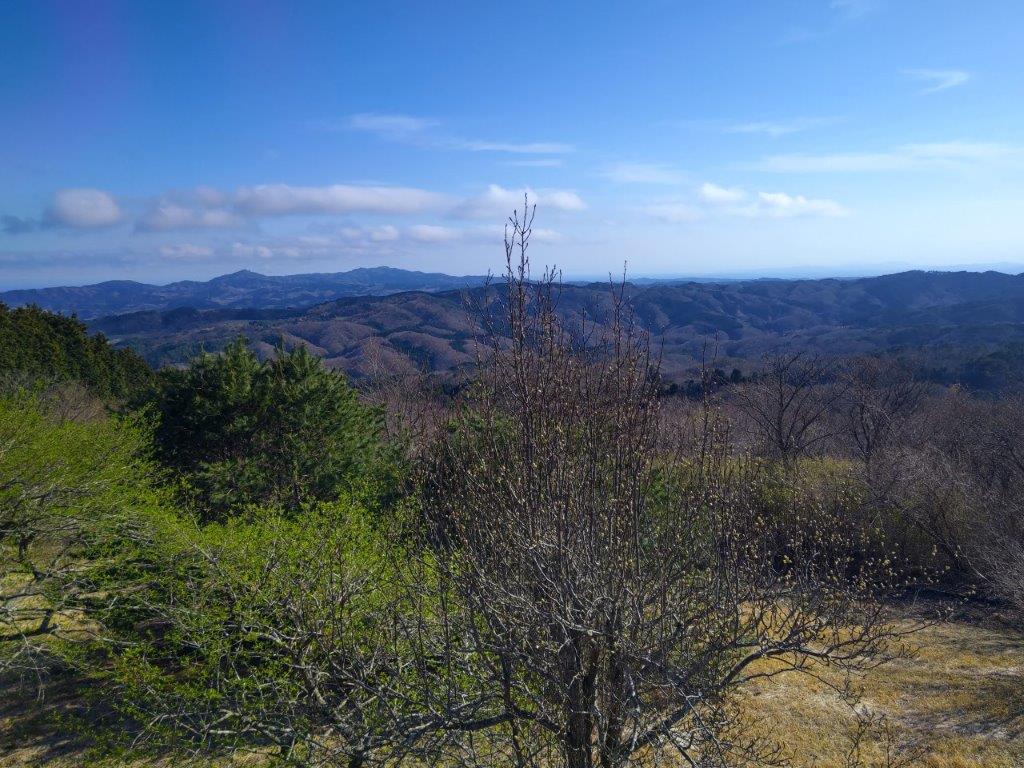
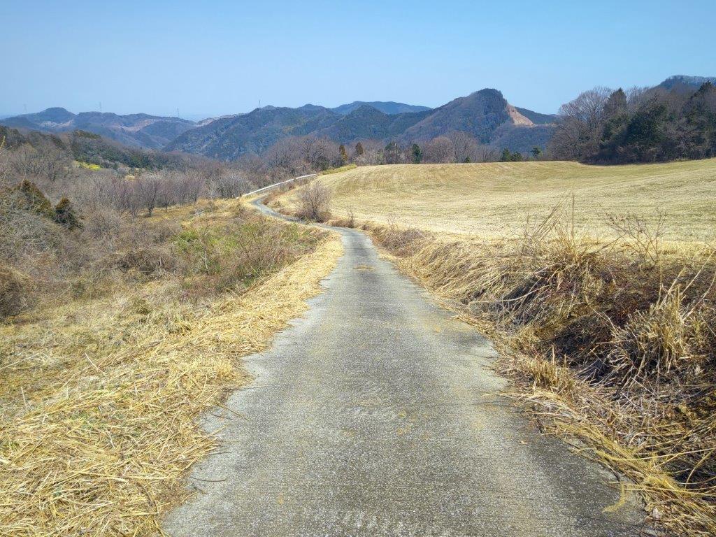
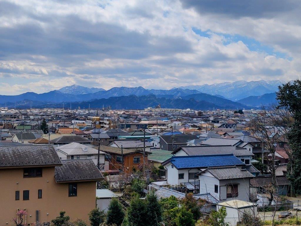
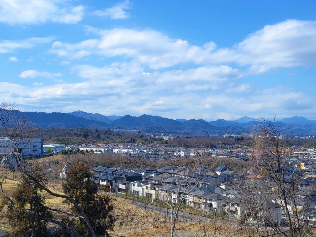
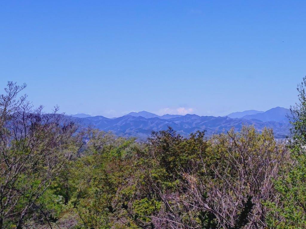
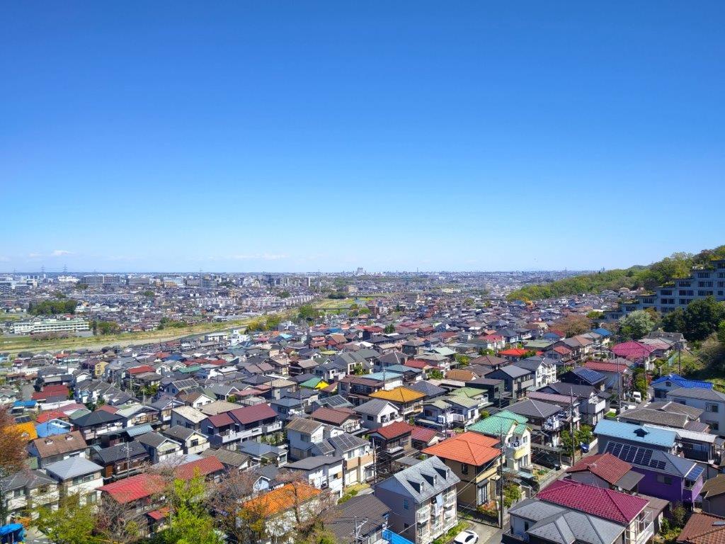
View South of the Hitachi Alps (left) and Mt Tsukuba (right)

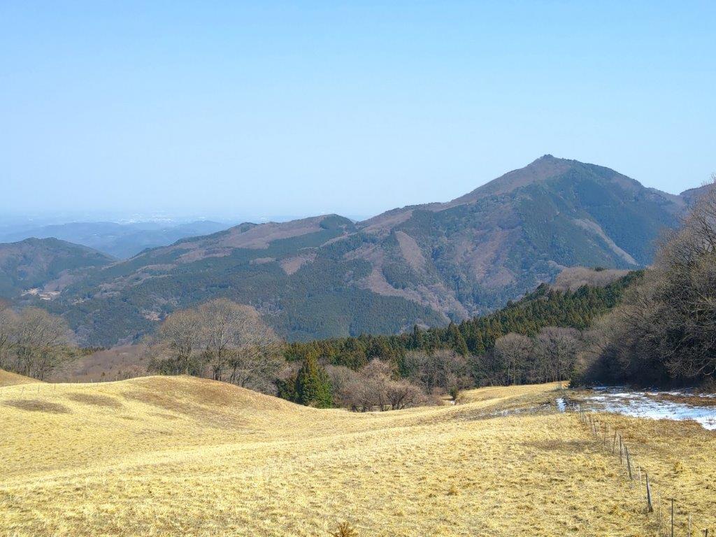
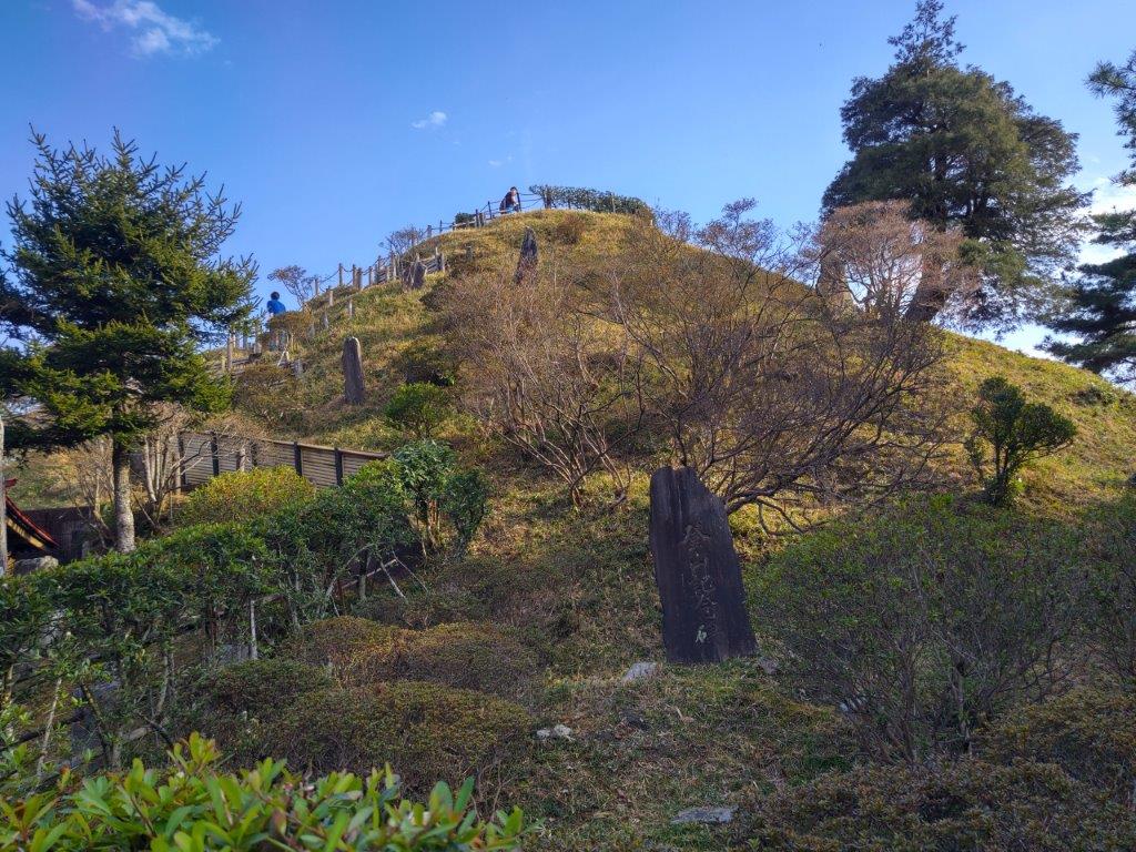
Mt Tatsuware, a 100 Famous Mountain of Kanto

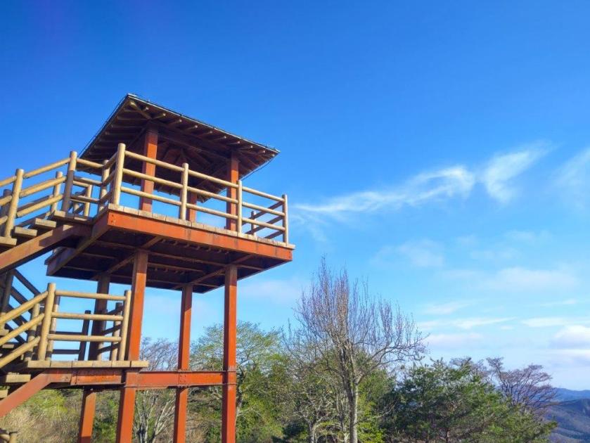
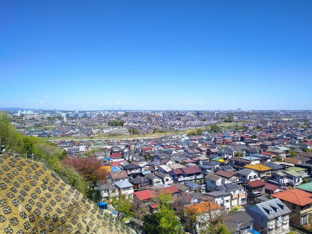
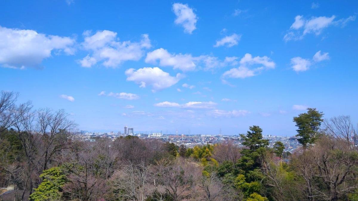
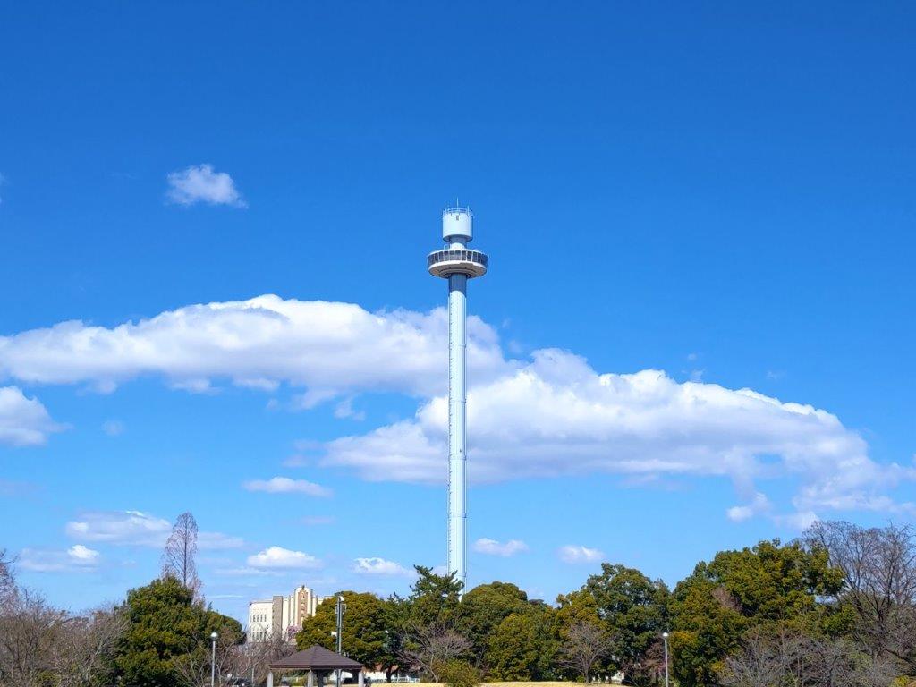
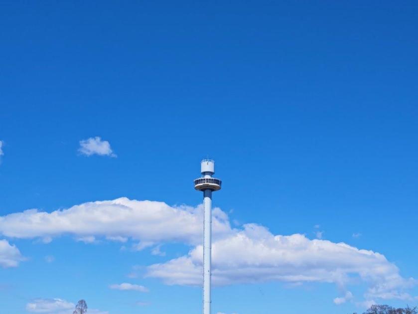
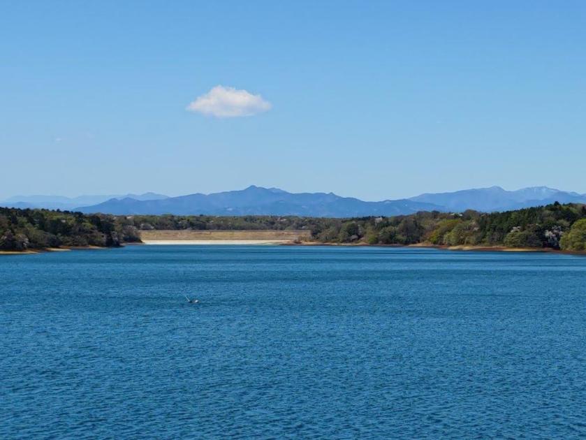
Shortly past 3h30, I arrived at the fairly new-looking observation tower on the summit of Mt Tsuichi (土岳 つちだけ tsuichidake), meaning Mt Dirt, although the summit was mostly lawn grass, with several pine trees blocking the view on the north side. To the south I could see Mt Kamine, as well as Mt Takasazu with its TV antennas, 2 prominent peaks of the Hitachi Alps; nearby, on the west side, was the long flat summit of Mt Tatsuware; in between and much further away, I could just make out Mt Tsukuba, nearly lost in the haze. According to the signboard near the summit marker, with the right conditions, one can see the Nikko Mountains, Mt Adatara, Mt Bandai and even Mt Fuji.

Mt Kamine (left) & Mt Takasuzu (right)

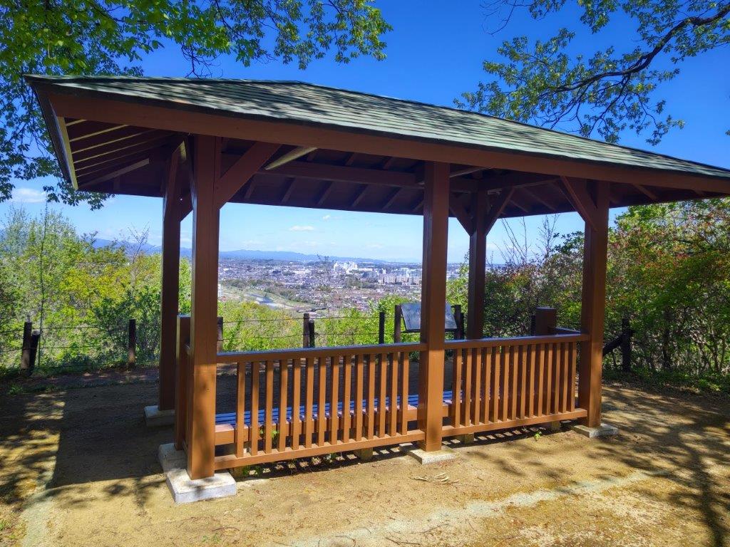
Observation Tower at the Top of Mt Tsuichi

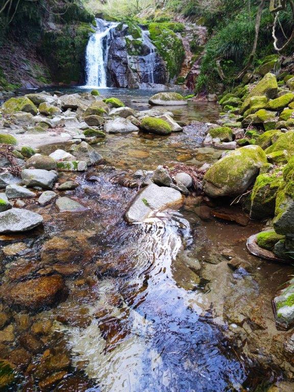
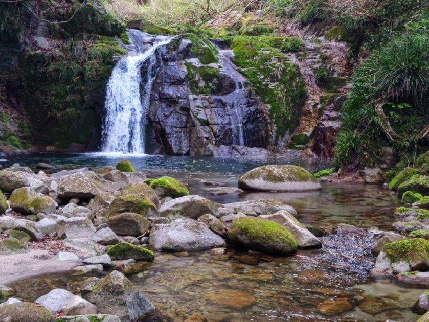
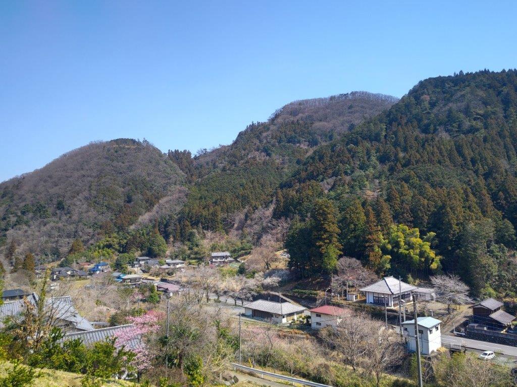
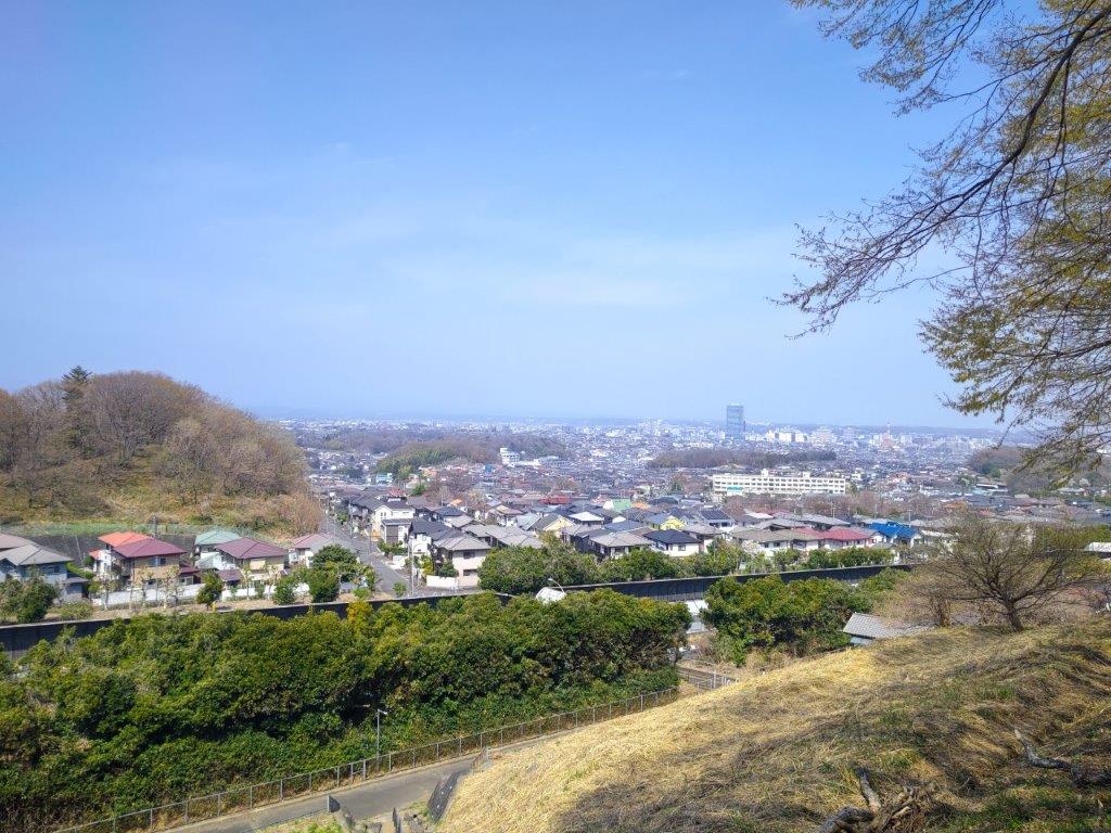
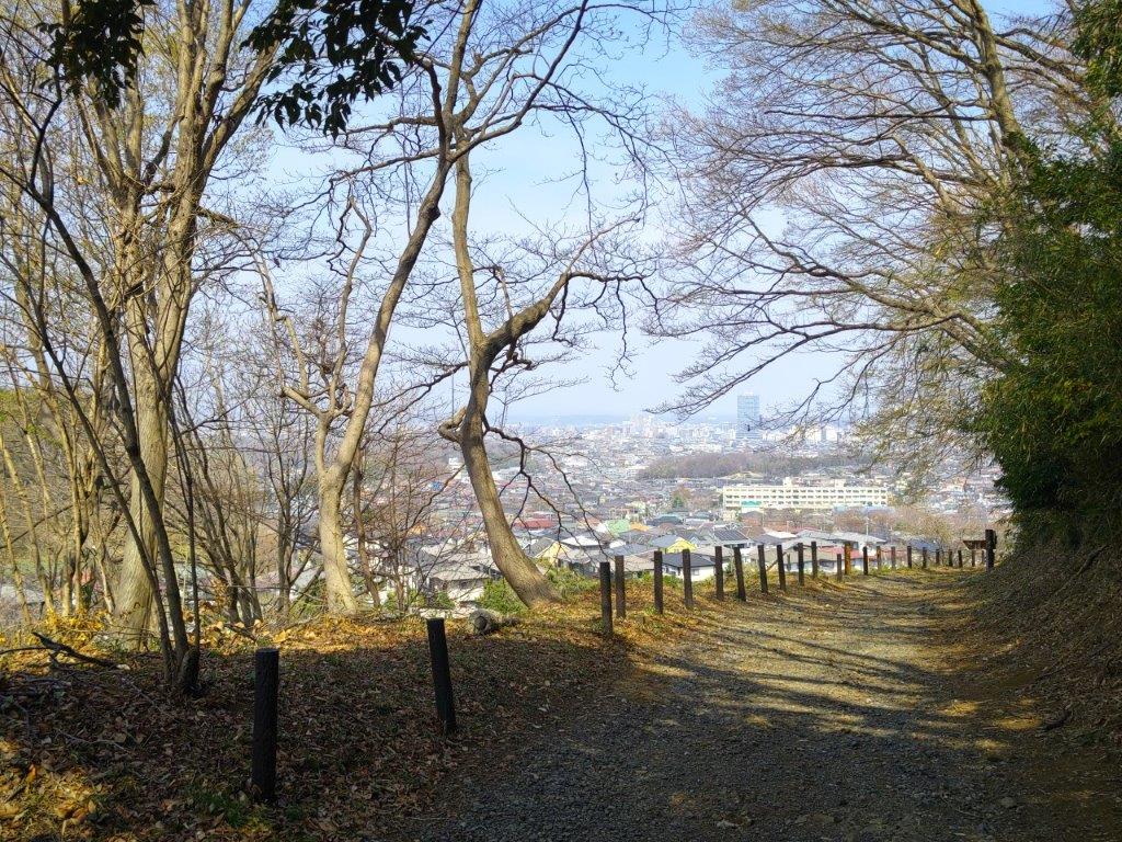
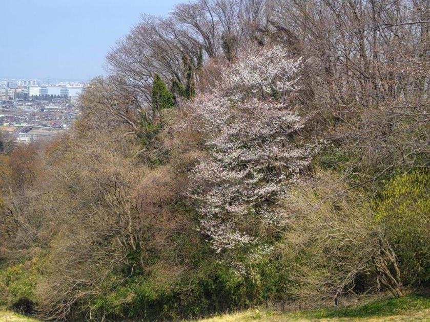
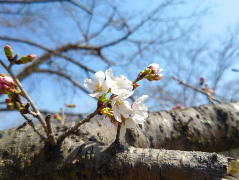
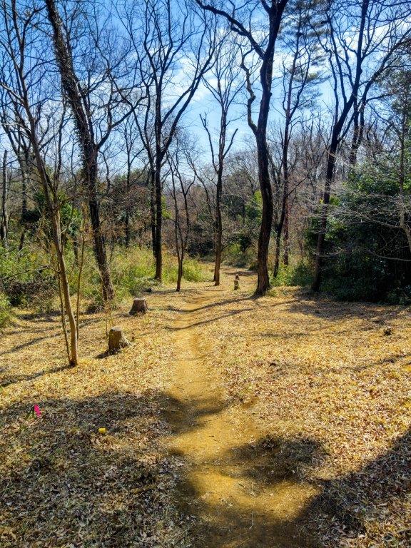
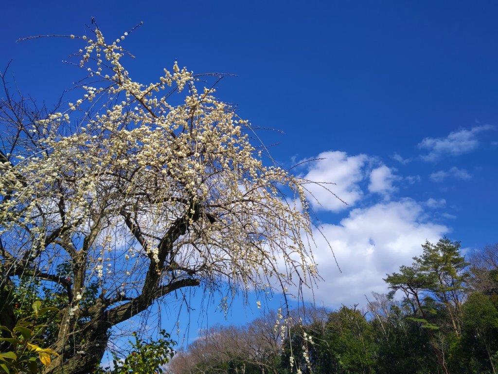
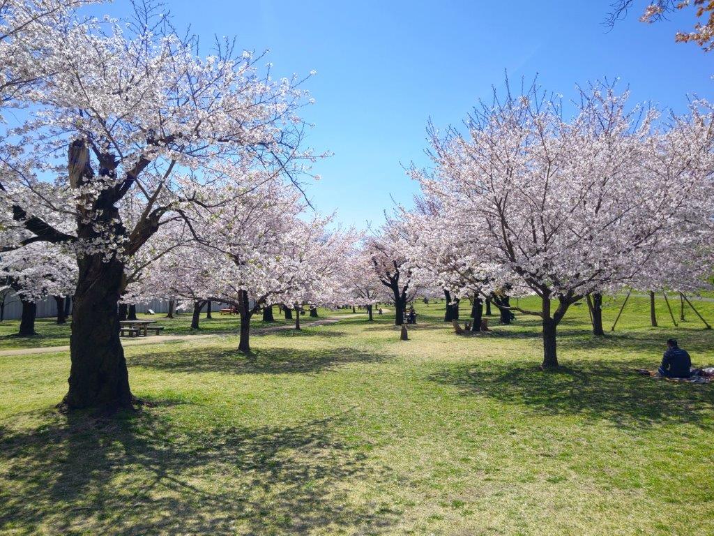
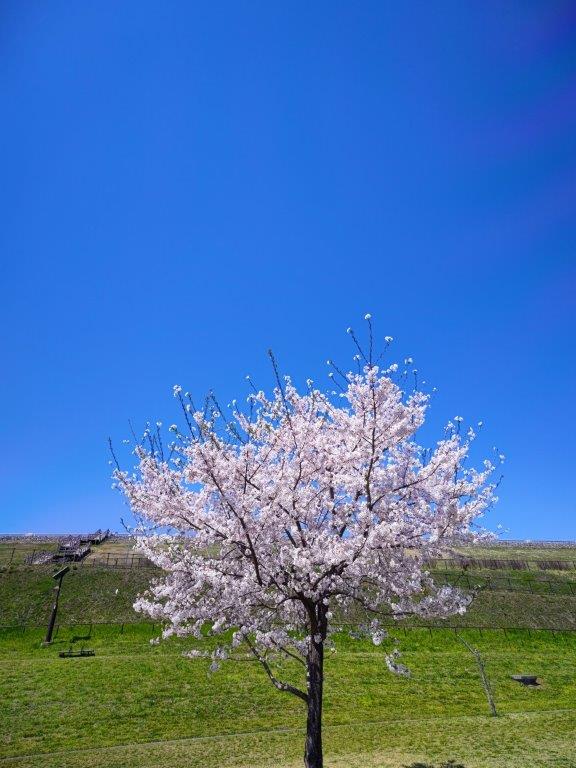
At 4pm, I headed back, enjoying the soft late afternoon light still reaching the summit ridge through the leafless trees. The new green hadn’t arrived yet but the silver lining was that I was mostly in the sun on a slightly cold day and had glimpses of the views in other directions. During the steep descent, I happened to notice a group of small white flowers, Nippon Bells (イワウチワ) which I had missed on the way up. At the base of the slope, I was suddenly plunged into the shade, the sun now too low for it to reach the valley bottom. At 5pm, I was back at the campground parking, and after a short drive, reached the Hananuki Gorge (花貫渓谷) parking area, with a superb sakura tree in full bloom in one corner.

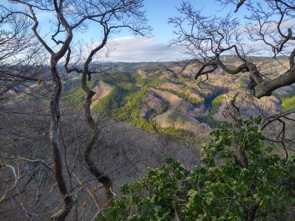
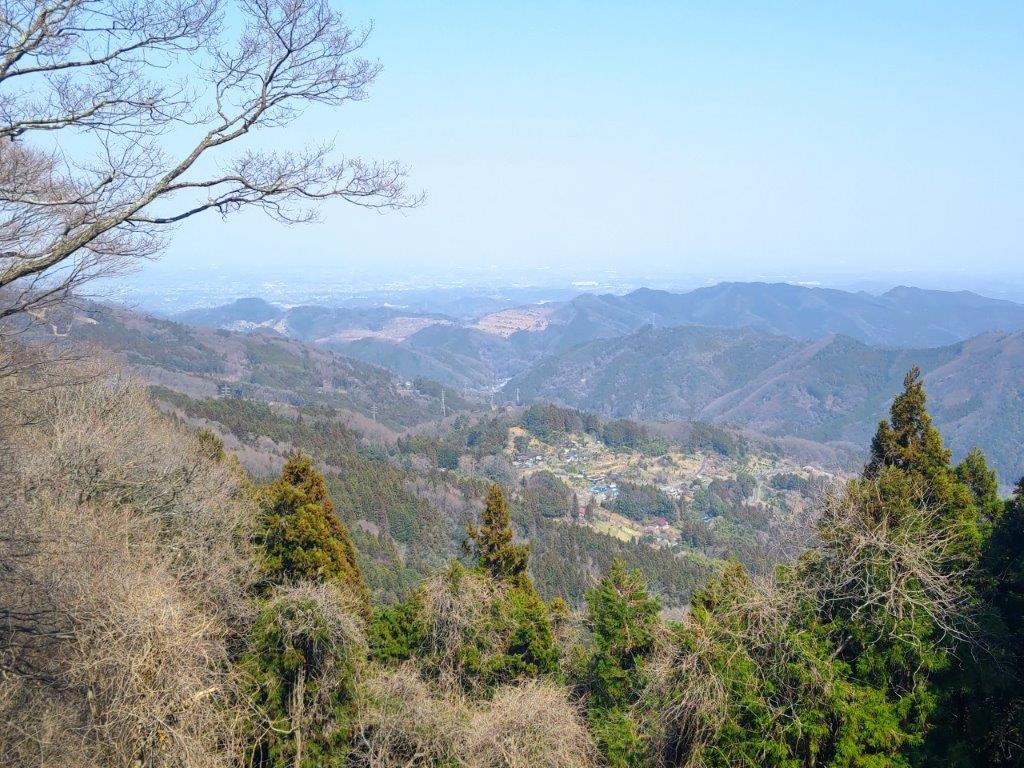
View North Between the Trees

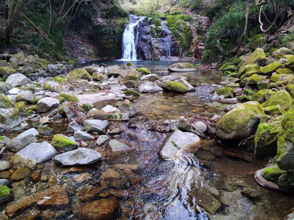
Otome Falls in Hananuki Gorge

I made my way to the small path along Hatanuki River, the only visitor at this late hour. I first passed Fudo Falls (不動滝), before arriving at the bigger Otome Falls (乙女滝). After enjoying the sight of the falls surrounded by moss-covered rocks, I made my way back to my car. After a one-hour drive, I was back at Mito station where I had half an hour to check out various Ibaraki Japanese sake using a coin operated “sake server”. At 7h30pm, I boarded the Hitachi Limited Express for the 80-minute ride back to Tokyo.

Watch a Video of the Hike

Watch the Video of the Hike on YouTube

See a Slideshow of More Pictures of the Hike

Mt Ogiri (766m), Higashi-chichibu & Chichibu Cities, Saitama Prefecture, Sunday, March 23, 2025

I wanted to do another hike in Higashi-Chichibu, as my previous hike there a few months ago had reminded me of what a great place it was for hiking. Looking at my map, I saw I could traverse from eastern to central Chichibu, passing by a peak climbed some years ago. The middle part of my planned hike followed the Kanto Fureai no Michi, as well as the Outer Chichibu 7 Peaks Traverse Hiking Trail, meaning the trail would be easy to follow. It had snowed heavily a few days before, but looking online, it seemed that most of the snow had already melted in the subsequent warm weather.

For subscribers, read this Post on Hiking Around Tokyo for a better viewing experience and the latest updates

To get to the start of the hike, I’d ride the Tobu-Tojo express train from Ikebukuro to Ogawamachi, and from there, board the Higashi-chichibu Village line bus for the half an hour trip to Kaiya in Higashi-Chichibu. For the return, I could catch a bus from Sadamine in Chichibu itself for the thirty-minute ride to Seibu-Chichibu station, where I could get a hot bath at Matsuri-no-yu and taste some local nihonshu from their “sake server” before catching the Laview Limited Express for Tokyo. The weather was supposed to be sunny and warm for the season and so I was looking forward to an early spring hike in the Chichibu mountains north of Tokyo.

Find Japan Hiking Maps on Japanwilds and subscribe to our newsletter

Trail past the Summit (left) After Sadamine Pass (right)

Hiking the Outer Chichibu 7 Peaks Traverse Hiking Trail

外秩父七峰縦走ハイキングコース

Hiking the Kanto Fureai no Michi 関東ふれあいの道

View of Higashi-Chichibu from above Kaiya

Looking back at the Road for Kayunita Pass

The first part of the hike took me from the base of the valley to the open shelter at the Kayunita Pass (粥仁田峠), where I turned left, onto the Fureai no Michi the Outer Chichibu 7 Peaks Traverse. I started out at 11am and arrived at the pass just before 1230 during which time I saw only one other hiker, wearing a traditional Japanese straw hat or “amigasa”. He was walking behind me and occasionally picked up pieces of trash, so I assumed he was a member of the “Kaiya Genki Club”, the name shown on the many new-looking signposts I had seen along the way.

These Fields will Turn Green in the Summer

View East Between Kayunita Pass and Mt Ogiri

This first part was entirely along deserted country lanes through open fields, meaning I had wide sweeping views of the Higashi-Chichibu valley every time I stopped and turned around. On the southeast side, I could see Mt Kasa and Mt Dodaira, climbed in November last year; on the northeast side was Mt Kannokura. Most of the surrounding vegetation was still in winter mode which felt a bit strange considering that the temperature was above 20°. On the same day I saw cherry blossom trees that had already reached full bloom and patches of leftover snow, sometimes even at the same spot.

Walking the Outer Chichibu 7 Peaks Traverse Hiking Trail

View of Chichibu Highland Farm from Mt Ogiri

The next part from the Kayunita pass to the summit, up a proper hiking trail, took half an hour. It was mostly in the forest although I had a view of Higashi-Chichibu through a gap in the trees mid-way. The guy in the “amigasa” caught up with me at the summit but it turned out that he was just another hiker. The view was a bit hazy and better appreciated with the naked eye than in photos. Straight ahead, northwards, I could see Chichibu Highland Farm, Mt Misuzu and the Nagatoro Alps. To the west was the outline of Mt Ryokami and the Oku-Chichibu mountains: and on the south side was the easily recognisable pyramid summit of Mt Buko. Mt Ogiri (大霧山 おおぎりやま meaning big fog) is a 100 famous mountain of Kanto, hard to believe since I had the summit to myself (the straw hat guy left after a short break).

Level Section Past the Summit

View East of Mt Kasa and Mt Dodaira

I sat on one of the benches for a half hour lunch break. During that time, using the detailed “View Guide” (展望案内), I tried to identify many of the mountains that could be seen on a day with perfect visibility. At 1h30, I set off again, and reached the Old Sadamine Pass (旧定峰峠) less than an hour later. This up and down section was also mostly in the trees, except for a view of Mt Kasa and Mt Dodaira beyond a field on the left side. The ground was dry and free of mud despite the heavy snow just a few days ago, allowing me to walk at a good pace. I was also glad to be in the shade of the trees, shielding me from the sun on an unseasonably warm spring day.

Leftover Snow on a Warm Spring Day

Approaching the Sadamine Pass

At the Old Sadamine Pass, a crossway surrounded by tall cedars, I turned right, heading down the valley towards Sadamine, leaving the Fureai no Michi and 7 Peaks Traverse which both continued straight along the ridgeline. A signboard recounted the Legend of Daidarabotchi, including the origin of Mt Ogiri:


Long ago, there was a giant named Daidabo who lived in the Musashi Plain. One day, on his way to Mt. Haguro, he straddled the Chichibu Mountains, sitting on Sadamine Pass, and putting his straw hat on top of Mt Kasa. He stretched out his legs toward the nearby Yokogawa Rive and, placing his bowl of cooked rice gruel on Kayunita Pass, enjoyed his lunch. After he finished eating, he placed his chopsticks (made from two logs) into the ground and stood up, accidentally leaving a large rock behind that had been supporting his lower back. He then took a sip of water from the Arakawa River and blew it out—this is said to have formed Mt. Ōgiri. To this day, the footprints left behind by the giant remain in the form of wetlands and marshes in the upper reaches of the Yokogawa River and in the mountains around Shiraiwa.

End of the Hike in Sadamine on the Chichibu Side

View Towards Maruyama from Sadamine

The last part of the hike was a straightforward descent through forest. At 3pm, I popped back onto a road near Sadamine. It was another 30 minute walk back to the road and a bus stop. Since I was ahead of schedule, rather than waiting under the afternoon sun, I decided to visit the nearby Shimabuji Temple (四萬部寺), #1 on the Kannon Temple Circuit. By 4h30, I was on the bus for Seibu-Chichibu station. Surprisingly the food court and souvenir shops were not crowded, possibly because March is still out of season for the area. Shortly after 6pm, I was comfortably seated on the Laview Limited express for the 90 minute ride back to Ikebukuro.

Watch a Video of the Mt Ogiri Hike

Watch the Video of the Hike on YouTube

See a Slideshow of More Pictures of the Hike

Mt Otsuka (213m), Machida & Hachioji Cities, Tokyo Prefecture, Thursday, March 20 & 27, 2025

I was looking for an easy hike for the Spring Equinox, since I planned to go hiking again a few days later on the weekend. It had snowed the day before in the mountains around Tokyo so I decided to explore some more parks inside the capital, which I hoped were mostly snow-free. Looking at my map, I noticed that Machida seemed to have a lot of green areas so it felt like a good place to start. I also saw that many trails started and ended at train stations so it seemed relatively easy to make a station to station hike.

For subscribers, read this Post on Hiking Around Tokyo for a better viewing experience and the latest updates

Find Japan Hiking Maps on Japanwilds and subscribe to our newsletter

To get to the start of the hike, I’d ride the Chuo line from Shinjuku to Hachioji station, enjoying the comfort of the newly added green (1st class) cars. There, I’d transfer to the JR Yokohama line and ride 3 stops to Aihara station. I’d end at Naganuma station on the Keio line which, after a transfer to the express at Takahatafudo station, I could ride all the way back to Shinjuku. Although Aihara is geographically far from Machida station (13km), it is connected to Machida city via a narrow neck extending westwards.

From the station, I’d head west along Machida-Kaido Avenue to the start of the Nanakuni Pass Promenade (七国峠遊歩道 nanakoku-toge yuhodo), an ancient road that used to run to Tsukui; I’d follow it north past Dainichido Shrine (大日堂 223m), the highest point of the hike, and Nanakuni Pass, where I’d turn eastwards along the north side of Aihara Central Park (相原中央公園). On the way, I hoped to get a view of the Okutama mountains on the west side from the Nanakuni Ridge Viewpoint (七国尾根見晴台).

After crossing Hachioji-kaido Avenue near Goten Pass (御殿峠 206m), I’d continue eastwards along another path, hugging the north side of a university campus; past a bridge over Hachioji bypass, I’d be standing at Yarimizu Pass (鑓水峠), just below the top of Mt Otsuka (大塚山 おおつかやま ootsukayama), also the site of Doryado Ruins (道了堂跡), a famous haunted spot. It’s also on the historical Silk road, between Hachioji and Yokohama, which I’d only follow for a short section before turning left. I’d then walk a few minutes down a paved road leading to the Kitanodai residential neighbourhood, and rejoin another hiking trail, on the south side of a small park.

After passing through forest, countryside and farmland in the Nakayama locality, and then crossing the Kaien-kaido Avenue, I’d finally arrive at Naganuma Park (長沼公園), a forested area occupying a steep slope south of Asakawa river, a tributary of Tama river. I’d descend to the park entrance via Tonoyato Path (殿ヶ谷戸の道), and from there it was a short walk through Naganuma Town to get to the train station. The weather was supposed to be cloudy in the morning turning sunny in the afternoon. I was looking forward to doing a rare hike within the city of Tokyo and getting views of the city as well as the surrounding mountains.

In the end, I decided to cut the hike short at Goten Pass, and head north to Katakura Station on the Yokohama line, one stop from Hachioji. The next Thursday, I returned to Aihara station, and after following a shorter route to Goten Pass, picked up where I had left off a week before. I reached Naganuma station around lunchtime, thus completing the planned hike. The one week delay gave me a chance to see the first cherry blossom trees in full bloom of the season.

Donichido Shrine (left) Bell near Goten Pass (right)

See a Slideshow of pictures of the Trail

Snowy Tanzawa mountains near Aihara station

Fallen Tree on the Nanakuni Pass Promenade

Gentle Climbing on the Nanakuni Pass Promenade

Trail on the North Side of the Aihara Central Park

Path heading up Nanakuni Ridge Green Space

View West of Okutama from the Nanakuni Ridge Viewpoint

Trail heading inside Aihara Central Park

Mt Takao (center front), Mt Goten & Mt Odake (right back)

Trail Past the Nanakuni Ridge Viewpoint

Trail Past Goten Pass

Bridge over Hachioji Bypass

View of Western Tokyo from Yarimizu Pass

Looking back at Yarimizu Pass on the Silk Road

Looking down at the Kitanodai Residential Neighbourhood

On the Other Side, Naganuma Park

Back on a Hiking Trail in Nakayama

Beyond the Farmland, the High Rises of Tama Center

View of West Tokyo from the Top of Naganuma Park

Walking along the Tonoyato Path

Early Sakura at Rokushagu Shrine

Watch a Video of the Mt Otsuka Hike

Watch the Video of the Hike on YouTube

See a Slideshow of More Pictures of the Hike

This Blog Post Continues a Little Longer…

I was so taken by Naganuma Park that I decided to return on the third Wednesday of April for some more exploring. This time, I’d ride the Chuo line limited express from Shinjuku to Hachioji, and from there, take the Tama Monorail to Takahatafudo, 3 stops from Naganuma station on the Keio line. I chose this slightly longer way to enjoy the view of Mt Fuji from the right side of the Monorail. For the return, I’d simply ride the Keio line from Naganuma station back to Shinjuku.

A short walk from the station would bring me back to Rokushagu shrine (六社宮). There, I’d follow the West ridge (西尾根) trail to the top of the park (頂上園地 chojo-enchi), then walk a short way to the Naganuma Park Observation Point, an open shelter with a view of West Tokyo and the Okutama mountains. I’d then head down the Tochimoto Ridge (栃木尾根) on the east side of the park. After that, if time allowed, I’d head up the Chosenji Ridge trail (長泉寺尾根), and then, halfway up the park, head down the connecting Western Chosenji Ridge Trail (西長泉寺尾根). After descending once again to the base of the park, I’d make my way back to the nearby Naganuma station.

I was looking forward to getting some more views of western Tokyo, as well as the Tanzawa and Okutama mountains. Blue skies were forecast all day, and in this season, I’d also get to enjoy the new green of Spring, as well as the pleasing melody of birdsong, especially the distinctive call of the Uguisu, the Japanese bush warbler, a sure sign that Spring has arrived.

New green at the Top of the Park (left) and on the Chosenji Ridge (right)

Rokushagu Shrine without Cherry Blossoms

Hiking the West Ridge Trail

Bridge with a View near the Top of the Park

Mt Gozen (left), Mt Odake & Mt Mitake (center), Chichibu Mountains (right)

The Naganuma Park Observation Point

West Tokyo and Surrounding Mountains

Mt Mito (center) & Mt Kumotori behind Mt Odake (right)

Top of the Tochimoto Ridge Trail

Heading down the East Side of the Park

View of the Nikkei Housing Complex

In the Distance, the High Rises of Tachikawa

Watch a Video of Naganuma Park

Arahata-Fuji (119m), Tokorozawa, Higashi-Murayama & Higashi-Yamato Cities, Saitama & Tokyo Prefectures, Sunday, March 2 & 9, 2025

I was looking for a low-altitude hike near Tokyo to stay clear of the snow that usually covers the mountains surrounding the Kanto area in this season. I also wanted something relatively easy and straightforward to help me get back in shape after being out sick for a couple of weeks. I had explored the parks surrounding the Sayama and Tama lakes by bicycle many years ago. I thought it would be a good chance to revisit them on foot and have a closer look at the sights along the way.

For subscribers, read this Post on Hiking Around Tokyo for a better viewing experience and the latest updates

To get to the start of the hike, I’d ride the Seibu Laview Limited Express to Tokorozawa, and from there, walk half an hour to the entrance of Hachikoku-yama Park (八国山緑地). After traversing the park, I’d make a short detour to Hatomine Park (鳩峯公園) to visit one of the many Totoro forests in the area, as well as Hachiman Shrine (八幡神社) at its eastern end. I’d then head over to Arahata Citizen’s forest (荒幡富士市民の森) where I could “climb” Arahata-Fuji (荒幡富士), an artificial Mt Fuji with 10 real stations. After checking out the view from the summit, I could drop by the nearby Sayama Hills Flora & Fauna Interaction Center (狭山丘陵いきものふれあいの里センター) to learn more about the plants and animals that grow and live in the surrounding forest.

Hiking in the Sayama Natural Park 都立狭山自然公園

If time and energy allowed, I’d then cross over to Tama Lake (多磨湖), next to Seibuen Theme park. After admiring the view of the Okutama mountains, and hopefully Mt Fuji, from Murayama-shita Dam (村山下ダム), I’d walk clockwise around the lake to Higashi-Yamato Green Space (東大和市立狭山緑地) which promised a view of the Tanzawa mountains on its south side. I’d then double-back to Higashi-Yamato Park (東大和公園), making sure to visit the Higashiyamato City Local History Museum (東大和市立郷土博物館) on the way. Next, I’d head to Sayama Park (狭山公園), just below Tama Lake and its dam.

Find Maps & Blogs on Japanwilds & subscribe to our newsletter

Finally, if I made good time, I could explore the nearby and relatively short Seseragi road (せせらぎの道), and the equally short Megurita Greenway (廻田緑道), after which I’d follow the Yanase river to Kitayama Park (北山公園), a park famous for its flowers, although probably none in this season. This final park in my tour sits opposite Hachikoku-yama park, the forested area divided by the Seibuen line and its yellow train cars. From the bridge at the eastern end of the park, I could walk 15 minutes to Higashi-Murayama station, one stop from Tokorozawa on the Seibu-Shinjuku line. The weather was supposed to be clear in the morning, turning cloudy in the afternoon. I was looking forward to revisiting one of the closest nature spots to the center of Tokyo.

In the end, I decided to cut the hike short after visiting the Sayama Hills Flora & Fauna Interaction center, and headed home using the nearby Shimo-yamaguchi station on the Seibu Sayama line, a couple of stops from Tokorozawa. The next week I returned to the same station to pick up where I had left off, after making a second visit to Arahata-Fuji. Once again, I decided to skip the last part of the hike, and so after Sayama Park, I made my way back via Seibuen station on the Seibuen line.

Above is a slideshow showing the wide variety of trails within the many parks surrounding Tama Lake

Steps heading down in Hachikokuyama Ryokuchi Park

Totoro Forest #2 in Hatomine Park

Arahata-Fuji and its 10 stations

Leaving Arahata Citizen’s Forest

Re-entering Arahata Citizen’s Forest the Following Week

View North from the Top of Arahata-Fuji

Weeping Plum Blossom Tree on the Way to Tama Lake

Fujimi “Periscope Tower” in Seibuen Park

Murayama-shita Dam on Tama Lake

Few People Walking the Dam

…on a Cold Winter Day

View East of Higashi-Murayama City & Hachikokuyama Park

View West of the Okutama Mountains

Mt Fuji was in the Clouds but Seibu Dome was visible on the right

Wooden Walkway in Higashiyamato Sayama green space

Observation Plaza in Higashiyamato Sayama green space

Heading to one more viewpoint on the Southwestern Side of the Park

Tanzawa Mountains (left) and Okutama Mountains (right)

Diorama of the Mountains around Tokyo in Higashiyamato City Museum

Unsho-ji Temple on the way to Higashi-Yamato Park

Watch a Video of the Arahata-Fuji Hike

Watch the Video of the Hike on YouTube

See a Slideshow of More Pictures of the Hike

This Blog Post Continues a Little Longer…

I wanted to return to Tama Lake to complete my originally planned hike. I finally had an opportunity for a short morning hike on the second Wednesday of April. The cherry blossom season had started later than usual due to unseasonably cold weather at the beginning of the month, and I was hoping to still see some sakura in full bloom, as well as the new green, inside Sayama Park.

I would ride the Laview Limited Express to Tokorozawa, then change to the Seibu Shinjuku line for the one stop ride to Higashi-Murayama, and change again to the Seibuen line for another one stop ride to Seibuen station, the whole trip possible in one hour thanks to short connection times. The weather was supposed to be warm and sunny and so I hoped to get my third view of Fuji of the year.

Seibuen Fujimi “Periscope Tower” Surrounded by Sakura

New Green at the North Side of Sayama Park

View of Mt Fuji from Tama Lake

Murayama-Shita Dam under the Morning Sun

Clear View of the Okutama Mountains (Mt Odake on the left side)

Cherry Blossom Trees in Sayama Park

A Good Spot for Hanami

Wooden Steps Connecting the Dam and the Park

Walking among the Sakura in Sayama Park

Following Seseragi Road in Higashi-Murayama

Observation Deck on Megurita Greenroad

Walking on Sakura Promenade at the End of Megurita Greenroad

Another Good Place for Hanami

Two People Enjoying a Break under a Huge Sakura Tree

Group of Huge Cherry Blossom Trees in Kitayama Park

Kitayama Park in the Early Spring

Pair of Weeping Cherry Blossom Trees in front of Higashi-Murayama Station

Watch a Video of the Final Part of the Arahata-Fuji Hike

See a Slideshow of some more Pictures of the Hike