Mt Takara (374m), Mt Hizure (382m), Mt Hachioka (460m), Mine (423m) & Mt Kongo (420m), Sagamihara City, Kanagawa Prefecture, Sunday, December 29, 2025

For the final outing of 2024, I was looking for a hike close to Tokyo, something straightforward to ensure I could end the year safely. I also wanted to finish at a hot spring, the cold months of winter being the best time to indulge in one of my favourite activities. A few weeks ago, I found out about the Hizure Alps, and I thought it might be the perfect time to explore this up and down route along four minor peaks south of Sagami lake; since the hiking time was just over 3 hours, I could extend it with a round-trip to a 5th peak on the south side.

For subscribers, read this Post on Hiking Around Tokyo for a better viewing experience and the latest updates

Hiking the Hizure Alps 日連アルプス

I would ride the Chuo line to Fujino station, and from there, walk to the trail entrance on the east side of the “Alps”. I would finish at a trail entrance on the west side, where I could catch a bus for Yamanami Onsen. After a hot bath, I could take the bus in the opposite direction, back to Fujino station. I knew that the Chuo line had recently added green cars so I was hoping to use one on the return. The weather was supposed to be sunny and cold, usual for this time of the year, and I was looking forward to an enjoyable last hike of 2024.

Find Japan Hiking Maps on Japanwilds

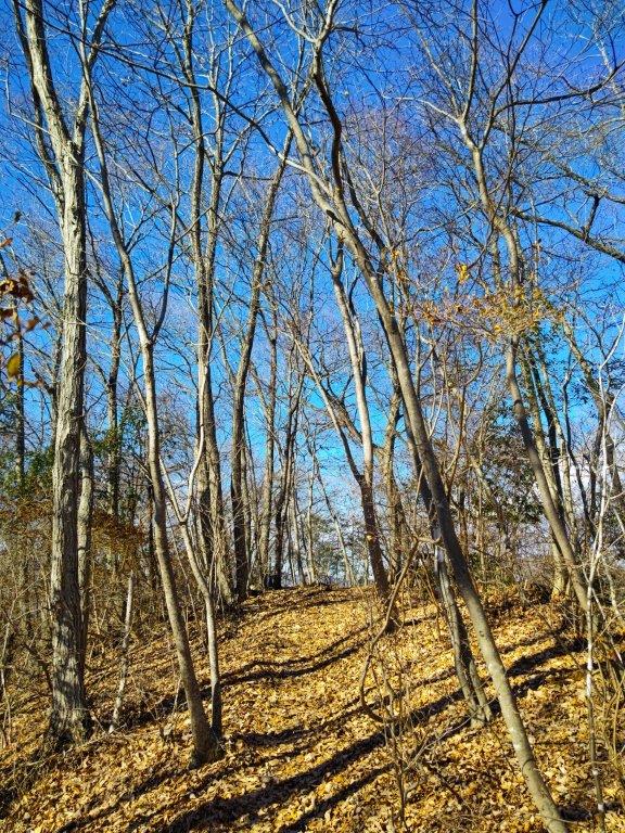
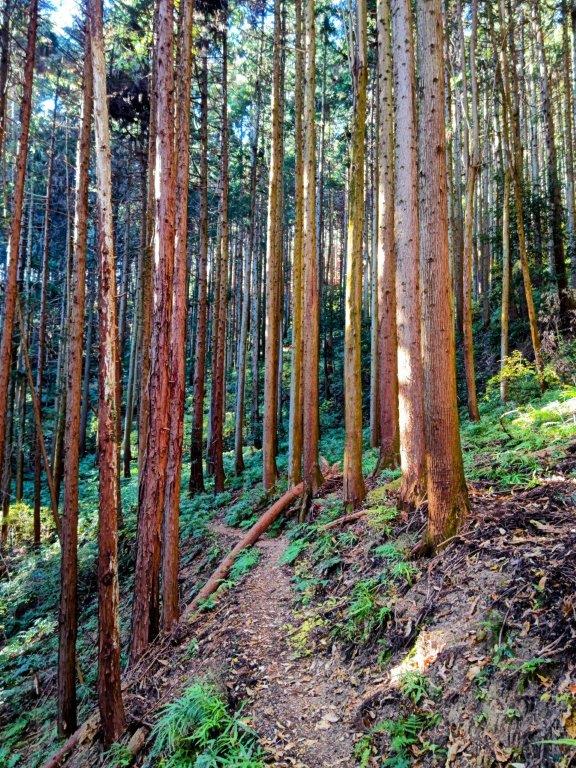
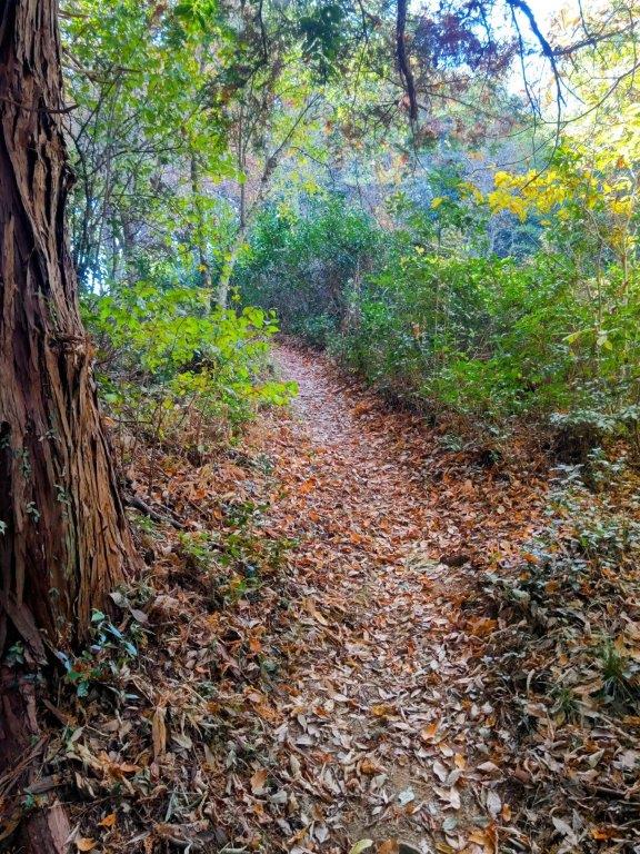
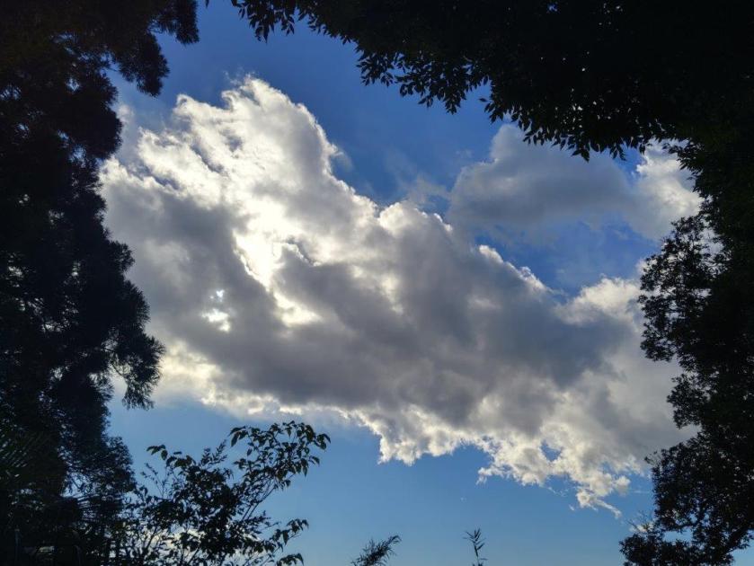
Hike in the Shade (left) Hiking in the Sun (right)

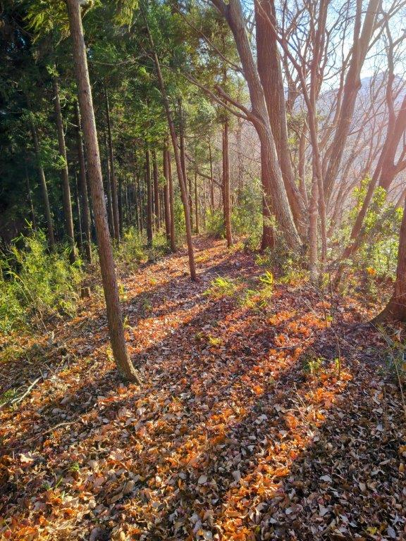
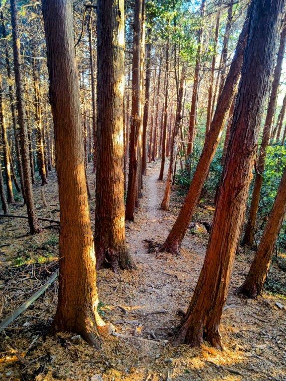
Late Afternoon sun near Mine (left) and Mt Kongon (right)

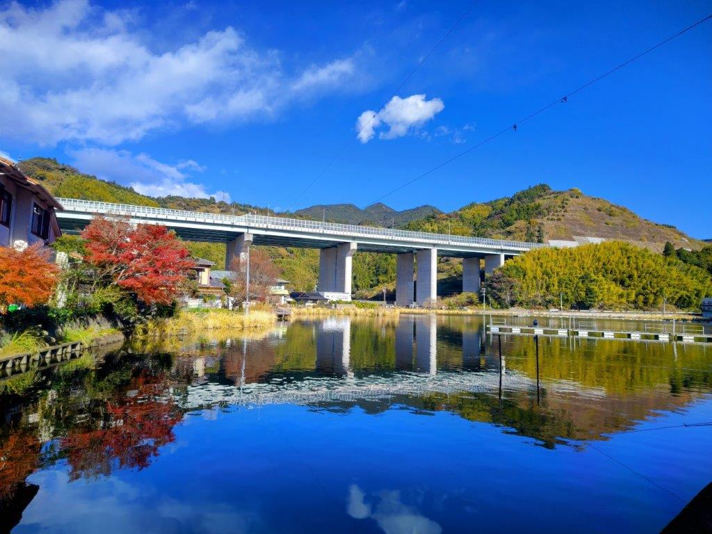
It was a beautiful sunny winter day as I stepped off the Chuo line at Fujino station. After getting ready, I made my way down to Hizure Ohashi Bridge. While crossing the Sagami river, I could already see the Hizure Alps on the other side. Although the nearest entrance was right up the road, I turned left past a supermarket, and followed back lanes eastwards till I reached the Hizure Alps Trailhead (日連アルプス登山口) shortly before noon. On the way, I passed a charming little shrine with red banners flapping in the wind.

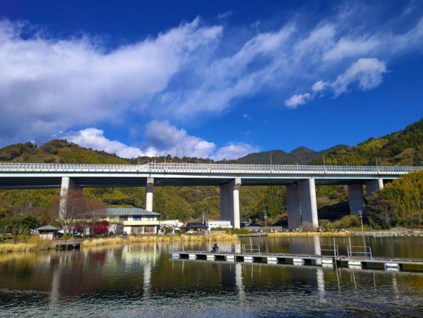
Sagami River from Hizure Ohashi Bridge

View North on the way to the Trailhead

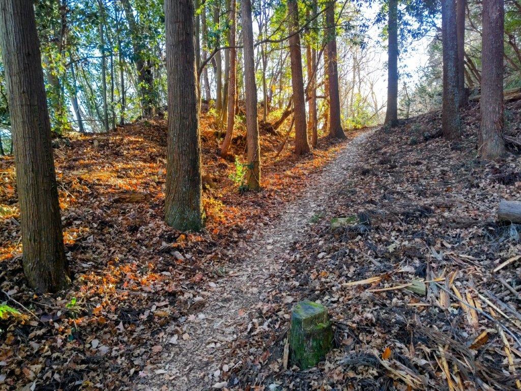
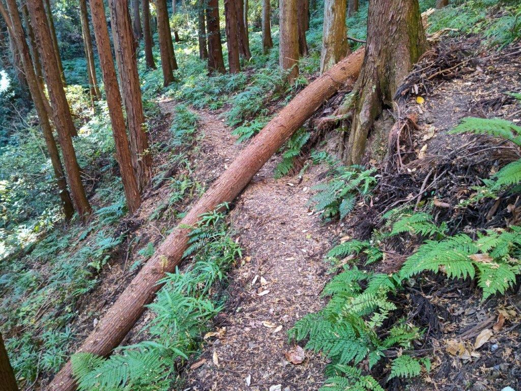
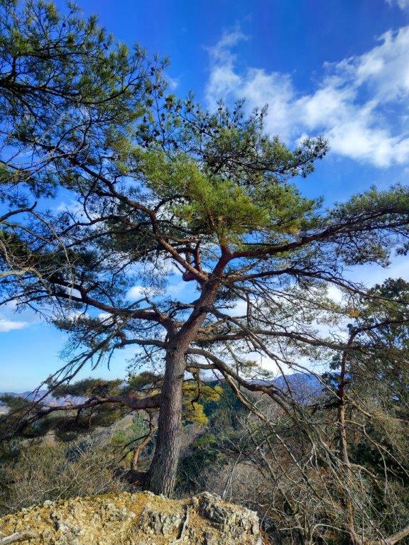
I patiently followed the trail as it hugged the mountain side instead of climbing right away. Just as it reached the eastern end, it suddenly made a right turn and headed up at a steep angle. After hauling myself up, the trail soon regained a more reasonable angle and was in the sun again. At 1230, I arrived at a picnic table on the summit of Mt Takara (宝山(たからやま takara-yama meaning treasure). Framed between 2 trees on the south side was a view of Mt Jinba. I continued on my way, and soon after, reached another picnic table at the top of Mt Hizure (日連山 ひづれやま hizure-yama); it was completely in the trees so I continued without a break.

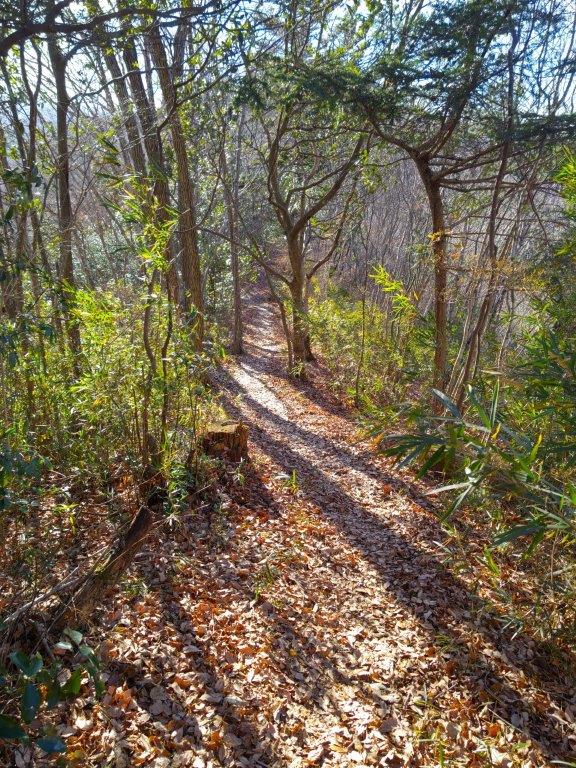
Walking in the Sun Past Mt Hizure

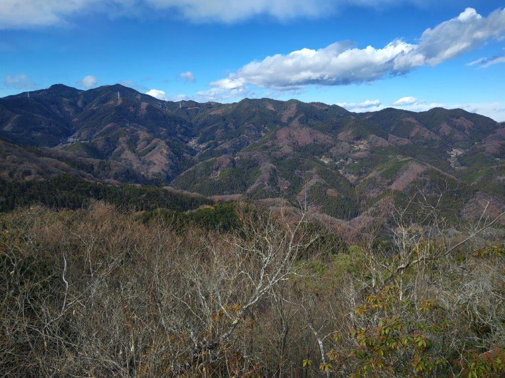
Mt Omuro (left) & the Doshi Mountains (right) on the way to Mt Hachioka

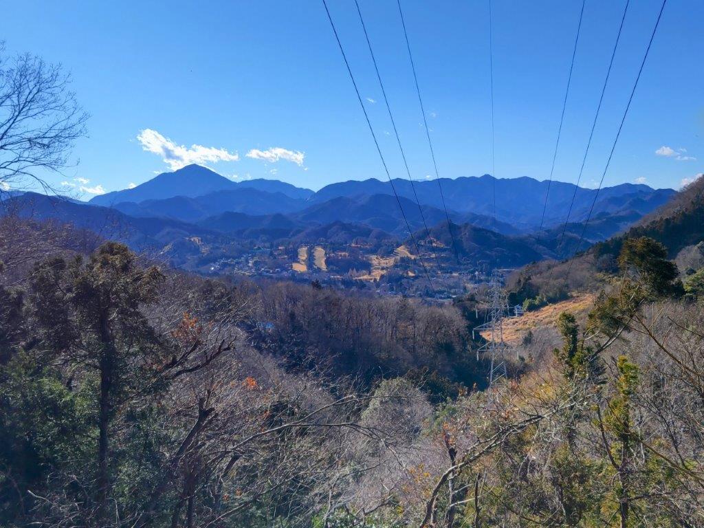
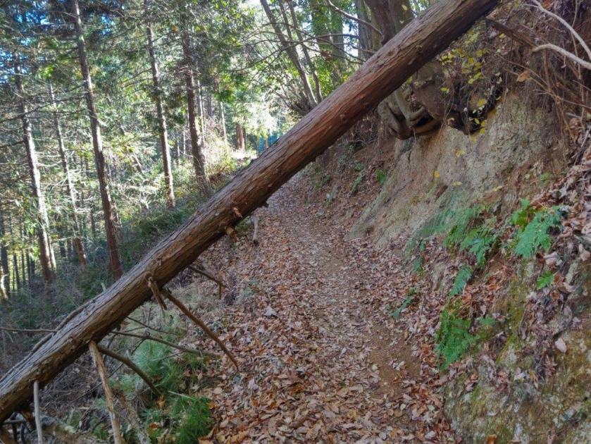
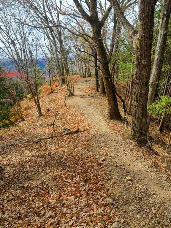
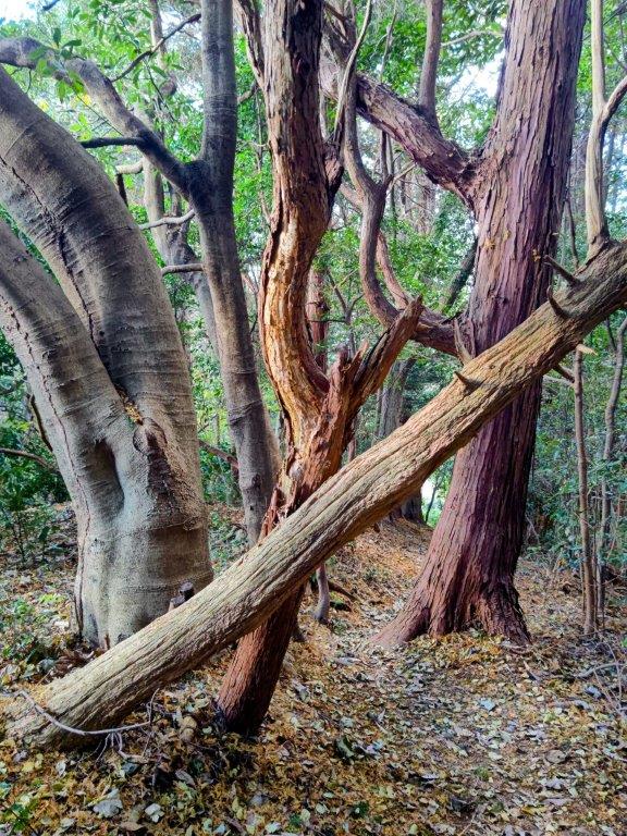
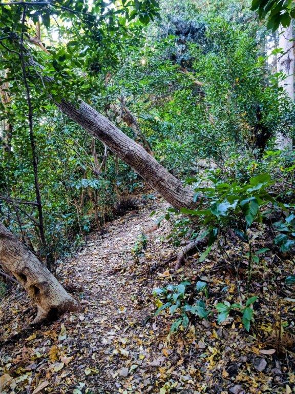
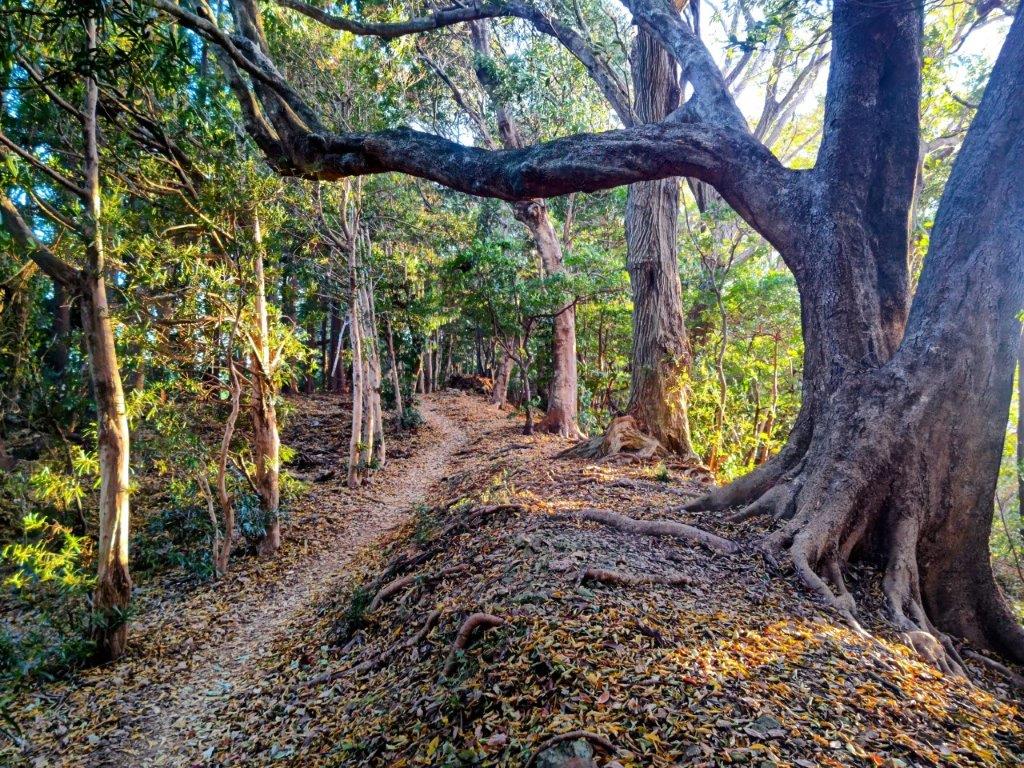
The trail was mostly level with some slight ups and downs, mostly in the sun thanks to the bare trees, and mostly free of people thanks to the Japanese year-end holidays. At 1pm, I reached a third bench at a fork in the trail. I went left, leaving the Alps momentarily to head along a southern spur. This change of direction also exposed me to strong winds blowing from the west. I soon arrived at an electric pylon with an open space on the west side. I gazed at the pyramidal summit of Mt Omuro for a short while before being chased away by the wind. After a short slippery climb over dead leaves, I reached the top of Mt Hachioka (鉢岡山はちおかやま hachioka-yama), one of the 15 famous mountains of Fujino town, and also the site of a TV antenna. Despite the lack of view, it was sunny and quiet, so I settled down on a log for a lunch break. Once done, I retraced my steps to the Alps.

Windy Section of the Trail on the Way to Mt Hachioka

Viewpoint at the Top of Mine

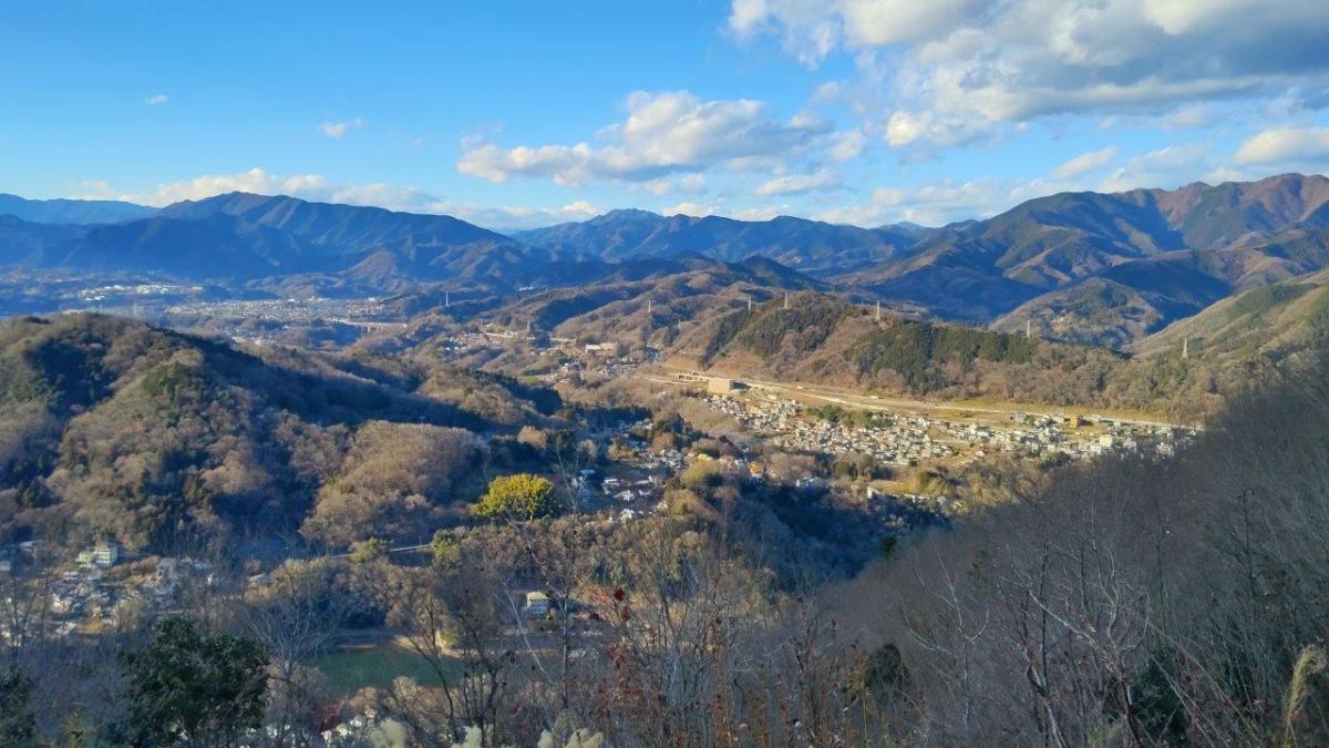
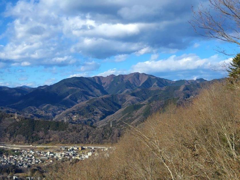
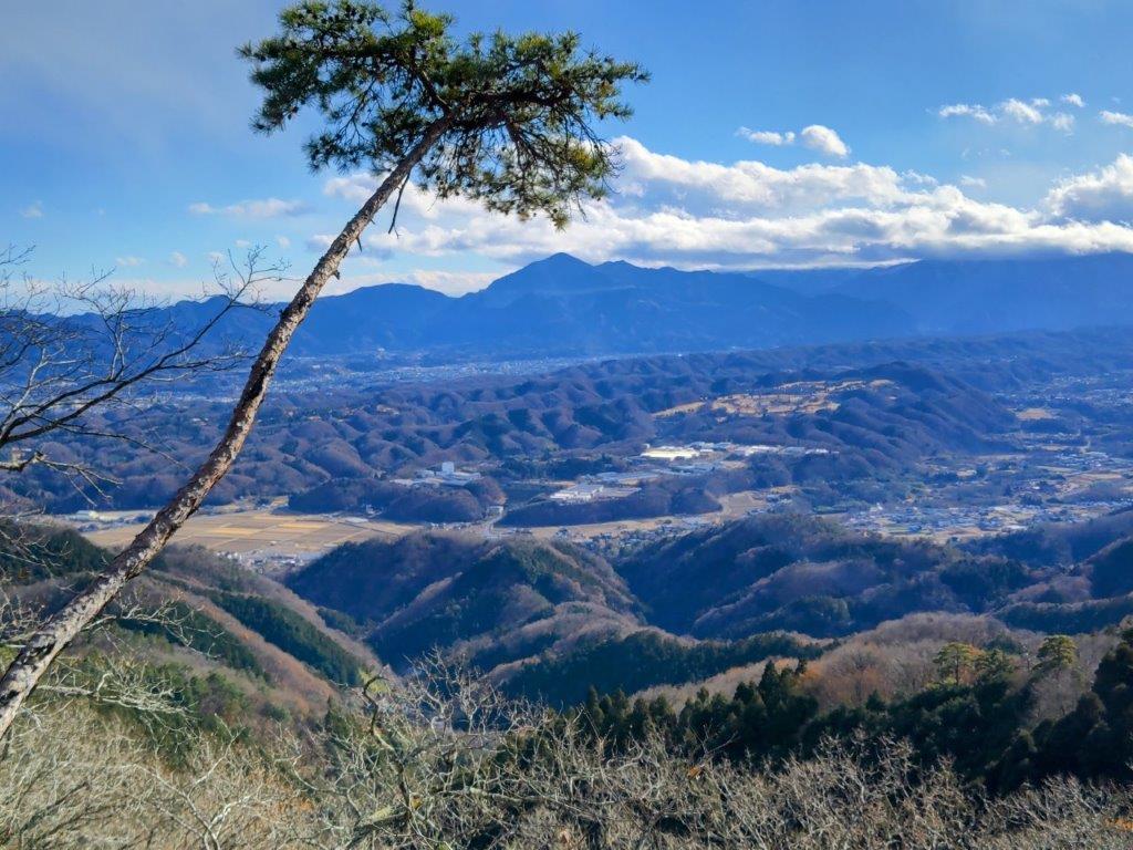
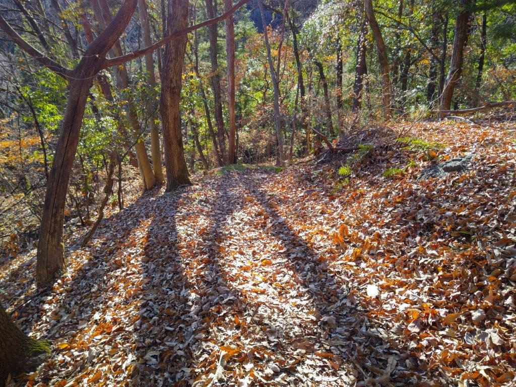
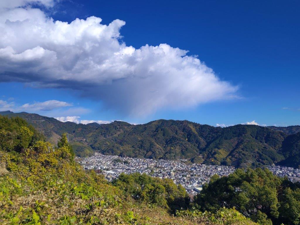
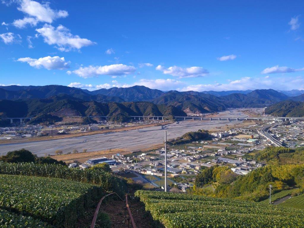
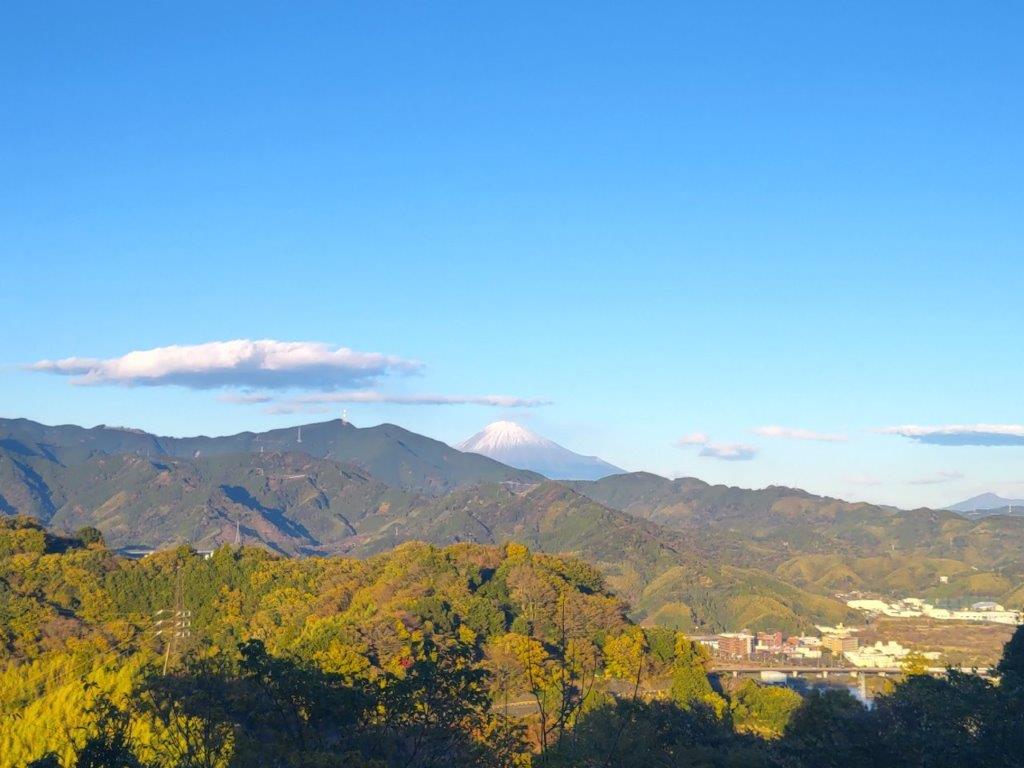
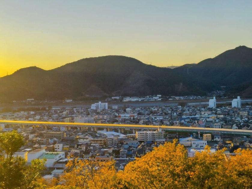
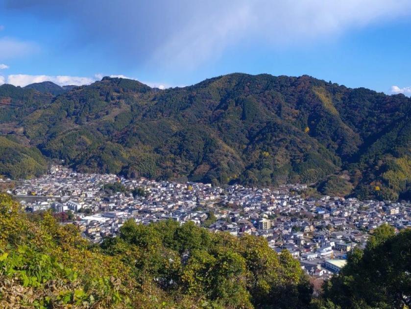
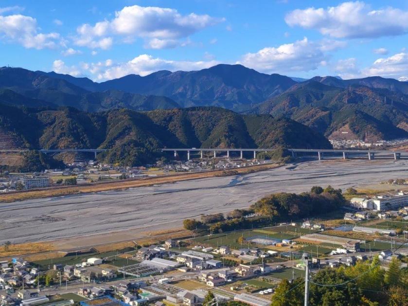
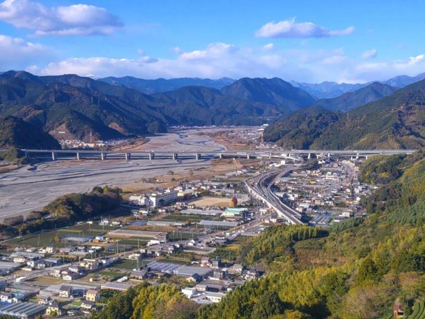
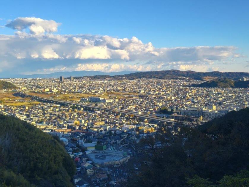
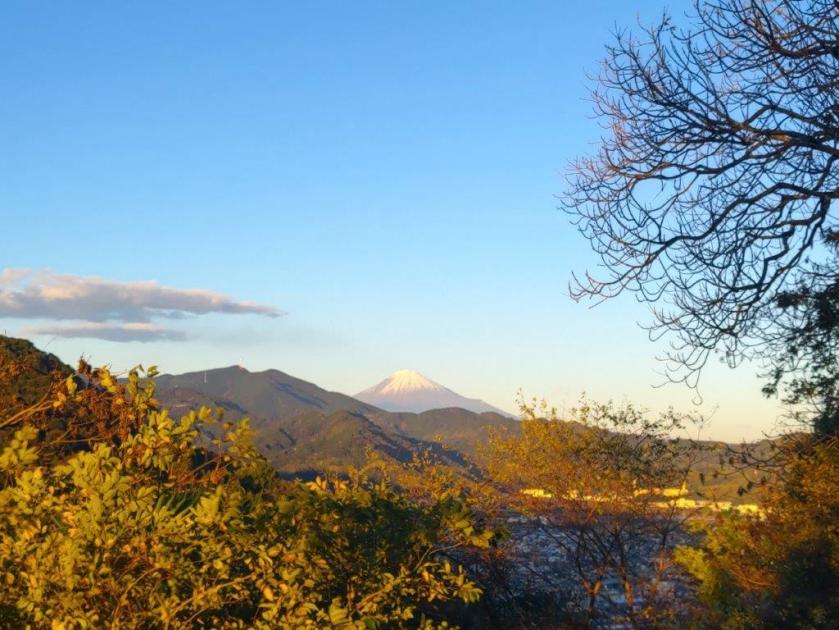
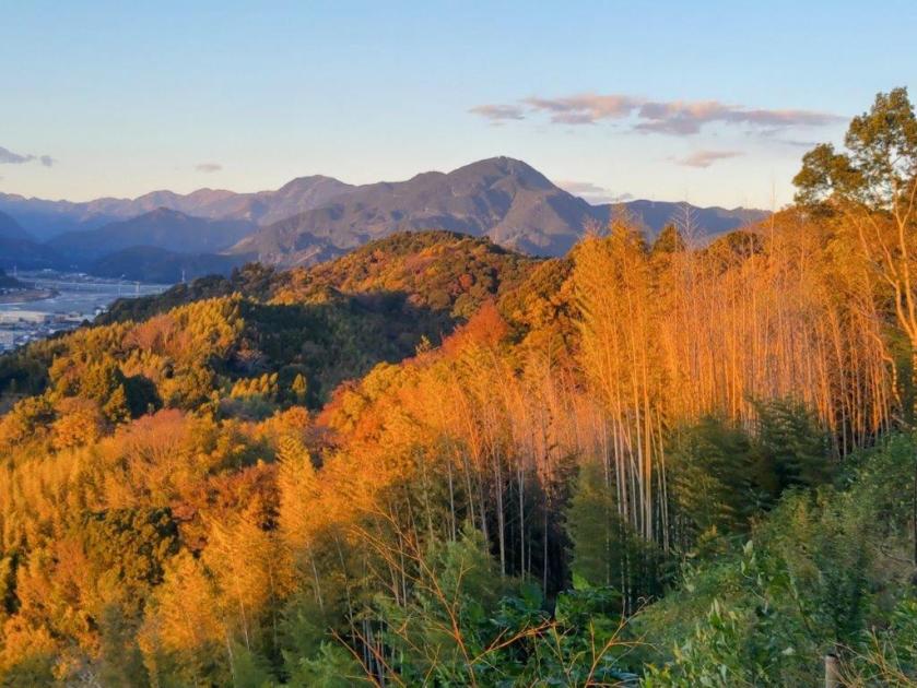
The next section was probably the nicest part of the entire hike, heading southwest into the afternoon winter sun, the surrounding vegetation reflecting its soft light. It was only 2pm, but I seemed to be the last person left on the mountain. At one point, I had a view on the south side of Mt Sekiro and Mt Hachioka, side by side. A little before 2h30, I turned right at another fork, this time following a spur northwards, and a few minutes later, arrived at the top of Mine (峯 みね). I had a stunning view of Uenohara and the surrounding mountains on the west side: from left to right, I could see Mt Ogi, Mt Gangaharasuri, Mt Gongen, Mt Mito and Mt Jimba.

Mt Ogi (right), Mt Gangaharasuri (center) & Mt Gongen (right) from Mine

Mt Gongen (left), Mt Mito (center) & Mt Jinba (right) from Mine

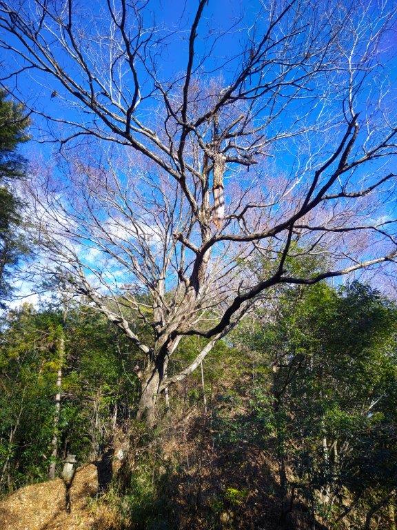
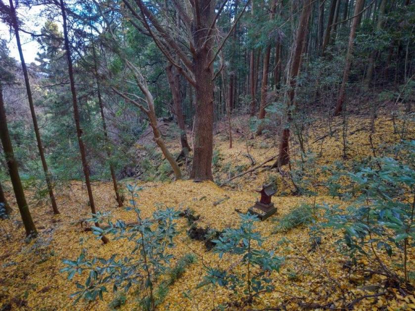
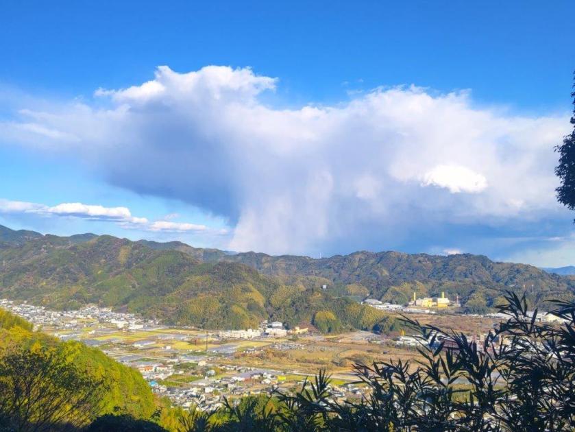
I took my time taking in the view, trying to spot the smaller peaks I had hiked in the area such as Mt Yae, Mt Furo and Mt Yogai. The wind had pushed in some clouds from the west, testing my patience as various areas alternated between sun and shade. Once satisfied, I left my pack and trotted further down the ridge to the nearby Mt Yasaka (八坂山 やさかやま 420m), in the forest and thus less famous. After collecting my pack, I returned to the junction and continued to the final peak of the day only a short distance away. Mt Kongo (金剛山 こんごうざん kongo-zan), named after a Buddhist term meaning “something indestructible”, was the site of a small shrine surrounded by cedars.

View of the Uenohara Area from the the Top of Mine

Heading to Mt Kongo

A couple of picnic tables in the shade made it seem like the ideal place for a break on a warm day. However, it was already past 3pm, so I started down a steep path on the south side. No rain for the past few weeks meant the trail was dusty and slippery and I made ample use of the attached rope to keep my balance. Half an hour later, I popped onto a road at the Hizure Alps Entrance (日連アルプス入口) and a few minutes later, caught a bus for Yamanami Onsen. After a quick but restorative hot bath, I hopped back on the bus for the short ride to Fujino station. There I boarded the Chuo line green car for the first time (free of charge till the Spring) for the one hour ride back to Shinjuku.

Watch a Video of the Hizure Alps Hike

Watch the Video of the Hike on YouTube

See a Slideshow of More Pictures of the Hike

Mt Happu (626m) & Mt Omae (653m), Minano Town & Chichibu City, Saitama Prefecture, Sunday, December 22, 2024

I had hiked Mt Happu about a year ago but wanted to return to explore some more trails on this up and down ridge, also known as the Minano Alps. Its relatively easy access and low elevation made it the perfect place for an outing during the cold, short days at the end of December. Finally, I was eager to try out our Japanwilds Happu-san Hiking Map, published in March 2024, by making sure to download the free map in Avenza before heading out.

For subscribers, read this Post on Hiking Around Tokyo for a better viewing experience and the latest updates

To get to the start of the hike, I’d ride a bus from Minano station and get off on the north side, just past Mangan no Yu. I’d follow the Kanto Fureai no Michi to the summit, then continue to Fudatachi Pass, and from there, follow the Edo Old Pilgrimage Trail down the south side. At the base of the mountain, it was a one-hour walk through the countryside to Seoto no Yu. After a hot bath, I could use their free shuttle bus to get back to Minano station.

Hiking the Minano Alps 皆野アルプス

Hiking in Chichibu 秩父

If time allowed and the weather was clear, I’d do a round-trip to one of the viewpoints along the ridge beyond Fudatachi Pass; I could also do another round-trip to Temple #33 on the Kannon Temple Circuit, about ten minutes on foot from the hot spring at the end of the hike. The weather was supposed to be sunny but cold for the season. I was looking forward to exploring new trails on a well-trodden mountain.

Get a map of the Mt Happu hike

Find Japan Hiking Maps on Japanwilds

Trail before Saru Rock (left) Trail between Mt Happu & Fudatachi Pass (right)

It was a beautiful, sunny day as I rode the Laview Limited Express from Ikebukuro. After transferring to the local Chichibu line in Yokote, I got off at Minano station around 10am. The sun had mischievously vanished behind thick clouds rolling in from the surrounding mountains; I checked the updated forecast for the day, and it seemed the sun would return in the early afternoon. I walked to the nearby bus stop and also noticed that the departure time had been pushed back slightly since last year, meaning I had to wait a little longer out in the cold.

Walking along Nyokin Ridge (left) Walking the Old Pilgrimage Road (right)

I felt a little warmer after getting off the heated bus at Futto Iriguchi (風戸入口). I was the sole passenger and, considering the gloomy weather conditions, I wondered if I might be the only person on the mountain today. At 11am, I started up the Kanto Fureai no Michi, behind an “Onsen Stand“; this is like a petrol station, but instead of petrol, people pay a small fee to fill plastic containers with hot spring water for home use; while I was getting ready a couple cars pulled up, so it seemed a more popular activity than hiking on a cold day. After barely a few minutes, the trail ended at the road bend, which I followed up and through a village. I opened the Avenza app on my smartphone and loaded the Happu-san Hiking map, a blue dot tracking my progress along a green line showing the trail.

Start of the Trail Near Futto

Looking up, I was delighted to see patches of blue in the sky, a hopeful sign for the rest of the day. I passed an ancient “kura“, or storehouse, encircled by vegetation, slender bamboo on one side and evergreen trees on the other, the bright green contrasting with the deep blue sky; gusts of wind rustled through the leaves, contributing to the this enchanting sight, as well as pushing the remaining clouds further away. At 1130, I reached an open shelter with a view of Mt Hodo to the north. Here, the hiking trail resumed, clearly indicated by the familiar wooden Kanto Fureai no Michi (関東ふれあいの道) signposts. At the top of some log steps, I entered the forest.

View North from the Summit of Mt Happu

I was surprised to see a carpet of golden leaves covering the path ahead and the nearby forest floor. Looking left, I spotted a tall, leafless ginko with a small shrine at its foot: what a magnificent sight it must have been earlier in the month. Autumn was still hanging on in Tokyo but here in the mountains winter had arrived. After a short climb through the forest, I arrived at the Kasato junction (another reading of “Futto”) and turned right along the main ridgeline of the Minano Alps, now following last year’s hike, but in reverse. At noon, I arrived at Saru-iwa (猿岩 meaning “monkey rock”), a huge yellow-coloured rock protruding dramatically from the narrow ridge.

View of the Chichibu Basin from Nyokin Ridge

I was glad to see it properly this time as I had somehow missed it on my last visit, possibly because it was hidden by the foliage which had now fallen; it was also clearly labeled on the Japanwilds Hiking Map, so I was sure to see it, foliage or not. Apparently, the rock resembles the face of a monkey looking up, but before I had time to turn my own face up to confirm this, a big group suddenly arrived from the other direction, and I quickly departed (the face can be discerned in the slideshow picture at the end of this blog post). Shortly after, I arrived at the top of Mt Happu (破風山 はっぷさん happu-san), my third time to stand on the top.

Pine Tree and Mt Buko below the Top of Mt Omae

The breathtaking view of the Chichibu basin and the Oku-Chichibu mountains on the south side was dulled by the lingering, low grey clouds, while the more muted view on the north side was nearly clear of clouds. As more people arrived, I set off without a break, down the steeper trail on the east side. At 1230, I reached Fudatachi Pass, earlier than expected, so I pushed ahead along the ridge, feeling optimistic as the weather was slowly but surely improving. After some easy walking through the forest, now off the Kanto Fureai no michi, I reached Nyokin Ridge.

View of the Oku-Chichibu Mountains from the Musashi Observatory

From this point, I found myself scrambling over some rocky sections, chains attached for safety; I also had to navigate a narrow ledge with drops on both sides, lined with a rope to prevent any mishaps. I was surprised how quickly I had to change my walking style from carefree rambling to a cautious advance. I still made good time and soon reached the Musashi Viewpoint, on top of a prominent rock with a couple of twisted pine trees, like two hairs on a bald head. By now, the clouds on the south had mostly retreated, with most of the basin bathed in sunlight.

View North of the Nagatoro Alps from Musashi Observatory

The view had considerably improved in the space of one hour, although the triangular peak of Mt Buko was still the only easily recognizable mountain. Blue skies continued to rule on the north side, and I could see Mt Hodo, with the Nagatoro Alps behind, and even further behind were the Hachioji Hills (no relation to Hachioji city), beyond a narrow neck of the Kanto Plain. I decided to continue a little further, and after a short climb, arrived at Mt Omae (大前山 おおまえやま oomae-yama), also the location of a small statue. It was surrounded by trees but a few meters away, on the south side, was a ledge with a view.

Fallen Tree along the Old Pilgrimage Road

I kept my distance from the edge as the mountain side dropped away steeply, offering a remarkable bird’s eye view of the wrinkled terrain far below. Since it was past 1pm, I found a tree root that could double as a seat and settled down for lunch with a view. Looking to my right, I could see Mt Tengu, the highest peak of the Minano Alps: it looked deceptively close but I knew from previous experience that the next valley would take time and energy, the ridge really starting to deserve its Alps nickname, and the views wouldn’t be worth it.

Fallen Leaves and Afternoon Sun on the Old Pilgrimage Road

I made my way back at a swift pace, taking care when traversing Nyoho ridge, arriving back at the crossroads at Fudatachi Pass at 2pm; there, I turned right onto a narrow but well-defined trail. I was now following signs for Fudasho #33 Kikusui-ji Temple (札所33番 菊水時), along the Edo Old Pilgrimage road (江戸巡礼古道), heading eastwards and hugging the mountainside. Judging from my lunch spot perch, I expected a steep gradient but so far I was enjoying a gentle, almost level descent. I was making good time, except for some maneuvering around a couple of fallen trees; on the other hand, the fallen leaves, rather than being a nuisance, shone brightly under the sun, as the sky was back to its morning blueness.

Watch a Video of the Mt Happu Hike

Watch the Video of the Hike on YouTube

The path abruptly ended at a road, which I followed for a short while before rejoining the trail on the right side. At 3pm, I popped onto another road, leading me to a temple and a main road at the base of the mountain. Following the signs for Temple #33, as well as Google Maps since I was now off the Japanwilds Hiking Map, I turned right and followed back lanes past the “Michi no Eki” Ryusei Kaikan, till I found myself beside the Akahira river. The sun had already sunk below the rim of the Chichibu Basin, and so I had to save my visit to Temple #33 for another time. I reached Seoto no Yu just before 4pm, my 2nd time to this charming hot spring. At 5pm, I was the only person to board the free shuttle, the last of the day, and less than a hour later, I was at Seibu-Chichibu station, sampling some local sake from their convenient self-serving sake machine (“sake server”) while waiting to board the Laview Limited Express for the comfortable ride back to Ikebukuro.

See a Slideshow of More Pictures of the Hike

Mt Fukunari (227m) & Mt Shizuhata (171m), Shizuoka City, Shizuoka Prefecture, Saturday, December 14, 2024

I wanted to do some more hiking in Shizuoka. Looking online, I found a trail along a north-south ridgeline extending all the way into Shizuoka city, the Mt Shizuhata Hiking Trail. It seemed a bit on the short side meaning I could walk it at a leisurely pace while enjoying the views. After visiting Asama shrine at the end of the trail, I could drop by the nearby Ofuro Cafe Bijinyu, a public bath doubling as a cafe.

For subscribers, read this Post on Hiking Around Tokyo for a better viewing experience and the latest updates

I could get to the start of the hike by riding the bullet train directly to Shizuoka station, and from there, catch a bus for Ume-ga-shima Onsen, getting off at the entrance for Kujira-ga-ike Pond (actually a lake), a short distance from the trail entrance. After the hot bath at the end, I could catch a bus for the short ride back to the station. The weather was supposed to be sunny and cold, as well as a little windy. I was looking forward to exploring a new area with new views.

Find Japan Hiking Maps on Japanwilds

Start of the Hike past Kujira Lake (left) Entering the Bamboo Forest (right)

Trail near the 1st Viewpoint (left) Trees in the Way below Mt Fukunari (right)

It was a blue-sky day as I rode the shinkansen, arriving at Shizuoka station around 10am. Soon after, I was riding a city bus northwards, with glimpses of the ridge I’d be walking today on my right side. It took half an hour to reach the Kujira-ga-ike Iriguchi bus stop, from where it was a short walk to Kujira-ga-ike, a fishing spot meaning “Whale pond”, presumably named after its shape. I decided to head around its south shore to better admire the view of the Shin-Tomei expressway on the opposite side .

Trail near the 2nd Viewpoint (left) Trail near the 3rd Viewpoint (right)

Trail past Mt Tanku (left) Mid-section of the Shizuhata Trail (right)

The view was best from the east side, just past Kujira-ga-ike Benten Shrine, the expressway disappearing into the mountains of the Southern Alps, puffy cumulus clouds reflected on the water surface. It was nearly noon, so I left the fisherman behind, and just before a tunnel, went up a paved road on the right, simply signposted as “Hiking Trail”, one of the trail entrances of the Mt Shizuhata Hiking Trail (賎機山ハイキングコース). I soon reached a real hiking trail, where I turned right, heading south along a gently undulating ridgeline. After passing through a tunnel of tall grasses, I arrived at the entrance of a bamboo grove.

An Easy to Walk Trail (left) Trail Past Ipponmatsu (Right)

Heading down after Ipponmatsu (left) Heading Towards Mt Shizuhata (right)

I love walking through bamboo groves as it’s something unique to this part of the world. This one was especially amazing, with one tall bare tree in its center, like a lord among its subjects. It was totally quiet, except for the occasionally cracking noises of the bamboo growing. After exiting the grove, the trail took on a very countryside-like quality, passing between hedges and rows of identical trees. Occasionally I could see some blue sky between gaps in the tree and I was starting to wonder whether I would get any views. Finally, one hour after I started along the trail, I reached the first viewpoint of the day, at the edge of a fruit orchard.

The Shin-Tomei Expressway from the South Side of Kujira Pond

The Shin-Tomei Expressway from the East Side of Kujira Pond

Looking eastwards, I could see all the way to the mountains of Izu peninsula; in front was Nihondaira, and to the south, Suruga Bay, with Shizuoka city filling in the low-lying spaces between the mountains and the ocean. I set off again, and after a short climb, reached Fukunari Shrine at the top of Mt Fukunari (福成山 ふくなりさん fukunari-san) at 1pm. It was mostly in the trees, with a window view of Abe river through a gap on the west side. I continued on my way, heading slightly downhill, and soon arrived at a bench and a second viewpoint, mostly of Shizuoka city on the south side. I pushed on a little further, and reached another bench and a third viewpoint.

View East of Asahata Village from the 1st Viewpoint

View West of Abe River from the 3rd Viewpoint

I had a better view of the Abe river valley than from the summit, and since this bench was in the sun, I decided to take a break for lunch. I set off again, a little before 2pm, and soon found myself ascending through tea fields, typical scenery of Shizuoka prefecture. Thanks to the low tea bushes, a wide view soon opened up on the west side. To the north, was Mt Ryuso; to its left, I could see the multiple mountain ranges of the Southern Alps, one tall peak in the very center already white with snow; from this mountainous mass emerged the Abe river, passing under the busy Shin-Tomei expressway.

Row of Trees Separating the Tea Fields

View of Abe River and the Shin-Tomei Expressway from Mt Tanku

It was easily the best view of the day; it was also the coldest spot of the day, the wind blowing hard, a blast of cold air descending from the Alps, bringing dark clouds in its tow. I arrived at a concrete platform with a bench and a view on the east side, the culminating point of the surrounding tea fields. It was next to a large cylindrical storage tank, and was thus called Mt Tanku (タンク山 229m), although a summit marker seemed to be missing. I had a panoramic view of the Izu peninsula, Nihondaira, Suruga Bay and Shizuoka city; just Mt Fuji was missing from the picture. It was nearly 3pm, and I hadn’t reached the halfway point, so I stepped up the pace. The next part was mostly level, with frequent views on the east side through gaps in the vegetation.

Mt Ryuso, Tea Fields and Dark Clouds

View from Mt Tanku of the Southern Alps

I noticed a mushroom-shaped cloud formation above the next ridgeline, a sudden downpour created by the influx of cold air from inland, a lucky escape for me. I left the tea fields behind and was once again walking through the forest. I was surprised by the variety of trees, very different from the monotonous cedar forests in other hiking areas; hanging between the branches were the ever-present jorogumo spiders still alive and well, despite the cold. After passing an electric pylon and some more orchards, I reached a road. Here, beyond the orange mikan, I had my first view of Mt Fuji, half-hidden by the clouds. I followed the road for a short while before rejoining the hiking path.

Bench with a View at the Top of Mt Tanku

Nihondaira and Shizuoka City from Mt Tanku

Great views, now including Mt Fuji, kept on appearing on the east side, slowing my pace. After passing 3 panda figurines hanging from a tree, I reached another road section heading up, but soon left it for path with plastic tubes for steps, leading to Ipponmatsu (一本松 192m), meaning “One Pine Tree”, which stood all by itself on the north side. From this vantage point, I could admire the ridgeline I had walked so far today, with Mt Ryusu rising directly behind; to its right was Mt Fuji, its famous snowcap now free of clouds. It was nearly 4pm, and I still had a third of the way to go, so I turned away from the view and headed down a path in the opposite direction.

Mushroom-Shaped Cloud on the Next Ridge

Mt Ryuso and the Mt Shizuhata Hiking Trail from Ipponmatsu

The late afternoon sunlight created a wonderful effect as I headed down some log steps facing westwards, although it also signaled that sunset was imminent. At another viewpoint with a bench, I saw the sun touching the opposite ridgeline, the Shin-Tomei expressway simply a yellow line along the valley; in the other direction, Mt Fuji was clearly visible and starting to turn pink. I continued up a steep trail, requiring one final effort to get to the top of Mt Shizuhata (賤機山 しずはたやま shizuhata-yama), also the remains of an ancient castle; apparently the “shizu” in Shizuoka comes from this mountain’s name. It was mostly in the trees so I soon moved on, along a level trail with wide open views on the west side.

Mt Fuji from Ipponmatsu

Trail between Ipponmatsu and Mt Shizuhata

Turning around, I was stunned by the orange colours on the mountain side, highlighted by the fast setting sun. A little further on, I had another view of Shizuoka city on the east side, under pink clouds and a full moon. I quickened my pace, and after one final effort up a section crisscrossed with tree roots, forcing me to tread carefully in the growing gloom, I reached the top of Mt Asama (浅間山 140m). It was also inside Shizuhatayama park, with a paved path and occasional lampposts, meaning I could complete the hike safely even in dark conditions.

Autumn Colours Past Mt Shizuhata

Mt Fuji and Full Moon from Mt Asama

I had a breathtaking view of pink Fuji under a yellow moon, lights slowly coming on throughout the city spread out below, the last view of the day. It was past 4h30, so I quickly made my way down through the park, past Asama Shrine, the path enchantingly lit by lanterns, people still dropping by for a quick prayer in the early evening. At 5pm I emerged onto a busy road at the base of the mountain, and a short while later, arrived at Ofuro Cafe Bijinyu. After a reinvigorating hot bath, I caught a city bus for the short ride back to Shizuoka station, where I hopped onto the shinkansen for the one-hour trip back to Tokyo.

Watch a Video of the Shizuhata Hiking Trail Hike

Watch the Video of the Hike on YouTube

See a Slideshow of More Pictures of the Hike