
I found these two mountains on my Takao area hiking map – they aren’t mentioned in any of my guidebooks. I was mainly interested in the second one; however, since it was too short for a day hike, I decided to tack on a small mountain just north of Mt No and Mt Yae, with a little road walking in between. One advantage of this addition was that I already knew which bus to take to the start of the trail. Since my planned hike made a loop and ended quite close to the starting point, I would be able to take the same bus back with a little more road walking. I had done several hikes in the area before, so I was wondering if I would get any new views on this trip.
Mt Fuji view from the top of Mt Koyashiro

View of the mountains south of the Chuo line
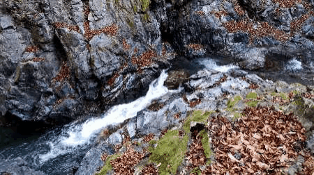
There wasn’t a cloud in sight when I arrived at Uenohara station around 9am. I rode the bus till the end of the line; after getting off, I could see the white top of Mt Fuji popping above the low mountains to the south. I continued walking along the road, and soon arrived at a small trail on the left leading to a trio of waterfalls. I decided to check them out quickly since I hadn’t had time to do so on my last visit. The path descended steeply into the valley via a series of switchbacks. I soon reached a small partly frozen waterfall, something I don’t usually see so close to Tokyo.
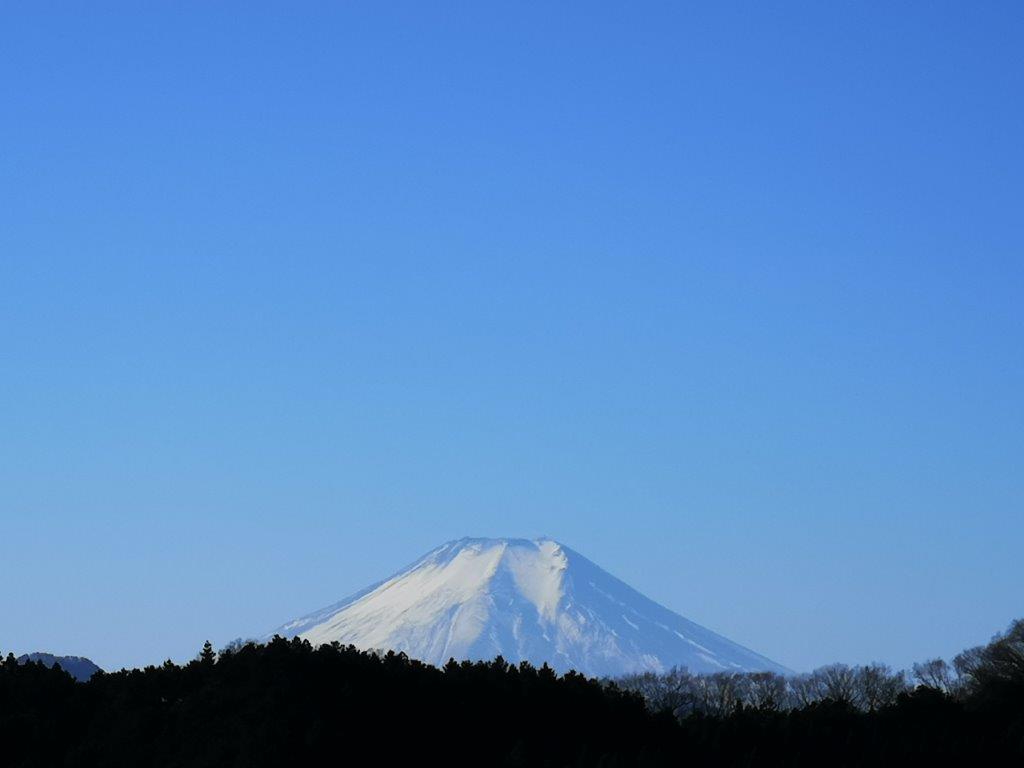
Mt Fuji from near the start of the hike

A good place for a short break on Mt Shomure
I reached a much higher waterfall just above a bend in the Tsuru river (see video). The path ended there, so I made my way back up; just below the road, I spotted the third waterfall through the forest. Back on the road, it took another ten minutes to reach the base of the today’s first mountain. I took the east route, heading straight up, with ropes on the side for the less sure-footed. Half-way up, I arrived at at small open space with a good view of Mt Fuji. At 11am, I reached the top of Mt Shomure (聖武連山 しょうむれやま shomure-yama). It took only 30 minutes but it was enough to work up an appetite, and I sat down for a late breakfast.

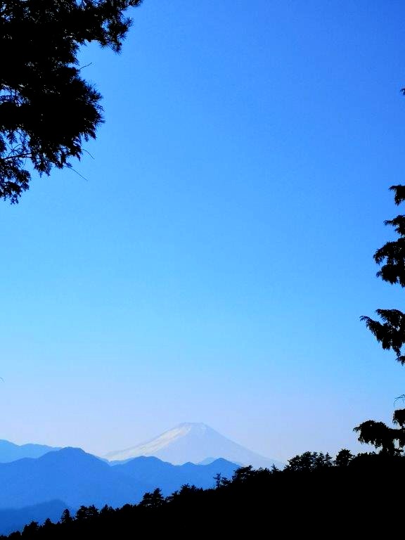
Mt Fuji from the top of Mt Shomure

The Tsuru river
I had a good view southwards of Uenohara city and Mt Fuji. I shared the summit with an NHK radio wave tower. At 11h30, I descended via the west route. This trail zigzagged down the side of the mountain and was the better of the two routes. Fifteen minutes later I was back on the same road as before; I crossed it and continued down the mountain side following the signs for Shomure Bridge. Halfway down, I came across a side trail on the left for another waterfall viewpoint. I decided to check it out since I had ample time for detours today. The path led directly to the riverside, and then turned left following it downstream.

Lots of good views of Mt Fuji in the area

A gentle slope up the mountain
I reached a tricky rocky section with chains on one side. The valley narrowed beyond and the river became a rushing torrent below high cliffs (see video). I soon reached the end of the trail with a viewpoint. On the left was another small half-frozen waterfall. Although it was winter, there were still many fallen leaves on the ground; I suppose this spot must be quite popular in the autumn. I retraced my steps, rejoined the main path and crossed the hanging bridge over Tsuru river. Walking up the other side, I had some good views of Mt Shomure. I was soon back on the main road, and a few minutes later I was at the entrance of the hiking trail for today’s second mountain at 12h40.

Looking east towards Mt No and Mt Yae

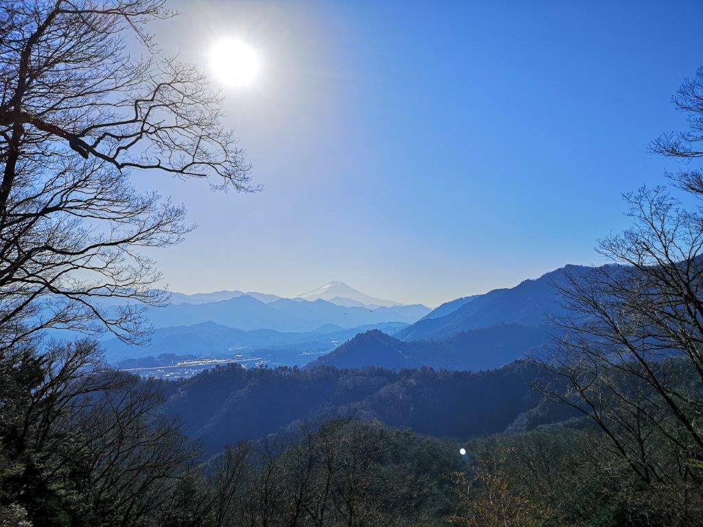
The top of Mt Koyashiro, a good place for lunch
The trail climbed gently through the forest with occasional views towards Uenohara city on the left. Thirty minutes later, I reached the top of Mt Ozuku 538m (尾続山 おづくやま ozuku-yama). To the south, I could see the top of Mt Fuji through a break in the trees. A little further, I had a good view westwards of Mt No and Mt Yae, with Mt Jinba and Mt Sekiro in the background. Twenty minutes later, I reached the summit of Mt Minashi 609m (実成山 みなしやま minashi-yama). It was the highest point of the hike but completely surrounded by trees. Ten minutes of walking along the top ridge brought me to another Fuji viewpoint and the top of Mt Koyashiro 600m (コヤシロ山 こやしろやま koyashiro-yama).

Paragliders enjoying the Mt Fuji view


An up and down trail
From here I could properly admire Mt Fuji, finally in its winter coat. Circling the valley like birds of prey, were two paragliders enjoying front row views of Japan’s most famous volcano (see video). It was now 2pm, so I sat down for a late lunch. There was almost no wind, and it felt very pleasant in the afternoon sun. At 2h30, I set off again, leaving the main ridge and following a smaller one as it curved back eastwards. At first, it descended steeply before climbing again to the top of “Kaze no Kamisama” 540m (風の神様 meaning the wind god). There, I had good views of the long flat top of Mt Gongen to the west.

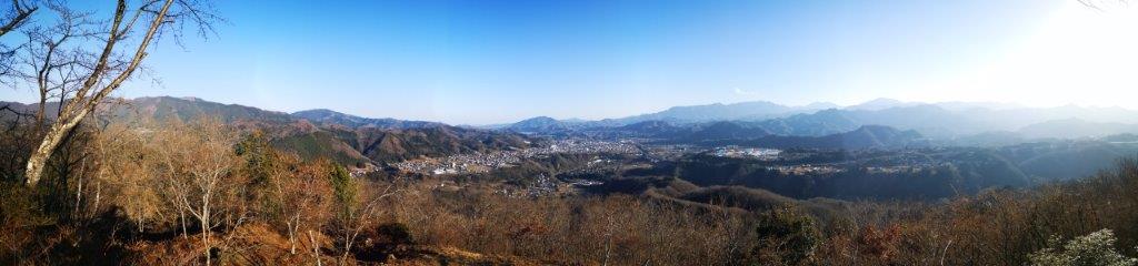
Panoramic view from the top of Mt Yogai

Mt Sekiro framed by the trees
The way down followed a narrow, exciting ridgeline through mountainous terrain with lots of up and down. At 3pm, I finally reached the top of Mt Yogai (要害山 ようがいさん yogaisan meaning Mt Fortress) where I had the best view of the day. I could see the entire valley spanned by the Chuo line from east to west; this was one of the best panoramas I had ever had in the Tokyo area. Half an hour later, I headed down the mountain, and had some more good views of Uenohara before reaching a small road. At 4pm, I was back on the main road just one kilometer south of the start of the of the Yogai Hiking Trail (要害ハイキングコース). It was another 15 minutes back to the bus stop, and thirty minutes later I was on the Chuo line for Tokyo.
See the waterfalls of Tsuru river

Rapids of the Tsuru river


Hello! Thanks for sharing your adventure to Mt. Yogai.
We did that hike and I found it traumatizing and exhausting despite the beauty of forest and its trails.
I truly realized that trails like this with steep ups and down is not my cup of tea.
Nevertheless, thanks for sharing.
Thanks for your feedback. Indeed, that might be the reason why it’s not featured in any of my hiking guidebooks…for a more relaxed hike, you could try nearby Mt Nodake & Mt Yaeyama
https://hikingtokyo.com/2020/02/01/mt-nodake-543m-mt-yaeyama-531m-uenohara-city-yamanashi-prefecture-tuesday-december-24-2019/
Thanks David. Fortunately we did Mt. Yae and Mt. Noudake before attacking ( hehehe) Mt. Yogai.
From yae yama we descended towards Mt. Toramaru a bit undulating as well.
Best regards,
Mari
Glad to hear that! if you haven’t done them already, I would suggest trying Mt Momokura and Mt Takagawa next. There are English maps available so you can know exactly the terrain and times.
If you’d prefer a pdf for printing instead of the app version, please let me know!
https://hikingtokyo.com/2022/03/14/momokura-yama/
https://hikingtokyo.com/2022/01/16/mt-takakawa/
Thanks David for your write up.
I was looking for a short hike today accessible through public transport and your suggestion fitted the bill. I did the second part of your hike today and throughly enjoyed it. Beautiful views of snowcapped Fuji at a number of places and as you said a widest possible panaromic view of Doshi & Tanzawa mountains.
Keep up the good work going.
cheers!
Thanks Naresh! I’m glad it helped 🙂 This is probably the best time of the year for this hike, reasonable temperatures and clear weather.