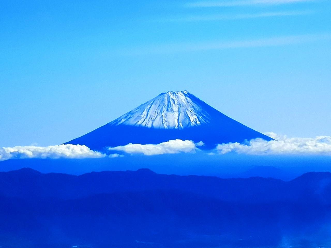
Here are two hikes from a couple of years ago in December that had one thing in common: great views of snow-covered volcanoes, on opposite sides of the Kanto plain, separated by 120 kilometers. One was the famous Mt Fuji, and the other one was the lesser-known, but currently active, Mt Asama.
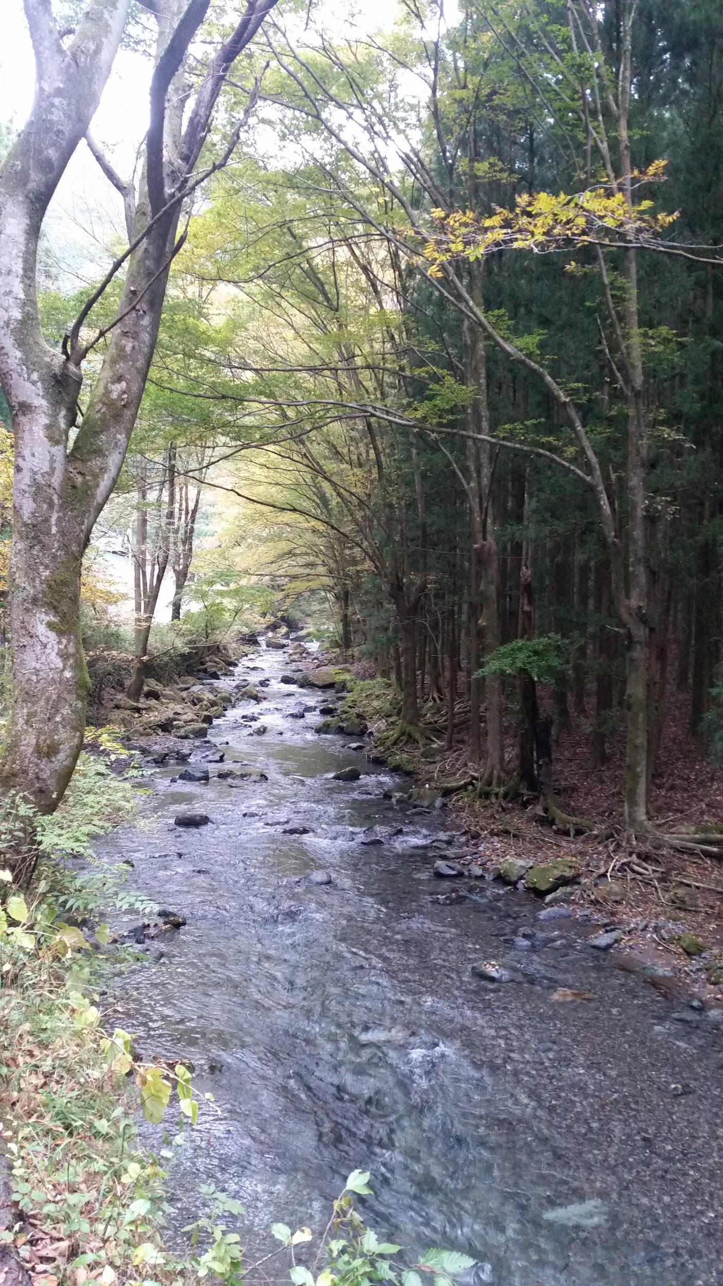
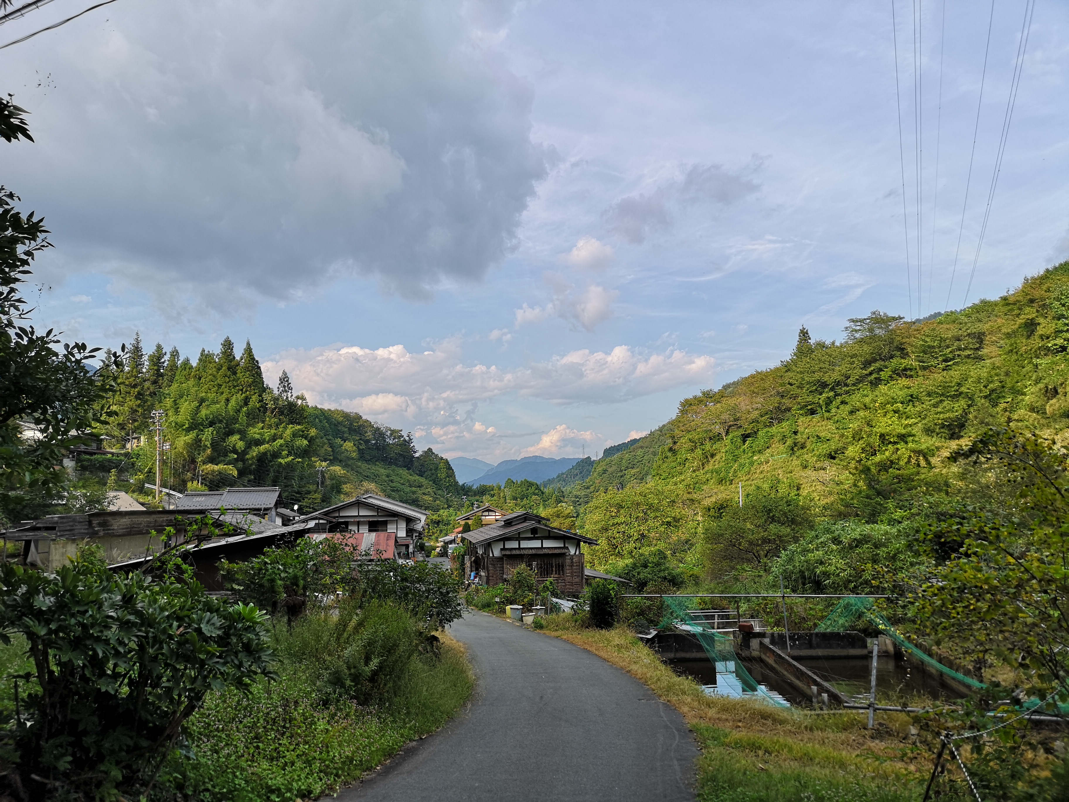
I had already hiked parts of the Misaka mountains – the mountainous area between Mt Fuji and the Oku-Chichibu mountains (for example Mt Ou to Mt Oni). However, I had never hiked the central part, between Kawaguchi and Saiko lakes. I decided to approach from Ashigawa valley on the North side, and finish at lake Saiko, on the South side. I took the Chuo line to Isawa Onsen station, and then the bus to the farmer’s market in Ashigawa 芦川. I had a very good impression of the place since they offered me free tea while I got ready for my hike!
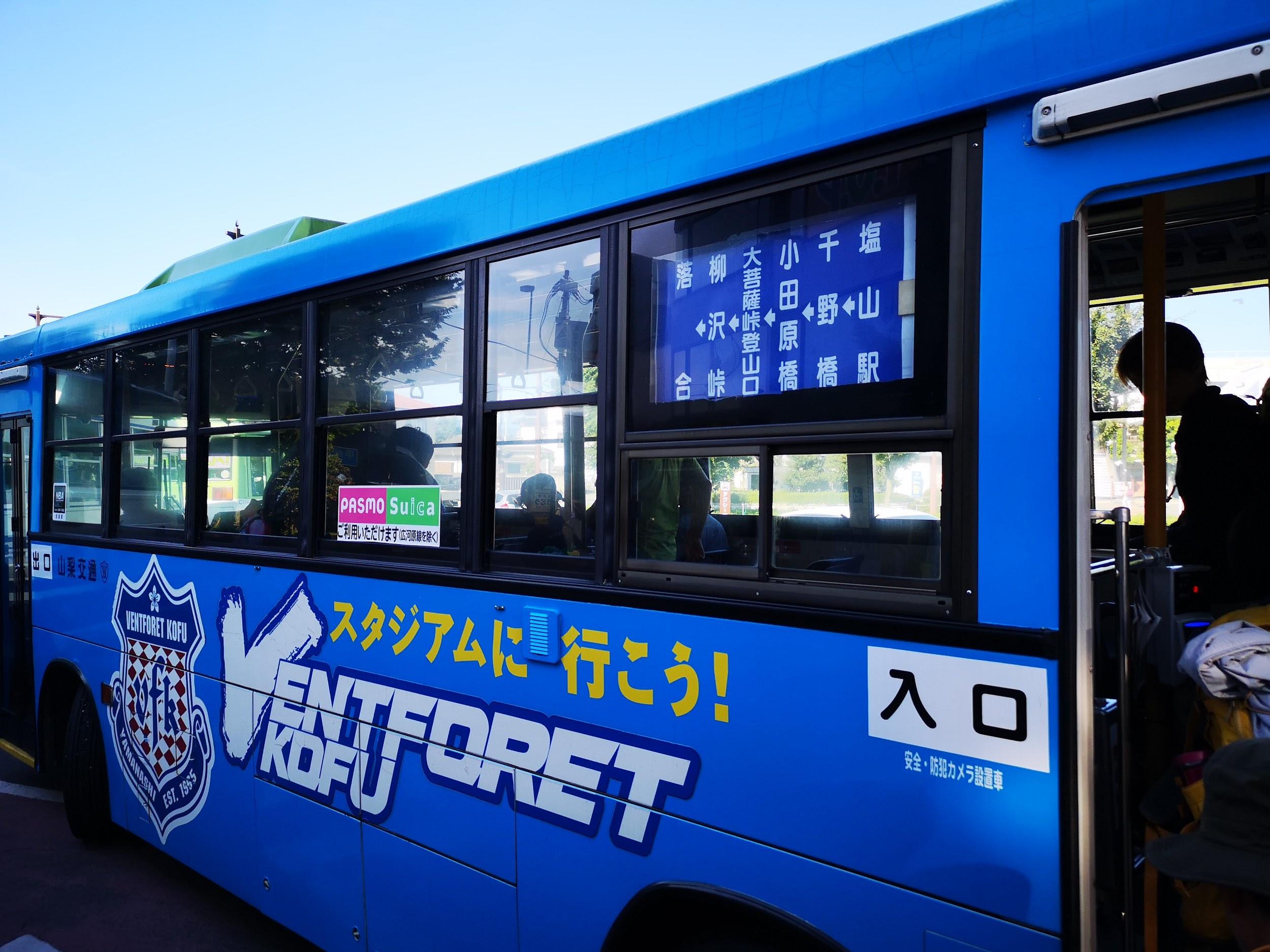
The Fujikyu bus from Isawa Onsen to Ogossoya (the Ashigawa farmer’s market) was discontinued in 2024. Access is now via car, or by bus from Kawaguchiko Station. However, since 2024, a free shuttle bus runs on weekends between Ogossoya and Suzuran.
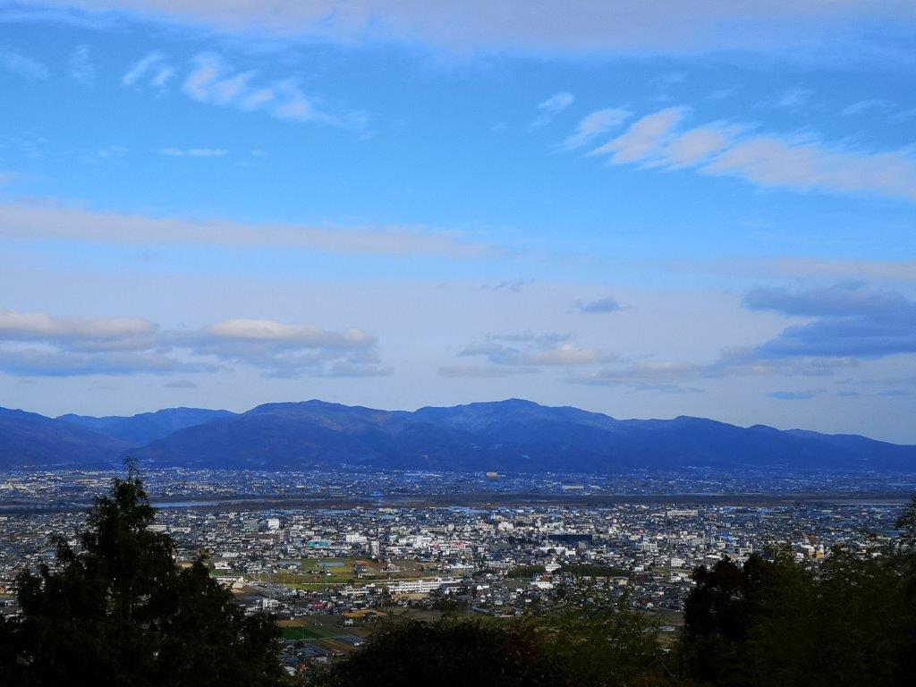
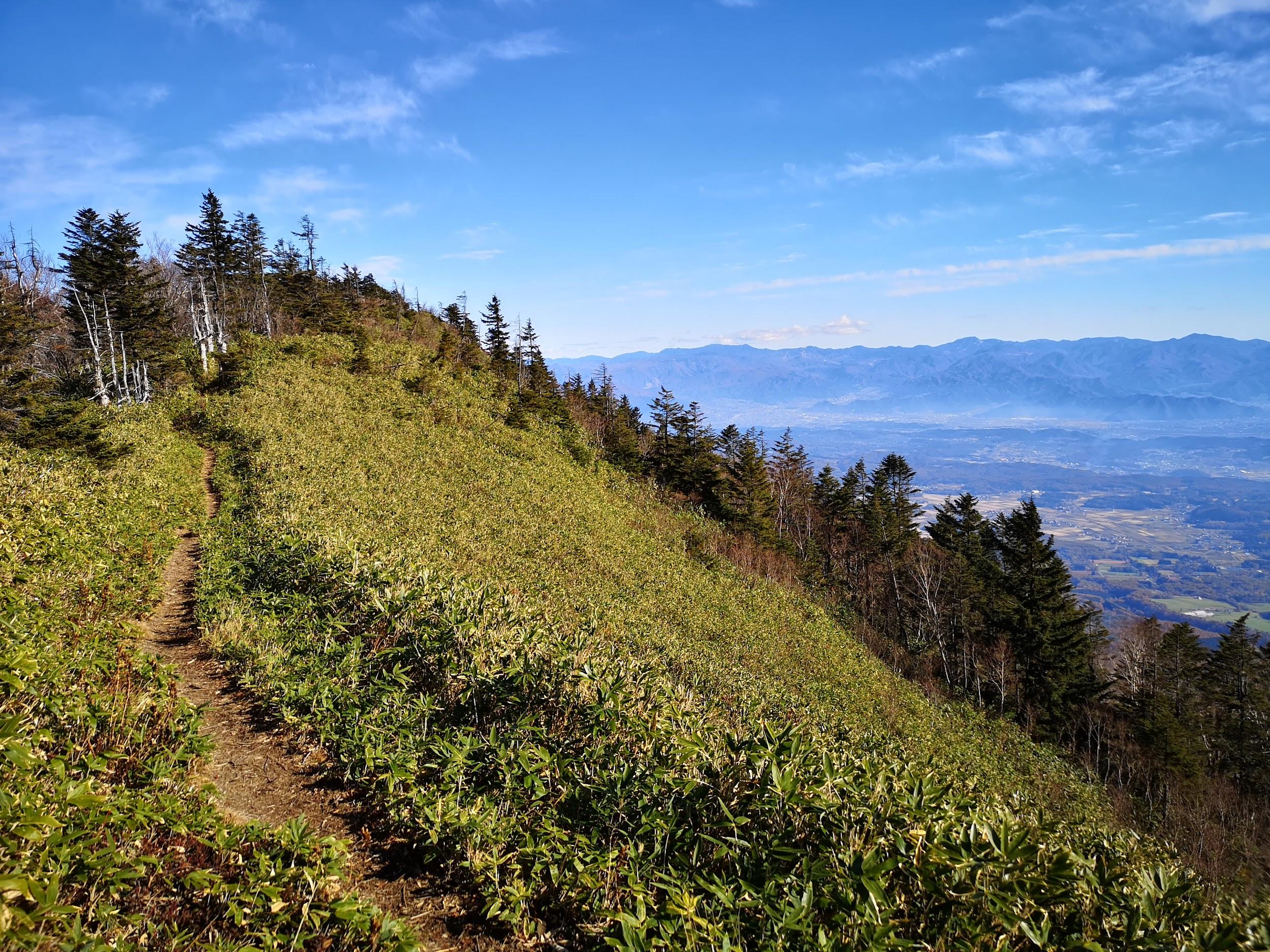
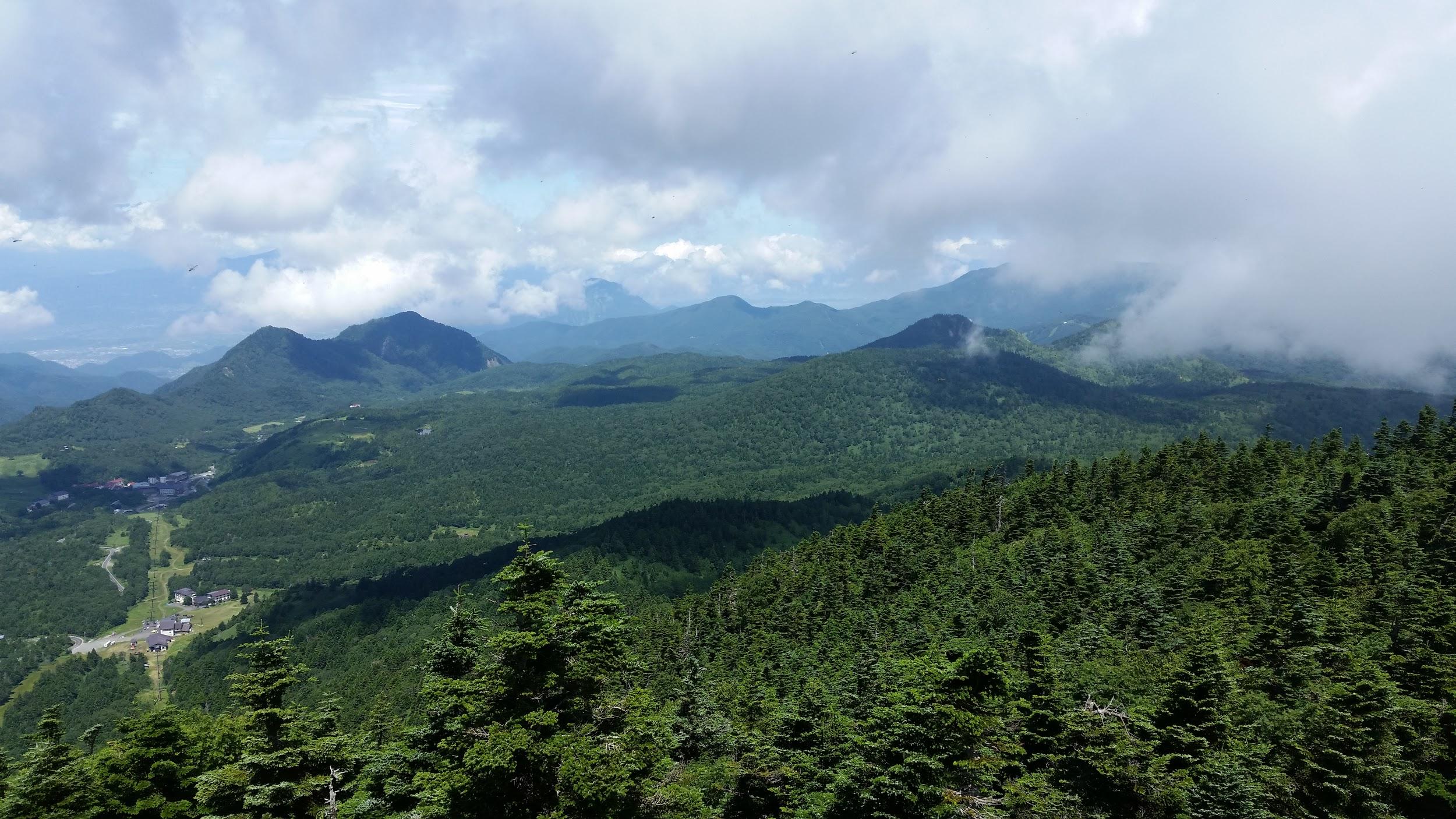
Kawaguchiko City surrounded by nature
I started out after 10am, and walked along the road for about 20 minutes to the start of the trail, which then went straight up the side of the mountain, through trees completely bare of leaves. I reached Oishi pass (1515m) 大石峠 around noon. I had been there once before when hiking from Mt Kuro further to the East. This time I turned right and continued Westwards along the ridge.
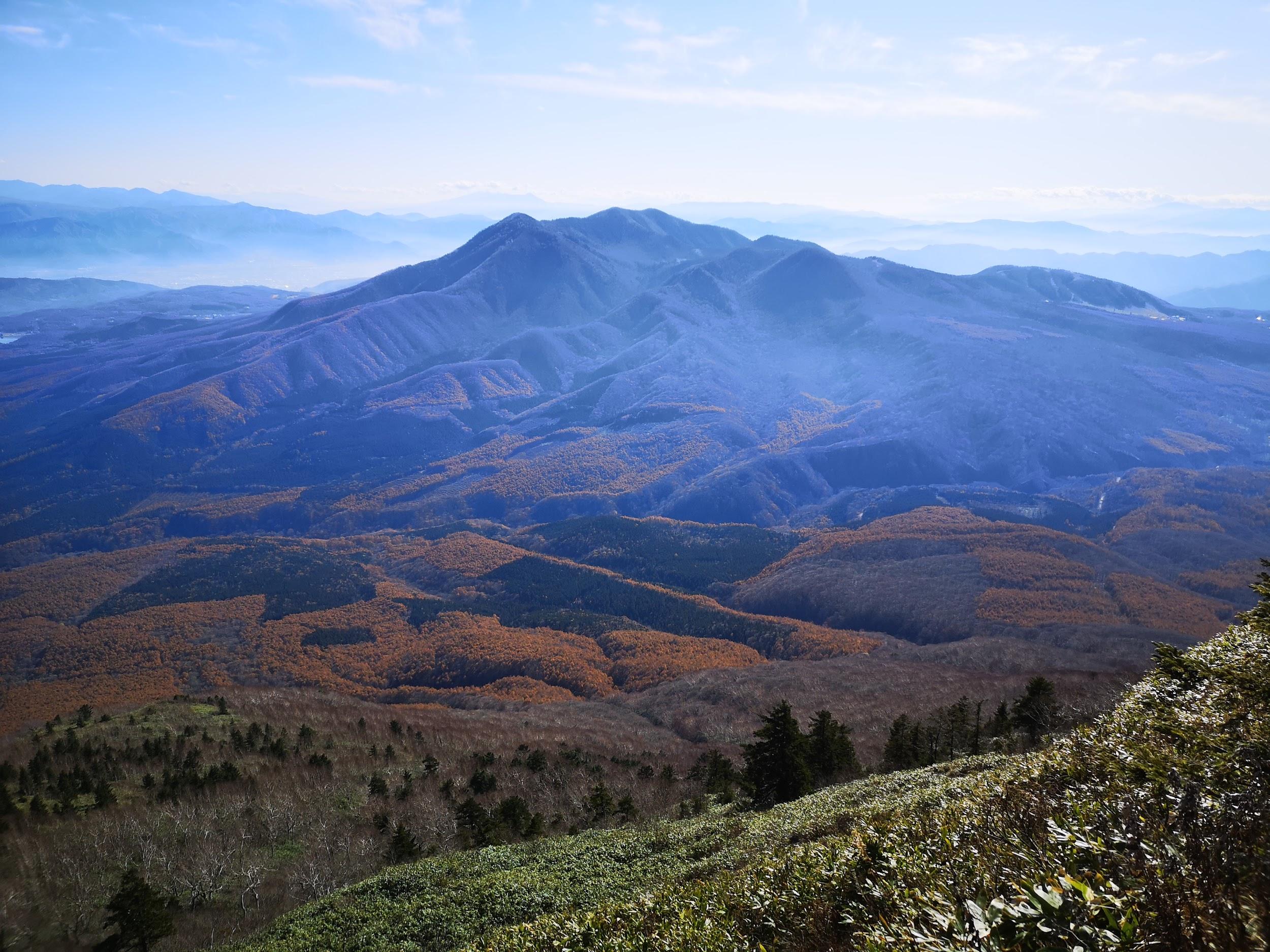
Kofu valley and beyond the Oku-chichibu mountains
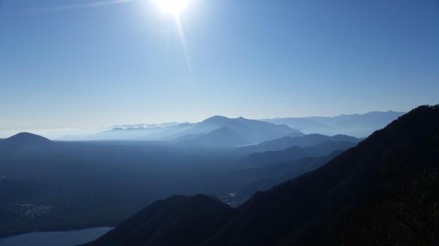
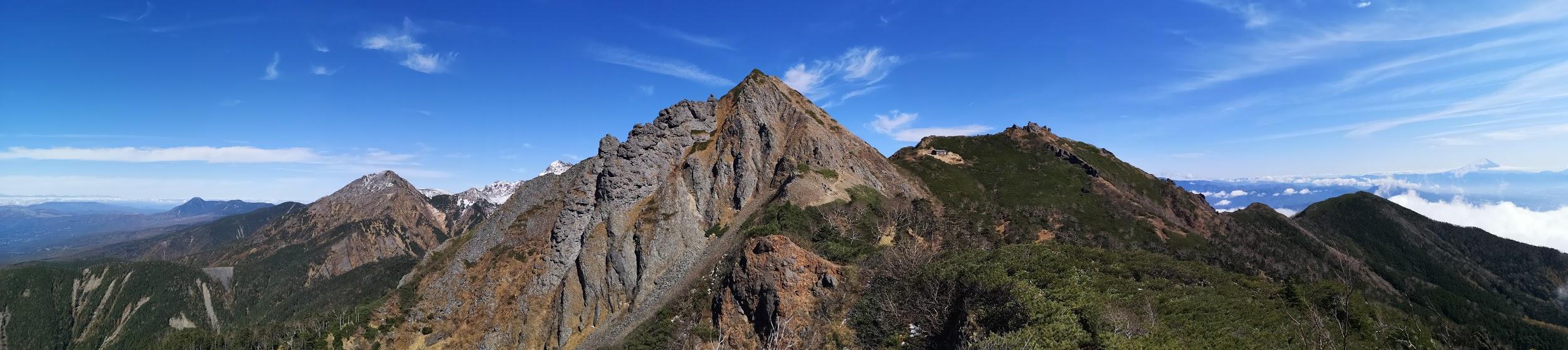
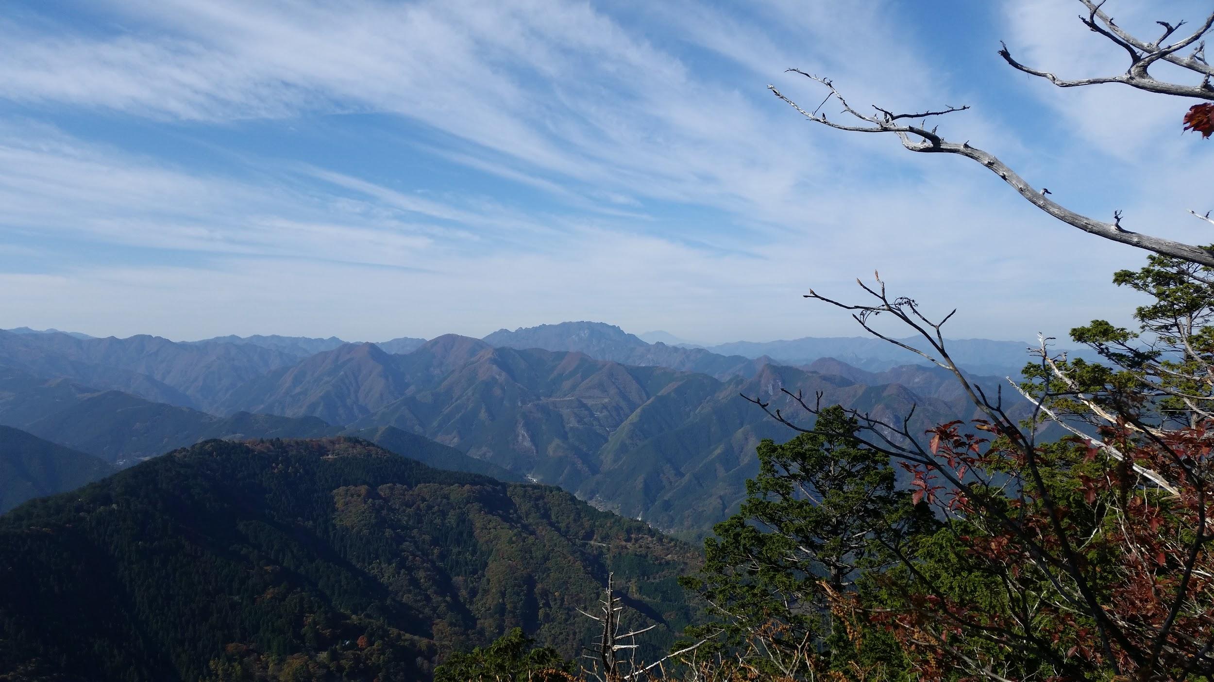
The hiking path went up and down a wide ridge through beautiful evergreen forest. I had occasional views of Mt Fuji to my left, lake Kawaguchi behind me, and the Ashigawa valley to my right. I soon reached the top of Mt Settou 節刀ヶ岳 the third highest mountain along the ridge, after Mt Mitsumine and Mt Oni. From there I could see all the way to the Southern Alps, and the Kofu valley.
Against the sun, looking back towards Minobu
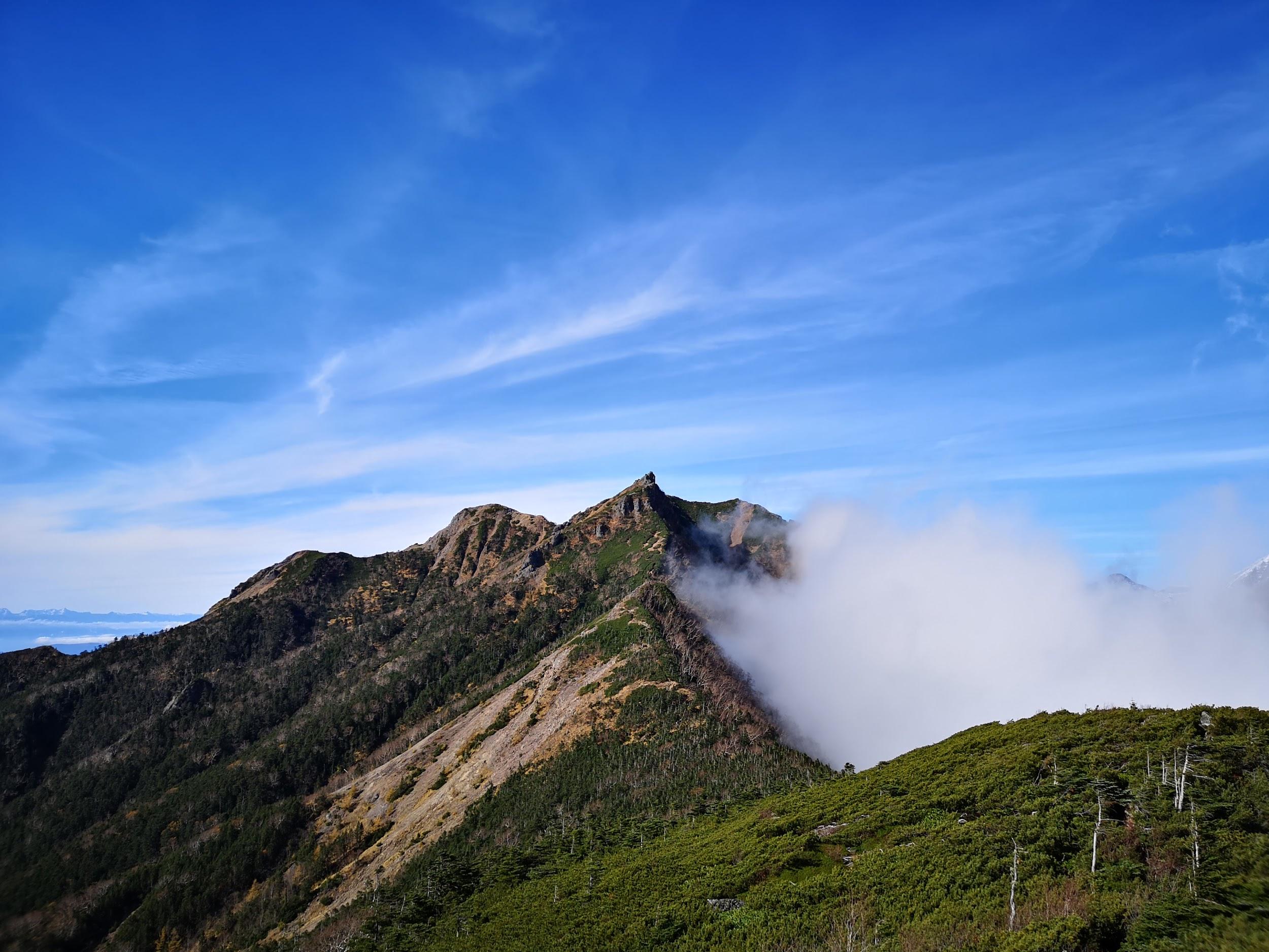
After admiring the view, I started to head down towards Saiko lake. Soon, I had to negotiate a slightly tricky bit involving some rocks and chains. After that, I arrived at the top of Mt Junigadake 十二ヶ岳 which translates simply as “Peak 12”, from where I had some more great views of Mt Fuji ahead of me. I now had two options. The path to the left was an exciting ridge including suspended bridges. Alternatively, I could head straight down to Izumi no Yu, a hot spring on the side of Saiko Lake. Since it was already 3pm, I decided to head down, and leave the exciting ridge for another hike.
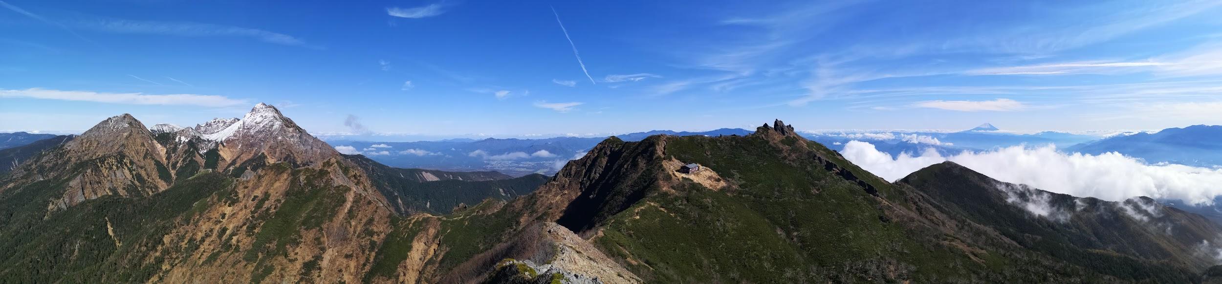
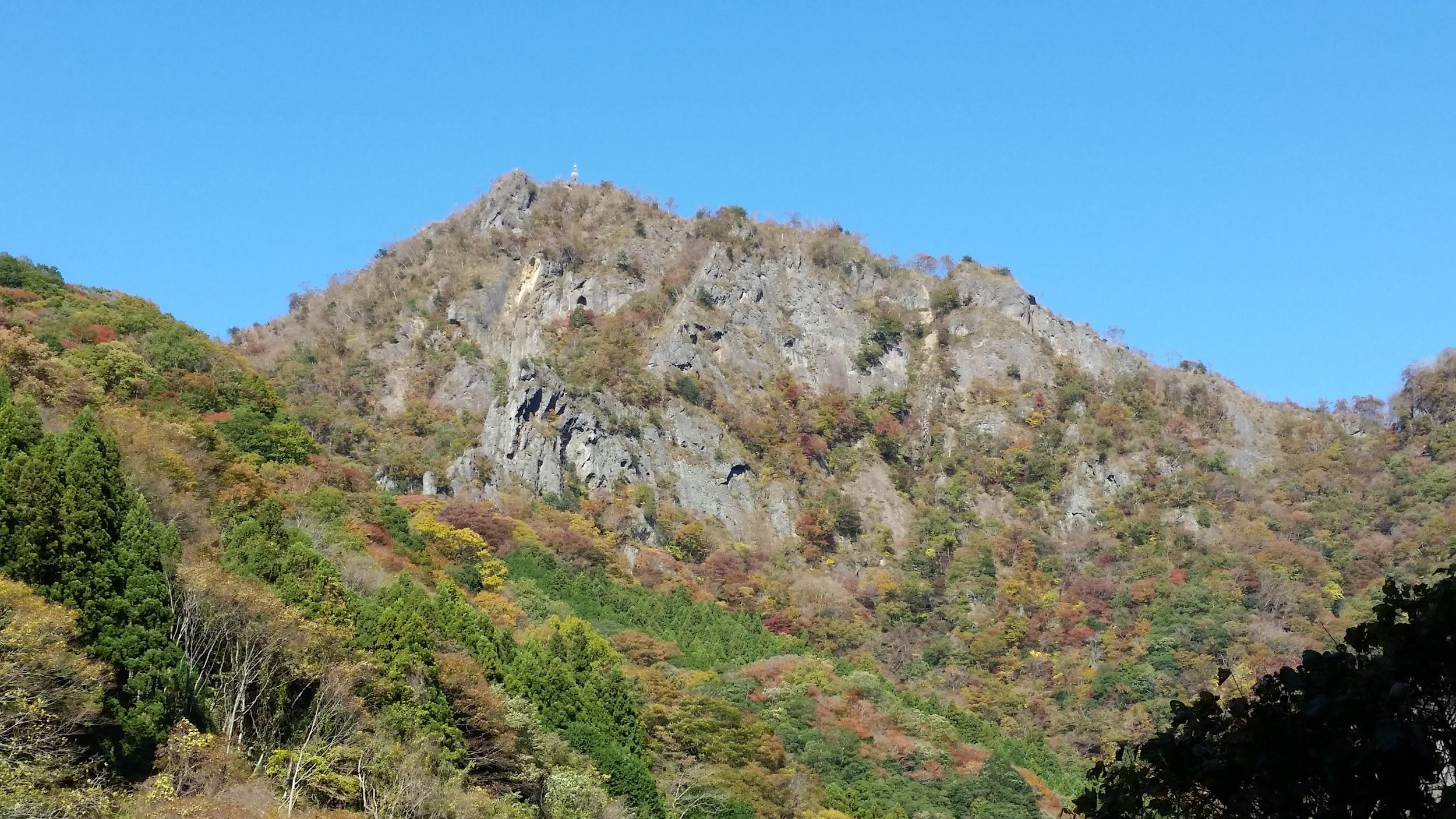
Mt Asamakakushi (1757m), Takasaki City, Gunma Prefecture, Saturday December 9, 2017
For this hike, I drove a rental car from Takasaki city to a small parking area near the entrance of the trail to the mountain. Starting from an elevation of 1450m at 11am, the hike to the top took only one hour. Although the top of Mt Asamakakushi 浅間隠し, meaning “Hidden Asama” was similar to that of my previous hike, it was a lot colder, since I was further North.
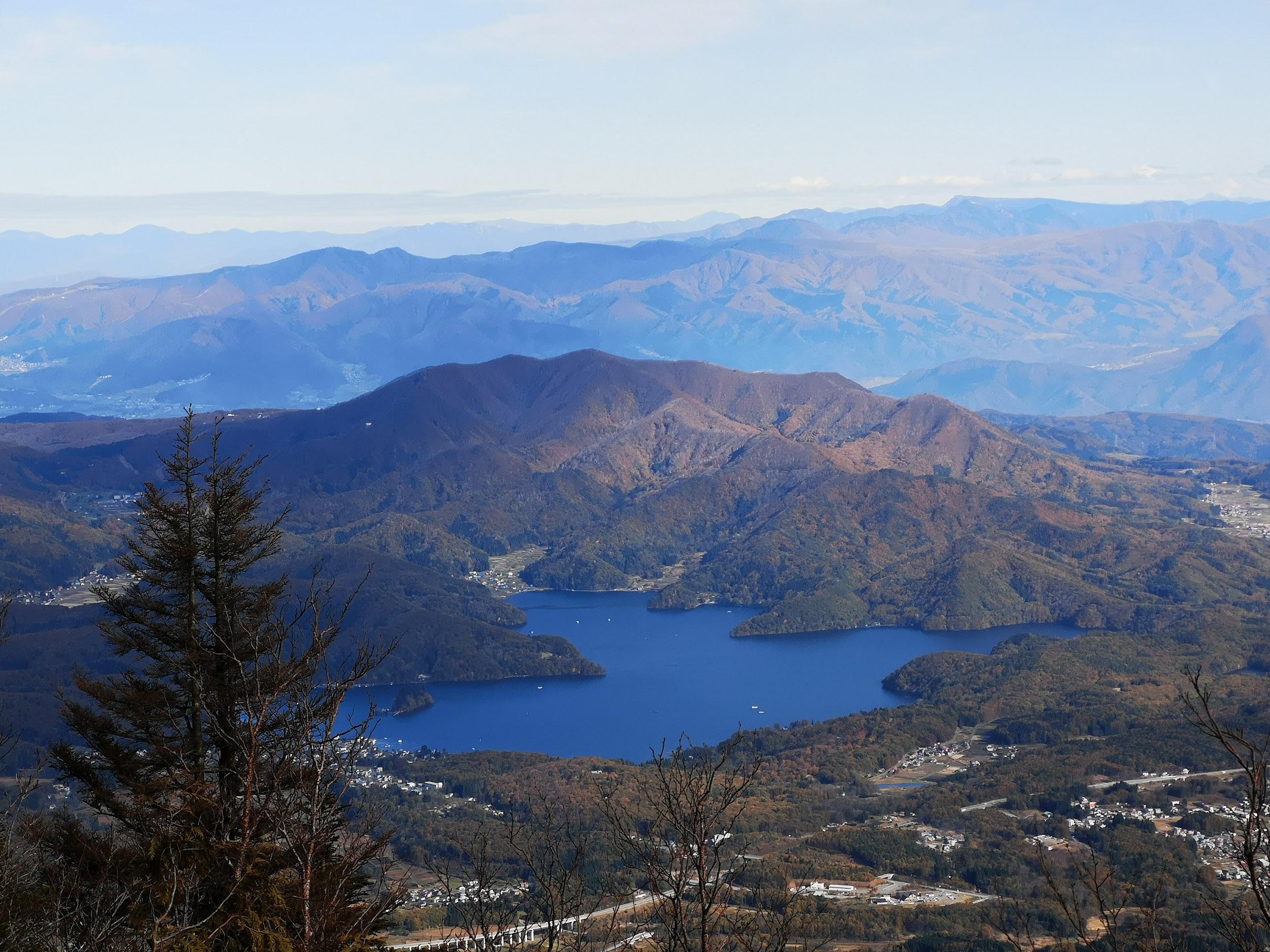
Yatsugatake in the background
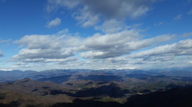
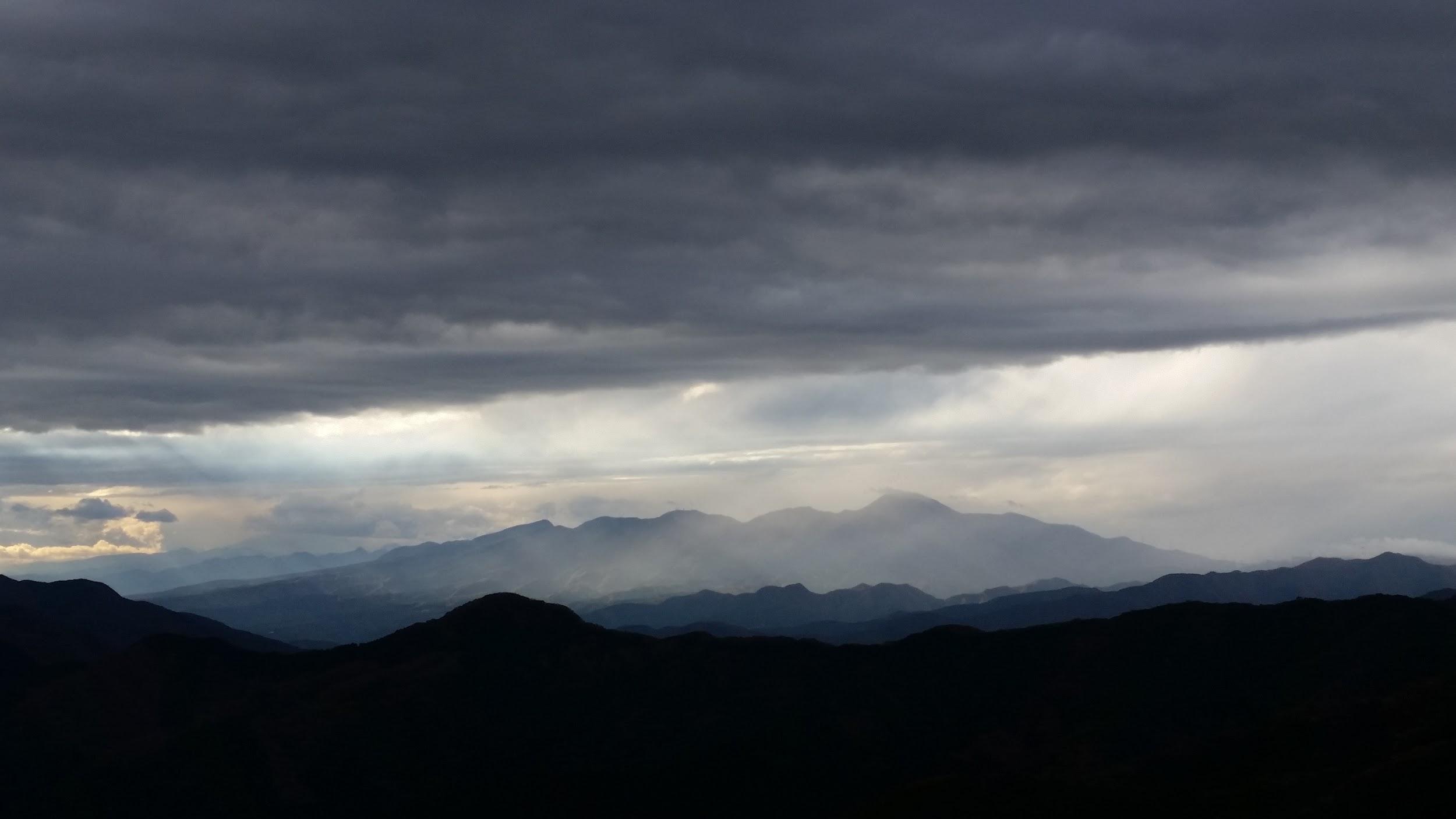
The view of snow covered Asamayama to the West was breathtaking. I could also see the entire Joshin-Estsu mountains forming the Northern edge of the Kanto plain; there are just too many mountains to list here. Southwards, I could make out the Yatsugatake range, Karuizawa and the Oku-Chichibu mountains. Finally the three holy mountains of Gunma – Myohgi, Haruna and Akagi – were all visible in the same panorama.
The Joshin-Estsu mountains
After an hour taking pictures and eating lunch in near freezing temperatures, I made my way down the same way I had come up. Once back to the car, I drove to the onsen at Hamayu Sanso at the base of the mountain. I got there just before 2pm and I was able to warm myself up, before driving back to Takasaki station.
I had been to Shikoku twice, but I had never walked its famous pilgrimage trail, nor visited any of the 88 temples along the way. In January, I went on a short trip to Kamiyama. Since the Shikoku Pilgrimage went through this town, I decided to hike one section of it. Although mostly on the coast, a few sections went inland. Looking at the map, I could see that the Kamiyama section was the deepest inland the trail ever went; so deep that I wouldn’t be able to see the ocean. I knew that more than half ofthe pilgrimage was on paved roads. However, the section between temples 11 and 12, just before Kamiyama, followed a hiking trail through forestedmountains. The walking distance between them was about 13 kilometers, perfect for a one-day hike.
My enthusiasm wasn’t dampened after reading that this was one of the toughest parts of the pilgrimage due to its many ups and downs. Apparently, a lot of pilgrims give up on this section, known as “henro-korogashi”, an ominous phrase meaning “knocking down pilgrims”. However, since my purpose was to hike, I was looking forward to breaking a sweat on the trail, especially since I would be able to relax at the Kamiyama hot spring afterwards. I was concerned about the weather, since it was supposed to rain during my visit. However, on the day of my hike,the forecast was cloudy with some sun in the morning. I had brought all my waterproof gear, and although I didn’t mind a punishing trail, I preferred doing it in dry conditions. I kept my fingers crossed that the forecast would be accurate.
Hiking the Shikoku Pilgrimage Trail 四国遍路
Blue skies at the start of the hike
Since it was my first time to hike the Shikoku pilgrimage, I decided to do some reading beforehand. I learned that it connected places visited by Kobo Daishi (774–835), the founder of Shingon Buddhism. The pilgrimage itself only became popular during the Edo era, 1000 years later. Nowadays, the Shikoku Pilgrimage, or “Shikoku Henro” (“henro” is the Japanese word for pilgrim) is 1200 km long, passes by 88 temples, and takes one to two months to complete on foot. Although he’s one of the most famous historical figures from Shikoku, I had never heard of Kobo Daishi, also known as Kukai in his lifetime, but I had heard of the temple town of Koya-san, which he founded in 819.Some people believe he’s still alive on Mt Koya, in a state of meditative consciousness awaiting the appearance of the future Buddha. He also is said to have invented the Hiragana and Katakana writing systems, two things I am very familiar with.
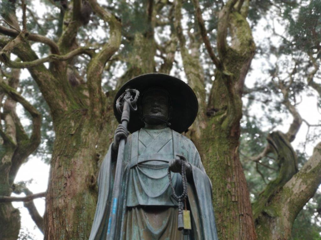
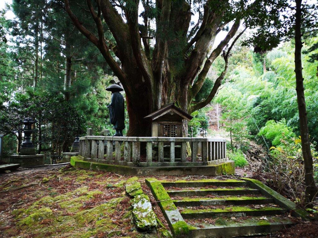
Statue of Kobo Daishi between temples 11 and 12
It’s important to note that it’s not necessary to be a Buddhist to appreciate the trail. It’s also a way to find yourself, and immerse yourself in nature. Pilgrims usually wear a pilgrim’s outfit consisting of a conical hat, white vest, and a wooden staff. Anyone walking the trail is free to dress this way, the same way one wears a yukata or a jimbe to a fireworks festival. However, I felt more comfortable in my hiking clothes, including a cap, backpack and sturdy hiking boots.
Statue of a pilgrim dressed in his pilgrim outfit
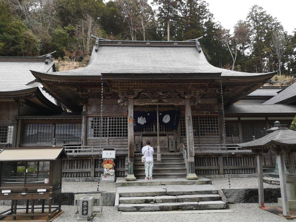
I had an acquaintance living in Kamiyama Town, and after telling him that I planned to hike the Shikoku Pilgrimage between temples 11 and 12, he offered to pick me up at Tokushima station, and drop me off at temple 11, officially known as Fujii-dera Temple (藤井寺) . I gladly accepted his offer, since the temple was nearly one hour on foot from Kamojima station (about 30 minutes by train from Tokushima station). I wasn’t afraid of some extra walking, but I wanted to save my energy for the trials ahead. At 9h30, we reached the small parking area below the temple and above a wide valley. At the entrance gate was an illustrated signboard showing the different landmarks along the trail, before and after Fujii-dera.It included distances and walking times, of great interest to pilgrims (and hikers).Since I hadn’t been able to get my hands on a paper map, I studied it religiously.
The main hall of Fujii-dera, built in 1860
The temple’s name includes the character for the Wisteria flower, and beautiful blue Wisteria can be seen inside the temple grounds every year in May. Unfortunately there weren’t any colours in the middle of January. It is said that it was founded by Kobo Daishi in the ninth century. It was converted into a Zen temple during the Edo period, and is one of the three Zen temples along the pilgrimage (the other 85 remained Shingon). As is often the case, the wooden buildings burned down several times throughout history, and the present ones date from the 19th century. However, a statue carved by Kobo Daishi survived each time, and is said to offer protection from disaster. Behind the temple were 88 small statues representing the 88 temples along the pilgrimage (I was in a hurry to immerse myself in nature, so I missed it).
Great views along the first part
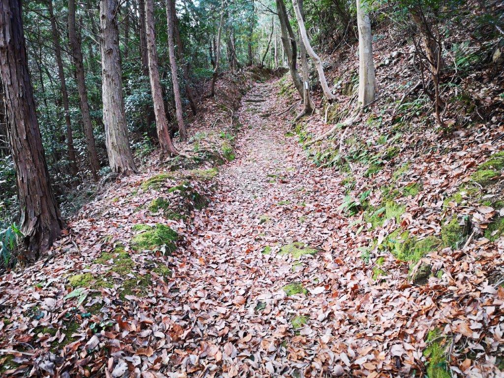
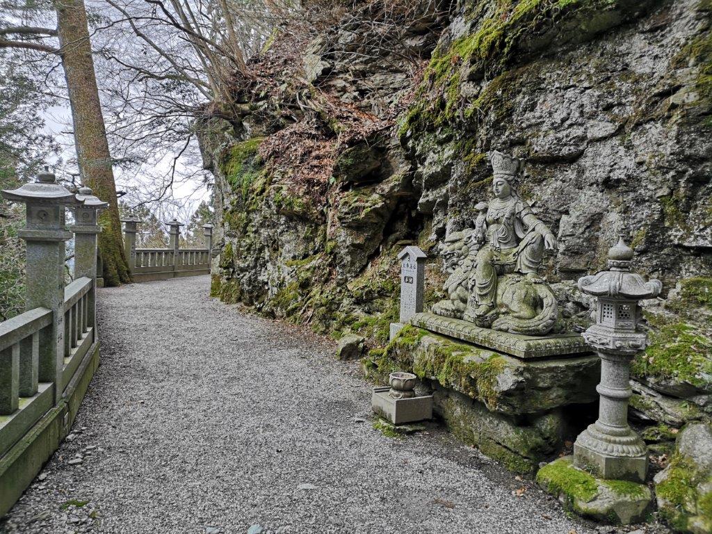
From the start, the path climbed steadily, slowly winding up the mountain side. Close to the temple,there were many reminders of the spiritual aspect of this journey: statuettes and mini-shrines could be seen on both sides of the path. The stone railing on the left was covered in green spongy moss. Small signs saying “henro-michi” (へんろ道) meaning “pilgrimage trail”, were periodically attached to tree branches, preventing all but the most absent-minded of pilgrims from straying from the path.
Helpful signs showing the way
At exactly 10 o’clock, I reached the first viewpoint after crossing a small road. I could see the valley created by the Yoshino River, the second largest river in Shikoku (194 km), and one of the 3 great rivers of Japan. Beyond was a range of low mountains stretching East to West across Tokushima Prefecture. It seemed like an excellent spot for a late breakfast. A man in full pilgrim attire walked by. His pace was so slow that I thought I could easily overtake him later on, but I never saw him again, as if he had vanished into thin air.
Great view of the Yoshino river basin
After setting off again, I soon reached a rest spot with another view and a small sheltered sitting area. Looking up, I could see large patches of blue sky, but the sun was still lurking behind the clouds. Here and there, attached to tree branches, were short Buddhist sayings. I didn’t stop to decipher them but I imagined that they were meant to encourage the weary traveler. The trail was covered in a layer of dead leaves, andalternated steep and gently sloped sections. This year’s winter was relatively mild throughout Japan, and so I felt lucky not to have any snow on the trail.
A typical section of the hike
I eventually reached a pleasant flat section. Initially I thought I had reached the pass, but I was only moving around the side of the mountain into the fold of a deep valley. Around this time, the sun finally came out. I had seen no one else apart from the phantom pilgrim from earlier. The noises from the valley below had become muffled. This was probably the most enjoyable section of the hike, and the tough ups and downs that lay ahead were, for now, completely forgotten.
A pleasant stroll in the sun
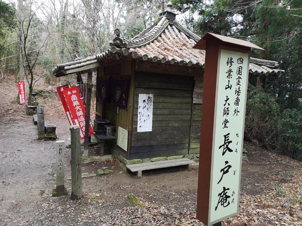
At the end of the valley the path started to climb steeply again.A few minutes later, I reached Chodo-an (長戸庵), a tiny Buddhist temple surrounded by trees at the top of the ridge. It was just past 11 o’clock and I was 3.2 km from Fujii-dera. According to the legend, Kobo Daishi was taking a break here, when an old man came by with pain in his leg. Kobo Daishi healed the pain by chanting a Buddhist mantra. Afterwards, the old man built the temple as a token of thanks. The characters in the temple’s name stand for “long” and “entrance”, and it’s said that the name refers to a place to take a break and recover. However, I wasn’t feeling tired yet, so I decided to push on.
Chodo-an, a tiny temple at the first stop on the trail
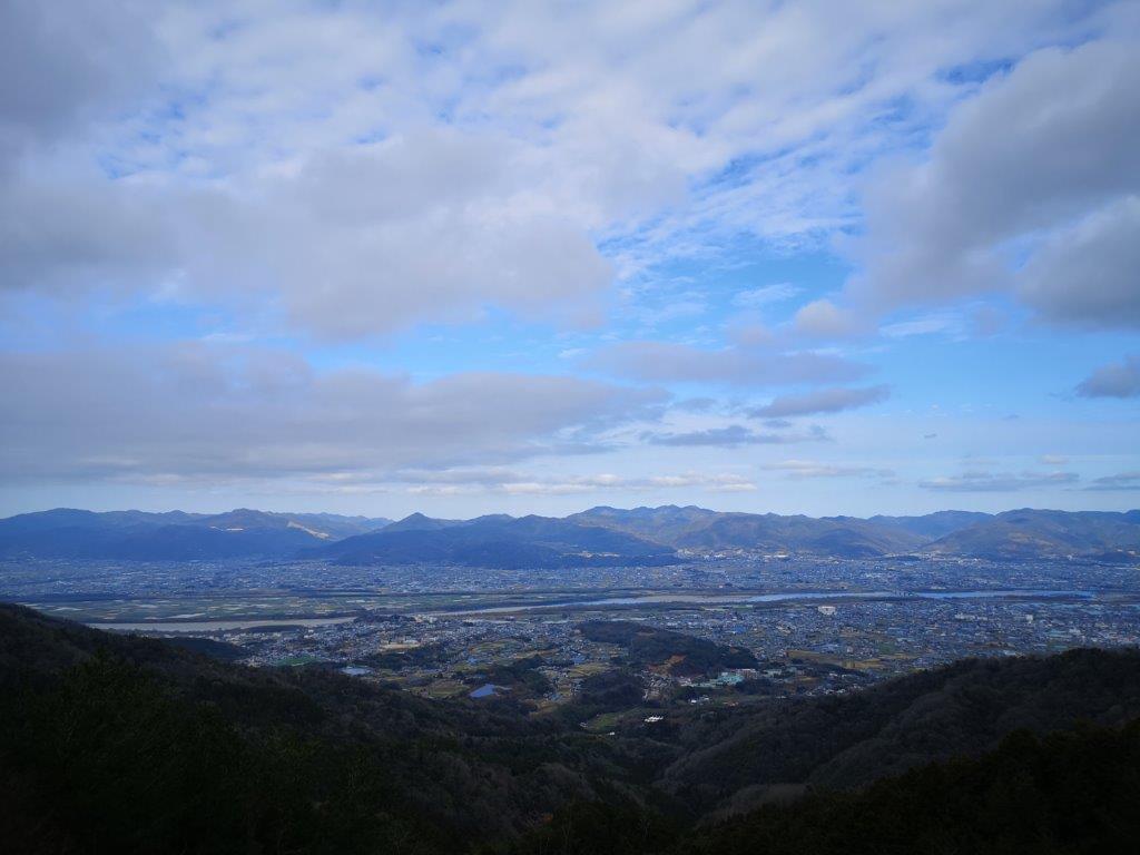
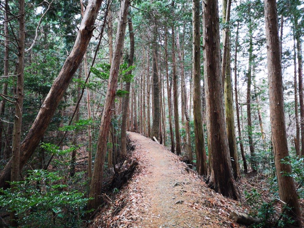
The path now followed a mostly flat forested ridge, with some short up and down sections. There were occasional glimpses of the mountains on the Kamiyama side. The sun had retreated behind the clouds; it felt cold, and a bit lonely. I suddenly emerged from the trees, and had an outstanding view of the Yoshino river valley. A sheltered bench beckoned me to sit down for an early lunch, but I wasn’t hungry yet. The path turned south, away from the Yoshino valley, and towards the Kamiyama area, and I soon re-entered the forest. There were frequent signs, including the distance and walking time to the next small temple on the way. I never had to wonder where I was, and the lack of a map didn’t seem to be adisadvantage after all.
View from just after Chodo-an, from an altitude of 500m
After reaching an elevation of 600 meters, the path descended quickly, and I soon arrived at another, larger, Buddhist temple called Ryusui-an (柳水庵), 6.6km from my starting point. The first two characters meant “willow” and “water”. When Kobo Daishi arrived here, he wanted to drink some water but there was none. So he used a mantra on a willow branch, which led him to an underground spring. Nowadays, the spring is called “yanagi no mizu”, meaning the willow’s water. I had my own supply of water, so I had a good long drink from my water bottle and moved on.
Trail just before the descent to Ryusui-an
I finally came across another person as I was walking past the temple buildings. I asked him if he was hiking the trail, or maybe a monk looking after the temple. He replied that he was doing some sightseeing, and pointed at his car, parked on a road behind. I had arrived at the first of the escape routes along the trail. I had been walking for two hours and a half, and was halfway to temple 12. There was a small rest house a few minutes away on a bend on the road, but I still wasn’t tired or hungry, so I crossed the road and continued along what was now a wide forest road.
Interesting statuette seen along the trail
From this point, I saw fewer signposts and religious symbols along the way. The forest road went straight through the forest, and it soon joined up with another forest road. While I was trying to figure out whether I had to go left or right, I noticed that the hiking path had reappeared on the other side, marked by a small sign. I started to climb up the side of the mountain through a dark forest of tall cedar trees. Above, I could see some rocky cliffs, and I was hoping the path wouldn’t take me there. Just after 1pm, I reached a staircase at the top of which was a statue of Kobo Daishi.
The statue of Kobo Daishi at the top of the staircase
I was amazed to see a massive thirty-meter high cedar tree, called “Souchi-no-ipponsugi” (左右内の一本杉) or “ipponsugi” for short. Although at the base it was just one tree, it quickly formed several trunks that spread out in all directions, and could be better appreciated by walking past and seeing it from the other side. At 745 meters, this was the highest point of the section between temples 11 and 12. There was a bench, so I finally sat down for a quick lunch. According to the legend, Kobo Daishi took a nap using the roots of the tree as a pillow, and as he slept he saw the Buddha in his dreams. Although I felt tired from the steep climb, it was really cold, so I thought it would be better to skip the post-lunch nap, and hurry along my way.
The many branches of Ipponsugi
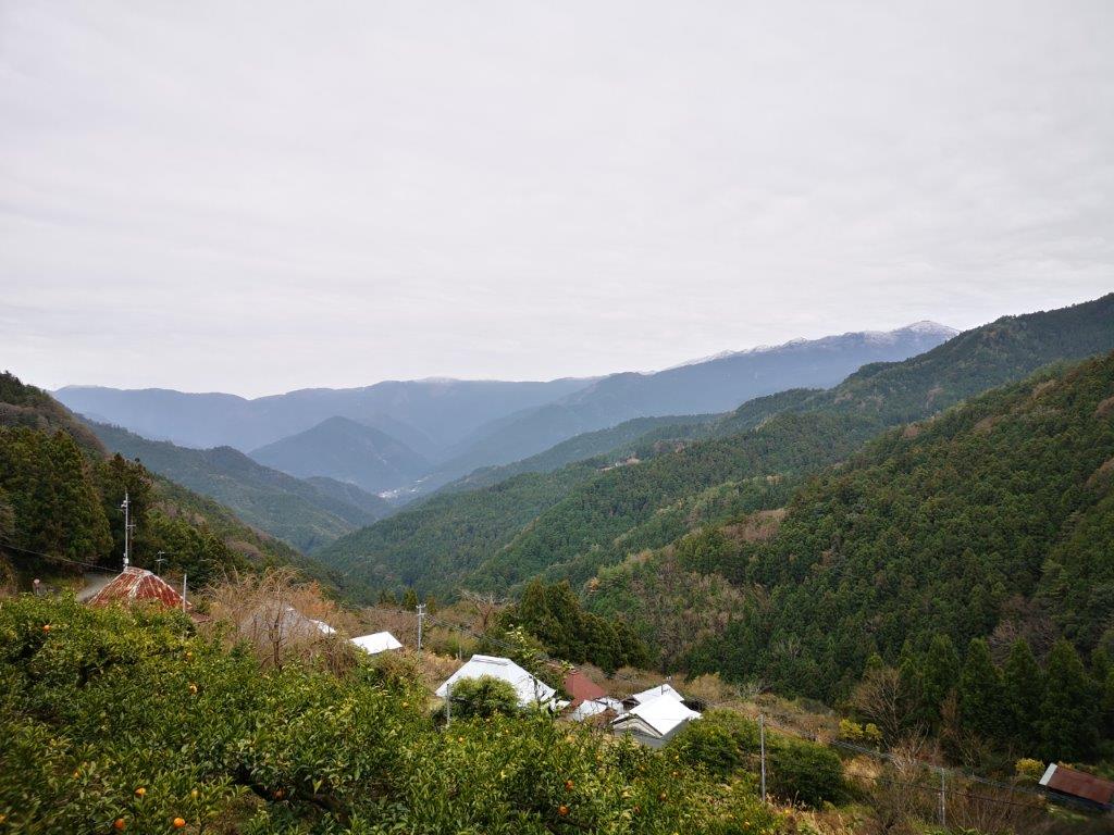
The path down was less steep than on the way up, so I started to run down. I wasn’t behind schedule, but it was an excellent way to warm myself up. I soon popped out of the forest into a cultivated area near a small village. There was a wide view of a valley to the north, at the end of which was Kamiyama Town. However, before I could get there, I needed to climb one more mountain.
In the distance, my final destination, Kamiyama
I noticed a house with a pointed metallic roof, like a pyramid, just outside the pyramid. Afterwards, I found out that it was a protective aluminium cover and underneath was a thatched roof, also known as “kayabuki”. In the past the roof was uncovered and exposed to the elements, but as the number of roof-thatchers dwindled, it became very difficult and expensive to repair these types of roofs, so these metal tops were introduced.
A short detour through a village
I was now walking along a road, but I picked up the hiking trail again shortly after crossing bridge over a rushing river. The final climb took me from the bottom of the valley up to a temple on the side of Mt Shosan. At 700m, it was the second highest temple on the Shikoku Pilgrimage. The path was steep and a bit rocky at times. At 3pm I reached the temple parking lot, where I was rewarded with a good view, looking back across the valley at the ridge with the spreading cedar tree.
Final approach to Shosan-ji Temple
I walked another ten minutes along a wide flat gravel path round the side of the mountain to reach the main temple area, at the top of a staircase and past the entrance gate. I observed many interesting-looking statues along the way and within Shosan-ji, but my limited knowledge of Buddhism meant that I couldn’t really appreciate their significance. Within the temple grounds, there were many tall cedar trees; apparently, some of them were over 500 years old.
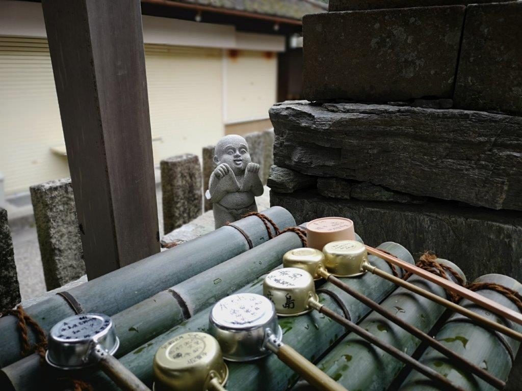
Mischievous child behind the purification basin
Shosan Temple was founded over a thousand years ago, and its name can be translated as “Burnt Mountain”. According to the legend, a dragon used to live there occasionally setting the mountain on fire, till Kobo Daishi came along and imprisoned it in a cave. I found out afterwards that there was a trail leading to this cave, which then continued to the top of the mountain (938m). Since I completely missed it, I have a burning desire to return and complete this part of the hike.
The main temple building at Shosan-ji
Since it was still early afternoon, I decided to walk down, adding a couple of kilometers to the hike. The main road descended through a series of switchbacks, but the trail went straight, and cut across it several times. Just before 4pm, I reached the small Buddhist temple of Joshin-an (杖杉庵). The legend associated with this place is more heart-wrenching than the previous ones. Emon Saburo was once the richest man in Shikoku. One day, he chased a pilgrim away from his house. Unbeknownst to him, the pilgrim was Kobo Daishi. After Emon’s eight sons all fell sick and died, he realised his terrible mistake. He walked the Shikoku pilgrimage 20 times looking for Kobo Daishi to ask for forgiveness. In the end he collapsed with exhaustion. However, he was visited by Kobo Daishi before he died and was forgiven. The statue next to the temple shows this last scene, and onecan’t help but feel a bit moved after knowing the story.
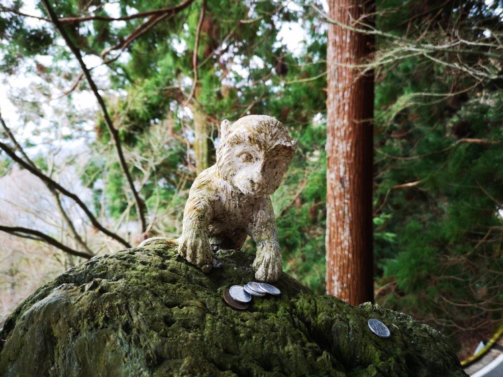
Cheeky monkey stealing offerings
This last temple on my pilgrimage hike was also my rendez-vous point with myKamiyama acquaintance, and he turned up with his car just a few minutes later. I was looking forward to getting to my hotel at Kamiyama Onsen and enjoying a relaxing hot spring bath, to wash away the weariness of the pilgrim’s trail. The path hadn’t knocked me down but my muscles felt knocked about!
Since I made blog entries for nearly all my hikes in the Tokyo area in 2019 – there are some December ones left that I’ll write up soon – I won’t do a summary like last year. Instead, I’ll share some numbers for the past year.
Total Number of Hikes
In 2019, I had 46 outings that resulted in some form of hiking (ten more than in 2018). “Hiking only” trips within the Tokyo area, totaled 40 (also ten more than the previous year). I’m glad I achieved my personal goal of surpassing the number of hikes in 2018, and equaling that of 2017, (although 2019 had more short hikes), despite tendinitis in my left ankle that has been bothering me since the summer. The hikes were evenly divided between Saturday and Sunday, an improvement from last year when most hikes fell on a Sunday.
Hikes per Prefecture
The prefecture where I did the most hikes was Yamanashi (11) – a bit surprising since I had already done many hikes in that area, but then Yamanashi has many mountains. Gunma (8) ranked high up because half the hikes bordered on other prefectures. I was also surprised that Kanagawa (5) did well. I really thought I had exhausted that area in previous years. I was glad I was able to do several hikes in Ibaraki (4), an area I started to explore only last year. I also managed more hikes in Shizuoka (4) that weren’t on, or close to, Mt Fuji, and I hope to explore that prefecture more in 2020.
One of my goals for 2019 was to do more hikes in Tokyo (3), and although the result isn’t great, it’s honorable. I had really wanted to go to Tochigi (3) more often, but I often found myself canceling my plans there because of the weather. My biggest regret is not hiking more in Chiba (2). Many trails were severely damaged due to last year’s powerful typhoons, and it’s unlikely I will be able to go there this year. I was kind of shocked to see how little I had hiked in Saitama (2). However, this is one area I had extensively explored in previous years.
Hikes by Means of Transport
I wasn’t surprised that so hikes many hikes required access by bus (23). However, I still managed to find many station to station hikes (11), although road walking was required for a few of them. Occasionally, I opted to go by rental car (7) or by taxi (3), since there was either no bus or the times weren’t convenient.
This was my fourth hike inside Togakushi kogen and the Myoko-Togakushi renzan National Park, one of the places I definitely wanted to visit again in 2019. Although Nagano prefecture had some bad flooding because of Typhoon Hagibis, it was spared the strong winds that knocked down many trees in the Kanto area. I used the shinkansen to make it a day trip. It was also my last “big hike” of 2019; temperatures dropped significantly in the second half of November, and there was more rain than average, meaning snow in the mountains.
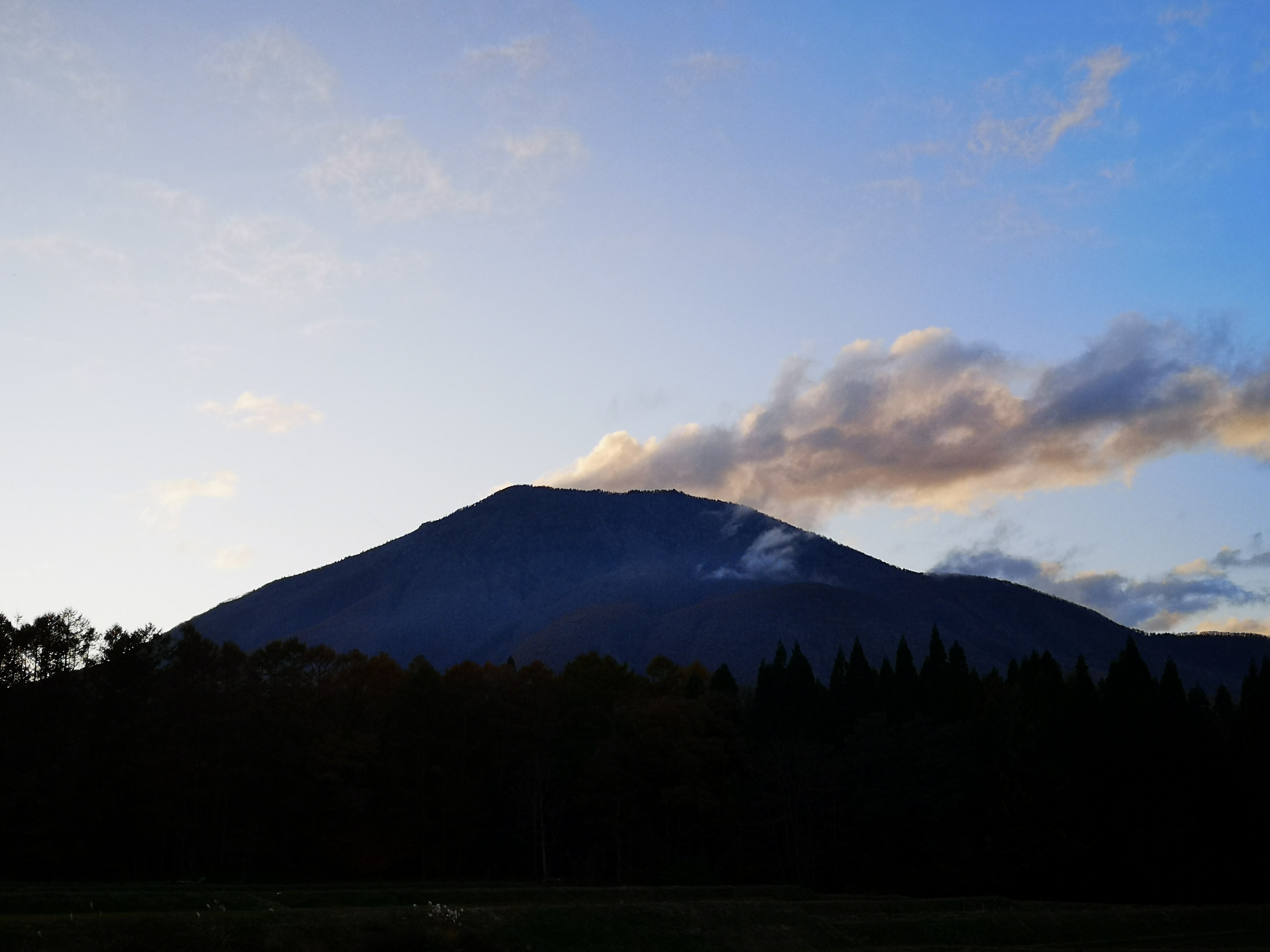
Evening clouds mimicking volcanic fumes from the top of Mt Kurohime,
After arriving at Nagano city, I made my way to the Alpico Information Desk across from Zenkoji exit to buy my one-way ticket to the Togakushi Campground. My plan was to walk down the other side of the mountain and end at a train station along the Hoku-Shinano train line, so that I wouldn’t have to go back the same way. Although it was out of season, there were quite a few people, so an extra bus turned up, and everyone was able to sit comfortably during the one-hour ride. All the other passengers got off at the stop for Togakushi shrine, and I was the sole person getting off at the end.
Japanese birch trees cover the mountainside
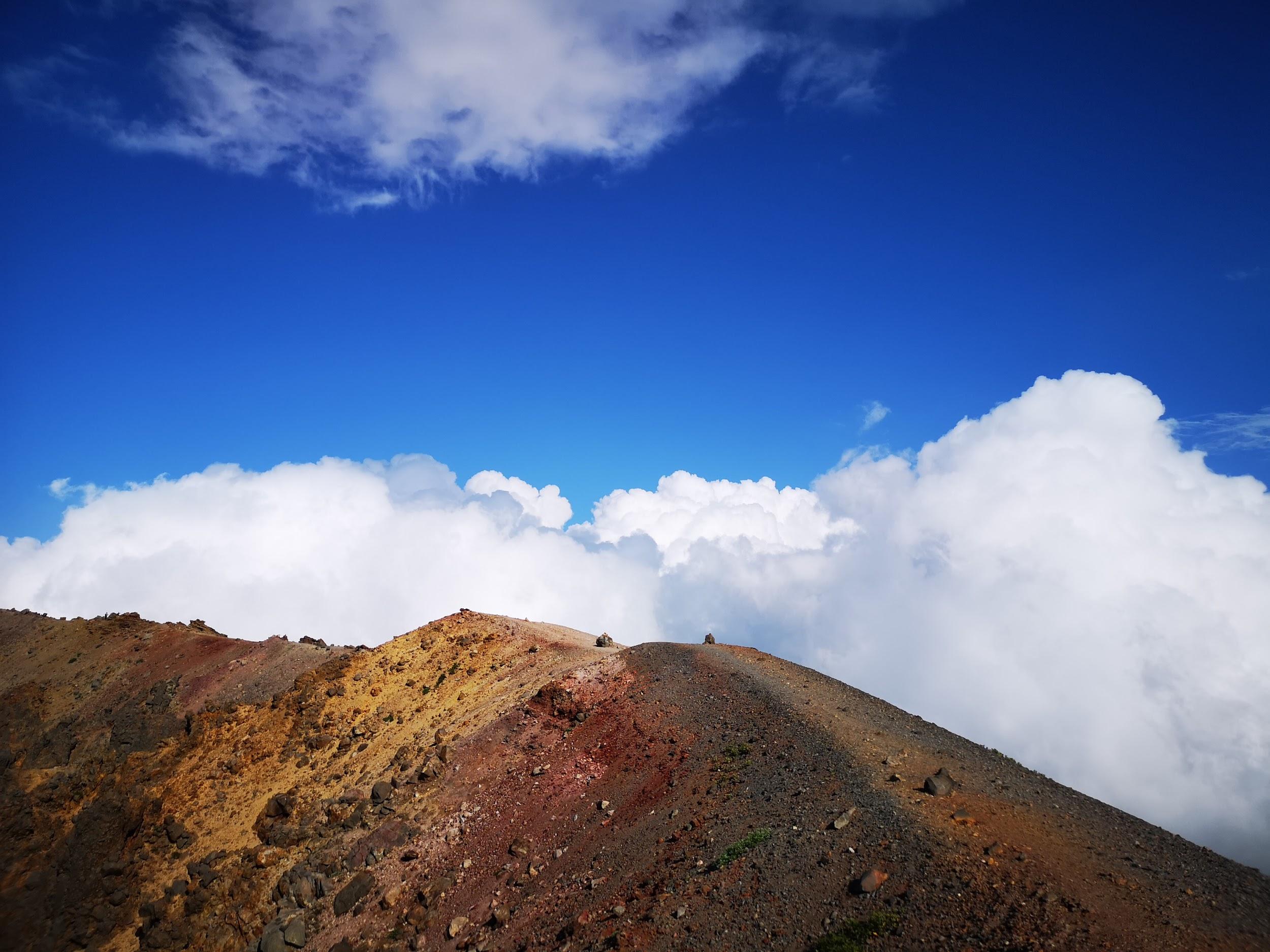
Easy and fun hiking along the crater rim
It was a thirty-minute walk along the road, till I reached a turn-off for a forest road closed to cars, and yet another half and hour to reach the start of the hiking trail. Autumn was late this year, and the needles of the fiery larch trees were still tumbling to the ground. I finally started climbing at 10h30. Very soon, the trees changed to white birch. After one hour of steep climbing, I reached the top of the ridge – actually the crater rim since it’s a volcano – and my first views. Looking back, I could see the entire Togakushi highland, as well as Mt Takatsuma and Mt Izuna. In the distance, I could see the Northern Alps, Mt Yatsugatake and Mt Asama, with plumes of smoke drifting up. Unfortunately, I couldn’t make out Mt Fuji – it should have been visible but it was perhaps too late in the day. Looking forward, I could see Mt Amakazari, Mt Hiuchi and Mt Myoko, the latter two with a dusting of snow on the top.
Mt Takasuma (2353m), a hundred famous mountain, climbed in 2011 & 2014
Mt Izuma (1917m), another volcano and 200 famous mountain, climbed in 2014
I set off again, and saw some patches of leftover snow on the trail, a sure sign that this was the very end of the regular climbing season. As I followed the curve of the crater, slowly bending Northwards, the Chikuma river valley came into view, the longest river in Japan. Looming up above, were the mountains of the Joshin-Etsu. It was my first time to see the view from this side – I had seen it before while skiing in Nozawa Onsen, diametrically opposite. In the center was Mt Madarao and Nojiri lake. The view reminded me of the wide valleys of the Swiss Alps. To my right, the lower half of Mt Izuna was all orange because of the larch trees covering its side and base.
The “Joshin-Etsu” mountains, where Nagano, Niigata and Gunma meet
Mt Madarao (1382m), also a ski resort in the winter, and Nojiri lake
From this point, the trail was fairly easy to walk with some slight ups and downs, but I lost time taking photos. I reached the summit of Mt Kurohime (黒姫山) a little after 1pm, a 200 famous mountain of Japan, and one five famous mountains of Northern Shishu. At this late hour, I had the summit to myself. Despite the near freezing temperatures, it felt pleasant in the sunshine, with almost no wind. I was so busy admiring the views and taking pictures, that I almost forgot the time, and finally set off after 2pm. I was shocked to discover that my ankle, which hadn’t bothered me much today, was suddenly quite painful. I had been counting on a quick descent to make it down before sunset, but I was uncertain how fast I could go with a lame ankle. Fortunately after a few minutes the pain dissipated, but it was a good reminder to always keep a buffer of time.
Mt Hiuchi (2462m), a 100 famous mountain, climbed in 2012, and Otomi lake
Mt Myoko (2454m), another hundred famous mountain, also climbed in 2012
The path continued along the ridge for a while, before turning sharply to the right and down the steep side of the volcano. With more time, it’s possible to descend the opposite side and explore the ponds inside the narrow crater area. However, I was now confronted with a problem other than time: there was a lot more snow than I had expected. I had to proceed carefully to avoid slipping. Luckily the trail zigzagged down and never became too steep. The snow persisted till more than halfway down, and I was relieved when I was finally walking on leaves and dirt again. I reached the end of the trail a couple of hours later, just past 4pm, and less than thirty minutes later I was at Kurohime station, where I caught a local train back to Nagano station. Hopefully I will get to this area next month for some skiing!
Early winter snow on the way down
The name Kurohime translates into English as “Black Princess”
I was hoping to climb one last big mountain in 2019, before the arrival of snow, and I had had my eye on the two Southernmost peaks in the Yatsugatake range for a while. Even though they are the closest to Tokyo, right between Yamanashi and Nagano, they’re challenging to climb as a day trip from Tokyo – Mt Tengu, further North, was possible thanks to the Hokuriku shinkansen. In the end, I decided to stay the night in Kofu and drive to the mountain; this way I could leave at dawn, and finish around sunset. I had to travel to Yamanashi and back by highway bus, since the trains weren’t running as usual due to damage by typhoon Hagibis. This was a blessing in disguise, since the bus costs half the price of the train, so I could recoup some of the cost of the hotel and the car.
Looking back at the pointy tip of Mt Gongen from Mitsugashira
On Thursday morning, the sky above Kofu city was foggy, but as I drove West along the highway, blue skies appeared overhead. As Yatsugatake came into sight, I got a shock: the top was white with snow! As I drew closer, I saw with relief that it was only the highest peak, Mt Aka (2899m), that was covered in snow, and today’s hike would be snow-free. I reached the Kannondaira parking lot (1560m) just before 8am – there were quite a few cars, even on a weekday. The first part of the hike, a gently rising trail through forest that was still green, was fairly easy. After half an hour, I reached a clearing with a good viewpoint of Mt Fuji sporting a brand new snow cap – a good place for breakfast.
The trail continued through thick forest, and after another half an hour I reached the turn-off for my first peak. A steep climb straight up the side of the mountain, with occasional views through the forest of the Kofu valley behind me, brought me to the bare and rocky top of Mt Amigasa 編笠山 at 10h30. The 360 degree view was one of the best I’ve ever seen while hiking.
From left to right I could see Mt Fuji, the Minami Alps, the Chuo Alps, Mt Ontake, Mt Norikura and the Kita Alps – all the highest were covered with snow. I could also see the entire Yatsugatake range stretching North, with in the center the matterhorn-like peak of Mt Aka. There were so many great pictures from this hike, that it was impossible to share them all here.
Today’s mountain is the highest point on the far right, but lower than Mt Aka in the center
After a quick bite, I set off downhill just after 11am, towards a saddle where the Seinen Hut was located, just 20 minutes away. The last part was full of giant boulders, and it took some time since I had to step carefully from boulder to boulder, following painted yellow arrows. After that, I was climbing again through forest. Suddenly, I was above the treeline at around 2600m; there was a sharp drop on my left, and an impressive rocky outcrop towering in front of me.
Fortunately, there was a switchback path on the right, with helpful chains in several places. It looped around the back, and led up to what I thought was the highest point. Noticing that there was no summit marker, I turned around – the true top was behind me, five minutes away and just a little higher. Looking left, I could the impressive “kiretto” or mountain ridge, leading to Mt Aka.
The “kiretto”, on the right, leading up to the highest point of the Yatsugatake
Originally I had planned to go up and down the same way. However, I had made good time climbing up, so I decided to take a different and longer route down. I hurried past another hut to the highest point of my hike, Mt Gongen (権現岳 gongendake) – in fact the highest mountain climbed in 2019. I couldn’t actually get to the very highest point since it consisted of a bunch of huge boulders, but I got as high as I felt safe doing, and had the rest of the lunch while enjoying the view of Mt Fuji in the distance. Since a boulder was in a way, I couldn’t get a perfect 360 degree view. The weather was still sunny, with almost no wind. Despite the high altitude, and proximity of the snowline 200m higher, I was perfectly fine wearing just a base layer. At one point a cargo plane, probably from the Japan Self-Defense Force, flew past the summit (see video at the end).
Perfect view of Mt Fuji from the top of Mt Gongen
I had to set off fairly quickly if I wanted to complete the hike before dark, around 5pm. First I headed down and back up again to Mitsugashira 三ツ頭 (2580m). Looking back, the view of snow-covered Mt Aka, wrapped in mist was breath-taking. By now, it was nearly 2pm and I needed at least a couple of hours to get back to my car, so I pulled myself away from the view, and descended into the forest. This was one of the nicest and easiest downhill hikes I’ve ever done. There were good views of my first peak, with orange larch trees around the base. One hour and a half later, I reached the Yatsugatake crossing path (“oudan hodo” 八ヶ岳横断歩道), part of a trail that circles the entire mountain range – something to try one day. From there, it was another thirty minutes back to the parking area along a mostly level trail, although the last meters were steep uphill – pretty tough after what was nearly an 8 hour hike! Fortunately, there was a hot spring at the base of the mountain, so I could have a good soak before making the long trip back to Tokyo.
Although it’s called the red peak, today it was partly white
I believe this was a JIETAI plane flying past the summit
Autumn is probably the best time of the year to go hiking in Japan: the weather is usually clear and the leaves are beautiful. However, with a dizzying number of mountains and hiking trails, and a complex public transportation system, it’s not easy to figure out where to go, and how to get there – and back. I’m often asked how to get started with hiking, so here are six tips on how to plan your first hike, and hopefully many others!
With the hike + onsen book you’ll save time looking for a hot spring (photo source: books.jtbpublishing.co.jp)
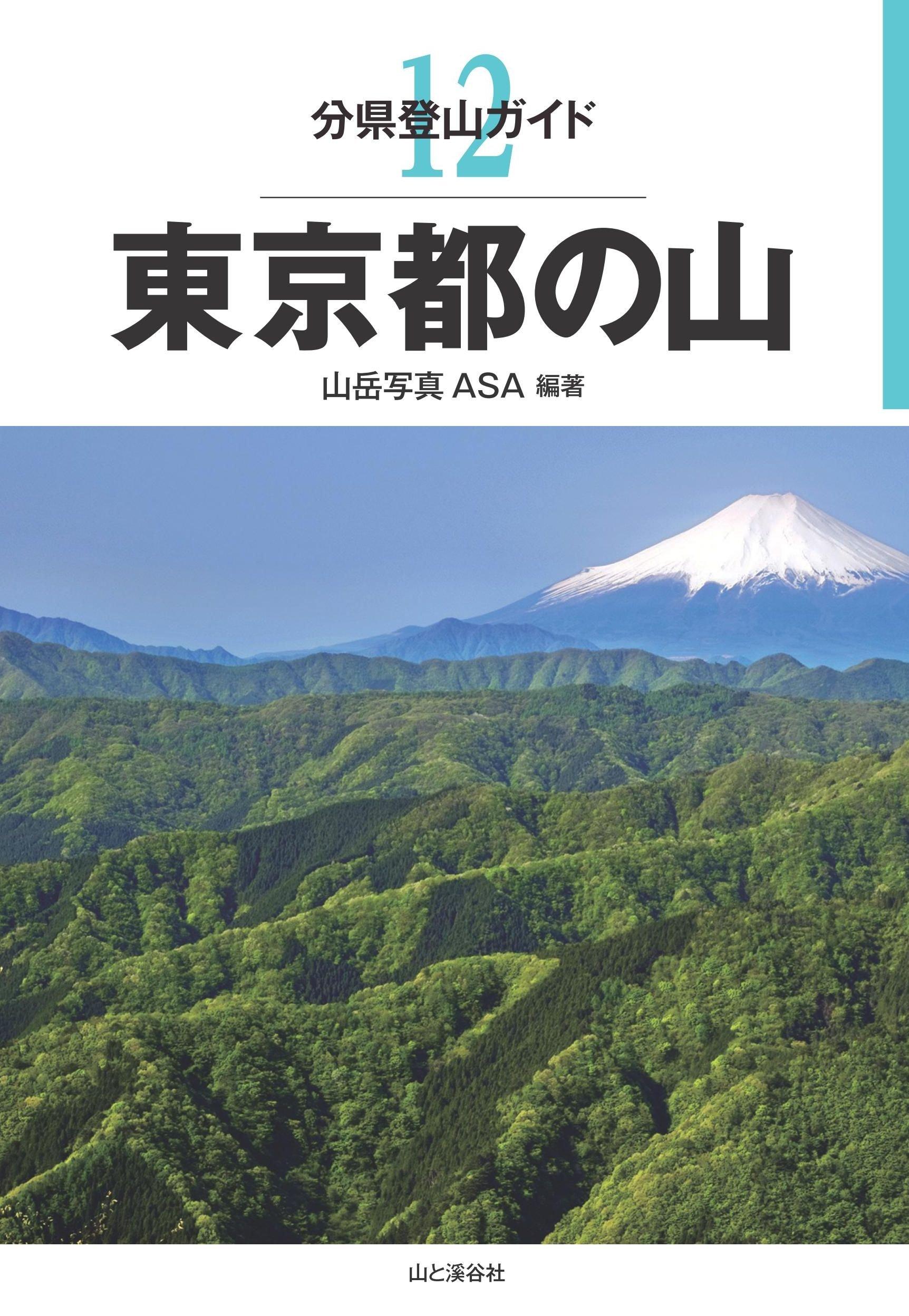
If you’re looking for hikes in a specific area, I’d recommend the “Bunken Tozan Gaido” (分県登山ガイド), book series published by Yamakei. They have guides for each prefecture, and each one has around 50 hikes. The layout is also fairly easy-to-understand, and the hikes range from beginner to advanced. Some are even secret trails known to locals only – and you! If you live in Tokyo, the book to get is “The mountains of Tokyo Prefecture”, but the ones for the mountains of Saitama, Kanagawa and Yamanashi are all excellent choices.
Mt Fuji can be seen from the top of many mountains in the Tokyo area (photo source: http://www.amazon.co.jp)
2) Get a Paper Map
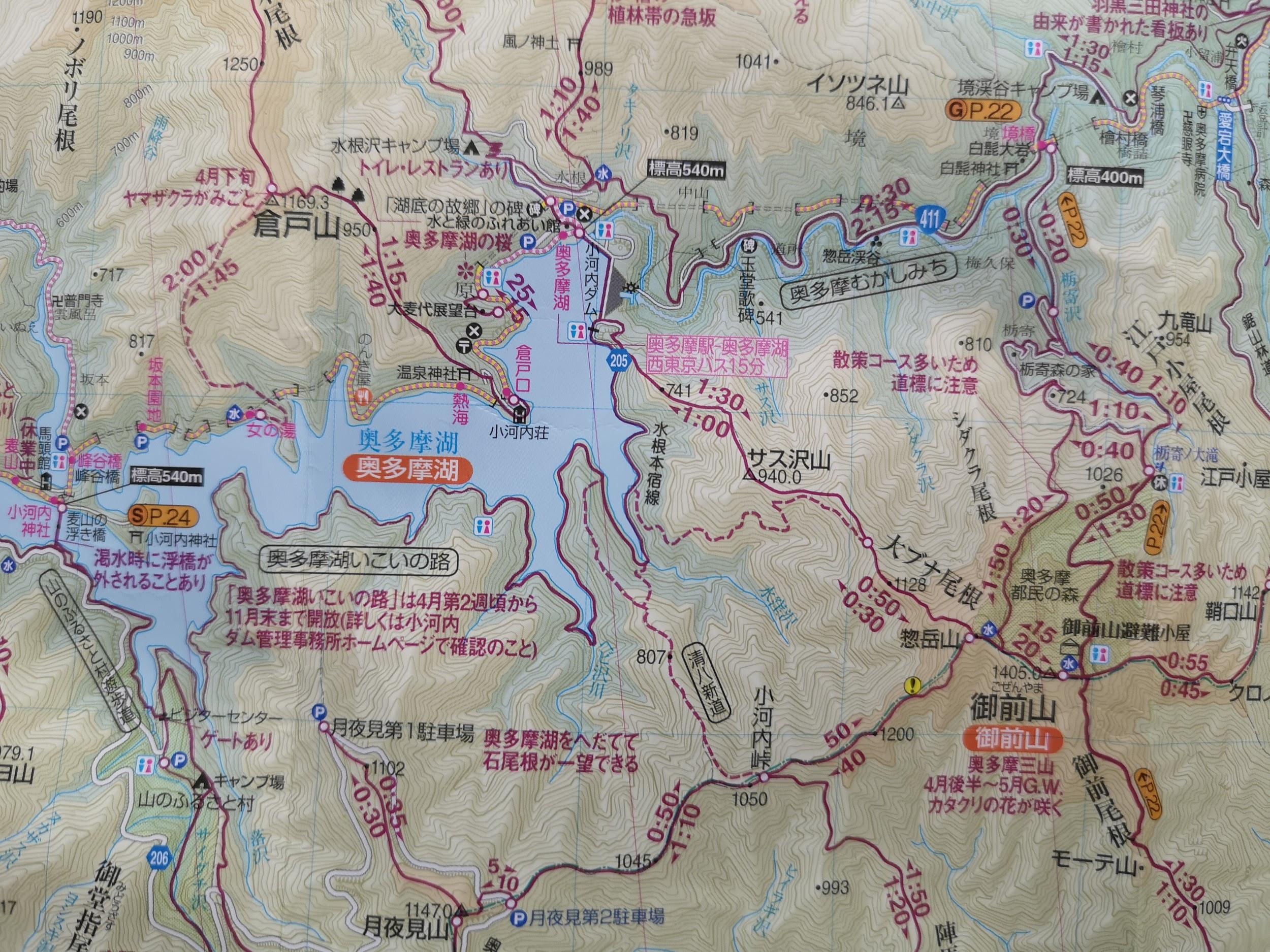
Although the above guidebooks include a map of the hike, nothing beats a separate paper map. It contains a lot more details and covers a wider area. The most popular hiking map series are “Yama to Kogen Chizu”, or “yama chizu” for short, by Mapple. Even if you don’t read Japanese, you’ll be grateful for the mountain routes, times and elevations. It’s possible to buy a digital map and pay for updates, but I’m a little concerned about my phone battery dying on a hike!
Section of the Okutama map – the paper is robust and water-resistant
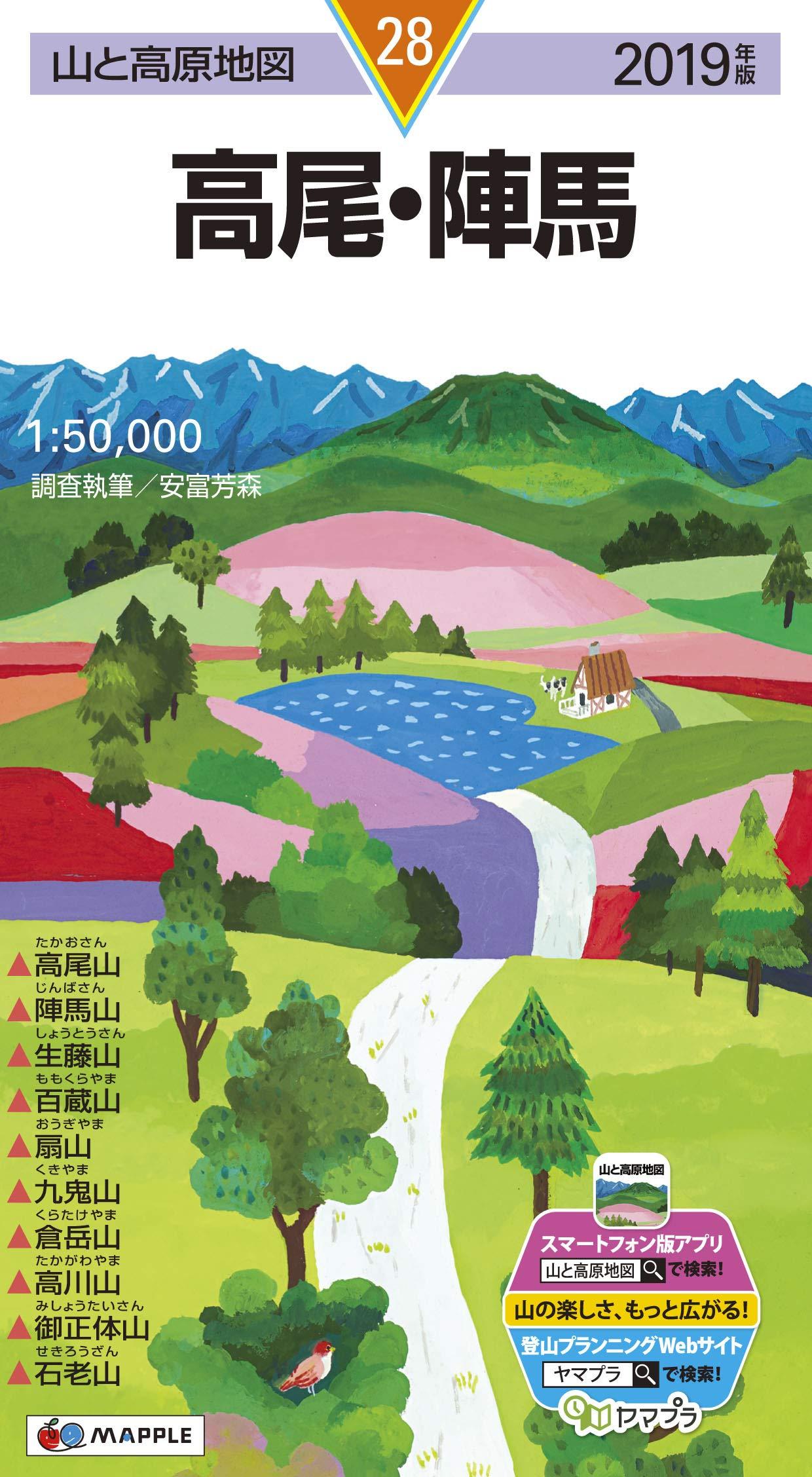
The map I’ve got the most use out of is the Takao – Jinba (高尾 陣馬) map. It covers, not only Mt Takao, but also the mountains along the Chuo line all the way to Otsuki station. Many of these can be done as station to station hikes, so there is no need to worry about bus times. Other excellent maps are the ones for Okutama 奥多摩 (Tokyo prefecture), Tanzawa 丹沢 (Kanagawa prefecture) and Oku-musashi Chichibu 奥武蔵・秩父 (Saitama prefecture).
The very useful Takao-Jinba map – on the left side are all the mountains featured (photo source: http://www.amazon.co.jp)
3) Check the Trail Condition
Once I’ve chosen a hike, I go online to get the most up-to-date trail information. First, I check yamareco (meaning “mountain record” ヤマレコ), a Japanese only site, where people can post pictures and descriptions of their hikes. Popular mountains will usually get many updates, especially after the weekend. Googling “yamareco” + the mountain’s name (in Japanese or English) is an easy and quick way to get to the right page.
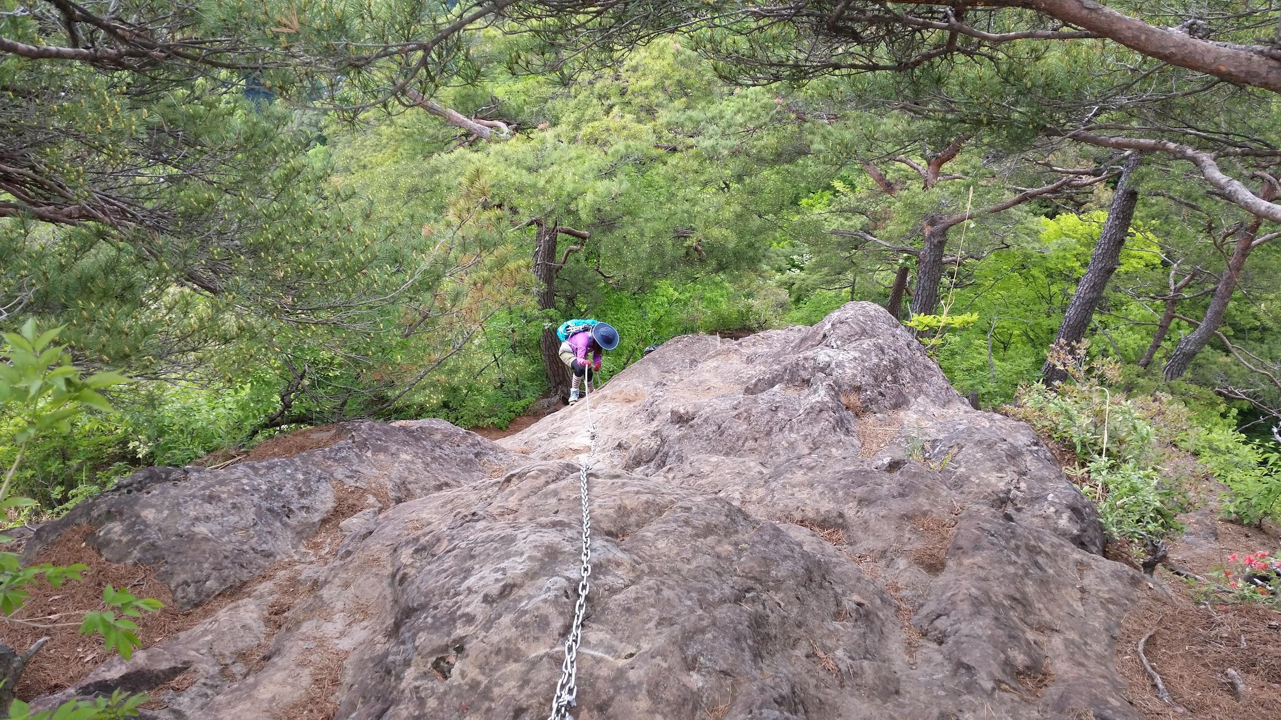
Some trails can be unexpectedly challenging – chains assist a hiker down a rocky section on Mt Take in Gunma
Afterwards, googling the name of the mountain by itself can lead me to other useful resources for planning my hike. Depending on the mountain, recent trail information can be found on a website for :
a Visitor Center
a Mountain Lodge or Hut
a Nearby City or Town
a Ropeway or Cable Car
a Private Hiking Blog
Before setting out on your hike, it’s important to know whether the trail is not closed for some reason! On the other hand, if a website announces that autumn colours are at their peak on your chosen hike, you can expect crowds of people! Some of these websites have English versions, or automatic translation functions.
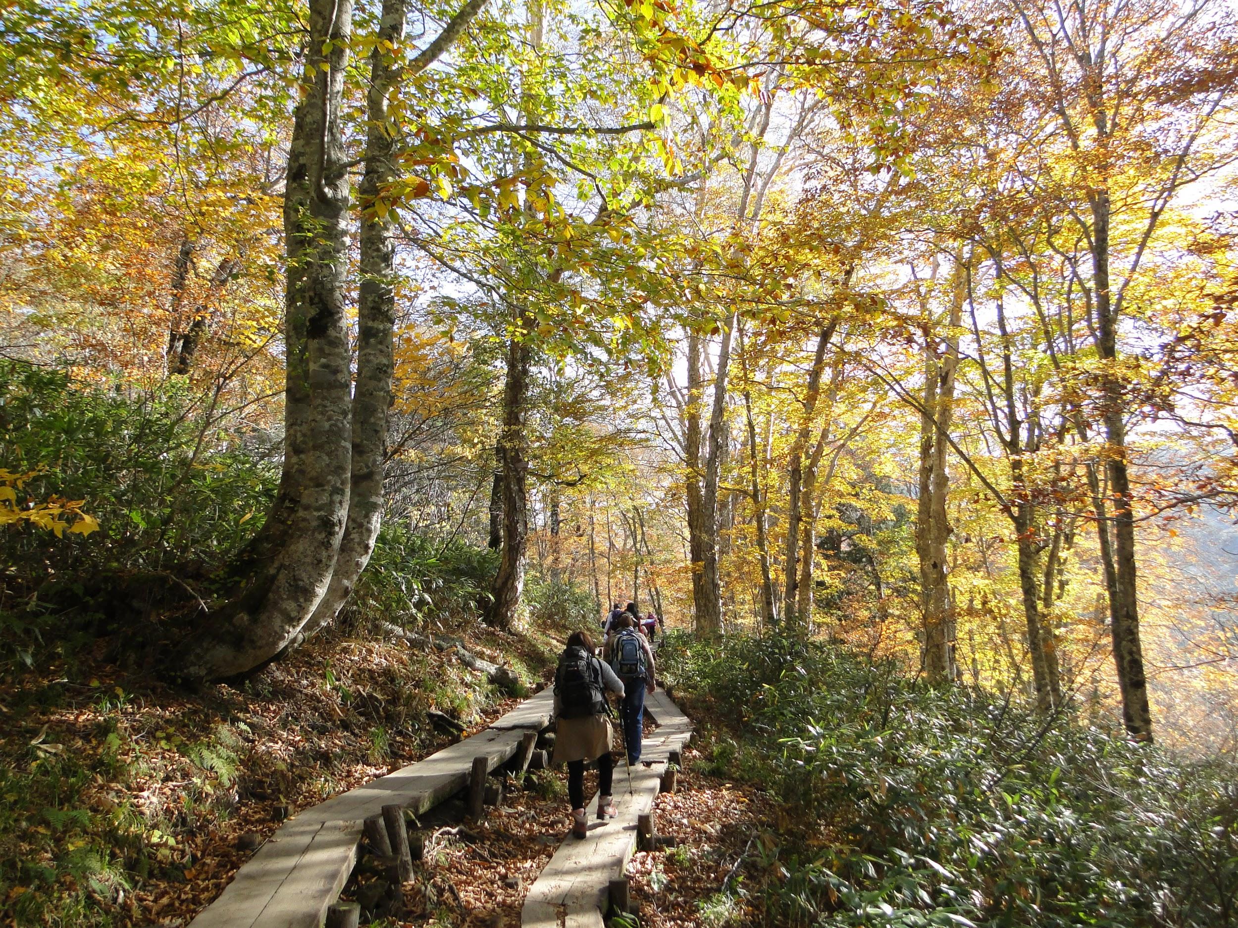
Hiking with the crowds in Oze in the autumn
4) Find Out How to Get There
[2023 update: Hyperdia is no longer in use. Google Maps is the best option for planning hikes from home to the trail entrance]
If the hike is from train station to train station, then you just need to check the train route and times on the English version of hyperdia. More work is neededif access to the start of the trail (and back) is by bus, since there is no hyperdia for bus routes. Bus companies operating in popular sightseeing spots, like Nikko and Mt Fuji, have websites with routes and timetables in English. However, most bus companies provide information in Japanese only. Googling the name of the bus company + the bus stop (in Japanese) will often get you a PDF with the bus timetable, but not always.
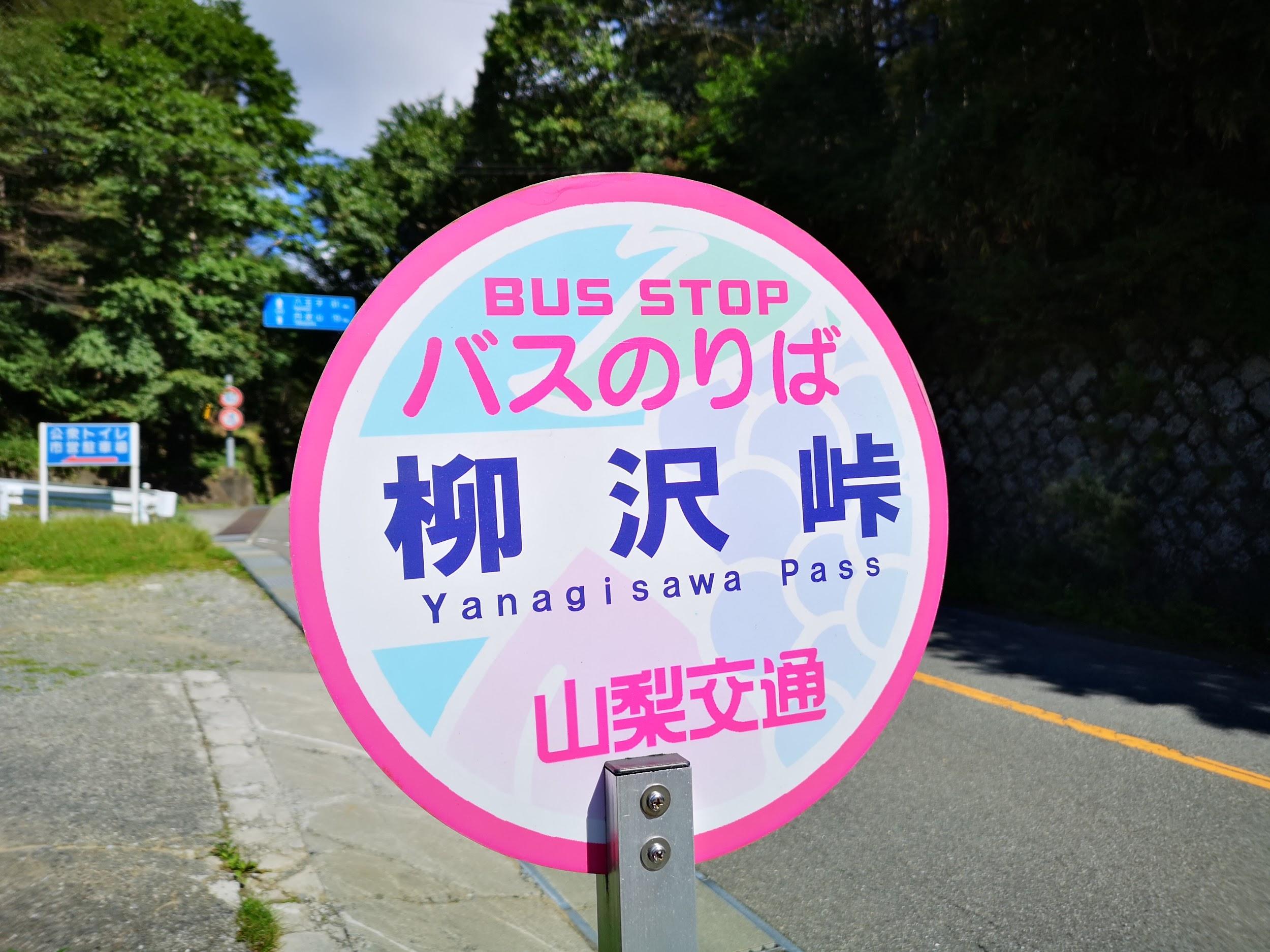
Bus stop names are sometimes translated in English
Recently, Google Maps has started providing bus schedules, so it’s worth playing around with that as well. However, it’s still a work in progress, and not all bus routes are in the system yet. If Google Maps can’t find a bus route, that doesn’t necessarily mean there is no bus service in the area. Finally, I always double check the day and date, since bus times can vary according to the day of the week and time of the year.
The bus is the most usual way to get to the start of the trail – many buses now accept IC cards such as Suica/Pasmo
5) Keep an Eye on the Weather
After choosing and planning my hike, I spend some time checking the weather. You don’t want to get caught in a downpour (or a snowstorm) mid-hike. I prefer Japan-specific websites such as Weather News (Japanese only) and the Japanese Meteorological Agency (Japanese and English) to get an idea of the weather in the area near my hike.
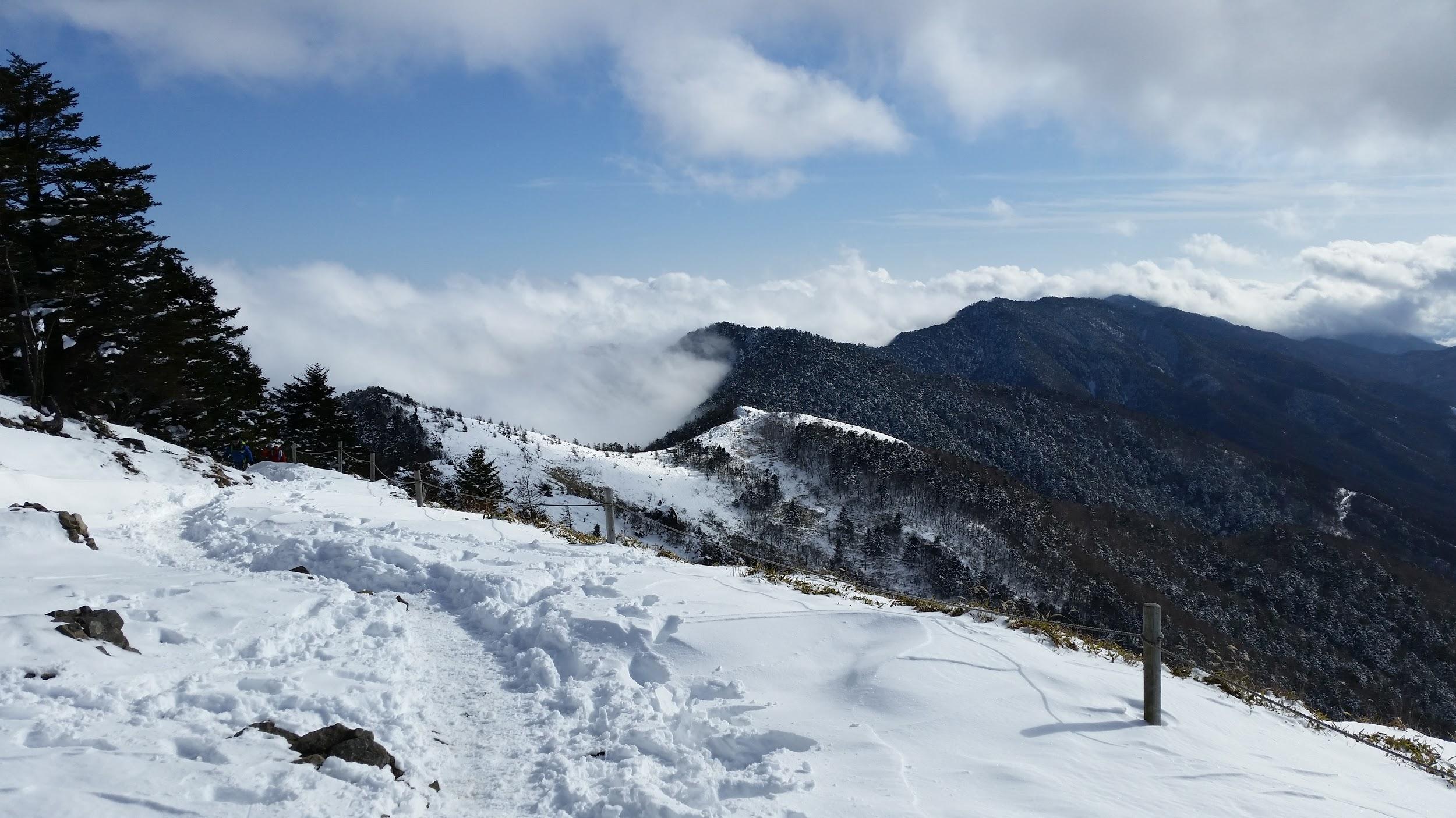
Snow on the trail – here Daibosatsurei in November – can radically change the nature of a hike
Even if it’s sunny in the lowlands, mountain weather can be completely different. It’s important to check the temperature and wind strength on the mountain itself so that you can dress appropriately.Mountain Forecast gives detailed forecasts for famous mountains throughout Japan. Tenki to Kurasu has more mountains, but it’s in Japanese only. The latter has a handy rating system that helps me decide whether I need to postpone/change my hike – or adjust my clothes. For example:
Sunny but cold and windy weather might be rated “C”, meaning unsuitable for hiking.
Cloudy but mild weather with little wind might be rated “A”, meaning suitable for hiking.
Both sites are automatically updated several times a day. Forecasts can sometimes be wrong so it’s best to be prepared for different conditions – I always pack rain gear even on sunny days!
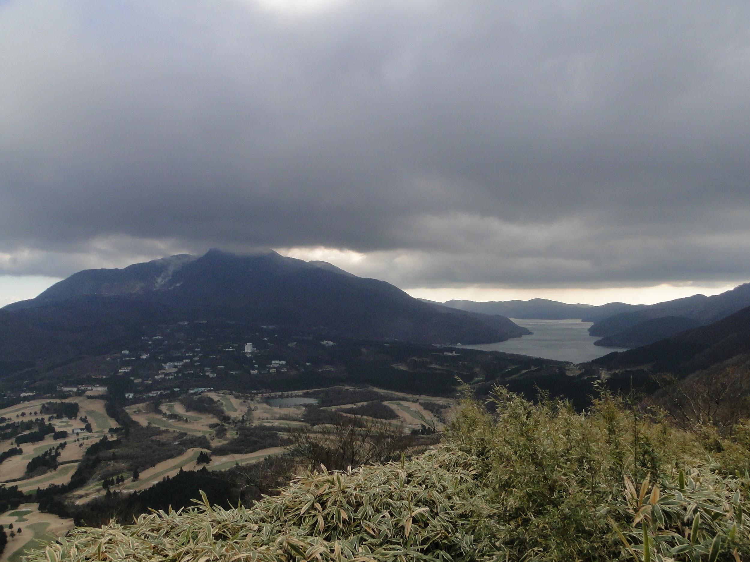
Rain clouds hovering above Hakone – fortunately it didn’t rain on this hike
6) Look For a Hot Spring
I am a big fan of Japanese hot springs, or “onsen”: there is nothing better than relaxing in a hot bath after a long tiring hike. Not every mountain will have a hot spring at its base, but many do, so it’s worth taking some time to research this in advance. The guide books mentioned in the first tip will include hot spring information, if available. The hiking maps from the second tip will show the hot spring symbol. It’s best to check the website of the hot spring place to make sure that it’s open the day and time of your visit.
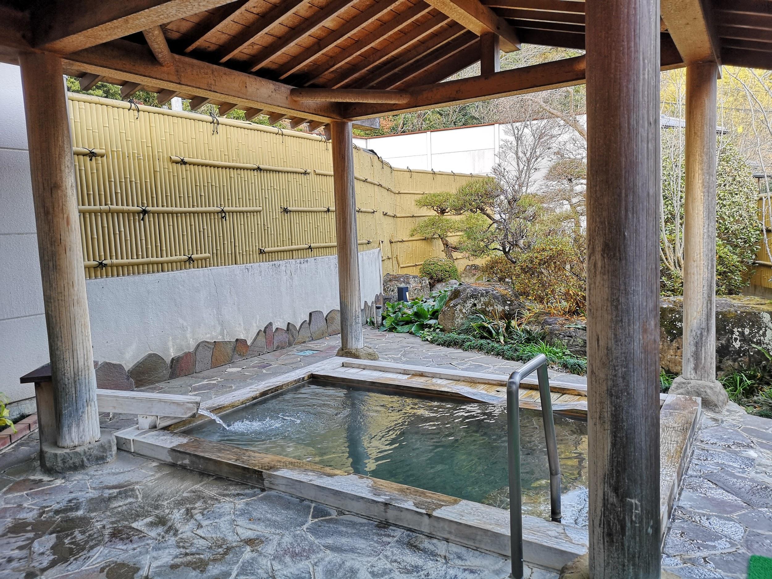
Expect the hot spring to be a lot more crowded on a weekend!
If there aren’t any hot springs mentioned in the guidebook or on the map, I try searching for “日帰り温泉” (day-trip hot spring) on Google Maps near my hike. I’ve found great places that were a short walk from the train station, or located along the bus route. If nothing comes up, I also search for “日帰り入浴” (day-trip hot bath), so that I can just take a regular bath to wash off the sweat before the train ride home. Sometimes some extra effort is required to get to that hot bath – it’s up to you to decide whether it’s worth it!
November is the peak of the hiking season, and thanks to the usually good weather in Japan around that time, I was able to climb a mountain every weekend, and two National Holidays. Half of the six hikes already have their own write-ups on this blog. Here are the summaries of the other half.
Mt Myoho (1332m), Chichibu City, Saitama Prefecture, Thursday, November 2, 2017
Hiking in the Chichibu Mountains 秩父山地
The starting point for this hike was Mitsumine Shrine, a place I had visited a few times before, but had never really taken the time to explore. Since today’s hike was relatively short, I first took some time to check out the Mitsumine visitor center, one of the starting points for visiting the Chichibu-Tama-Kai National Park. It was a pleasant surprise – I found the displays of mounted animals and the model relief of the area particularly interesting.
View of Mt Wanakura (also known at Mt Shiroishi and climbed in 2018) from Mitsumine Shrine
After spending nearly an hour at the visitor center, I hurriedly set off along the hiking path up Mt Kumotori. The autumn colours were at their peak, and since it was a weekday, I had them mostly to myself. Very soon I reached the turnoff for today’s mountain, located on a small ridge branching left off the main ridgeline. In less than an hour, I reached the small shrine at the top of Mt Myoho 妙法山, from where I got some great views of Oku-Chichibu, with Mt Ryokami in the center.
View of the jagged peak of Mt Ryokami from the summit
After lunch, I headed back to the shrine, and since it was still early in the day, I took some time to check out the shrine grounds – it was beautiful with all the autumn colours. At the back, there was a spectacular view of the mountain I had just climbed as well as Chichibu city.
Good views from the trail heading down from Mt Mitsumine shrine
Afterwards, I located the hiking path leading down the mountain. Although there were a number of people at the shrine, no one seemed interested in hiking down, so once again, I had the path entirely to myself. Unfortunately, it wasn’t possible to hike all the way down to the train station, and the path ended up on the road, from where I caught an express bus back to Seibu-Chichibu station.
Mt Nemoto (1199m) & Mt Kumataka (1169m), Kiryu City, Gunma Prefecture, Saturday, November 4, 2017
Hiking in the Ashio Mountains 足尾山地
This was my very first visit to Kiryu City – I returned a couple more times last year in the autumn. I was again the only person on the bus, and when I got off at the last stop, I was surprised that it cost only 200 yen – probably the cheapest bus ride I’ve ever done in Japan. I had to walk another thirty minutes along the road, but I didn’t mind since it followed the beautiful Kiryu river.
Kiryu river, one of the top 100 forested valleys in Japan
I reached the start of the trail around noon – there was a well-made sign in Japanese and English explaining that the Kiryu River had been selected as one of the top 100 forested valleys in Japan – I wasn’t aware that such a list even existed! There are two trails up the mountain – the one on the left following a small mountain stream is the more challenging one. I took the more direct trail going up the ridgeline. This trail had its share of fun, with rocky sections lined with ropes for safety – it’s not really dangerous, but it isn’t for beginners either.
The autumn colours made up for the gloomy weather
The autumn colours were still at their peak, and a little before 1h30, I reached the top of Mt Nemoto 根本山 (meaning “tree root”), a Gunma 100 famous mountain. There was no view, but there was a brand new sign. The weather had been sunny and cloudy all morning, but now it was completely overcast, with a cold wind. It felt like it might snow at any moment.
Mt Akagi, looking somber
I continued along the ridgeline, circling the source of the Kiryu river, clockwise. Soon, I was walking South along an easy trail, and I arrived at Mt Kumataka 熊鷹山 less than an hour later. There was a small observation tower with a 360° view of the surrounding mountains. I could make out Mt Koshin and Mt Kesamaru to the North, where there was some sun, and Mt Akagi under a dark cloud to the West. In the East, it seemed like it was raining.
Trees marching up the side of the mountain – blue skies returned at the end of the hike
After enjoying the view and before my hands froze, I started to head down the mountain. The hiking trail quickly became a forest road, and the sun came out again. Soon, I was walking next to the Kiryu river again under blue skies. I was back at the start of the trail before 4pm, and half an hour later I was riding the last bus back to Kiryu City.
Kiryu river, also one of the 100 top forested water sources
This was a trip to a prefecture that I have recently come to appreciate as a great hiking destination. This was also my first time to take the Suigun line that connects Mito, the capital of Ibaraki, and Koriyama in Fukushima (I took it again this year). This was also a good station to station hike – I had to walk one hour along a road from Saigane station to reach the start of the trail, but the surrounding scenery was beautiful.
One of the other peaks in the area
Once I started hiking in earnest, I got some really great views of the rocky summit of this Kanto 100 famous mountain. The weather was perfect, and the autumn colours were still at their peak. Soon I started climbing through some beautiful forest, and I reached the top of Mt Nantai 男体山 around 1h30. From the top, there was no doubt that this was the highest mountain in the area. To the south, I could see the shape of Mt Tsukuba in the distance.
At the very back, Mt Tsukuba and neighbouring mountains
After enjoying the bird’s eye views, I continued along the ridge. First down a steep slope, then along a pleasant mostly level path. It was so pleasant that I completely missed the turn-off down the mountain. After a while, I realised I was going in the wrong direction and retraced my steps to the junction which was properly signposted – I must have looked the other direction just when the sign came into view!
The prominent bulk of Mt Nantai
The downhill part to Kami-Ogawa station was through pleasant autumn forest, then along countryside back roads. Looking back, I got some more nice views of the rocky summit of the mountain I had just climbed. I reached the station in time for the infrequent train back to Mito city.
These two hikes in Gunma prefecture are from August 2017, during another of my mother’s visits. We had taken the train to Takasaki the previous day, and had spent the night at Dormy Inn. In the morning, we used a Times Share car to drive to the base of Mt Nikko-Shirane. After our hike, we then made our way to Kusatsu-onsen on the other side of the Kanto plain, and spent the night at a hot spring hotel. The next day, we went to the base of another Shirane mountain – Mt Kusatsu-Shirane – after which we drove over to Shiga Highland to climb Mt Shiga.
Since these two hikes weren’t day trips, they fall outside the scope of this blog, but they are in areas relatively close to Tokyo and inside National Parks, so they are well worth a visit. I think that each area is reachable from Tokyo as a day-trip using the Tokyo Wide Pass, and I might attempt it one day!
Nikko-Shirane Ropeway & Goshiki-Numa Lake
A beautiful lake high up in the mountains
The drive from Takasaki to the Nikko-Shirane Ropeway was fairly uneventful. Even though it was a weekday, I was surprised by how few people there were, especially since it was the middle of the summer holidays. The place is mainly a ski resort in the winter so perhaps people aren’t aware that it also runs from June to October. I love ropeways and I keep on discovering new ones – it’s amazing how many there are in Japan!
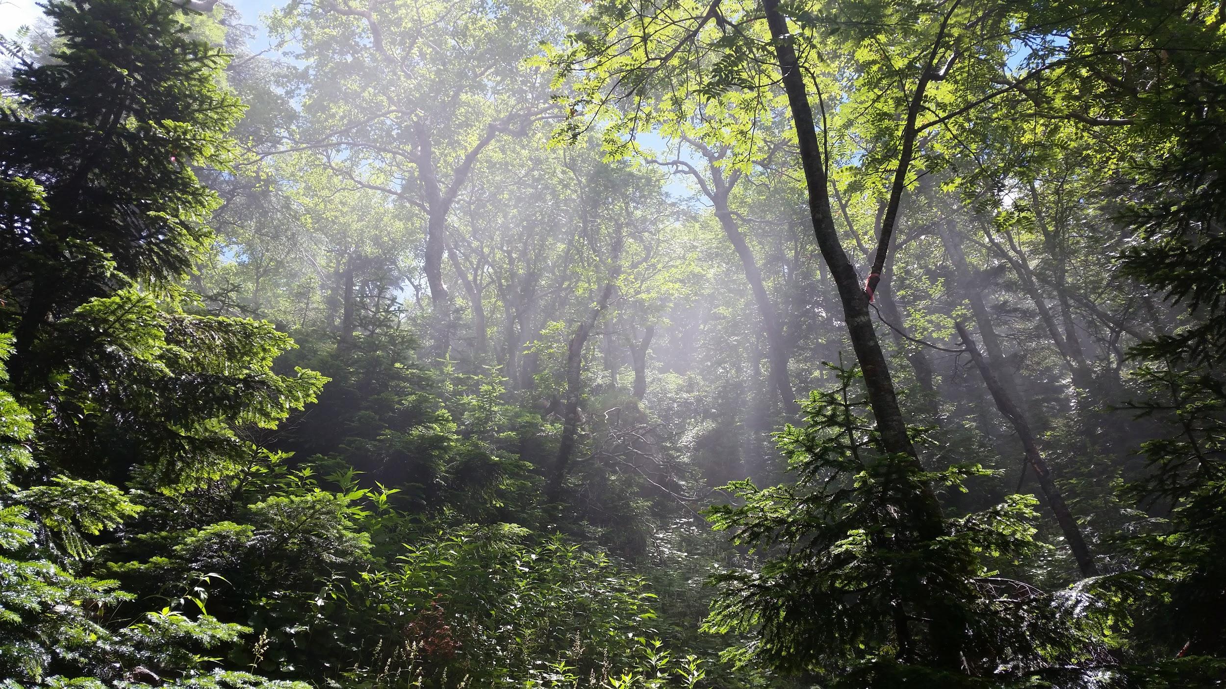
Sun shining through the forest
At the top of the ropeway, inside Nikko National Park and nearly 2000m high, the visibility wasn’t the best, and the views were a little disappointing. At least it was cooler than down in the valley. The hike started out on a fairly level trail through beautiful forest. After an hour or so, we had to climb steeply for a short while to reach the edge of a pond. Here I was able to look up towards the top of Mt Nikko-Shirane. I had been hoping to get my revenge, since it was in clouds when I climbed it several years ago. However, the top was in the clouds again, and another ascent seemed pointless.
Midaga Pond near the top of Mt Nikko-Shirane
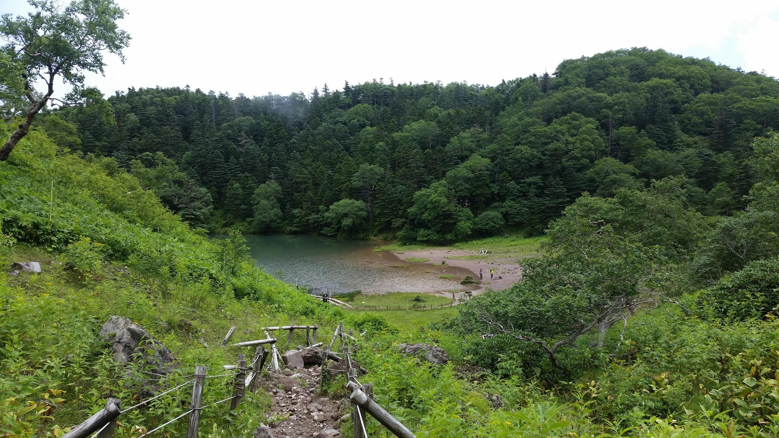
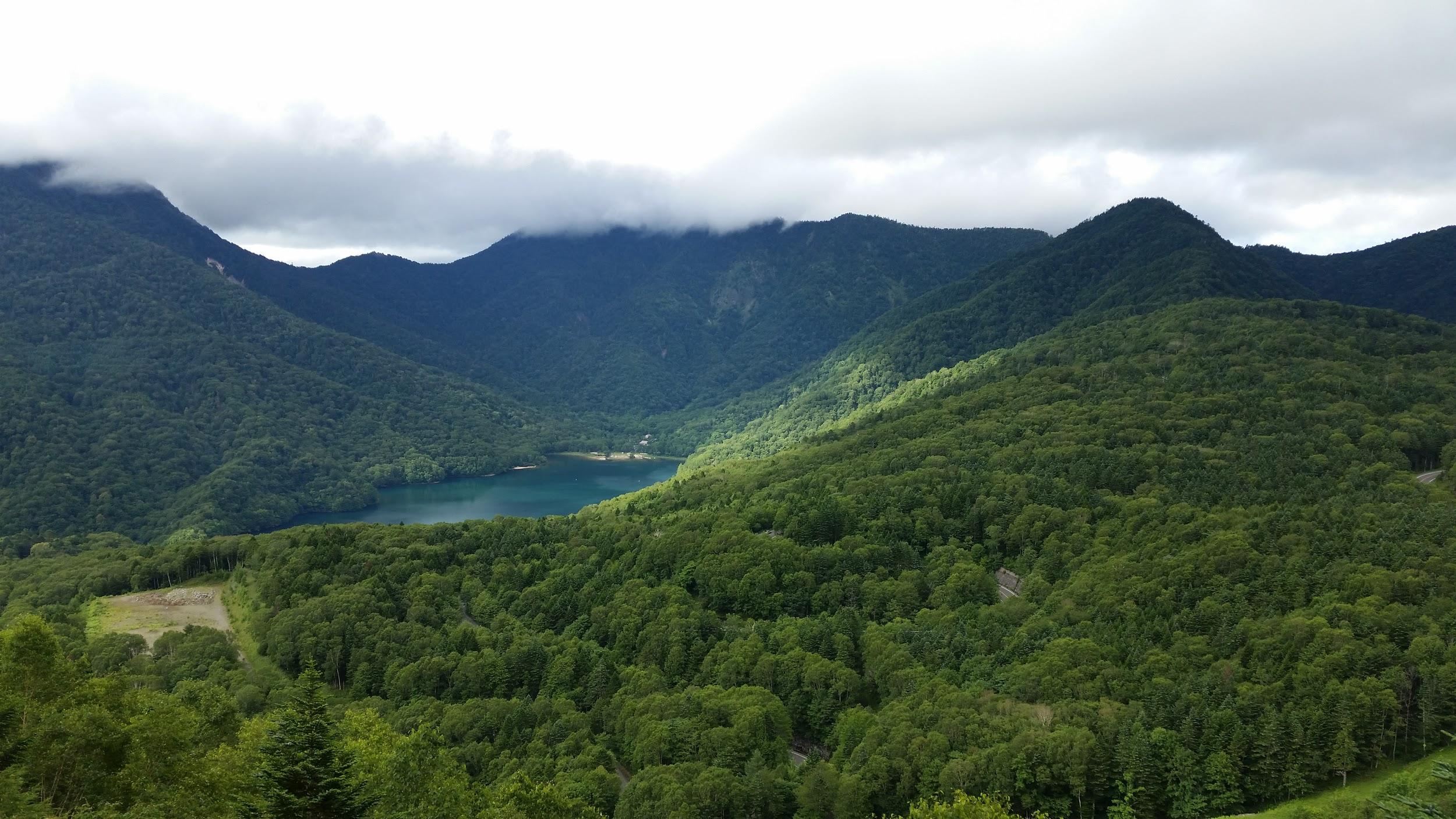
We continued a little further and reached the edge of a crater with at the bottom, the beautiful Goshiki-Numa lake 五色沼 (which means five-colour lake). Since we had enough time, I decided we could descend to the shore of the lake and climb back up again. Unfortunately the descent was steep and rocky, and we regretted it a bit.
The Goshiki-numa lake, inside Tochigi prefecture
After enjoying the peace and quiet of the lake, we made our way back up to the edge of the crater via a different path, and then walked back the way we had come. At the pond, we passed a group of noisy school children who had come up a different path. We headed back down the steep path to the forest below, and at the bottom we took another trail that looped back to the top of the ropeway.
View of Maru-numa lake from the ropeway
Check out the views of Nikko-Shirane
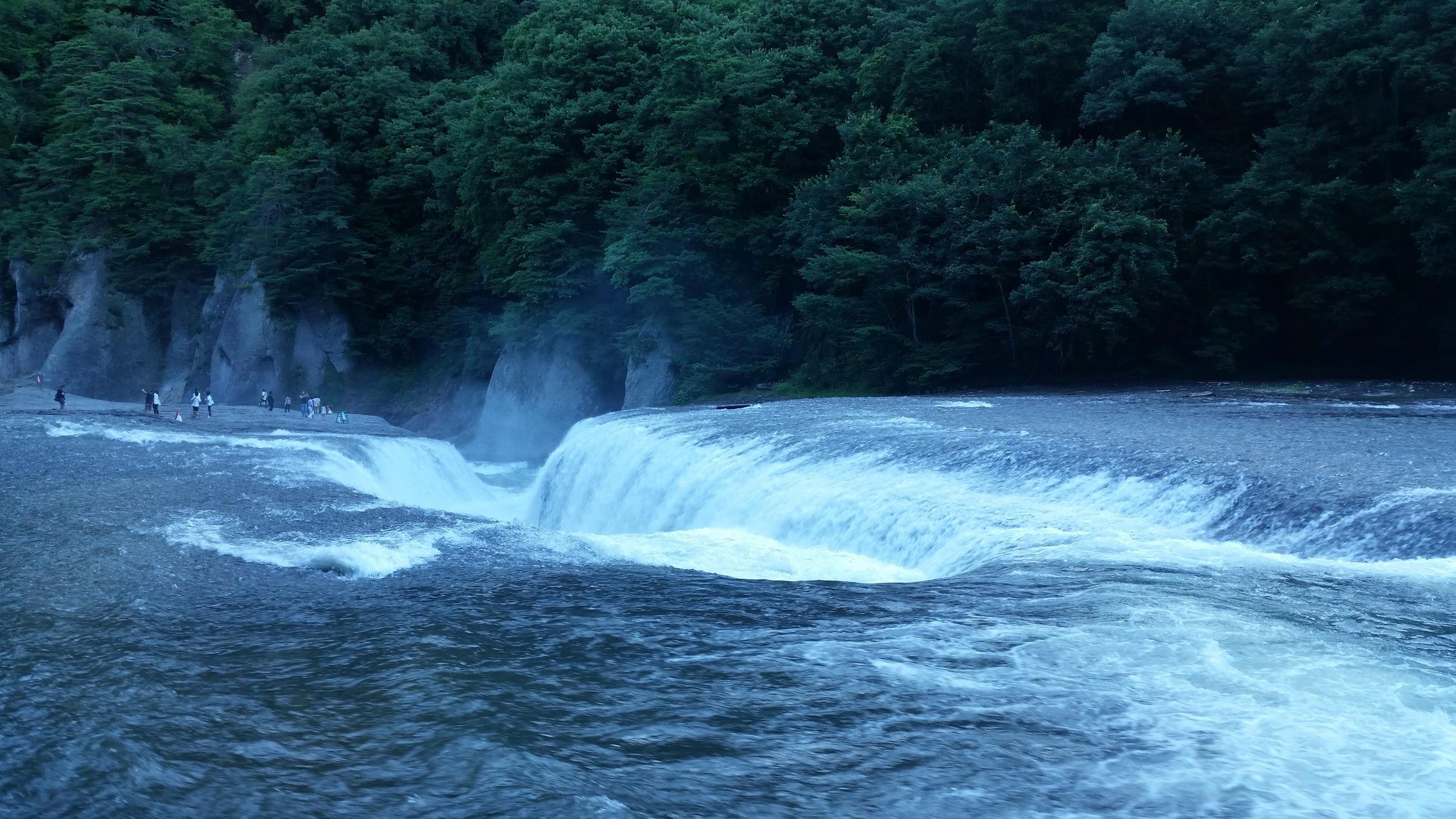
On the drive back we stopped at the very impressive Fukiware Waterfalls 吹割の滝 where we could walk along the river and the falls for a short way. Afterwards, we drove on to Kusatsu Hot Spring about 100km away, and we reached our ryokan after dark.
Where is all the water going?
Check out one of the famous waterfalls in Japan
Yugama Lake, Mt Yokote (2307m) & Mt Shiga (2037m)
Looking back towards Mt Shiga
The next morning was sunny, but by the time we had drove all the way up to Yugama Lake 湯釜 the clouds had rolled in. We admired the light blue colour of the crater lake, but gave up on climbing Mt Kusatsu-Shirane. I had climbed it before in the clouds, and had little interest in doing it again in similar conditions.
A beautiful crater lake
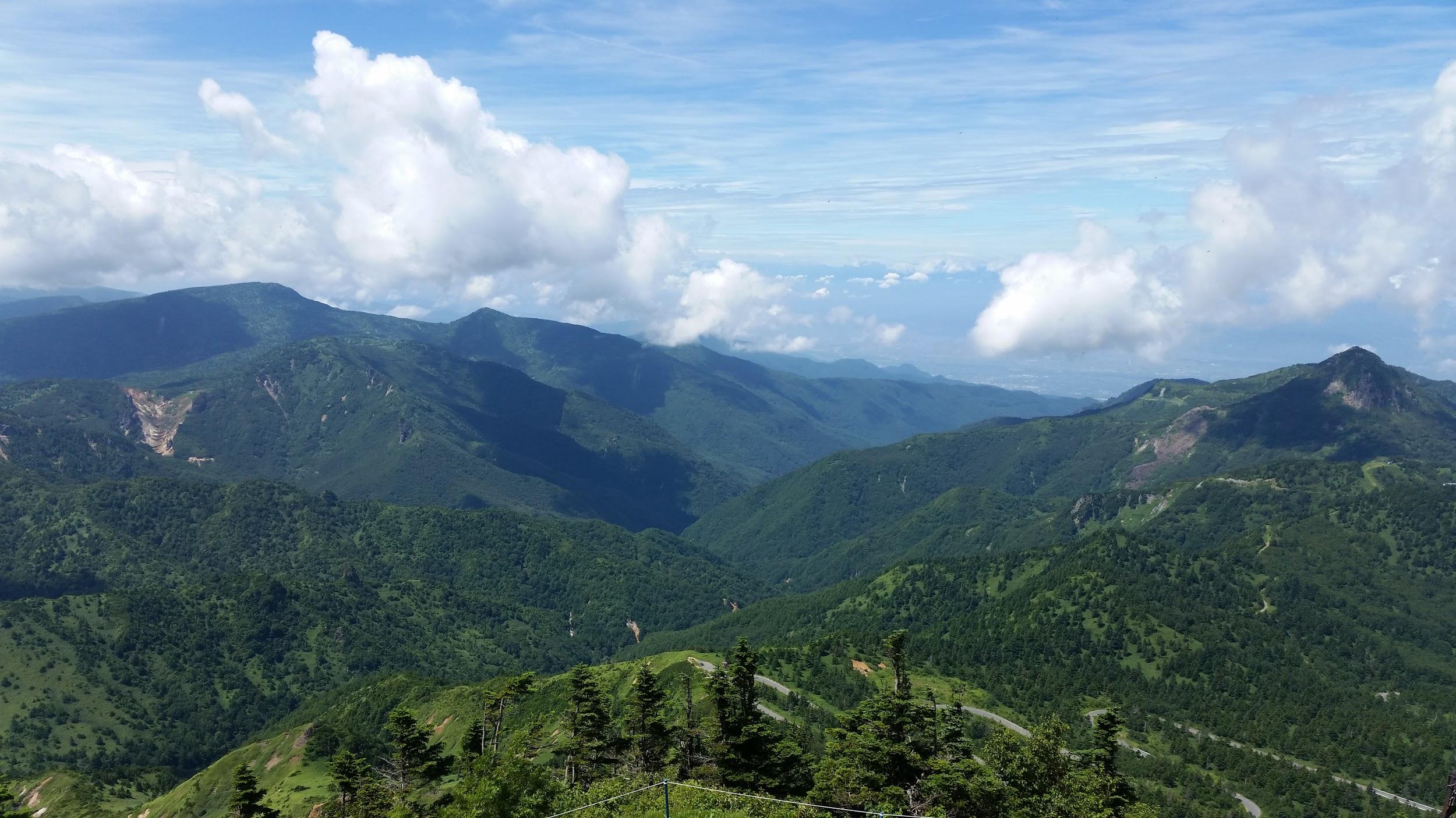
We drove on to Yokoteyama Ropeway which took us to the top of Mt Yokote 横手山. We got some nice views of Shiga Highland 志賀高原. Fortunately, the Nagano side was still free of clouds. We finally arrived at Kumanoyu (meaning the bear’s bath) where we left the car. We were now firmly inside Nagano prefecture. Another short ropeway took up to the start of the hike. Luckily, the weather was holding up. The first part was quite level. At one point the path went through some very high bamboo, higher than our heads, and I was worried about bears. So I reached into my bag to retrieve my bear bell only to realise that I had left it in the car!
View from the top of Mt Yokote
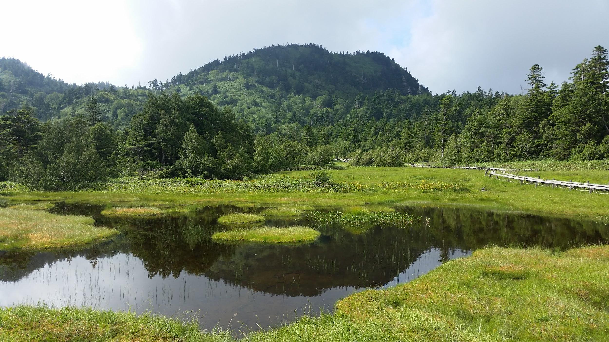
Soon the path started to climb. It was steep, with big rocks and protruding tree roots, making progress slow. The path slowly wound up the side of the mountain. We saw few people, and thankfully no bears. We reached the top of Mt Shiga 志賀山 just before 2 pm. A little way past the summit, there were some good views of Onuma-ike Lake below. The whole hike is inside the Joshin Etsu Kogen National Park and is very wild and beautiful.
The area of our hike – Mt Shiga is in the clouds on the right
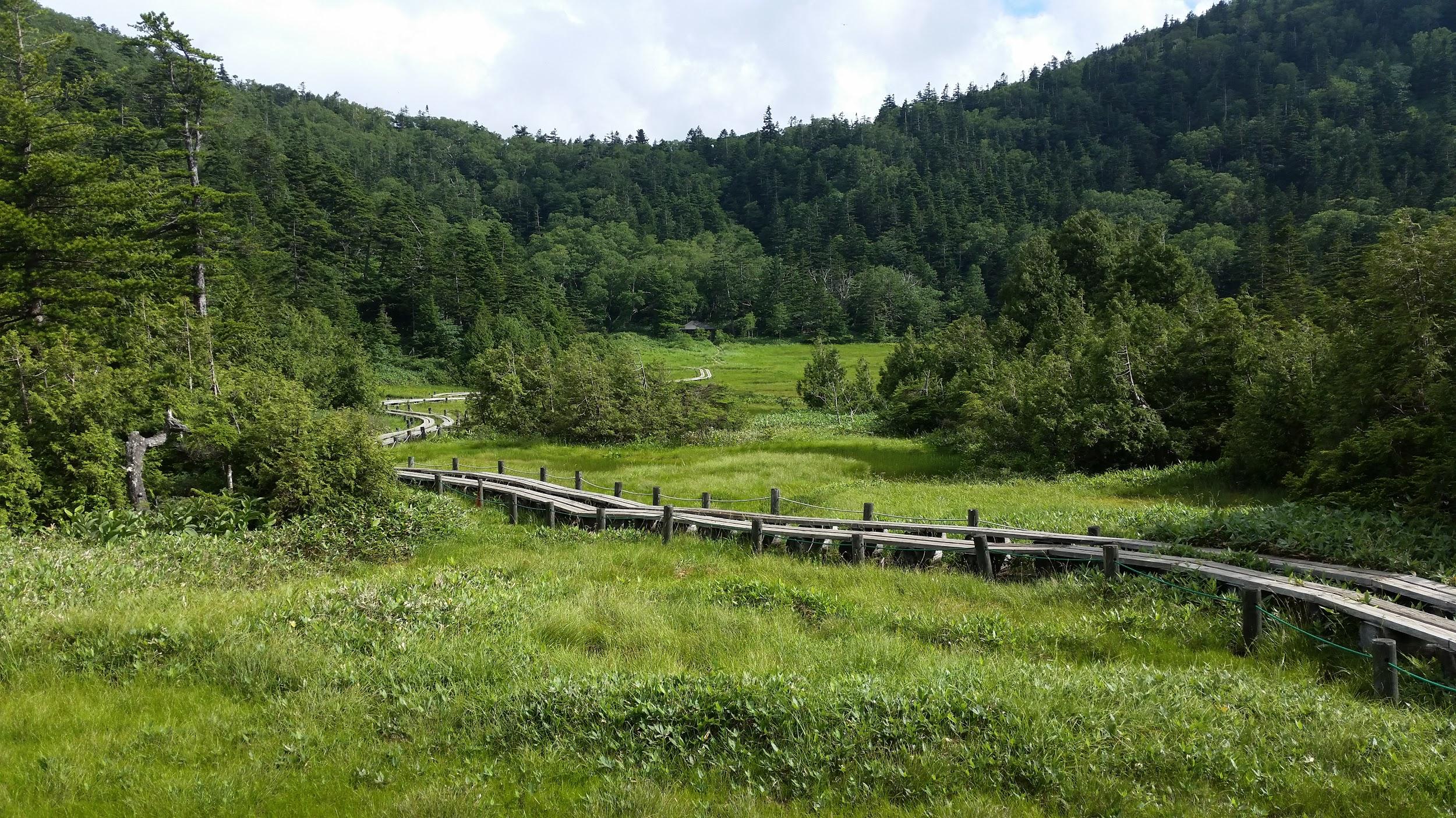
We climbed down via a different path, spotting various small ponds on the way. Finally, after passing through a shinto gate or “torii”, we reached the base of the cone-shaped Mt Shiga. The next part involved walking along an elevated walkway through marshlands – much easier than the rocky path down the mountain! The final part back to the ropeway was along a wide and level path through the forest.
Onuma Lake in the middle of Shiga Highland
Since it was getting late, we decided not to take a bath at Kumanoyu, and leave right away. No sooner had we set off, that a dark shadow dashed across the road – it was a bear cub. It disappeared into the bushes opposite. We waited a bit for a mother bear, but she was nowhere to be seen. In any case the place certainly deserves its name!
On the way back, we stopped briefly for some photos at the marker for the highest national road in Japan at 2172m high. The drive down to Kusatsu onsen was through thick mist. We had a bath at the Sainokawara open-air bath, one of the biggest in Japan. After we were done, it started raining really hard, but we managed to get back to Takasaki safe and sound, a little after nightfall.
I had been planning to hike the old Nakasendo highway (中山道) between two of its most famous post towns, Magome-Juku and Tsumago-Juku, for ages. However, since it required an overnight stay, it kept on getting postponed for various reasons. Finally, at the beginning of autumn, all the pieces fell together, and I managed to organise a trip there. The weather forecast was good: mostly sunny then cloudy from the afternoon of the second day. I knew it was a popular sightseeing spot, but off the beaten track for overseas visitors, so it felt worthwhile to share the experience. This was my second trip to the area: in February 2013, I had visited Narai-Juku, another famous post town, and followed this old highway over a mountain pass, and down to the next post town of Yabuhara-Juku. There was about half a meter of snow near the top of the pass, and a troop of monkeys on the move in the surrounding forest. I didn’t expect this hike to be quite as adventurous, but I was looking forward to hiking through pristine nature in the heart of the Kiso mountains.
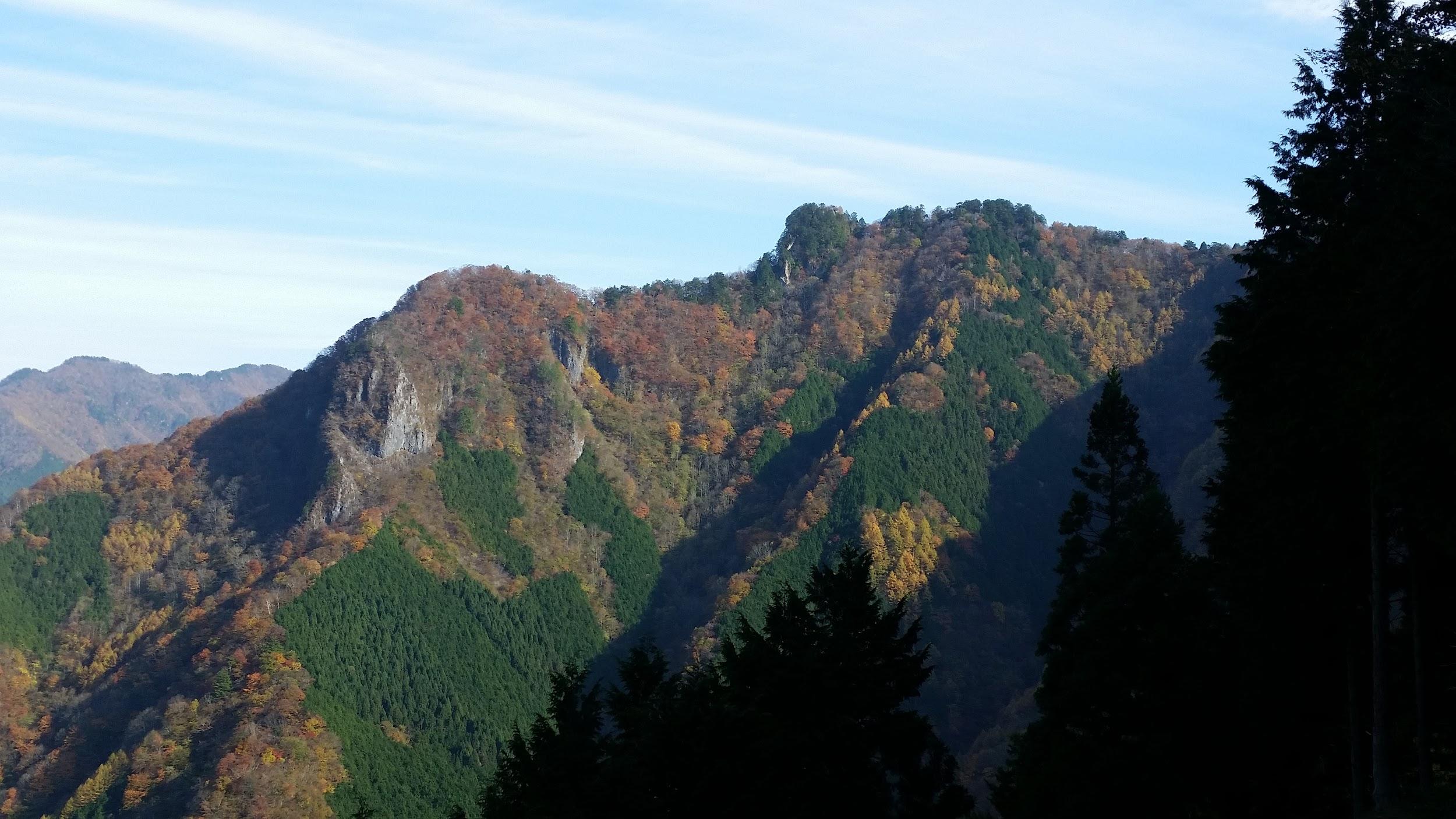
The bus from Shinjuku dropped me off in the middle of nowhere, about a hundred meters off the expressway exit. Fortunately, I soon spotted an English sign informing me that I was still 2 kilometers from Magome-Juku. I walked along a small paved road through pleasant countryside, and then ducked down a dirt path leading to a wooden footbridge over a stream. I reached the edge of Magome post town (馬籠宿 magone-juku) a little before noon. I slowly made my way up a steep, curving slope that crossed the entire town. I thought that the contrast of traditional houses and clouds on the horizon was especially beautiful; I could easily imagine tired travellers looking for a place to rest after a long day of plodding through the mountains. Near the top of the town, I stopped for a tasty soba lunch at Keiseian (恵盛庵) inside a charming old house.
View of Mt Ena, the summit hidden in the clouds
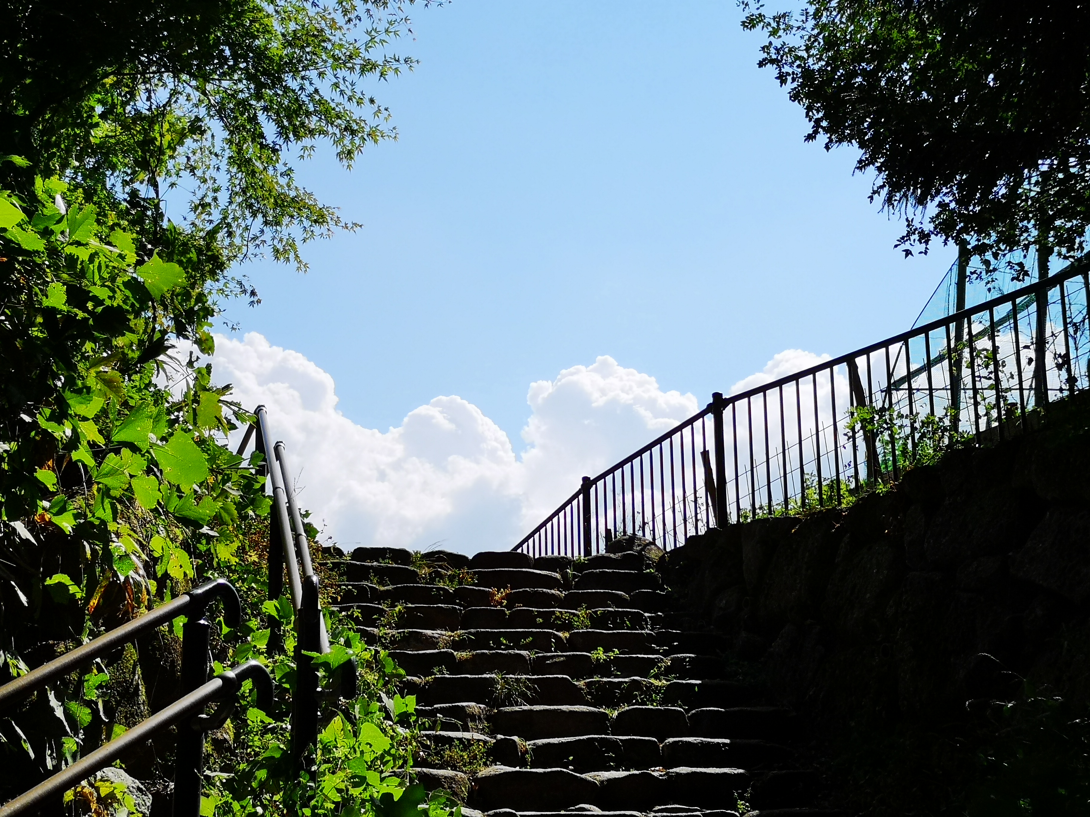
This staircase marks the start of the Nakasendo hiking trail
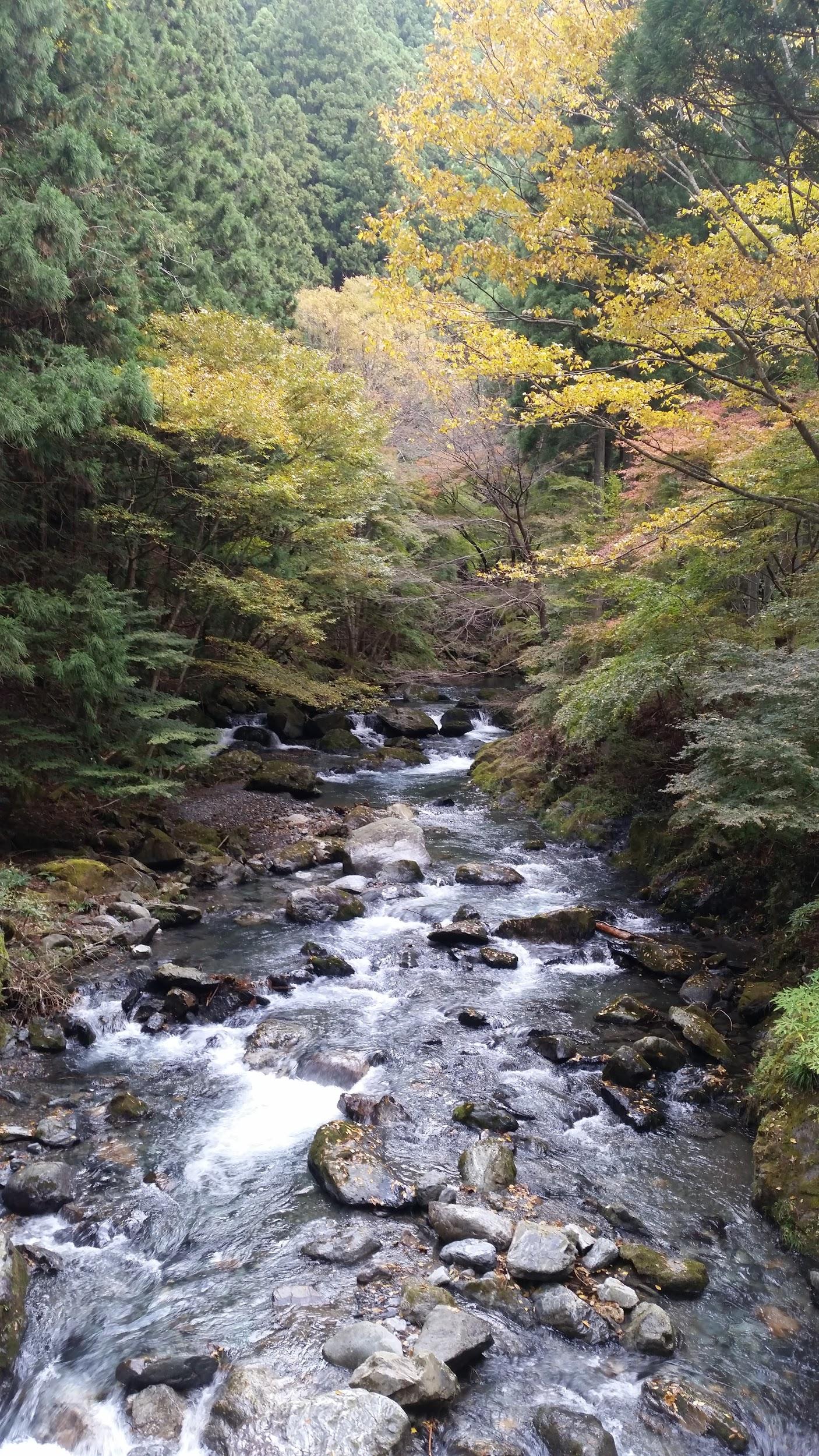
Just past the restaurant was the old bulletin board where travelers could leave messages for one another, a kind of ancient social media system. A little further was a lookout point, where I could gaze at Mt Ena (2191m), a hundred-famous mountain of Japan, climbed a few years ago. Next, I had to make a small detour around somebody’s garden to reach the official start of the hiking trail. After walking down some steps, I crossed the modern road connecting the two post towns, walked down some more steps, and then followed a dirt path next to a stream. I had to be careful not to step on the small green-coloured frog taking a break in the middle of the trail. I crossed the road again, and bought some water from a shop on the left side; the early October weather was turning out to be warmer than expected. I continued along a paved road slowly rising through a sleepy village. I spotted another frog, brown this time, squatting on the trail.
First I spotted a green frog…
...then a brown one
At 2pm, I finally reached Magome Pass, the highest point of the hike at 801 meters; I would now leave Gifu prefecture and enter Nagano. Straight ahead, I could see the summit of Mt Nagiso (1679m), popping out from above the treetops, and which I hope to climb one day. I thought that this was the nicest part of the hike: it followed an easy-to-walk path heading down the valley through a conifer forest. I could easily imagine myself in the Edo period, since there were few other hikers to remind me of modern times. Halfway down, I reached a spacious rest house; I was beckoned inside by the owner, made to sit at a long wooden table, and offered some cold green tea and slices of Japanese peach (“nashi”). Once again, an excellent example of Japanese hospitality. After setting off again, I crossed a bridge over a mountain stream, and a little later on, made a small detour to see a couple of waterfalls, simply called Male and Female waterfalls (男滝・女滝 odaki-medaki).
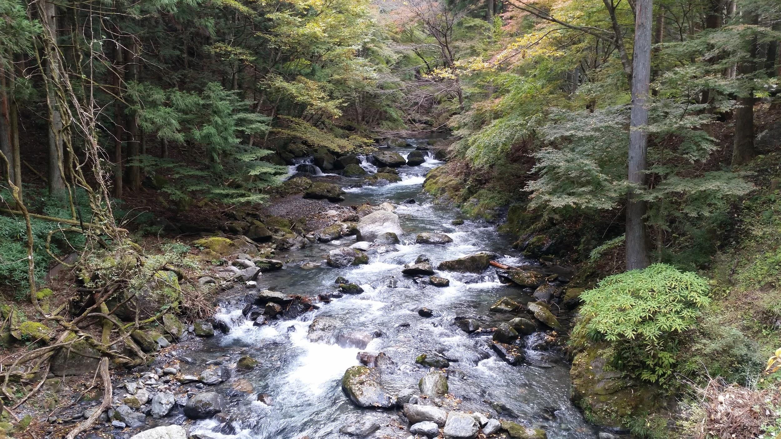
Mountain stream on the Nagano side of the hike
The male waterfall, not surprisingly, the bigger of the two
Around 3h30, the trail left the forest at the bottom of the valley, and continued next to the modern road. It took me another half an hour to reach my destination, Tsumago post town (妻籠宿 tsumago-juku). Here, the central road was straight and level, with an impressive view of Mt Nagiso in the background. It was lined with traditional wooden houses on each side, coated in a black substance, a common Edo period fire prevention measure. I thought that his post town was even nicer than the previous one: there were less sightseers, and it felt peaceful and remote. After visiting a couple of famous houses turned museums, I took a taxi to my hotel. The next day, I rode the train along the Kiso valley to Narai post town (奈良井宿 narai-juku), where I did some more sightseeing, before catching the bus back to Shinjuku.
Returning to the road at the bottom of the valley
The main street through Tsumago-Juku with Mt Nagiso in the back
After a one-month break, I’ve resumed my hiking activities, despite an ankle that hadn’t really healed. I needed something easy to allow me to get back into the groove, and also at a high elevation, since it was still quite hot and humid. With the weather forecast looking good, I decided to take the shinkansen all the way to Fukushima city, and then drive up the Eastern side of Mt Azuma, a hyakumeizan inside the Bandai-Asahi National Park about 230 km North of Tokyo.
Technically, the highest point is the Western summit about ten-kilometers away, so summiting the Eastern summit doesn’t really count towards increasing my tally of hundred famous mountains, stuck at 81 since last July. Although there is a bus from Fukushima city, the return is quite early, and doesn’t allow enough time to hike to the top and back.
Part I: Usagi-daira – Toriko-daira – Mt Higashi-Azuma
The top of Mt Higashi-Azuma in good weather
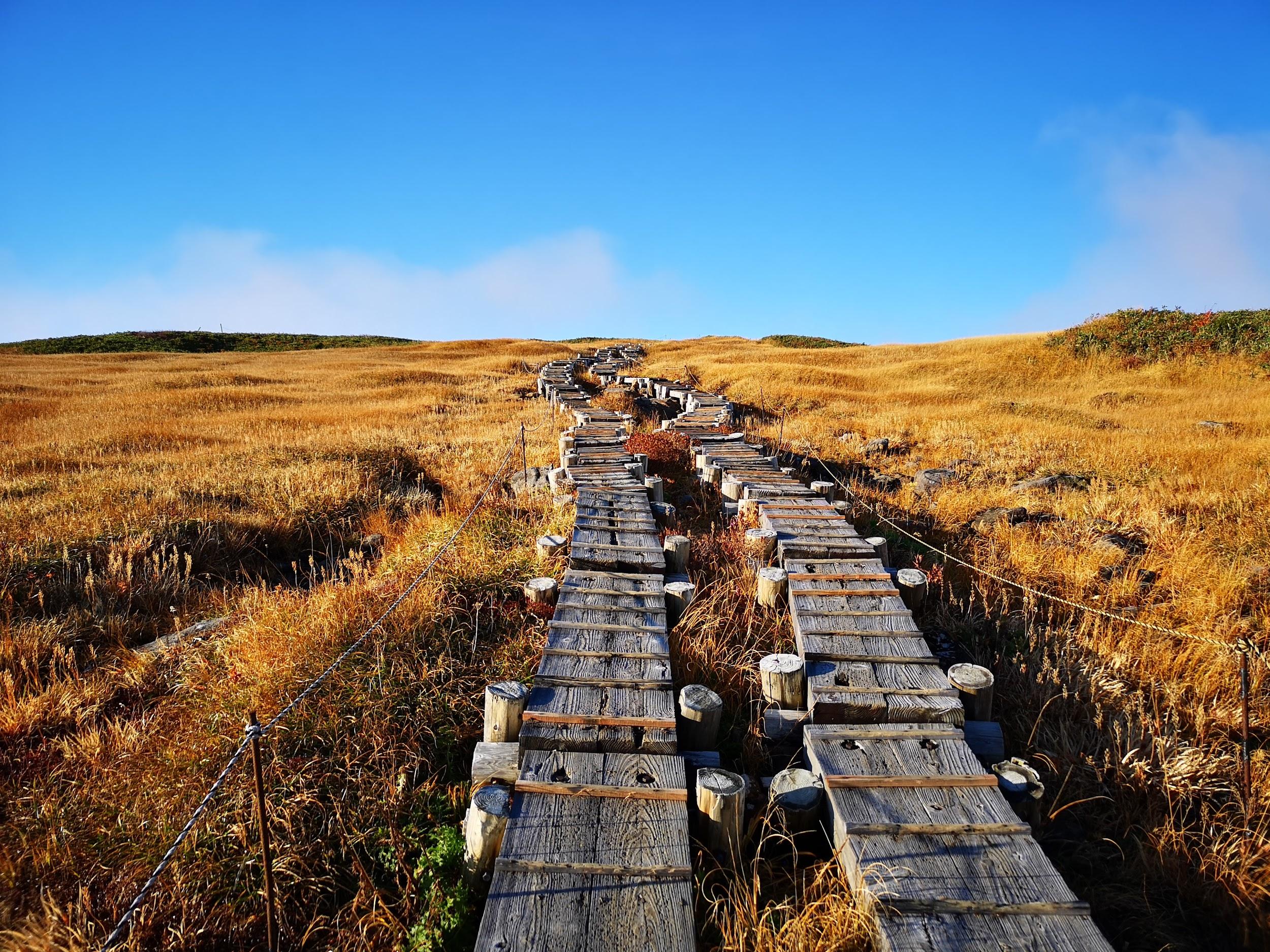
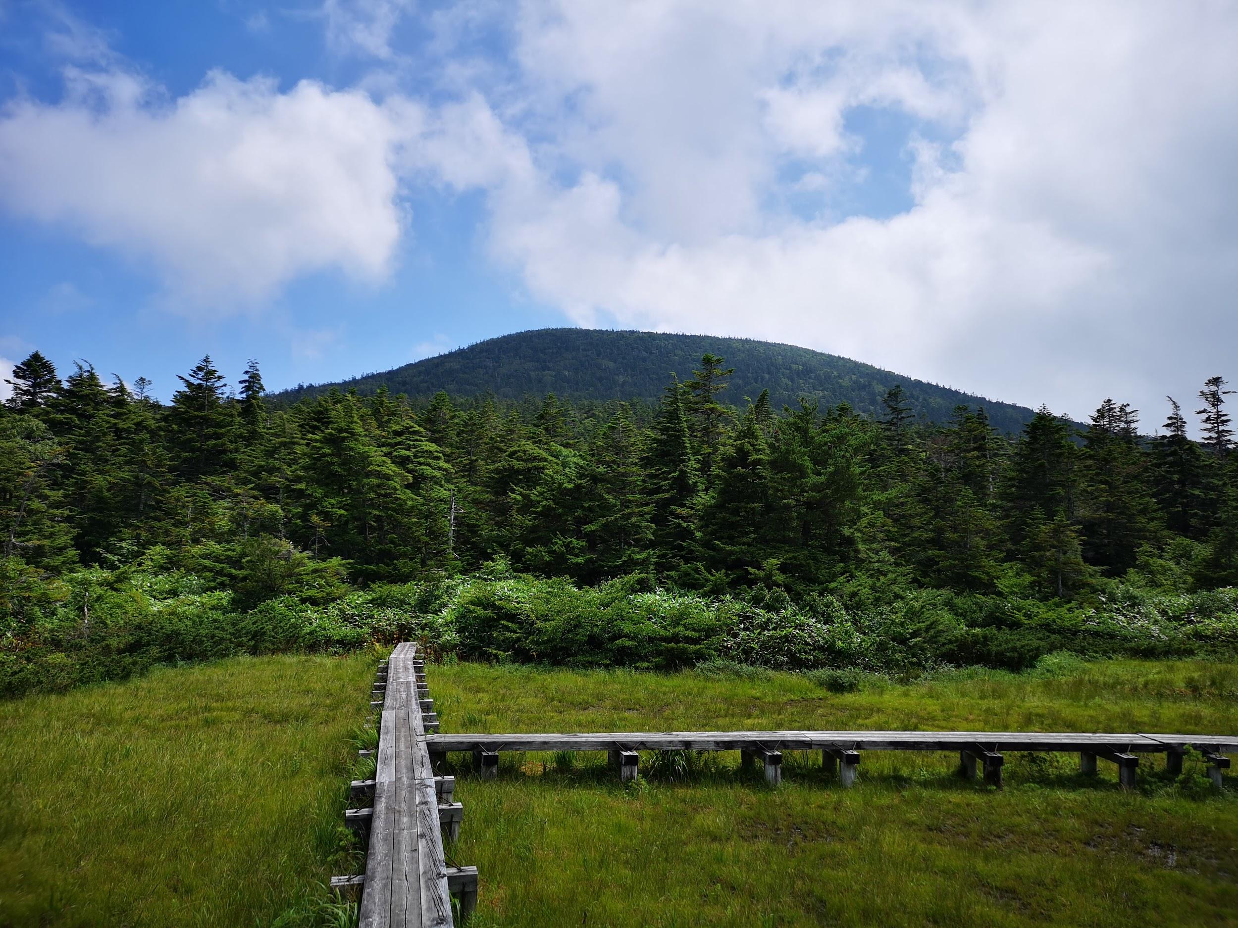
After parking my car at the free parking at Usagidaira 兎平, just a few minutes from the huge paying parking in front of the Jododaira visitor center, I set off on a small path that went through the campsite on the other side of the road. Apart from a few nice sections, I didn’t enjoy it very much. The path was tricky to walk, and was in dire need of maintenance. It was a relief when I finally reached Toriko-daira 鳥小平 with its wooden walkways and many dragonflies.
Here I turned right instead of going straight
Instead of heading up Mt Takayama straight ahead, I turned right, crossed the Bandai-Azuma Skyline, and slowly started climbing. Shortly, I reached a kind of plateau where I had great views of the summit, as well as a small lake. I was at the same height as the clouds and it was fascinating to watch them drift by. I soon resumed my climb. As I gained more altitude, the weather started to worsen, and by the time I reached the observation point near the top, I was, to my great despair, in the cloud with almost no visibility.
I continued somewhat dejected towards the highest point, but by now it had started raining. I took refuge under the trees just a few meters short of the summit. I put on my rain gear and proceeded to have some lunch. I was hoping the rain would let up, but it only seemed to pound down harder. The wind was blowing, and it felt cold even though it was still August. Finally I gave up and made a dash for the exposed summit of Higashi-Azuma 東吾妻山. I took a quick summit pic, and immediately headed down the other side.
Blue skies and clouds reflected in a pond
I was glad I had put on my rain clothes, as they soon got soaking wet, partly due to the rain, and partly from brushing against wet vegetation. The rain eventually stopped and the sun came out, but I had already descended too far to return to the summit. I didn’t like the path down very much: lots of roots and rock, making it tricky with my bad ankle.
Part 2: Uba-ga-hara – Kama-Numa Pond
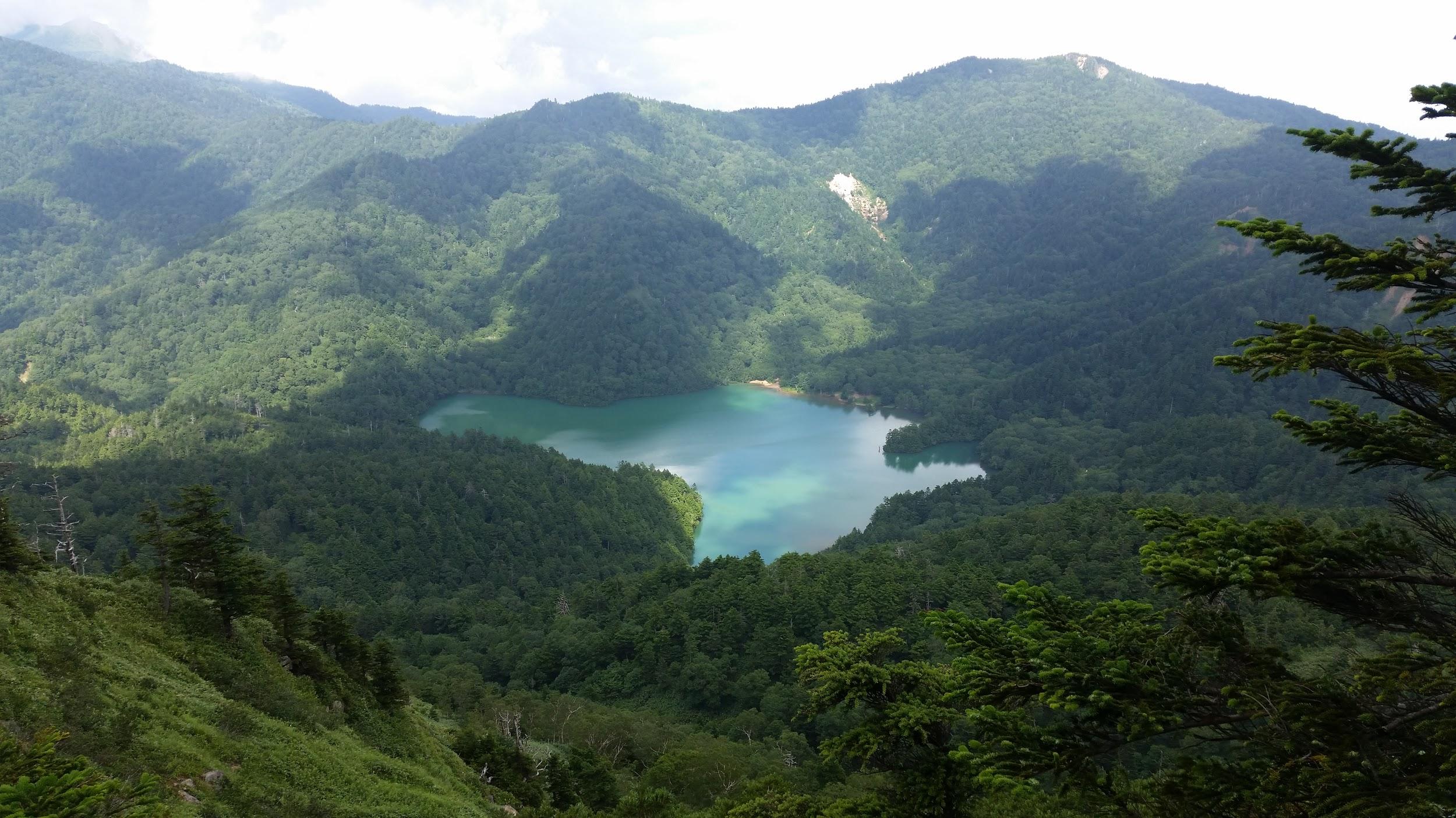
A beautiful lake high up in the mountains
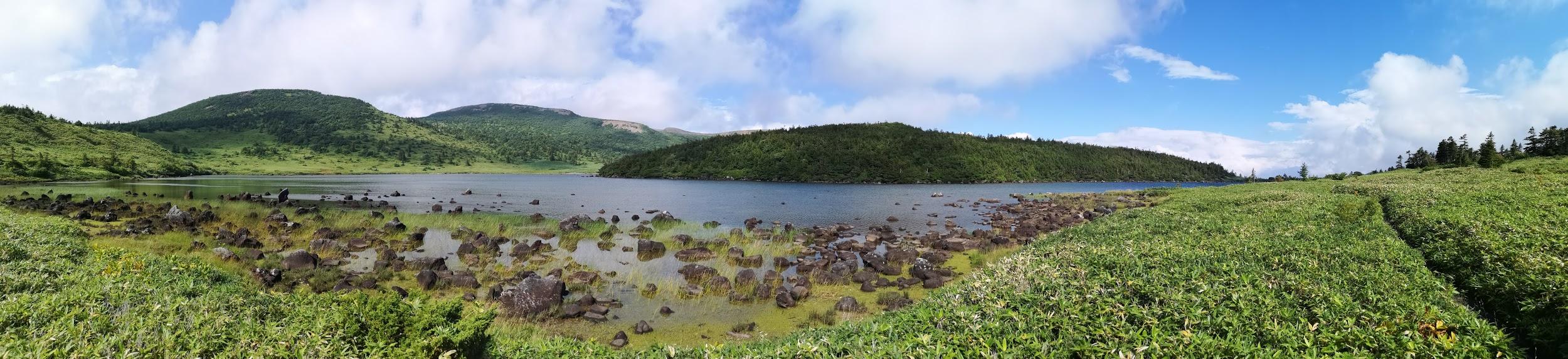
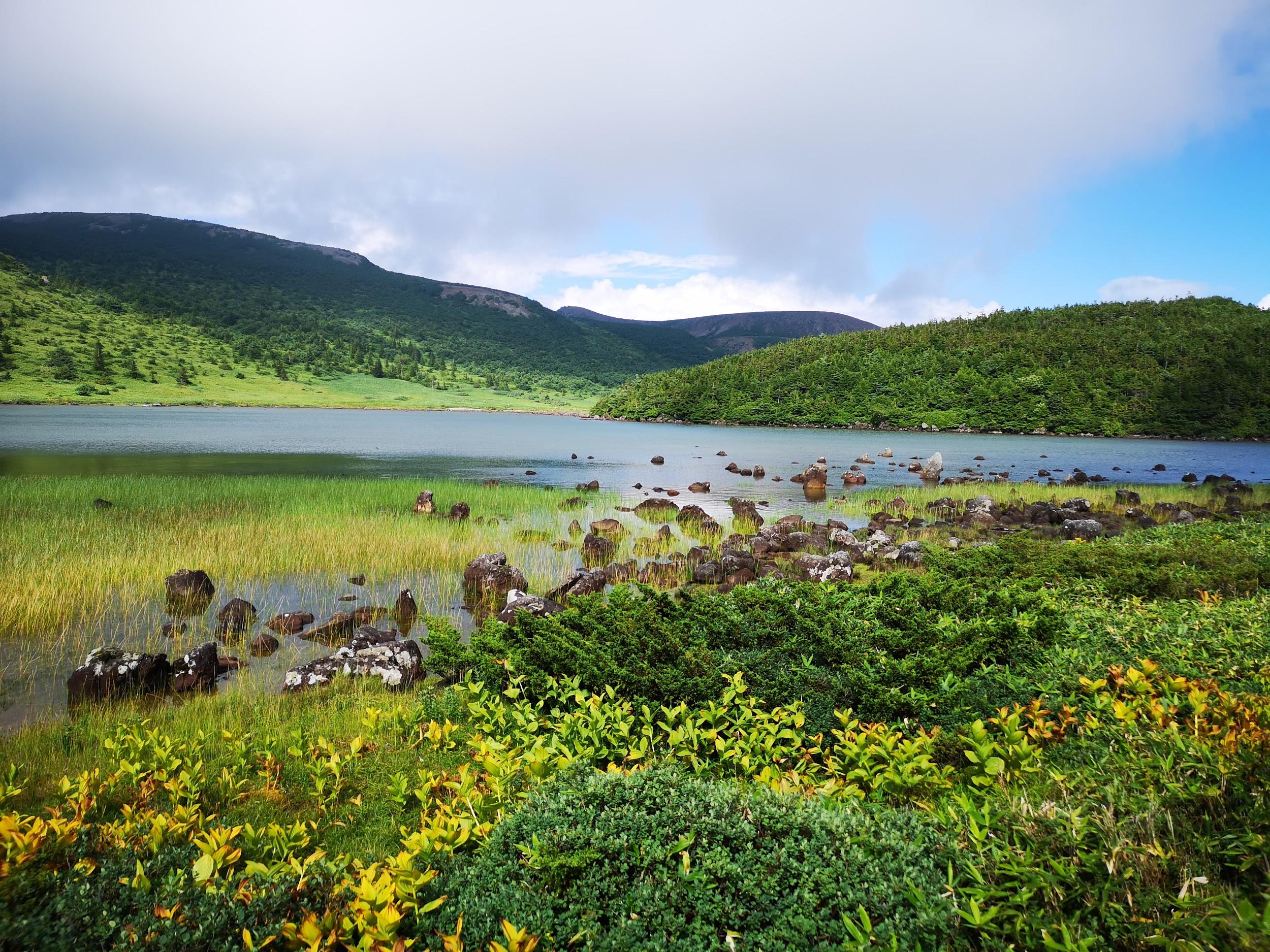
Eventually, I emerged at Uba-ga-hara 姥ケ原 where I was faced with a crossroads. I decided to head straight rather than head back straight to Jododaira. Very quickly, I reached Kama-Numa Pond 鎌沼池 which was quite a breath-catching sight. The dark blue water and light sky perfectly complemented the light green grassy rocks near the shore, and the dark green forested hills opposite. Definitely a landscape that would be worth painting.
The path leading down and back to the visitor center
Initially I thought I would walk clockwise around the lake, but my footsteps somehow took me counter-clockwise. I hope to come back some day and climb the remaining peaks on the other side of the lake. Eventually I left the lake behind me, and started to head back towards the visitor center. The weather had completely recovered. Descending in the sunshine, it was hard to believe that only one hour earlier I was sheltering from the wind and the rain near the summit!
Part 3: Jododaira – Mt Azuma-Kofuji
Spectacular view of “small Fuji” on the side of Mt Azuma
I was behind schedule, so I started to hurry towards Jododaira 浄土平. Although I had come by car, according to signs I had seen on the way up, the road back to Fukushima city closed at 5pm, so I had to make sure I was gone by them. My pace slowed somewhat after I started getting some jaw-dropping views of Mt Azuma-Kofuji 吾妻小富士, the mini-volcano sprouting from the side of Mt Azuma like a pimple. I definitely wanted to walk around the rim!
Walking above the clouds…
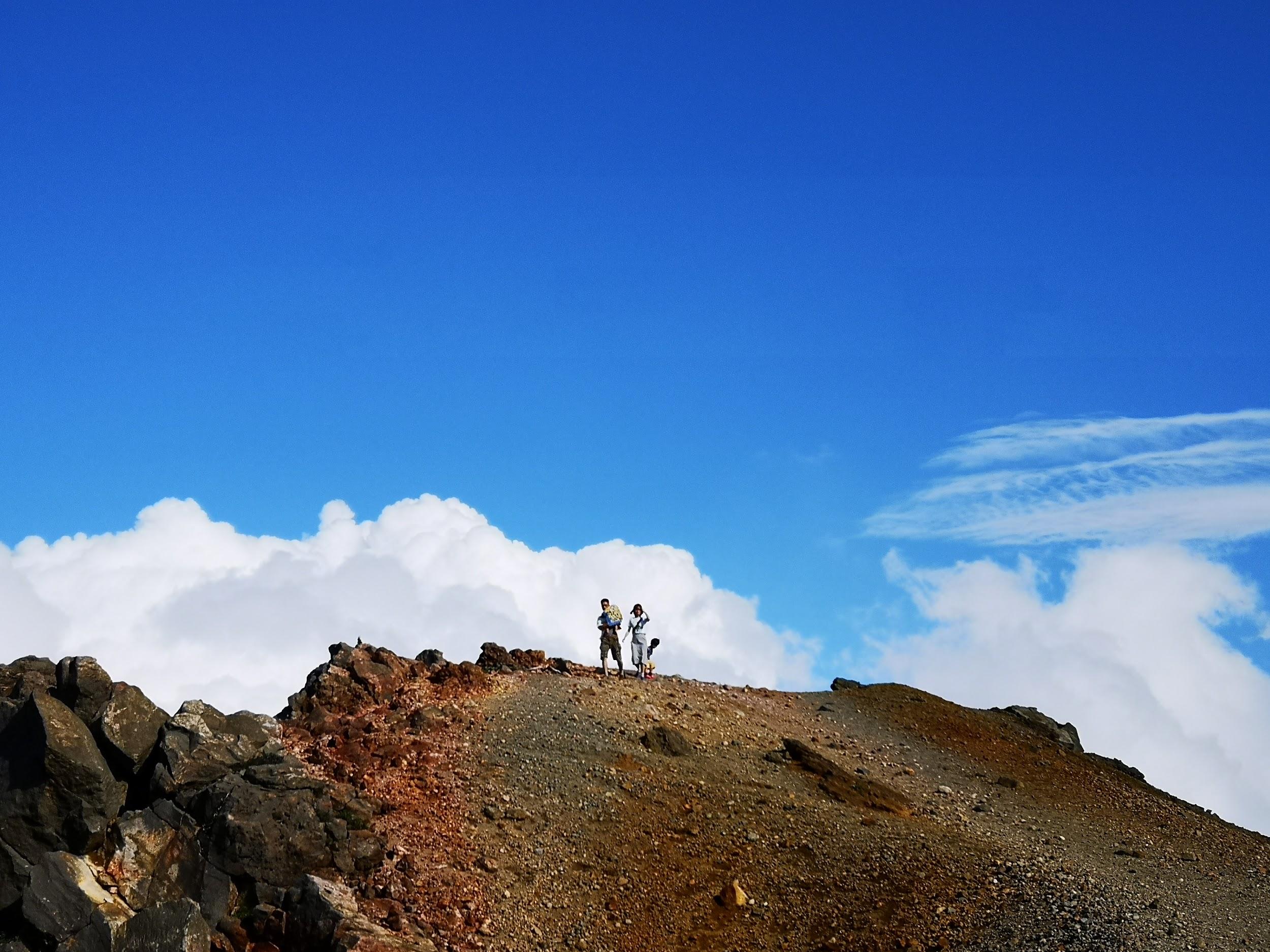
Although some sections had steps and walkways, a lot didn’t, so my ankle suffered some more. To my right, steam was venting out of the side of Mt Issaikyo. It was with great relief that I finally reached the visitor center. I took off my rain gear, and then rushed up the side of the mini-volcano and was standing at the edge of the crater less than five minutes later. I managed to walk around it in less than half an hour, enjoying the stunning views in every direction. It’s a pretty easy walk and anyone can do it. I managed to be back at the car before 4h30 and was happily driving back to the train station by 5pm. On the way, I had a quick bath at the very nice public onsen Attakayu.
Next up: Hiking at Yu no Maru, on Mt Asama (Nagano prefecture)


![Hiking the Nakasendo: Magome-Juku to Tsumago-Juku, Gifu and Nagano Prefectures, October 2019 [Map Available]](https://hikingtokyo.com/wp-content/uploads/2020/11/img_20191001_125332.jpg?w=1200)


You must be logged in to post a comment.