Mt Kinjo (1369m), Minamiuonuma City, Niigata Prefecture

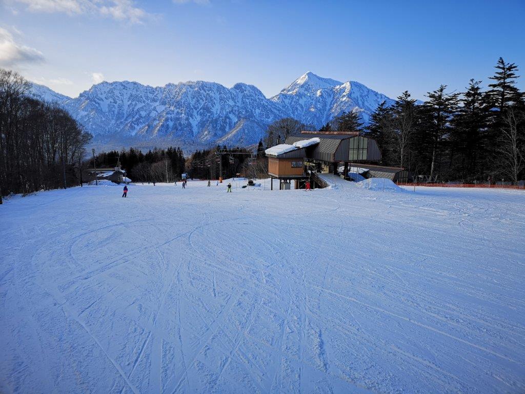
Hiking this Echigo Hundred Famous mountain turned out to be a very unusual experience. Since I had used the Tokyo Wide Pass to hike on Yatsugatake, I wanted to use it once more within the 3-day limit. An approaching typhoon meant rain for the entire Kanto region, but fortunately the Echigo mountains worked to hold back the clouds, and gave the Yuzawa area one extra day of sunny weather. I hadn’t really thought about climbing this mountain before, but it seemed like a good hike for the early autumn. Since there were four trails to the top, I first needed to decide my route. A little research showed that one trail had recently been closed due to typhoon damage, and two others required caution. Since it was my first visit, I decided to go up and down the remaining trail. Although it was physically demanding with a 1000 meter ascent, it seemed fairly straightforward. I had planned everything in detail, but there was one element I couldn’t have foreseen, and which nearly forced me to abandon my hike!

Hiking in the Echigo Mountains 越後山脈

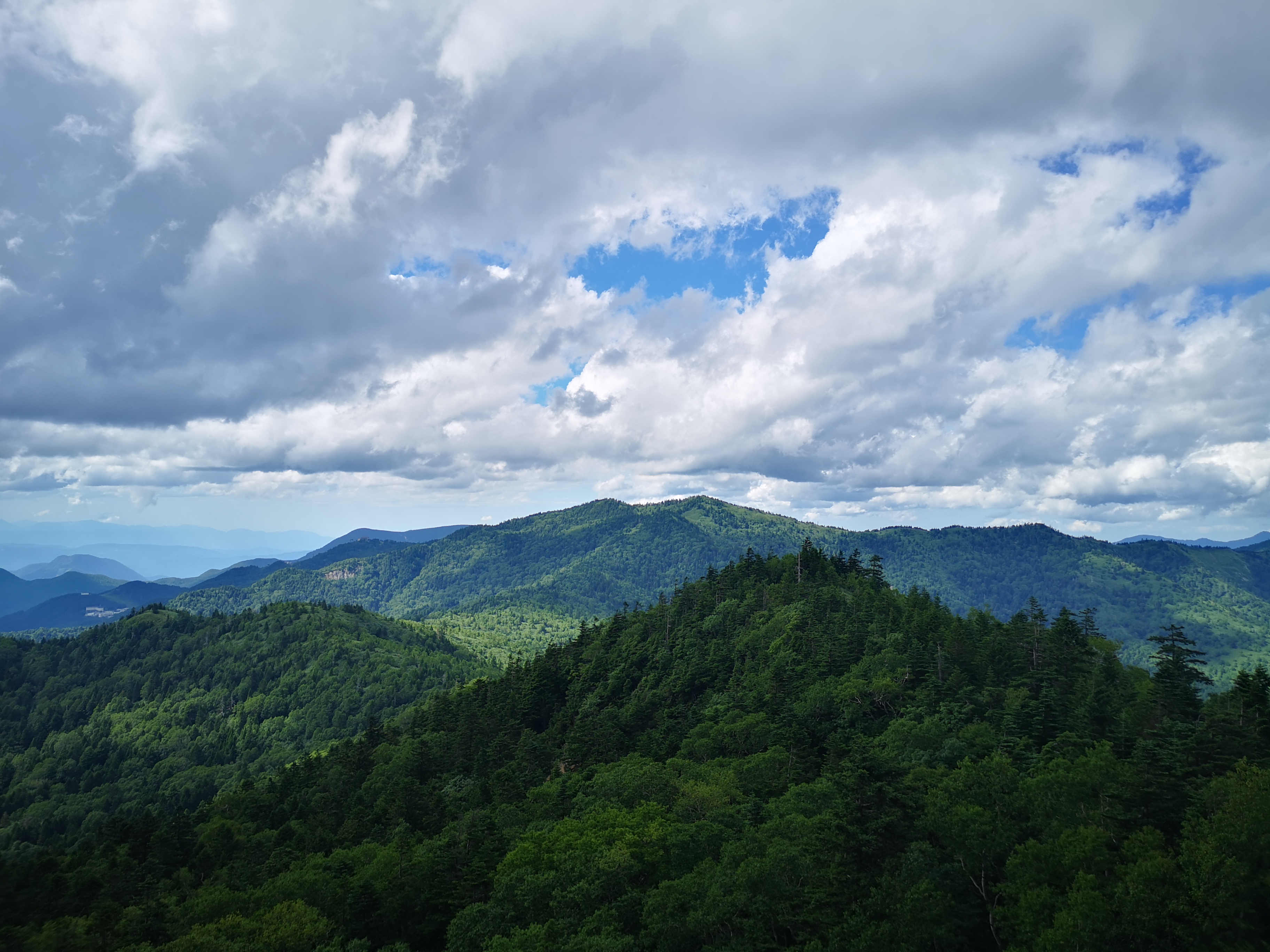
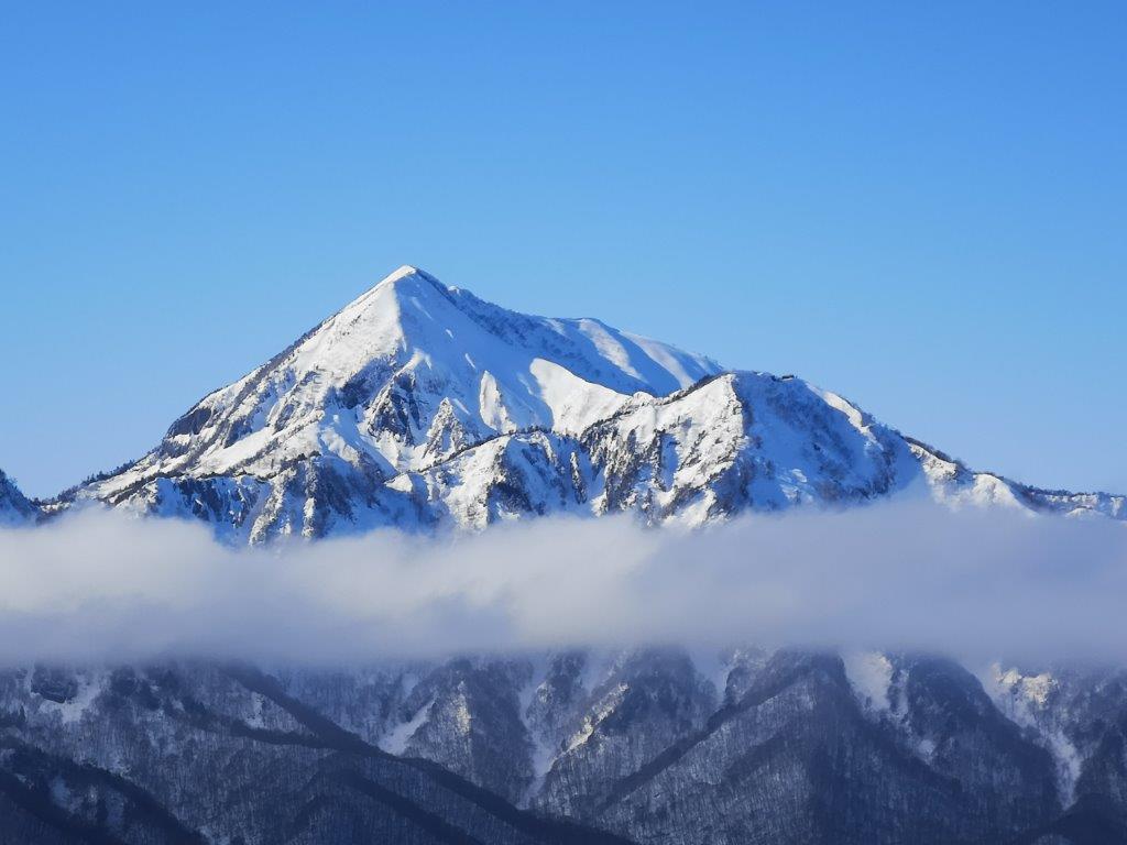
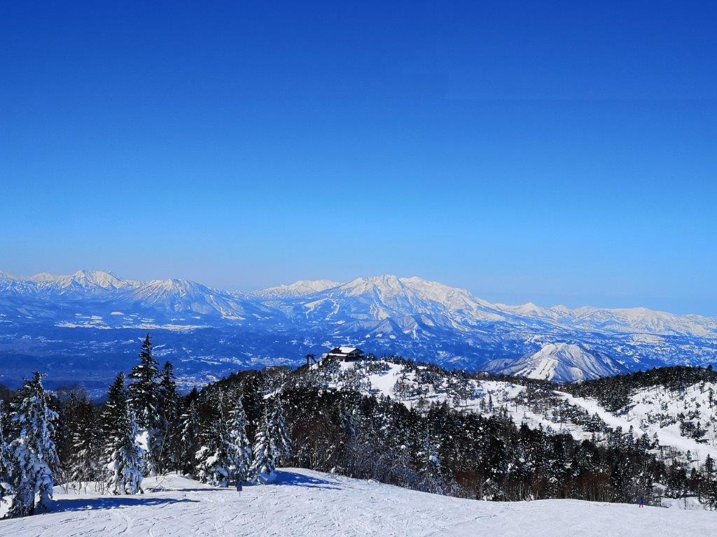
View of Mt Makihata from the summit

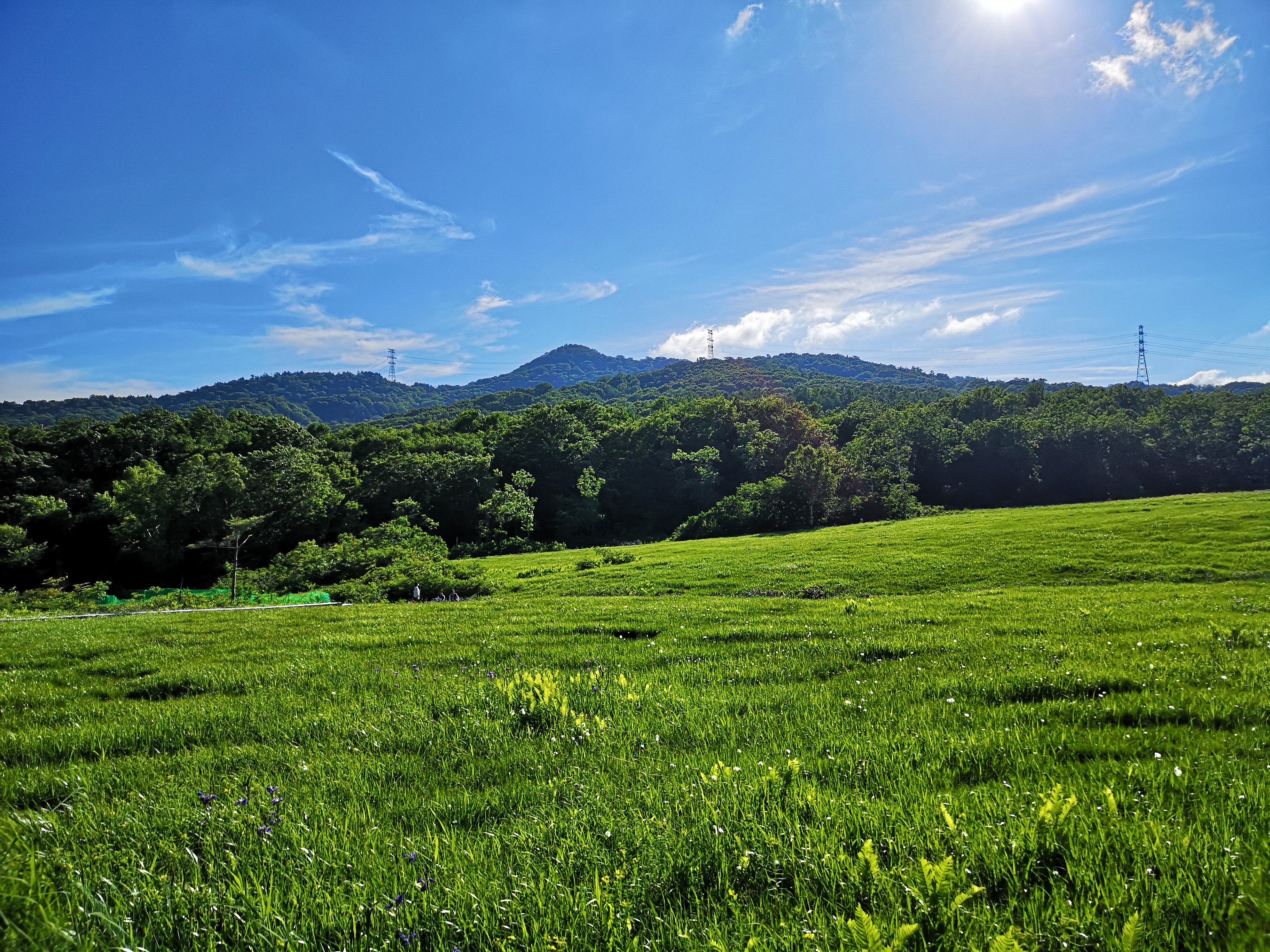
I left rainy Tokyo by shinkansen and arrived in sunny Niigata less than an hour later. I transferred to the local Hokuhoku line – “hokuhoku” is an expression meaning chuckling to oneself- and got off at Shiozawa station about ten minutes away (this section isn’t covered by the Tokyo Wide Pass). From there it was a short taxi ride to the start of the trail near Kikoji Temple. The driver was very chatty and had many questions about air travel. At 9am, I was ready to hike. It took me only ten minutes to reach the first viewpoint next to a shelter. There were a couple of bells that one can ring to scare away bears; I gave one of them a good “gong”. The Niigata countryside, a patchwork of fields, was spread out beneath my feet. Turning around, I could see the top of today’s mountain and the long ridge leading to it. My starting point was only 300 meters high, and it felt quite warm under the early autumn sunshine.

The Niigata countryside

The hiking trail follows the left ridgeline

No sooner had I set off again, that I walked into a spiderweb. After clearing my face of the sticky thin threads, I turned around to see that my head had just missed its occupant, a “jorogumo” or golden orb-weaving spider. It reminded me of my hike on Mt Ashitaka last year. A few minutes later, I spotted another web across the path with a big golden spider at face level. I used a branch to gently break the web just below the spider and slipped under. A few meters further, there was another web. I repeated the procedure, but I couldn’t do it so well this time, and ended up breaking most of it, the owner making a quick escape onto a nearby branch. I was impressed with the sturdiness of their weavings – true feats of engineering! I kept the branch in hand, constantly waving it in front of me, in case I failed to spot a web, which happened occasionally in the shady sections.

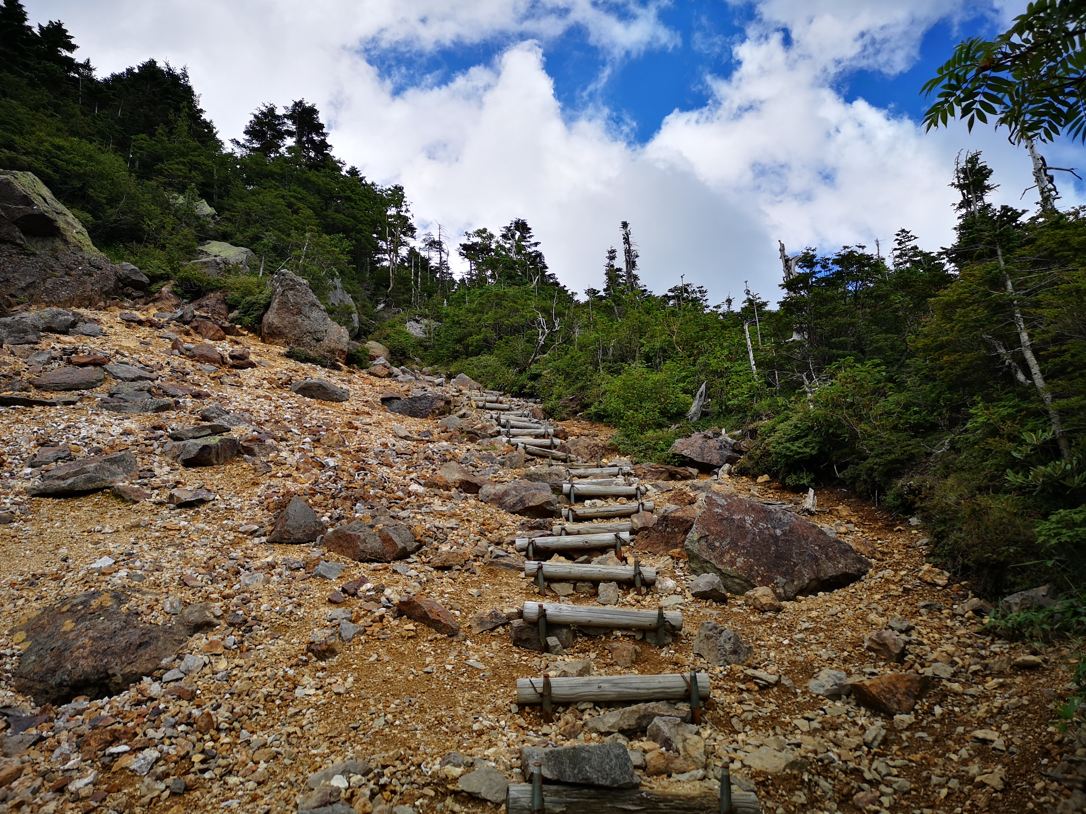
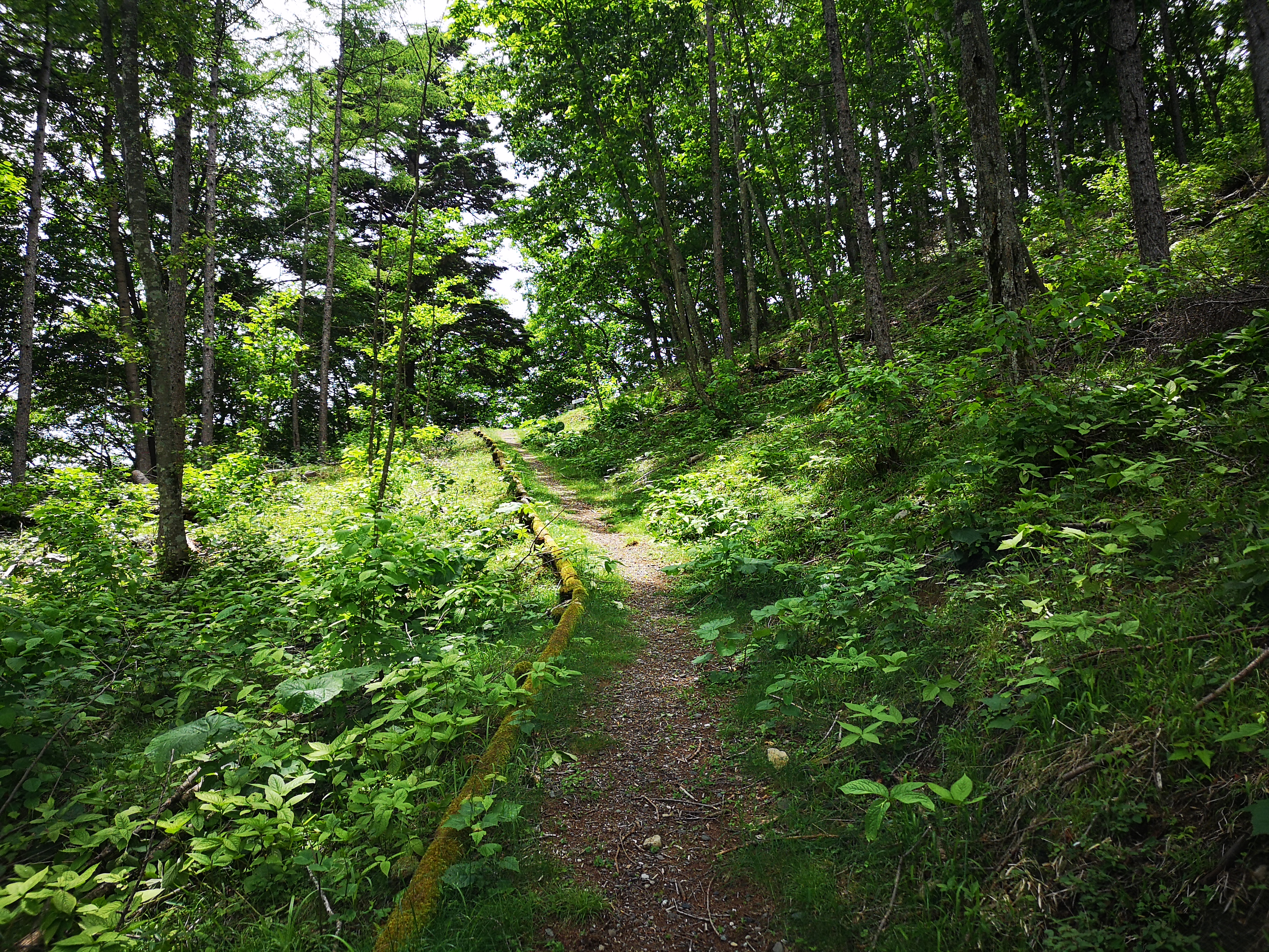
The entire trail was well-maintained

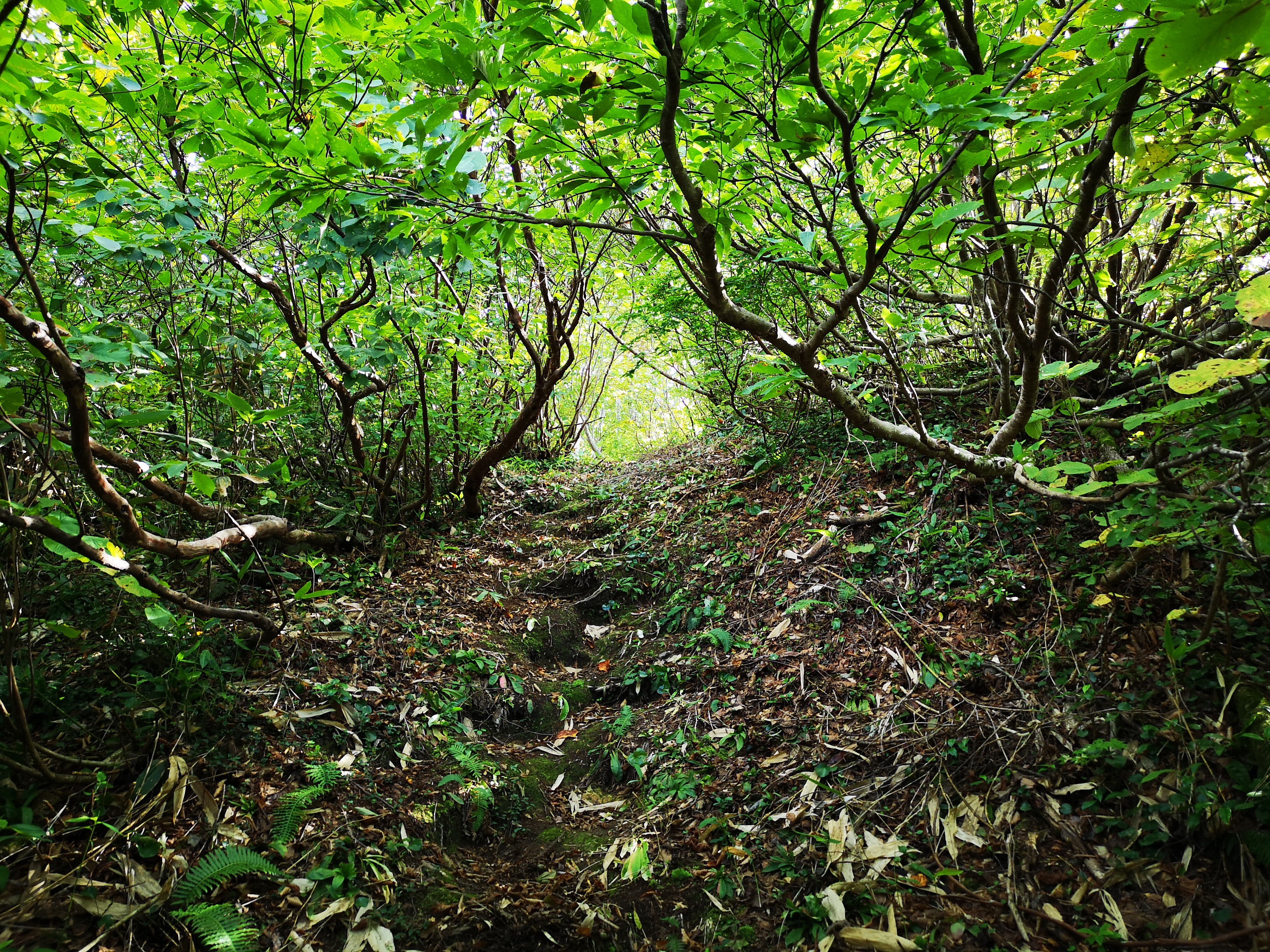
The tunnel through the shrubs

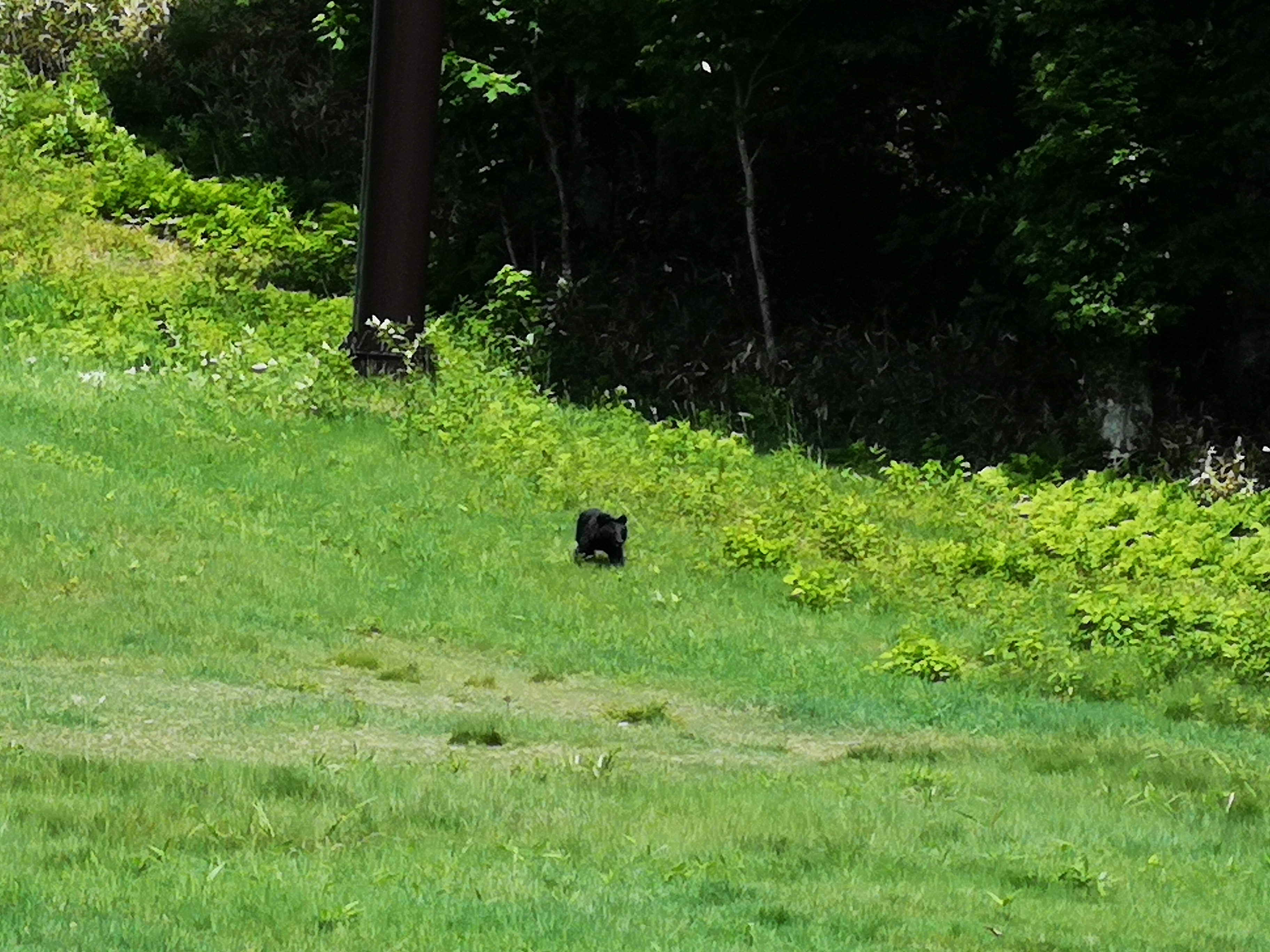
From that point on, there were webs every few meters. The easy-to-walk path formed a tunnel through the shrubs which the spiders exploited to spin their traps; I had never seen so many of them before. If they weren’t strung across the path, they were hanging from the branches on each side and in the trees above. Keeping an eye out for the webs, as well as partly breaking and slipping under them, was time-consuming and energy sapping. As I would need to return the same way, anything I dodged on the way up, would be waiting for me on the way down. I had fallen behind schedule and needed to pick up the pace if I wanted to catch the last bus back. I switched to a two-stick double-chopping movement; this technique was tiring on the arms, but at least I was moving at a good pace again. It was like hacking one’s way through the jungle with a machete. I felt sorry for the spiders and their hard work, but eventually other hikers would be passing through, and the webs would be cleared anyway. I found it hardest when the path suddenly climbed steeply; I had to raise my head and arms at a sharp angle in order to keep clearing the path. A couple of times I heard a rustling noise near my feet, and saw a snake slither away; not only did I have to watch out for spiders but for snakes as well!

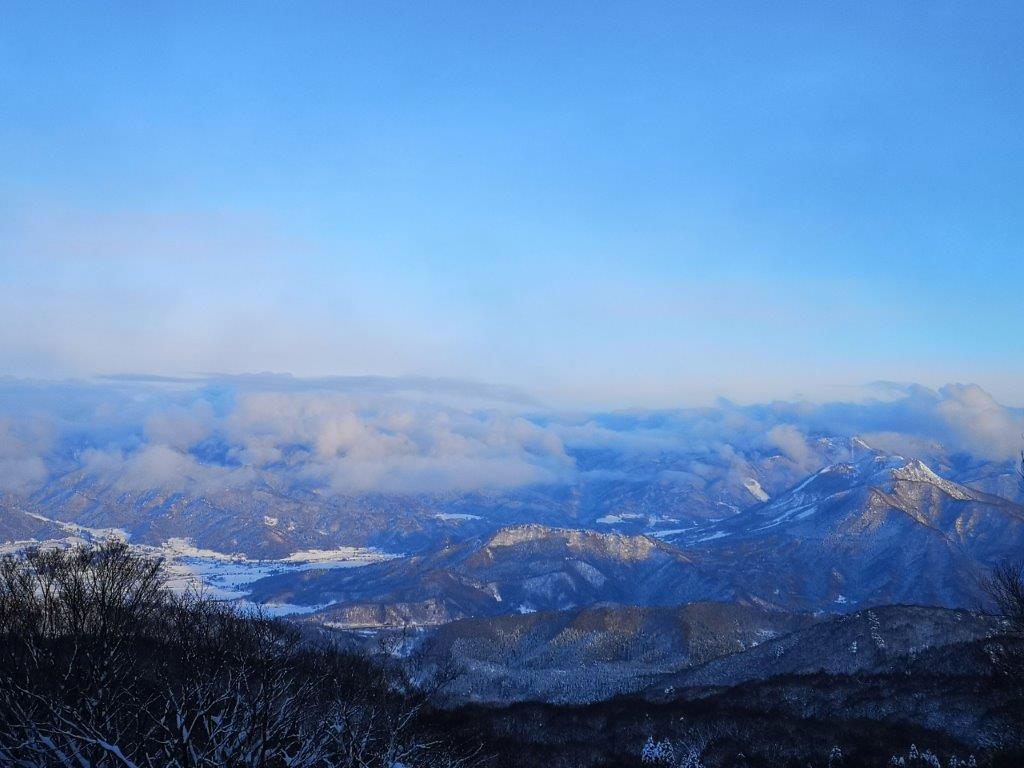
A spectacular view of Niigata

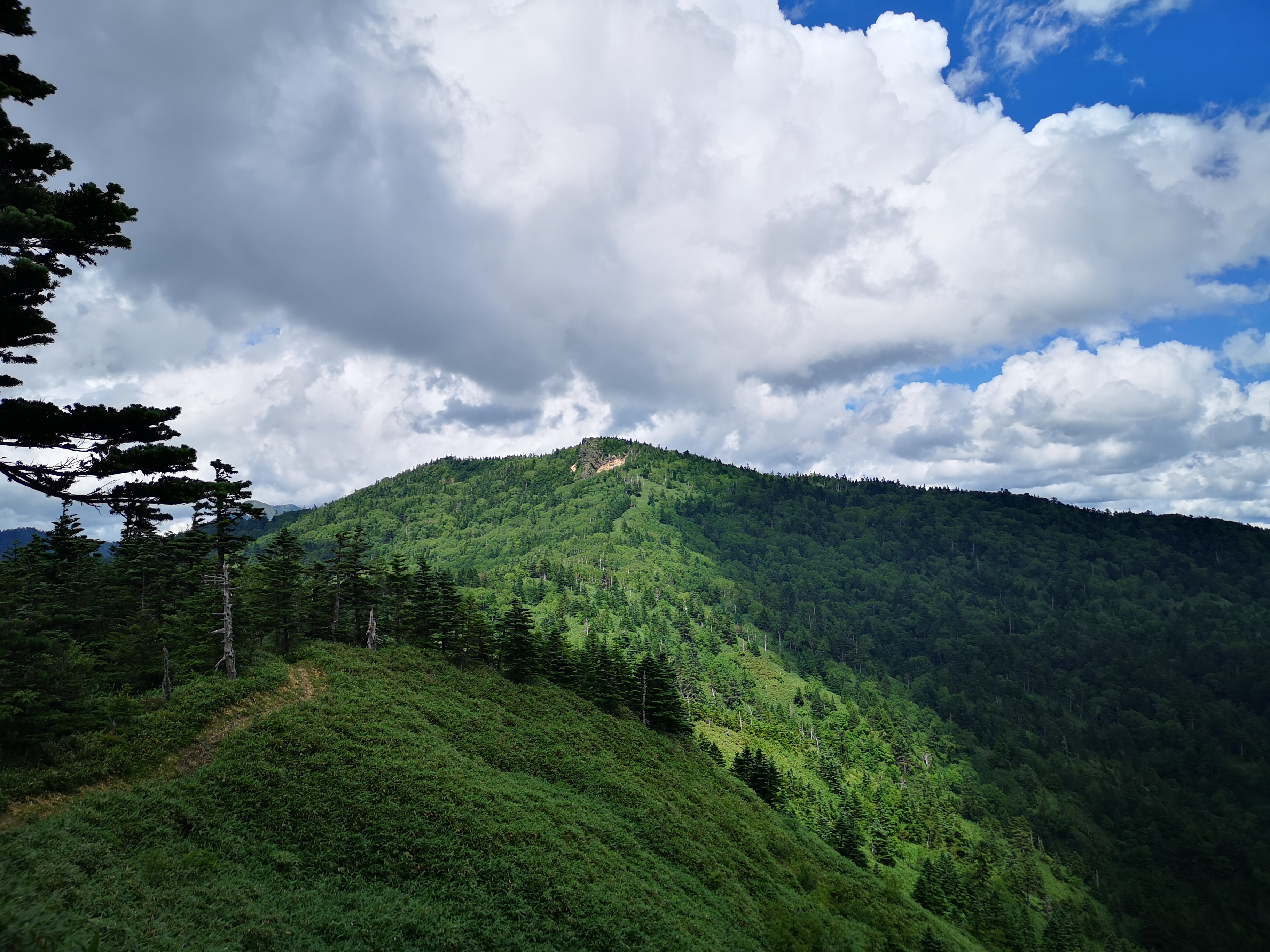
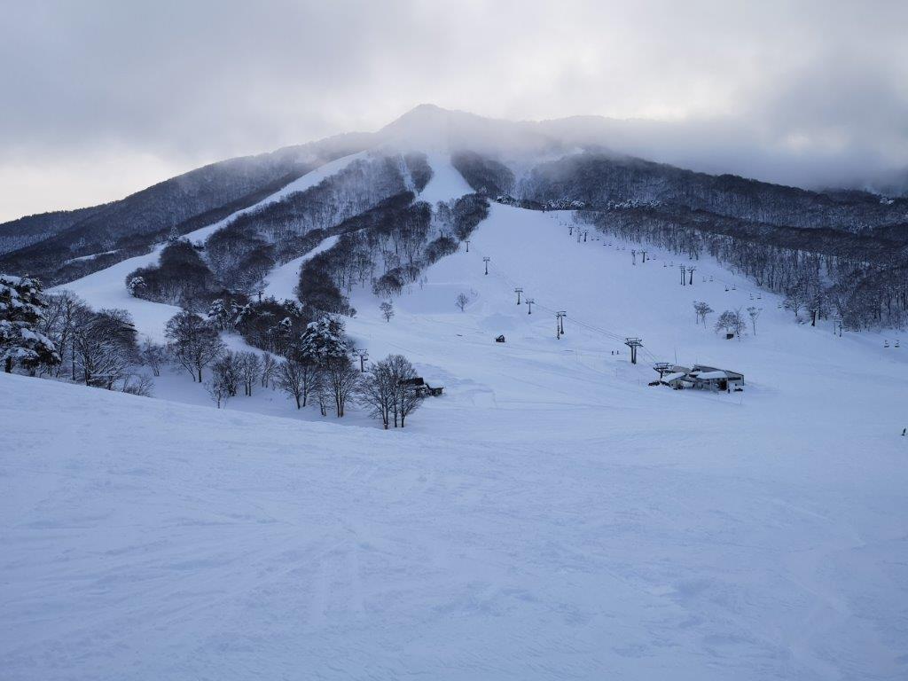
The route up this ridge is no longer in use

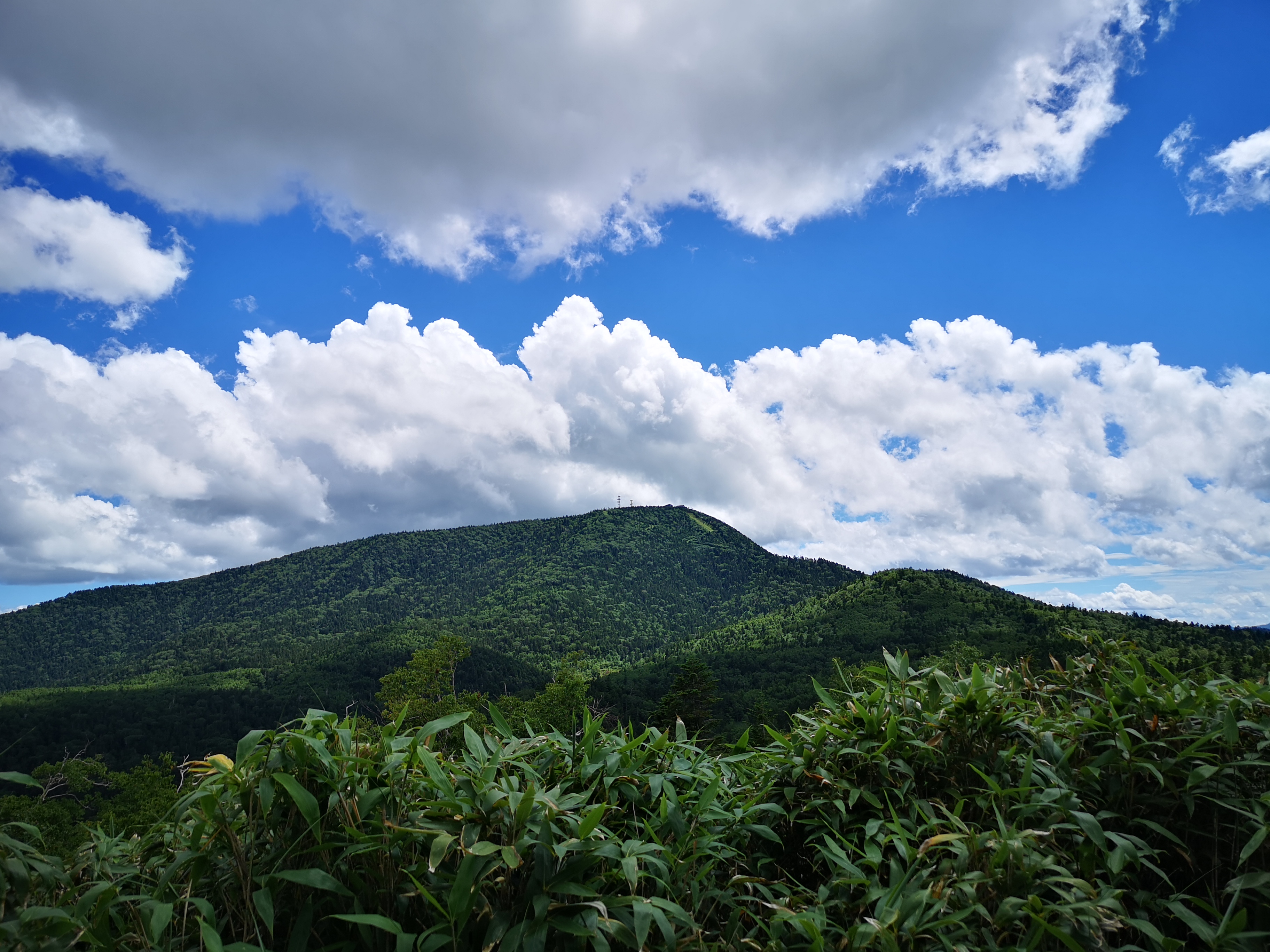
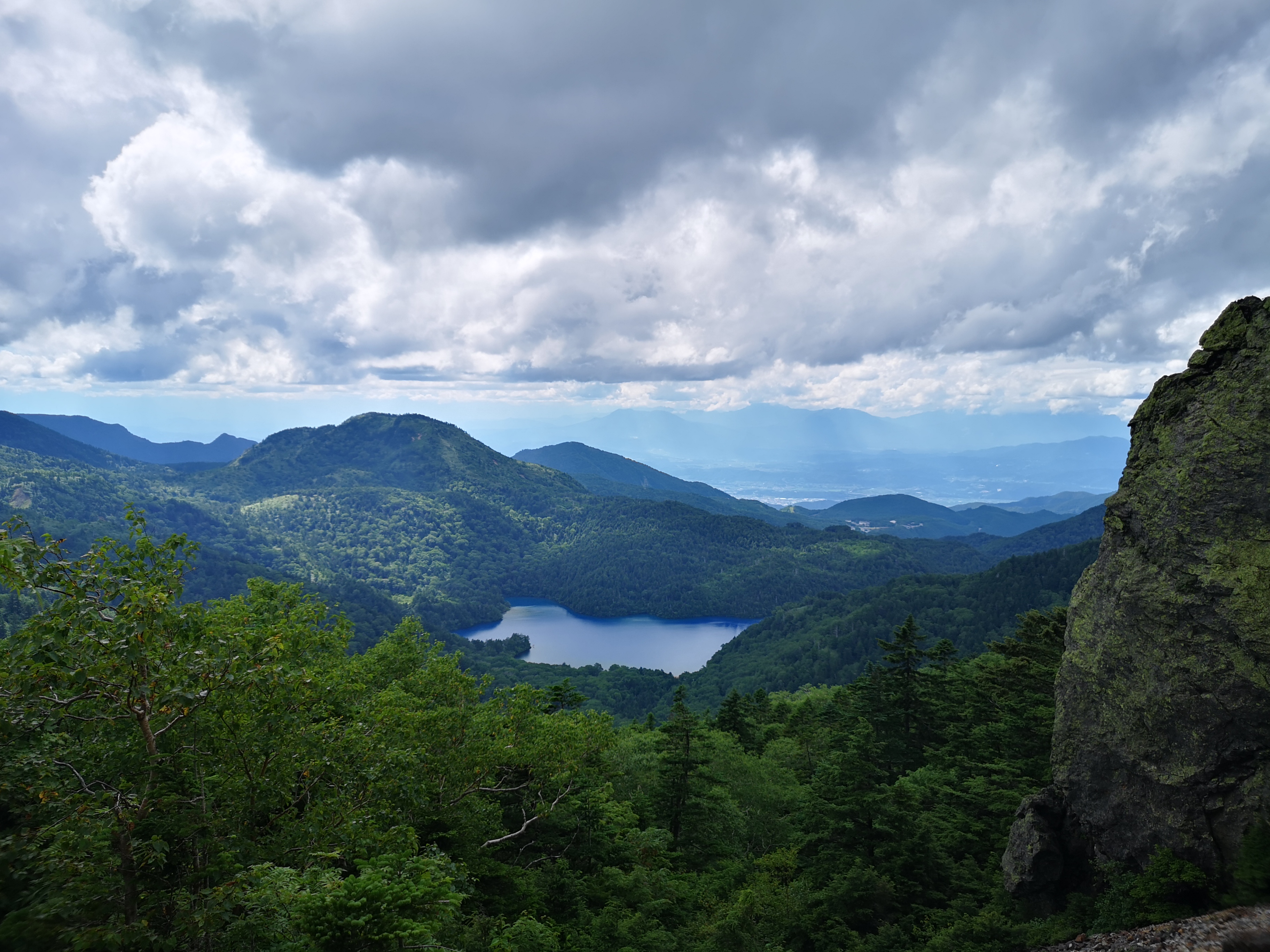
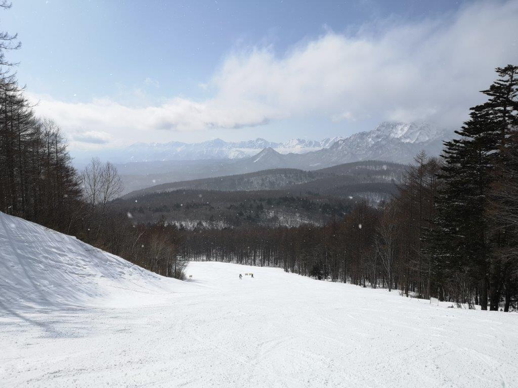
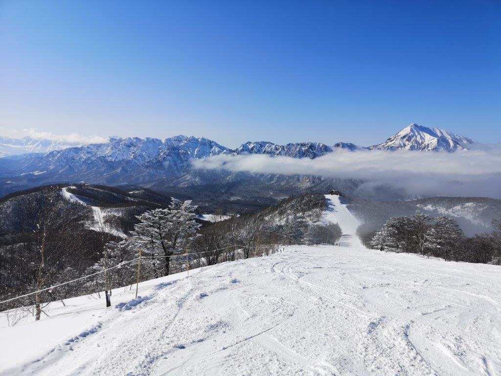
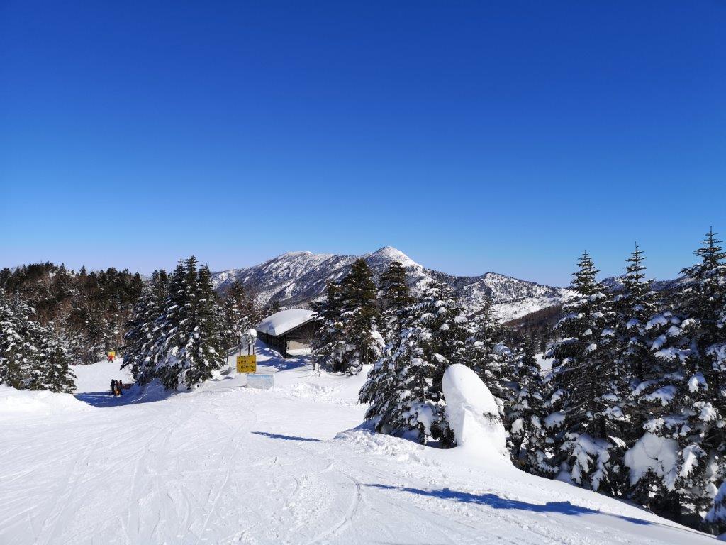
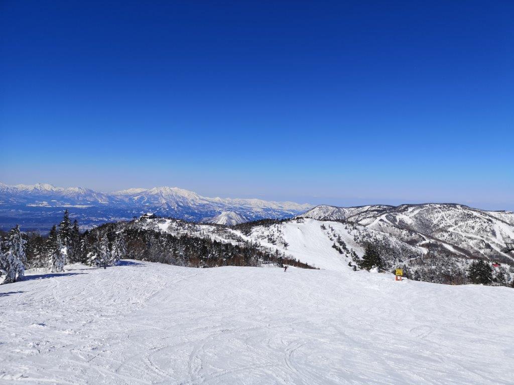
It took me 2 hours to reach the stone marker for the 5th station (“gogoume” 五合目) around 700m high and halfway up. I took a short break and had some food; I was drenched in sweat and my arms were starting to feel sore. There seemed to be no end to the spiderwebs. I couldn’t imagine doing this all the way to the summit, and then repeating it on the way down, since in the space of a few hours new webs would surely be spun. As I munched on my onigiri, I considered giving up. The good weather was holding and the summit was visible in front of me, so I decided to continue just a little further. From this point, the path entered into a forest of beech trees, and the spiders webs magically disappeared. I soon reached the 7th station surrounded by tall birch trees, the rustle of their leaves in the wind sounded like soft rain (see video at the end). The path then rose sharply, with some sections lined with ropes or chains. Thirty minutes later I reached a flat section with great views; I could now see the craggy top of Mt Hakkai to the North. I was above 1000 meters high, and all that was left to climb was the pyramidal summit. It was a long, steep slog but seemed easy compared to what I had endured lower down. At 12h30, the path leveled again and I had my first views of Mt Makihata. After one last scramble up a rocky outcrop, I was finally standing at the top of Mt Kinjo (金城山 きんじょうさん kinjousan).
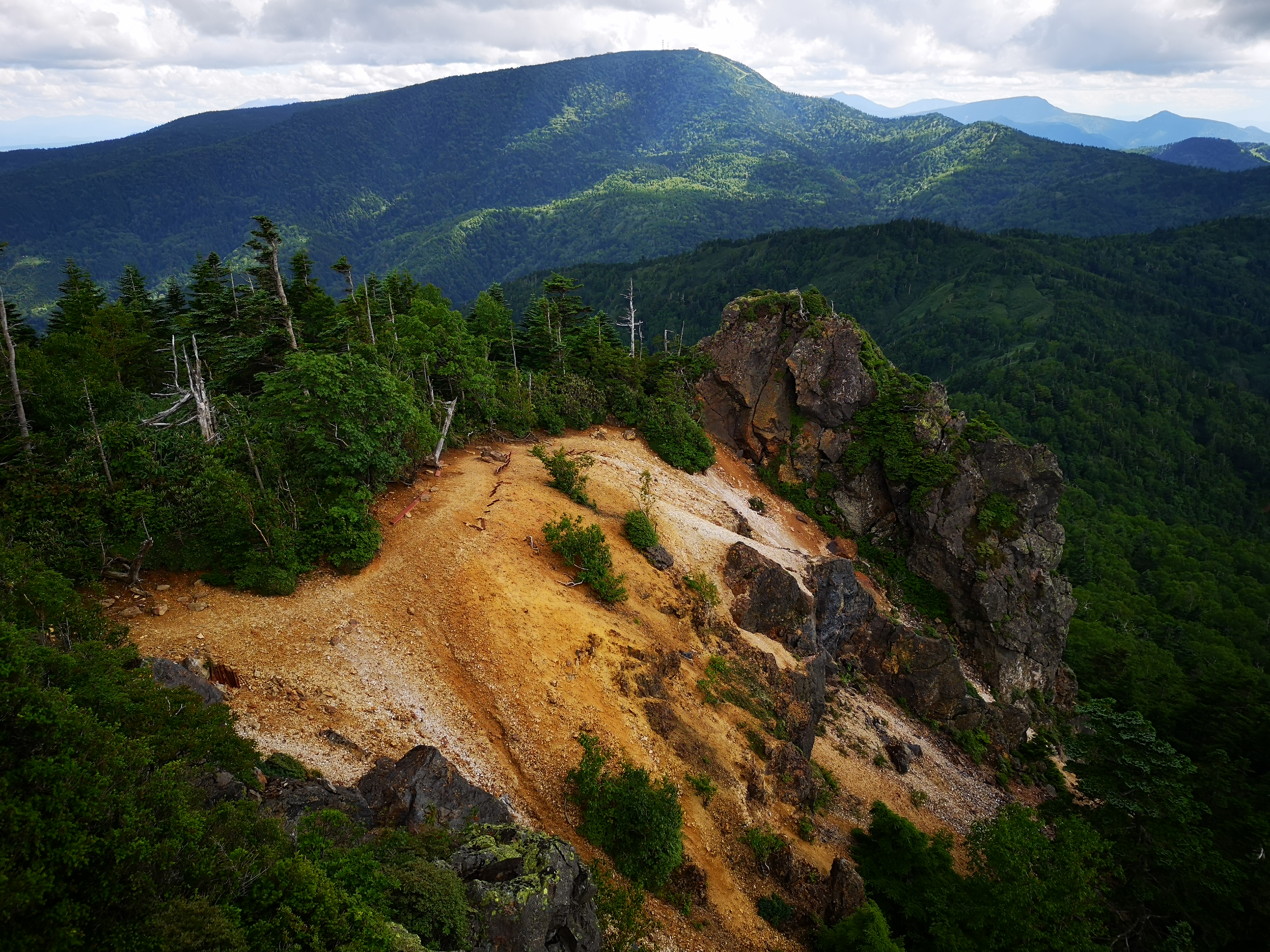
Summit of Mt Kinjo

Highest point of Mt Kinjo

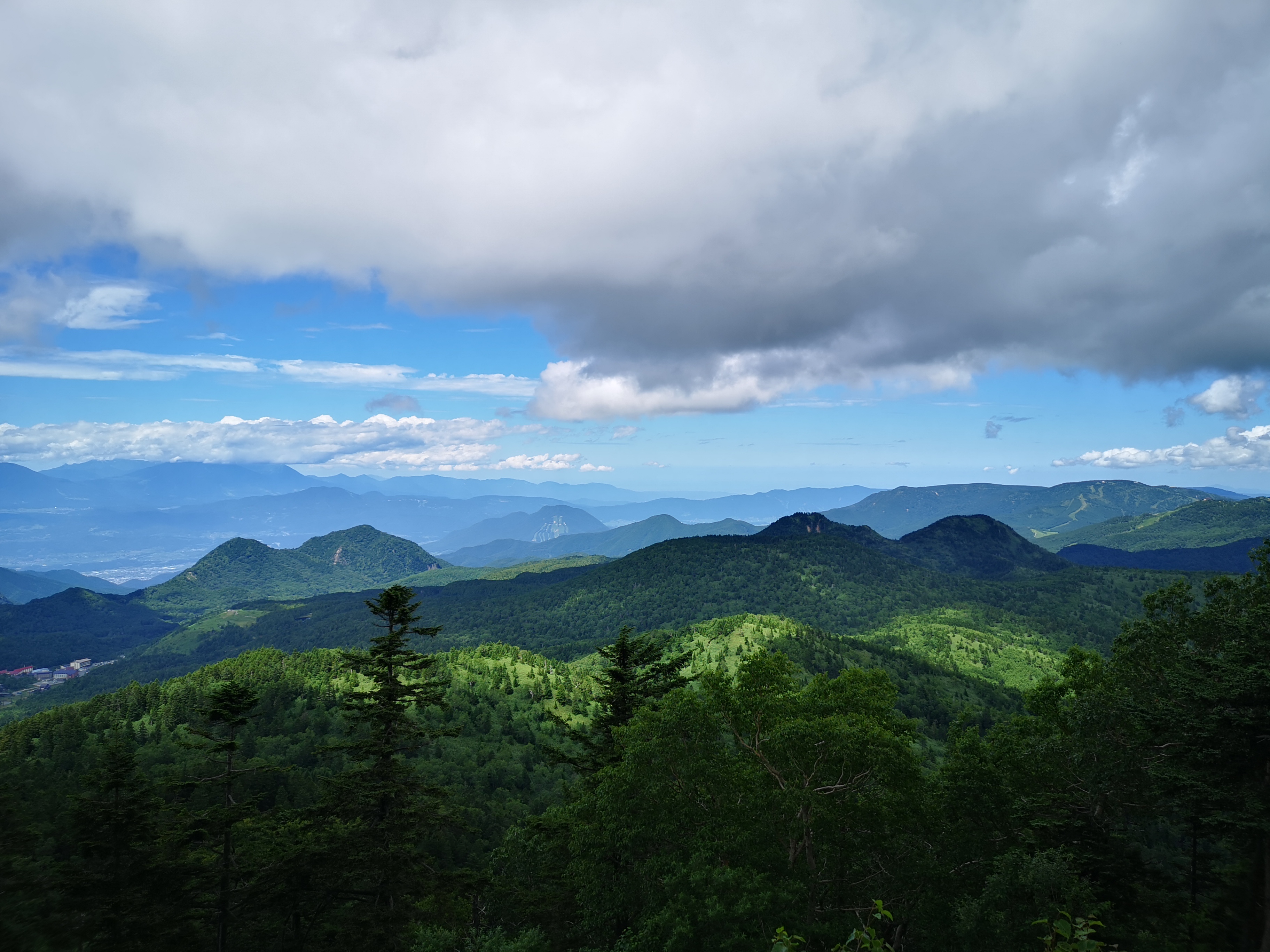
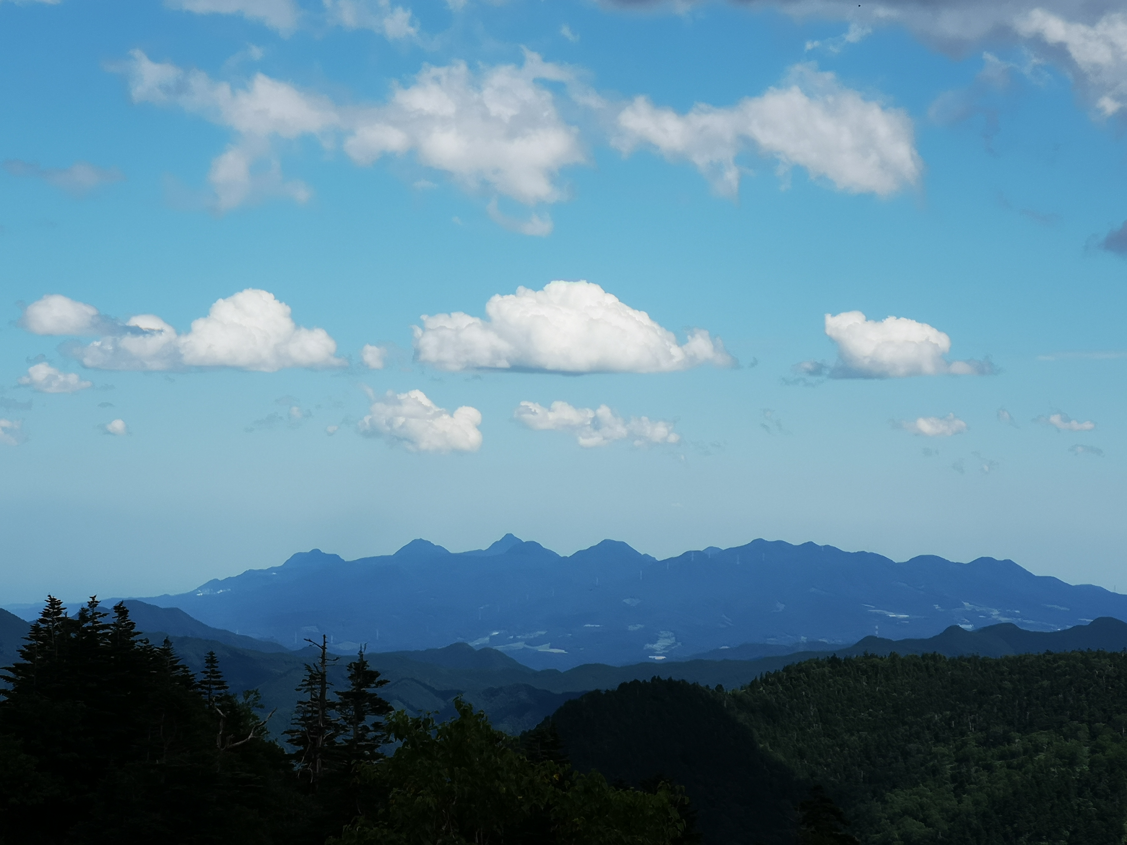
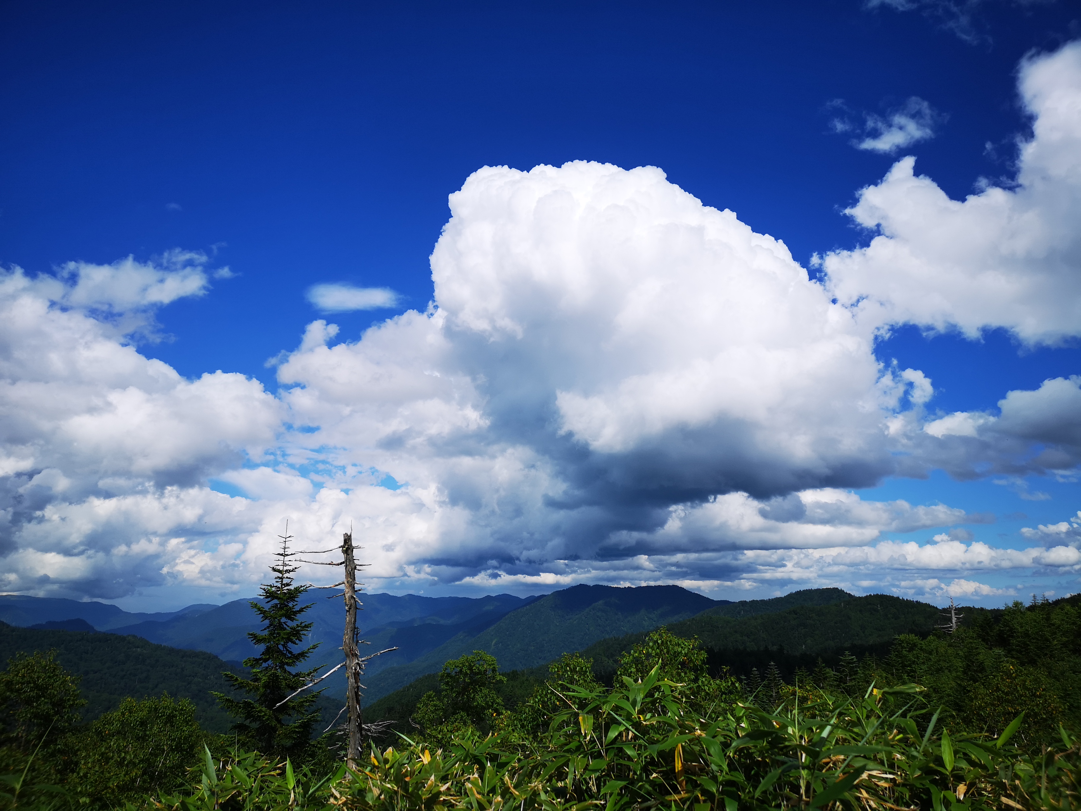
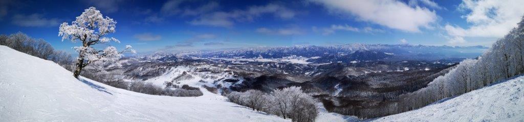
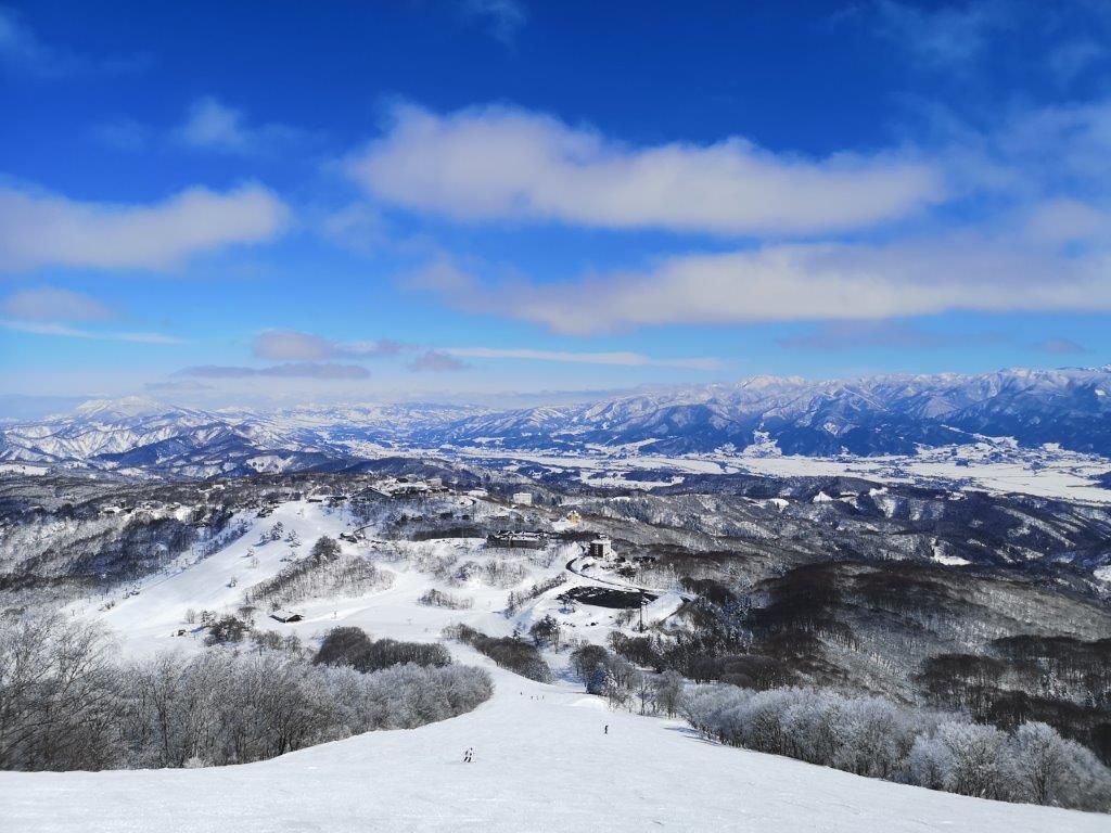
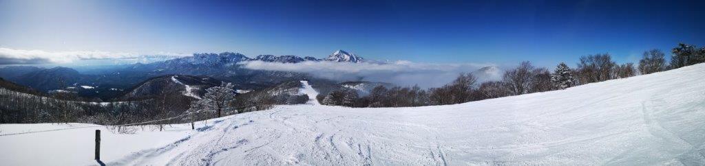
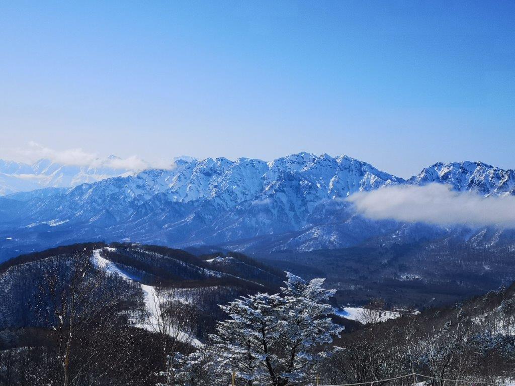
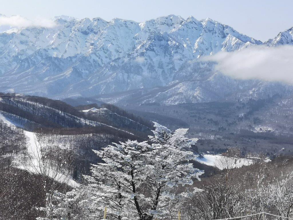
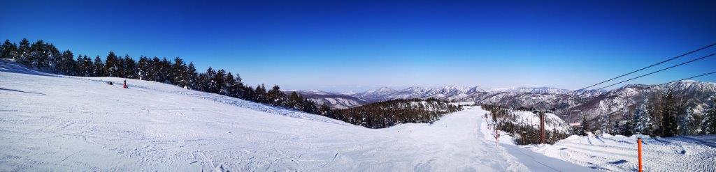
The surrounding views were astounding, mainly because of the 1000 meter height difference between the flat valley and the top. There were no high mountains westwards, and I had a bird’s eye view of Niigata prefecture. Looking East, I could see the massive bulks of the “Echigosanzan“, the three Echigo mountains, with dark clouds sitting on each summit. Southwards, I could make out the Tanigawa mountain range, half-hidden by the clouds. High altitude cirrus clouds were streaking across the sky from the South, a sure sign of rainy weather. I sat down for lunch, keeping a safe distance from the top of the cliff on the South side of the flat top. The summit marker doesn’t really mark the highest point. It’s another thirty-minute scramble along the ridge to a slightly higher spot among the trees and without a view, a little beyond the emergency hut; I decided to skip it. A few meters away, I found a rocky slab where I could lie down, close my eyes, and enjoy the warm sun and soft silence created by the absence of wind. I was alone, except for a pigeon, sitting on a nearby boulder, apparently also enjoying the panoramic views.

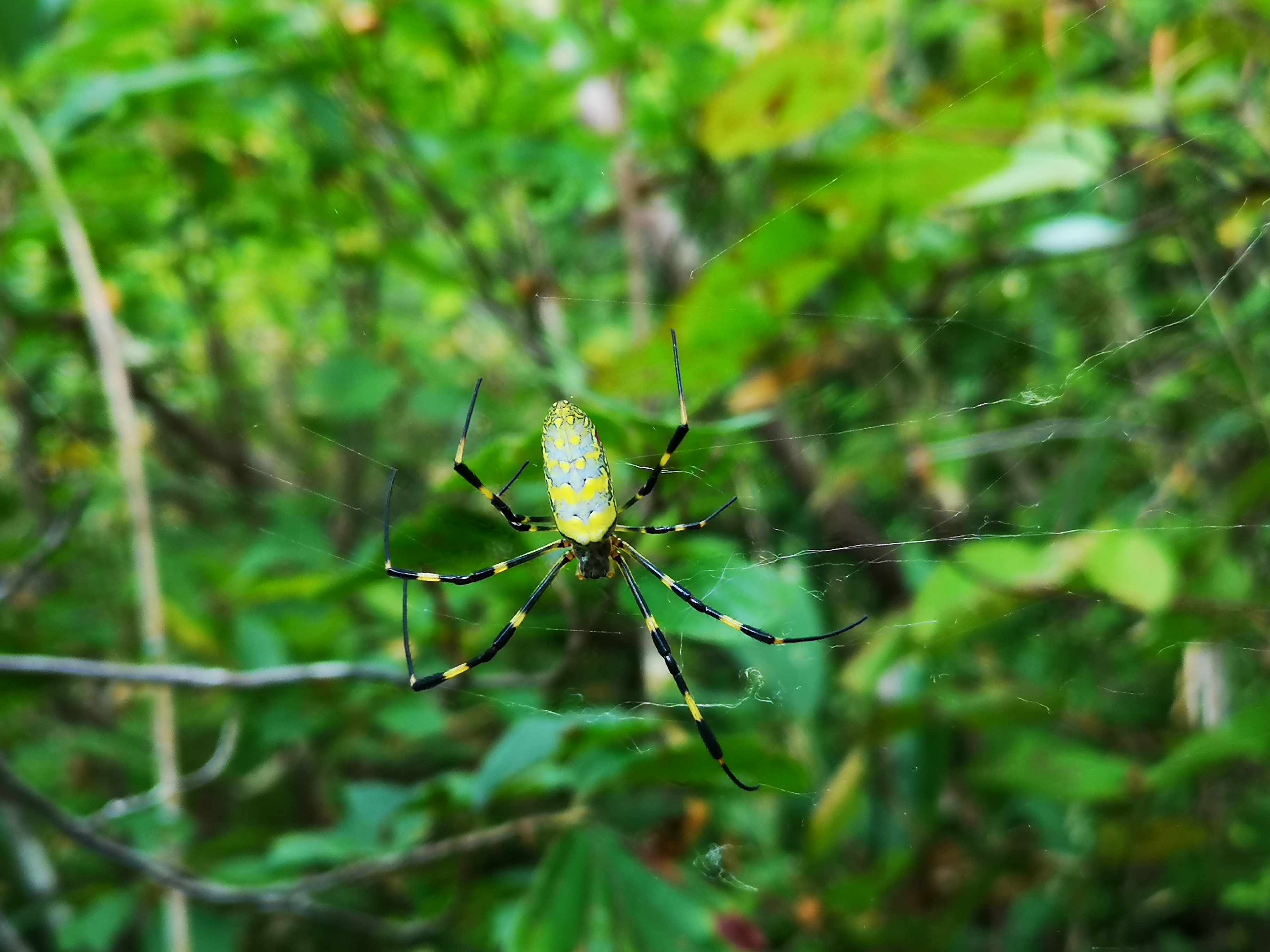
A close-up of the Joro spider

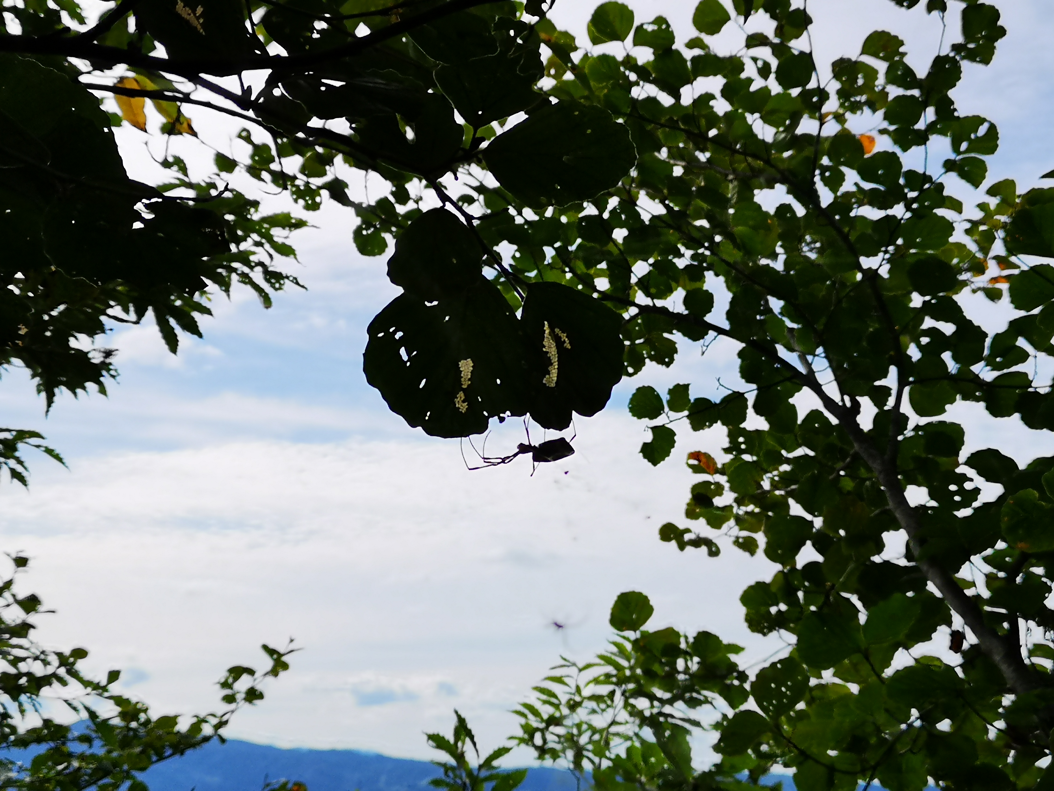
Can you spot the spider?

At 1h30 I headed down and since I knew that the trail was spider free till the 5th station, I moved as quickly as I could. One hour later, I was walking with a stick in front of me again. As I had expected, some webs had been rebuild, although by smaller spiders. Going downhill, I was walking at a straighter angle and I was hitting the higher webs. Despite my best efforts, I occasionally got tangled in them; it was hard to determine whether the web I was caught up in was connected to the spiders dangling nearby; once I stopped just a couple of centimeters short of a big yellow and black spider hanging in mid-air. Since I was keeping an eye out for arachnids, I also spotted other small creatures such as a praying mantis and a big grasshopper. I reached the bottom of the mountain at 4pm under cloudy skies. It took me 7 hours to go up and down, including a hour break at the top; it would have taken six if it hadn’t been for the spider webs. In all my climbs in Japan and around the world, I had never experienced such an exhausting battle to the top. Since the “Joro spider” is mostly active in the autumn, I guess it’s easier to climb this mountain in other seasons. It was a 15-minute walk to the bus stop which I reached with twenty minutes to spare. Unfortunately, the hot spring inside Echigo-Yuzawa station was already closed so I wasn’t able to wash away the cobwebs till I got back to Tokyo !

Listen to the sound of leaves rustling in the wind

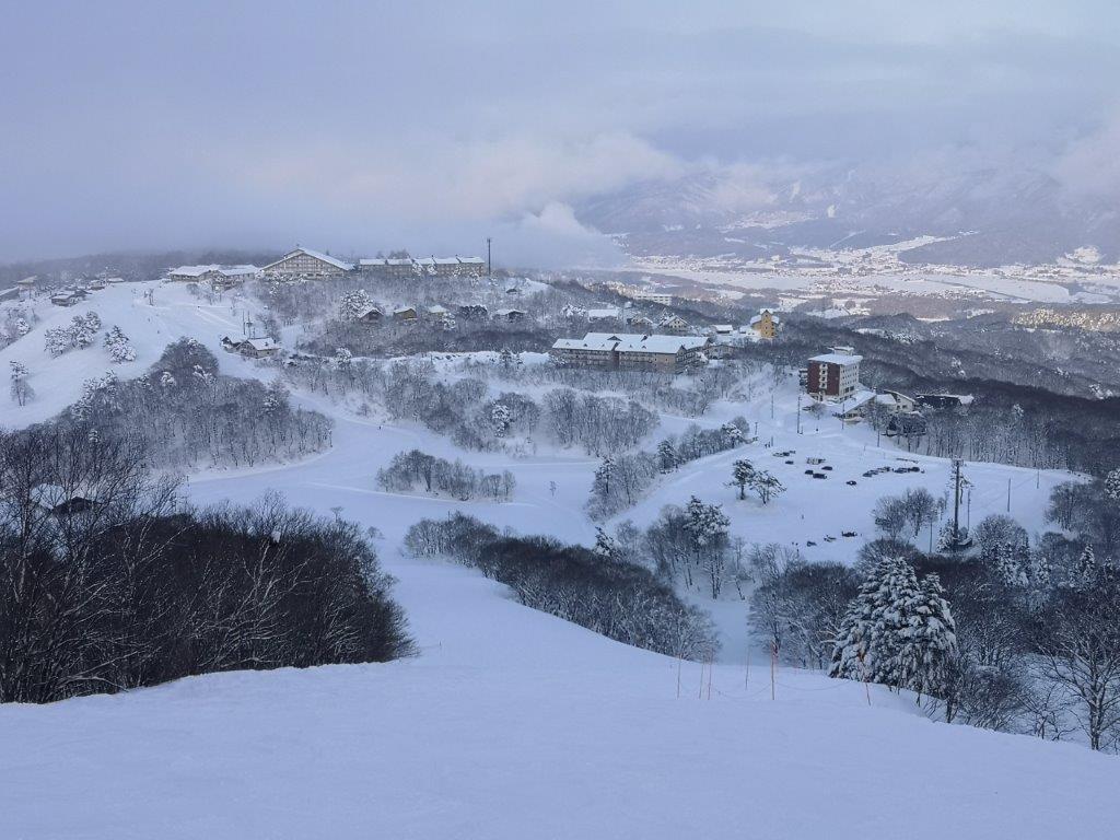
Traditional Niigata architecture with Mt Kinjo in the background

Mt Hachi (2041m), Mt Akaishi (2109m) & Mt Terakoya (2125m), Yamanouchi Town, Nagano Prefecture

I had been to Shiga Kogen once before, but I had done it as an overnight trip, staying at Kusatsu Onsen on the way. This time I wanted to see whether it was possible to do it as a day hike, by using the Shinkansen to approach from from the Nagano side. I was also curious to see how crowded public transportation would be this far from Tokyo. The temperature in Tokyo was supposed to exceed 35 degrees, so I was worried that it might be too hot for comfortable hiking. Finally, I was hoping for clearer weather this time round; last time, thick clouds rolled in around noon and hid a lot of the views. This is an original hike spanning the central part of the Joshin-Etsu National Park.

Hiking in Shiga Kogen 志賀高原

IMG_20200811_110715

In the foreground, Mt Kasa, in the background, Togakushi Highland

IMG_20200811_140946

The jewel of Shiga Highland, Onuma lake

I arrived at Nozomi のぞみ just below Mt Yokote at 10h40 after a four hour journey that included a regular train, the shinkansen, a limited express and a bus. As I had hoped, the final train and the bus were nearly empty, most people having come by car. It took me about an hour to reach the top of Mt Hachi (鉢山 hachiyama) -sadly no view from the top. The descent was pretty tough, the trail being in urgent need of maintenance. It’s possible to skip this summit by starting from Hotaru Onsen instead.

IMG_20200811_113730

Today’s hike, from the top of Mt Yokote, lit up by the sun

IMG_20200811_142313

The final, and highest section, of today’s hike

The next section was mostly flat and easy, the views obscured by head-high bamboo grass growing on both sides of the trail. There were a couple of spots where the views to the East opened up, and I was able to see Mt Yokote and, further away, Mt Haruna. Looking up, I was still able to enjoy the blue sky and white clouds. I didn’t feel too hot thanks to the combination of clouds and light wind. I saw about three toads along the trail, but I couldn’t get any good pictures or video before they hopped under the bamboo grass.

IMG_20200811_125757

Mt Yokote, today’s starting point

IMG_20200811_132153

I didn’t expect to see Mt Haruna so clearly today

After a short climb, I reached the rocky top of Mt Akaishi (赤石山 akaishiyama) just after 2pm. From the summit, I could see the whole of Shiga Kogen. South was Mt Yokote, West was Onuma Lake and Mt Shiga, North was Mt Iwasuge (which I hope to climb in the future), and East was Mt Haruna. Despite the threat of thunderstorms, good weather prevailed, and I was able to see views that had been denied to me on my previous visit.

IMG_20200811_133426

Mt Akaishi, the middle section of today’s hike

IMG_20200811_140310

The final meters before the top of Mt Akaishi

After a short lunch break, I set off again. The path headed down steeply, then was level for a while, before climbing again. I passed the top of Mt Terakoya (寺子屋山 terakoyayama or 寺小屋峰 terakoyamine), surrounded by trees, but didn’t stop long since I was slightly behind schedule. Very soon, I emerged from the trees and I could see my final destination, the top of the Higashi-Tateyama Gondola Lift, which I reached at 4pm (last Gondola down at 4h20). I could have walked down to the base and bus stop, but then I wouldn’t have had time to take a much-needed hot spring bath at Hotel Higashidate. I was the sole passenger on the bus ride back to Yudanaka station.

IMG_20200811_140331

Onuma lake with Mt Shiga behind

IMG_20200811_142153

Looking Northwards to Niigata prefecture

Although it’s a long way there and back, not to mention the price, I was very satisfied to be able to hike in such beautiful surroundings; at times, I could only see mountains in every direction. This hike is also special in the sense that I could start and finish at around 2000 meters high, a good altitude for hiking in the summer. Finally, because it’s so far from the capital, there were few other hikers so I really had the mountains to myself.

IMG_20200811_142002

Akaishi means red rock so it’s easy to see where the name comes from

IMG_20200811_143849

Mt Amagoi (2037m), Hokuto City, Yamanashi Prefecture

Hiking in the Minami Alps 南アルプス

As the weather becomes hotter and humid, I need to find higher and higher places to go hiking. This also means traveling further from Tokyo, since I have already climbed the highest peaks close to the capital. I had never heard of this Yamanashi 100-famous mountain 140 km West of Tokyo in the Minami Alps, till I saw it listed on a website about Yamanashi prefecture (I was researching river walks). My previous visit to the area was in November 2018 when I climbed Mt Nyukasa, about 10 km to the North.

IMG_20200627_133745

As usual, access was a bit of a headache; in the end I decided to take a train to Nagasaka station on the Chuo line, then take a taxi from there to the trail entrance, next to the Hakushu Village campsite; other options would have been too long for a daytrip. According to my map, the hike was about 6 hours; since I hadn’t recovered my hiking legs yet, I was curious whether it would be as easy as it seemed. Also, since it was the middle of the rainy season, I wasn’t sure whether I would get any good views.

IMG_20200627_094856

View of the Minami Alps on the way to the trailhead

IMG_20200627_103601

The forest is beautiful this time of the year

The taxi dropped me off right at the trail entrance at 10am, after a long winding drive up a narrow mountain road. I was surprised to see how lush and green the surrounding vegetation was; definitely worth risking a little rain, although today the sun was shining. The start of the trail gently wound up the side of the mountain, packed earth beneath my boots, the rare steep sections offset by low wooden steps. It was very peaceful. The temperature was on the warm side, but since there was no hard climbing, I didn’t break a sweat.

IMG_20200627_110006

An easy to hike trail going up

IMG_20200627_123709

First views of Mt Kaikoma (right) and Mt Hou (left)

Around noon, I got my first views to the South of Mt Kaikoma and Mt Hou, two “hyakumeizan” in the Minami Alps. Slightly to the left, I could make out the triangular outline of Mt Fuji, nearly 70 km away.  Much closer, and lower, was the white sandy top of Mt Hinata which I have yet to climb (it had the river valley I was researching). I took a short break and had the first half of my lunch, before setting off again. The trail now alternated climbing and level parts. I had some more views, this time to the East of the Oku-Chichibu mountains. I passed several groups walking down; it seems many people drive to the campsite and just walk up and down the same way.

IMG_20200627_123410

Some level hiking – are we getting close to the summit?

IMG_20200627_130039

Mt Kaikoma through the trees

During the climb, I couldn’t see the summit at all, and apart from a stream halfway up, there were no landmarks to tell me how far along I was. Suddenly, at 1pm, I reached the top of Mt Amagoi (雨乞岳 あまごいだけ). There was one other hiker, who left soon after I arrived. I had good views East and South, the Yamanashi side, but the Nagano side was hidden by the trees. Descending a little bit on the other side, I was able to make out Yatsugatake on the left side. While having some lunch sitting on a fallen tree, it was so peaceful that a deer wandered closeby, but ran off immediately after spotting me (I still got a photo).

IMG_20200627_132359

Hello my dear! 

IMG_20200627_133640

Opposite, the Oku-Chichibu mountains

The weather had now turned cloudy, and it felt cool above 2000m. I started to head down after 1h30, along a very steep slope –  I was glad I hadn’t climbed this way! At 2pm, the path flattened and led me to a T junction. To the right, it was a short roundtrip to a place called Suisho Nagi 水晶ナギ, a place where crystal used to be mined. In less than 15 minutes I emerged onto an impressive narrow sandy and rocky ridge with surrounded by green forested mountains. I couldn’t see any sign of civilisation, and I felt like I was exploring a new world.

IMG_20200627_141045

On the right Mt Nokogiri, a 200-famous mountain next to Mt Kaikoma

IMG_20200627_150846

Going down was also easy (except the bit near the top)

It was getting late so I quickly made my way back to the main trail. From here the path was easy to walk, although there were no more views. It took me an hour and a half to reach the road at the end of the trail, where there is a shrine called Sekison 石尊神社 accessed via a long steep staircase. It was a 20 minute walk to the bus stop opposite a 7/11/ from where I caught a bus around 17h30 for Nirasaki station. Closeby was the Hakushu whisky brewery, normally open to visitors but now closed due to the pandemic.  I ended walking nearly 6 hours, and I definitely felt it the next day, although I was glad that I had clear weather and great views!

IMG_20200627_122828


Tanbara Highland (1200m), Numata City, Gunma Prefecture & Bear Sighting

I had been to Tanbara highland in May 2018 (also spelled “Tambara”), so I thought it would be the perfect place for some easy hiking during the rainy season. Since I had already been to the highest point, Mt Kanomata, this time I decided to take a different trail and skip this summit. This would make for a slightly shorter hike which was good, since this time I was driving there and back myself (it’s also possible to get there by bus). My main concern was the temperature – would it already be too hot and humid to hike comfortably?

Get a Digital Free English-Japanese Hiking Map for Tanbara Highland on Avenza

This map was developed for Japanwilds with the Hokkaido Cartographer

Find Japan Hiking Maps on Japanwilds

IMG_20200620_144654

Tanbara Lake, seen from ski slope, turned grassy field

I arrived at the Tanbara Center house 玉原センターハウス around 12h30. Contrary to my expectations, the air felt a little chilly and a few raindrops were falling; however, the sun was just coming out from behind the clouds. I set off the along the same trail as my previous hike, heading gently uphill through a beautiful beech forest and following a small bubbling stream. Just before arriving at the Tanbara camping ground, I turned left along the road towards the Lavender Park  in bloom from next month only. Now, however, the flowers were still closed, and the area was deserted.

IMG_20200620_130656

Hiking next to a small stream

IMG_20200620_134814

The Tanbara Lavender Park

I walked up one of the paths among the flowerbeds to a small observatory. It had a bell that one can ring to scare away any bears that may be lurking nearby. I gave it a good ring. After climbing down, I spotted a black shape out of the corner or my eye. It was about a hundred meters away on the edge of the ski slope (Tanbara is a ski resort in the winter months). Using the zoom of the camera, I was able to ascertain that this was in fact a bear cub. It seemed unperturbed by the noise of the bear bell, but a few seconds later it ran off into the forest. This was my fourth bear sighting, and it had been a while since the previous one, so this made my day.

IMG_20200620_140442

Bear cub above the Lavender Park (taken using 10x zoom on my camera)

IMG_20200620_132542

Tanbara is mainly known as a ski resort

I headed back down, and continued along the hiking trail up into a forested area between two lavender zones. Unfortunately, after a few minutes, the trail became so overgrown with bamboo grass that I had to give up . Even though it was indicated on the maps, it was obvious that the trail wasn’t much used, most people preferring the direct route to the summit. I decided to make my way back to the start of the hike, and turn right along the the bird-watching route 探鳥ルート so that I could at least reach the beech flats ブナ平, one of the highlights of the hike (I didn’t see any birds though).

IMG_20200620_163859

Tanbara Marsh, after descending from the beech flats

IMG_20200620_164022

The Iris flowers were in full bloom

Around 4pm, and somewhat behind schedule, I was finally walking on a level path among the beech trees. This is one of the rare places with a mostly flat trail high up in the mountains, so it’s perfect for beginners. Soon, I turned left, down the river source route 水源ルート, ending up at Tanbara Marsh 玉原湿原 around 4h30, another of the highlights of this hike. After crossing the marsh on wooden planks, I emerged onto a road (closed to traffic), and I was back at the parking lot just before 5pm. Even though I couldn’t do the hike exactly as I had planned, I was still able to hike for around 5 hours through beautiful nature in good weather. I was also relieved that the temperature and humidity had turned out to be perfect for hiking!

IMG_20200620_130513

Skiing in Nagano: Madarao Kogen (900m-1300m) Part II

Looking up at Madarao mountain

View of Mt Myoko from the Tangram area

I was lucky to be able to do another daytrip to Madarao Kogen, this time with sunny blue skies and colder temperatures, suitable for skiing. It had snowed the previous night, and all the trees were covered in a thin layer of snow, giving the entire resort a fairy world quality. The weather only turned cloudy later in the afternoon, making it easier to stop skiing in time.

Directly opposite is Nozawa Onsen

A small resort with steep slopes

This time, I ventured to the very top of the resort. I rode what was possibly the smallest chairlift I had ever taken (see video), to the spot where I had eaten lunch on my last year’s hike. I had an amazing view of Mt Myoko, as well as the southern part of Niigata prefecture stretching all the way to the Japan sea. Heading down, I followed a fun red slope, called “Ocean View”, that zigzagged through the forest.

Nearing the top of Madarao ski resort

In the distance, the sea of Japan

I had a late lunch and decided to have pizza again at Aki’s Pub & Cafe’s. This time, I could sit outside in the afternoon sun. The pizza was as good as I had remembered; I especially enjoyed the chewy, tasty dough. Since I had another hour of skiing, I ordered a tall black coffee to help speed up my digestion (or help me forget about it).

Aki’s Pub & Cafe, the best pizza in Madarao

Enjoying pizza outside is the best

The most remarkable part of the day were the views, missed on my previous ski trip. Although I also had good views on my hike, the winter air is a lot clearer and crisper than in the autumn. Since Mt Madarao is a minor peak sitting between the Myoko-Togakushi Renzan and Joshin-Etsu Kogen National Parks, it has a front row seat to all the major mountains of the area, and it would take too long to list them all here.

The mountains of Nagano part I

The mountains of Nagano part II

Interestingly, I could see exactly where the snow line ended between the wet coastal area and the dry interior. After a few last runs near the bottom of the resort, I returned my ski gear at 4h30. This time I had tried the other ski rental shop, Shirakaba. They didn’t have my ski size, so they gave me “fat demo” skis instead. I could do curves really well but skiing fast was less easy. One could say I wasn’t convinced by the demonstration!

On the left, the wet coastal area, on the right, the dry interior

Good skiing can be had at Madarao

Of all the resorts, Madarao Kogen offered me the most satisfying day-trip from Tokyo. It might not have had the most slopes, nor the highest ones, but it had the perfect combination of easy access and good-quality skiing. Hopefully, I will be able to return next season, on another blue-sky day to enjoy the amazing views.

Skiing at Madarao Kogen in good weather

Skiing in Nagano: Togakushi Ski Resort (1300m-1800m)

For my last ski trip of the season, I headed to a place I hadn’t really considered until recently. While shopping for a ski mask, I picked up a brochure for the Togakushi Ski Resort (also called Togakushi Ski Field or Togakushi Snow World). I read online that it was an old-fashioned, smaller resort off the beaten track, and I decided to keep it in reserve. With the good February weather continuing, it’s number came up. Access was straightforward, since I had been to Togakushi highland many times before. I had even crossed a part of the resort when hiking Mt Iizuna a few years ago. The Alpico bus company even sold a combined bus roundtrip / ski pass for 5500 yen. I had to choose between leaving at 6am or 7am. The weather forecast was cloudy in the morning with sun and blue skies arriving around 2pm, so I opted for the later departure. If the Japanese Meteorological Agency was right, I would get to see what Togakushi Kogen looked like in the winter.

Early afternoon view

Late afternoon view

It was a shock to see that it was snowing lightly when I arrived at Nagano station . There wasn’t much I could do about it, but since I had half an hour before the bus left, I decided to change into my warmer ski clothes inside the station. It continued to snow during the entire bus ride, and I was starting to feel pessimistic about the day’s prospects. I arrived at the ski resort at 11am and decided to have an early lunch at Charmant restaurant. Afterwards, I would get my gear from the rental shop on the second floor or the Guest House, since starting from noon, the day prices were 1000 yen cheaper. I got the cheese burger and fries, filling but not too heavy; a good thing, since I had a full afternoon of skiing ahead of me.

View of the North Alps from the panorama slope

Dramatic view of Mt Togakushi

It was still snowing when I took my first chairlift at 12h30. I had planned to head to the highest point of the resort, Mt Menou (1748m), but it was still in the clouds. Instead, I headed to the top of Mt Kenashi (1549m – no relation to the one in Nozawa Onsen). Most people seemed to be skiing the black slopes on the West side. I was more interested in the “Sweet” slope, a red that zigzagged through the forest on the South side. It felt like a blue, except for the hairpin curves – I had to be careful not to ski straight into the forest!

Skiing the Shakunage slope

A view you might get in the Swiss Alps

I then decided to try the black “panorama” slope, also on the south side. I found out why few people were skiing it – the top layer was frozen snow, and instead of biting into the slope, my skis skidded over them helplessly. Although it was still snowing gently, the weather was slowly improving, and I could now see the northern part of the North Alps ahead. I decided that it was about time to move to the other side of the resort.

View from the top of Mt Menou

Skiing the Menou slope

The sun was shining by the time I reached the top of Mt Menou. Opposite, I could see the jagged summit ridge of Mt Togakushi. To the right was the peak of Mt Takatsuma, a hundred famous mountain, its highest point popping through the clouds. I had climbed this peak twice, once in bad weather and once in good weather. As I skied down the “shakunage” slope (meaning rhododendron), I was awed by the dramatic views of the Togakushi mountains – it reminded me of skiing in the Swiss Alps.

The views were also great at the bottom of the resort

The black slopes of Mt Kenashi

The weather kept steadily improving during the afternoon, and eventually all the clouds disappeared from the surrounding mountains. Looking north, I could also see Mt Kurohime, with Mt Myoko visible just behind, Mt Hiuchi and Mt Yake. After enjoying the “shakunage” run a few more times, I made my way back to the base of the resort to return my skis. At 5pm I was back on the bus for Nagano station, and by 6h30 I was speeding back to Tokyo on the shinkansen.

See the views of the Togakushi Ski Resort

Skiing in Nagano: Nozawa Onsen (600m-1600m)

This was the only resort I knew well since I had skied there several times during my first years in Japan. Back then, the shinkansen ended at Nagano station, and I used to go there via overnight bus from Tokyo. Nowadays, Nozawa Onsen is just a short bus ride from Iiyama station on the Hokuriku shinkansen, and is included in the Welcome Japan JR East pass. I was curious to see how the resort had changed since my last visit about ten years ago. I knew for sure that the easier access had made it more crowed. The weather forecast was sunny blue skies but with unseasonably warm temperatures – about 12 °C at the base and 7 °C near the top. I was worried that the conditions wouldn’t really be suitable for skiing. However, I couldn’t resist the chance to check out the views, and also ski the “skyline”, one of the best slopes I’ve ever done in Japan.

Nozawa Onsen Village from near the end of the skyline

I was first in line for the Nozawa Onsen liner departing at 10am sharp. It took less than half an hour to reach the bus terminal in the middle of the village. Unlike other resorts, I had to catch a (free) shuttle bus to get to the rental shops and lifts. After renting my gear from Sports Thanx, I was finally ready to take the Nagazaka gondola up at 11h30. It felt late, but at least I knew which slopes I wanted to spend time on. First, I headed to the Yamabiko area, the highest part of the resort, and also the summit of Mt Kenashi (1650m) where I was sure to get the best views. Also, since it was such a fine day, I thought the snow condition would be better high up.

View of Niigata form the top of the Yamabiko area

Halfway down the “skyline”

There was a huge line for my second chairlift of the day. Apparently, everybody else had had the same idea! Regretfully, I decided to flee the top area and head straight for the “skyline” before it got crowded as well. The “skyline” is a long slope following a narrow ridgeline from the top of the resort down to the village, alternating steep and flat sections. It has unobstructed views of the entire valley which is why it is such a spectacular and popular run. Luckily for me, it was now lunchtime, and I had several sections entirely to myself. After going back up with the gondola, I descended towards the Uenotaira area and did the “Challenge” slope, a nice red, a few times in the sun.

Skiing an easier slope lower down the mountain

Skiing a more challenging slope higher up

It was now past 2pm, and time to get some lunch. I decided to try the pizza at the recently opened Yamabiko Rest House. There was no easy way back to the Yamabiko area, and I had to combine a gondola and two chairlifts. However at the second chairlift, I encountered another long line, meaning that I would not make it to the restaurant before closing time. Instead, I headed to Panorama House Buna, where, true to its name, I could sit outside and enjoy the panorama. I had an excellent mushroom curry, the house specialty. Straight ahead, and hazy in the afternoon sun, I could make out the majestic shape of Mt Myoko where I had been on my previous ski trip.

View from Panorama House Buna in the Uenotaira area

Riding the Hikage gondola

I almost wanted to spend the rest of the afternoon lounging in the sun, but I was worried about getting sunburnt; I also wanted to get some more skiing in before the end of the day. It was 3pm and I had less than two hours before the bus back. I did one more “Challenge” run, at a slower pace on a full stomach, and then headed back to the Yamabiko area to finish with the skyline. Once again, I wasn’t the only person with this idea. Fortunately, I had been conservative with my timing, and I could afford to hang around waiting for the slope to clear while enjoying the views. Despite the warm temperatures, the snow never got slushy and wet (except at the base of the gondola), and I just had to remove one layer of clothing to ski in comfort.

The Uenotaira course, half-way up the mountain

Back at the top for the last run of the day

After returning my skis, I decided to skip the shuttle, and walk to the bus terminal less than 15 minutes away. One of the attractive features of Nozawa Onsen is its village, a maze of streets lined with traditional houses, with several public bathhouses spread throughout. It looks especially beautiful in the winter under several meters of snow. Today, however, a lot of the snow had already melted, and the scenery wasn’t quite as charming as I had remembered. I skipped the hot bath so that I could claim a good seat on the bus. There was nearly an hour wait for the shinkansen back to Tokyo, and I hung out at the small cafe inside Iiyama station enjoying Nozawa Onsen craft beer.

See what it’s like to ski at Nozawa Onsen

Skiing in Niigata: Myoko Kogen (800m-1800m)

Since the start of the season, this ski resort had been at the back of my mind as a potential day-trip. Famous for getting lots of snow and having a very long season, it’s nearly 200 km from Tokyo, and would be the furthest resort for me so far. Most people take a local train from Nagano station, about 30 kilometers south. Since I was using the Welcome Japan JR East rail pass, I decided to ride the shinkansen to the new Joetsu-Myoko station, 20 kilometers north; there, I would catch a bus for Akakura Onsen (赤倉温泉), part of the Myoko-Kogen Ski Resort. Although I needed to leave before 6am, I would arrive before 10am; for once, I would be able to hit the slopes early. The weather was supposed to be overcast in the morning, before turning sunny after lunchtime. I had climbed Mt Myoko (2454m) several years ago in thick mist, so I was looking forward to finally seeing the views from the slopes of a hundred famous mountain of Japan.

View from the top of the Akakura Kanko ski resort

At 8h30, I arrived at Joetsu-Myoko station in Japan’s snow country (“yukiguni“). There was over a meter of snow and little sprinklers placed on the roads were preventing them from freezing (see video). I boarded the bus outside the station, and arrived at Akakura Onsen at 9h30, just as the sun was coming out. I headed at once for Yukibancho rentals on the main street. Erika, from Australia I think, set me up with skis and boots; I appreciated the explanations about my gear, which I had never gotten before. As I was about to walk out of the store, I realised that I had mistakenly brought two left-hand gloves. Without hesitation, she lent me a pair for the day – I was glad I didn’t have to start my day with a shopping trip!

The start of the Akakura Onsen ski resort

First stop: the ski rental shop

The Akakura Onsen ski area was just a few minutes down the road. For an extra 1000 yen, I bought a combined ticket that included the neighbouring Akakura Kanko ski area. I then stepped onto a short moving belt that took me through a tunnel to my first chairlift of the day. I decided to move to Akakura Kanko (赤倉観光) as soon as possible, ski over there for a while, then move back to Akakura Onsen and finish the day there. I had learned from my Shiga Kogen experience that moving between areas inside the same resort can be confusing and time-consuming!

Still overcast in the morning

…but starting to clear later in the day

I soon felt that Akakura Kanko was the better of the two areas. Not only did it have the resort’s sole gondola lift, it also had the highest lift and longest run. Getting to the highest point, however, required some maneuvering. First, I had to take the gondola; then ski down one third of the way to a chairlift; after that, ski down a few seconds to another chairlift that would finally take me to the top. After two hours of skiing, I stopped for lunch at Burnet, a kebab place right on the slopes. I was surprised to see a huge cone of meat behind the counter, and even more surprised to see the Japanese guy serving the food wearing a tall turban. I had a satisfying “kebaboo” with “caesar cream” topped with egg and tomato for 7oo yen.

A quick stop for lunch

Great weather in the afternoon

At 1pm, the sun had come fully out of the clouds, and I was ready to hit the slopes again. Now that the morning clouds had lifted, I was able to enjoy some amazing views. Northwards was the flat coastal plain of Niigata; westwards, I could see the mountains of the Joshin-Etsu Kogen National Park in the background, and Mt Madarao and lake Nojiri in the foreground; behind me, was Mt Myoko, one of the highest peaks of the Myoko-Togakushi Renzan National Park. I had been to the area several times before, but this was the first time I saw the snow-covered mountains in clear weather.

The Akakura Kanko hotel

The mountains of Joshin-Etsu

At 2h30, I dropped by the bakery at the Akakura Kanko hotel; there, I had an amazing chocolate “melon pan“, a type of sweet bun. I suddenly realised that it was already 3 pm, and I had less than an hour to catch the bus back. I had been having such a fun time skiing in the Kanko area that I hadn’t left any time for the other half of the resort. I crossed over, and managed one more run before it was time to return the skis. At 5pm, I was back at Joetsu-Myoko station, where I checked out their well-stocked Japanese sake shop while waiting for my high-speed ride back to Tokyo.

See what it is like to ski at Myoko Kogen

Skiing in Nagano: Shiga Kogen (1300m-2300m)

After my successful trip to Madarao Kogen Ski Resort, I decided to try something more ambitious. Shiga Kogen would be my largest ski resort so far (64 lifts, divided into 10 areas), as well as the highest. Access was via a winter-only express bus; as the last bus back was fairly early, I would only have five hours to explore this huge resort. I was wondering whether it would be worth it, but since the weather was supposed to be sunny all day, it made sense to go. For once, I could look forward to skiing many different slopes in one day in ideal conditions.

Looking down from the top of the Ichinose Family area

I arrived at Nagano station before 9am and headed directly to the bus stop outside the station. There was a small booth on the pavement where I could pay for my ticket (where do they sit in bad weather?) It was a beautiful blue-sky day, and as I waiting, the sun shining in my face, a long line formed behind me. During the 70-minute bus ride, I had fine views of the mountains of Togakushi Kogen on the left side, and Mt Kosha straight ahead (see video). We passed the entrance to the Jigokudani monkey snow park, and a little later, I saw a few monkeys enjoying the fine weather in the snow next to the road.

A beautiful day for skiing

Despite its high altitude, the resort is entirely below the tree line

I had reserved my skiing gear the day before with Alpina Sports inside Shiga Kogen Yama no Eki (志賀高原 山の駅); I got off there at 10:25, the bus continuing to Oku-Shiga at the top of the valley. The ski shop seemed brand new; the staff were super efficient: I had all my gear in less than 10 minutes. I could also buy my ski pass there, and I chose one for the entire area, 600 yen more than for the central area. It was impossible to visit the whole resort in 5 hours, but at least I could try. By 11am, I was ready to ski, and I headed towards the gondola next to the shop.

The northern half of the North Alps and Togakushi Kogen

View from the top of the Terakoya area

I was surprised that my first ride of the day was down instead of up. Apparently there was no way to ski down to the start of the central area. Luckily it was a short ride. From there, I decided to up the mountain to the higher areas, leaving the smaller and lower Sun Valley area for later. I was keen to see the views from the top of the resort before the afternoon haze set in. It me took one gondola and two chairlifts to reach the Terakoya (around 2100m) at noon. Incredibly, I had spent the first hour of my short skiing day just sitting on lifts!

Ichinose Diamond area on the other side of the valley

Looking north towards Niigata prefecture

There wasn’t a cloud in sight from the highest point of the central area (around 2100m). I could see the northern part of the North Alps, as well as Mt Iizuna, Mt Kurohime and Mt Myoko (also a ski resort). This was where I had ended my summer hike in Shiga Kogen last July but I could barely recognise it. I did a couple of short runs and then decided to stop for a quick lunch at Terakoya, a restaurant serving Japanese and Western dishes. I then skied along a blue connecting slope through the forest to the top of the Ichinose Family area.

Ski lift and ski slope at right angles

Matching ski wear on a chairlift to Higashi-Tateyama

From there, I had the most impressive view of the day: I could see most of the vast resort, spread over both sides of the valley. Since it was already past 1pm, I thought it would be better to continue to the opposite side (called Ichinose Diamond). Once there, I realised that I couldn’t just take a lift to the top, and then ski diagonally across the mountain; I had to follow the various lifts as they zigzagged across the mountain side. I found that Shiga Kogen was a hard resort to understand (and probably to explain); it made no difference whether I was looking at the map or looking around with my eyes.

In the center back, Mt Myoko

Mt Iwasuge, a mountain I hope to climb this summer

After making one such zig-zag, I reached the top of the Yakebitai area (around 2000m) at the end of a gondola lift. I was now outside the central area, and I was glad I had bought the all area pass. To my right, I could see the Oku-Shiga area, at the northern end of the resort. It was now 2pm – could I continue all the way there, and still make it back to the ski rental shop and bus stop by 4pm? after estimating that it would take at most one hour and a half to get back, I set off, skating at a brisk pace along the short connecting slope between the two areas.

Waiting to get on the gondola in the Yakebitai area

View from the top of the Oku-Shiga Kogen area

I was enjoying the amazing views of the mountains of the Joshin-Etsu Kogen National Park from the top of the Oku-Shiga Kogen Gondola, when I realised that it was already past 3pm. I quickly crossed back to the Yakebitai area and immediately skied down the Panorama course, stopping at several viewpoints on the way for some quick photos. Doing the zigzag in reverse, I eventually arrived at the road separating the Ichinose Diamond and Ichinose Family areas, halfway back to my starting point.

Top of the Oku-Shiga gondola

Few people on the slopes on this side of the mountain

This was where things suddenly went horribly wrong. I was unable to find the middle part of my next zigzag and had to ask a ski lift operator for directions. At the top of the lift, I discovered that I had dropped a glove while we were talking, and I had to ski back down to get it. I was starting to seriously fall behind schedule; there seemed to be no end to the zigzags. At 4pm, I was at the top of the Higashi-Tateyama area (2000m), mournfully looking down towards Yama no Eki five hundred meters below, where the last bus back to Nagano station was leaving in less than half an hour.

Riding the Ichinose quad lift

The classic Shiga Kogen view

Determined not to give up, I raced down the mountain, following a long winding blue slope. Ironically, this was the longest run of the entire day. I arrived at the final gondola with about 10 minutes to spare, only to see that it was stopped. It was an agonizing wait while it slowly started up again. I arrived at the rental shop with only 5 minutes to spare. I returned my gear in record time, thanks again to to the efficient staff, and collected my belongings from the coin locker at the back. The bus was waiting patiently outside – it was the starting point for the return – so I hopped aboard and settled in for the ride, relieved that I had made it back on time. Less than 2 hours later, I was seated comfortably on the shinkansen for the 90 minute ride back to Tokyo.

Check out the skiing conditions at Shiga Kogen Ski Resort

Skiing in Nagano: Madarao Kogen (900m-1300m)

Over the years, I’ve done relatively little skiing in Japan. The resorts are quite small compared to Europe, and although the snow quality is great, the weather is usually horrible. So I decided to apply the same system I use for hiking: go by shinkansen on one day trips when the weather forecast is favourable. Thanks to the Tokyo Wide Pass, and the JR East Welcome Japan Pass, many resorts in Nagano, Niigata and the Tohoku region became easily accessible. One year ago, I had a great time skiing on Hunter Mountain in Tochigi. This year, I decided to return to a mountain I had climbed a few weeks ago. Getting to the Madarao Kogen Ski Resort seemed fairly straightforward: I would ride the shinkansen to Iiyama station in Nagano, and from there catch a shuttle bus to the resort. The weather forecast wasn’t great, but it wasn’t terrible either; I could even expect a little sunshine in the afternoon. Finally, the ski resort covered two sides of the mountain, so I was hoping that would be enough ski slopes to keep me busy the whole day.

View of the slopes from Madarao Kogen

I left Tokyo under clear blue skies. I had fantastic views of the mountains of northern Kanto, tipped in white. In Nagano, however, I was greeted by snow, mist and clouds. The weather seemed to be improving, but not quite fast enough. At least there seemed to be enough snow for skiing. After getting off at the new and compact Iiyama station (built in 2015), I headed straight for the bus stop. A nice lady came over and redirected me to a ticket vending machine inside the station which I had missed. My ticket bought, I went back to wait for the bus. As the snow flakes floated down before me, I wondered what the conditions were like up on the mountain.

View of Madarao Kogen from the slopes

I was amazed to see how much the landscape had changed in just two months, during the thirty minute bus ride to Madarao Kogen hotel. It was still snowing when I got off the bus, but it wasn’t windy and it didn’t feel too cold. This was good news since there were no gondolas here, only chairlifts. Visibility was good, except for the top of the mountain, hidden in the clouds. I was glad it wasn’t whiteout conditions, and I was optimistic about the weather improving later in the day.

Good conditions for skiing lower down

I wandered into the hotel to get cover from the snow, and stumbled upon their ski rental shop. Originally, I had planned to go to the rental shop next to the ski slopes just a little further away. However, seeing that this shop was deserted, I decided to save some time and get my gear here instead. The staff was helpful and efficient, and I had all my gear in a matter of minutes. They also allowed me to use the hotel’s changing room downstairs. Once I was ready, I headed to the ticket center, next to the Shirakaba restaurant.

Less good conditions for skiing higher up

I decided to buy the Mountain Pass, valid for the Madarao Kogen Ski Resort and Tangram (on the other side of the mountain), since it was only 500 yen more. If I returned it at the end of the day, I could get 500 yen back. At 11am, I was finally ready to start skiing. I put on my skis and skated towards the ski lift, and I was surprised that the slope went down instead of up. I then realised that Shirakaba (and Madarao Kogen Hotel next to it) was on a rise separated from Mt Madarao by a small valley. I had to ski down a short slope to reach the main chairlifts.

In the afternoon, the weather improved

I started with the Superquad lift which took me two thirds up the mountain. It was fast, and had a cover that shielded me from the cold. I used it a couple of times, and found that I preferred the right side slope for going down. Then, I headed to the Tangram side, where I had been hiking last November. I could either ride to the highest point of the the mountain and take a black down. I wasn’t too keen, as the top was still in the mist. Instead, I took lift #15 halfway up, and used a gentler blue (marked green on the maps) through the forest . I remembered walking along it, and it felt funny to be zipping by on skis.

Sunny conditions on the Tangram side

At 1h30, the sun suddenly came out and blue skies appeared overhead. I enjoyed nearly an hour of sunny skiing before the clouds charged back. Even though there were only four chairlifts (Madarao Kogen had 9), only one of them had a bar for resting the skis on. This is a curious thing about Japanese ski chairlifts: they almost never have that bar, so your legs are dangling in the air for the whole ride, which I find uncomfortable and dangerous. At 2h30, I made my way back to Madarao Kogen to have lunch. To avoid skiing a black in whiteout conditions, I used a blue to ski to the base of the resort. Oddly enough, it ended at the parking, and I had to skate a hundred meters over flat terrain to reach the lifts.

Mushroom & bacon Pizza at Aki’s Pub and Cafe

I had an excellent pizza at Aki’s Pub & Cafe. I had to use Google Maps to locate it, since it stood apart from other buildings halfway down the small slope between Shirakaba restaurant and Mt Madarao. At 3h30, I was back on the slopes. The clouds were still in although it wasn’t snowing anymore. I had one hour of skiing left, but it didn’t seem that the sun would return. I chose to stick to the Superquad for my last runs. At 4pm, as I stood at the top of the lift before the final run of the day, the clouds suddenly parted and I had a glorious view of the valley below, including Shiga Kogen opposite.

Great views at the end of the day

I now had the slopes entirely to myself as most people had already finished for the day. I took my time even though the ski patrol was on my heels, stopping here and there to take photos. I returned my rental gear at 4h30 after five hours of satisfactory skiing. I’ve always had problems with ski shoes, but, these ones were quite comfortable. I had a quick hot spring bath inside Madarao Kogen Hotel before catching the 17:20 bus back to Iiyama station, where I hopped on the shinkansen for the under two-hour trip back to Tokyo.

A little unusual – finishing the day going up

Check out the conditions at Madarao Kogen Ski Resort

Madarao Kogen Ski Resort at closing time