
I’d visited Jogashima island at the southern end of the Miura peninsula in 2013, and hiked Mt Hodai and Mt Fuji-Miura, its southernmost peaks, in 2015. I had known for a while that the Kanagawa Kanto Fureai no Michi followed its southern coastline from east to west, and after my recent walk on the Boso Peninsula coast, I was in the mood for another seashore hike. Along the way, I’d pass by a famous lighthouse, a couple of bays and several fishing ports; finally, I could expect some good views of the Boso peninsula. This was another popular summer spot which I hoped would be free of people in the middle of winter.
Hiking on the Miura Peninsula 三浦半島
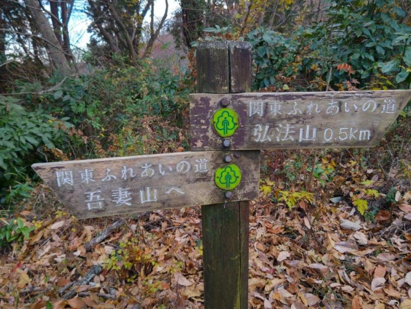
Hiking the Kanto Fureai no Michi 関東ふれあいの道
To get to the start of the hike, I’d ride the Shonan-Shinjuku line to Yokohama, and there, change to the limited express on the Keikyu Kurihama line. I’d get off at Miura-Kaigan station, one stop before the end of the line, and then ride a bus to the start of the Fureai no Michi. For the return, I’d catch a bus for Misakiguchi Station, and then ride the limited express again back to Yokohama. The weather was supposed to be sunny all day, although quite cold and windy. I hoped the conditions would be tolerable and was looking forward to an interesting outing along the Miura Peninsula coastline.
This hike can only be done at low tide since some sections are under water at high tide. Make sure to check the tide times beforehand.
Start of the Reef Route (left) Tsurugisaki Lighthouse (right)
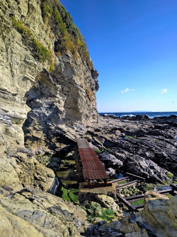
Reef Path (left) Metal Bridge (right)
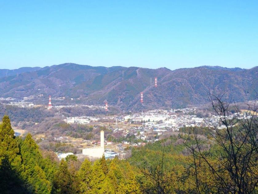
It was another blue sky day as I rode the Shonan-Shinjuku line to Yokohama. Although there is no extra fee for the Keikyu limited express trains, not all have forward-facing seats, and I ended up having to stand for most of the trip. Fortunately, the spectacular views of Tokyo Bay made time go by faster. At Miura-Kaigan Station, I boarded a bus for the last leg of the trip and was glad to get a seat for a short while. Shortly before noon I got off at a stop on a windswept plateau surrounded by green fields with a view of the Boso peninsula across Tokyo Bay.
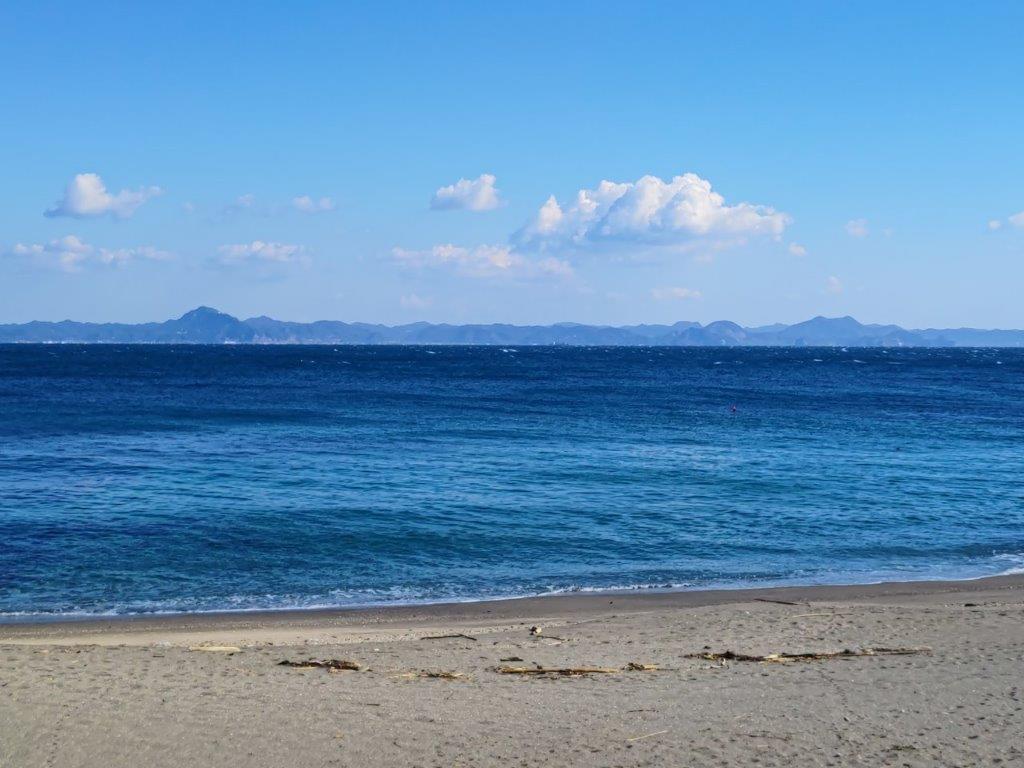
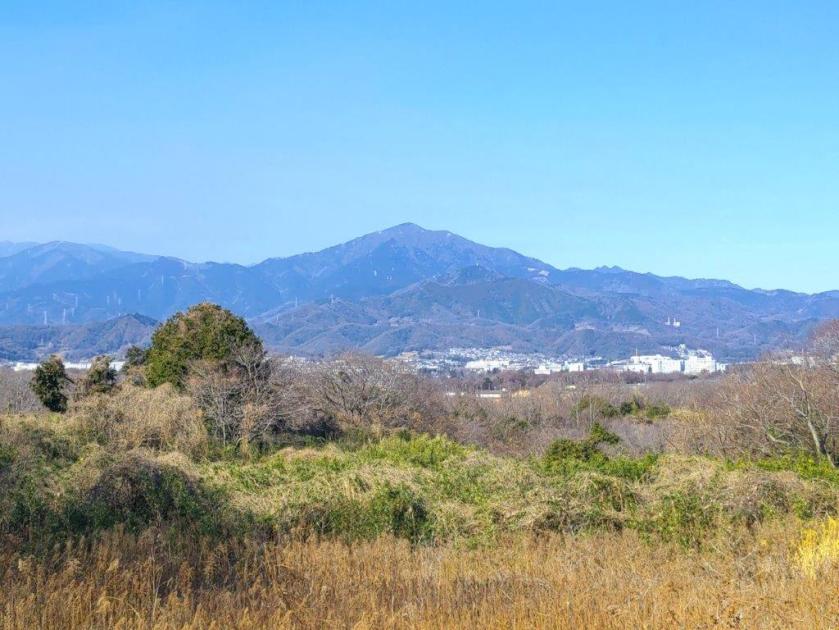
View of the Boso Peninsula from Oura Beach
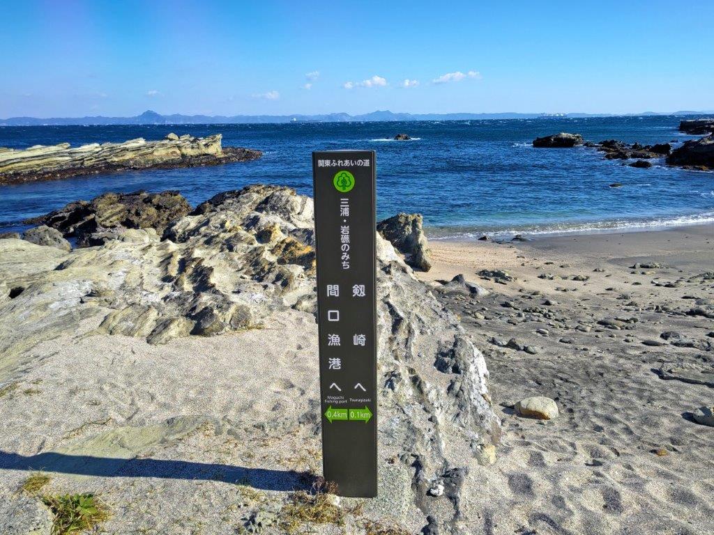
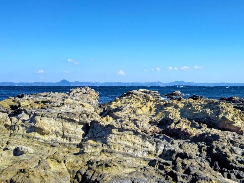
Fureai no Michi Marker on the Reef
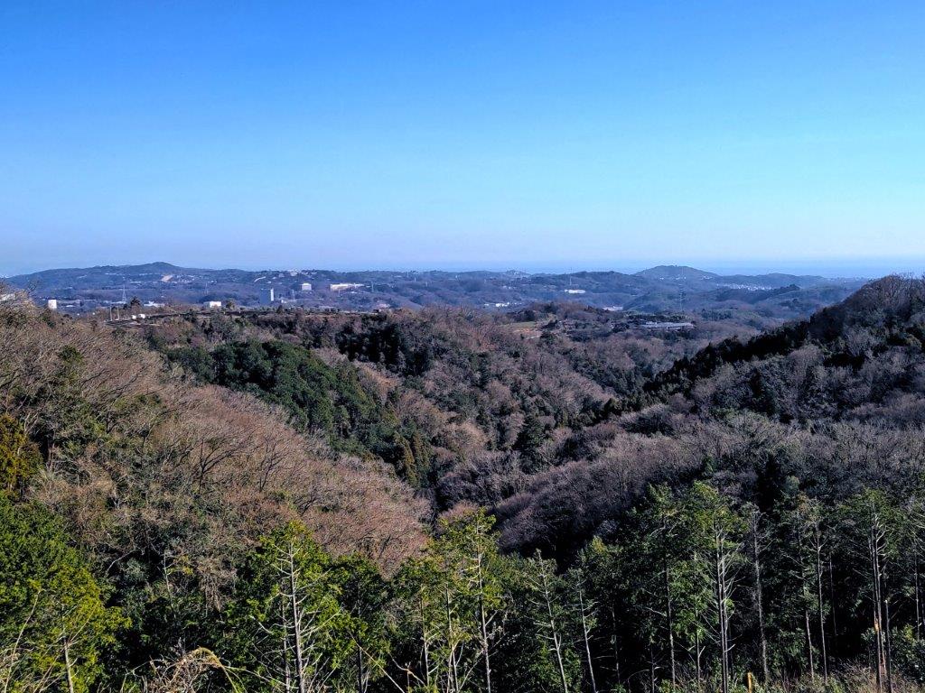
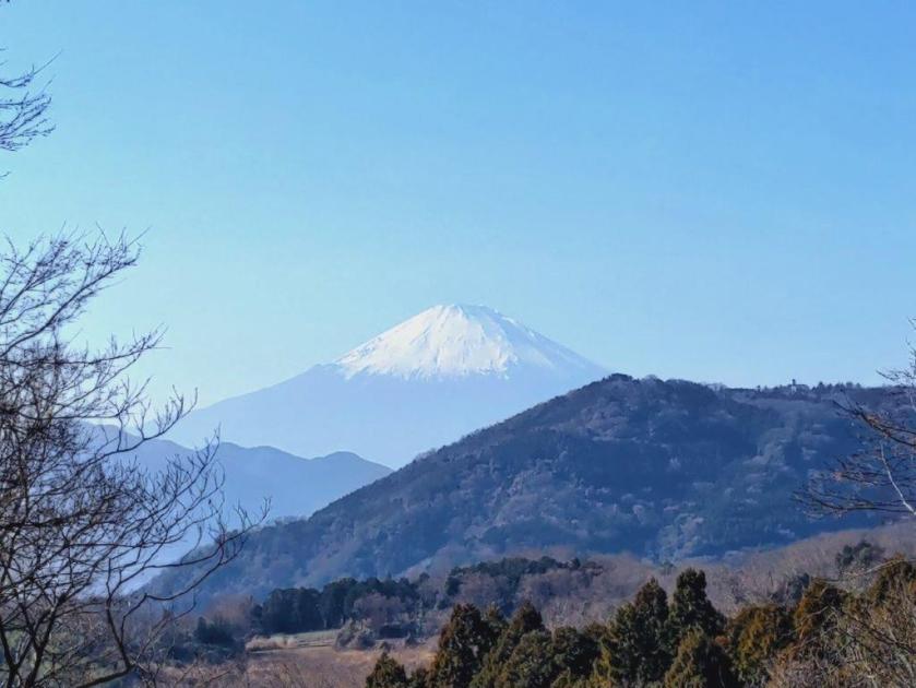
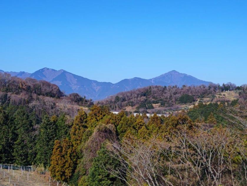
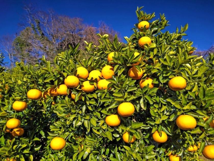
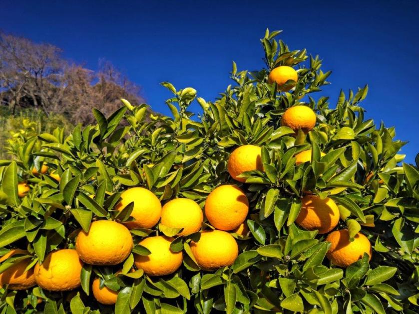
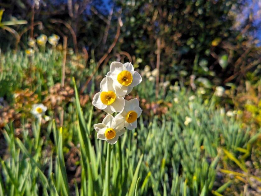
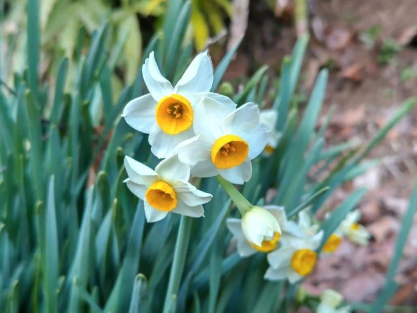
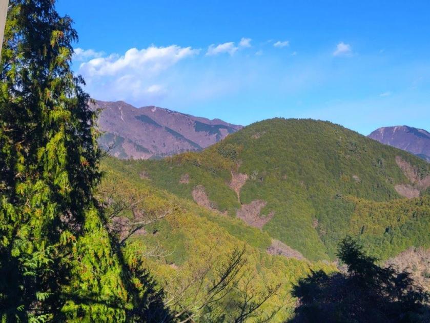
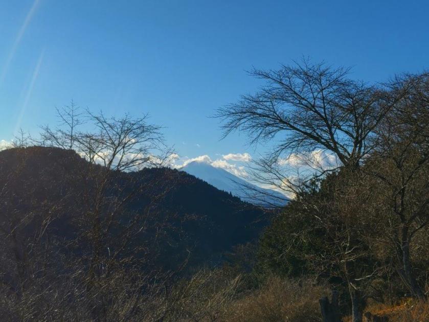
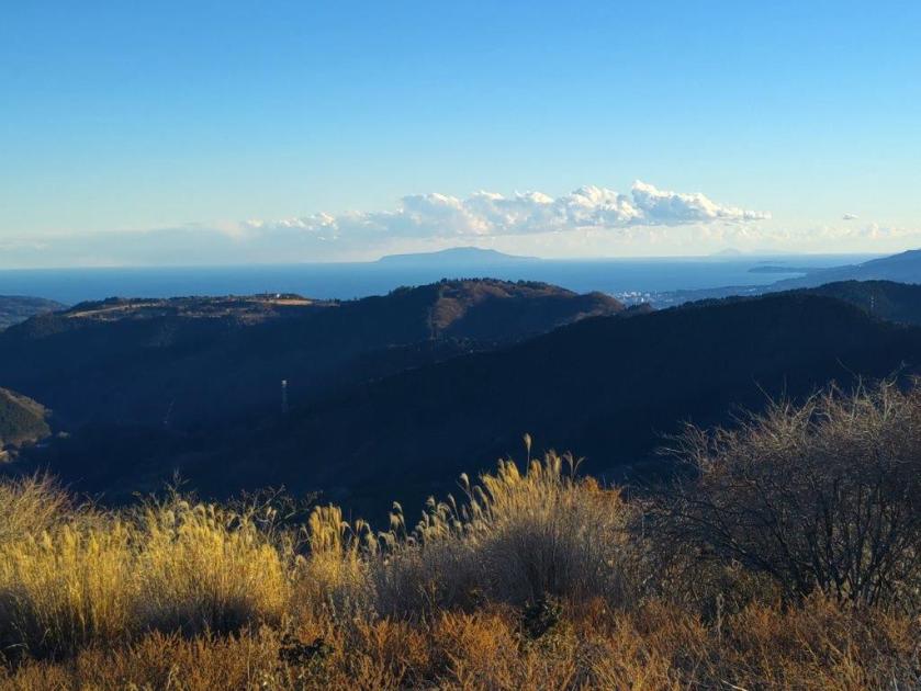
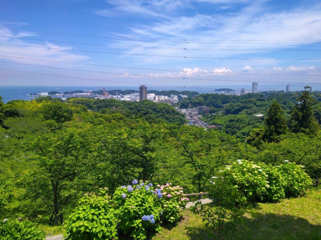
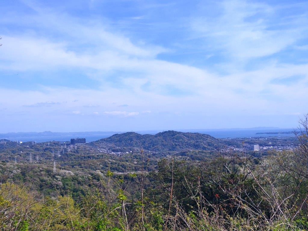
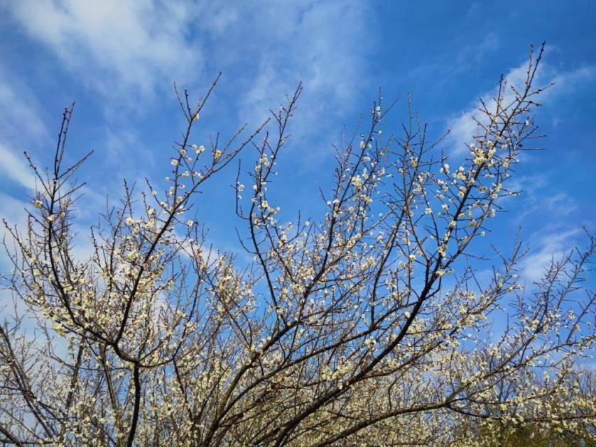
It was my first time to see the peaks of the Boso Peninsula so clearly. From left to right I could see Mt Kano, Mt Nokogiri and Mt Tomi, all directly on the sea; further inland, I could make out the summits of Mt Atago, Mt Iyo, Mt Goten and Mt Dainichi. A cold wind started blowing so I quickly headed downhill towards the coast, following the wooden signs of the Fureai no Michi. At a bend in the road I noticed some “suisen” (daffodil) and yellow “katabami” (woodsorrel) in full bloom. Near the base of a slope, I make a short detour to Oura Beach (大浦海水浴場) where I got another view of the Boso Peninsula. I then retraced my steps and soon arrived at Maguchi Port (間口漁港), the first fishing port of the day.
Mt Nokogiri (left) and double-peaked Mt Tomi (right)
Lunch spot between Misaki Cap and Ena Bay
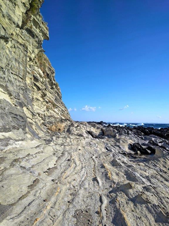
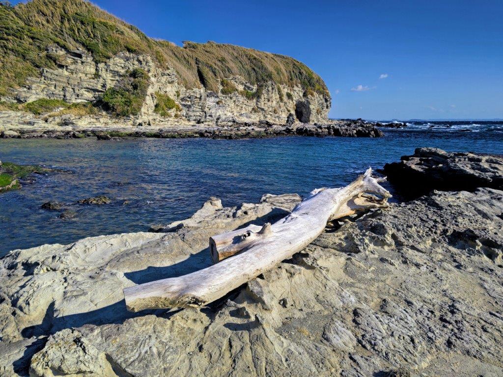
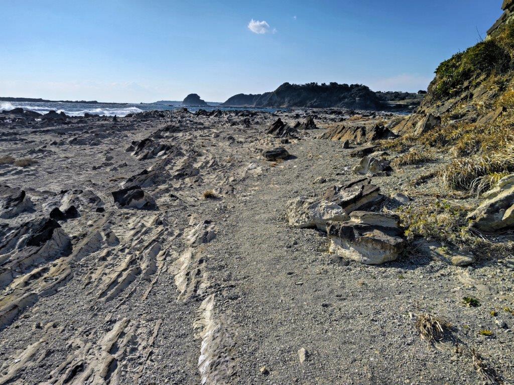
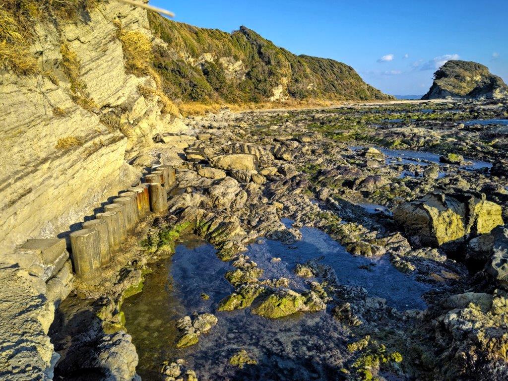
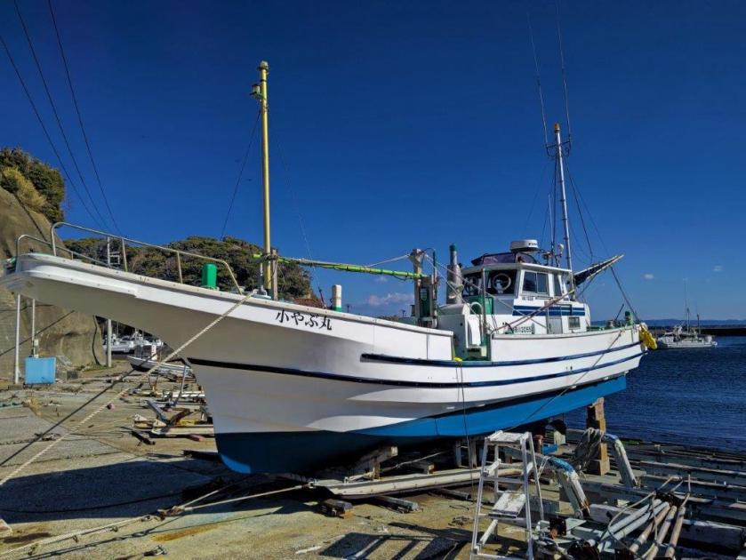
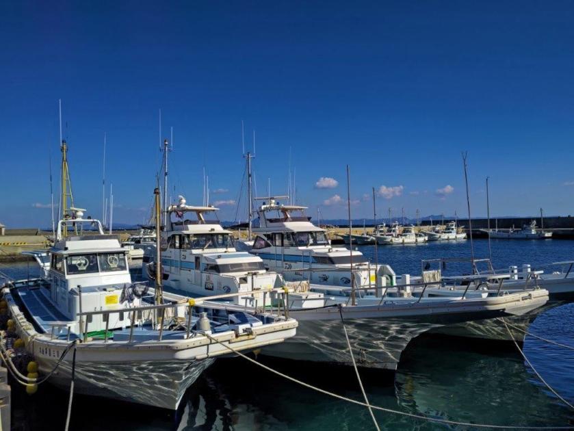
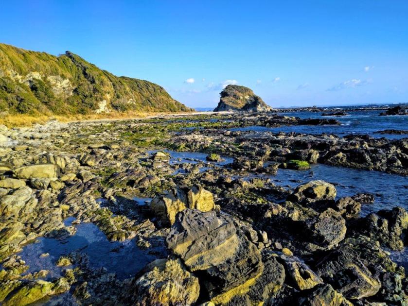
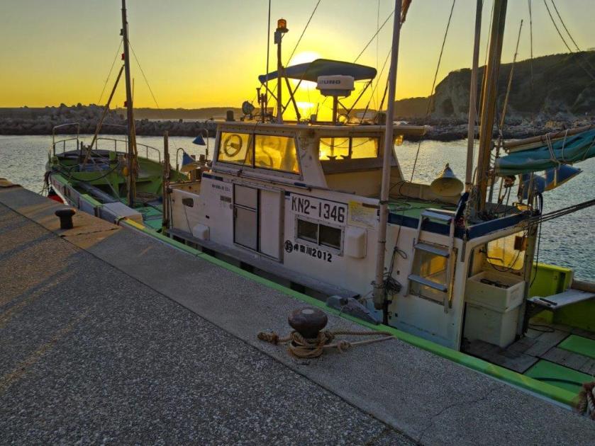
I was surprised how quiet and peaceful the port was on this cold winter day, most boats moored to the quay or even out of water. I saw no one as I made my way round the circular quay, no waves disturbing the dark blue water. At 1pm, I reached the end of the concrete platform and passed through a gap in a wall with tetrapods, wave breaker blocks, on the other side. I suddenly found myself walking on a rocky shore directly on the coast. The transition from walking on flat concrete to balancing on smooth rocktops was quite abrupt and I proceeded slowly to give myself time to adjust to the change.
Sea Waves Crashing into the Reef
Reflected Sunlight on Calmer Waters
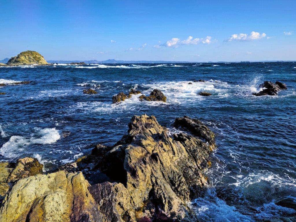
The sea, so calm moments before, now turned noisy as waves crashed onto the reef, encouraged by the strong winter wind. I wondered how quickly I’d be able to move among the rocks but I soon spotted a well-defined sandy path near the cliff base; it led to a small beach in the shade of a bluff on the south side. Here stood a wooden signpost for the Fureai no Michi in excellent condition, reassuring me that I’d easily be able to follow the Reef Route (岩礁のみち “gansho no michi“). After observing wavelets gently wash up through rocky inlets, I headed up a road on the right side, temporarily leaving the coastline behind.
Looking back towards the Boso Peninsula
Looking ahead towards Jogashima Island on the left side
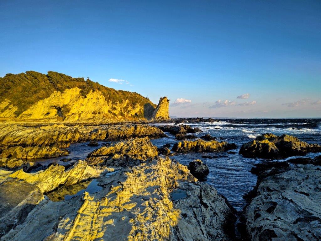
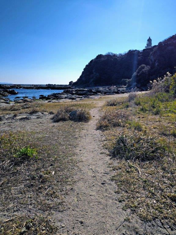
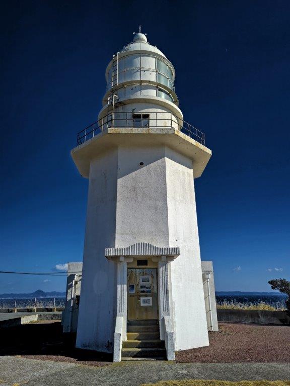
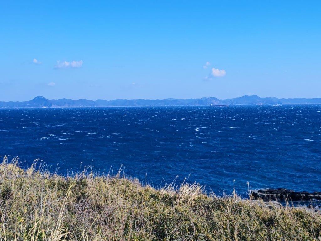
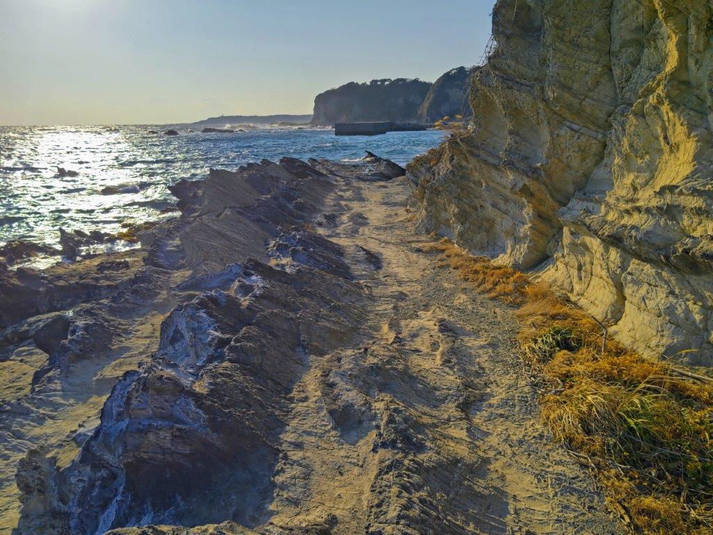
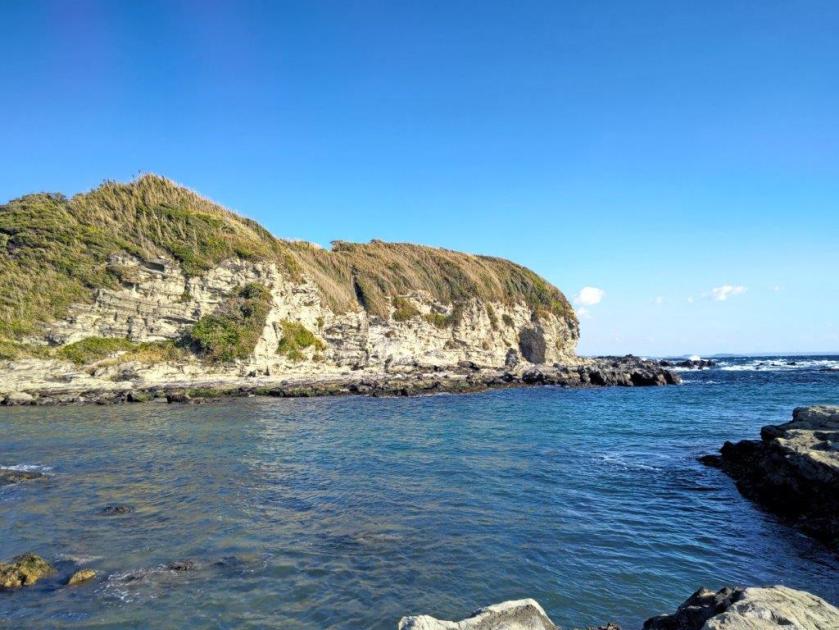
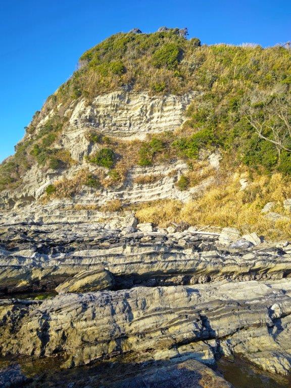
I soon arrived at a white tower at the top of the bluff, one of today’s highlights, the Tsurugisaki Cape Lighthouse (剱埼灯台), built more than 150 years ago and featured in a number of dramas. From this higher vantage point I could now see the entire length of the Boso peninsula, all the way to the hilly Minami-boso area. Huge tankers passed slowly through the choppy waters of Tokyo Bay and into the Pacific ocean. Gusts of wind cut my gazing short and I quickly made my way back to the reef. The path headed back onto the rocks and along a narrow ledge protruding from the cliff face, allowing to get past a rocky inlet still free of water. As I rounded Tsurugisaki Cape, a hidden bay opened up in front of me.
Second Break Spot between Ena and Bishamon Bays
Green Algae near Kochizaki Cape
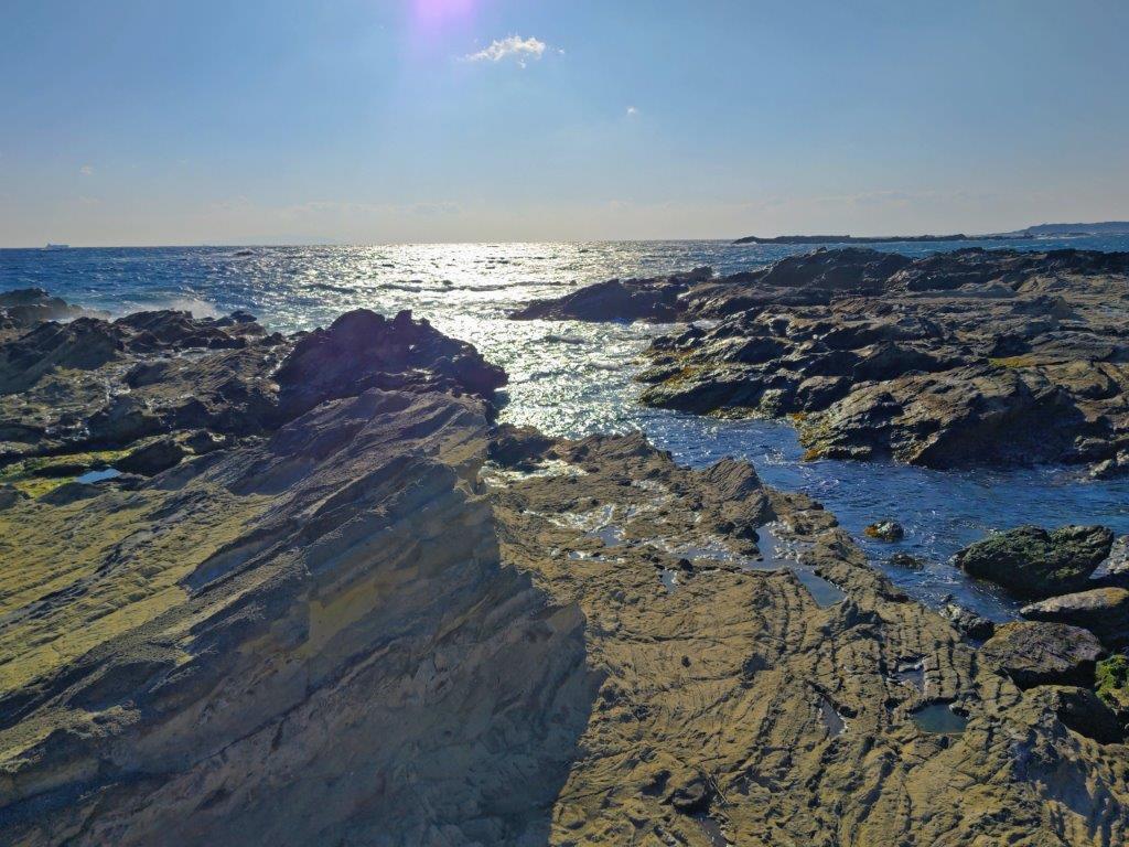
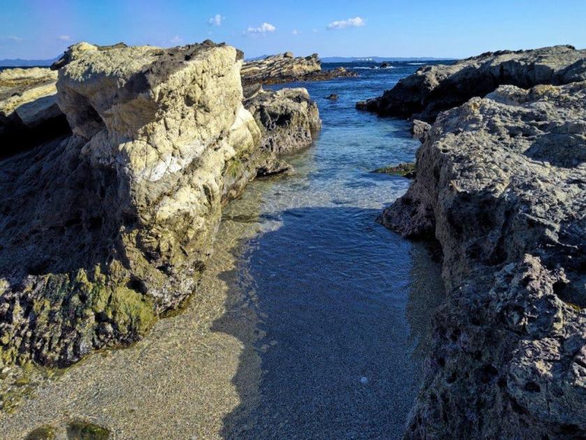
I realised how deceptive distances could be, the far side of the bay now seeming a long way away. I cautiously picked my way through the reef, steering clear of the most slippery rocks. The bay was enclosed by pale yellow cliffs providing few escape routes. It was past low tide, and although hide tide was several hours away, the crashing of windblown waves against the surrounding reef made me nervous. I was reassured by the continued presence of the Fureai no Michi signposts, but they now included warnings to take a detour route in case of high waters, as well a warning of falling rocks.
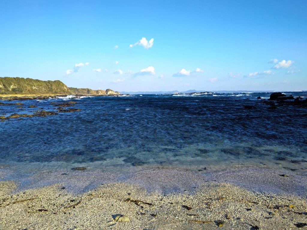
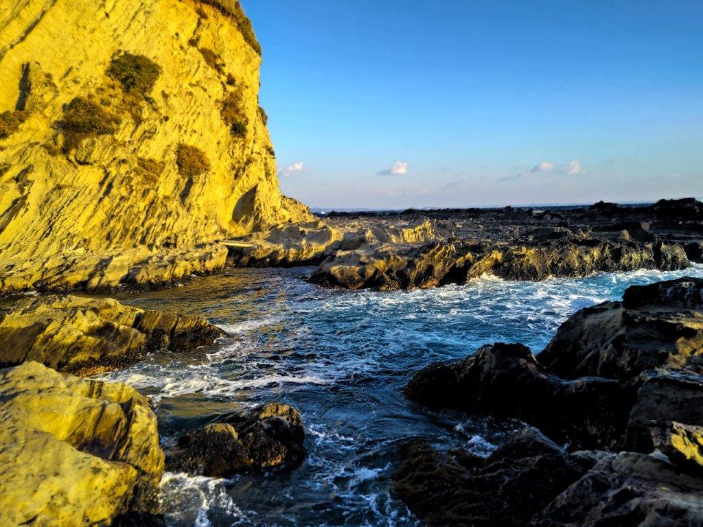
Green-blue Waters Free of Waves
Tricky Passage on the left side near the End of the Hike
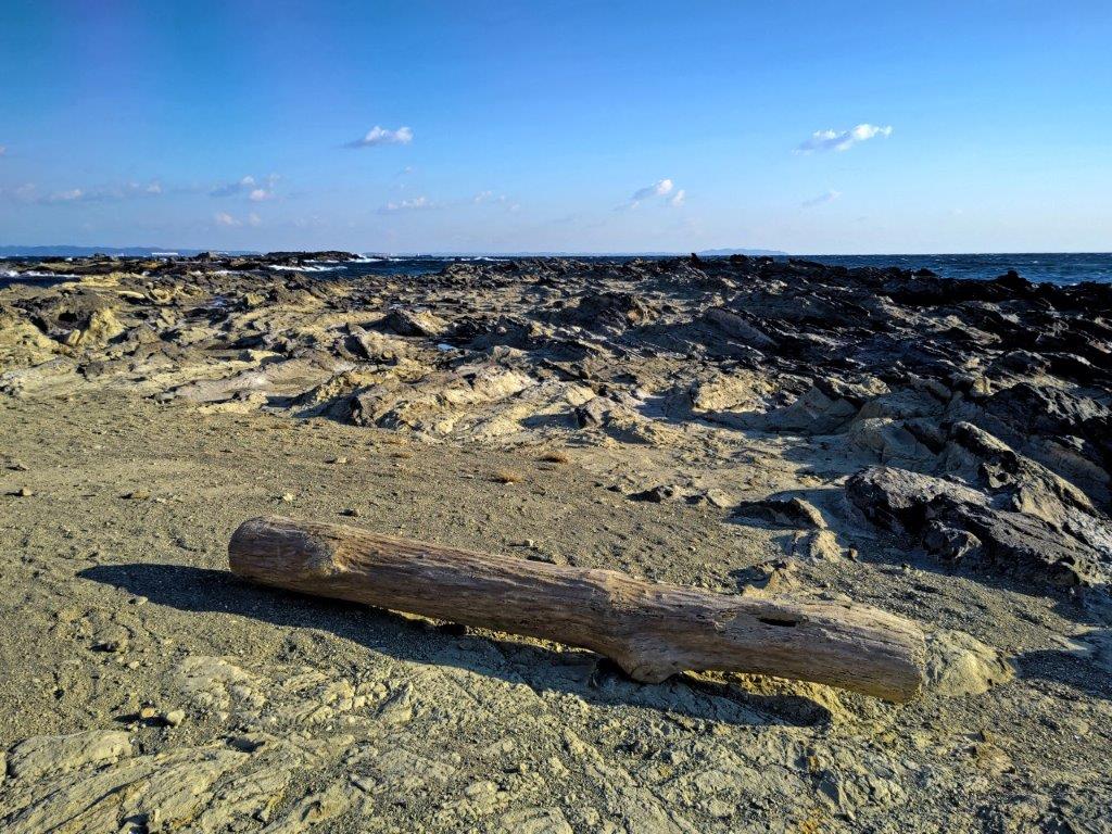
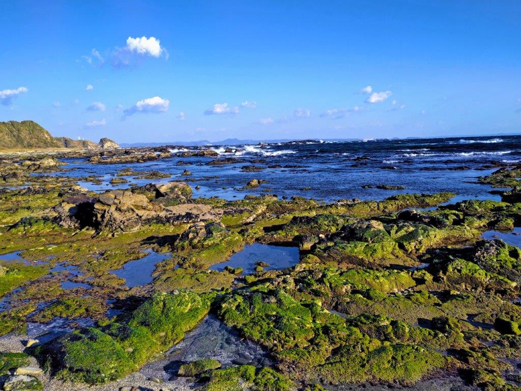
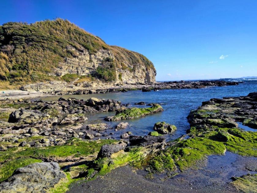
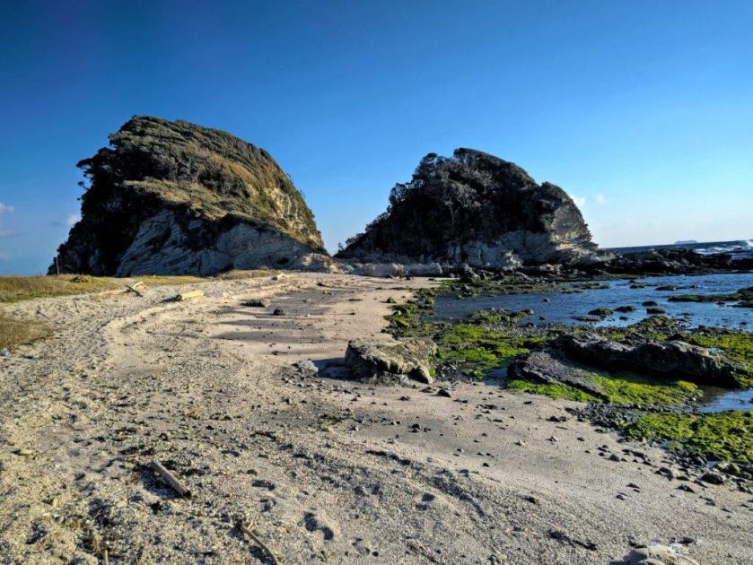
For once, I was relieved to see people along the route, although relatively few in this season. At 2pm, I settled on a whitened log for a lunch break with a view of the cliffs. A sandy section sped me up, and I soon rounded the southern side of the small bay, the outline of Jogashima Island visible in the far distance. Shortly after, I climbed onto the concrete dock of Matsuwa fishing port (松輪漁港) on Ena Bay (江奈湾). From this point, I followed the road as it curved around the bay and then headed up inland. At the highest point, with a view of farmland on the north side, I turned left, heading back to the shore where I resumed walking along the narrow reef between sea and cliffs. I took a second break at another washed up log just before Kochizaki Cape (東風崎), this time facing the wide open sea. The waters were calmer here, the rocks covered in green algae.
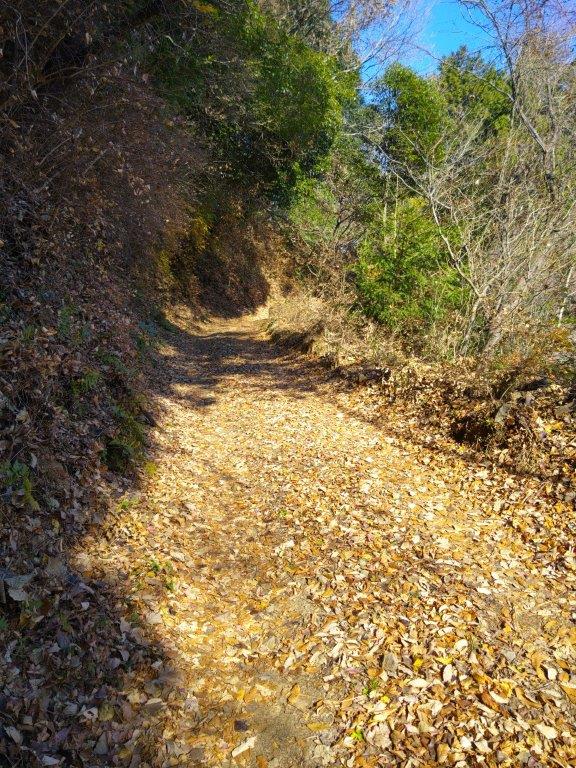
Narrow section of the Reef Route
Tidal Waters from the High Tide
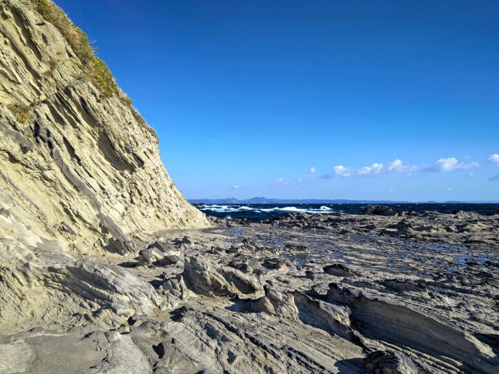
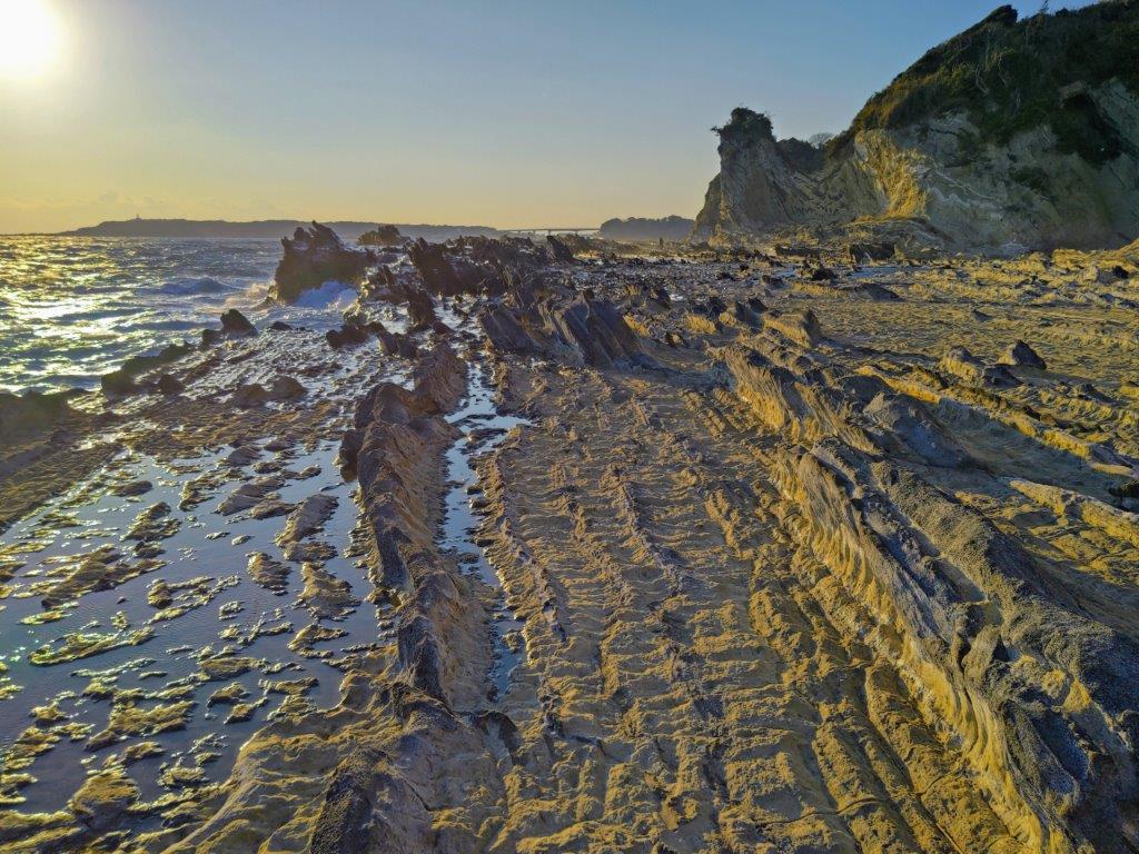
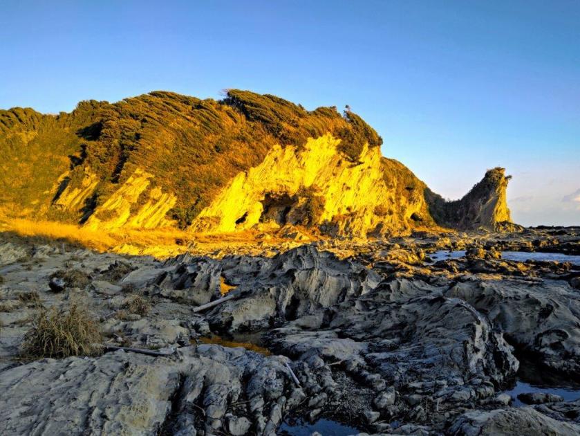
This section required some pathfinding in addition to surefootedness to navigate around the deep, twisting water inlets, some already filling up with seawater. Several metal bridges, as well as a series of raised stepping stones, helped me leapfrog over the trickier bits but I could imagine getting trapped by the rising water. A little after 2h30, I reached Bishamon Bay and Fishing port (毘沙門湾・毘沙門漁港), a short section of more relaxed walking before I returned to the reef. The sun was now low on the horizon and I alternated between shaded and sunlight sections. I turned around occasionally to admire the cliffs, golden yellow in the late afternoon sun. Before each bend, I could hear breaking waves and see white foam, further passage seemingly impossible, but gradually a safe passage comes into view, the fierce waves firmly held in check by the reef.
The Route Passes along the Base of the Cliff
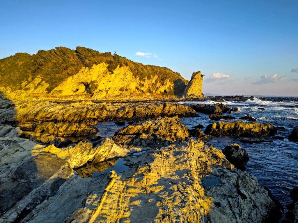
Gold-Coloured Cliffs in the Late Afternoon Light
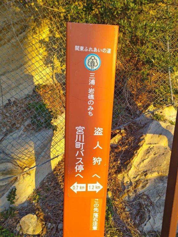
Here and there, short concrete walkways appeared, making it easier to cross wide sections of reef. Around 4pm, I passed Nusuttogari (盗人狩 meaning “hunted thief”) where according to legend a fleeing thief was trapped by the steep cliffs and raging waters. I could easily relate to feeling trapped and quickly escaped from the spot. After passing a dark cave, I slipped through a passage to the left of a rocky cape and entered Miyagawa Port (宮川港), the end of the Miura Reef Route, around 4h30. I headed up a sloping road, leaving the reef behind, and after a 20-minute walk though Miyagawa town, reached a bus stop from where it was a short ride to Misakiguchi station. This time I was lucky to get the more comfortable forward-facing seats on the return trip to Yokohama.
Watch a Video of the Hike
See More Pictures of the Hike


![Mt Ogusu (241m), Yokotsuka City, Kanagawa Prefecture, Saturday, June 1, 2024 [Shonan International Village Route]](https://hikingtokyo.com/wp-content/uploads/2024/06/dsc_0262.jpg?w=1024)


You must be logged in to post a comment.