
2021 started off very cold so I wanted to stay low for the first hike of the year. I also wanted to start and finish near areas where buses would be running during the Japanese New Year. In the end I decided to combine two small mountains at the edge of the Tanzawa mountains, just south of 2019’s last hike. The first one was featured in my Kanagawa hiking book; the second one I found on Google Maps; the trail in between followed the Kanto Fureai no Michi (関東ふれあいの道), a real treasure trove of good hiking paths around Tokyo. The weather was supposed to be sunny – it usually is this time of the year – and I was hoping to get some good views of the capital.
Hiking in the Tanzawa Mountains 丹沢山地

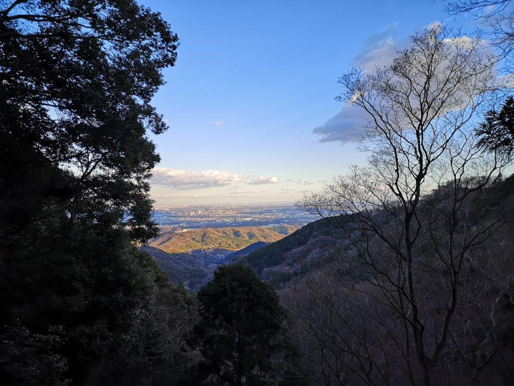
View from near the highest point of the hike
I left late, arriving at Atsugi station around 10am. I caught one of the frequent buses for Iiyama, running as usual over the New Year so that people can visit the nearby Iiyama Kannon (Hasedera) Temple (飯山観音). At 11am, I reached the bright red bridge over Koayu river, marking the official entrance to the mountain. I walked up the road and then a flight of steps to reach the temple. I walked past a the line of people waiting to pray, and found the trail entrance behind the main temple building.

The sunny “woman’s slope”
I went up the “woman’s slope” (女坂 “onna-zaka“), the gentler of the two trails up the mountain, mainly because I didn’t see the entrance to the steeper, “man’s slope”. The well-maintained path followed the valley side, colourful arrows pointing the way. Despite the cold temperatures, it felt warm thanks to the midday sun shining above the trees. At 11h30 I reached the small observation tower at the top of Mt Hakusan (白山 はくさん hakusan). Although It was a short climb, I decided to take a short break and have a late breakfast at one of the benches.

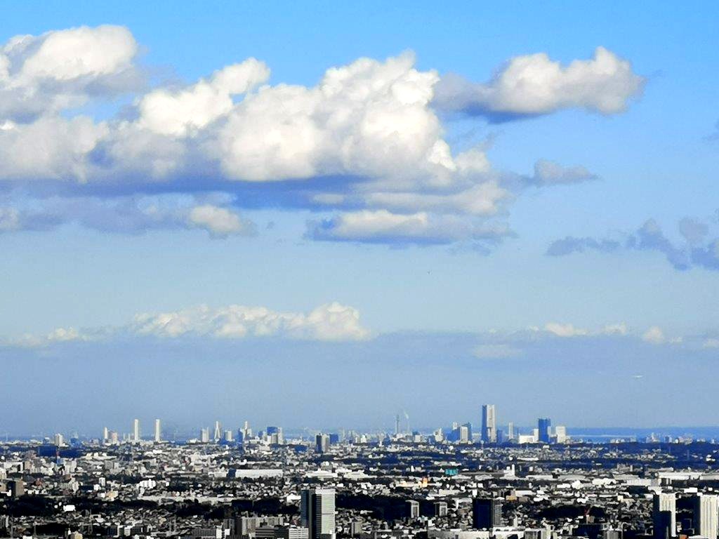
The Shinjuku skyscraper district
Taking up the entire eastern view was the vast Tokyo Megapolis, with the Shinjuku skyscrapers in the center just 40km away; beyond Shibuya, I could make out the Tokyo Skytree; to the west was Mt Oyama in the Tanzawa mountains; looking south I spotted the outline of Oshima island, 80km away. After checking out the view, I made a quick roundtrip to Hakusan Shrine (白山神社) just 5 minutes away along the top ridge. At noon, I set off again, walking down a steep path on the other side of this small mountain.

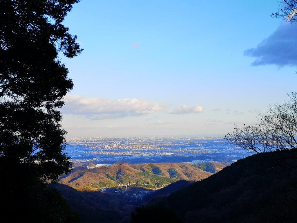
Looking south towards Shonan bay
The path soon leveled and I was now walking along the Fureai no Michi trail, a pleasant path along a forested ridge, with occasional viewpoints with benches. I passed several other hikers; it seemed to be a well-known secret among the locals. The path descended gradually, and I eventually arrived at the Nanasawa Forest Park (七沢森林公園). It was past one o’clock, so I stopped for lunch at another Tokyo viewpoint. Looking east, I could see the Miura peninsula and, half-hidden behind it, was the Boso peninsula, 50km away.

The Nanasawa Forest Park
At 1h30, I headed down the valley on the west side, towards Nanasawa Onsen (七沢温泉 meaning “seven stream hot spring”), a place I had first visited after descending Mt Tanzawa in a snowstorm several years ago. I stopped by a convenience store to replenish my supplies and started up my second, slightly higher, mountain of the day at 2pm. I soon found the start of the trail thanks to the abundance of signboards. Although I had never heard of it till a few days ago, it seemed a local favourite, probably because of the shrine at the top.

The path for Nanasawa Onsen
The path followed a ridge up through thick forest, alternating flat and steep bits. After thirty minutes of climbing, I reached a group of exposed boulders with good views eastwards of Tokyo, its buildings much sharper in the mid-afternoon. A little later, I had a good view of the ridge I had walked earlier in the day, also known as the Hakusan Pilgrimage Hiking Trail (白山順礼ハイキングコース). Looking down from my viewpoint 300 meters higher up, it looked very small indeed.
Tokyo in the late afternoon light
I finally arrived at a long stone staircase, marking the final approach to the shrine, and at 3pm, I was standing next to Asama Shrine (浅間神社). I wasn’t quite at the highest point, but there was a bench with a view of Tokyo, so I settled down for a break and an afternoon snack. By now, the sun had disappeared behind the mountains, and it was getting quite cold. Since it would be getting dark in about an hour, I quickly walked the final meters to the top of Mt Kane (鐘ヶ嶽 かねがたけ kanegatake), completely in the trees, and continued straight ahead down the other side.

In the shade, Mt Kyo, hiked at the end of 2019
I definitely felt that this trail was the nicer of the two. The surrounding forest was wild and beautiful despite the proximity of the city; I could hear deer calling in the distance; the path zigzagged down the steep, rocky mountain side, with chains fixed to the rock for safety. At 4pm I reached the road for Nanasawa Onsen next to a tunnel, and less than an hour later I was back on the road for Atsugi, waiting for the bus that would take me back to the big city.


can you pls give me directions on how to come here? Thanks
Hello, the hike for Mt Haku starts at the Iiyama Kannon Temple
This is the start of the Mt Kane hike
Google Maps can give you directions for both locations.