Mt Kanamaru (532m) & Mt Omaru (567m), Fuji & Shizuoka Cities, Shizuoka Prefecture, Sunday, December 8, 2024

I felt it was time to return to Shizuoka as my last hike there was nearly a year ago. I also wanted to see Mt Fuji with its brand new snow cover. Looking online, I found a station to station hike through the Kanbara Hills (蒲原丘陵) right on Sugura Bay. It also passed by a number of peaks, two of which had views from their summits. Finally, it followed a section of the Tokaido Nature Trail which I had been wanting to explore more.


To get to the start of the hike, I’d ride the Tokaido shinkansen from Tokyo to Mishima station, then change to the local Tokaido line, and get of at Fujikawa station. I’d finish the hike at Kanbara station, two stops further down the line. The weather was supposed to be clear and cold all day, ideal for viewing Japan’s most famous mountain. I was looking forward to a relaxing autumn hike outside my usual stomping grounds.

For email subscribers, read this Post on Hiking Around Tokyo for a better viewing experience and the latest updates

Find Japan Hiking Maps on Japanwilds

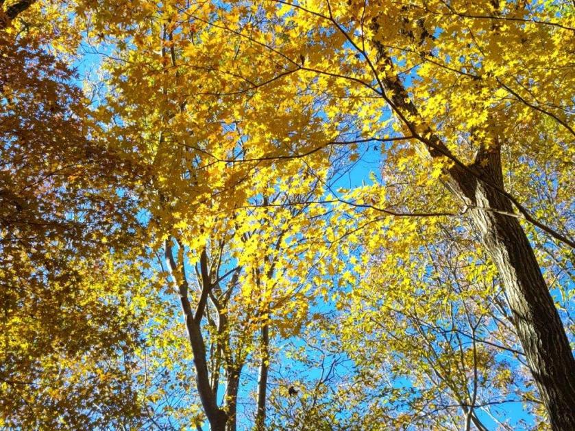
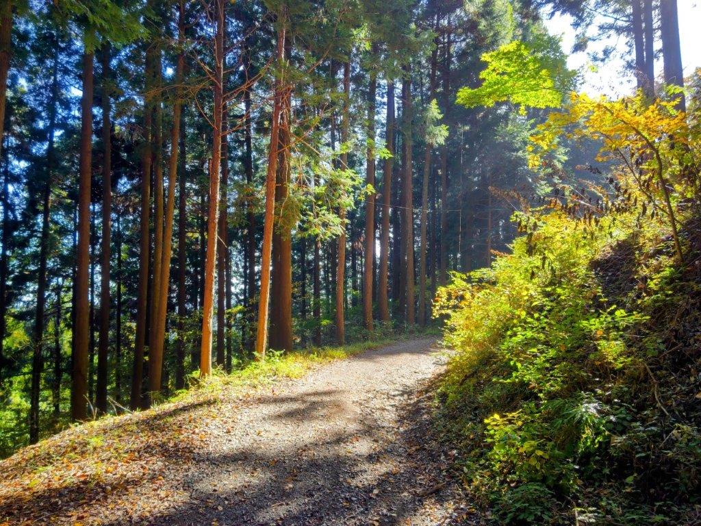
Start of the hike above Jissoin (left) Trail for Mt Hanamaru (right)

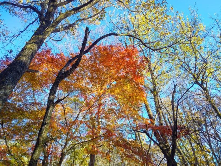
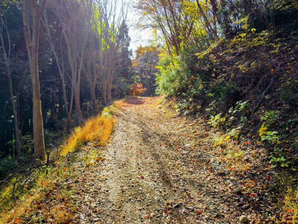
Daishido Temple (left) Path for Mt Ohira (right)

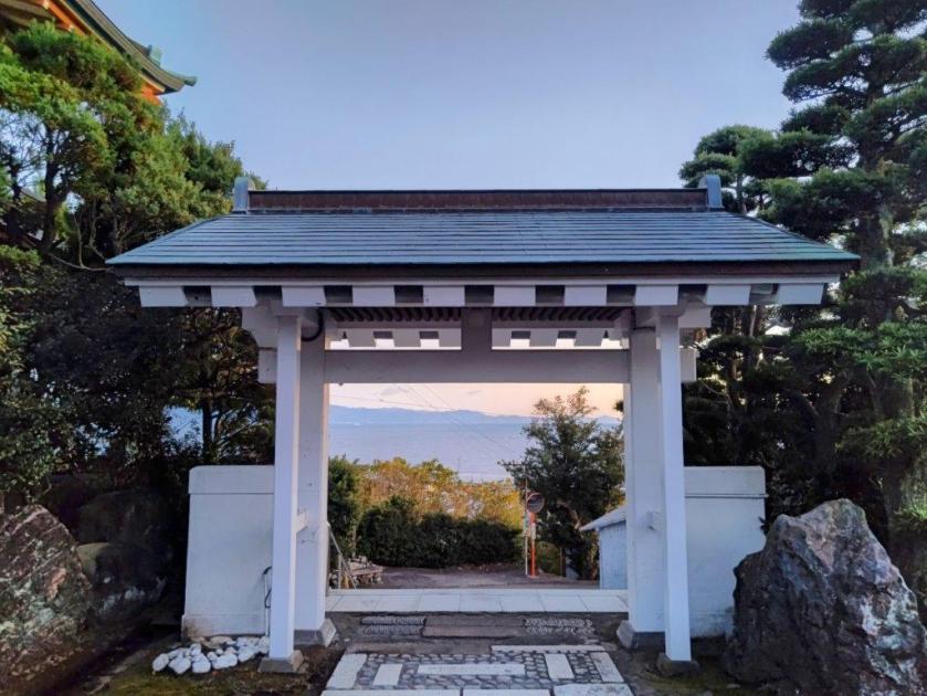
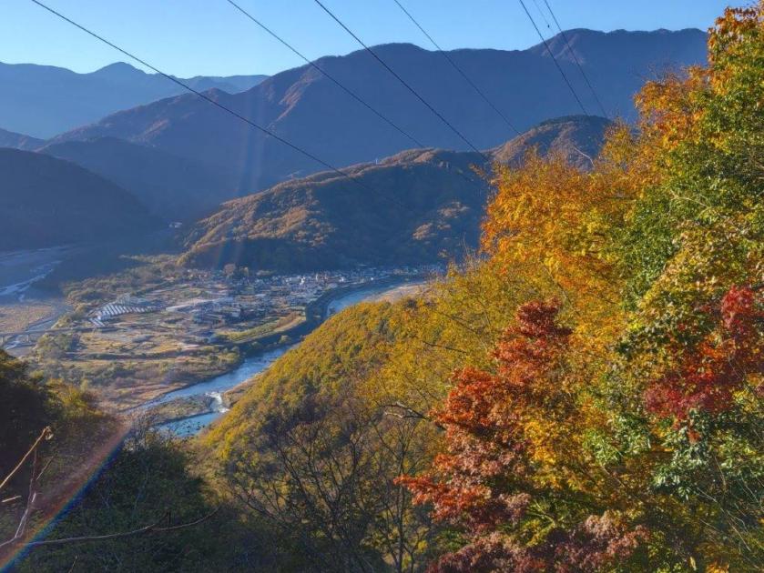
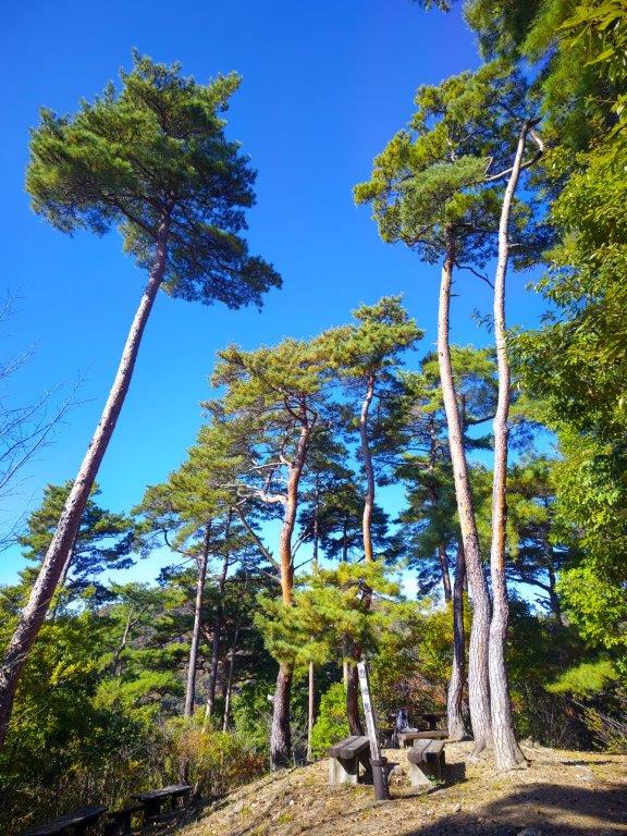
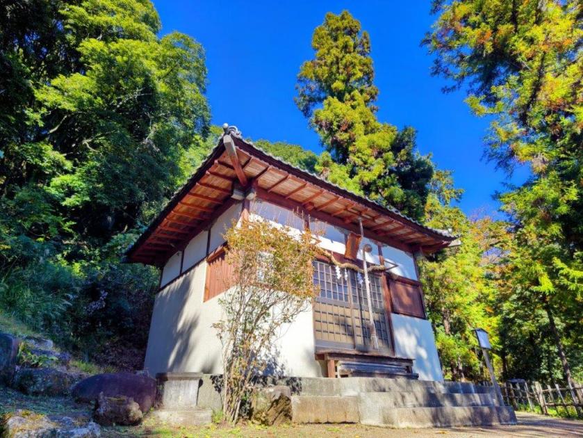
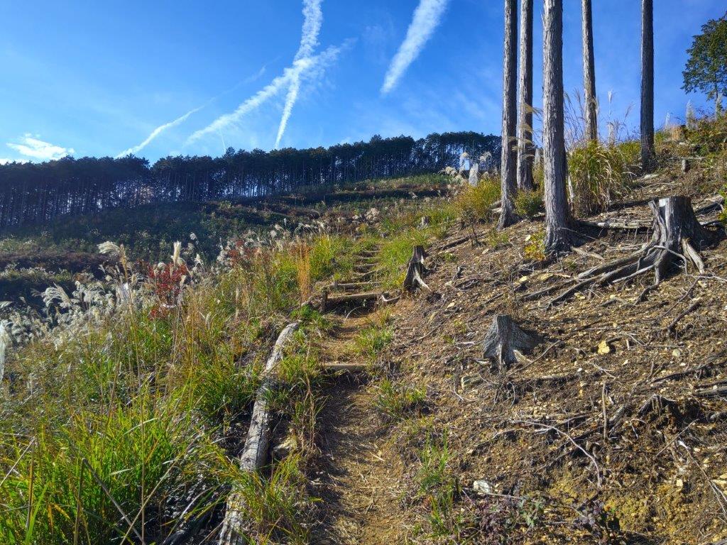
I could see it was going to be another fantastic Autumn day, judging from the weather during the short trip to Mishima. From there, it took half an hour by slow train to reach Fujikawa station where I already had a view of Mt Fuji, its top crater hiding in the clouds. At 11am, I reached Jissoin (実相院), a small temple at the edge of the mountains. Turning around, I could see Suruga Bay and the Izu peninsula. I could also see Jorogumo spiders sitting in their webs so I picked up a stick and headed up a paved path behind the temple building.

Going down Mt Noda (Left) Going up Mt Omaru (right)

On the way to Miharashi-Kannon (left) Walking down to Kanbara Station (right)

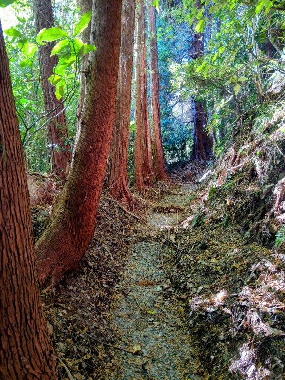
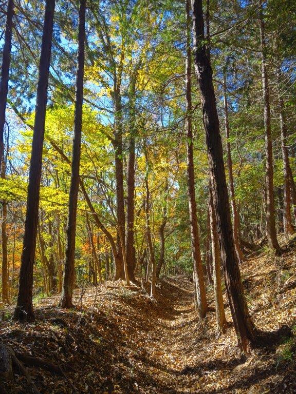
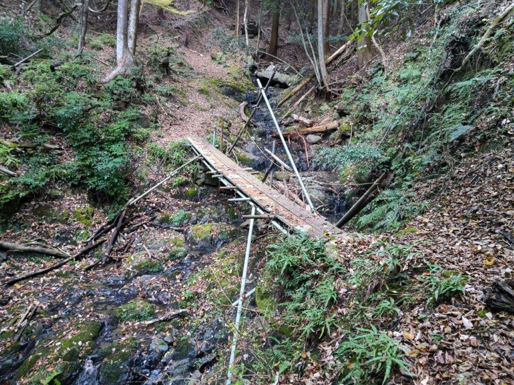
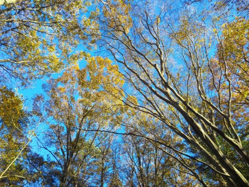
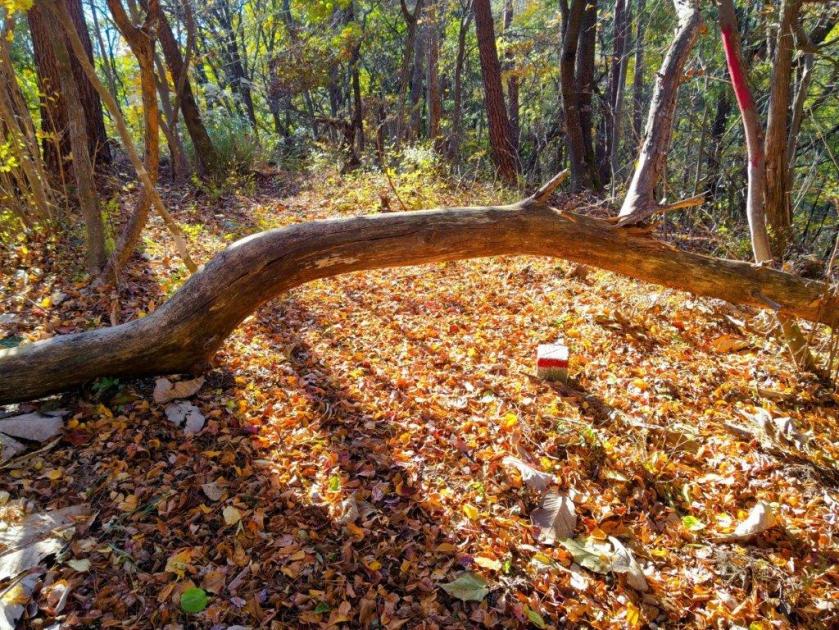
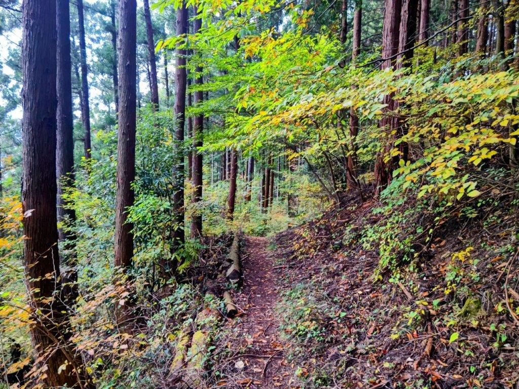
I was relieved the path was free of webs and was easy to follow, although I had to duck under a couple of fallen trees along the way. After thirty minutes, the path turned into a proper trail, with log steps fitted in the climbing sections. The trail crossed a forest road several times, marked with relatively new signs for “Kanamaruyama-hiroba” (金丸山広場). I soon found myself walking through an area of cut trees, blue sky appearing above; a little before 1230, I arrived at the Fujikawa Camping Ground (富士川キャンプ場), and followed a small path to a bench and a viewpoint above the campsite.

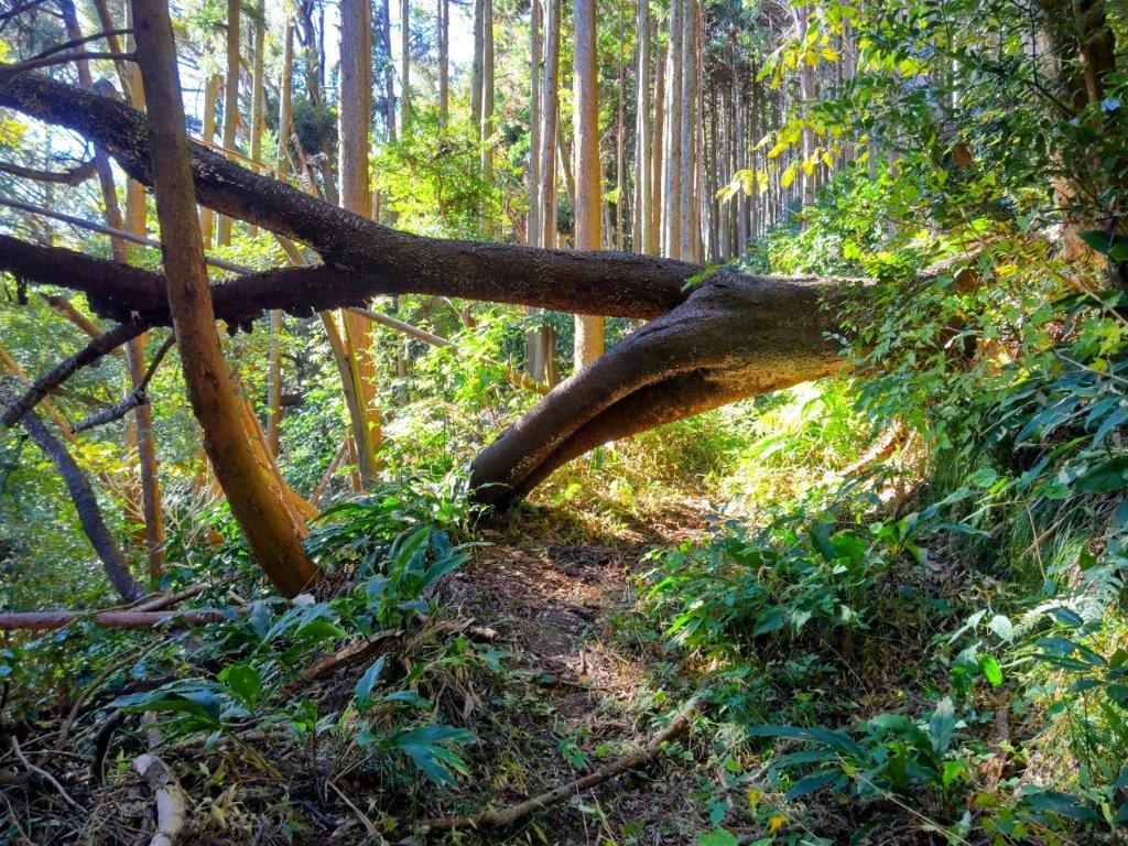
Fallen Tree Blocking the Way to Mt Kanamaru

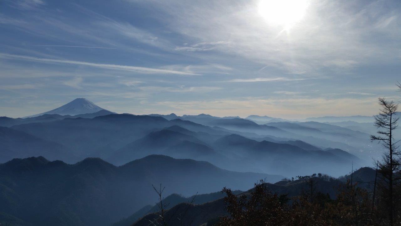
Mt Fuji View from the Fujikawa Camping Ground

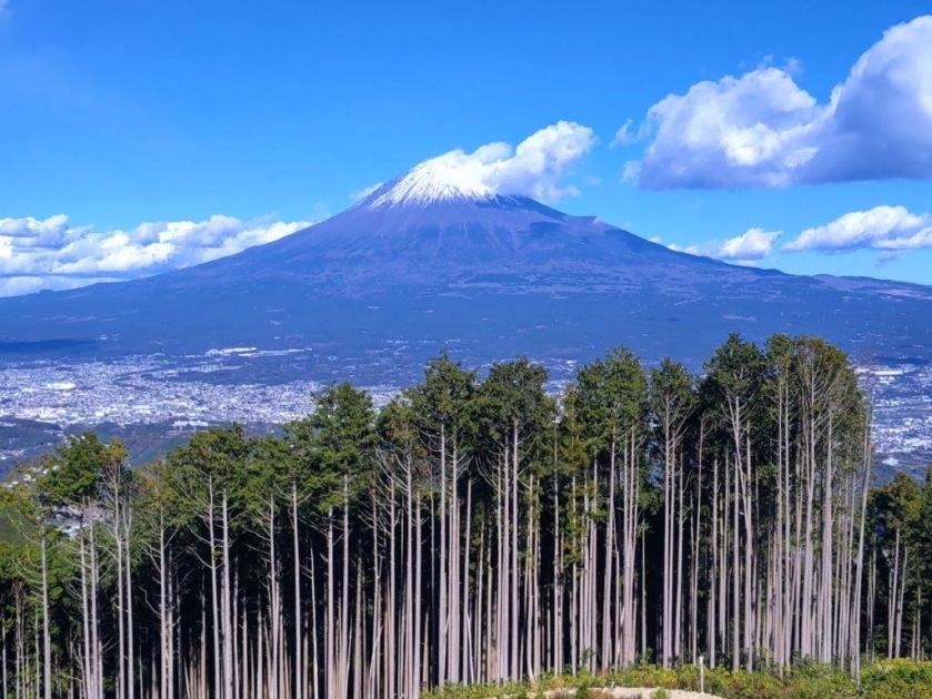
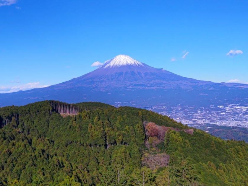
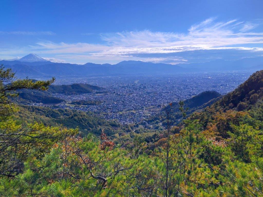
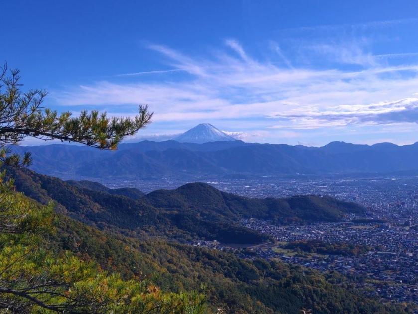
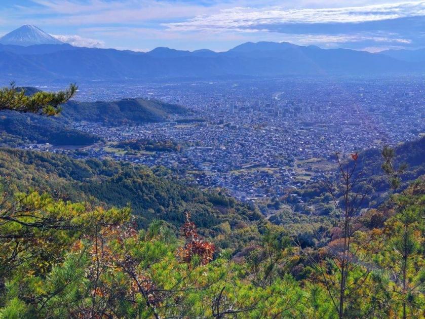
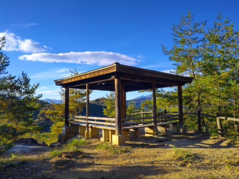
I was delighted to see that Mt Fuji was now entirely free of clouds, with Mt Kenashi on its left side and Mt Ashitaka on its right side. I was also impressed with the urban build-up from Fuji’s lower slopes to the curving coastline of Suruga Bay, most certainly a wonderful view at night. Beyond the bay, I could see the outline of the mountains of Izu peninsula, extending into the Pacific Ocean. Since it was nearly 1pm, I settled on the bench for an early lunch with a panoramic view.

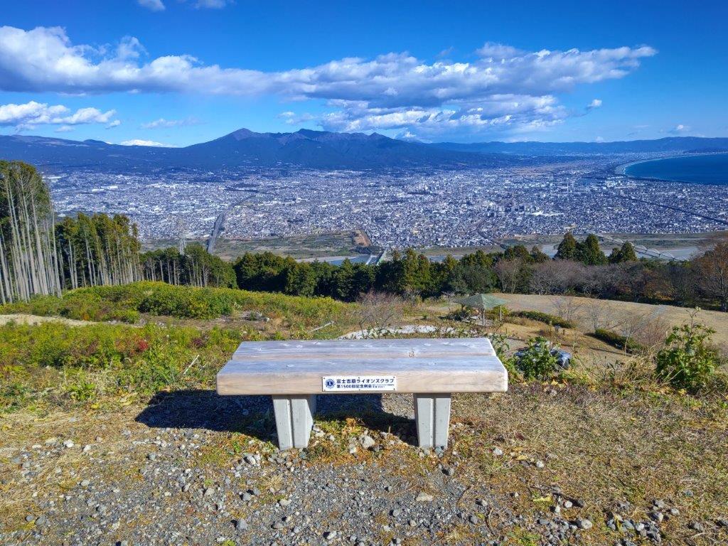
Today’s Lunch Spot with a View

View of Mt Kenashi and Mt Fuji

I wondered why I hadn’t seen any other hikers so far, even the campsite had only one solitary tent. I continued my way and soon reached the top of Mt Kanamaru (金丸山 かなまるやま kanamaruyama), the site of a telecommunication tower, completely in the trees and with no visible summit marker. I quickly moved on, heading steeply down through thick forest. After a couple of turns, I reached Daishido Temple (大師堂), where a stone bridge crossed a stream flowing into a lonely pond.

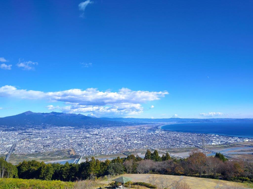
View of Mt Ashitaka, Fuji City and Suruga Bay

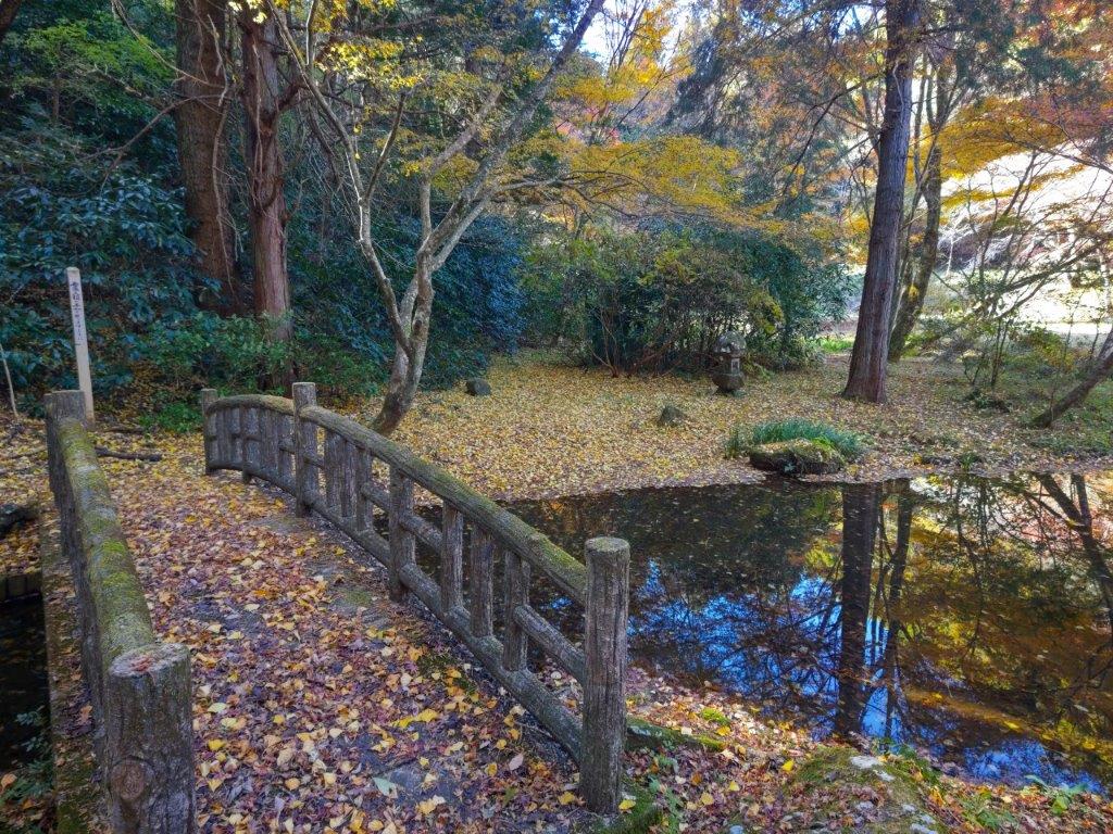
Stone Bridge near Daishido Temple

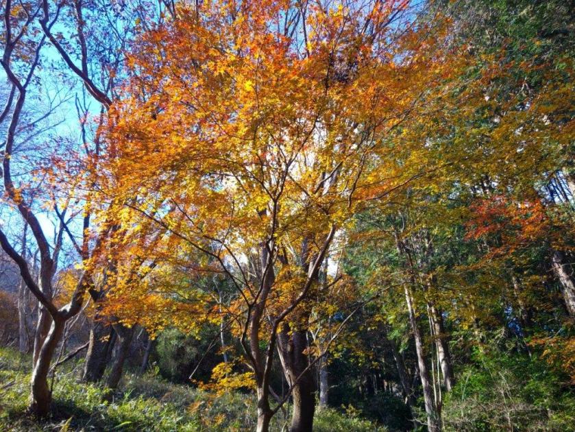
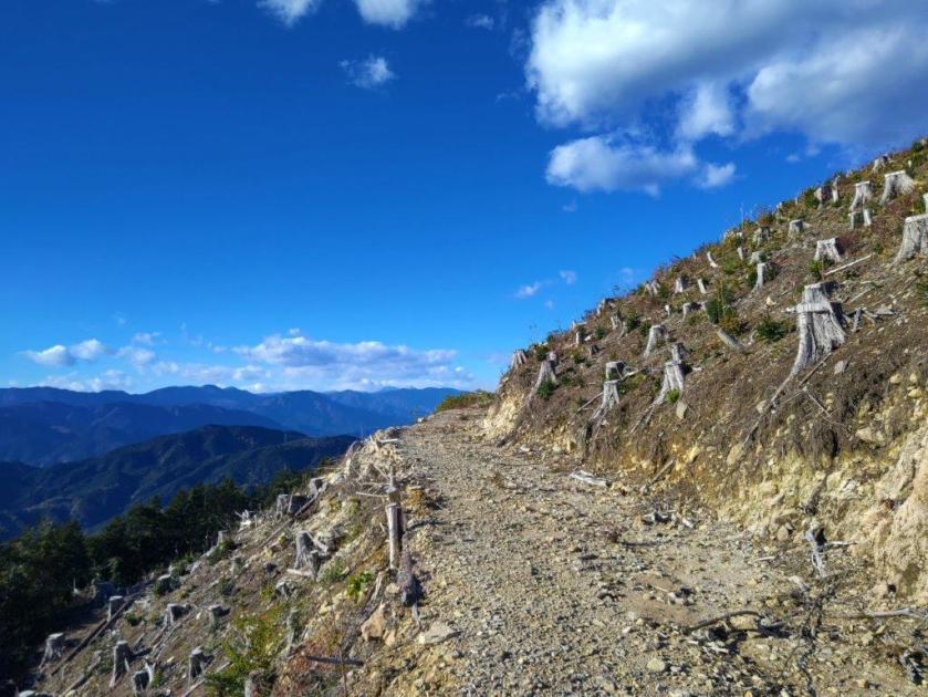
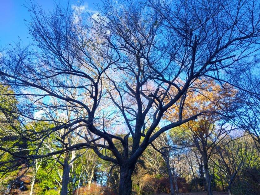
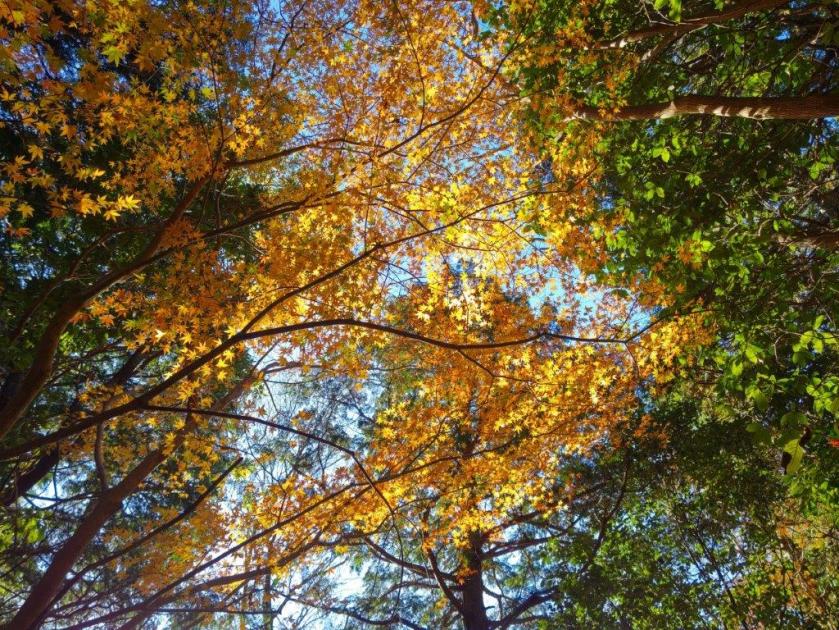
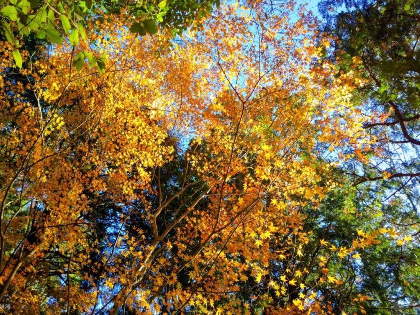
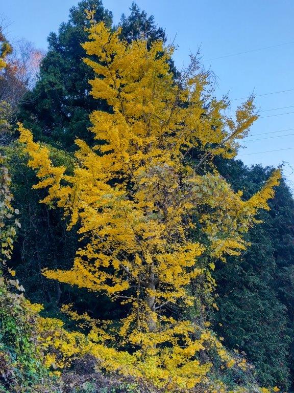
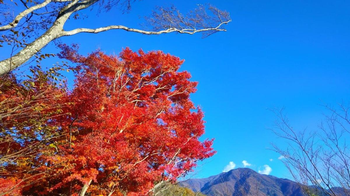
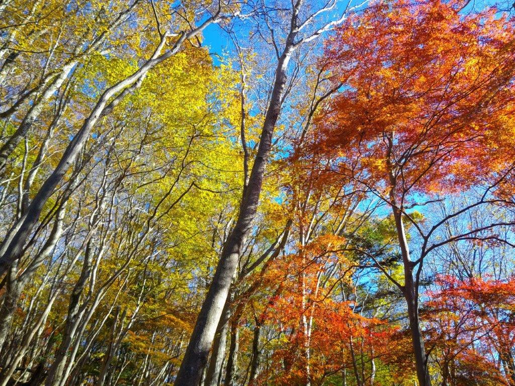
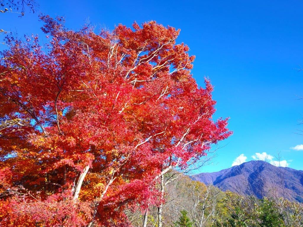
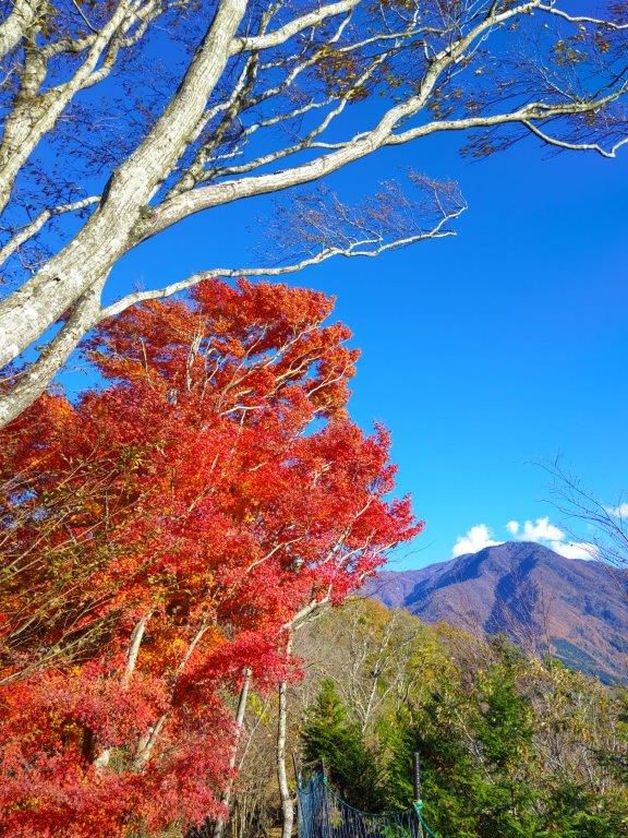
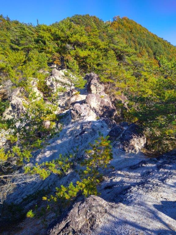
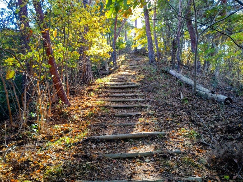
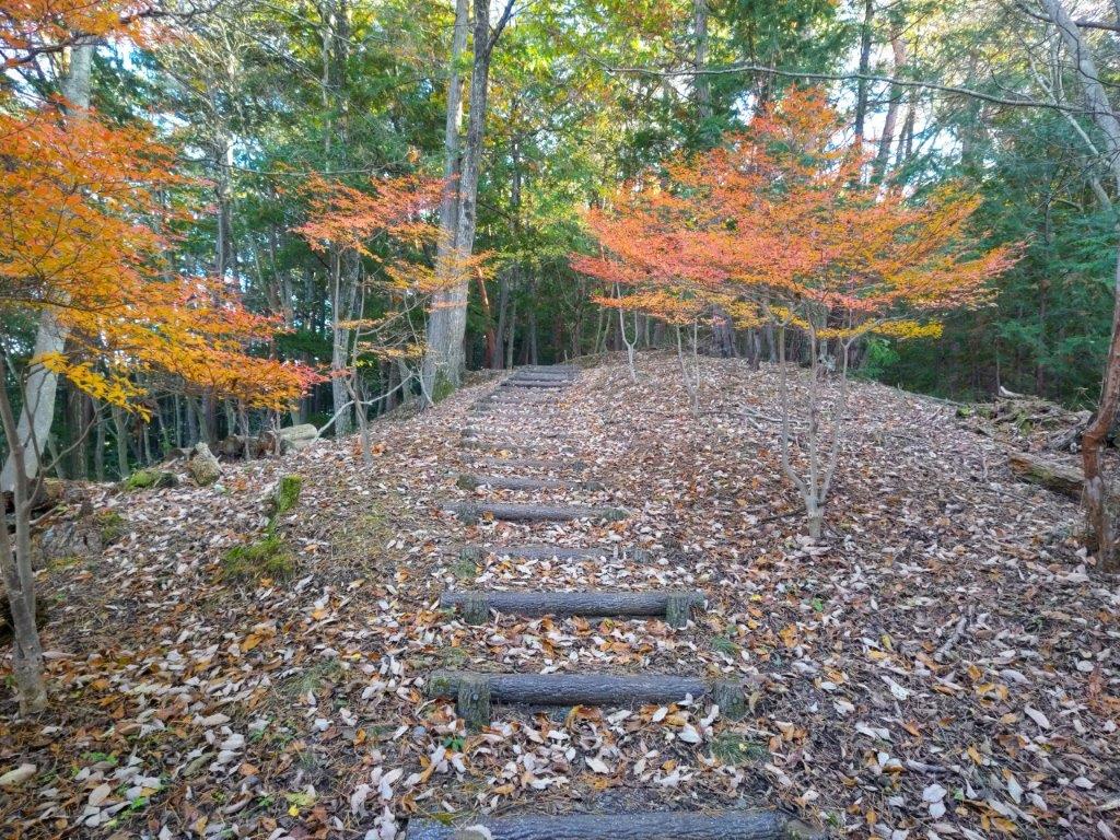
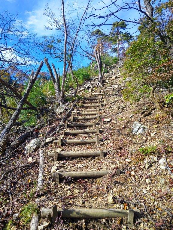
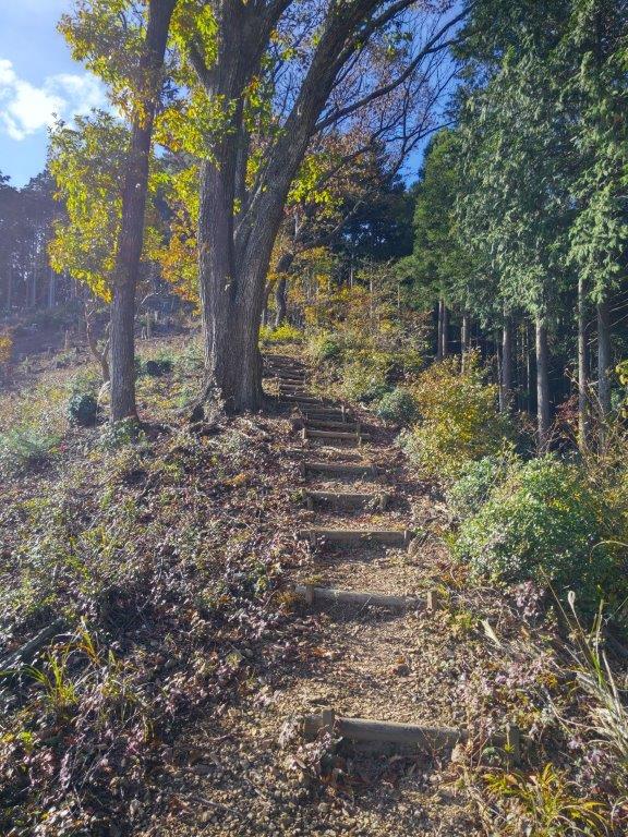
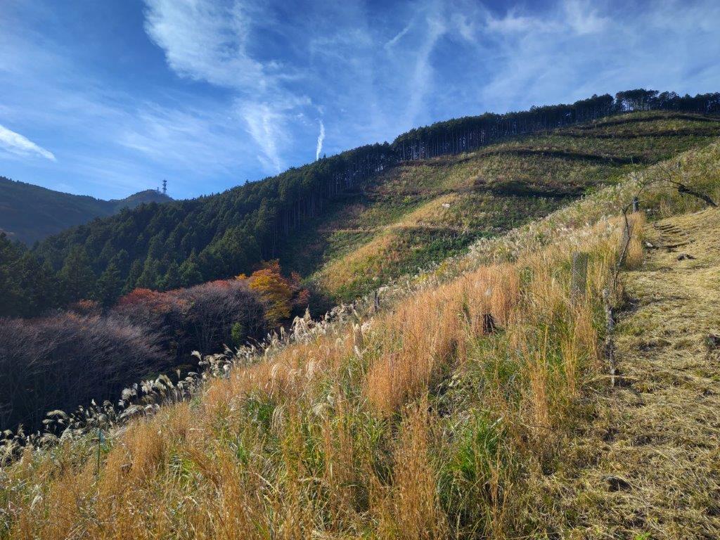
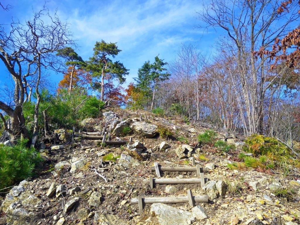
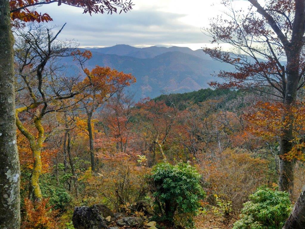
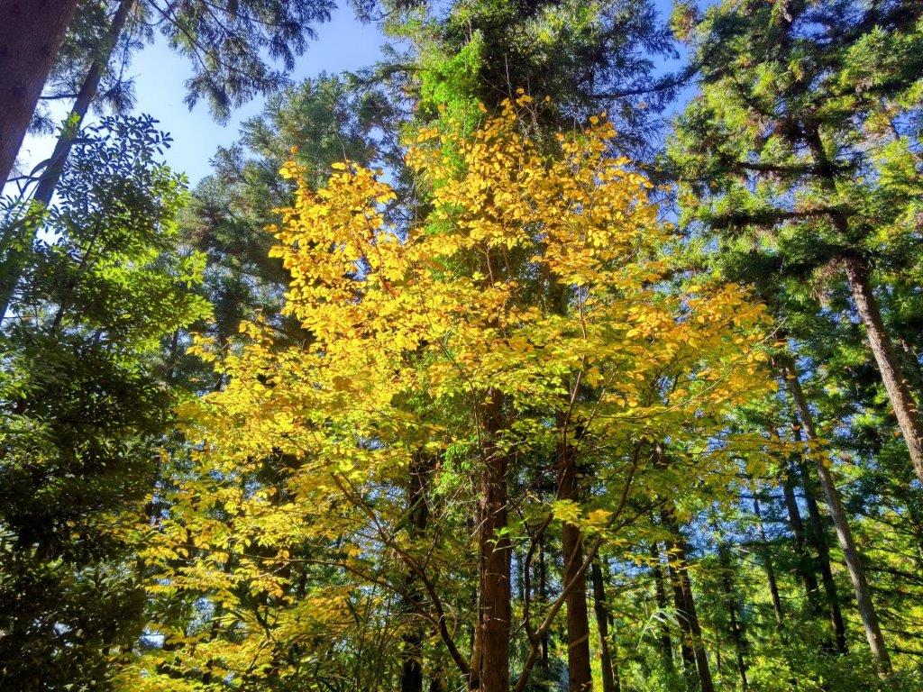
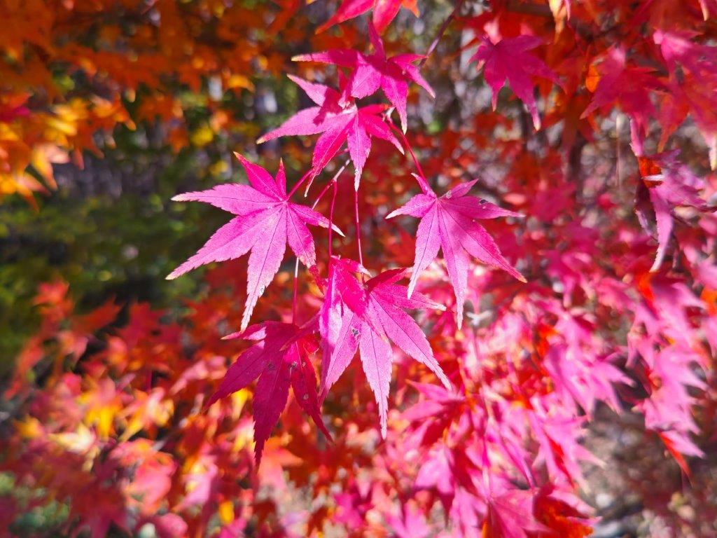
I took a moment to enjoy the scenery of yellow leaves, half on the trees and half scattered on the ground, a sign that Autumn was nearly over. I followed a road southwards, hugging the mountain side, and after ten minutes, reached a fork with a signboard for the Tokai Nature Trail Bypass Route (東海自然歩道バイパスコース) which I’d now be joining. I went up some log steps on the right side, emerging from the forest onto a small grass field at the top of Mt Ohira (大平山 569m), surrounded by trees, some still with Autumn leaves. I turned right at a junction and soon arrived at a gate, beyond which was a forest road and a rounded summit completely cleared of trees.

Road section near Daishido Temple

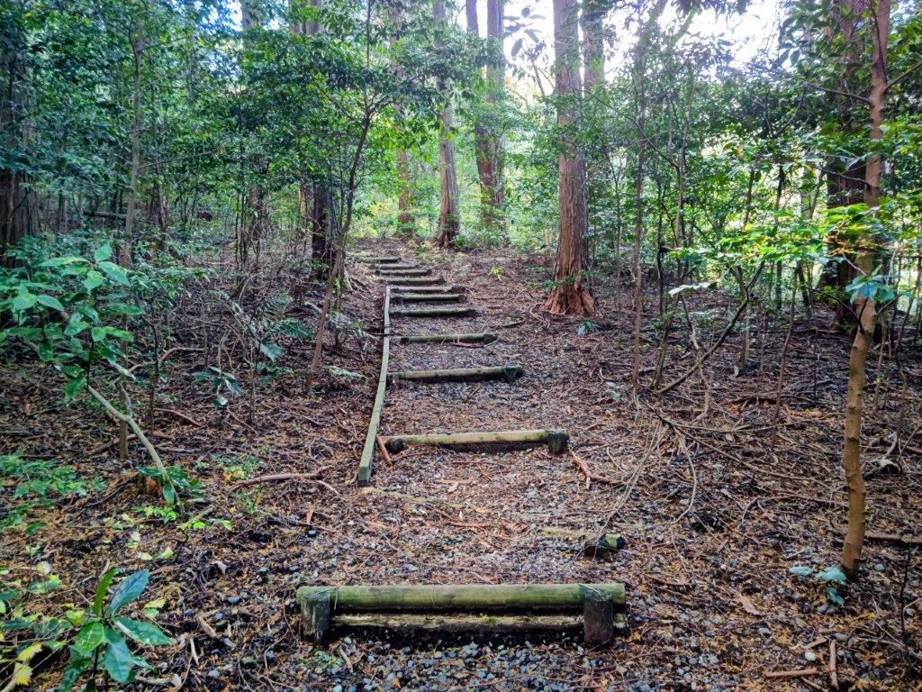
Log Steps Leading to Mt Ohira

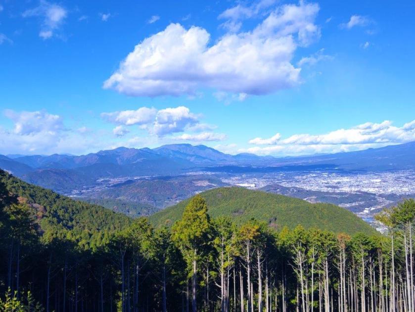
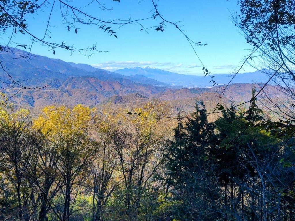
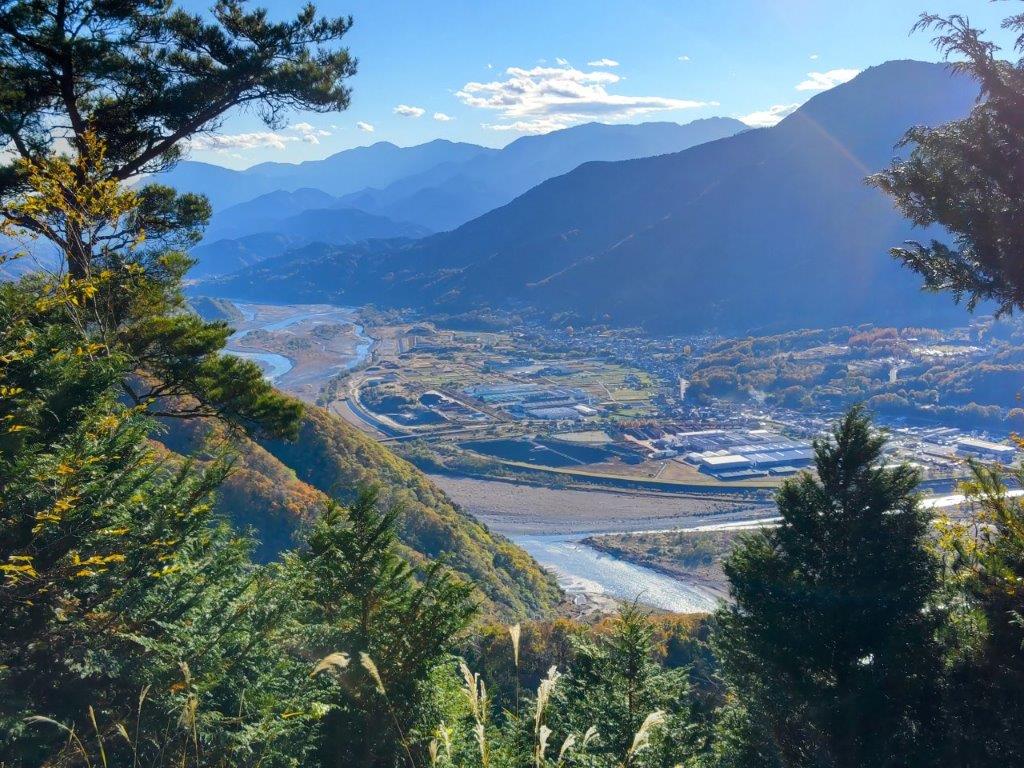
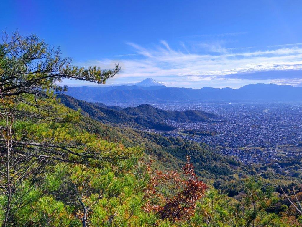
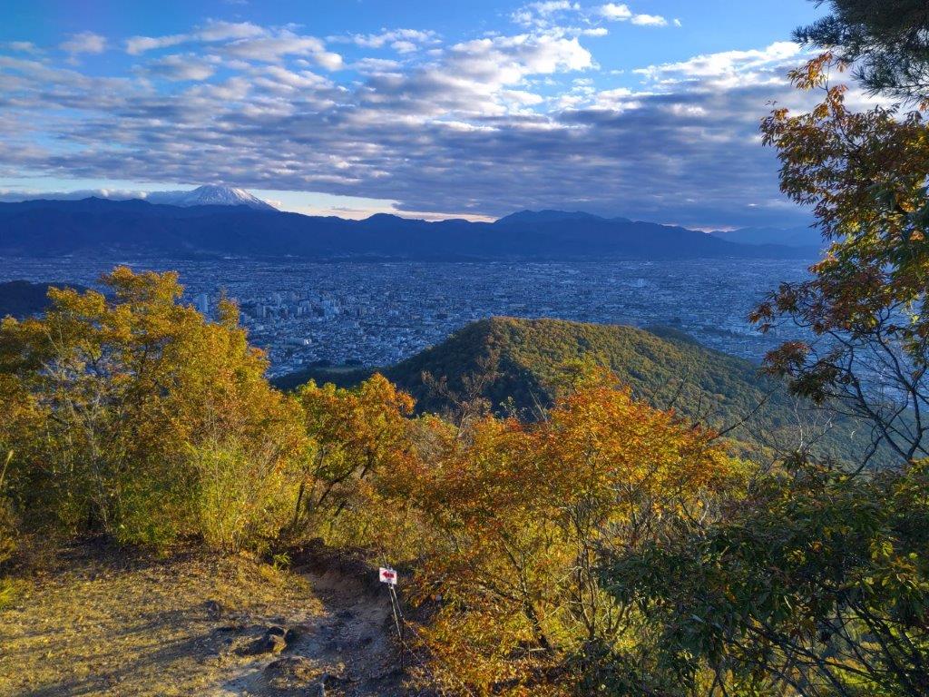
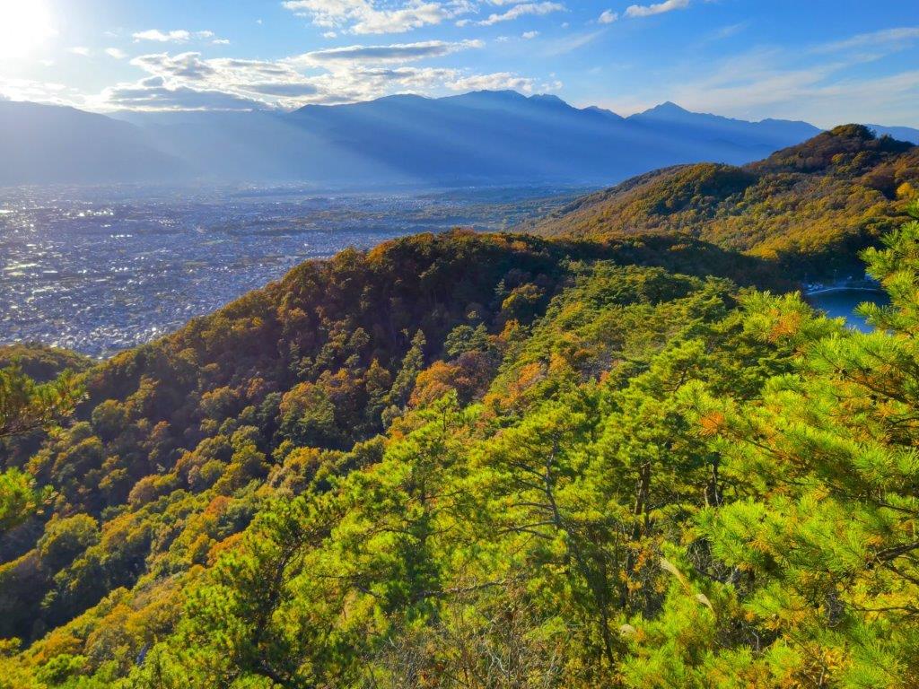
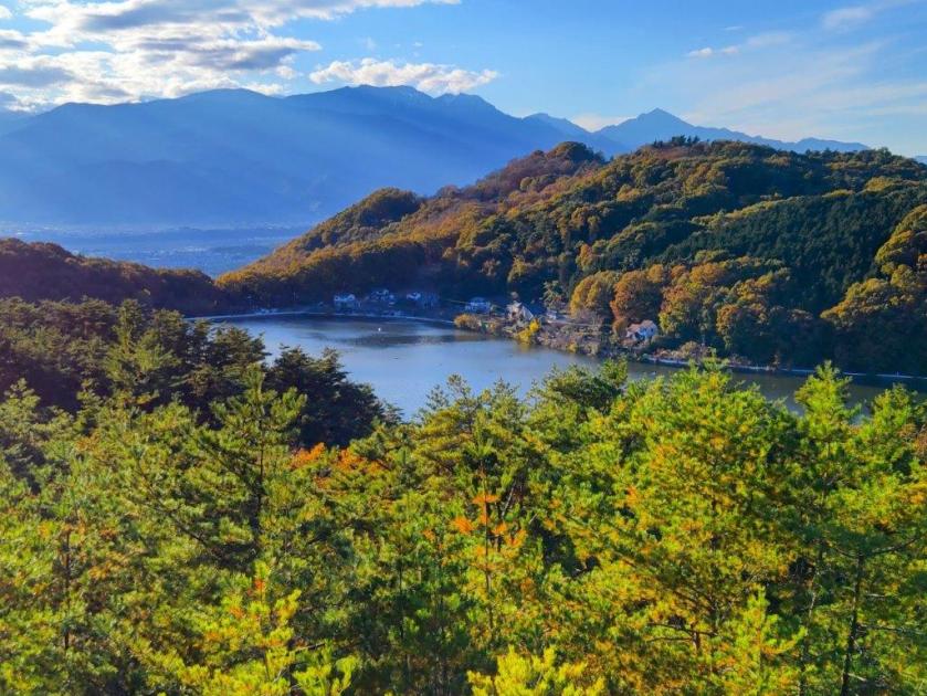
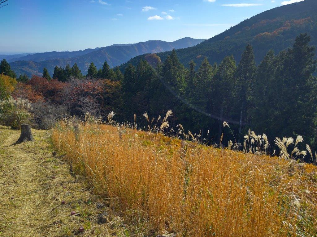
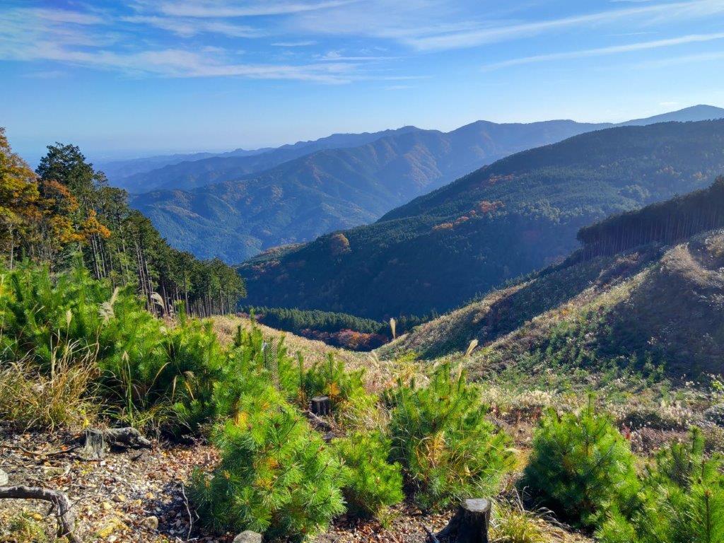
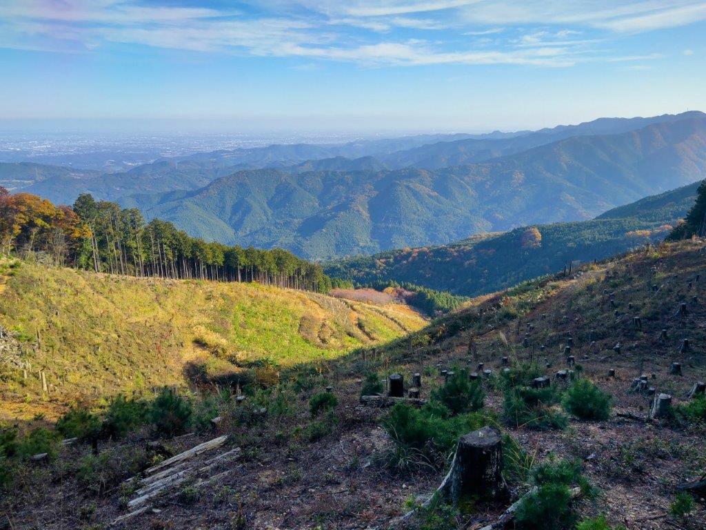
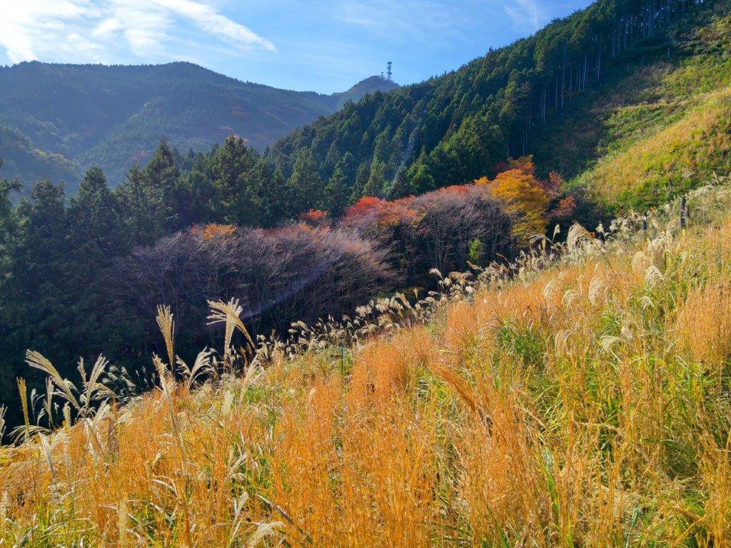
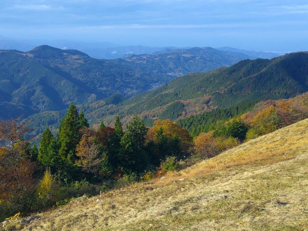
I was stunned by the view that suddenly came into view, a range of mountains stretching from south to north, the southernmost part of the Southern Alps. Following a footpath through the tree stumps, I reached the top of Mt Noda (野田山 598m) marked by a small shrine in lieu of a summit marker. I had the best view of the day: from left to right, I could observe the Pacific Ocean, the Southern Alps, Mt Fuji, Mt Ashitaka, Suruga Bay and the Izu Peninsula. I retraced my steps back into the forest, and after a brief up and down, arrived at another grassy field, the top of Mt Okubo (大久保 565m). Since it was also in the trees, I continued without a break.

Autumn Colours near the Top of Mt Ohira

View of the Southern Alps from the Top of Mt Noda

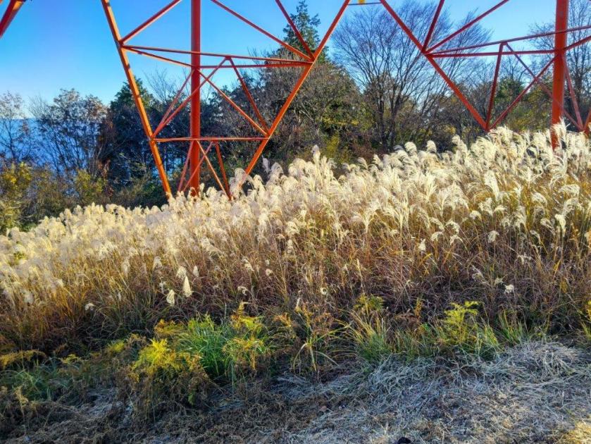
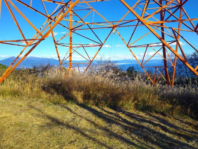
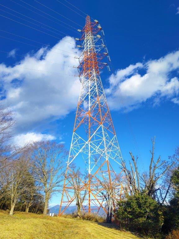
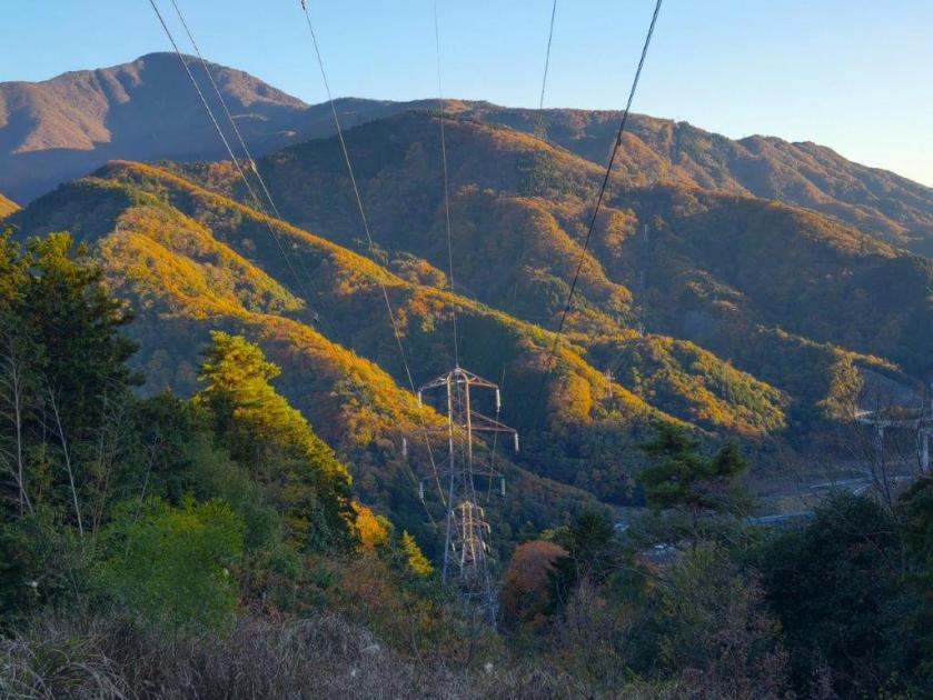
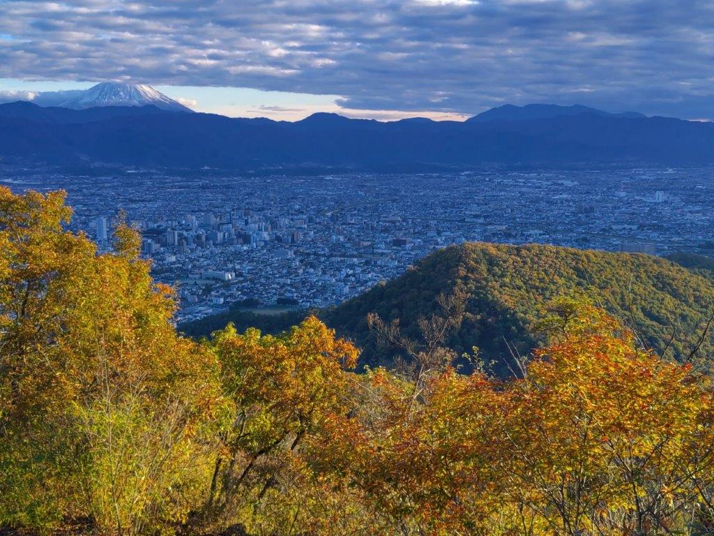
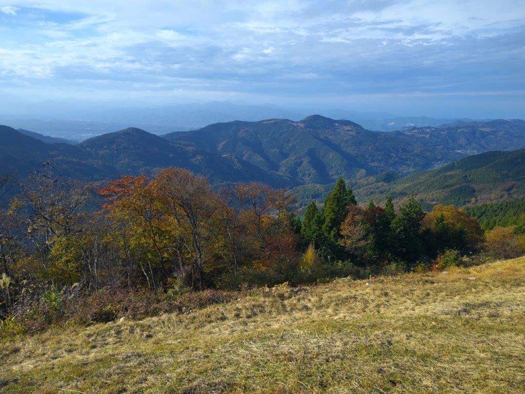
I was surprised by the profusion of signposts, some so detailed it was possible to find one’s way without a map. I enjoyed hiking through the quiet forest, apparently being the only person on the mountain today. After some gentle climbing, I arrived at an electric pylon marking the top of Mt Omaru (大丸山 おおまるやま oomaruyama); there was also a grass field, seemingly a common feature of the area. The view was somewhat blocked by vegetation but I could see Mt Fuji, Mt Ashitaka and Suruga Bay. It was now 2h30 so I sat on a bench for a short break before the hike down.

Mt Fuji and Mt Ashitaka from Mt Noda

Close-up of Mt Fuji and its Snowcap

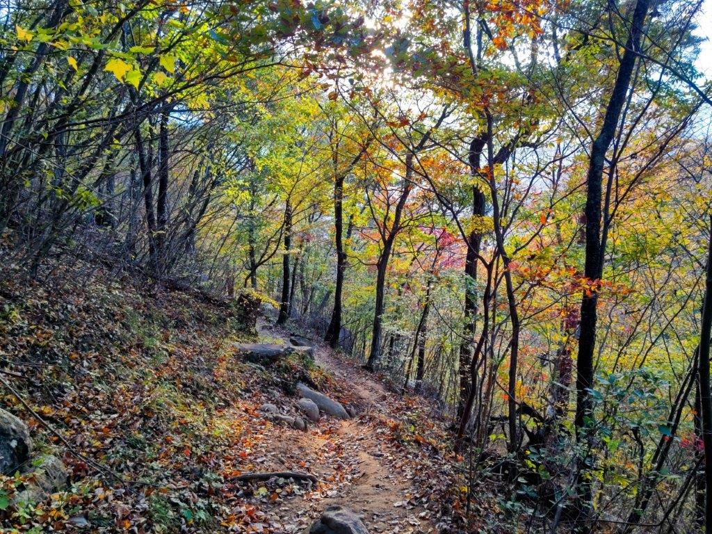
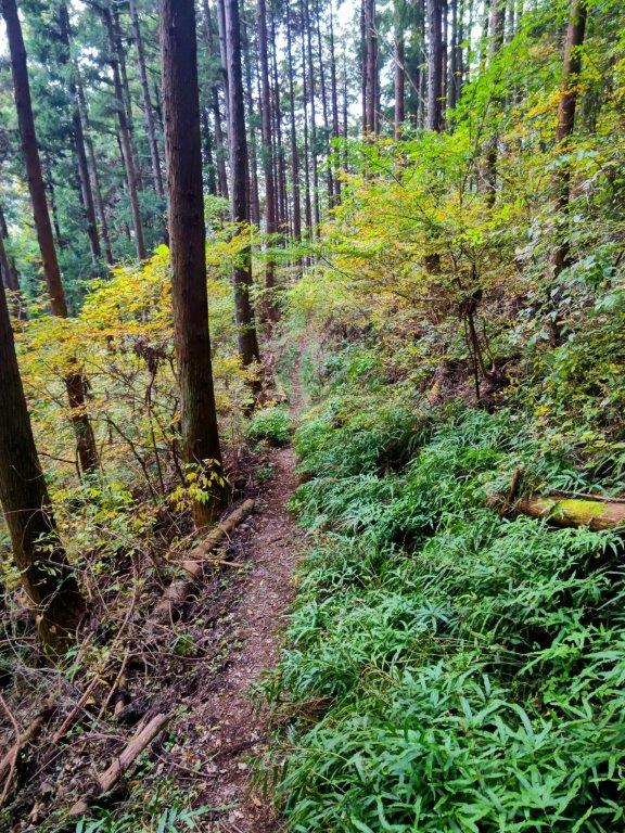
It was very pleasant, sitting on the sunny bench, gazing at the golden “susuki” swaying in the wind in front of the bright red pylon with the blue sea and sky in the background. At 3pm, I set off again, heading down the mountain through the forest. This was probably the nicest part of today’s hike, and I was glad that it was part of the Tokaido Nature Trail, even though it was just a bypass. I soon arrived at a secluded spot called Miharashi-Kannon 見晴観音 (438m), seemingly just a crossroads. I turned left, leaving the Tokaido Nature Trail which continued straight, towards Mt Hamaishi.

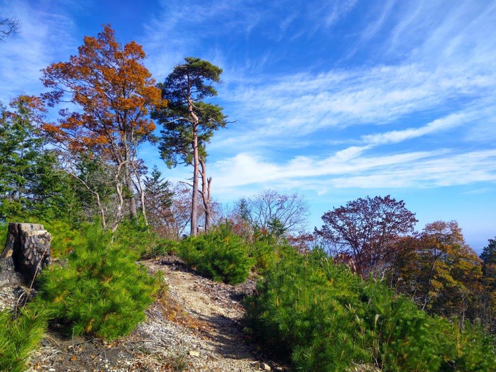
Heading towards Mt Okubo and Mt Omaru

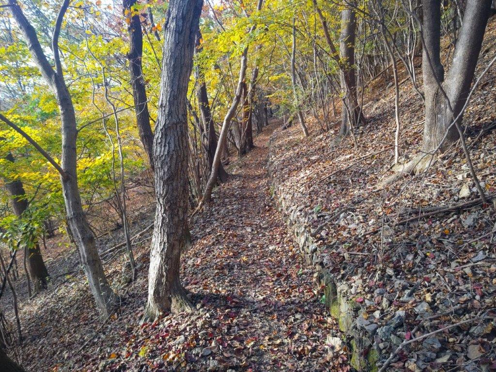
Ancient Pathway past Miharashi-Kannon

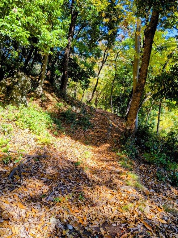
I was now following what seemed like an ancient road due to the stone markers appearing at regular intervals and traces of a stone wall. I soon arrived at another junction with multiple signposts where I continued straight, soon emerging into an open space. I could see the sky, light fading, half moon visible above a tall pine. I had to watch out for spiders again as they had suddenly reappeared, sitting in elaborate webs next to the trail. I heard the sound of rushing water, a brook running through the vegetation on the right side. Just before 4pm, I popped onto a road, where I turned right.

Last Light on Kanbara Farm

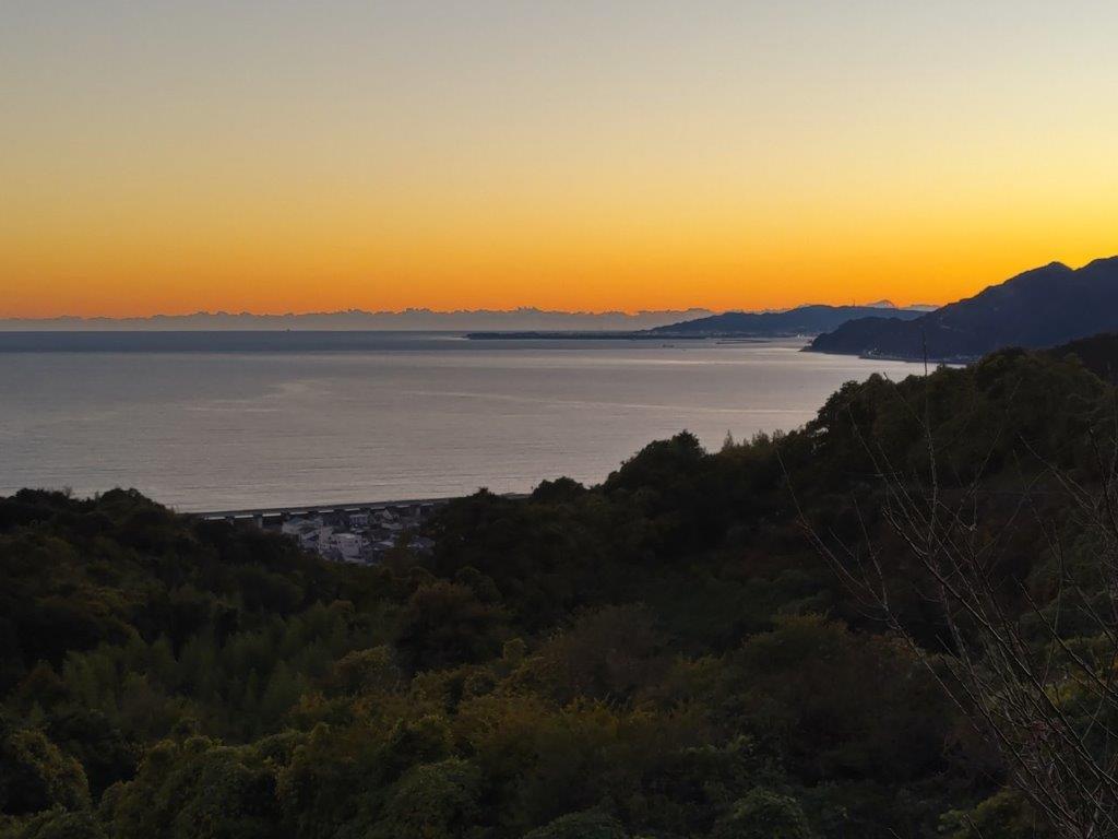
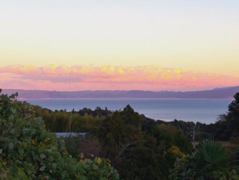
Dusk on Suruga Bay at the End of the Hike

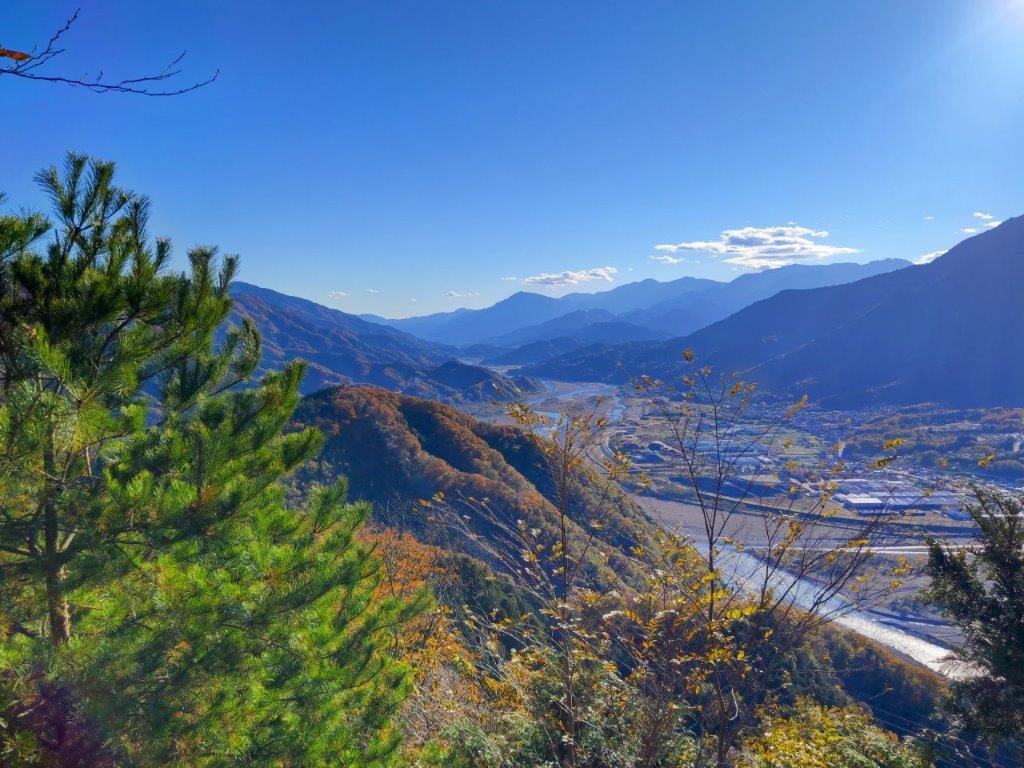
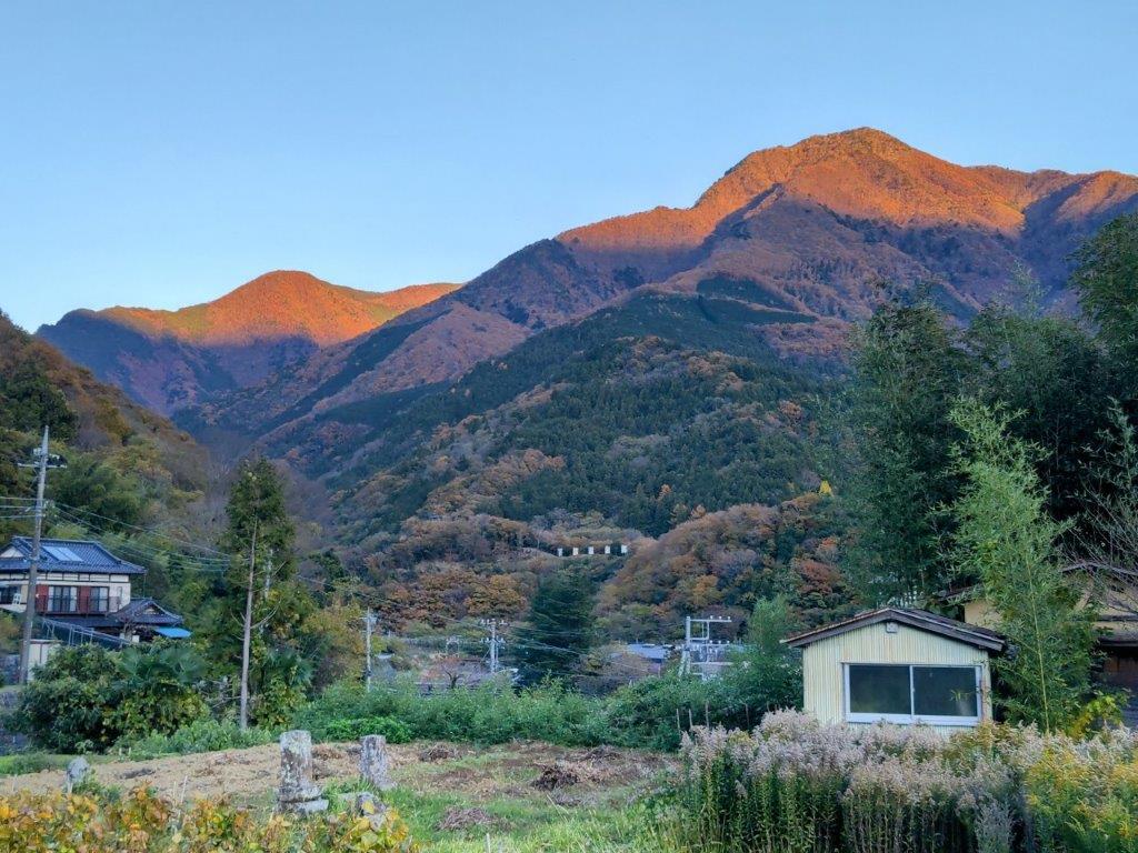
Facing south on the descent, I had views of yellows and oranges, not of leaves but of the sky, as the sun had set and dusk had arrived. At 4pm, I passed through Kanbara Farm and spied many handwritten signs warning against fruit theft. Just as it was starting to get dark, I heard the noise of cars and trucks from the Tomei expressway, and shortly after, I could see houses and buildings along the ocean. At 5pm, I arrived at Kanbara station and soon after I was riding the train back to Mishama where I caught the shinkansen for the lightning speed trip back to Tokyo.

Thank you for reading – make sure to check out the Japanwilds website for more hiking blogs and maps

Watch a Video of the Mt Kanamaru hike

Watch the Video of the Hike on YouTube

See a Slideshow of More Pictures of the Hike

Mt Daigo (635m) & Mt Nishi (487m), Minobu Town, Yamanashi Prefecture, Sunday, December 1, 2024

I had spotted this station to station trail the previous year while searching online maps for new hikes; although mostly in the forest, it had one good viewpoint of the Southern Alps on the west side. Online reports showed that the Autumn leaves had reached their peak in the area, and with the excellent weather forecast for Sunday, sunny with little wind, I decided it was time to make the long trip to this remote corner of Yamanashi prefecture, last visited in 2019.

For subscribers, read this Blog Post on Hiking Around Tokyo for a better viewing experience and the latest updates

To get to the start of the hike, I’d once again ride the Chuo line Limited express to Kofu, and there, transfer to the infrequent Minobu line. I’d arrive around noon, but this was fine since the hike was on the short side and ended at Shimobe Onsen, where I could relax in a hot bath while waiting for the train back to Kofu. Incidentally, Minobu Town is where Yuru Camp mostly takes place, so I was looking forward to revisiting an area I’d become familiar with through the Yuru Camp manga and anime.

Find Japan Hiking Maps on Japanwilds

Near the Start of the Hike (left) Past the Mt Goro Viewpoint (right)

Early Afternoon light (left) Leaning Trees (right)

It was another blue-sky day as I rode the limited express in a straight line westwards, from the Kanto Plain to the Kofu Basin. After transferring to a local train on the Minobu line, it was another one hour ride, this time southwest and then south, the railway following the Kamanashi river, as it squeezes between the Southern Alps and the Misaka Mountains. I was the only passenger to get off at the unmanned Kai-Tokiwa station around noon. I quickly found my bearings and followed a road westwards, to a small graveyard with a Kannon Statue.

View of the Tokiwa Area and Mt Goro from the Kannon Statue

Afternoon Sun and Autumn Leaves

Turning around, I enjoyed the first view of the day: the Tokiwa area with the summit of Mt Goro (五老峰 goroubou) rising behind. I located the start of the hiking trail and headed up the mountain side through the forest. The trail soon leveled and was bathed in the afternoon sun, enhancing the yellow colours of the surrounding Autumn leaves. I wondered why no one else was walking this path as it seemed like the perfect time of the year for this hike. I soon passed Hatouchi Pass (鳩打峠), and at 1pm, arrived at a bench with a view on the east side.

View of Mt Goro past Hatouchi-toge

View of Yatsugatake below the Summit of Mt Daigo

From this higher vantage point, I now had a proper view of Mt Goro. For such a local trail, I was surprised to see how well-maintained it was, with good quality signposts, panels with tree names and even distance markers to the top. I heard deer sounds nearby but never saw any, an indication of how few people pass through. I had another view, southwards this time, of the foothills of the Southern Alps, Yatsugatake, its highest peaks white with snow, and Mt Kaya. After a steep but short climb, I reached the top of Mt Daigo (醍醐山 だいごやま daigo-yama), a Buddhist term meaning nirvana.

Yellow and Red Leaves near the Summit of Mt Daigo

Red Maple & Mt Goro near the Mt Daigo Viewpoint

Standing on top of “Mt Nirvana”, I didn’t feel especially enlightened, under the shade of trees with not even a hint of a view. I was delighted by the signboard showing a hand-drawn bird’s-eye view of Mt Daigo (also online, Japanese only). Following the signs for the observatory, I walked downhill in a westward direction, surrounded by stunning autumn leaves, the reds and yellows swaying in the breeze. I reached a narrow ridge, the vegetation shrinking away on both sides and letting the sunlight through. I stopped near a huge “momiji” (Japanese maple) and turned around.

View of Mt Minobu (left) & Mt Shichimen (right) from the Mt Daigo Observatory

View of the Fuji River Valley from the Mt Daigo Observatory

I had probably the best view of the day, the vivid red leaves sharply contrasting with the light blue sky, the now familiar triangular summit of Mt Goro in the background. I moved further along the ridgeline till I reached a signboard next to a gap in the vegetation on the south side, the Mt Daigo Observatory (醍醐山展望台), in truth more of a viewpoint. Directly ahead was Mt Minobu with the massive bulk of Mt Shichimen lurking behind; on the west side was Mt Zaru, the highest peak in the vicinity; far away to the south, I could just make out the top of Mt Takadokkyo. It was already 2pm, so I settled on a comfortable rock for a lunch break.

View South of the Japanese Southern Alps

View Northwest of Mt Fujimi from Daigo-toge

I enjoyed the view of the Fuji river sparkling under the sun, as it snaked its way towards Suruga Bay. Sadly, Mt Fuji was missing, so close yet invisible, one of the rare blind spots in the area. I was only halfway through my hike so at 2h30, I set off again, retracing my steps to the summit and heading down a faint path on the south side. The descent turned steep, down log steps half buried in dead leaves, rope attached to adjacent trees for safety. A little after 3pm, I reached the lonely Yama-jinja shrine, its access blocked by the huge trunk of a fallen tree. This was also the junction for the second mountain of the day; I went right, along a path through some bamboos, leading to Daigo Pass (醍醐峠) and the final viewpoint of the day.

Mt Daigo in Orange near Mt Nishi

Looking north, I had an amazing view of the orange-coloured mountain side of Mt Daigo with the dark shape of Mt Fujimi rising like a wall in the background; in the valley below, houses filled the narrow space between the Fuji river and the foothills. To the south was Mt Goro again, small puffy clouds passing over its summit. I dived back into the forest, and soon reached the flat top of Mt Nishi (西山 にしやま nishi-yama), completely in the trees. It was 3h30, just one hour to sunset, so I hurried back to the junction and headed down, past an abandoned house, down a switchback path through a dark forest, along a stream over a couple of wobbly bridges and out through an electric gate. At 4pm, I emerged onto a road where I turned left, soon walking through an inhabited area.

Spooky Bridge near the End of the Hike

Today’s “beacon”, Mt Goro near Shimobe Onsen

I was now walking straight towards Mt Goro, its tip lit up light red in the last light of the day, looking very much like the beacon that had guided me throughout the day. I turned left onto a main road, and after crossing a bridge over the Fuji river, arrived at Shimobe onsen, where I indulged in a hot spring bath at the modern Shimobe no Yu, just across the tracks from the train station. As I exited the hot spring facility, I was delighted to see life-size cutouts of characters from Yuru Camp. A little after 5pm, I boarded the faster express train for Kofu, and there, transferred to the limited express for the 90-minute ride back to Shinjuku.

Thank you for reading – make sure to check out the Japanwilds website for more hiking blogs and maps

Watch a Video of the Mt Daigo Hike

Watch the Video of the Hike on YouTube

See a Slideshow of More Pictures of the Hike

Mt Komatsu (514m), Mt Shiro (640m) & Mt Yumura (446m), Kofu City, Yamanashi Prefecture, Saturday, November 23, 2024

I was looking for another hike in Yamanashi before the arrival of the snow. I also wanted to stay relatively low since the temperatures had plummeted since the previous week. Looking at my map, I spotted a group of suitable mountains just north of Kofu. I had already done a great hike on the northeast side so I was keen to explore the area more. I saw that I could make an open loop passing by several viewpoints, including an interesting rock formation and a lake, within a reasonable amount of time.

Hiking in the Chichibu-Tama-Kai National Park

秩父多摩甲斐国立公園

To get to the start of the hike near Suwa Shrine, I’d ride the Chuo limited express to Kofu station, and from there, ride a bus to a stop within walking distance of the shrine. I’d finish the hike at Yumura Onsen in northwest Kofu, and after a hot spring bath, ride a bus back to the station. The weather was supposed to be clear but cold. I hoped I could get some good views of the surrounding mountains, including Mt Fuji, and still catch the Autumn leaves at their best.

For subscribers, read this Blog Post on Hiking Around Tokyo for a better viewing experience and the latest updates

Find Japan Hiking Maps on Japanwilds

Start of the Hike near Suwa Shrine (left) Tall Pines on Mt Komatsu (right)

Exposed Rocks above Kinsu-toge (left) Autumn Colours near Chiyoda Lake (right)

It was a cloudless, blue-sky day as I stepped off the limited express in Kofu station at 10am. I boarded a local bus, the driver even kindly confirmed my destination, and after a short ride, I got off at a stop still within the confines of the city. A few minutes of walking brought me to the foot of the mountains, and after a short climb, I arrived at Hizakutsu-suwa Shrine (膝屈諏訪神社). It was just after 11am as I passed under the stone shinto gate next to an impressive yellow gingko-tree.

Trail below Mt Shiro (left) Trail past Mt Hosenji (right)

Path for Mt Yumura (left) Flagstones for Yumura Castle Ruins (right)

Turning around, I was rewarded with a view of snow-capped Fuji. I made my way to the white shrine building surrounded by tall cedars, and after taking a few minutes to adjust my gear, set off along a level trail at the far end of the shrine grounds. I soon emerged from the trees onto a sports field, and after crossing a busy road, followed a residential street up the mountain side to a staircase below the trail entrance. This section has no signposts and I had to rely entirely on my phone GPS.

Log Steps Leading to the Top of Mt Komatsu

Walking the Takeda no Mori Promenade

I was surprised to see that the trail was partly overgrown, a sign that it was little used in this season; I was even more surprised to notice spiders again, a sign of their resilience to cold weather. Once the path started to climb, the trail became better defined; I saw the first signpost of the day upon reaching a wide path along the top ridge. I turned right, and after climbing a series of log steps, arrived at the top of Mt Komatsu (小松山 こまつやま komatsu-yama), the promised view mostly blocked by vegetation.

Heading up to Kinsu-toge

The exposed rocks of Mt Awayuki

I was tempted to take a break at one of the sunny summit picnic tables but since it was barely noon, I decided to press on. Even though the mountain name means “little pine”, it was home to some very tall red pines, one of the 100 famous forests of Yamanashi. I went back down the steps and followed the ridge northwards, soon merging with the Takeda Forest Promenade (武田の森遊歩道 takeda-no-mori-yuhodo named after Takeda Shingen, a famous feudal lord from the Sengoku era), an ancient road connecting Wada and Iwado passes; I had already walked the latter part on my Mt Yogai hike. I strolled along the wide, level path as it followed the mountain side eastwards through the forest.

First view of the day near Kinsu-toge

Mt Fuji, the Misaka Mountains and the Kofu Basin

From time to time, I waved a stick to clear the stubborn spider webs that were too low to duck under, their occupants groggily moving out of the way. Shortly before 1pm, I left the promenade and turned left onto a wide path leading up the mountain side, the webs now thankfully gone. I soon reached Kinsu Pass (679m 金子峠) where I had a view of Mt Fuji between a gap in the trees. I now rejoined a hiking trail, and continued eastwards, soon arriving at a group of white-coloured rocks, called “Exposed Rocks of Mt Awayuki” (702m 淡雪山の露岩 あわゆきやまのつゆいわ), similar to the scenery one can find at the nearby Shosenkyo. It was also the highest point of today’s hike.

Mt Kaikoma from the Exposed Rocks

Afternoon Light at Chiyoda Lake

I felt lucky to have such a spot all to myself. Above the pines on the south side, I had a fantastic view of Mt Fuji and the Kofu basin. To the west, I could see Mt Kaikoma, also known for its white rocks, and the long summit ridge of Mt Houou. After taking a few minutes to explore and take photos, I selected a suitable rock to sit on for a lunch break. A little after 2pm, I headed back to Kinsu Pass, and followed the ridge westwards. Here the trail became faint and I had to rely on my phone GPS and the occasional pink ribbon. After a short descent, I reached a proper trail which soon turned into a road through a residential area; at 3pm, I arrived at the edge of Chiyoda lake.

Autumn Colours on the way to the Mt Shiro Viewpoint

Chiyoda Lake from the Mt Shiro Viewpoint

I was dazzled by the reflection of sunlight on the blue water surface and green water plants. I headed up log steps surrounded by red and orange leaves, happy to be back on a hiking trail. After a short climb, I reached an open shelter at the Shiroyama Viewpoint (白山展望台). Directly below was Chiyoda lake; to the west, I could the see the outline of Mt Houu against the fast sinking sun; looking north, I spotted Mt Kaya and the Kurofuji volcanic group, with the white rocks of Shosenkyo in the foreground and the peaks of Yatsugatake in the background. I still had a little way to go to the next summit, so after a short break, I set off again. The up and down trail was easy to follow, and at 3h30, I reached the Hachioji shrine (八王子神社) at the top of Mt Shiroyama (白山 しろやま), meaning “white mountain”.

View of Kofu from the top of Mt Shiro

Dark Clouds and Yellow Leaves from Mt Shiro

I was stunned by the view of fleecy clouds spreading from the snowy slopes of Mt Fuji, casting shade over Kofu city’s urban sprawl; luckily, the light still reached the surrounding slopes, lighting them up in gold. I quickly admired the view of the South Alps on the other side of the shrine, before moving on, picking up the pace as I wanted to get down before dark. I descended a steep, sandy trail, the rocky outcroppings and gnarly pines along the way feeling quite typical of the Chichibu-Tama-Kai national park. I was delayed by two more superb viewpoints, the setting sun creating a striking contrast of light and shade, before reaching a level trail, now in the shade. At 4pm, I passed the minor summit of Mt Hosenji (539m 法泉寺山 ほうせんじやま), completely within the trees.

The Tip of Mt Fuji hidden by the Clouds

The South Alps from the Top of Mt Shiro

I was suddenly walking on flagstones (“ishidatami), a reminder that today’s last summit was also the location of Yumura castle (湯村城), although only some stone foundations remain today; I had to be careful not to miss my step, especially since the visibility was starting to fade. After a short descent, I reached a fire beacon (“noroshi“), a recent reconstruction of one of the many that used to exist during the Edo period, creating an ancient communication system. One final effort brought me to the open shelter at the top of Mt Yumura (湯村山 ゆむらやま yumura-yama), meaning “hot spring village”.

Sun Setting behind Mt Houou

Trail between Mt Shiro and Mt Yumura

I had one last view of Mt Fuji, its top half truncated by a layer of grey clouds. It was 4h30, so I sped back to the fire beacon and headed down a switchback trail on the west side, occasionally taking the well-worn short cuts between the bends. I was relieved to reach Yumura Onsen (湯村温泉) before it was completely dark, arriving at Yumura Hotel just before 5pm. After a refreshing hot spring bath, I caught a bus for Kofu station, where I boarded the limited express for the 90-minute ride back to Shinjuku.

Easy to Follow Trail below Mt Shiro

Last View of the day from Mt Yumura

This hike ended up taking 6 hours, a bit longer than planned, mainly because of the superb views along the way. The section around Mt Shiro was especially stunning, and I’d like a chance to redo in lighter conditions. It deserves to be better known, and it’s a mystery why I saw no other hikers the whole day. In the future, I’d also like to climb Mt Kata (片山) on the other side of Chiyoda lake and also explore more of the Takeda Forest Promenade towards Yogai Onsen. Before that, I definitely want to revisit the white rocks of nearby Shosenkyo.

Watch a Video of the Mt Shiro Hike

Watch the Video of the Hike on YouTube

See a Slideshow of more Pictures of the Hike

Skiing around Tokyo

Since the skiing season has officially kicked off, why not hit the slopes? Thanks to the shinkansen, several great resorts are within easy reach of Tokyo, even as day trips. Below are my writeups on several resorts in Nagano and Niigata where you can enjoy the fresh powder.

Find Japan Hiking Maps on Japanwilds

Getting Ready to Ski at Nozawa Onsen

Most Hot Springs: Nozawa Onsen

Easiest Access: Madarao Kogen

Biggest Resort: Shiga Kogen

Longest Season: Myoko Kogen

Best Views: Togakushi Ski Resort

Mt Dodaira (875m) & Mt Kasa (837m), Tokigawa & Ogawa Towns, Saitama Prefecture, Sunday, November 17, 2024

I had already done the Tokigawa Trekking Trail in February 2017, at the end of a long hike and partly in the dark. I wanted to experience this excellent trail in better conditions and in a different season, so I decided to redo it but in reverse, east to west, starting from Ryozen-in, a short distance past Jiko Temple. After summiting Mt Dodaira, if time allowed, I’d continue to neighbouring Mt Kasa, before descending the valley into Higashi-Chichibu. The weather was supposed to be sunny and unseasonably warm, as it had been for the past 2 weeks.

For subscribers, read this Blog Post on Hiking Around Tokyo for a better viewing experience and the latest updates

Trail past Kanmuri-iwa (left) Trail past Mori-no-hiroba (right)

Contrails above the Trail (left) Log steps for the Steep Sections (right)

To get to the start of the hike, I’d take a Tobu-Tojo express train from Ikebukuro to Ogawamachi, and from there, a taxi to Jiko-ji, which I had already done earlier in the year. I’d finish at the starting point for the Higashi-chichibu Village line bus back to Ogawamachi station. I’d be skipping the first part of the trail, the climb from the prefectural road, but I wanted to ensure I could do the later part of the hike in optimal conditions. I was looking forward to revisiting a familiar area and seeing some more autumn colours.

Tokigawa Trekking Trail ときがわトレッキングコース

Trail before Matsu-no-ki-toge (left) Arriving at Matsu-no-ki-toge (right)

Heading to Dodaira Observatory (left) Descending into Higashi-Chichibu (right)

It was a blue-sky day as I rode the express train to Ogawamachi. After buying lunch and water at the convenience store opposite the station, I rode a taxi to Ryozen-in Temple (霊山院), a peaceful place in the middle of the forest, completely deserted as when I was last there 7 years ago. After quickly getting ready, I set off at 11am, following the stone markers for the Tokigawa Trekking Trail. I was surprised how warm it still felt, although a cold wind occasionally blew through the trees.

Sunny Trail past Nanae-toge Rest Spot

Arriving at Mori-no-hiroba

I was concerned to see webs and spiders, hanging from nearby branches. I had hoped I wouldn’t have to deal with “jorogumo” spiders past mid-November but apparently the unusually warm weather had extended their life cycle. Fortunately, I was walking along a level forest road with little chance of webs spanning its width. I soon left the forest road, following a sign for the observatory (天文台 “tenmondai“) up some steps on the right. At 1130, I arrived at Kanmuri rock (冠岩 “kanmuri-iwa“), merging with my May hike. However this time, I continued straight.

Susuki above Mori-no-hiroba

Cirrus Clouds High in the Sky

I was delighted to be following a level trail through tall cedars, the shade welcome on this unseasonably warm day. Very soon, I reached a road which the Tokigawa Trekking Trail then follows to the Nanae Pass Rest Spot (七重峠休憩所); however, I opted to take a path on the other side of the road, a more direct route to the rest spot. Past that point, I was again following a forest road, the midday light filtering nicely through the trees. At Mori-no-hiroba (森の広場), I turned right, onto some log steps taking me straight up the mountain side, out of the trees and through a field of “susuki” or Japanese Pampas grass.

Looking back at the Oku-musashi Mountains

Aiming for the Contrails

I was excited to be surrounded again by pampas grass swaying in the breeze, reminding me of last year’s hike on Mt Shakushi. As I climbed the switchback trail, in and out of mini cedar forests, a wide view of the Oku-musashi hills gradually opened up on the south side. After a short, steep section, I arrived at Matsu-no-ki Pass (松の木峠), with a sitting space and a solitary pine, a good place for a breather. Through the vegetation on the north side, I could see the Kanto Plain and the foothills of Mt Akagi.

South View below Matsu-no-ki-toge

An Easy to Walk Trail

This was by far the best part of the hike, the wild scenery complementing the outstanding views. Overhead, cirrus cloud and contrails spread across the sky, announcing a change in the weather. I was puzzled, and grateful at the same time, that more people hadn’t chosen this great trail today. I soon continued on my way, along a short, level section through bright green pine saplings leading to the final climb before the summit. Before reentering the forest, I turned around for one last look.

Final Steps before Matsu-no-ki-toge

Green Saplings and South View from Matsu-no-ki-toge

I was amazed by the plunging view, even though I was relatively low. I could now see beyond the Oku-musashi hills to the hazy Kanto plain in the distance. At 2pm, I arrived at “Stars and Green Creation Center” campground (星と緑の創成センター), where I was able to enjoy a multitude of yellow, orange and red Japanese cedars or “momiji“. Shortly after, I reached the highest point of Mt Dodaira (堂平山 どうだいらさん doudaira-san) for the 3rd time (the first time was in 2011), also a famous 100 mountain of the Kanto area, known for its white dome observatory used for stargazing on clear nights.

Looking back at the Sole Pine of Matsu-no-ki-toge

The Kanto Plain past the Oku-musashi Hills

The summit view was less clear than on my previous visit: directly ahead, the mountains of Higashi-chichibu extended northwards; on the west side, however, I could only make out a vague outline for the Oku-chichibu mountains, high-altitude clouds coming in from the west. The cold breeze from the morning had vanished, and it was quite pleasant at the top of the highest mountain in the area. After a short lunch break, I continued on my way, escaping the company of other people, most of whom had driven to the top.

Autumn Colours near the Top of Mt Dodaira

View of Higashi-chichibu from Mt Dodaira

I was glad to be once again walking on a level dirt road, after the steep one-hour climb to the top. I had reached the end of the Tokigawa Trekking Trail and was now walking along the Outer Chichibu 7 Peaks Traverse Hiking Trail (外秩父七峰縦走ハイキングコース soto-chichibu-shichihou-juusou haikingu kosu), a 42km loop connecting Ogawamachi and Yorii stations. However, I’d only be doing a short portion today. I passed the paragliding jump-off point, sadly deserted today, and reentered the forest.

Walking the Outer Chichibu 7 Peak Traverse Hiking Route

Heading down through the Forest

It was great to be walking through the trees with the trail all to myself, the surrounding forest beautiful in the late afternoon light. After a short descent, I reached a road at Nanae Pass (七重峠), my third time crossing the same road. I alternated between hiking paths and the roads for a short while, and at 3pm arrived at the trail entrance for today’s next mountain. I had more than an hour before my bus so I headed up a steep slope through a dark cedar forest in sharp contrast to the previous section. I soon reached the top ridge and a summit sign.

Walking near Nanae-toge

Ogawamachi View from Mt Kasa

I continued without stopping as I knew that the true summit, five meters higher, was a few more minutes along the ridge. At 3h30, I arrived at Kamisha Shrine (神社上社) and the top of My Kasayama (笠山 かさやま kasayama), meaning Mt Umbrella, also a 100 famous mountain of Kanto. To the east I had a view towards Ogawamachi; on the west side, I had a glimpse through the trees of the Oku-Chichibu mountains, looking dark and menacing under grey clouds. I quickly retraced my steps back to the road, leaving the Outer Chichibu 7 Peaks Traverse Hiking Route, and darted down a path between the guardrails on the left side.

Oku-chichibu View from Mt Kasa

Path for Shiroishi-shako Bus Stop

It was much darker now under the trees, the weather having unexpectedly turned cloudy on the Higashi-chichibu side. I walked at quick pace, the path following the mountain side and descending gradually. A little after 4pm, I reached Shiroishi-shako bus stop where I boarded an empty bus waiting for the departure time. By 5pm, I was back at Ogawamachi station, where I was able to pick up some Okara donuts from Shimizuya before boarding the train for the one hour ride back to Ikebukuro.

Watch a Video of the Tokigawa Hiking Trail Hike

Watch the Video of the Hike on YouTube

See a Slideshow of More Pictures

Happy New Year 2025

Thank you for following and subscribing to Hiking Around Tokyo in 2024, as well as liking and commenting on blog posts. It’s always a pleasure to get feedback on hike writeups and help fellow hikers get into the mountains.

This year saw the launch of Japanwilds, where you can find high-quality digital maps for hiking in Japan, as well as hike descriptions from bloggers around Japan. Please make sure to have a look and subscribe for future updates, thank you!

The Japanwilds Logo

Below are some numbers from the past year:

In 2024, I completed 33 day hikes (7 are yet to be published), the same number as in 2023, down from 38 in 2022 and 2021. I missed a handful of weekends in the early spring due to rainy weather, as well as a bunch in the summer due to high temperatures and humidity. On the bright side, I was able to hike every weekend from October till the end of the year, thanks to better weather in Autumn.

Saitama and Kanagawa had the most hikes, six each, followed by Yamanashi (5), Tokyo (4), Tochigi (3), Nagano (3), Shizuoka (2), Chiba (2), Gunma (1) and Fukushima (1). Sadly, no hikes in Niigata, nor Ibaraki this year; however, a couple were close to Ibaraki, with good views of the Abukuma Mountains. Ease of access and an abundance of mountains and trails explains why Saitama, Kanagawa and Yamanashi top this list.

The furthest location reached by train was Koriyama Station (200km) in Fukushima, followed by Kamisuwa Station in Nagano and Shizuoka station (both 150km). I used limited express trains for 14 hikes, local lines for 12 and the shinkansen for 7. I’m using bullet and express trains more and more, as they enable me to comfortably reach new destinations. From stations, I used local buses for 21 hikes, taxis and share cars 5 times each. I could still find 4 excellent station to station hikes.

The highest peak was Mt Washi (1798m), also the best 360° view of the year, and the highest elevation was Ama-ike Pass (2241m), both in Northern Yatsugatake. The lowest mountain was Mt Kinugasa (134m) on the Miura Peninsula. I reached about 50 summits, the tally varying on whether minor mountains are included or not; Mt Takao and Mt Ogusu were summited twice via different routes. Twelve of those peaks were repeats, also via different routes. I saw Mt Fuji six times and climbed 3 peaks with “Fuji” in their name. I visited 12 hot springs, among which 5 were first-time visits. Finally, I saw 3 snakes, leading up to year of the Snake.

Looking forward to more hiking in 2025!