Mt Otadaki (338m), Mt Hanzo (502m) & Mt Fuji (338m), Utsunomiya City, Tochigi Prefecture, Sunday, February 26, 2023

I was looking for a low-elevation hike close to Tokyo, suitable for a cold winter day. Looking at my hiking maps, I found 3 minor peaks in a hilly area northwest of Utsunomiya city, between Mt Kogashi and the Utsunomiya Alps. It was up and down the same way, except for the last part, where I could return via a different path. I could take the Utsunomiya line to Utsunomiya station and from there, ride a bus to a stop, just 15-minutes on foot from the trailhead; for the return, I could catch a more convenient bus back to Utsunomiya from a nearby roadside station. Since there was a hot spring close to the trail entrance, I could enjoy a hot bath before heading home. I was looking forward to a relaxing hike and good views at the edge of the Kanto plain.

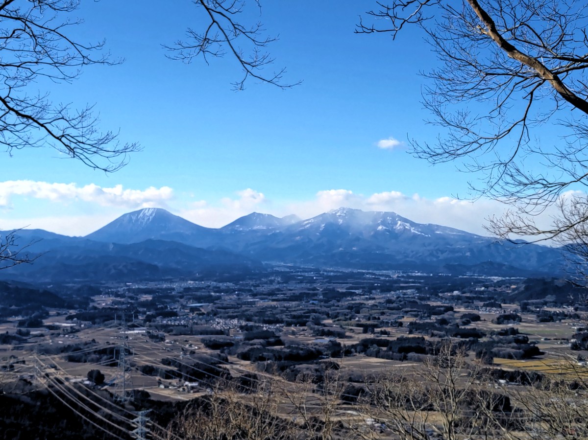
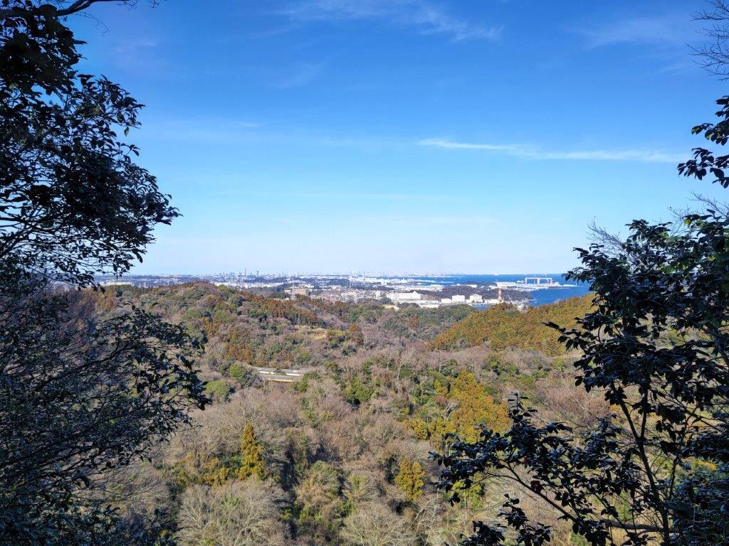
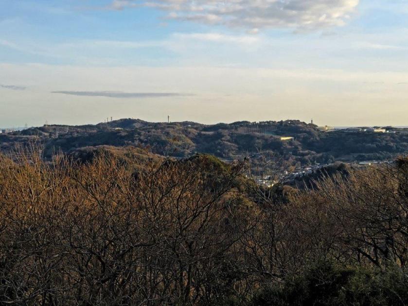
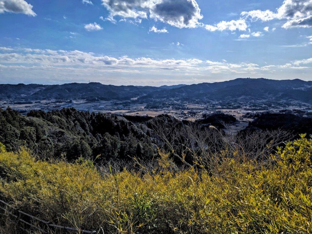
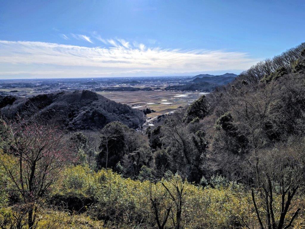
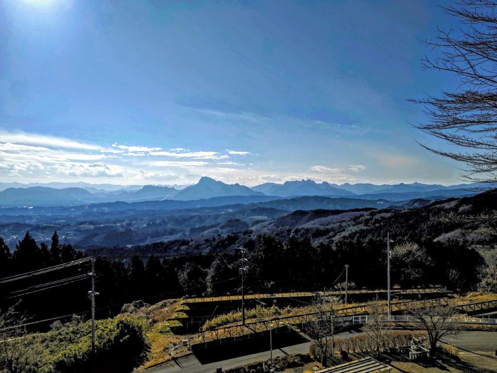
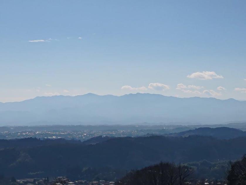
View South of Utsunomiya City and Mt Tsukuba from near the top of Mt Otadaki

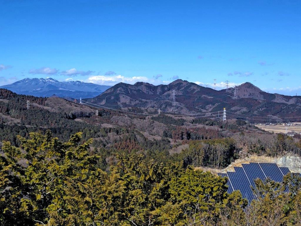
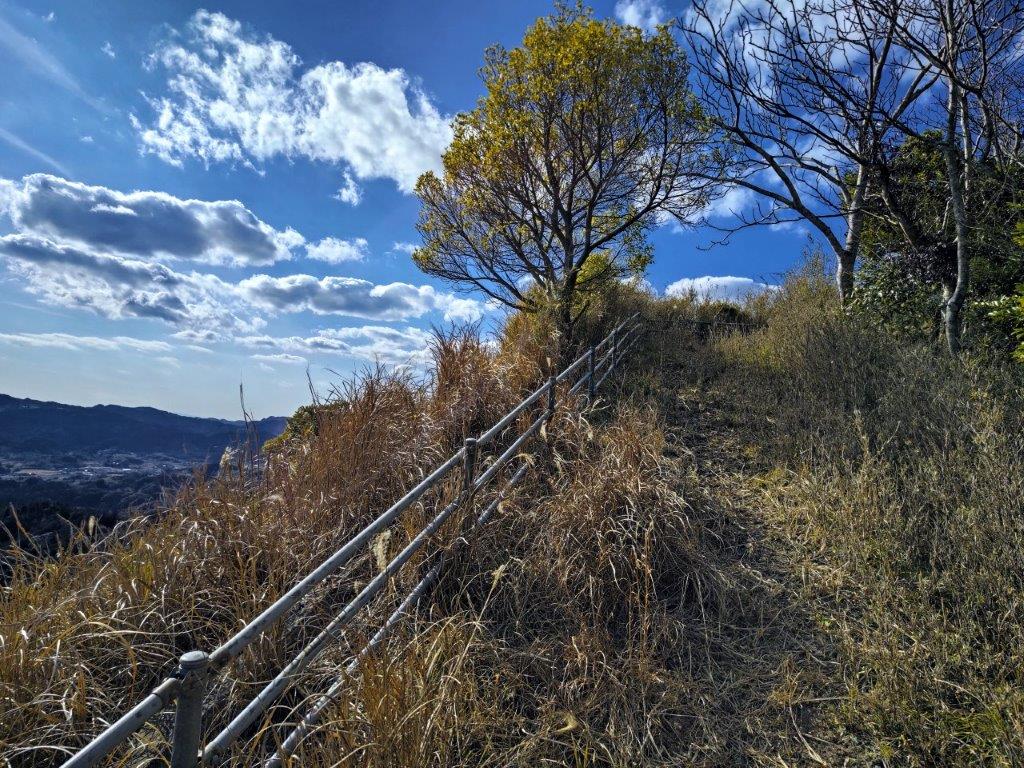
View North towards Mt Takahara (left) and the Utsunomiya Alps (right)

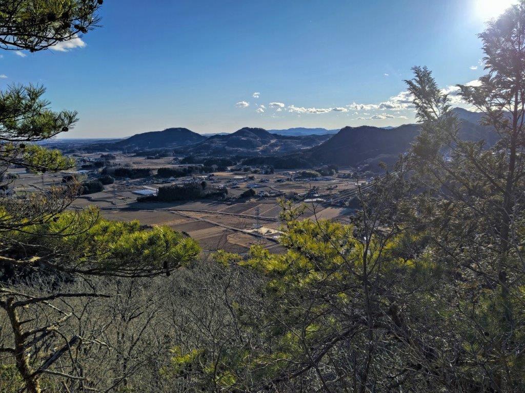
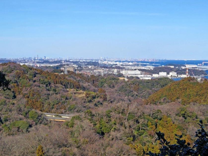
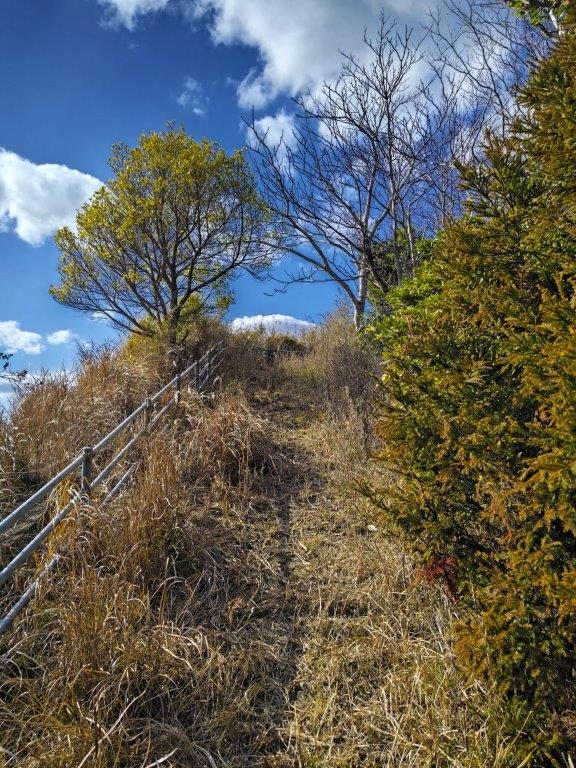
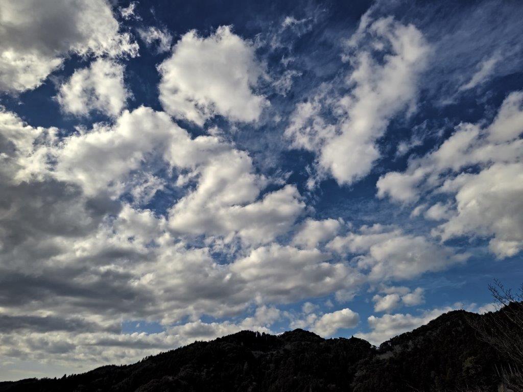
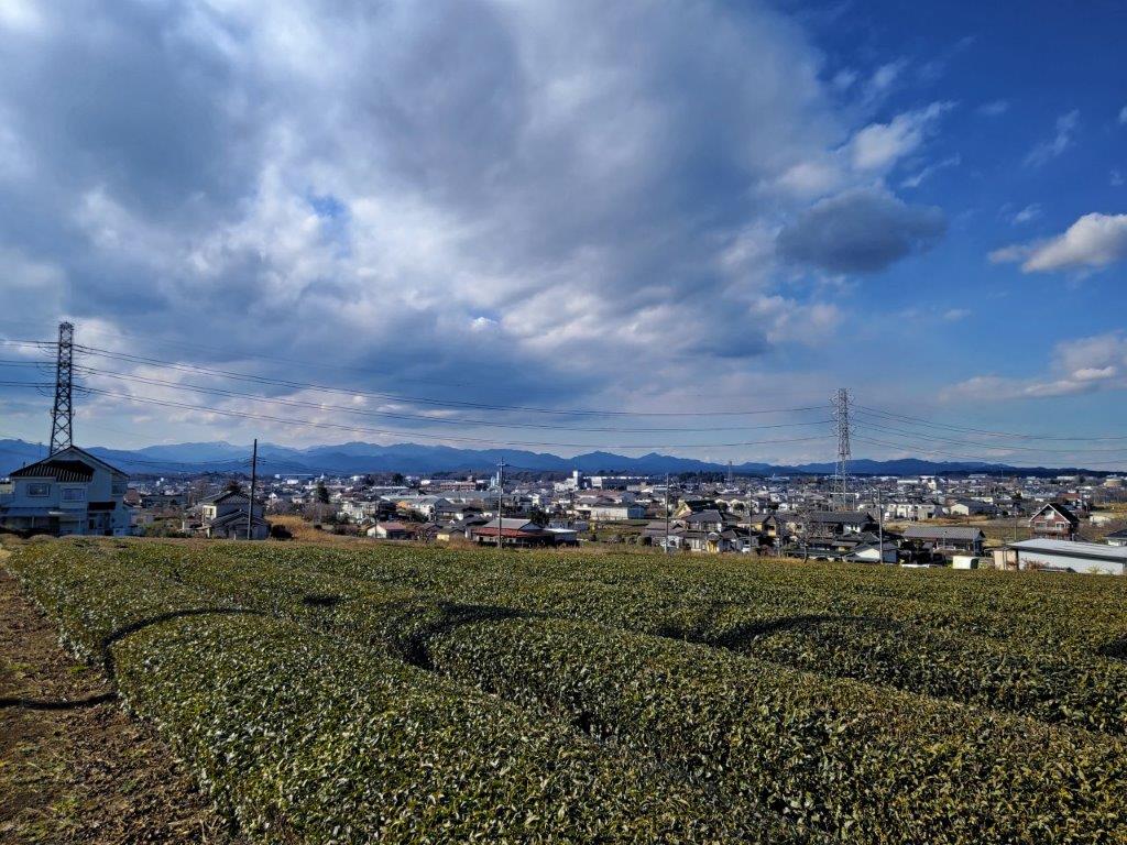
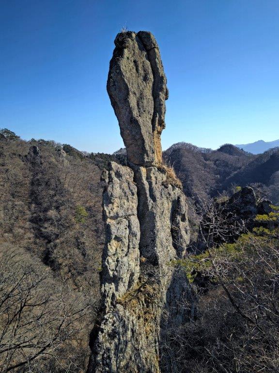
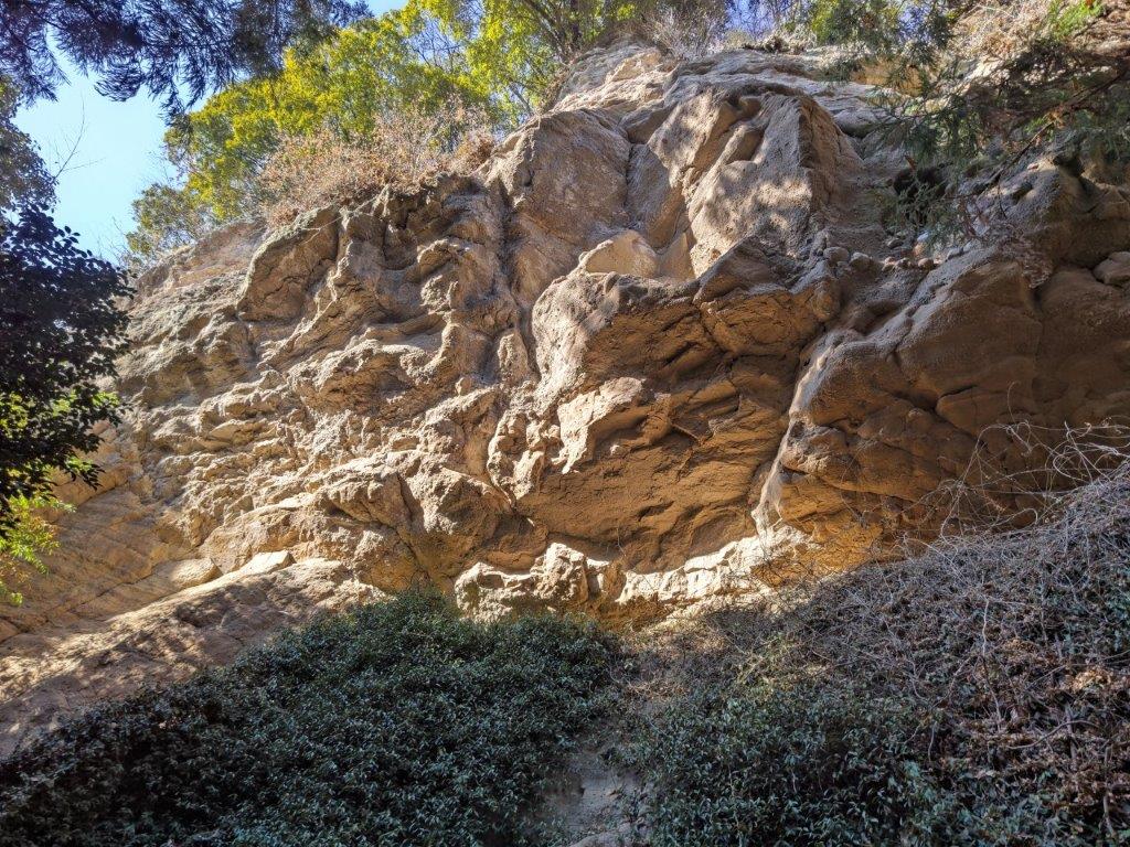
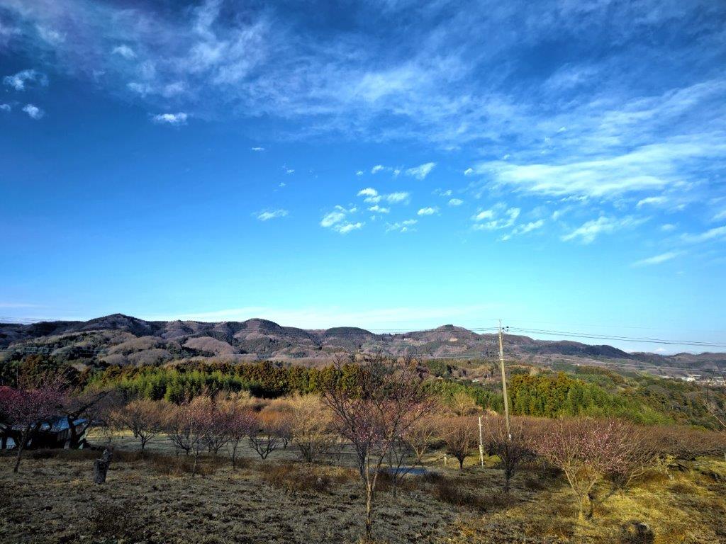
It was a cold, beautiful day as I arrived at the trailhead just before 1am. After a short climb through the forest, I arrived at an impressive rock pillar. After a little bit of scrambling through a rocky section, fitted with a rope for safety, I was standing on Mt Otadaki (男抱山 おただきやま otadaki-yama). From the narrow summit, I had a 360° panoramic view: directly in front was the Kanto Plain, Utsunomiya City and Mt Tsubasa; turning around, I could see the Utsunomiya Alps, snow-capped Mt Takahara, as well as the highest point of today’s hike.

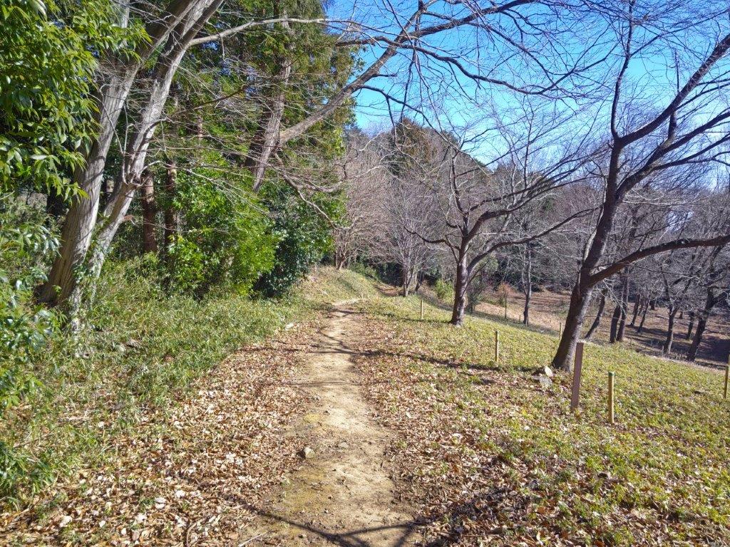
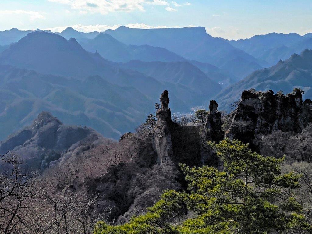
Start of the trail (left) Rock pillar near Mt Otadaki (right)

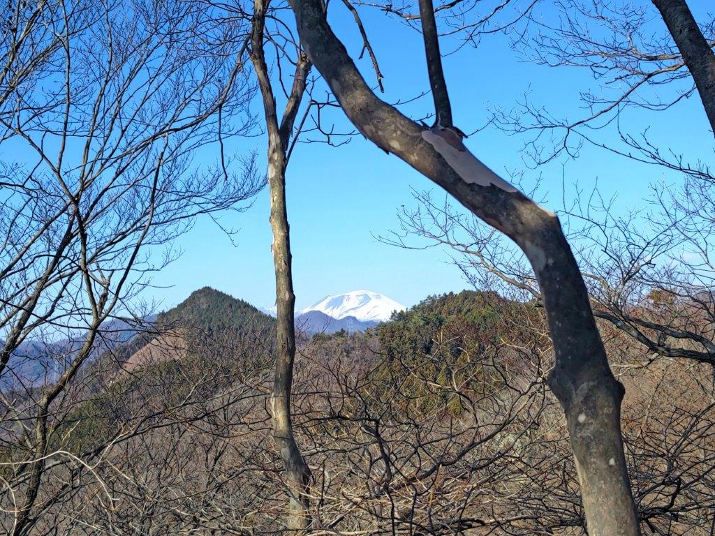
From left to right: Mt Amabiki, Mt Kaba, Mt Tsukuba

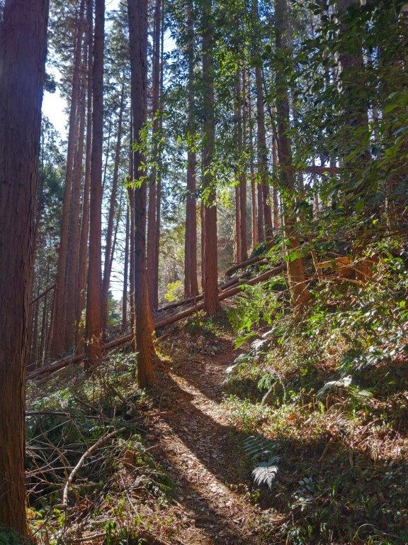
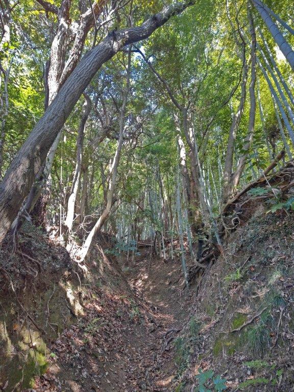
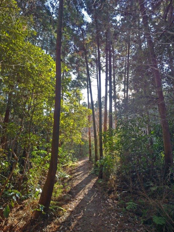
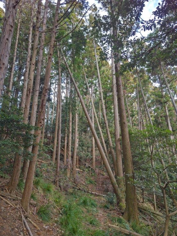
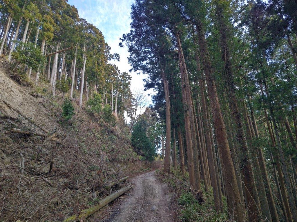
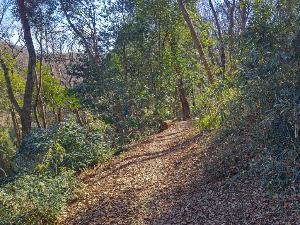
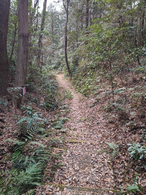
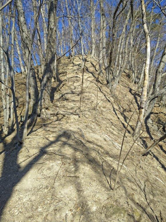
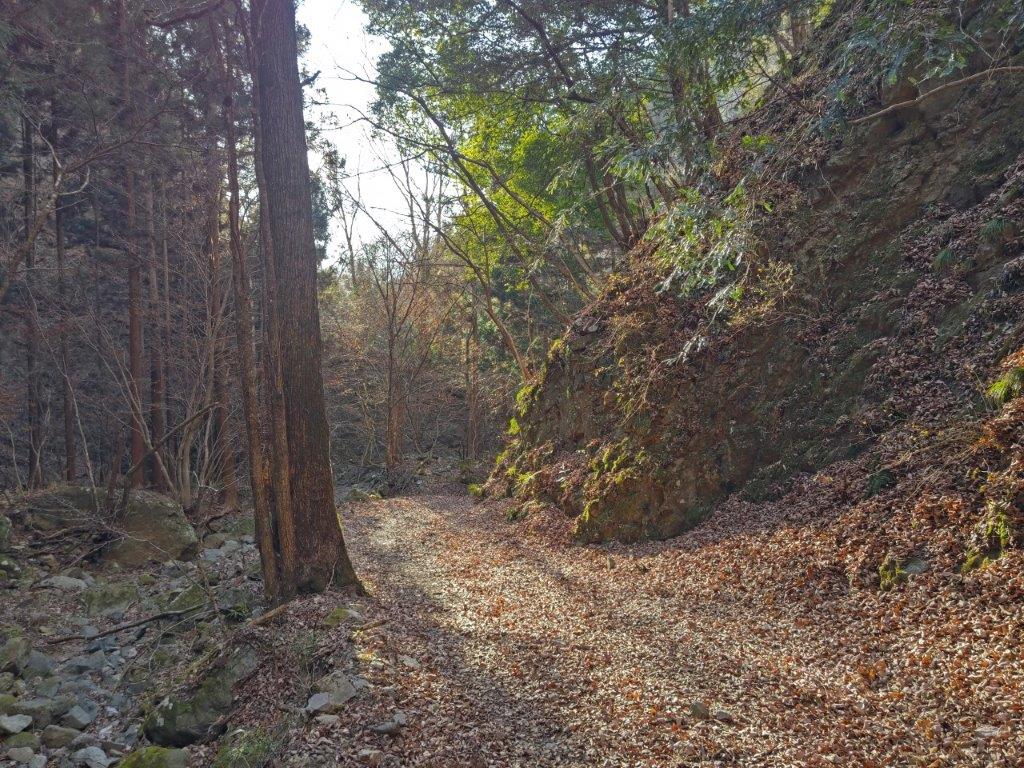
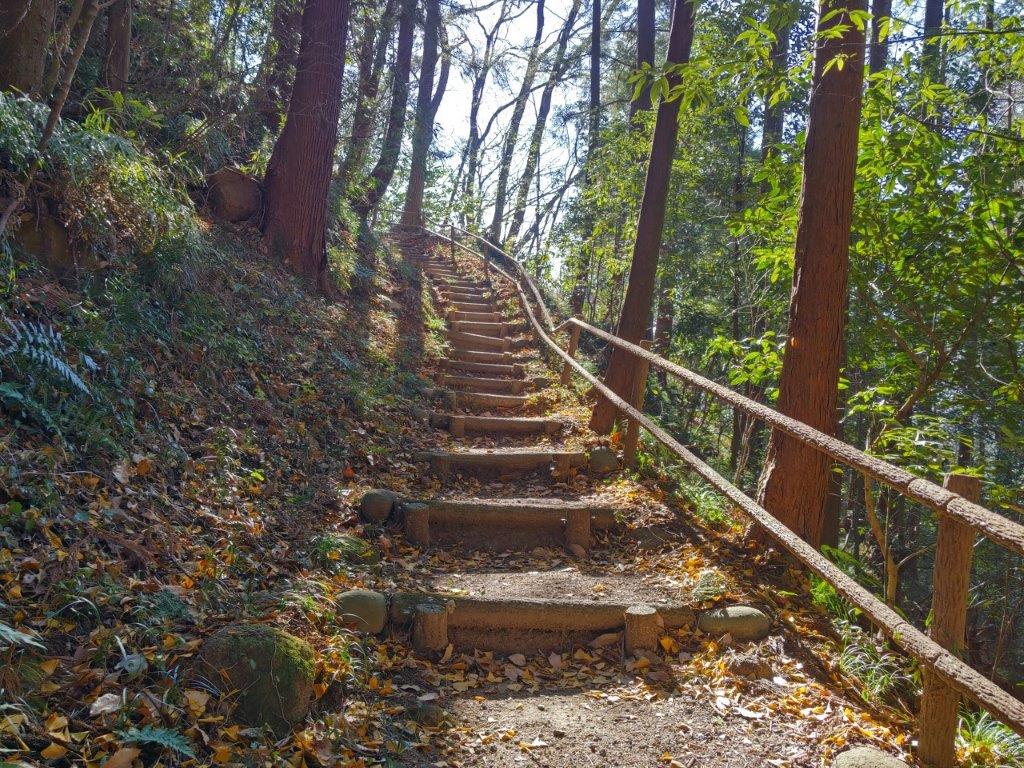
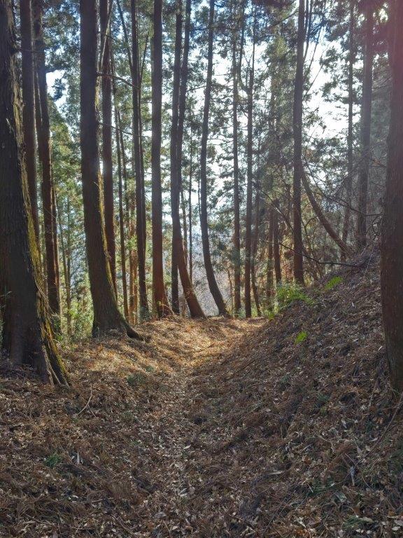
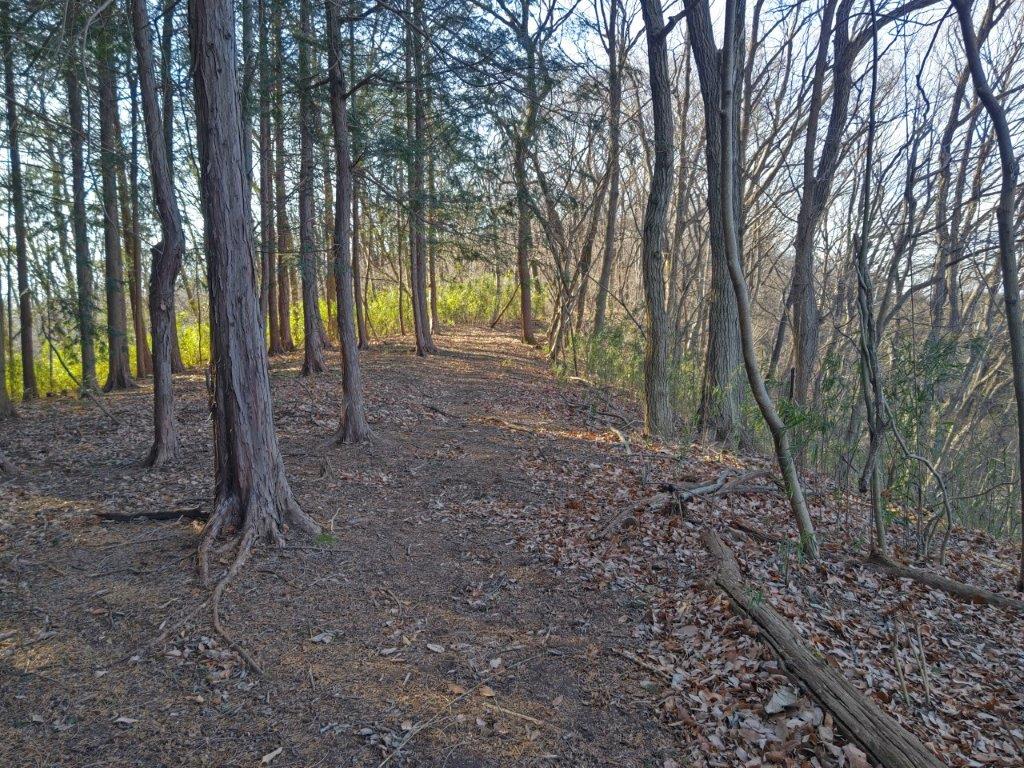
I was amazed by how quickly I could reach this spectacular viewpoint. After a short break, I carefully made my way down the other side of the rocky top. I followed the narrow trail till a junction, where I took the right branch downhill, and then continued along the mostly level trail through quiet, sunlit forest. Soon the path started to climb again, and around 2h30, passed by a huge rock, called Oiwa (大岩), standing firmly in the middle of the trees.

Mt Haguro (left) and Mt Hanzo (right)

View East towards the mountains of Ibaraki

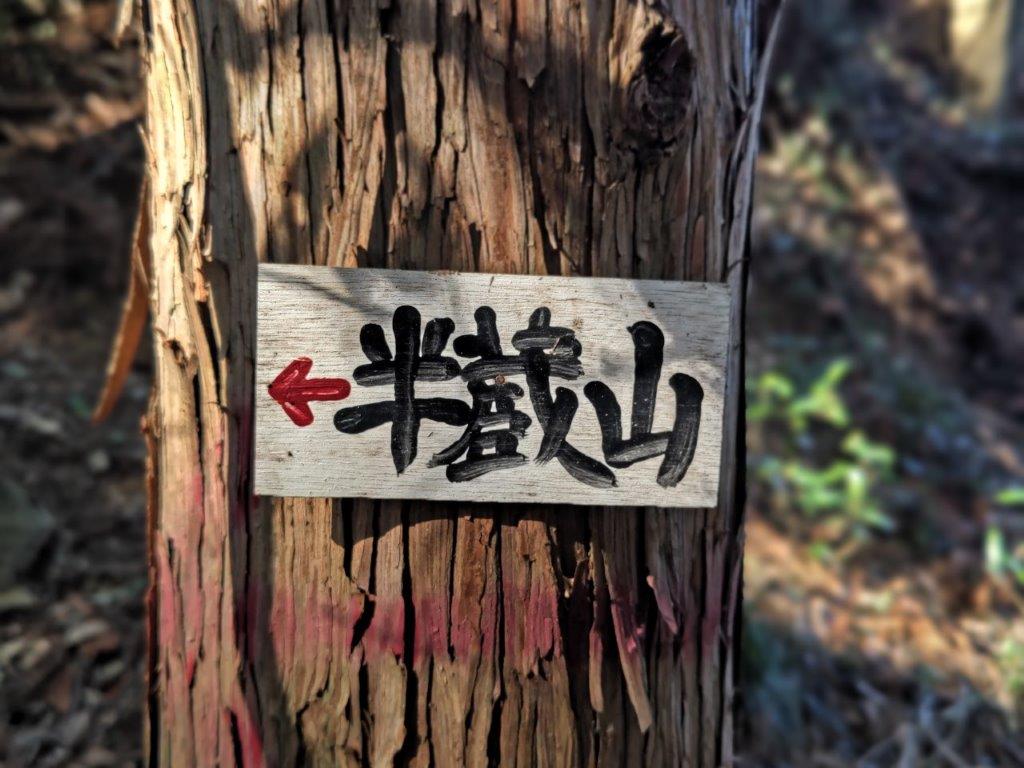
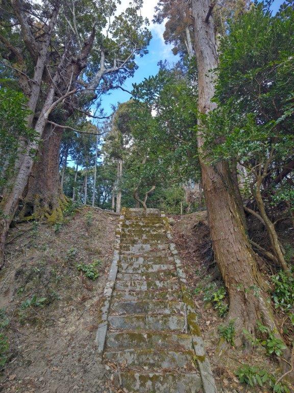
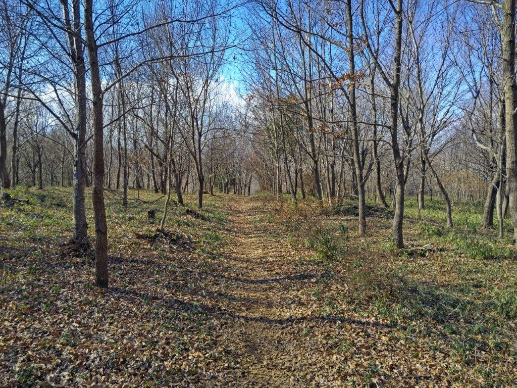
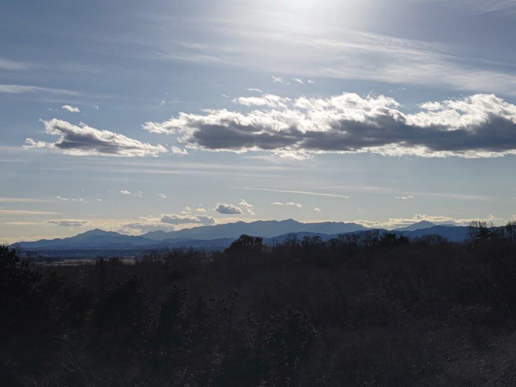
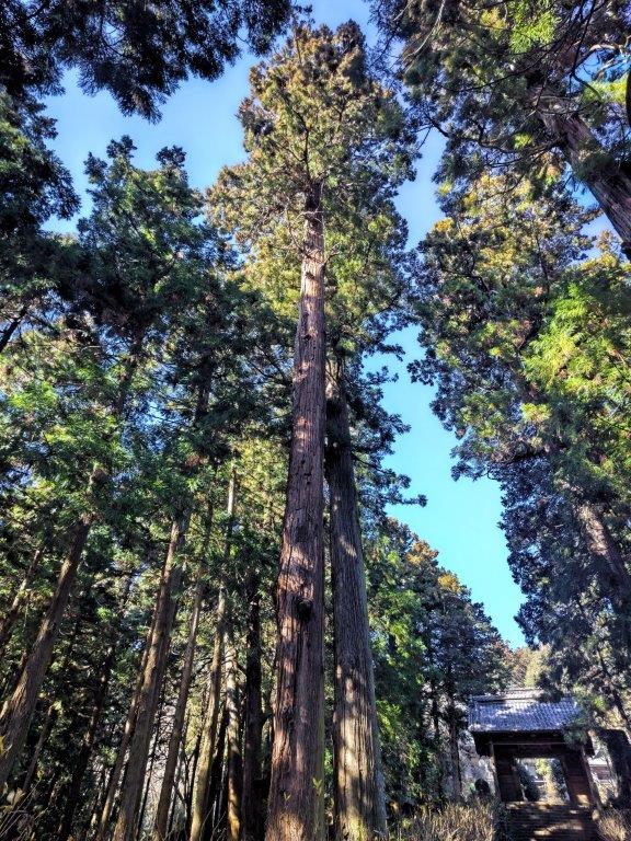
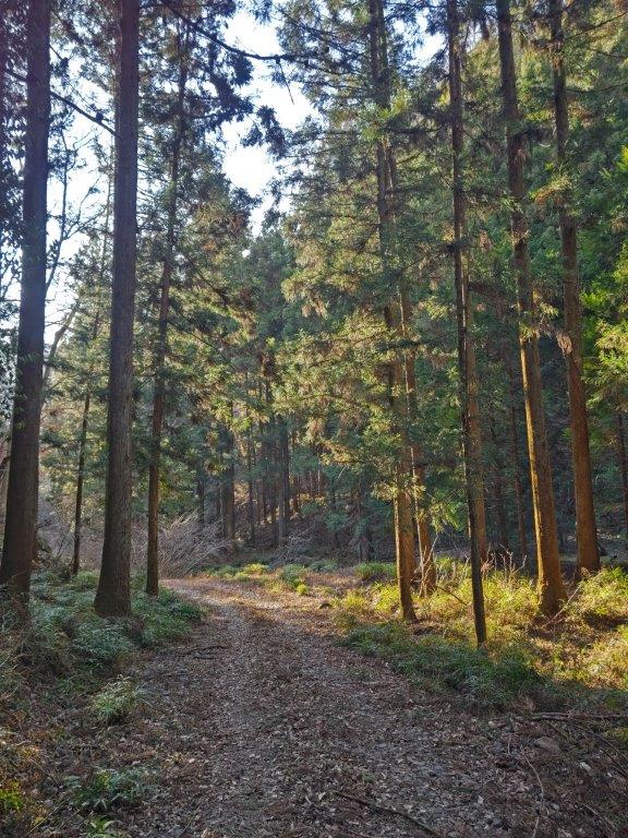
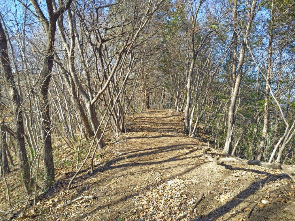
I was surprised by how easy the final climb was, along a gentle sloping forest road through the cedars. Before I knew it, I was on top of Mt Hanzo (半蔵山 はんぞうさん hanzosan), completely in the trees. I decided to continue a few minutes to Hanzo Rock (半蔵岩) where I was rewarded with a grandiose view of the Nikko mountains to the north, half hidden by mysterious misty veils. It was nearly 3pm, so I sat down for a late lunch.

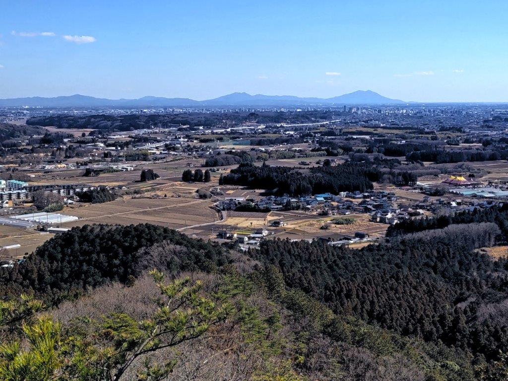
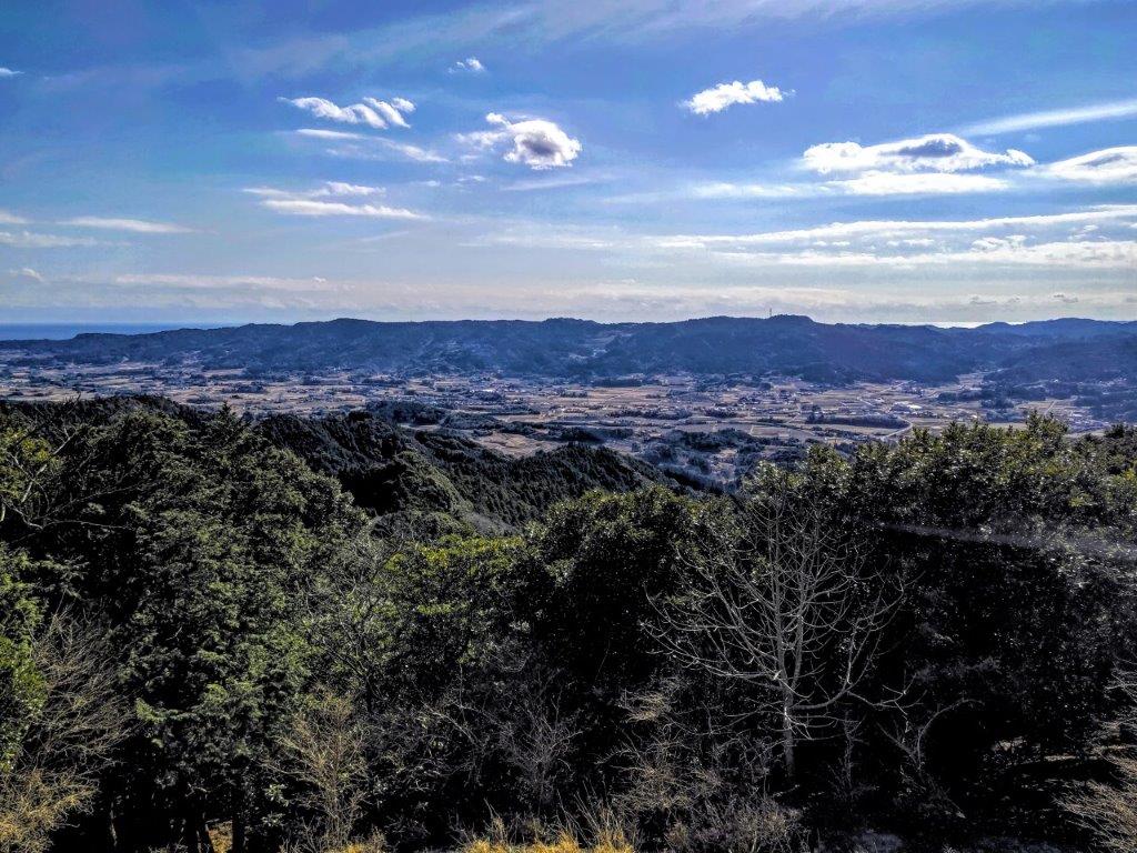
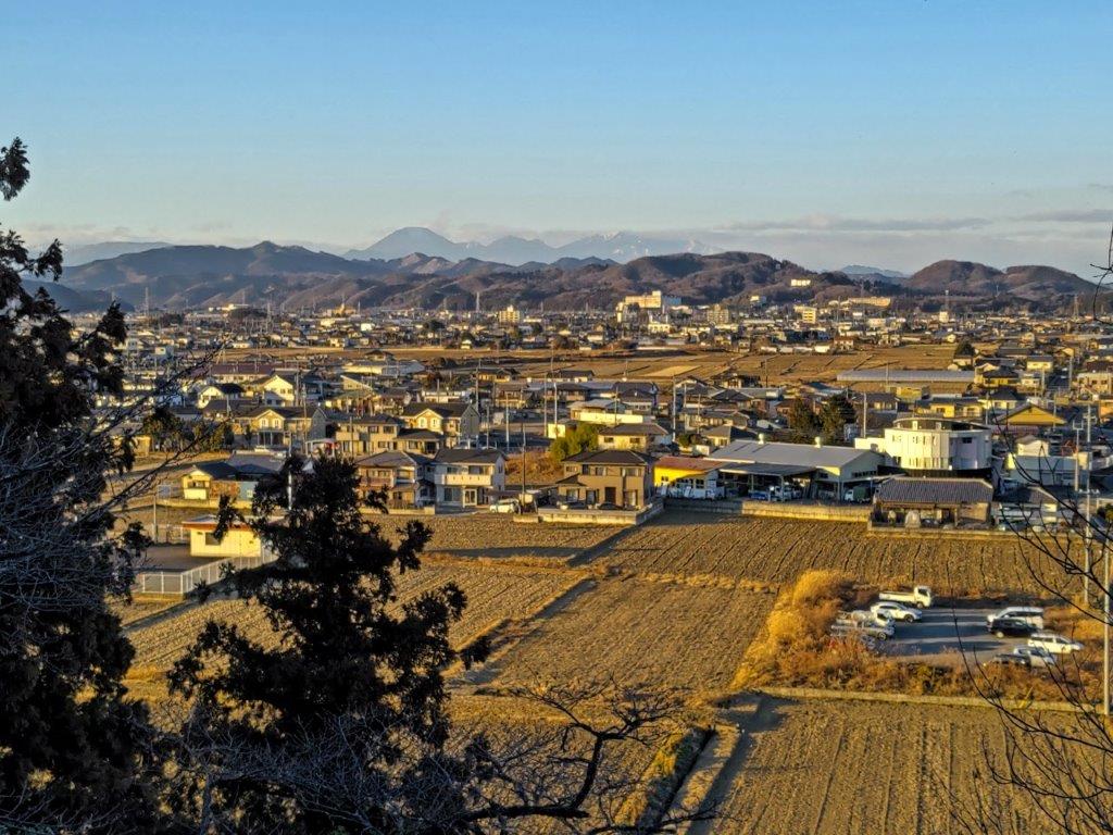
View south of the Kanto Plain

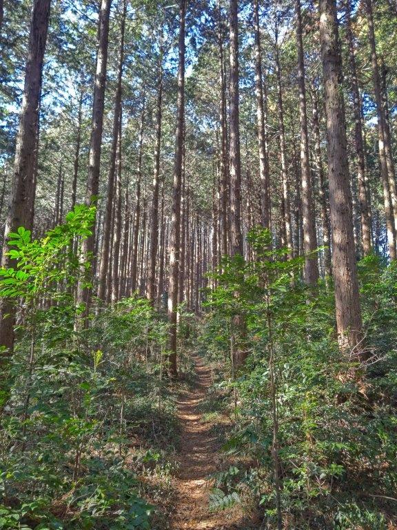
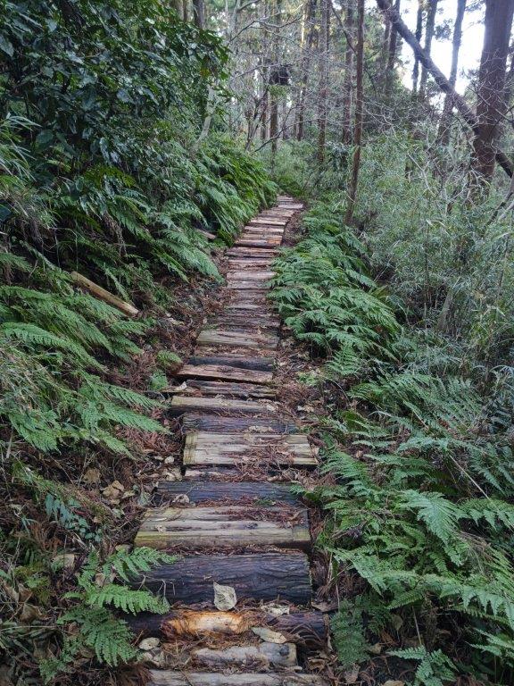
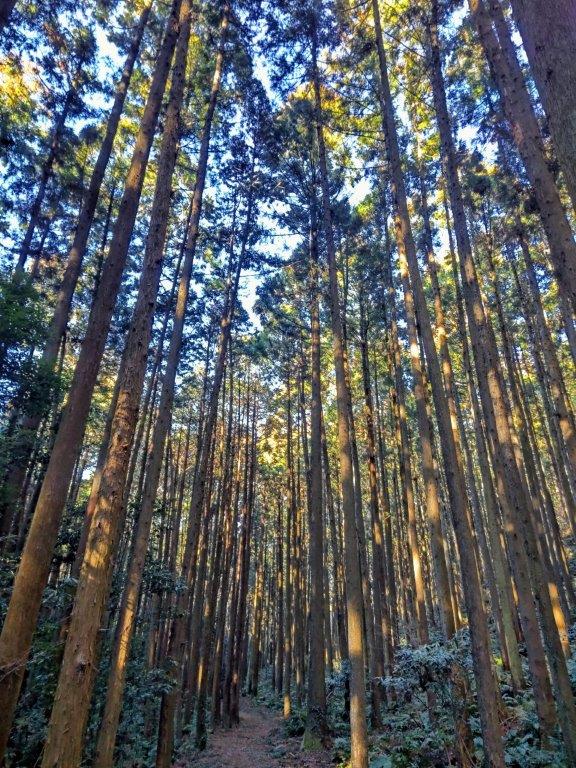
Hiking through the forest to Mt Hanzo

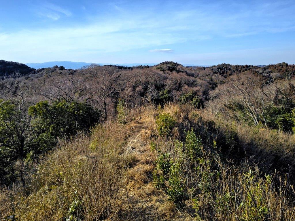
I felt extremely cold all of a sudden, as the wind started blowing from the north. I quickly retraced by steps to the summit and headed down the same way. Less than an hour later, I was back at the previous junction and took the trail on the right, up a short rocky section equipped with rope. At 4pm, I reached the top of Mt Fuji 富士山 ふじさん fujizan), from where I had a view of Mt Tsubasa to the southeast and Mt Kogashi to the west.

View of the Oku-Nikko mountains from Hanzo Rock

Mt Nantai (left), Mt Omanago (center) and Mt Nyoho (right)

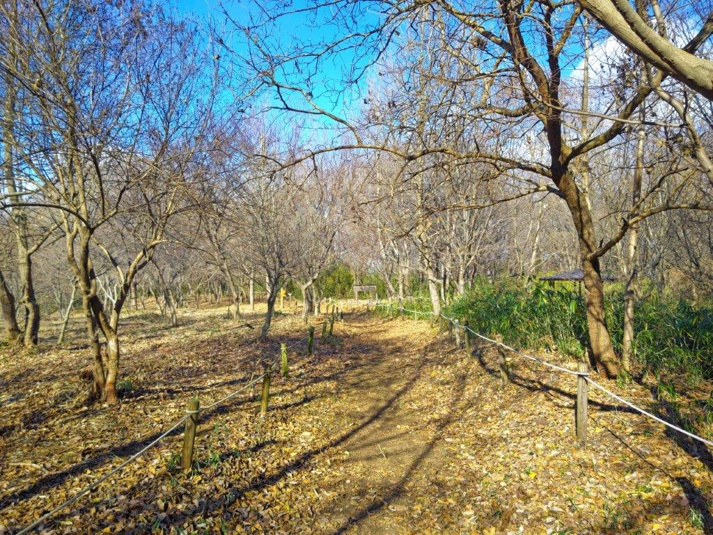
It was a peaceful spot and I wanted to spend more time, but it was getting late and I needed to head down. The trail passed by several viewpoints on the west side before reaching the bottom of the valley and merging again with the start of the hike. At 4h30m I arrived at Tadaomi Onsen, just a few minutes from the trail entrance. After a relaxing hot spring bath , I walked to the nearby Michinoeki Utsunomiya Romantic Village to catch a bus back to Utsunomiya.

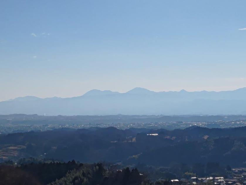
View of Mt Tsukuba from Mt Fuji (of Utsunomiya)

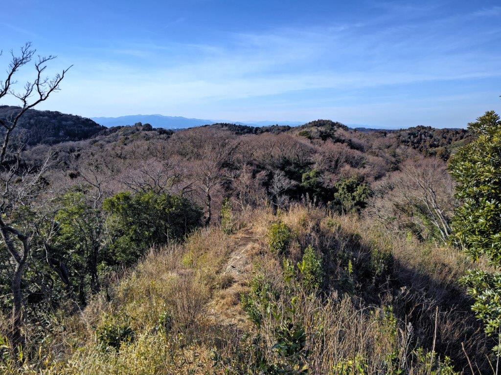
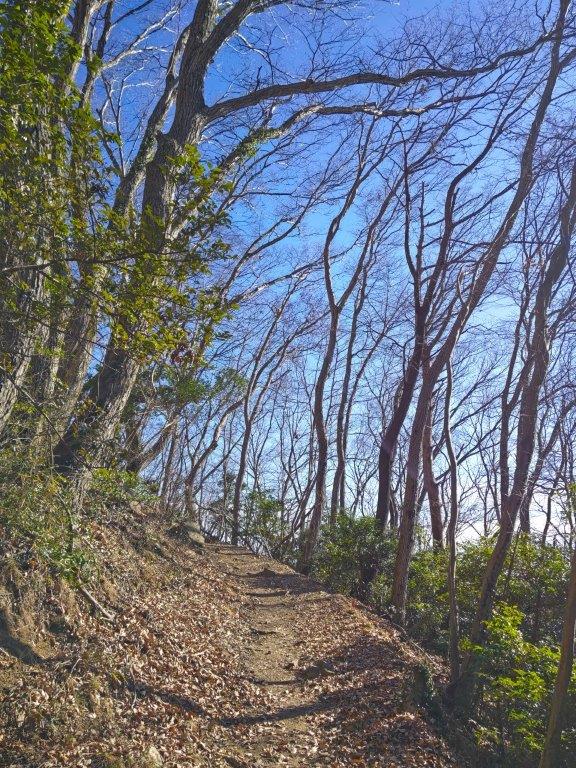
View South on the way down from Mt Fuji (Of Utsunomiya)

This was a relatively short hike, more than half of which was along the same trail, but the easy access, various viewpoints, beautiful forest with few hikers, and a convenient hot spring at the end made it totally worthwhile.

See a video of the Mt Otadaki, Mt Hanzo and Mt Fuji hike

Mt Hatake (205m), Mt Nyuto (202m) & Mt Futako (209m), Hayama Town & Zushi City, Kanagawa Prefecture, Saturday, February 11, 2023

Hiking the Miura Alps 三浦アルプス

I had hiked the Miura Alps four year ago, but looking at my mountains of Kanagawa guidebook, I realised there was more hiking to be done in the area. Previously, I had started on the southwest side and ended on the northeast side. This time, I would start on the southeast side, close to the end of the Mt Ogusu hike, and finish on the northwest side, intersecting only at one point; I could take a bus from Zushi station to the start, and then return by the same bus to the same station. I was looking forward to exploring a new trail through a familiar area, and hoping for some good views on both sides of the peninsula.

View towards Yokohama between Mt Hatake and Mt Nyuto

It was a sunny winter day, as I arrived at Zushi station at around 11am. After a short bus ride, I got off under an elevated highway, near a river and a small fire station. Just after noon, I set off up a small paved road, and soon after reached the trail entrance on the right. Almost immediately, I was walking through bamboo trees, swaying slowly in the wind.

Start of the trail (left) Walking through the bamboo (right)

View of Tokyo Bay through the trees

I was fascinated by the interplay of light and sound, an experience quite unique to this side of the world. At 1230, I exited the bamboo forest and followed a trail up the mountain side. Half an hour later, I reached the top of Mt Hatake (畠山 はたけやま hatake-yama), its summit marker, a simple name plate hanging from a tree branch. On the east side, I had a view of Tokyo Bay and the southern half of the Miura peninsula. After a short break, I moved on.

Short detour along the Nakaone Trail

The start of the Nakaone Trail had good views

I reached another view through the trees, after 30 minutes of mostly level walking; this time I was looking north towards Yokohama. Soon after, I merged with the trail of my previous hike, and at 2pm, was standing on the narrow summit of Mt Nyuto (乳頭山 にゅうとうさん nyuto-san) for the second time. Once again, I had a view on the dark blue wayers of Tokyo bay and the gleaming white skyscrapers of Yokohama. Just below, was a junction and a decided to check out the left branch, the Nakaone trail, off today’s hike.

Tanzawa mountains in the background

On the Nakaone Trail (left) On the way to Mt Futako (right)

I was rewarded with a view on the west side of the Tanzawa mountains, on a treeless ridge, just past a couple of electric pylons. The city was almost invisible and it felt like I was in the middle of the wilderness, despite being just a few kilometers from the biggest city in the world. I found a spot to sit for quick lunch break. At 3pm, I was back on the main trail, and a little after, I took a right turn, leading away from Higashi-Zushi station and Mt Takatori.

A relatively easy trail to walk

View of Mt Ogusu from the top of Mt Futako

I was now walking along the most peaceful section of the hike, invisible squirrels scampering along the tree branches, soft light filtering through the leaves. At 4pm, the trail merged with a gravel road winding up hill side. A few minutes later, I reached a wooden observation platform on top of Mt Futako 二子山ふたこやま futako-yama), a common name meaning “twins”. I had a wide view on the east side, including Yokohama City, Tokyo Bay, and the Miura Alps on the south side. The sun was setting soon, forcing me to continue moving.

View of Enoshima Island from near the top of Mt Abekura

Trail near Mt Futako (left) Heading down from Mt Abekura (right)

I hurried down the steepest section of today’s hike, fitted with rope for safety, surprising on such a low mountain. Soon the narrow path climbed again, and half an hour later, I reached the top of Mt Abekura (161m 阿部倉山 あべくらやま). It was a minor peak, slightly off the trail, but with a viewpoint of Sagami Bay and Enoshima island on the west side, the sky behind lit orange. It was called Sakura Terrace, and although the trees were bare, it must be beautiful in the spring. I made my way down and arrived at a road just after the 5pm chime. From the nearby bus station, it was a short ride back to Zushi, where I caught the Shonan-Shinjuku line for the one hour trip to Tokyo.

See a video of the Mt Hatake, Mt Nyuto and Mt Futako hike

See a slideshow of more pictures of the hike

Mt Awataka (364m) & Mt Shouu (320m), Kamogawa City, Chiba Prefecture, Sunday, February 5, 2023

I wanted to do a hike on the Boso peninsula, since winter is the best time for hiking there and my last trip to the area was nearly a year ago. I found a suitable hike in my mountains of Chiba guidebook, close to Kamogawa city on the Pacific Ocean, but accessible from the Tokyo Bay side. I could take the limited express from Akihabara to Hota station, from where it was a short bus ride to the start of the hike; I would return the same way. The weather was supposed to be mostly sunny with mild temperatures, and so I was looking forward to seeing the views of southern Boso and the Pacific Ocean.

The Kanaya bus line between Hota and Awakamogawa station was discontinued in March 2024 and this hike can only be accessed via the less convenient Kizarukamogawa line.

View from Atago Shrine of Mt Atago

Hiking between Mt Awataka and Atago shrine

I had a perfect view of Mt Nokogiri under light blue skies, after getting off at Hota station, a little before 10am. I had some time before my bus so I went to check out the view from the nearby Hota Beach: I could see Oshima island and the Miura peninsula, but Mt Fuji was hidden in the clouds. I rode the nearly empty bus to a 7/11 at an intersection, and after getting ready, set off a little after 11am.

Climbing through the cedars at the start of the hike

First view of the day, halfway up the mountain

I had good views of the east-west ridgeline of today’s hike, as I walked north along a road, which started to rise gently after crossing Kamogawa River. Half an hour later, I reach the start of the hiking trail on the right. It was relatively easy to follow the trail, but several fallen trees made it harder to walk; apparently, there had been little maintenance since the powerful typhoons of 2019.

View towards Kamogawa City and the Pacific Ocean

Mt Takago (foreground) and Mother Farm (background)

Halfway up, I had my first view of the day: through a gap in the trees, I could see Mt Atago. Around noon, I emerged onto a forest road, the Takayama Line (林道高山線), hugging the south side of the top ridge. I turned right and soon reached the entrance of the trail for today’s mountain. After a short climb, I was at the top of Mt Awataka (安房高山 あわたかやま awataka-yama). It was mostly in the trees, but I could see Mt Takago and Mother Farm on the north side; a few meters in the other direction, was a better view on the south side.

Mt Atago is the highest mountain in Chiba prefecture (408m)

Walking on the Takayama forest road

I had a view of the long east-west ridgeline on the other side of the Kamogawa river, as well as of Kamogawa City and the Pacific Ocean; on the way up, I had a glimpse of Tokyo on the east side, so I glad I had been able to see both during this hike. Since it was nearly 1pm, I found a place to sit and had lunch. Afterwards, I went down the same way. Back on the forest road, I turned right, heading west, and soon took another trail uphill. The first part was a little damaged, but beyond, it was easy to walk, with few trees and with a wide view of the valley below.

Hiking trail above the forest road (left) Stairs leading to Atago shrine (right)

One of the best views of the day from near Atago Shrine

This was by far the best section of today’s hike; it felt like I was hiking at a much higher elevation; looking eastwards, I could see Mt Iyo and Mt Tomi., both climbed in 2015. A little before 2pm, I reached a steep staircase below Atago Shrine (愛宕神社), also the top of Mt Shou (請雨山 しょううさん shouu-san). It was completely in the trees; I followed the ridgeline a few minutes northwards, but failed to find any views. I walked back down the steps, and continued along the trail, now heading down via some steps.

View Southeast of Kamogawa

View Southwest of Mt Iyo and Mt Tomi

I followed the narrow, forested ridgeline westwards, typical of the area. In no time, I was back on the forest road. The ridge trail continued to the next peak, Mt Migoori, but that would be for another time. I turned left and soon reached a junction, where I took the right branch, heading downhill. At 2h30, I was on the main road again, near the start of the morning trail, and by 3pm, I had was back at the 7/11.

Back on the Takayama line

I checked out a nearby store for Kameda sake Brewery, since I had some time before the return bus. At Hota station, I caught the limited express for the comfortable 90 minute ride back to Tokyo. Although the hike had taken less than 4 hours, I had been rewarded with some news, and some ideas for the futures hikes in the area.

The rice fields of Kamogawa

conclusion

Watch a video of the Mt Awataka hike

See a slideshow of some more pictures of the Mt Awataka hike

Mt Rokudo (194m), Tokyo & Saitama Prefectures, Sunday, January 29, 2023 [Sayama Lake Perimeter Road]

I had cycled the Sayama Lake Perimeter Road over ten years ago, so I thought it was time to revisit the area, but on foot this time; I wanted to explore the network of hiking paths surrounding this circular trail on the Tokyo-Saitama border, and the closest nature park to the capital. Previously, I had taken a train to Seibukyujomae station, near the eastern end of Sayama lake; however, the best trails are located several kilometers away on the western side. I decided to take a train to Kotesashi station on the Seibu line, and then a bus to Kojiya, on the northern side of the lake; I would finish at Hakonegasaki station on the Hachiko line and return via Hanno, from where I could return to Ikebukuro with the Laview Limited express. In between, I didn’t have a precise plan: my main purpose was to see whether I could get a satisfying half day of hiking through the area.

Hiking in the Sayama Natural Park 都立狭山自然公園

5/2024 update:some paths between the Saitama Green Forest Museum with the Sayama Lake Perimeter Road are closed indefinitely due to fallen trees. Please see this page (Japanese only) for more information (closed sections are in red).

Walking between the Tonbo and Nishikubo Marshes

View of Mt Fuji from the Mt Rokudo Park Observatory

It was a short bus ride from the station on a sunny winter day. Before setting off, I dropped by a nearby Ministop, one advantage of hiking within the city. At 12h30, I was walking through a residential neighbourhood, the houses separated by fields: I even saw a fox trot through one of them. I soon arrived at the peaceful Kojiya Hachiman Shrine (糀谷八幡神社) at the edge of Kojiya Marsh 湿地, and the start of the hiking trails.

Kojiya Hachiman Shrine near Kojiya Marsh

Heading towards the Saitama Green Forest Museum

I had a view of the Chichibu mountains, clearly visible on this cold winter day, from behind the shrine. I followed the gently sloping path up to the Sayama Lake Perimeter Road, but almost immediately took a side path leading directly to the Saitama Green Forest Museum (緑の森博物館), a small, free museum at the edge of Dragonfly Marsh (トンボ湿地), also the location of Totoro’s Forest #30.

Walking along the Sayama Lake Perimeter Road

Exploring the paths around the Nishikubo Marsh

I had a view to the north of faraway Mt Akagi, covered in snow, from an open, elevated space behind the museum. I set off again through the marsh and soon arrived at a intersection, where I turned right. This new path led to Nishikubo Marsh (西久保湿地), not much to look at in the middle of winter, but probably a great place to wander around in summer. I made a quick detour along a backstreet to check out the nearby Nishikubo-Kannon Temple.

Intersection at the edge of the Nishikubo Marsh

View towards the mountains of western Tokyo near Nishikubo-Kannon

From there, I had another view of the mountains of western Tokyo, extending northwards; the clouds had started to roll in, making me wonder how much longer the sun would last. I reentered the woods and after a long, gradual climb, arrived once more at the Sayama Perimeter Road (狭山湖外周道路), which I followed for a short while, before turning right onto the ridge trail for Takane (高根). However, I very soon took a left, heading down some steps.

Path for Yato 谷戸 (left) / Staircase for Asama Shrine (right)

Walking through the North Sayama Valley

I followed a narrow path next to a brook through the North Sayama Valley (北狭山谷); it soon turned into a wider path, ending near some ponds at Tanoiri-Yato (田ノ入谷戸). I was now inside Noyamakita-Rokudoyama Park 野山北六道山公園. I left it briefly to follow a road leading to Takaneyama park (高根山公園), from where I walked up the Takaneyama Walking Trail, and upon reaching a road, continued till the Rokudoyama Park Observatory (六道山公園 展望台), on top of Mt Rokudo, a Tokyo 100 famous mountain.

Heading towards the Triangulation Point

View of the Tanzawa Mountains from the Mt Rokudo Park Observatory

From the top, I had a view southwest of Mt Fuji and the Tanzawa mountains, and west of the Okutama mountains. After a short break, I retraced my steps, then took a left over a bridge, arriving at a triangulation point (194m) at 3pm. I took the Oiseyama Walking Trail, past Mt Atago (190m 愛宕山). I soon reached the tiny Asama Shrine (浅間神社), and went down a wooden staircase, ending at another shrine, and the end of the trail. After a 15 minute walk through Mizuho Town, I reached Hakonsegaseki station around 4pm.

Watch a video of the Mt Rokudo Hike

Sakura Pass (268m), Tochigi City, Tochigi Prefecture, Saturday, January 21, 2023

I passed by this spot while hiking Mt Ohira and Mt Teruishi in 2017, and was impressed by its wild beauty at the edge of the Ashio mountains. Since it’s also the intersection with the Fureai no Michi, I felt sure I would return one day. The trail had been damaged during the powerful typhoons of 2019, but was now open again. I had done the previous section of the Fureai no Michi, while hiking Mt Karasawa and Mt Suwa in 2018, so I decided to take a bus from Iwafune station on the Ryomo line, to a stop close to Murahi Shrine, at the end of that hike. From there, I planned to walk to Tochigi station, 15 km away. I was looking forward to revisiting the area after several years via a new route, and hoping to see some plum blossoms and other winter flowers along the way.

Hiking the Fureai no Michi ふれあいの道

View of the mountains of Tochigi and Gunma from Sakura Pass

The weather was sunny but very cold at 9am, as I waited for the minibus outside Iwafune station. It took nearly an hour to reach a bus stop in the middle of the fields, from where I walked up a road running through a golf course, eventually merging with the Fureai no Michi. At 10h30, I reached the top of a hill and continued along the road down the other side, reaching the head of a valley soon after.

Start of the valley leading to Sakura Pass

I was delighted by the surrounding bucolic landscape, and tried to imagine what it would look like in spring. A little after 11am, after passing some early plum blossoms, I reached a trail near a series of small lakes. First, it rose gradually through the cedars, then more steeply up some wooden log steps through the bamboo grass, before arriving at the intersection at Sakura Pass (桜峠 さくらとうげ sakura-toge). Turning around, I could see Mt Suwa in the foreground, with Mt Akagi rising behind, its highest peaks covered in snow.

Climbing towards the pass (left) Descending from the pass (right)

I followed a pleasant path through the woods down the other side of the pass, arriving at Seisuiji Temple just before 1230, its many suisen (daffodils) and robai (Japanese Allspice) swaying in the wind that had started to blow; to the right, the Kanto plain stretched southwards. The next section was mostly level, through the forest at the base of Mt Teruishi. A little after 1pm, I reached Daichuji Temple, towering cedar trees lining the approach to the main building.

Final steps before reaching Sakura Pass

Snow on Mt Akagi in the background

I now headed up a steep, rocky path near the back of the temple, a shortcut, as the Fureai no Michi made a loop via Ohirashita station. Half an hour later, I reached Ohirasan Shrine. I had been here before when I climbed Mt Ohira, so I soon moved on. A little further, I arrived at another part of the shrine I hadn’t been to before, from where I had a view of Mt Kogashi, Mt Takahara and Tochigi city on the east side.

Level trail between Seisuiji and Daichuji Temples

Towering cedars at Daichuji Temple

I was once again walking on a quiet path, back on the Fureai no Michi, heading down the forested mountain side. A little before 3pm, I reached the western edge of Tochigi city. I noticed a soba shop along the way and decided to check it out since it was still early. I was glad I did, since it had a terrace so I could enjoy my meal, a generous serving of soba noodle and a giant, crunchy Kakiage, with a view of Mt Tsubasa and the Ogodo Alps in the east.

Looking through the gate into the main compound of Daichuji Temple

Walking up to Ohira-jinja (left) Walking down from Ohira-jinja (right)

I was also lucky to see a picture taken by the owner just this morning of the sun rising directly behind the highest point, that happens just once a year (“Diamond Tsubasa”). At 4pm, I set off again and after crossing Nagano river, reached Kinchaku Park, also known as Mt Kinchaku (80m). From the top, I had a view of Mt Nantai and Mt Nyoho on the north side, Mt Tsubasa on the east side, and Mt Ohira, against the setting sun, on the south side.

View of the Kanto plain from Ohira-jinja Shrine

View of Mt Nantai from Mt Kinchaku

The sky was lit up in orange when I finally reached Tochigi station around 5pm. There, I boarded a Tobu limited express for the one hour ride back to Tokyo. With a total time of 7 hours, this was one the longest hikes I had done in a while, although it was mostly level, with two relatively short climbs. This was one of the better sections of the Fureai no Michi, as roughly half was along hiking trails, with several viewpoints and interesting shrines and temples along the way.

See the video of the Sakura Pass hike

See a slideshow of more pictures of the Sakura Pass hike

Mt Mido (878m), Shimonita Town, Gunma Prefecture, Monday, January 9, 2023 [Map Available]

After my Annaka to Annaka hike, I needed to find another mountain I could climb in the winter using the Tokyo Wide Pass. I decided to visit the Nishi-Joshu area, since my last hike there was nearly 3 years ago. I found a suitable peak in my mountains of Gunma guidebook, low enough to be still free of snow, and short enough so I could catch the mid-afternoon bus back. To give myself some extra time, I would get to Shimonita station an hour before the morning bus and take a taxi to the trailhead. Although the hike went up and down the same path, I could check out a couple of viewpoints on the way, as well as this peak’s claim to fame: two tall rock pillars perched on the mountain side. I was looking forward to revisiting Nishi-Joshu after a long interval and getting some new views of the area.

Hiking with the Tokyo Wide Pass

“Old Man Old Woman Rock” the highlight of the hike

Get a map of the Mt Mido hike

This map was developed for Japanwilds with the Hokkaido Cartographer

Find more Japan hiking maps on Avenza

View of flat-topped Mt Arafune from Jijiiwa-Babaiwa

I rode the shinkansen to Takasaki on a sunny, cloudless day and then transferred to the Joshin line for Shimonita, arriving there a little after 10am. It took about ten minutes by taxi to reach the trail entrance, and after getting ready, I set off along a forest road through the cedars. I soon passed the end of the forest road, and by 11am, was walking up a rocky valley; I was finally starting to warm up, thanks to the sun, shining through the bare trees.

Walking among the cedars (left) Mi-n0-Taki waterfall (right)

View of Mt Myogi from the summit

I was extra careful to check for hidden holes, the path being covered in a layer of dead leaves. At 11h30, I reached Mi-no-Taki waterfall, barely a trickle at this time of year. It was also the trickiest part of the hike, requiring a quick scramble up a rocky face, fitted with a rope for safety. Next, a short, steep climb brought me to an intersection at the top of the valley. Here, I dropped my pack and headed left for the short roundtrip to the first viewpoint.

Steep section at the top of the valley (left) Old Woman Rock (right)

Looking down at Jijiiwa-Babaiwa from the second viewpoint

I followed a narrow ridge passing by the base of a rocky outcrop, and after a few minutes, reached a level, rocky ledge, opposite “Jjji-iwa Baba-iwa” (じじ岩ばば岩) meaning “Old man rock old woman rock”), two impressive stone pillars perched at the end of the ridge. Turning around, I had a bird’s-eye view of a deep valley, with flat-topped Mt Arafune in the background. Since it was nearly noon, I found a spot to sit and had an early lunch. After enjoying the view, I made my way back to the intersection and continued along the right branch.

Looking south towards the Mikabo Super forest road

View southeast of Mt Ogeta

I was surprised by how dry everything was, dust flying up from the trail at every gust of wind. After some more climbing along the narrow, twisting ridgeline, I reached the summit of Mt Mido (御堂山 みどうやま mido-yama), a Gunma 100-famous mountain, a little before 1am. It was mostly in the trees, but I could make out the jagged summit of Mt Myogi, as well as the snowy top of Mt Asama, both on the north side. After a short break, I retraced my steps to a turn-off for the nearby “Jitoba-ura-tenbosho”, the rear viewpoint of the stone pillars.

Climbing the narrow ridgeline (left) Walking back along the forest road (right)

Late afternoon light filtering down into the deep valley

Standing next to a rocky outcrop, I had a fantastic view of “Jijiiwa-babaiwa”. I continued a little further to the end of the path, where I had a view of Mt Ogeta and the Kanto plain on the west side, and Mt Akaguna and the Mikabo Super forest road on the south side. I found a place to sit and finished the second half of my lunch. It was now past 2 pm so I quickly made my way back down the same way, carefully navigating the descent down Mi-no-taki waterfall, reaching the bus stop just in the time for the 3h30 bus. Back at Shimonita, I boarded the Joshin line for the one-hour trip back to Takasaki, where I transferred to the Shinkansen for Tokyo.

See a video of the Mt Mido hike

Mt Sekison (571m), Annaka City, Gunma Prefecture, Saturday, January 7, 2023

I wanted to use the Tokyo Wide Pass for the long first weekend of 2023. I searched my maps for some low-altitude mountains near a shinkansen station and finally found a series of minor summits, part of the Annaka Alps, north of Annaka-Haruna station, one stop from Takasaki on the Hokuriku line. I had often passed through this station on the way to and from Karuizawa, so I was glad for a chance to finally get off there. The hike through these hills was relatively short, but could be extended by following the Kanto Fureai no Michi, as it headed south from Mt Haruna. Upon reaching a road, I could catch a bus back to Annaka station on the Shin-Etsu line, therefore completing an “Annaka to Annaka hike” of my own creation.

Hiking with the Tokyo Wide Pass

Hiking the Kanto Fureai no Michi 関東ふれあいの道

Hiking the Annaka Alps 安中アルプス

View of the hike from Kanbai Park

I reached the Annaka-Haruna at 11am on a sunny winter day and was stunned by the clear view of Mt Myogi from outside the station. Half an hour later, I was walking up a road on the north side, and soon spotted a signpost for a trail on the right. I followed a narrow path as it went through a bamboo forest, then merged with a forest road, before reaching a parking lot at the end of a paved road. On the other side, the trail continued up a series of log steps through beautiful forest.

View of Mt Myogi from Annaka-Haruna Station

Start of the trail leading to the “47 statues”

I suddenly found myself walking under a cliff, and felt nervous about rockfall, something I hadn’t expected on today’s hike. I had arrived at a historical site called “The statues of the 47 loyal retainers of Ako-Gishu” (赤穂義士四十七士石像), in memory of the 47 Ronin. After quickly confirming that there were indeed 47 statues along the base of the cliff, I set off again, up a steep trail winding around the back of the rocky outcrop.

A log staircase going up through sunny forest

The trail passes near the base of a rocky outcrop

As I neared the top, I stepped into a hole hidden by dead leaves and banged my knee on a rock; fortunately, it was more fright than harm. A few minutes later, I reached the summit of Mt Goten (御殿山 400m); it was completely in the trees so I soon moved on. I followed a mostly level trail through a dark cedar forest till it ended at a dirt road. Using my map, I quickly picked up the trail again, as it led to the top of a hill.

The hike alternated between sunny and shady sections

Hiking through the winter woods

I was now walking on a sunny level path, with glimpses of Mt Haruna on the north side, through leafless trees. At 1pm, I arrived at the summit of Mt Sekison (石尊山 せきそんさん sekison-san), a gunma 100-famous mountain, and rested on a bench with a narrow view to the south. After lunch, I followed a path down the other side, and after crossing a road, walked up the next hill. I soon passed the summit of Mt Toya (605m 戸谷山 とややま), in the trees, and headed down the other side, arriving at the Kanto Fureai no Michi at 2pm, where I turned left.

Most of the trail was easy to walk

The entire hill range is known as the Annaka Alps

I followed a pleasant trail, downhill through sunny forest, with occasional views of the Joshu mountains, reaching a road and a bus stop at around 3pm. I decided to check out the Akima Plum Grove (秋間梅林), a short distance away. From the highest point of Kanbai Park (観梅公園), I was rewarded view of the hills I had just hiked, as well as some early pink plum blossoms. I followed a different path through the park back to the road. There, I got on a bus for Annaka station, just 3 stops from Takasaki station, from where I could catch the shinkansen for the 40-minute ride to Tokyo.

See the views along the Mt Sekison hike

See more pictures of the Mt Sekison hike