

I was looking for a relaxing hike for my first outing of the year. I found inspiration in a manga I had recently started reading called “The Climber“; it featured a mountain I knew from my hiking guide, but hadn’t attempted yet, as it seemed too short for a day trip. Using Google Maps, I discovered trails extending in several directions from the summit, along narrow forested ridges, similar to the ones I had previously hiked north of Kamakura. I decided to start from Keikyu-Jinmuji station and finish at Keikyu-Taura station, crossing the neck of the Miura Peninsula from west to east. The weather was supposed to be cold and sunny, typical for this time of the year. I hoped to enjoy a nice hike through the low hills south of Yokohama and get some good views of Tokyo and Sagami bays.

The rock climbing area featured in “The Climber” manga

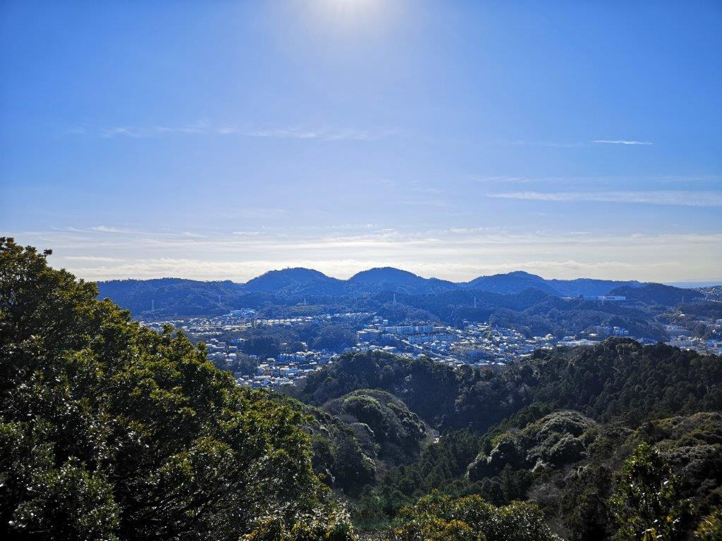
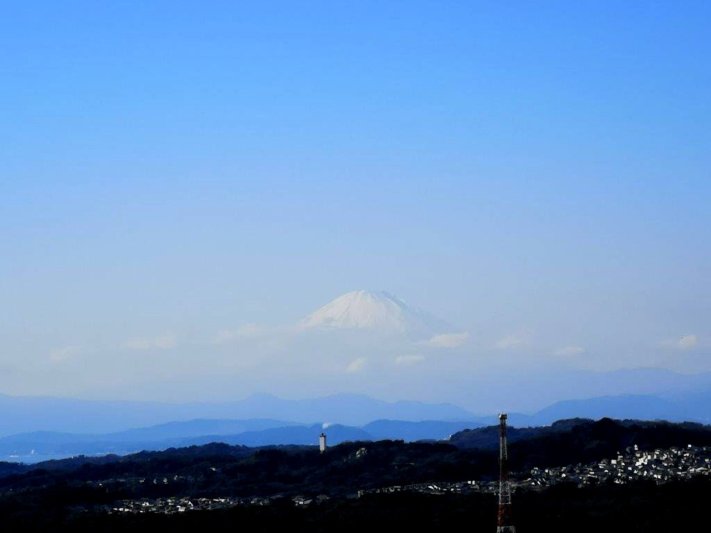
View south from the top observatory
I rode the Shonan-Shinjuku line under blue skies to Yokohama where I changed to the Keikyu line. I got off at Jinmuji station a little after 11am and walked ten minutes along a road to reach the start of the trail. I soon arrived at a path along a small stream leading up the mountain. Along the way, I could hear squirrels scampering away in the nearby trees. It was nearly noon and the sun was shining down into the narrow valley, creating a magical scenery.

Path leading to Jinmu-ji Temple


Start of the path for Jinmu-ji (left) Gate leading to the temple (right)
It took only 15 minutes to reach Jinmu-ji Temple (神武寺). I saw relatively few people doing “hatsumode“, the first temple visit of the year, perhaps because it was still early in the day. I climbed some stone steps and then followed a level path for a short while. A small path leading up on the right took me to my first viewpoint of the day and the top of Mt Jinmuji (神武寺山). I had a view or the Miura Alps and Shonan bay. I found a good place to sit and had an early lunch.
View of the Miura Alps from the top of Mt Jinmuji
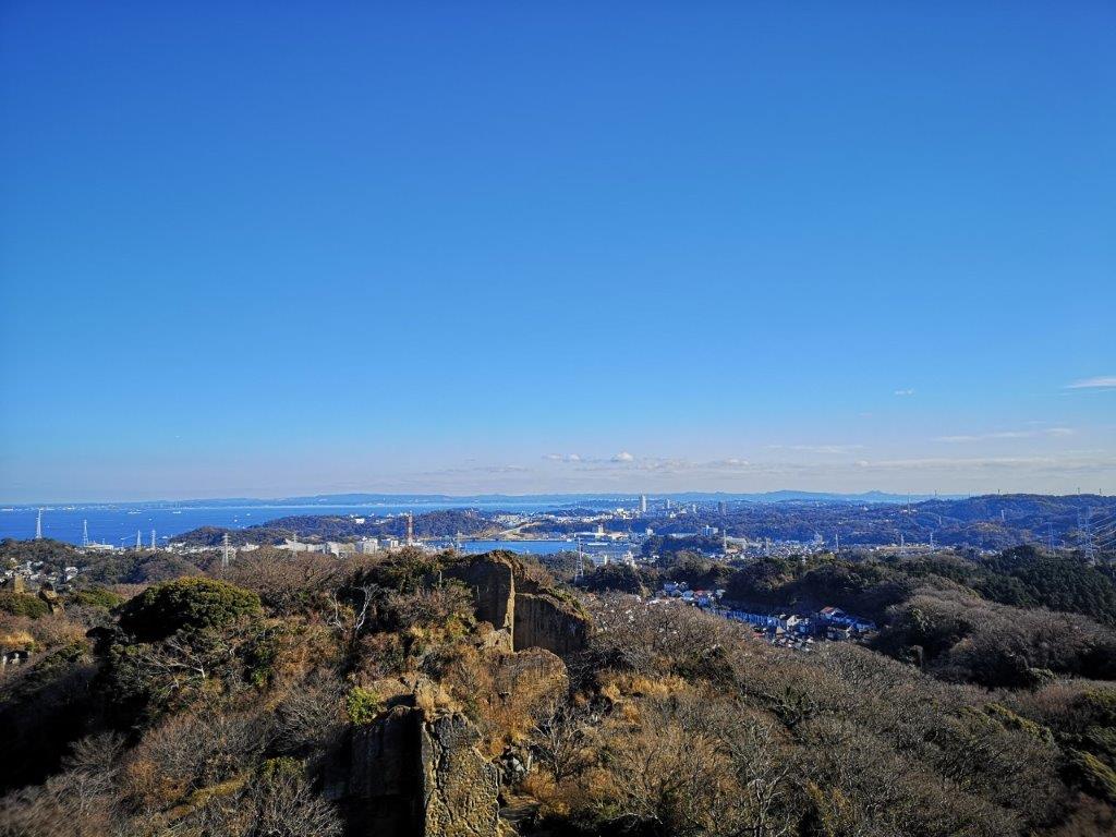
View of Chiba’s Boso peninsula beyond Tokyo bay
The next part followed a wide and mostly level path along the top of a ridge. Along the way, I had a view of Mt Fuji to the west and Yokohama to the north. Just after 1pm, I had a glimpse of a rock climber (see video); I had arrived at the climbing area. I walked around the base of the cliffs to a staircase leading to the top of Mt Takatori (鷹取山 たかとりやま takatori-yama). From the observatory, I could see Yokosuka city and Tokyo Bay to the east; to the south lay the Miura peninsula; directly below, children were flying kites at the base of the cliffs. After enjoying the view, I headed down at 2pm.

The observatory at the top of Mt Takatori

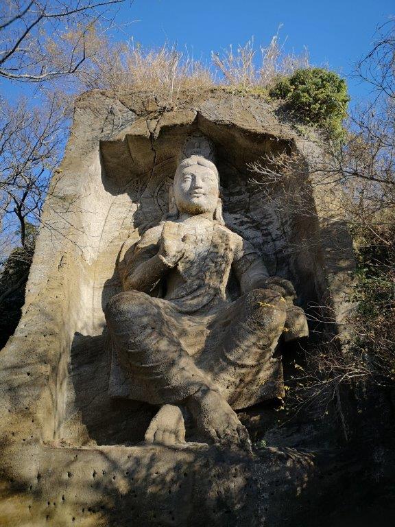
The rock climbing cliff (left) The Takatoriyama Buddha (right)
I made my way to an impressive Buddha carved into a cliff face, past several more climbing areas. I then turned right onto a path heading down a forested ridge and above a residential area. Half an hour later, I reached a junction where I took the left branch, and soon after, I found myself walking among the houses towards Taura station. At 3pm, I boarded a local train for Yokohama station where I changed to the Shonan-Shinjuku line for the one-hour ride back to Tokyo.
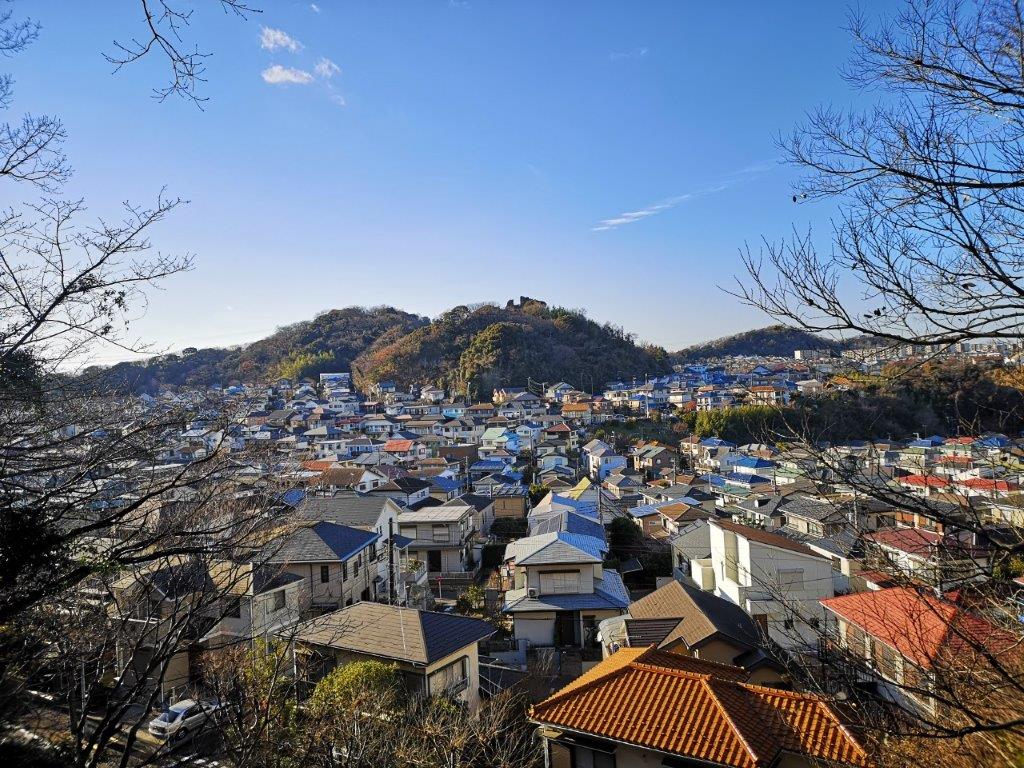
Walking above the suburbs
See the views of Mt Takatori


Hi David Where is start of the trail? Which direction from the station?
Get Outlook for iOS ________________________________
Hi igzem,
It’s from Jinmuji station. There is only one exit and once you reach the main road, the Kanazawa-Zushi line, turn left and walk straight for about 5-10 min till you see a sign in Japanese and English for Takatoriyama (on the right side, near a bus stop). It’s just before a junior high school.