Ojuhacha (162m), Mt Tanuki (139m) & Mt Kitsune (153m), Ichihara City, Chiba Prefecture, Sunday, January 26, 2025

I was looking for an easily accessible hike in Chiba. Looking at my map, I found a suitable loop hike inside Yonezawa Forest, in the northern half of the Bozo peninsula. It was a short walk from Kazusa-Ushiku station on the Kominato line, as well as a short drive from Mobara station. I chose to go by car to take advantage of the Sotobo line limited express. The route included 3 minor peaks, Mt Fuji apparently visible from the first one on clear weather days.

For subscribers, read this Post on Hiking Around Tokyo for a better viewing experience and the latest updates

Hiking on the Boso Peninsula 房総半島

To get to the start of the hike, I’d ride the Wakashio Limited Express from Tokyo station to Mobara station, and there, switch to a share car; for the return, I’d use the Wakashio bound for Shinjuku station. Before the hike, I’d stop by Nagara Chosei An for an early Soba Lunch. The weather was supposed to be sunny all day and I was looking forward to visiting a new spot on the Boso Peninsula, as well as getting my first proper view of Fuji of the year.

Find Japan Hiking Maps on Japanwilds

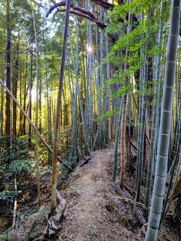
Start of the Hike (left) Entering the Bamboo Grove (right)

Inside the Bamboo Grove (left) Walking through Ferns (right)

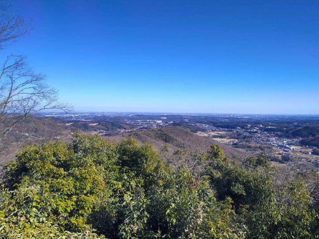
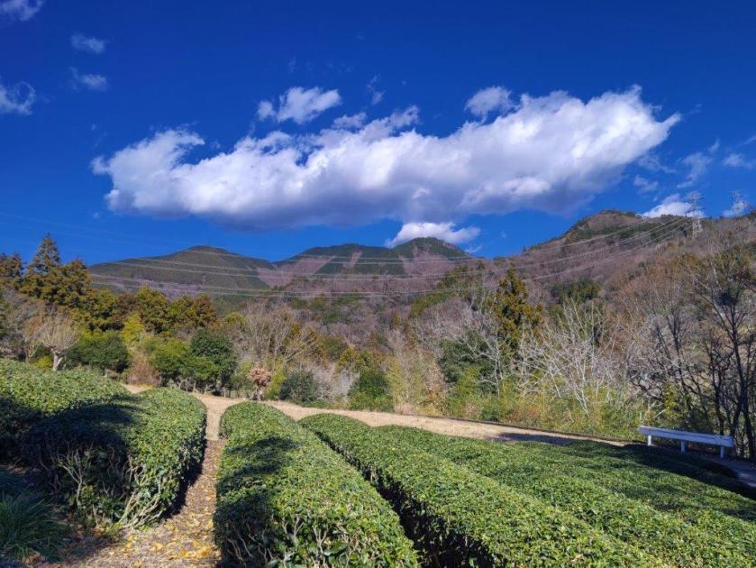
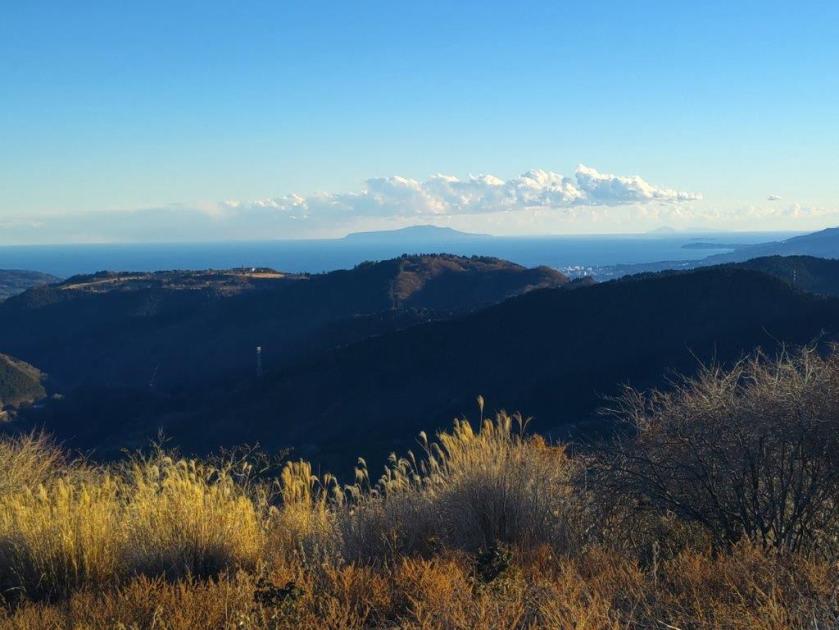
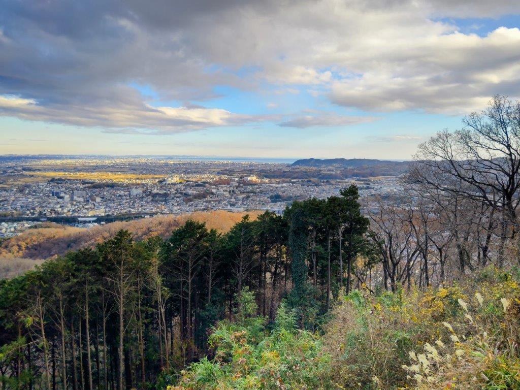
It was another perfect winter day as I rode the limited express from Tokyo Station, arriving at Mobara around 11am. After finding my share car, I drove to Nagara Taiyo Farm, situated on a tableland, also the location of the soba restaurant. After lunch, I walked a short way to the nearby Nagaiki Observation Deck (長生き展望台 meaning long life), perched at the edge of a steep incline; from a modest elevation of about 100 meters, I had a stunning view to the east of the forested coastal plain extending north to south.

Looking East from the Nagaiki Observation Deck

Looking North from the Nagaiki Observation Deck

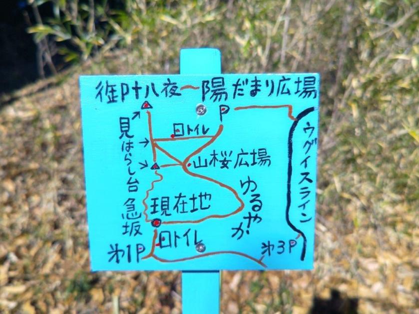
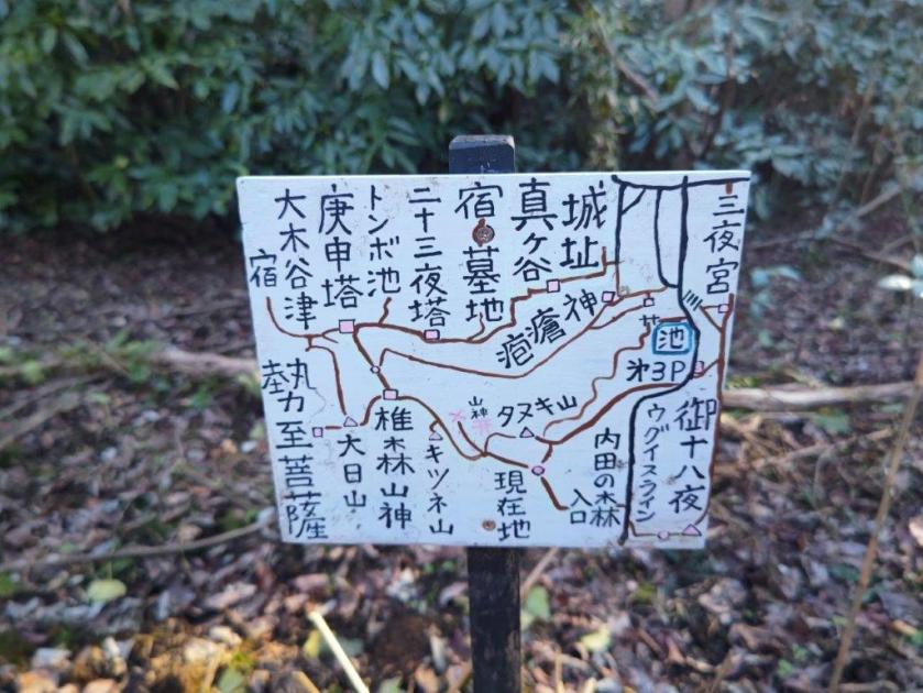
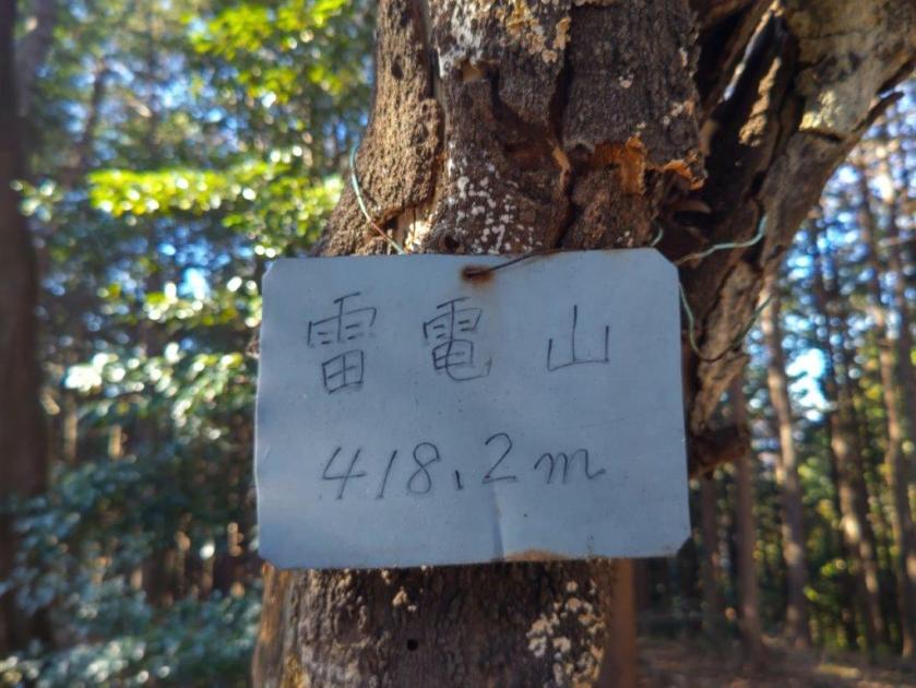
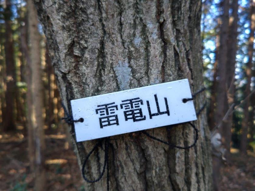
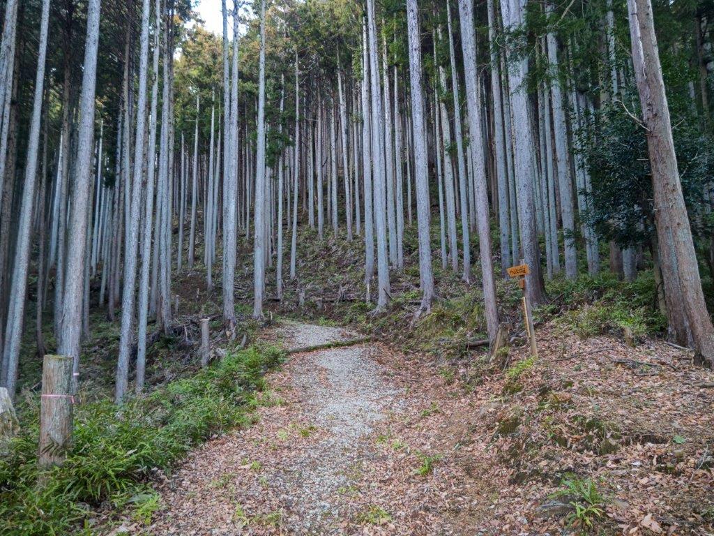
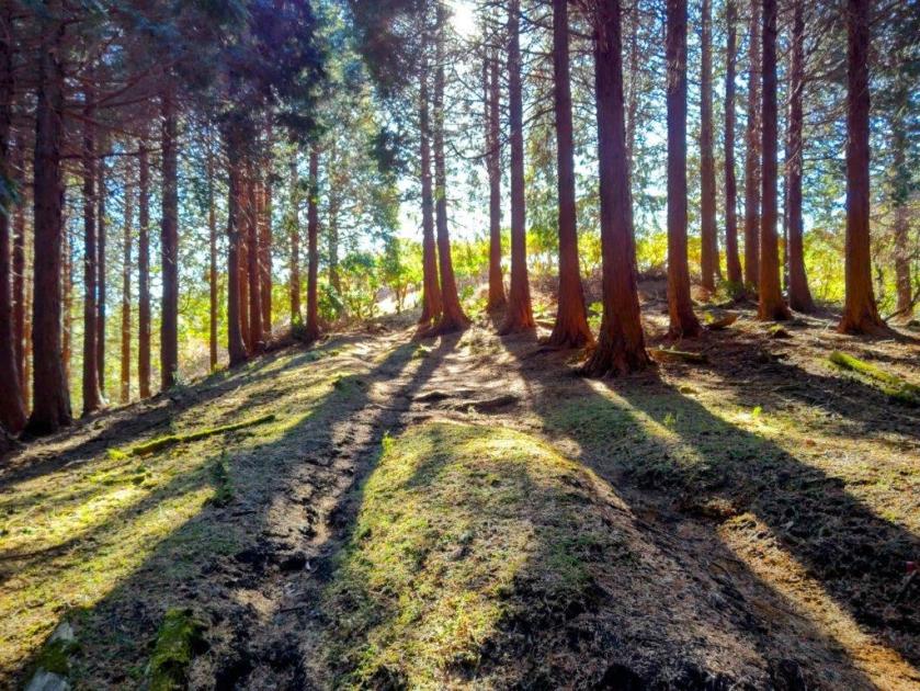
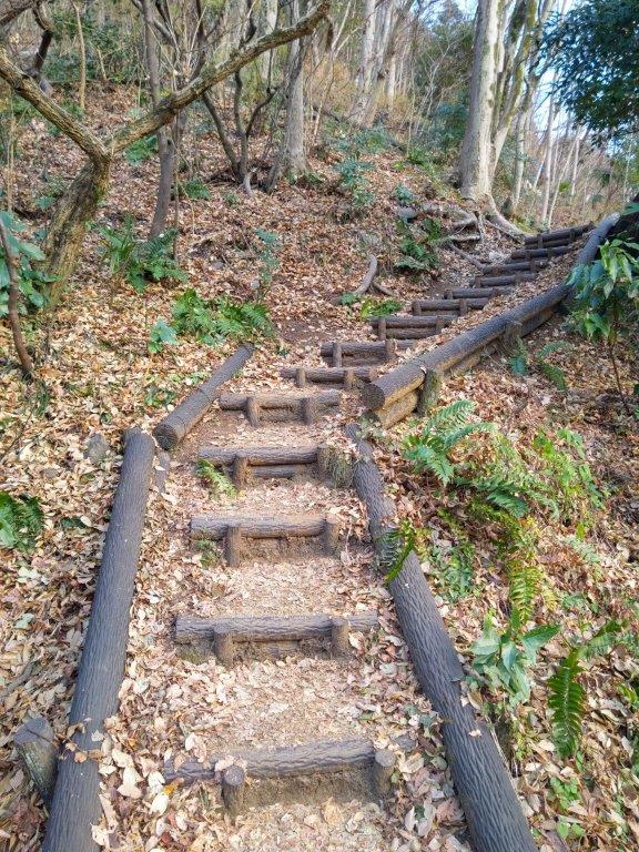
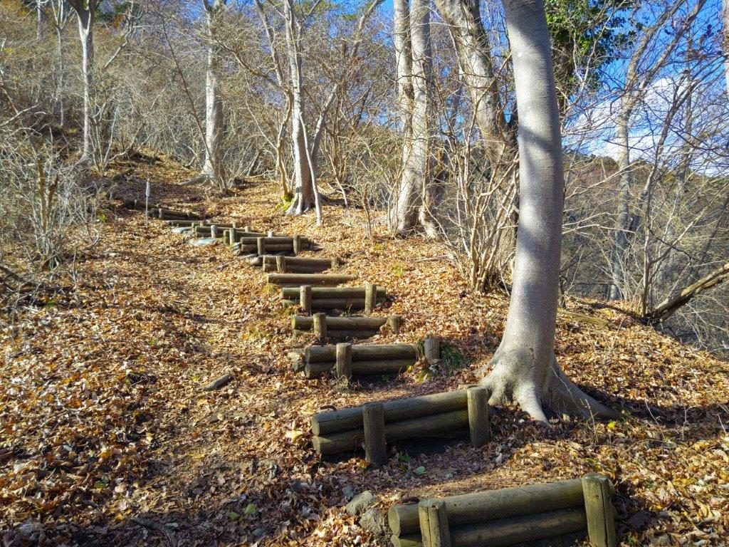
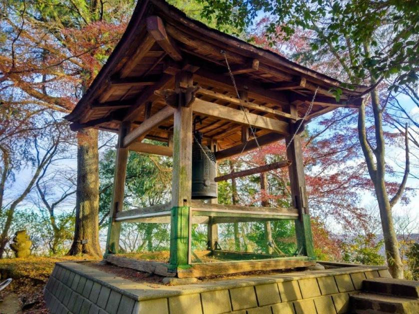
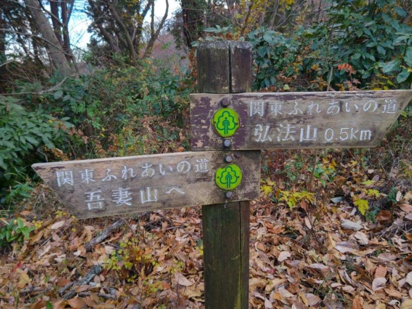
Cold gusts soon forced me to retreat to my car, and after a short drive, I reached the Yonezawa-no-mori #3 parking lot, along the Uguisu line (meaning Japanese Nightingale), one of the entrances to Yonezawa forest (米沢の森). After getting ready, I set off just after 1pm, up a gentle incline. I soon arrived at a junction on a ridge where I turned right. After following a pleasant path through the forest, I got to another junction where I turned right again. Here and there, helpful hand drawn signs along the trail kept me on the right track. At 1h30, I arrived at Ojuhacha (御十八夜 おじゅうはっちゃ ojuuhaccha), the highest point of today’s hike, also the location of a relay station, with a wide view on the west side.

Sun Filtering through the Foliage

Approaching the Turnoff for Mt Kitsune

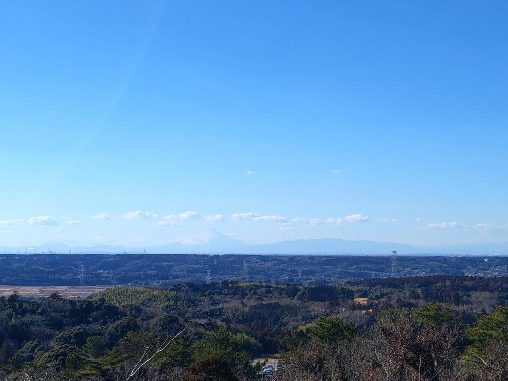
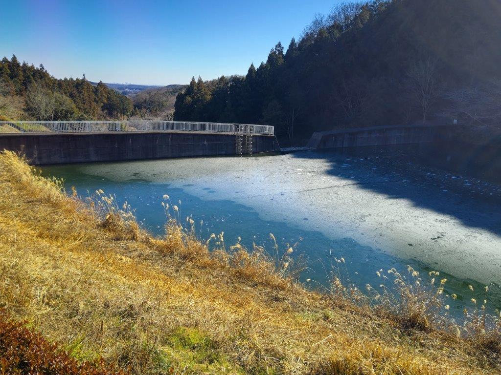
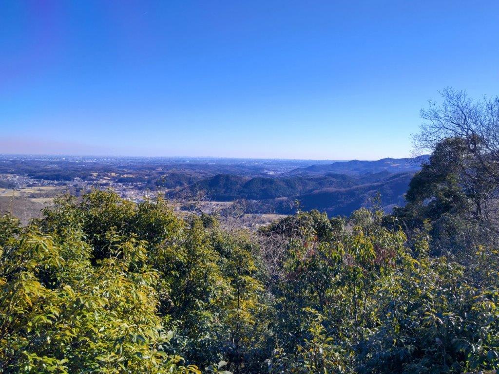
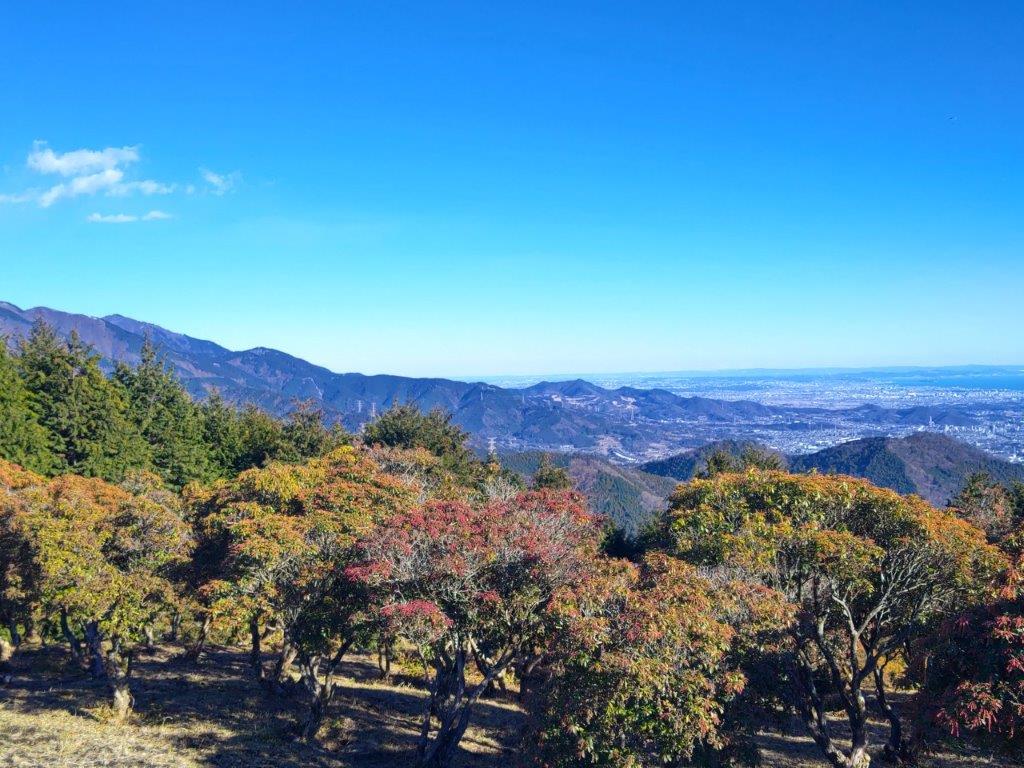
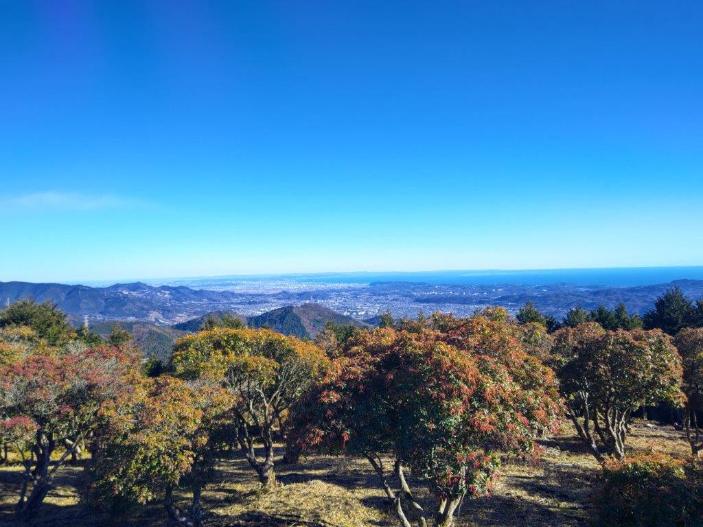
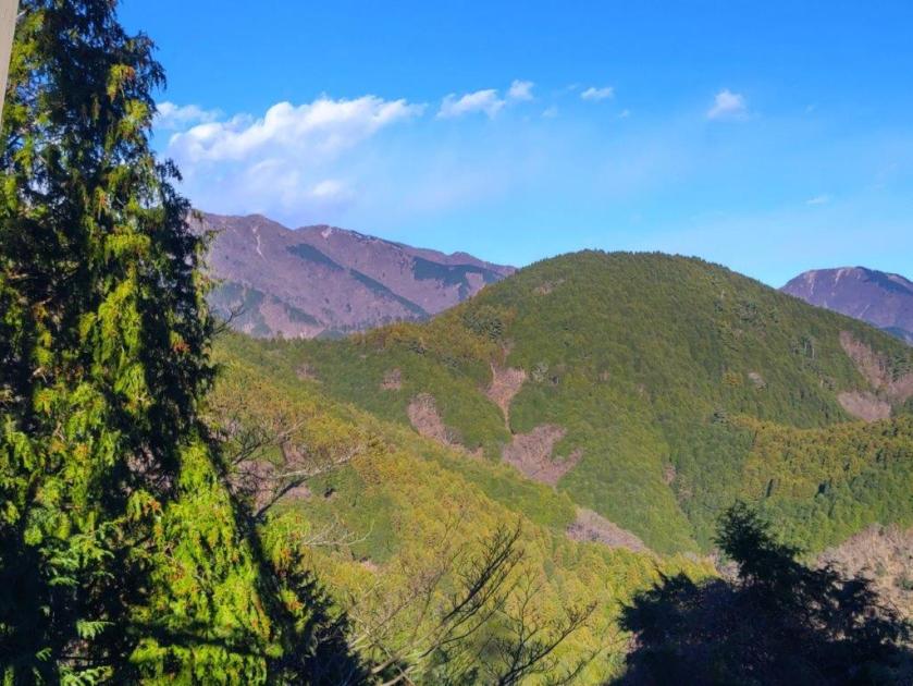
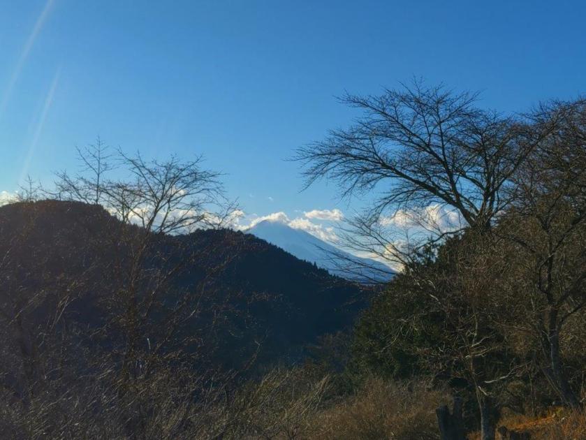
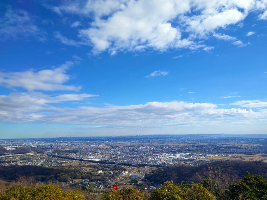
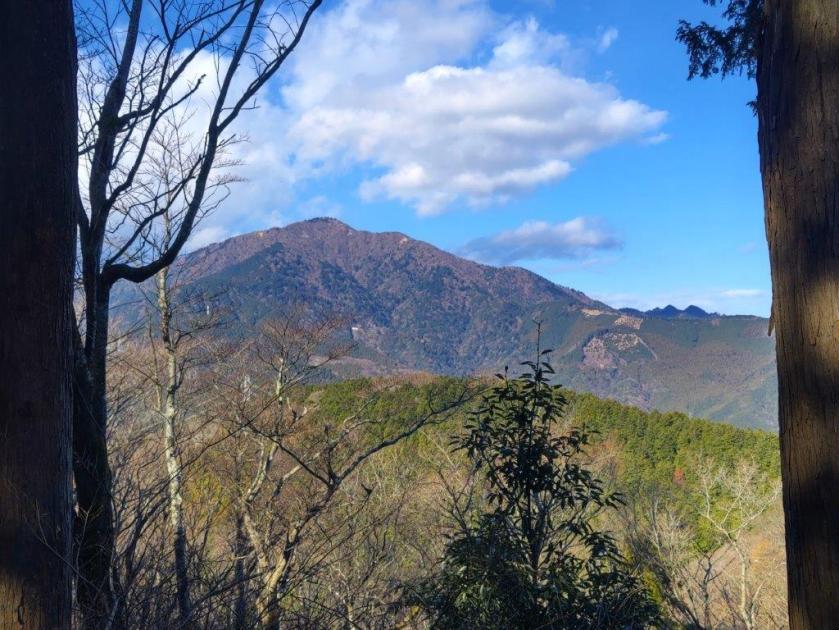
I was delighted by the view of white-capped Fuji, visible through the haze, on the other side of Tokyo Bay, with the Hakone mountains to its right, and Southwest, I spotted the prominent plateau of Mt Kano, also the location of Mother Farm, with the outline of the Miura peninsula on its right side; further south were the countless low mountains of Minamiboso. Looking northwest, I could make out the skyscrapers of Tokyo. I was tempted by a bench next to the relay building but it was too soon for a break. I headed downhill, glimpses of a golf course on my left side, and after a short while, reached the Uguisu line, but soon rejoined another hiking trail on the other side.

View west towards Tokyo Bay from Ojuhacha

Looking up the Bamboo Stalks

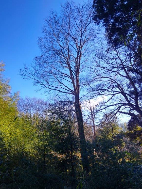
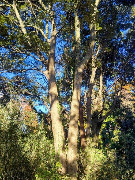
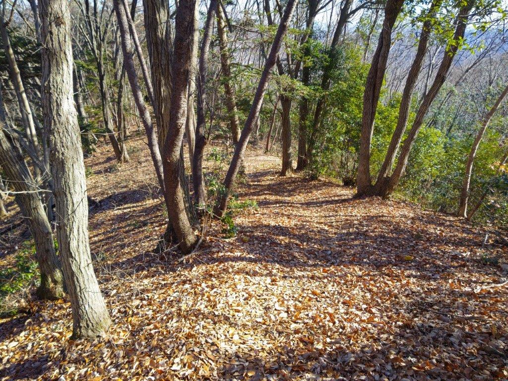
It was great to be walking through the evergreen trees that cover most of the Boso peninsula; some leaves were bright green, turning winter into a distant memory. After some ups and downs, I reached the top of Mt Tanuki (たぬき山 たぬきやま tanuki-yama meaning Mt Raccoon); it was completely in the trees, and despite the tanuki’s reputation for possessing people, I didn’t feel compelled to stick around.

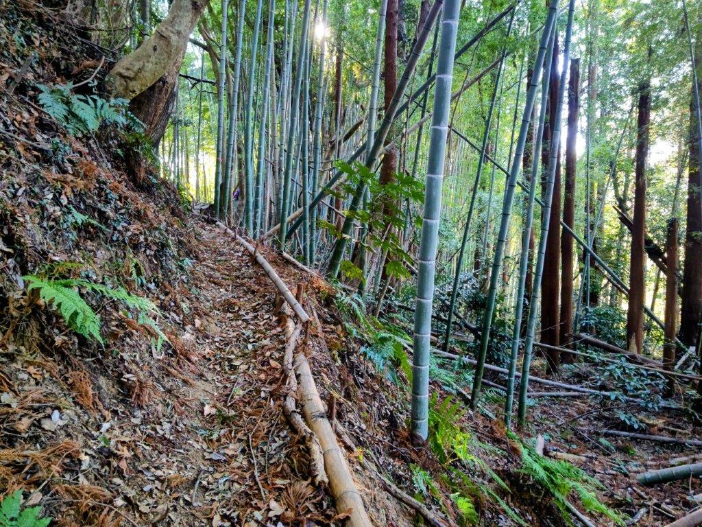
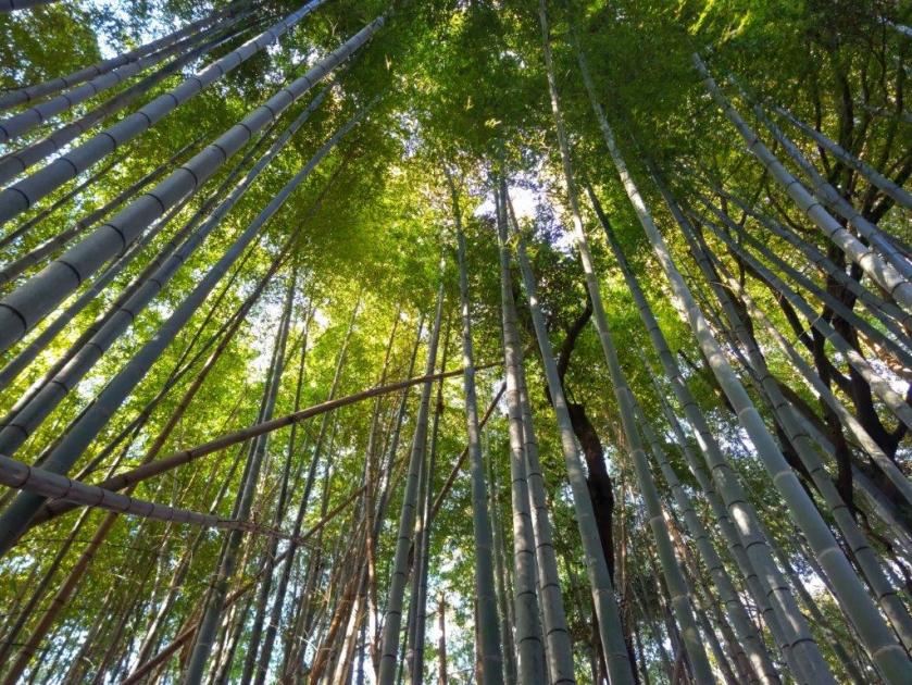
Path Leading into the Bamboo Grove

Walking Through the Bamboo

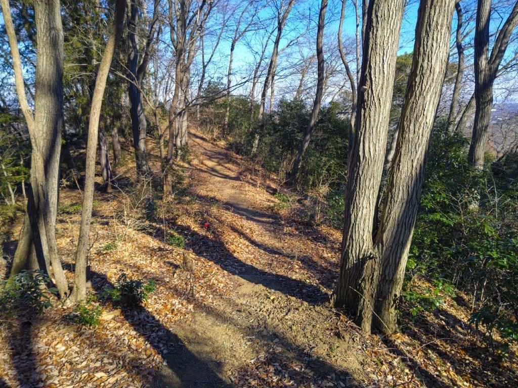
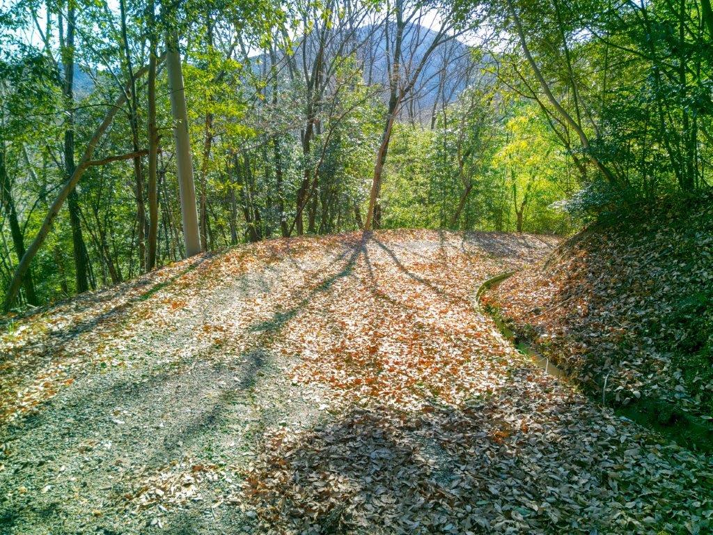
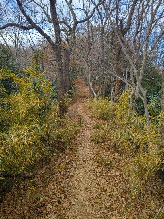
At 2h30, after some more ups and downs, typical of hiking in Boso, I arrived at the third and last peak of the day, Mt Kitsune (きつね山 きつねやま kitsune-yama meaning Mt Fox), slyly tucked away down a side path off the main trail, also surrounded by trees. I resumed my hike, following a slightly descending ridgeline straight through the forest, ignoring several tracks on the left side, and at 3pm, arrived at the edge of a bamboo grove.

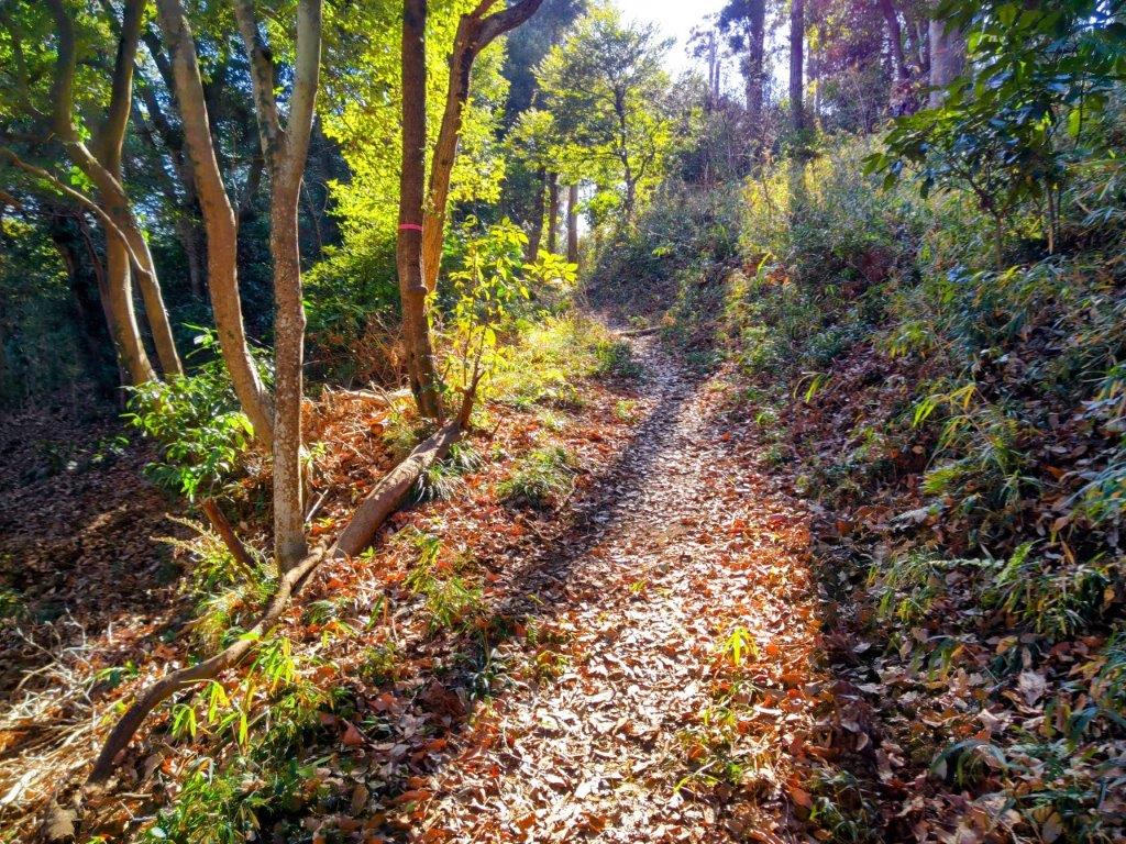
An Easy to Walk Trail

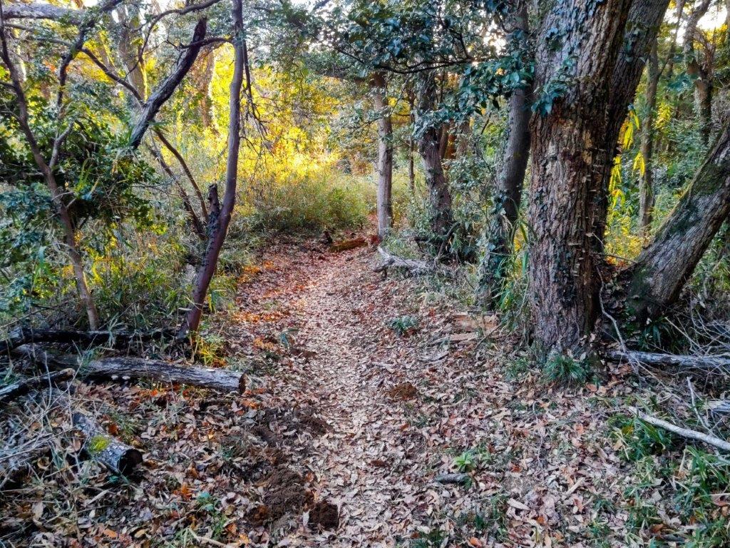
A Level Trail Through an Evergreen Forest

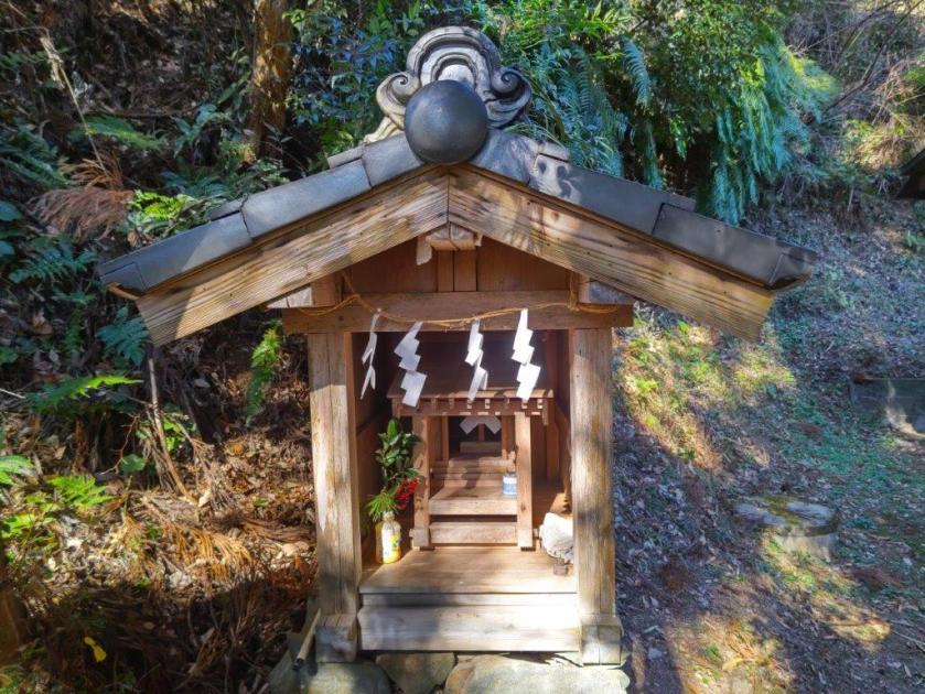
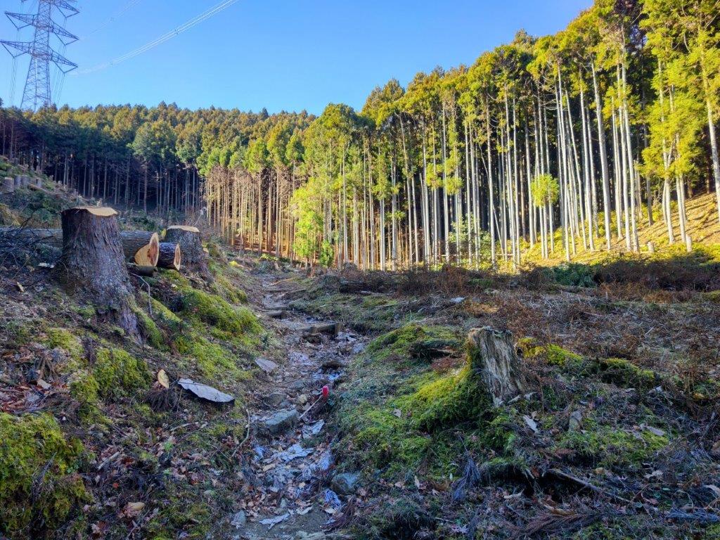
I was excited to be walking through bamboo, the tall stalks swaying and cracking in the breeze. After exiting the grove, I descended a fern-lined path ending at some houses along a road; here I turned left and soon crossed the Uguisu line again. After a short walk under the afternoon sun through the Yonezawa locality, I turned right, up a road leading back into the forest. The road leveled and turned into a path, in the shade of tall cedars. I passed a wooden “torii” (Shinto gate) on the right side, the entrance to Awasu Shrine. I continued straight ahead, thick vegetation crowding in on both sides, blue sky now reappearing above.

Mt Fuji & Hakone from Ojuhacha

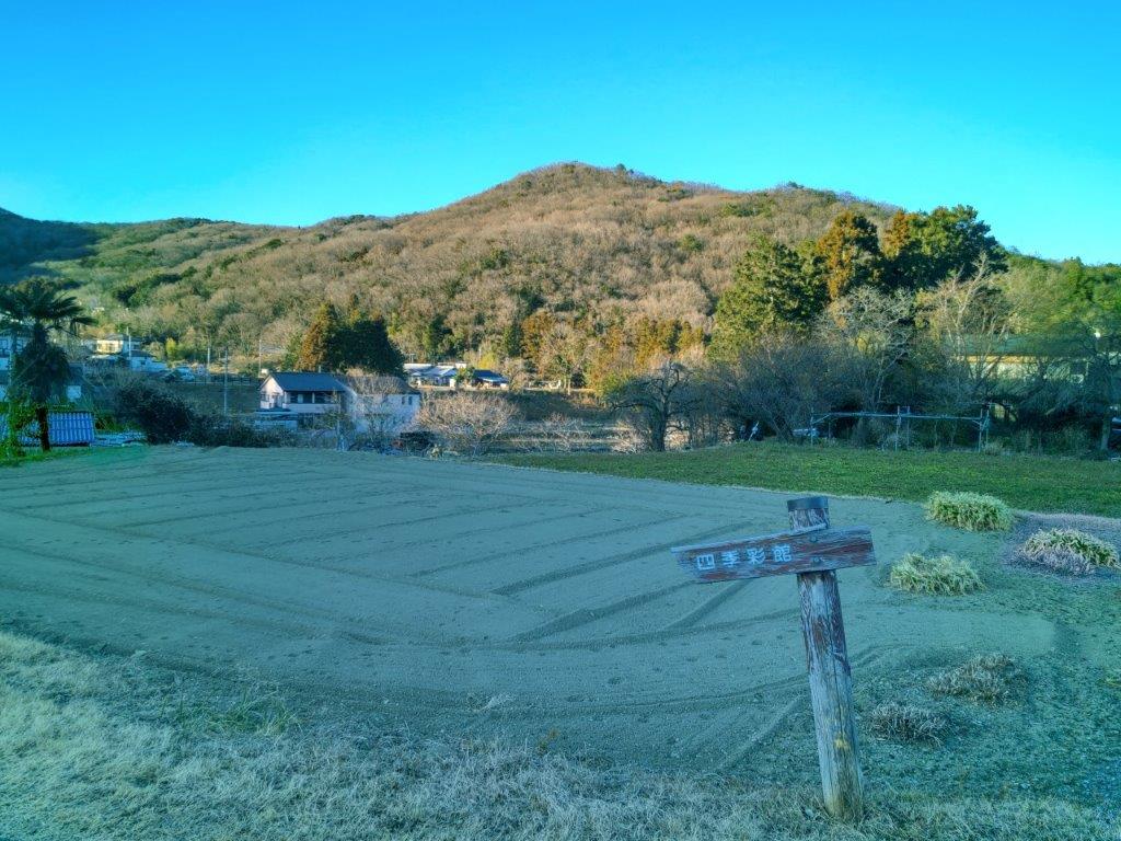
Mt Tanuki from above the Uguisu Parking Lot

I had an unexpected view of Mt Tanuki through a break in the vegetation on the right, the rounded tree-covered summit area bathed in the late afternoon light. Shortly after, I arrived at the turn-off for the parking lot, and by 4pm I was back at my car. I felt I had only walked a small part of the network of trails through Yonezawa forest but felt happy to have finally seen the full shape of Mt Fuji for the first time of the year. I returned the car at 5pm and then boarded the limited express; after enjoying the sunset from my seat, I settled in for the one hour ride back to Tokyo.

Watch a Video of the Ojuhacha Hike

Watch the Video of the Hike on YouTube

See a Slideshow of More Pictures of the Hike

Mt Raiden (418m), Tokigawa Town, Saitama Prefecture, Saturday, January 18, 2025

I was looking for a short, low-altitude, and relatively easy hike near Tokyo, with some good views, as well as a hot spring bath at the end, to take full advantage of the clear skies of the cold winter days. Poring over my map, I spotted a peak in the Tokigawa area, overlooked up to now, but which checked all the boxes. The summit was supposedly in the trees, but the shoulder beneath it was described online as a “Scenic ridge”. As an added bonus, I could check out the Sanba Gorge on the Toki river before heading to the nearby Toki no Yu hot spring.

For subscribers, read this Post on Hiking Around Tokyo for a better viewing experience and the latest updates

To get to the start of the hike, I’d rode a Tobu-Tojo express train from Ikebukuro directly to Ogawamachi, and there, hop on a local bus for the short ride to Suzume Dam. After a hot spring bath at the end of the hike, I’d walk a short way to the Seseragi Bus center. There, I’d catch a bus for Musashi-Ranzan station, and then board a Tobu line train for the trip back to Ikebukuro. The weather was supposed to be cold and sunny all day, and I was looking forward to a relaxing hike in the hilly countryside of Oku-Musashi.

Hiking in Oku-Musashi 奥武蔵

Find Japan Hiking Maps on Japanwilds

Suzume River and Dam

Trail past the Summit of Mt Raiden

It was another splendid winter day as I rode the express train to Ogawamachi, arriving there around 11am. After a short ride on a diminutive bus filled to capacity, I got off at the Suzume Dam entrance (雀ダム入口) in Hikage, actually a 10-minute walk to the dam itself. Along the way, I passed Hikage Shrine, its “shide” (zigzag-shaped paper streamers) swaying gently in the breeze. At the top of a slope, I reached the parking of a park, descriptively name the Suzume river dam erosion control park (雀川ダム砂防公園). A short climb up a steep staircase brought me to the top of the dam wall.

Sunny Hiking on a Winter Day

Following the Panoramic Ridgeline

Surprisingly, the water behind the dam was half frozen, sparkling white under the morning sun; yellow Japanese Pampas grass (“susuki“) in the foreground completed the scenery. In the far distance beyond the top of the dam, I could see the skyscrapers of Tokyo. I followed the road into the forest, and past a bend, reached a signpost marking the trail entrance on the right, shortly after noon.

View Southeast of Tokigawa Town

View East of Mt Doyama

It was a pleasant climb up a gentle slope through a mixed forest, the warm sunlight filtering through the leafless trees. Less than an hour later, I arrived at the small shrine marking the summit of Mt Raiden (雷電山 らいでんやま raiden-yama meaning thunder and lightning). This peak might hold the record for the most summit markers: I counted five different ones. It was completely in the trees, so after a short break, I headed down a trail on the east side.

View South of Mt Yumidate

Trail for Mt Doyama

I felt relieved that the trail was easy to walk and well-maintained, just what I had been hoping for. I saw no other hikers so I was also able to enjoy it in near complete silence in this season, before the return of the birds and insects. After a couple of turns, I reached the scenic ridge, although all I could see were the trees on both sides. Suddenly, at the top of a gentle slope and just before a steep descent, a view opened up on the right side.

Trail past Mt Doyama

Road near the End of the Hike

I was delighted to finally get a view, especially on such a beautiful day. Looking southeast, I could see Tokigawa Town, and beyond, the Kanto plain with the skyscrapers of central Tokyo in the distance. On the south side was Mt Yumidate, and below on the east side, the next part of the ridge. Since it was 1h30, I sat on a tree root at the side of the trail and had lunch with a view. Once done, I set off again, ready to tackle the steep section head.

Sanba Gorge on the Toki River

Looking back at Mt Doyama

This was the trickiest section of the hike, dead leaves making it especially slippery. I made good use of the attached rope, and once past it, the trail was mostly level. Thirty minutes later, I passed the minor peak of Mt Doyama 堂山 (どうやま 250m), and there, turned left down a pretty trail through green ferns. At 2h30, I exited the forest and reached a road along the Toki river which I followed to the entrance of Sanba Gorge (山波渓谷). I was lucky to catch the last rays of sun on the cascading, rushing water. After exploring the rocky riverbed for a while, I headed to nearby Toki no Yu at. After a relaxing bath, I walked to the bus center where I boarded another diminutive bus for the short ride to Musashi-Renzan station.

Watch a video of the Mt Raiden Hike

Watch the Video of the Hike on YouTube

See a Slideshow of More Pictures of the Hike

Mt Shidango (758m) & Mt Take (710m), Matsuda Town, Kanagawa Prefecture, Saturday, January 11, 2025

I wanted to do another hike in the Tanzawa mountains, winter being the best time to explore the area. Looking through my guidebook, I found a couple of nearby mountains I had yet to climb, along a river valley north of Matsuda station. The summit of the first peak was out of the trees; the second was in the forest, but with a viewpoint below it on the east side. Combining the two, I expected the hike to take about 4 hours, meaning I could leave mid-morning and take advantage of the “Mt Fuji Romancecar”, the only limited express train to stop in Matsuda.

For subscribers, read this Post on Hiking Around Tokyo for a better viewing experience and the latest updates

Hiking in the Tanzawa-Oyama Quasi-National Park

丹沢大山国定公園

To get to the start of the hike, I’d ride the Odakyu “Fuji-san” limited express from Shinjuku to Matsuda station, and from there, ride a Fujikyu bus to the last stop on the line. For the return, I’d catch the same bus several stops before the end of the line, and then ride the “Fuji-san” back to Tokyo. Apparently Mt Fuji can be seen from both summits, and since the weather was supposed to be sunny all day, I was looking forward to getting a second chance at my first Fuji sighting of 2025.

Find Japan Hiking Maps on Japanwilds

Paved road between Yadoriki and the Wildlife Gate

Powerline Clearing on the Way to Mt Shidango

It was a relaxing ride under light blue skies to Matsuda station. After getting off the train just before noon, I made my way to a bus stop in front of the nearby Shin-Matsuda station. I was surprised to find myself at the back of a line of teenagers, on their way to play a football match in the same place I was headed. Half an hour later, we all got off the bus in Yadoriki (寄). Leaving them to their ball game, I crossed a bridge over the Nakatsu River and followed signs for today’s mountain, past tea fields and up a steep road ending at a wildlife gate at the edge of the forest; beyond it was the start of the hiking trail.

View of Mt Kobo from Mt Shidango

View of Shonan Bay from Mt Shidango

I was glad to be walking through the forest, the cool shade contrasting sharply with the warm sun from moments before; walking up a series of log steps, I soon warmed up again. I soon reached a clearing allowing for the passage of a power line. Beyond it, I resumed my walk under the dark cedars. One hour after setting off, the path suddenly went straight up the mountain side, gnarly tree roots forming natural steps, and just before 2pm, I broke through the trees to reach a small shrine, also the top of Mt Shidango (シダンゴ山 しだんごやま shidango-yama), named after a hermit (“sennin“) called Shidagon who lived on this mountain top about 1300 years ago.

View of Mt Shidango on the Way to Mt Take

Fuji Viewing Platform below Mt Take

I was surprised to be the only person on the summit, since other nearby peaks usually have a lot of traffic. On the east side was the long ridgeline starting from Mt Oyama and ending at Mt Kobo, where I’d been one week ago. Directly ahead to the south was Sagami Bay. In between, I could make out the Miura Peninsula, and beyond it in the far distance, the Boso peninsula. On the west side, sandwiched between the next mountain and puffy clouds, I could see the white snows of Mt Fuji. The flat summit had a seating platform so I settled down for a late lunch with a view. At 2h30, I set off down some log steps, again under the cedars, heading westwards, and soon reached a paved road closed to traffic and hugging the mountain side. Here, ignoring a metal staircase heading straight up the opposite slope, I turned left along the road.

Mt Tono & Mt Oyama from near Mt Take

Walking through a Thicket of “Aburachan”

It was nice to walk on a level road for a short while, with views occasionally popping up on the east side through gaps in the vegetation. At 3pm, I reached the start of the trail for today’s second mountain. From this point, all signposts were in double, old wooden ones and newer metallic ones, provided by a local association. I appreciated how they felt the need to have sturdier and more functional signs while at the same time keeping the more fragile original ones. From this point, I also saw many warnings about leeches, as well as small salt containers (attached to most signposts) for their disposal (actively encouraged). I followed a path southwards and soon reached an electric pylon at the base of a steep slope.

The Tanzawa Mountains from the Mt Take Observation Platform

Mt Shidango (front), Mt Hiru (left), Mt Nabewari (middle), Mt Tono (right)

I took a few minutes to enjoy the unexpected view provided by the passage of the powerline. On the east side was Mt Fuji again, perfectly aligned with the next pylon; on the west side was the rounded green top of Mt Shidango. Behind, I could see Mt Tono to its left, and Sannoto to its right; in the far distance, I could just make out the pointy summit of Mt Oyama. After a little more climbing, I reached the top of Mt Take (タケ山 たけやま take-yama), another peak without Chinese characters. It was completely in the forest, one ray of sunlight fortuitously lighting up the summit marker (the wooden one). I soon moved on and reached blue skies at the edge of the forest.

Mt Tono (left) & Sannoto (right)

Sannoto (left), Mt Oyama & Mt Kobo (right)

Looking up, I could see the full moon, already high in the sky. Walking a little further, I reached a wide viewpoint on the east side: the Mt Take Fuji Viewing Platform (タケ山富士見台). Looking excitedly to my right, the east side, I could see Mt Fuji now mostly free of clouds but against the sun at this time of the day. To its left, I could see the Hakone mountains, reaching all the way to Sagami Bay. On the west side, I had an excellent view of Sannoto and Mt Odake. To the south, under huge puffy clouds, was Oshima island; beyond, in the far distance, I could make out Toshima and Nijima islands. I took a short break on a bench to enjoy the view, as well as the late afternoon sun, before continuing on my way.

Hadano & Isehara Cities

Descending through “Aburachan” Shrubs

I was now walking inside a thicket of bare shrubs, affectionately called “Aburachan” in Japanese (February spicebush in English). The trail was vanishingly faint under a carpet of dead leaves but fortunately I soon popped into another clearing with another wide view on the east side: the Mt Take Observation Platform (タケ山展望台), where I had the best view of the day. On the west side, I had a spectacular vista of the Tanzawa mountains, from Mt Hiru, its highest point, all the way to Mt Oyama, with the full moon hanging above; Mt Nabewari was also visible, directly behind Mt Shidango. Further south, Hadano and Isehara cities spread out on each side of Mt Kobo. As before, the Shonan Bay, Oshima island and the Hakone mountains could be seen on the south side, only Mt Fuji now missing from the panorama.

Descending under the Cedars

End of the Mt Take Trail

I was once again the only person to enjoy this glorious view, partly because it’s on a local trail but also partly due to the late time of the day. It was nearly 4pm so I set off at a quick pace down a switchback trail, first through another “Aburachan” thicket, coloured orange in the late afternoon light, then through a dark forest of tall cedars. Half an hour later, I reached a small park at the end of the trail, here and there “suisen” (daffodils) in full bloom. From this point, I followed a road along a terraced river. At the confluence with the Nakatsu river, I turned left, and after crossing a bridge, with one last view of a pink-tinged ridgeline on the north side, reached a wooden bus shelter. When the bus arrived, I was reunited with the soccer team from before; luckily I was able to sit, and a little after 5pm, was back at Matsuda station. There, I boarded the Romancecar limited express for the 80-minute ride back to Shinjuku.

Watch a Video of the Mt Shidango Hike

Watch the Video of the Hike on YouTube

See a Slideshow of More Pictures of the Hike

Mt Hijiri (380m), Mt Takatori (556m) & Mt Kobo (235m), Isehara & Hadano Cities, Kanagawa Prefecture, Saturday, January 4, 2025

Like for the last outing of 2024, I needed a straightforward hike close to Tokyo to ensure a smooth start to the new year. I decided to head to the Tanzawa foothills, notorious for its leeches in the warmer months, but pest-free at this time of the year. I had already walked from the top of the Oyama cable car to Mt Takatori, as well as from Mt Kobo to Tsurumaki Onsen. This time, I’d explore the southern ridgeline between Mt Takatori and Mt Kobo. I knew I could get a good view of Mt Fuji past Mt Kobo, and also finish the hike at Manyu no Yu, two reasons for making this the first hike of 2025.

For subscribers, read this Post on Hiking Around Tokyo for a better viewing experience and the latest updates

Hiking in the Tanzawa Mountains  丹沢山地

To get to the start of the hike, I’d ride the local Odakyu line to Isehara station, and then board a local bus for a stop near a city park, a short distance from the trail Entrance. For the return, I could walk from the hot spring to Hadano station, and there, board the Odakyu Limited Express for Shinjuku. The weather was supposed to be sunny in the morning, turning cloudy in the afternoon, putting a question mark on my new year rendezvous with Mt Fuji. Still, I was looking forward to exploring new trails in a familiar area.

Find Japan Hiking Maps on Japanwilds

Steps for Mt To (left) Road for Mt Hijiri (right)

Leaving Mt Hijiri (left) Steps up Mt Takatori (right)

It felt quite cold as I stepped off the bus in the midst of a residential neighbourhood of Isehara city, a little before 10am. Thankfully, the sun was high enough to warm me up while I made my way to Tonoyama Park (塔の山公園), a wooded area surrounding a small mountain. After a short climb up a wide path, I reached some benches from where I already had a view of the flat coastal area reaching to Shonan Bay. After a late breakfast I set off at 1030, and soon after, reached the top of Mt To (塔ノ山 とうのやま tonoyama 202m, meaning “Mt Tower”), from where I had a view of summit of Mt Ooyama on the north side.

Trail past Mt Nenbutsu (left) Trail for Zenba Pass (right)

Steps past Mt Gongen (left) Steps past Mt Sengen (right)

I continued along the ridgeline, heading down through leafless trees, and soon arrived at a road on the north side of the mountain. I turned right, heading south, past the main park entrance, then turned left, following a sign for Hokokuji Temple, and shortly after, came upon a signpost for today’s next mountain. After a few more turns along back roads, I reached the Mt Hijiri trail entrance (聖峰登山口), another paved road but this one closed to vehicles. After passing through a wildlife gate, I continued straight, ignoring the shortcut on the left side, and a little before noon, reached the top of Mt Hijiri (聖峰 ひじりみね hijiri-mine meaning “sacred peak”), also the site of a small Buddhist temple.

View East from Hijiri-mine of the Miura and Boso Peninsulas

View South from Hijiri-mine of Shonan Bay and Shonan-daira

I was delighted to have such a wide view on my first hike of the year. Looking north, I could see the skyscrapers of Yokohama and central Tokyo; eastwards, I could make out the low rounded mountains of the Miura and Boso peninsulas; to the south was the level-topped Shonan-daira with Shonan Bay in the background. While I was admiring the view, a pickup truck pulled up, and a man went to open the temple building, called Hijiri-mine Fudoson (聖峰不動尊), giving myself, and two other people who happened to be there, a chance to peer at the Buddhist altar inside; we even got to touch a small snake statue (2025 is the year of the snake); finally, we each received a paper stamped with its “goshuin“, a red seal proving one’s visit to the place. After carefully placing it inside my pack, I set off again, along a level trail through tall cedars, and soon reached a series of log steps where the ridgeline rose steeply.

Steps Leading to Mt Takatori

View South from below Mt Takatori

I broke a sweat for the first time of the day, only pausing briefly to take in a view that had appeared through a gap in the trees. Looking south, I could see the ridge I’d be following on the next part of the hike; curving northwards was the ridge I’d just ascended, green cedars crowning the top of Mt Hijiri. I reached a junction where the two ridges merged; I turned right, and after a little more climbing, reached the top of Mt Takatori (高取山 たかとりやま takatori-yama), also the site of an NTT relay tower. It was surrounded by trees except on the north side, where Mt Oyama’s pyramidal summit fit snuggly between two tree trunks. I retraced my steps to the junction and continued along the south ridge.

View towards Mt Hijiri and its “green crown”

Framed View of Mt Oyama from Mt Takatori

I was surprised by how steep and rocky the trail suddenly became, forcing me to slow my pace. I was relieved when the trail soon became more or less level again, and one hour after leaving Mt Takatori, I arrived at Mt Nenbutsu (念仏山 357m) where there was bench and a view on the south side. The name is a Buddhist term meaning visualizing a Buddha. By now, the clouds had covered the southern half of the sky forcing me to imagine most of the view as well. Since it was nearly 2pm, I had a late lunch break before continuing my way.

Trail between Mt Nenbutsu and Mt Kobo

View of the Tanzawa Mountains from the Fureai no Michi Junction

This was probably the nicest part of the hike, an easy to follow and slightly descending trail through an evergreen forest. At 2h30, I reached Zenba Pass (善場峠), and a little further, I emerged onto a road with a view of the Tanzawa mountains to the north, seemingly still free of snow. I crossed the road and headed up a trail on the other side, now inside Koboyama Park (弘法山公園) and also on the Kanto Fureai no Michi. After a short climb, I reached the top of Mt Kobo (弘法山 こうぼうやま koubou-yama), named after Kobo-daishi who is said to have trained in this place (he is also connected to Mt Mitsumine). Since my last visit in April 2016, a viewing platform had been erected on the east side. Like from Mt Hijiri, I had a view of the Shonan coastline, the Miura Peninsula and Shona-daira, but it looked quite different under a cloudy afternoon sky.

Final Steps before the Top of Mt Kobo

Viewing Platform on the East Side of Mt Kobo

I admired the constantly changing patchwork of light and dark patches in the landscape below. On the south side, the bell tower sitting directly in the sun’s path lit golden. I now followed Babamichi road (馬場道) meaning “riding ground”, indeed wide enough for riding a horse, to the next summit, Mt Gongen (権現山 ごんげんやま 243m), a flat, grassy area with an observation tower on the east side. From its top, I hoped to finally have a glimpse of Mt Fuji, but those hopes were dashed by the thick, dark clouds massed on the south side. A ray of sunlight managed to squeeze through, illuminating the urban sprawl of Hadano City, providing the proverbial silver lining. On the east side, I could look down on the Soga Hills, a range of low hills stretching from Matsuda town to Kozu station on the Shonan Coast.

Patches of Light and Dark from Mt Kobo

Shonan Coast and Shonan-daira from Mt Kobo

I was surprised to see a few snowflakes fall gently and thought perhaps a snowstorm was on its way; fortunately, there was no follow-up, bits of blue sky still appearing overhead. At 3h30, I headed down steep steps on the south side, leaving the Fureai no Michi as it headed east to connect with my last year’s hike to Mt Takatori. After crossing a road, I passed by Mt Sengen (浅間山 せんげんやま  196m). It was more of a shoulder that a summit but what it lacked in prominence was made up by the prominence of its beautiful wood-carved summit marker. On my last visit, the scenery was white from the cherry blossom trees covering the “shoulder”; today it was bathed in yellow from the late afternoon sun.

View of the Soga Hills from Mt Gongen

View from Mt Gongen of Mt Hadano under a Ray of Sun

The final descent of the day was surprisingly pleasant: a switchback trail delightfully easy on tired knees, late afternoon sun shining through evergreen trees, and no one but me on the mountain. Just before 4pm, I reached the trail entrance and a busy road where I turned left. On Kobo bridge across the Kaname River, I had one last look at Mt Kobo, firmly under blue skies now, before heading to the nearby Man-no-yu Hot Spring. I reflected on how most of today’s mountains names are common mountain names in Japan and how unusual it was to find all along one ridgeline. After a satisfying hot spring soak, I walked the final 15 minutes to Hadano station, where I caught the Romance Car limited express for the one hour trip back to Shinjuku.

Watch a Video of the Mt Hijiri to Mt Kobo Hike

Watch the Video of the Hike on YouTube

See a Slideshow of More Pictures of the Hike