Mt Kinugasa (134m) & Mt Ogusu (241m), Yokotsuka City, Kanagawa Prefecture, Saturday, April 13, 2024

I wanted to do another hike using the newly published Miura/Boso hiking map. Looking over the Miura section, I found a new peak to climb on the Tokyo Bay side. It was a little short but it seemed possible to continue along a hiking trail and go up the back side of Mt Ogusu (climbed in winter 2021). From the top, I would head down the main trail, ending on the Sagami bay side of the peninsula. It would be my first time to hike in this area in the spring and I hoped to catch the last cherry blossoms of the season

For subscribers, read this Blog Post on Hiking Around Tokyo for a better viewing experience and the latest updates

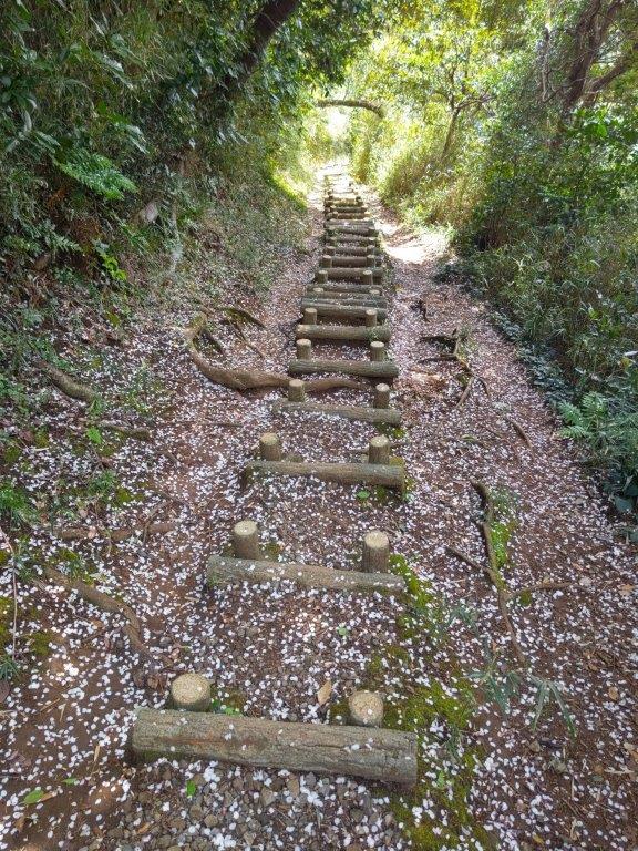
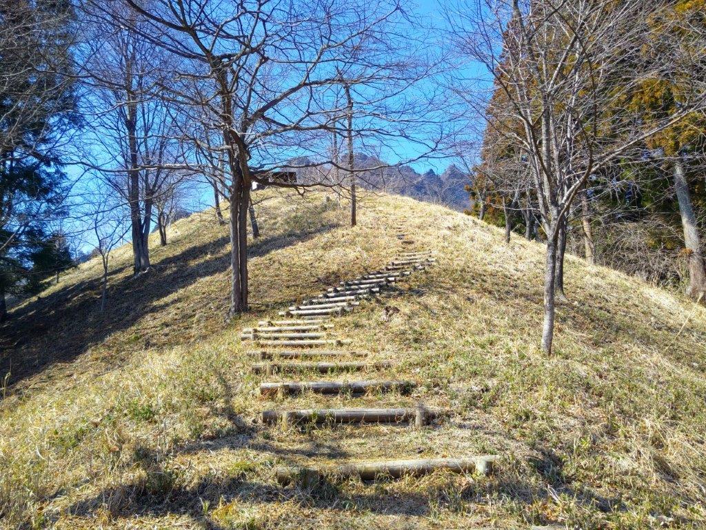
Steps going up (left) and down (right) in Kinugasa-yama Park

Connecting Path to Mt Ogusu (left) Alternative Trail up Mt Ogusu (right)

Hiking on the Miura Peninsula 三浦半島

To get to the start, I would take the Shonan-Shinjuku line to Zushi, and then ride the Yokotsuka line a few stops to Kinugasa station, a short distance on foot from the trailhead. For the return, I could catch one of the many buses for Zushi station, my only concern being the heavy weekend traffic around Hayama Town. The weather was supposed to be sunny most of the day and cooler near the ocean than on the mainland. Since each peak had its own observatory, I was looking forward to getting some good views of the Miura peninsula.

Hiking the Kanto Fureai no Michi 関東ふれあいの道

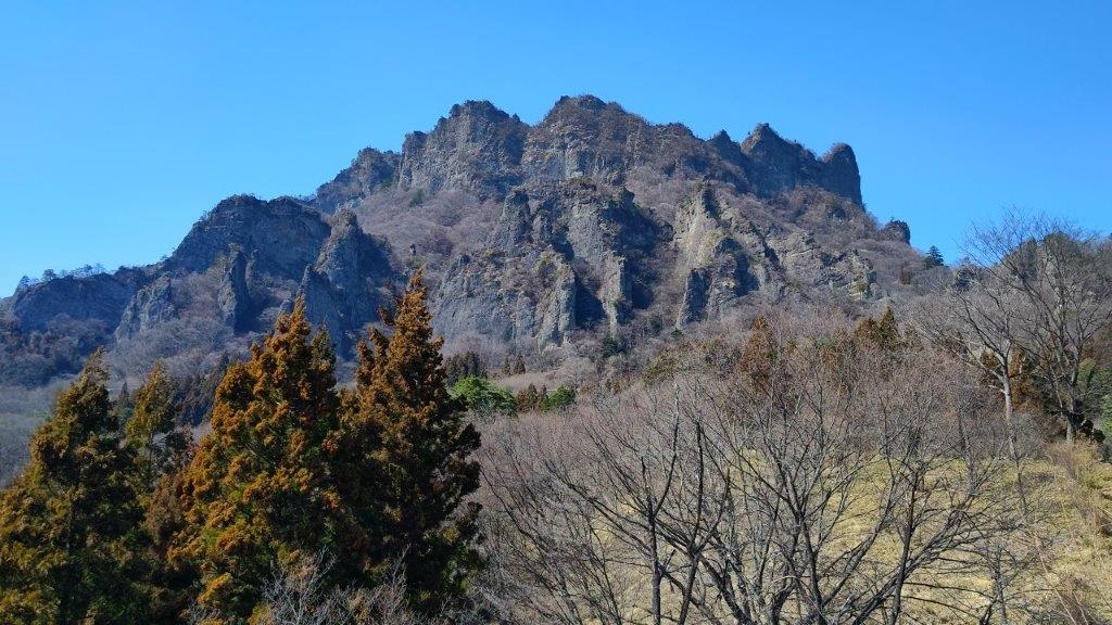
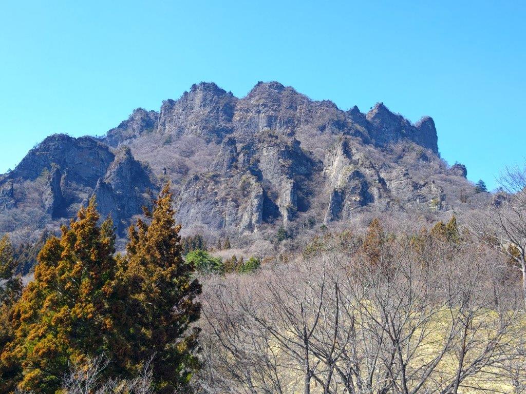
Rear Side Ridge (left) and Front Side Ridge (right) on Mt Ogusu

Walking in the Afternoon Sun (left) and along the River (right)

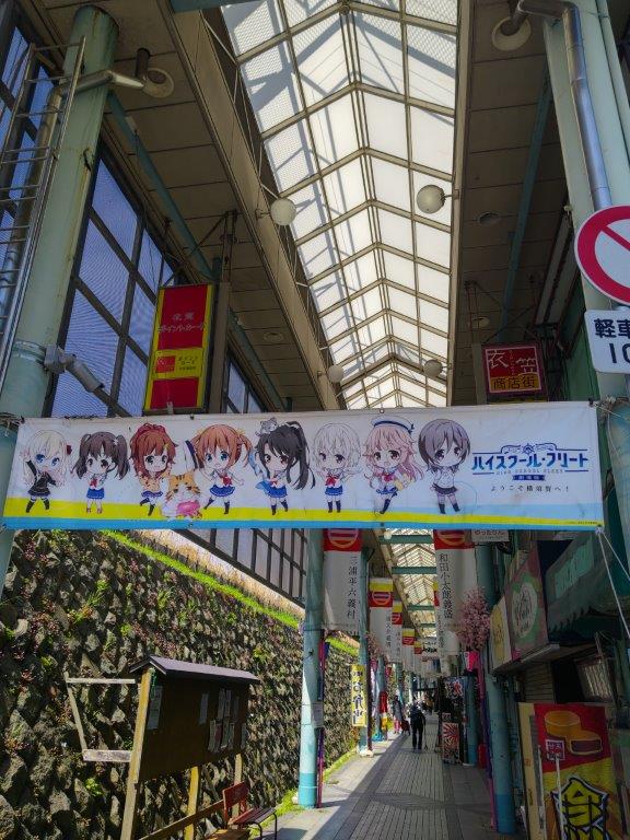
It was a fine spring day as I got off the train at Kinugasa Station around 10am. After a stroll through a shopping arcade, I reached Kinugasa-yama Park (衣笠山公園) and the start of the trail at 1030. Almost at once, I found myself walking through beautiful nature, no other hikers in sight. I soon arrived at a stone staircase where I turned left. At the top, I turned left again, now walking up a paved road, leading to a flat open space at the top of Mt Kinugasa (衣笠山 きぬがさやま kinugasa-yama). The view from the observation deck was partially hidden by cherry blossoms trees, so I quickly moved on to a taller observation tower a few minutes away.

Walking through the lower half of Kinugasa-yama Park

Walking through the higher half of Kinugasa-yama Park

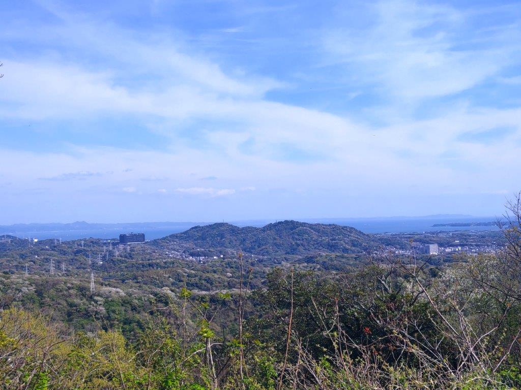
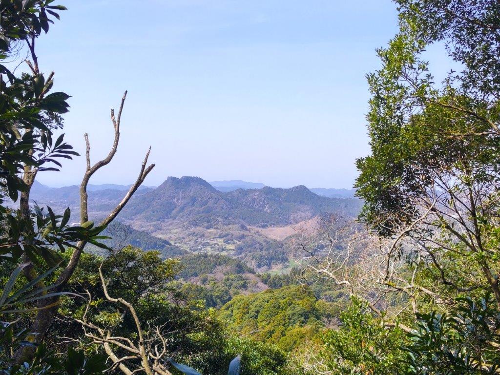
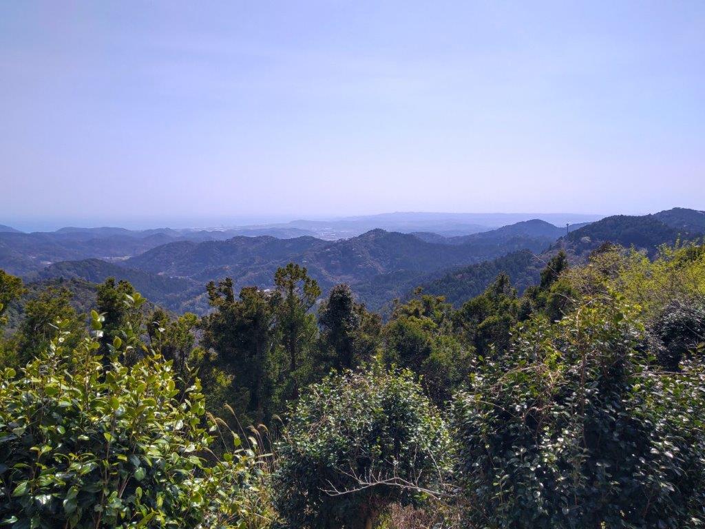
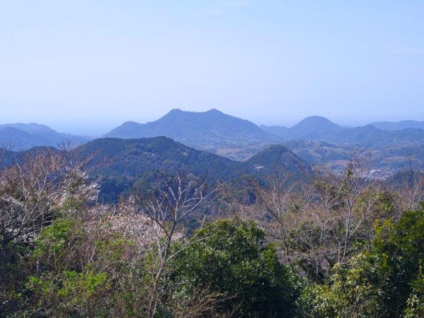
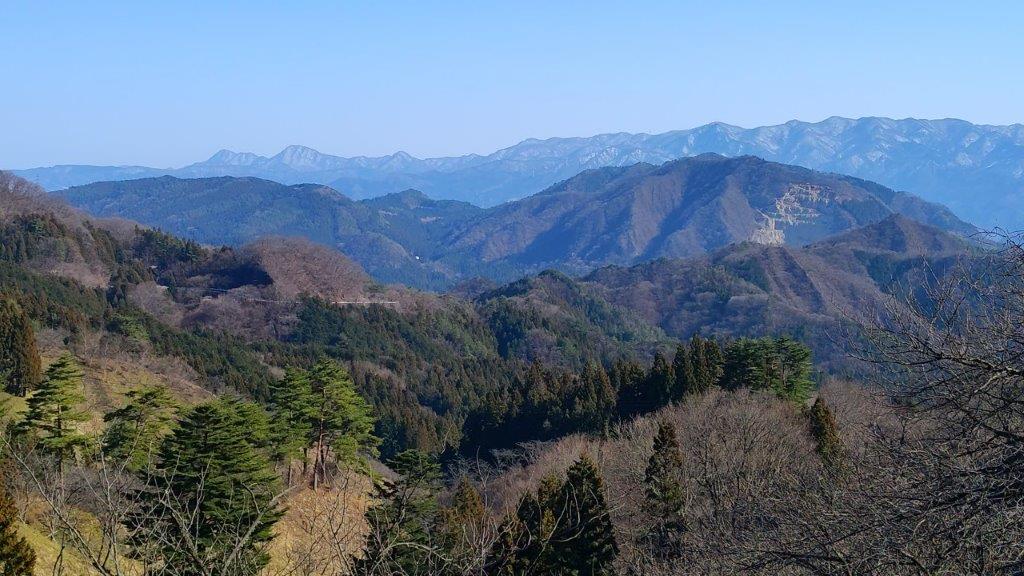
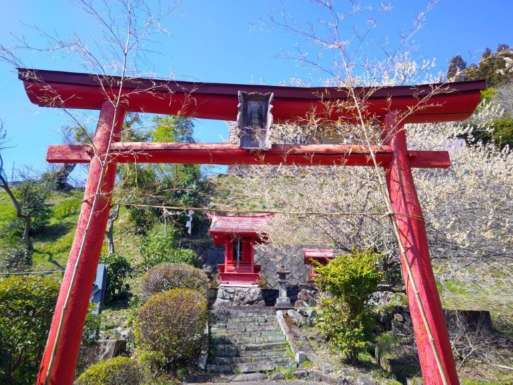
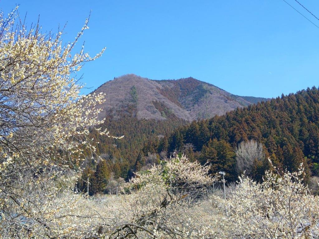
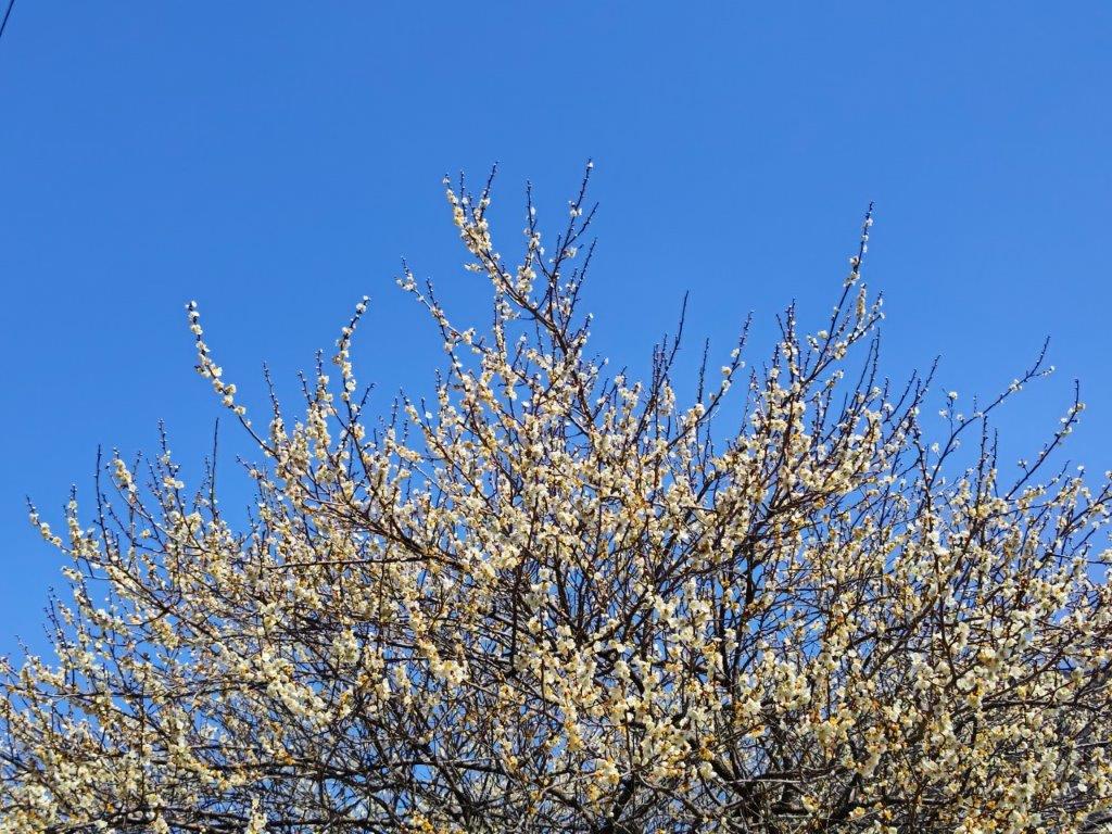
I was impressed by the view from the top of this low mountain, as I could see most of the peaks of the Miura peninsula, Tokyo Bay and the western coast of the Boso peninsula. To the south, I spotted Mt Hodai and Mt Miura-Fuji past the treetops; directly west was Mt Ogusu, the highest peak in the area; finally, the Miura Alps extended across the neck of the peninsula on the north side. Cherry blossom trees surrounded the tower but were already past their prime. I continued my hike, walking down log steps sprinkled with fallen petals. Just before noon, I reached a busy road at the base of the mountain. I followed it for a short while but soon left it to follow a lane up a steep slope. Just beyond a staircase leading to a shrine, the lane ended at another hiking trail.

View of Mt Ogusu from the top of Mt Kinugasa

View of Tokyo Bay from the top of Mt Kinugasa

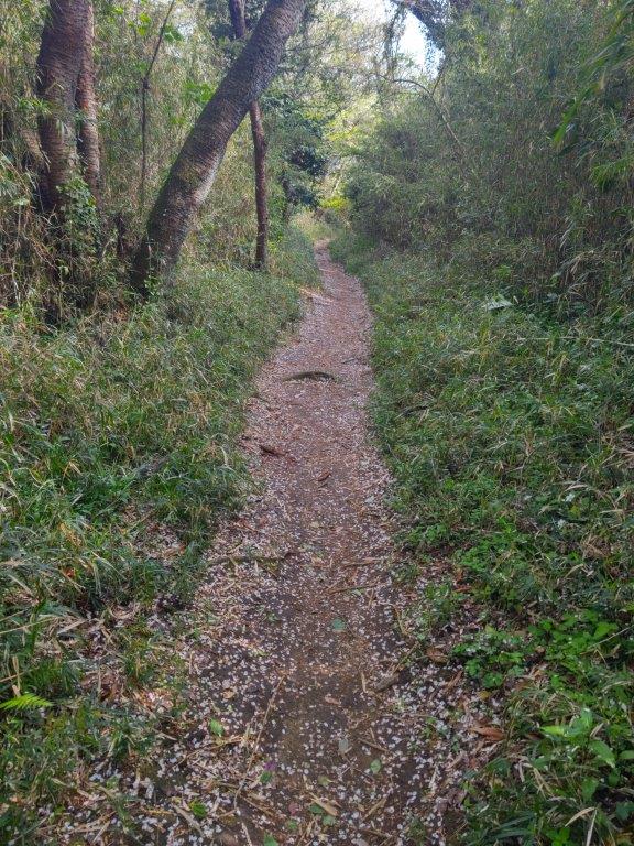
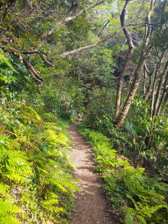
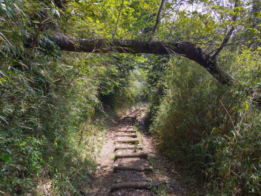
I was delighted to be back on a hiking path, surrounded by the forest and free of people. The trail was mostly level, a fallen tree trunk providing the only difficulty. Shortly before 1pm, I reached a bridge over a highway, picking up the trail on the other side. After a short climb, I arrived at a road free of traffic leading to a recycling center. After observing a couple of cats strut around, I made my way up some steps leading to the next part of the hiking route. After some easy climbing along a well-maintained path, I reached a ridgeline at 1h30, and continued straight, ignoring a trail on the left side.

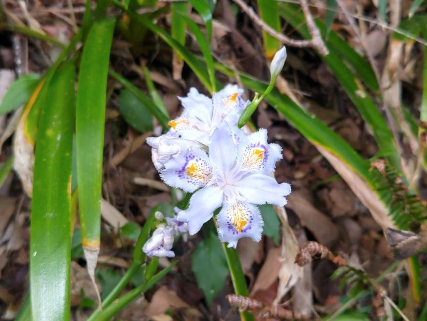
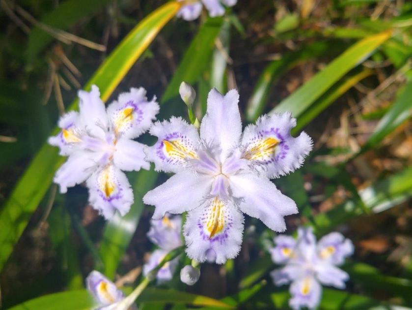
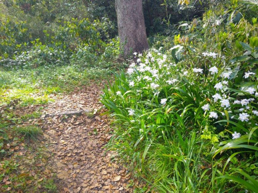
Irises lining the path

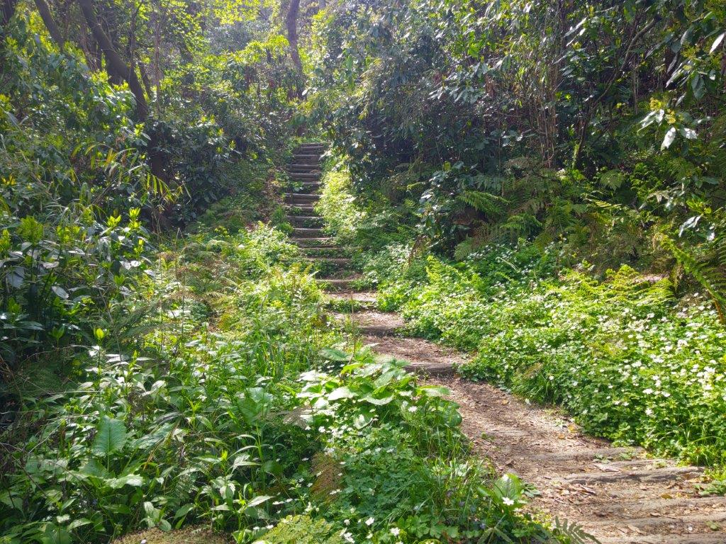
Many steps up Mt Ogusu

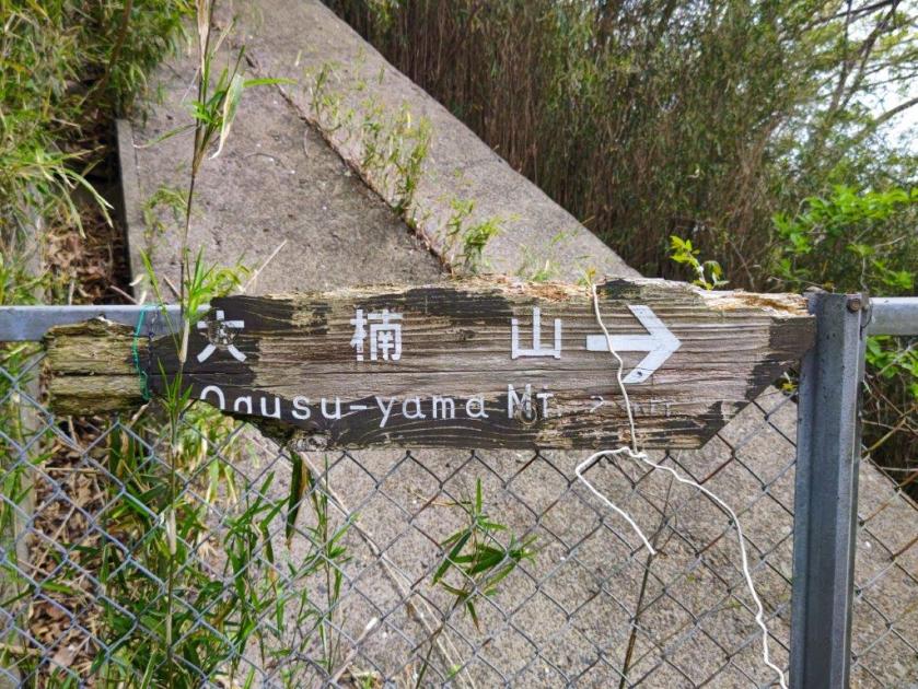
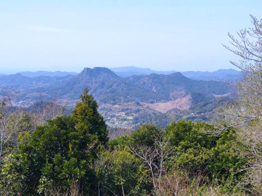
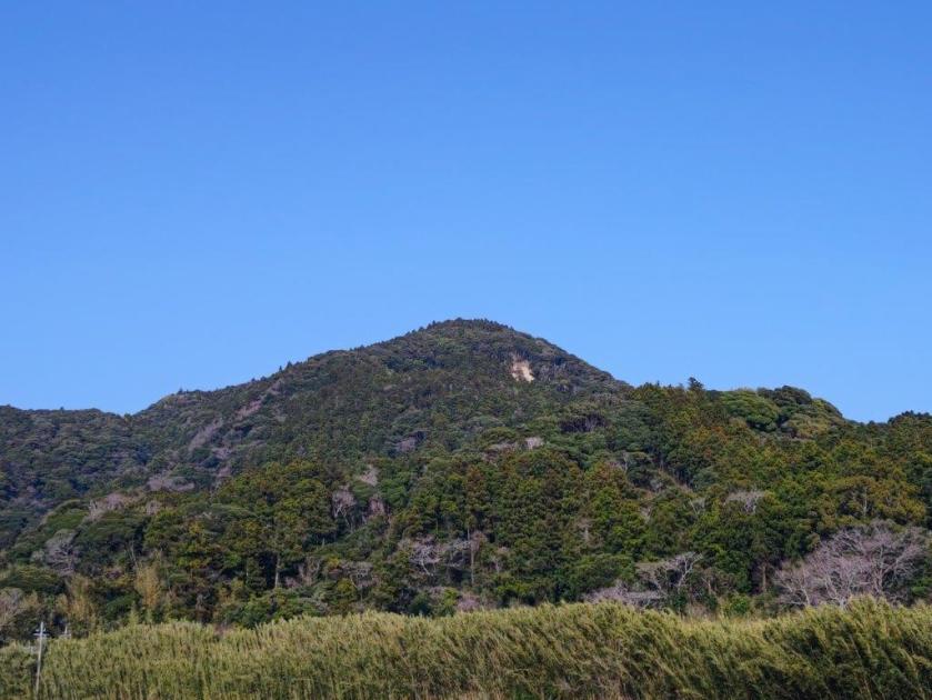
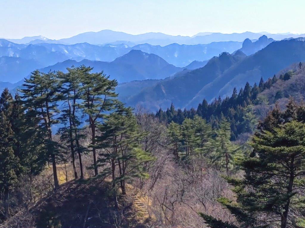
The many iris flowers lining both sides of the path made this the most pleasant part of the hike. The forest retreated to allow for a power line, revealing blue skies splashed with white cirrus clouds. Very soon I arrived at the junction of my previous hike here. From this point, I followed a series of log steps through the new spring green all the way to the top of Mt Ogusu (大楠山 おおぐすやま oogusu-yama), a Kanto 100 famous mountain. Since it was 2h30, I sat down for a late lunch. The main observation tower was closed but another one a short distance way provided good views of the Miura Peninsual to the south and the Miura Alps to the north.

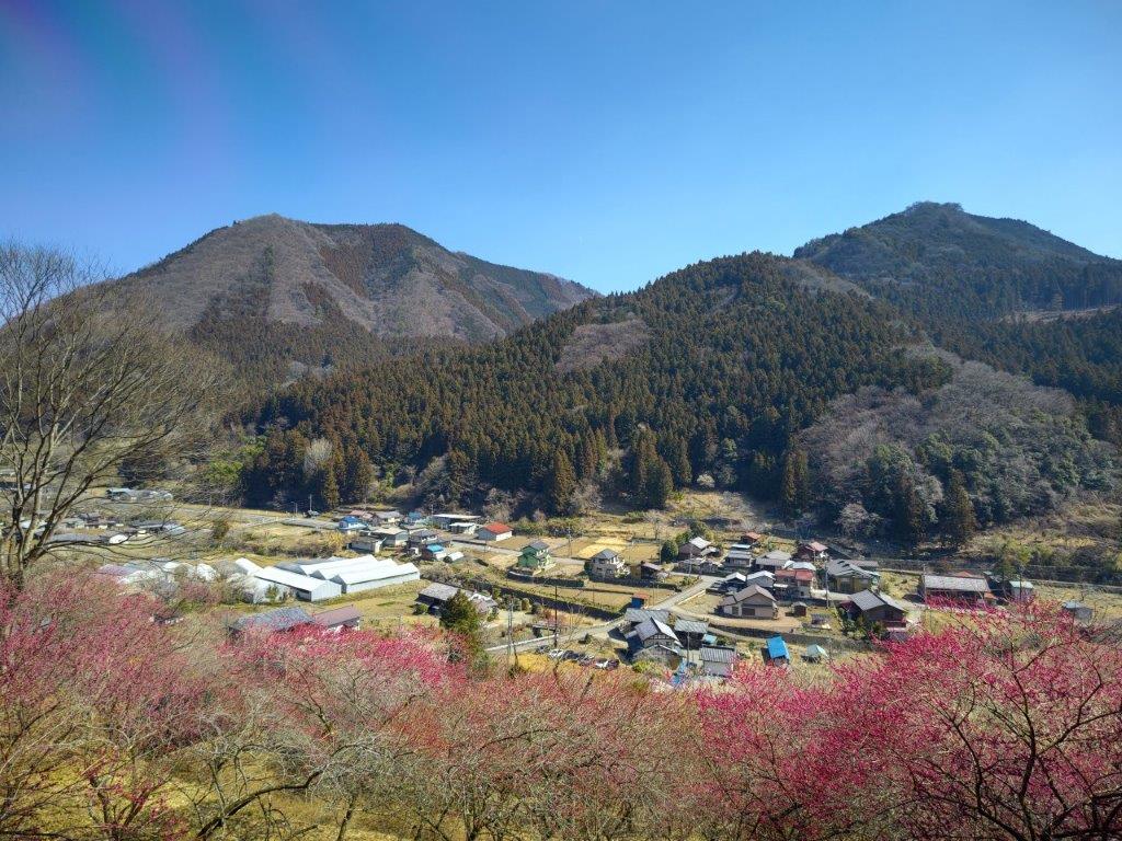
View of Mt Hodai and Mt Miura-Fuji from the top of Mt Ogusu

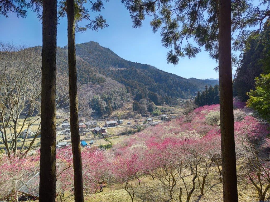
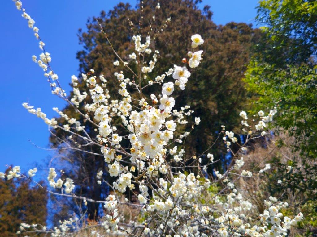
“Half Blossoms” and “half Miura” from the the Observation Tower

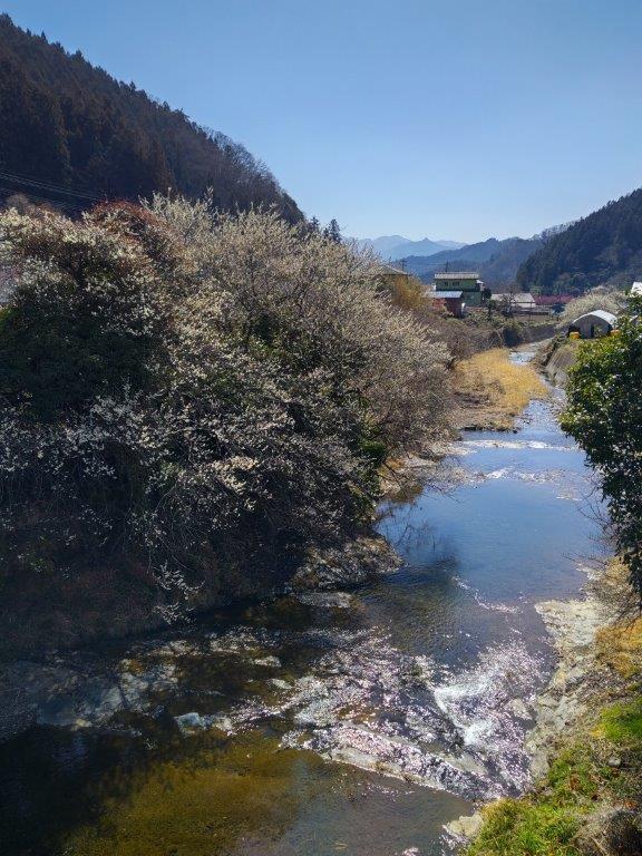
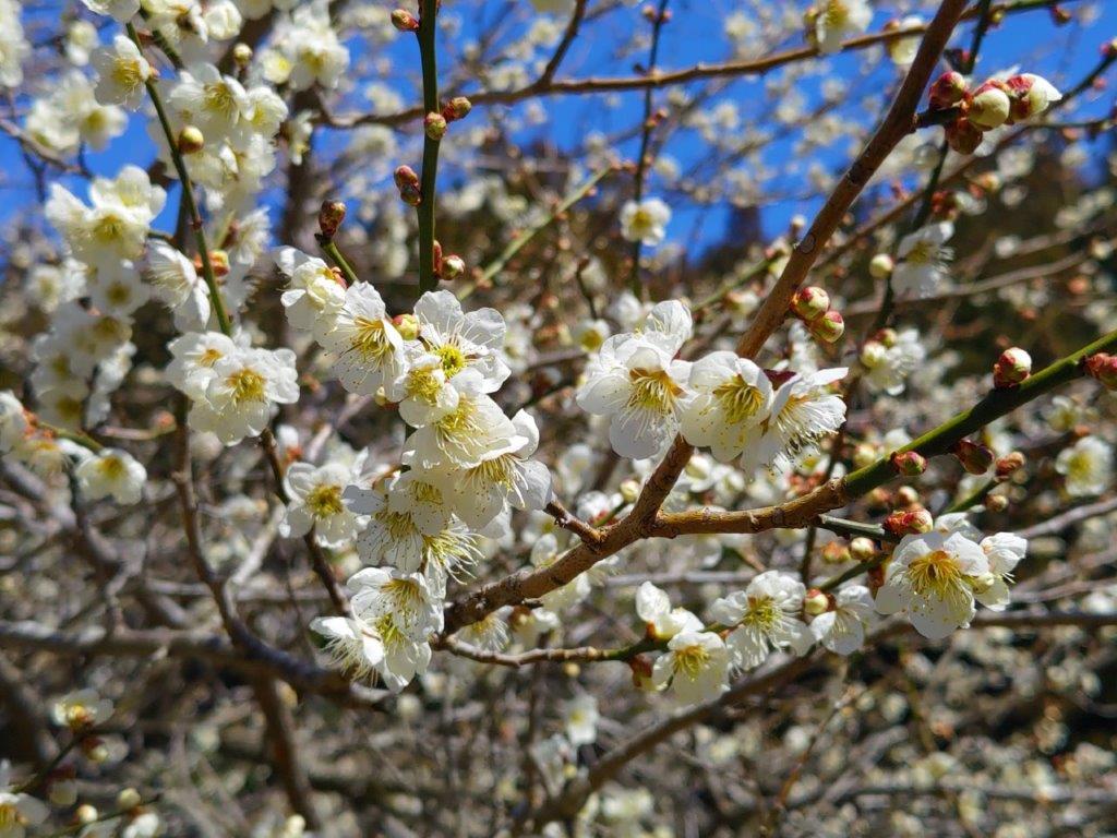
I was glad to see more cherry blossoms trees around the tower, half the petals still hanging on. I now headed down the Maedabashi route (前田橋コース), also the Kanto Fureai no Michi, passing relatively few people on the way. Half an hour later, I arrived at the start of the Maedagawa Promenade (前田川遊歩道). I had done it twice before but the water level had been lower than now, and it was a lot more impressive in this season. I wanted to linger to enjoy the sound of rushing water but I had a bus to catch. By 4pm, I was on my way back to Zushi station, reached after a slight delay due to the expected traffic jams. There, I boarded the Shonan-Shinjuku line for the one hour ride back to Tokyo.

Watch a video of the Mt Ogusu Hike

Watch the Video of the Hike on YouTube

See a Slideshow of More Pictures of the Hike

Mt Goten (364m) & Mt Kyozuka (310m), Minamiboso City, Chiba Prefecture, Sunday, March 31, 2024

I wanted to do a hike using the newly published Miura/Boso hiking map. Looking over the Boso Peninsula section, I discovered a new trail connecting Mt Goten (climbed in winter 2016), and Mt Kyozuka. The latter was mentioned in my mountains of Chiba guidebook, but had been badly battered by the powerful typhoons of 2018. Looking online, it seemed like the mountain had recovered sufficiently and the trails were passable again. Between the two mountains, was a dammed river crossable thanks to a pedestrian bridge.

Hiking on the Boso Peninsula 房総半島

To get to the start of the hike, I would ride the Sazanami limited express from Akihabara to Iwai station, and from there, take a bus to the Mt Goten trailhead*. From the base of Mt Kyozuka, I would ride another bus to Tateyama station. There, rather than catch the limited express back to Tokyo, the connection time being only a couple of minutes, I would take the longer but more picturesque ferry route back. The weather on the peninsula was supposed to be sunny, with temperatures high for the season, but cooler than the mainland. I was looking forward to exploring a new area on the eastern side of the Boso peninsula.

*The bus only runs to the Mt Iyo trailhead, about 30 minutes away on foot, and advance phone reservation is needed for it to continue to the Mt Gozen trailhead .

For subscribers, read this Blog Post on Hiking Around Tokyo for a better viewing experience and the latest updates

End of the Road and Start of the Mt Gozen Hiking Trail

View of Mt Atago from the Mt Gozen Hiking Trail

It was a perfect blue sky day as I rode the limited express to Iwai, with views of Tokyo Bay on the right side. A little after 10am, I boarded the microbus for the half an hour ride to the end of the line. After getting off at a parking near Koshoji-Temple, I was greeted with the soothing sound of croaking frogs and bamboo bushes swaying in the wind. Across the road was today’s first peak, looking tantalisingly close. After getting ready, I set off at 11am, continuing a little further along the main road, before taking a side road on the right, an alternative path to the summit. Here and there, I could see white and pink cherry blossom trees in full bloom.

View of Mt Iyo from the Mt Goten Trail

Trail below the Mt Goten Summit

Turning around, I had an impressive view of the valley, as well as Mt Atago, the highest mountain in Chiba. At 11h30, I reached a signboard marking the start of the trail. Although it was clearly marked on my map, it seemed to have fallen in disuse. After some scrambling and path finding, I reached the ridgeline and the main trail to the summit, a little after noon. A few minutes later, I arrived at a steep section leading to the summit. Instead of going up, I followed a level path on the right, around to the other side where some log steps made for a more relaxing ascent. At 1230, I was at the top of Mt Goten (御殿山 ごてんやま goten-yama), a Kanto 100 famous mountain and fifth highest peak in Chiba.

View south from the top of Mt Goten

View West of Mt Tomi and Mt Iyo from the top of Mt Goten

I had forgotten how impressive the view was, arguably one of the best on the peninsula. Since the summit is equally far from each coast, both Tokyo Bay and the Pacific Ocean are visible. On the west side, I could see Mt Iyo and Mt Tomi, and behind, the jagged top of Mt Nokogiriyama. All 3 peaks have unique shapes, creating a view worthy of a fantasy world. It was too early for lunch so I headed back down the steps and took a path on the left, leaving the ridgeline. The trail descended steeply and was at times rather faint, although the occasional log step showed I was on the right way; I eventually reached a stream at the bottom of the valley. The hike was starting to feel quite adventurous and I was a little worried I would suddenly reach a dead-end after one of the many twists and turns in the path as it now followed the meandering stream.

Walking under the Fallen Trees

Partially Buried Section

I was relieved to finally reach a forest road, right after crossing the stream. I still had to navigate a couple of obstacles, some fallen trees and a partially buried section, but eventually it became easy to walk. I heard the croaking of frogs again, and this time saw several soaking in the shallow pools along the road side. At 1h30 I reached the end of trail, marked by a domestic cat lounging on a paved road. After a short walk through the countryside, I reached a main road where I turned left. I soon turned left again, onto a smaller road, leading to a short, dark tunnel. A little beyond it, I crossed a bright red footbridge over a dammed river, its muddy waters light brown under the shining sun. On the other side, I headed up the trail for today’s second peak.

Near the end of the Mt Goten Trail

Dammed River between Mt Goten and Mt Kyozuka

It was delightfully cool in the shade under the trees on what was turning into quite a warm day. At a bend in the path, I came across an ancient mossy stone lantern, making me feel like I had stumbled into a Ghibli movie. After a short steep climb, I found myself surrounded by Japanese stone oaks (“matebashii“), their white tree trunks reaching up like an upside-down mangrove. A little after 2h30, I reached the summit of Mt Kyozuka (経塚山 きょうづかやま kyouzuka-yama). On the east side, I could again see the Pacific ocean, this time much closer. I sat on a log seat for a late lunch; I had somehow fallen behind schedule, the times indicated on the map being a little off, so I quickly moved on, now following a trail heading southwards and downhill. Half an hour later, I emerged onto a road leading through fields to a main road where I turned left, soon arriving at a bus stop.

View of the Pacific Ocean from the Top of Mt Kyozuka

Looking back at Mt Kyozuka from the End of the Hike

From Tateyama station, I rode the local Uchibo line to Hama-Kanaya station, where I switched to the Tokyo Bay Ferry for the forty-minute trip to Kurihama port. Mt Fuji was hidden by the clouds but it was refreshingly cool and pleasant around sunset. On the other side of the bay, it was a short bus ride to Keikyu-Kurihama station, from where it was thirty minutes to Yokohama. There I rode the Shonan-Shinjuku line back to central Tokyo. This hike took a little longer than expected, and although the connection between Mt Gozen and Mt Kyozuka is doable, it requires a GPS device to ensure one doesn’t lose the trail. In the future, I’d like to return to the area by car for some more exploring.

Watch a Video of the Mt Goten & Mt Kyozuka Hike

Watch the Video of the Hike on YouTube

See a Slideshow of More Pictures of the Hike

Sakura no Sato (700m), Mt Myogi, Shimonita Town, Gunma Prefecture, Saturday, March 16, 2024

I had been planning to do this section of the Gunma Fureai no Michi for a while but kept on putting it off since the second half, done more than ten years ago, was closed due to rockfall. As with my previous hike, it was becoming clear that the closure might be permanent so I decided to head out anyway, and just follow the road for the last part. Although I wouldn’t be passing any summits on the way, I hoped to to get a view of the mountains of western Gunma from a park located on the southern flanks of Mt Myogi.

Hiking on the Kanto Fureai no Michi 関東ふれあいの道

Hiking in Nishi-Joshu 西上州

To get to the start of the hike, I would ride the shinkansen to Takasaki and then transfer to the Joshin railway for the one-hour ride to Shimonita. There, I would ride a taxi to a nearby plum blossom garden. I would end the hike at a hot spring facility at the northern edge of Mt Myogi; after a refreshing dip, I could take a taxi to Matsuida station on the Shin-Etsu line, a few stops from Takasaki. The weather was supposed to be sunny, as well as warm for the season. I was looking forward to getting some close up views of one of the three famous mountains of Gunma.

For subscribers, read this Blog Post on Hiking Around Tokyo for a better viewing experience and the latest updates

Going up through the Sakura no Sato Park

View of Hitto Rock (left) Path for Myogi Shrine (right)

Surprisingly, almost all seats on the Joshin Electric line were taken upon leaving Takasaki station, although most passengers got off well before Shinomita, the final station on the line. After a short taxi ride, I was at the entrance of Fukujuso no Sato (寿草の里), a little past 10am. After getting reading for hiking, I made a small donation at the front gate and entered the plum blossom garden, the last day of the year it was open to the public. I made my way along a path under white and red blossoms, slowly heading up the mountain side; at 11am, I reached a viewpoint at the highest point of the garden.

View of Mt Ogeta (right) from Fukujuso no Sato

View of the Plum Blossoms from the Highest Point

I was amazed by the sea of pink spreading down into the valley. Opposite was Mt Ogeta; on the south side, I spotted the triangular shape of Mt Inafukumi, and northwards, I could make out one of Mt Myogi’s many peaks. After a short break, I headed down via a different path, and half an hour later, joined up with the Fureai no Michi, descending from Mt Ogeta on the right. I was now heading north along a road connecting Shimonita with Matsuida, but soon turned left onto a smaller road leading up a valley. On the left side, beyond a stream, I could see the higher slopes of Mt Mido. At noon, I arrived at the Nakamura bus stop, where I turned right, heading up a small mountain road with almost no traffic.

View of Mt Mido from the Fureai no Michi

View of Mt Myogi from the Fureai no Michi

Along the way, I enjoyed the view of plum blossoms trees in full bloom, whetting my appetite for the approaching cherry blossom season. As the road climbed higher and higher, I noticed patches of melting snow in the shade, a reminder of the winter weather that had only just loosened its grip a few days ago. At 1pm, I reached a trail at the base of the Sakura no Sato Prefectural Forest Park (県立森林公園 さくらの里), meaning “Sakura Village” and famous for its many cherry blossom trees, supposed to reach full bloom in a few weeks. A short climb took me above the tree tops, their buds firmly closed, and at a fork in the path I stopped to turn around.

View of Western Gunma from Sakura no Sato

Nearing the Open Shelter and Mt Myogi Viewpoint

I was stunned by the impressive view of the long mountain ridge separating Gunma and Saitama, still covered in snow; I had climbed many of these peaks, including the highest one, Mt Akaguna; in the foreground, I could see Mt Ogeta and Mt Mido. A few more minutes up some log steps brought me to an open shelter with a dramatic view of Mt Kondo, the north side of Mt Myogi. Since it was just past 1pm, I settled down for lunch. At 2pm, I resumed my hike and made my way to the rest house at the highest point of the park. Along the way, I had some excellent views of the nearby Hitto-Iwa (筆頭岩 826m), a mini-version of the Matterhorn. Although the trail to the summit is closed, I could follow it all the way to the base of the rocky summit.

Mt Kondo from Sakura no Sato

In the background, Mt Mikabo (left), Mt Inafukumi (center) and Mt Akaguna (right)

I was rewarded with a striking view of Mt Souma, the south side of Mt Myogi and its highest peak, the best view of the day. Since I was on schedule, I took some time to walk along the road above the park to get some more views of the mountains of Nish-Joshu; I could see all the way from Mt Mikabo on the eastern side to Mt Arafune on the western side. At 3pm, after crossing the road, I was back on a hiking path for Myogi Shrine along the Fureai no Michi, heading down a steep, rocky trail, now in the afternoon shade. Very soon, I reached another viewpoint of Mt Souma, this time from below; fortunately, the rocky face was sill bathed in the late-afternoon sunlight.

The Matterhorn lookalike Hitto Rock from Sakura no Sato Park

Mt Souma from the Fureai no Michi

I admired the ragged summit, tantalizingly close but beyond the reach of the casual hiker. Some more descending brought me back to the road I was on earlier; it had taken a long detour around Hitto-Iwa. From this point it was a thirty-minute walk to Momiji-no-yu Hot Spring, which I reached around 4pm. Before hopping into the outdoor bath with a view of Mt Akagi, a made a quick visit to the neighbouring Visitor Center where I was able to examine a couple of relief models of Mt Myogi. The onsen staff were kind enough to arrange a taxi for me, and by 5h30, I was at Matsuida station waiting for the train for Takasaki. Although roughly half of this six-hour hike was on paved roads, I met no other hikers, saw plenty of plum blossoms and had some amazing views of the mountains of Gunma.

Watch a Video of the Sakura no Sato Mt Myogi Hike

Watch the Video of the Hike on YouTube

See a Slideshow of More Pictures of the Hike