Mt Shazan (1826m), Nikko City, Tochigi Prefecture

This was my 8th hike in the Oku-Nikko or “deep Nikko” area (not counting several cross-country skiing trips). It’s one of my favourite places because of the easy public transport access, well-maintained trails, beautiful nature and, if the weather cooperates, breathtaking views. When I climbed Mt Hangetsu in 2018, I discovered a bus line that ended just below the summit, and I hoped to use it for another hike someday. Starting from there, I would be able to reach the next peak in a couple of hours, and then make my way back to Chuzenji Onsen via the lake. In theory it looked doable; in practice, due to the tight bus schedule, I had less than 5 hours to complete the hike. Also, rain was forecast in the afternoon, so I hoped I would be able to make it to the summit, and the views, before the clouds rolled in.

Hiking in Oku-Nikko 奥日光

I arrived at Tobu-Nikko station around 9h30, and caught the bus for Yumoto Onsen; as I had hoped, it was more than half empty on a weekday. I got off at Chuzenji Onsen, where I had to wait about thirty minutes for the bus for Hangetsu 半月, a seasonal bus running only a few months of the year. This time, I was the only passenger. It followed a thrilling road up the side of the mountain, with great views of the mountains South of the lake, and ended at a parking area next to a grassy park, on the shoulder of the mountain. Looking back at it during the hike, it reminded of an Inca terrace (see top photo).

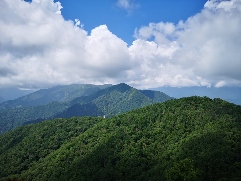
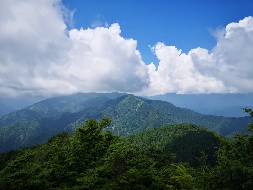
Today’s mountain was the triangular peak in the center

Good trail at the start of the hike

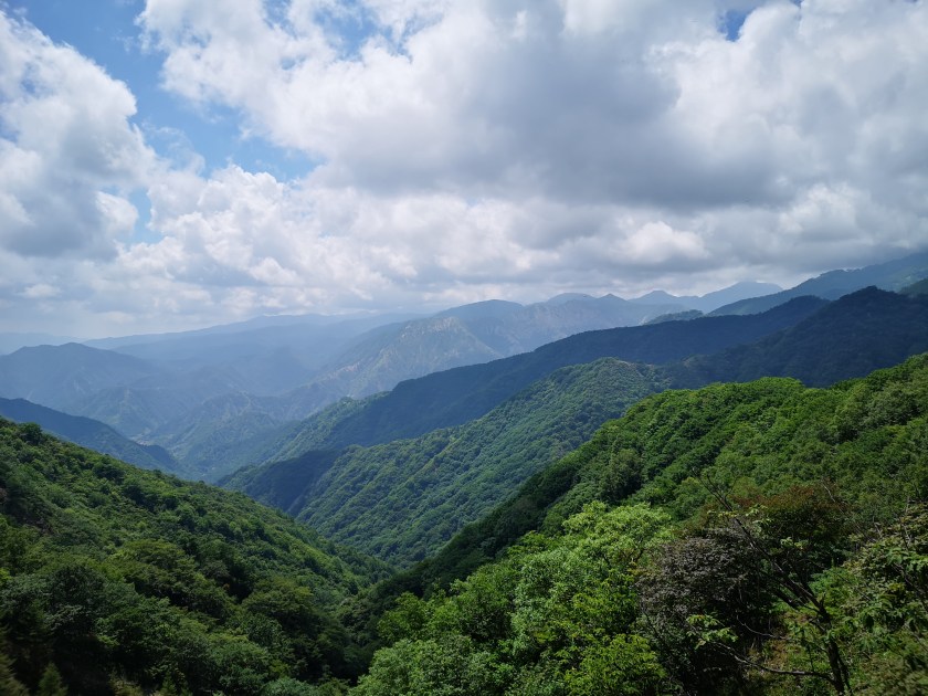
I got off the bus and admired the view for a while. The mountains ridges spread in every direction, with no signs of civilisation in the deep valleys.  I finally set off at 11h30. The start of the trail was easy to walk, alternating level and climbing sections. I soon reached the observation platform below Mt Hangetsu, with a view of Chuzenji lake and Mt Nantai to the North. Since I had been there before, I moved on quickly. The trail continued via a series of tight switchbacks down a steep grassy slope with few trees and great views South and West; the sky was full of big puffy cumulus clouds, the biggest one sitting on top of Mt Nantai!

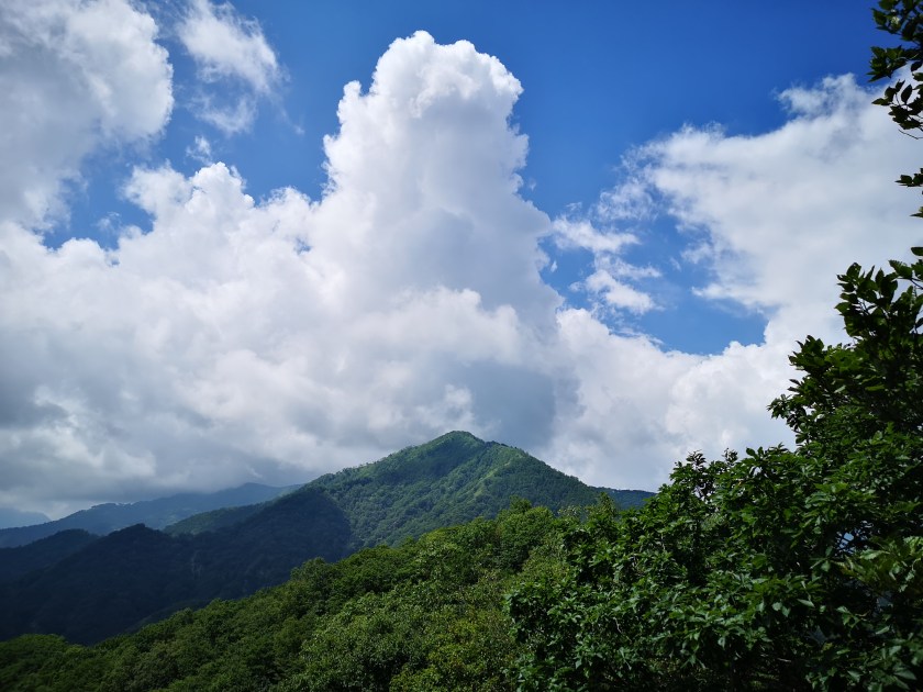
Summer is the time of Cumulus clouds

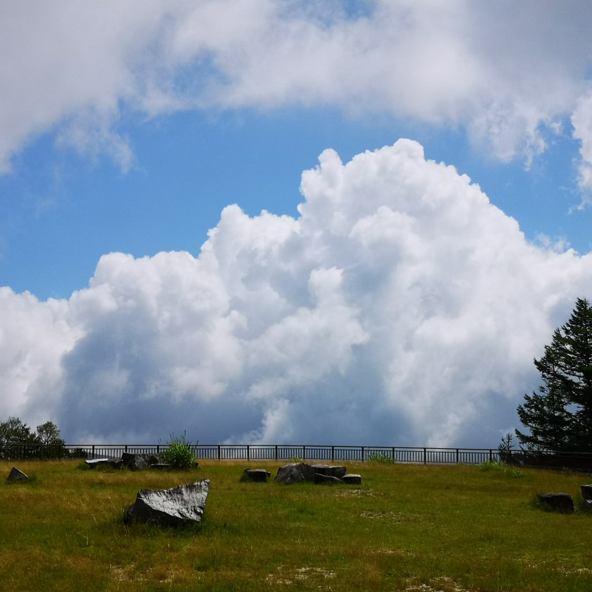
Despite all the clouds, the weather remained good

At noon, I reached Hangetsu Pass, where on my previous hike I had turned right, down to the lake; this time I continued straight. After a short climb, I reached the minor peak of Mt Chuzenji 中禅寺山 (1650m) in the middle of the trees. Next was a pleasant half an hour descent through a larch tree forest to Asegata Pass 阿世峠.  I had an early lunch before starting the last big climb of the day. So far the weather was holding, and although it felt hot in the sun, it was pleasantly cool in the shade. On the way up, I passed a couple of good viewpoints of Lake Chuzenji, before reaching a steep, but short, climb through some birch trees.

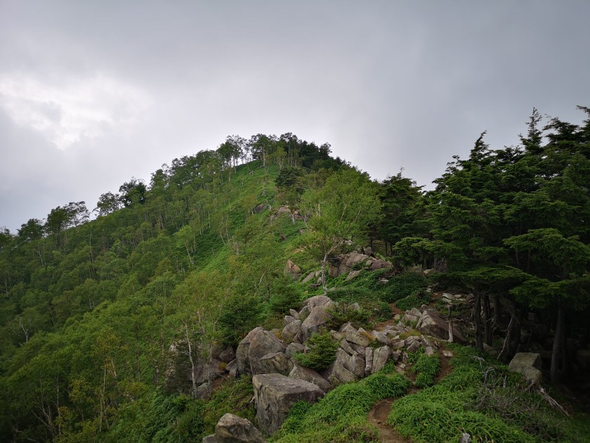
There is a hiking path following the top of the entire ridge

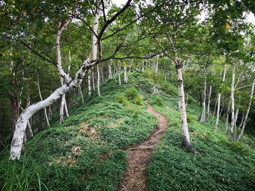
Climbing through the birch trees, called “kaba” in Japanese

The trees thinned, and I soon emerged onto a grassy rocky slope. Here, I had some of the best views of the day, I stopped every few meters to take photos. On my left, the lower ridges dropped away, giving the impression of being at the top of the world; on my right, the highest mountains of the Nikko National Park loomed above me, their peaks lost in the clouds, giving the impression of being at the edge of a hidden kingdom. I felt grateful that I could do such an amazing hike as a day trip from Tokyo.

The landscape tumbling downwards to the South

Getting close to the top

Shortly before 2pm, I reached the top of Mt Shazan (社山 shazan also read as yashiroyama). Although it’s a steep climb, the altitude difference is only 400 meters, so it didn’t required too much of an effort. Big grey clouds were hovering overhead, and a downpour felt imminent. I popped through some trees past the summit to have a quick look at the next part of the trail, and surprised a deer on the other side; it bounced away before I could get a picture. I saw that the trail continued up and down following the ridge around Chuzenji lake, the highest parts hidden by the slowly approaching mist. I quickly had the rest of my lunch, and headed down the way I had come up.

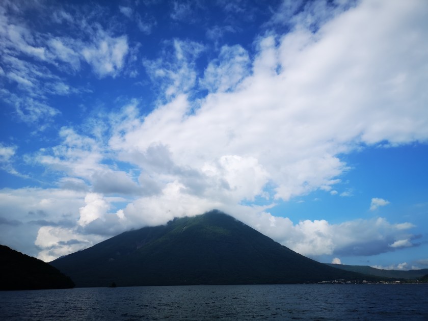
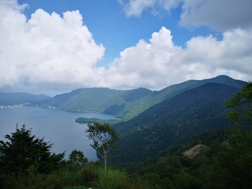
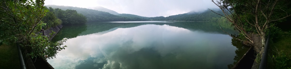
Mt Nantai, nearly clear of clouds, from the shore of Chuzenji Lake

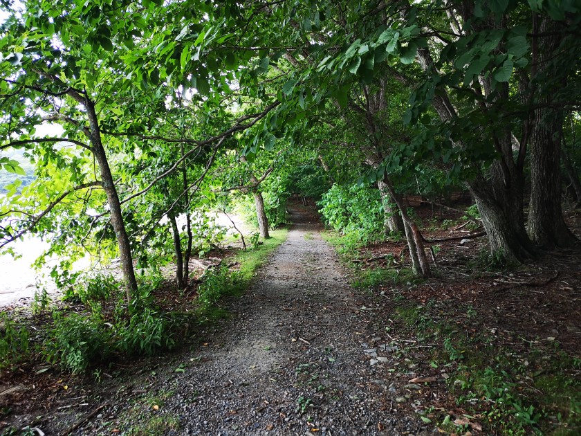
The Chuzenji lake “Shukaisen” path that goes round the lake

As I hurried down, the clouds retreated and the sun returned. It took me less than a hour to reach the lake shore. From there it was another hour of walking along a pleasant forest path to the end of the hike. The path was peaceful and easy to walk. It’s possible to hike around the lake, and I hope to do this in the future. At 4pm, I was back at Chuzenji Onsen, and I just had time for a quick hot spring bath at Nikko Sansui before catching the bus back to Tobu-Nikko station.

I was glad that this hike could be done in less than 5 hours, although it required some fast walking at the end. The weather forecast turned out to be wrong, a good thing for once!

Mt Hachi (2041m), Mt Akaishi (2109m) & Mt Terakoya (2125m), Yamanouchi Town, Nagano Prefecture

I had been to Shiga Kogen once before, but I had done it as an overnight trip, staying at Kusatsu Onsen on the way. This time I wanted to see whether it was possible to do it as a day hike, by using the Shinkansen to approach from from the Nagano side. I was also curious to see how crowded public transportation would be this far from Tokyo. The temperature in Tokyo was supposed to exceed 35 degrees, so I was worried that it might be too hot for comfortable hiking. Finally, I was hoping for clearer weather this time round; last time, thick clouds rolled in around noon and hid a lot of the views. This is an original hike spanning the central part of the Joshin-Etsu National Park.

Hiking in Shiga Kogen 志賀高原

IMG_20200811_110715

In the foreground, Mt Kasa, in the background, Togakushi Highland

IMG_20200811_140946

The jewel of Shiga Highland, Onuma lake

I arrived at Nozomi のぞみ just below Mt Yokote at 10h40 after a four hour journey that included a regular train, the shinkansen, a limited express and a bus. As I had hoped, the final train and the bus were nearly empty, most people having come by car. It took me about an hour to reach the top of Mt Hachi (鉢山 hachiyama) -sadly no view from the top. The descent was pretty tough, the trail being in urgent need of maintenance. It’s possible to skip this summit by starting from Hotaru Onsen instead.

IMG_20200811_113730

Today’s hike, from the top of Mt Yokote, lit up by the sun

IMG_20200811_142313

The final, and highest section, of today’s hike

The next section was mostly flat and easy, the views obscured by head-high bamboo grass growing on both sides of the trail. There were a couple of spots where the views to the East opened up, and I was able to see Mt Yokote and, further away, Mt Haruna. Looking up, I was still able to enjoy the blue sky and white clouds. I didn’t feel too hot thanks to the combination of clouds and light wind. I saw about three toads along the trail, but I couldn’t get any good pictures or video before they hopped under the bamboo grass.

IMG_20200811_125757

Mt Yokote, today’s starting point

IMG_20200811_132153

I didn’t expect to see Mt Haruna so clearly today

After a short climb, I reached the rocky top of Mt Akaishi (赤石山 akaishiyama) just after 2pm. From the summit, I could see the whole of Shiga Kogen. South was Mt Yokote, West was Onuma Lake and Mt Shiga, North was Mt Iwasuge (which I hope to climb in the future), and East was Mt Haruna. Despite the threat of thunderstorms, good weather prevailed, and I was able to see views that had been denied to me on my previous visit.

IMG_20200811_133426

Mt Akaishi, the middle section of today’s hike

IMG_20200811_140310

The final meters before the top of Mt Akaishi

After a short lunch break, I set off again. The path headed down steeply, then was level for a while, before climbing again. I passed the top of Mt Terakoya (寺子屋山 terakoyayama or 寺小屋峰 terakoyamine), surrounded by trees, but didn’t stop long since I was slightly behind schedule. Very soon, I emerged from the trees and I could see my final destination, the top of the Higashi-Tateyama Gondola Lift, which I reached at 4pm (last Gondola down at 4h20). I could have walked down to the base and bus stop, but then I wouldn’t have had time to take a much-needed hot spring bath at Hotel Higashidate. I was the sole passenger on the bus ride back to Yudanaka station.

IMG_20200811_140331

Onuma lake with Mt Shiga behind

IMG_20200811_142153

Looking Northwards to Niigata prefecture

Although it’s a long way there and back, not to mention the price, I was very satisfied to be able to hike in such beautiful surroundings; at times, I could only see mountains in every direction. This hike is also special in the sense that I could start and finish at around 2000 meters high, a good altitude for hiking in the summer. Finally, because it’s so far from the capital, there were few other hikers so I really had the mountains to myself.

IMG_20200811_142002

Akaishi means red rock so it’s easy to see where the name comes from

IMG_20200811_143849

Mt Choshichiro (1579m), Maebashi City, Gunma Prefecture

This was my 4th trip to Mt Akagi, but my first time by car. This ancient volcano has many peaks and trails surrounding the top crater, making it a great hiking destination for all levels. On my previous visit, I followed a little-used trail down a beautiful river valley. I was looking to repeat that experience, but on the other side of the mountain. As usual, I was concerned about the weather. The forecast called for rain showers, but I hoped that there would be an equal amount of sunshine.

Hiking on Mt Akagi 赤城山

IMG_20200803_152428

I arrived at the Konuma Parking lot around 1pm in sunny weather. Today’s hike was relatively short so I stopped for an early soba lunch on the way. The moment I set off, thicks clouds rolled in, followed by some light rain. Fortunately, there was no wind and the temperature was comfortable. It took me barely half an hour to reach the top of Mt Choshichiro (長七郎山 choushichirousan), less than 100 meters higher than my starting point. The rain had let up, but all I could see was white cloud…and lots of dragonflies.

IMG_20200803_132317

Do you dare to walk under?

IMG_20200803_133637

The East side of Mt Akagi

After this nice warm-up, I continued down the other side. This path was steep, and some sections had been washed away, maybe by last year’s powerful typhoons. Ten minutes later, I reached a four-way intersection with a sign. I took the path opposite for Otogi no Mori オトギの森, meaning fairytale forest. There were many paths but almost no signs; most joined up a little further down; a few headed down to the Kasu river on the right. I avoided the latter since from my pre-hike research I knew that the area around the river had been damaged by typhoons.

IMG_20200803_142319

A hidden river valley near the top of Mt Akagi

IMG_20200803_142435

Otogi no Mori or Fairytale Forest

Eventually I reached the center of Otogi no mori, a flat quite area with many impressive oak trees, possible “konara“, and a view across the river valley. Continuing straight along the sole remaining path, I soon reached another intersection where I turned right towards Cha-no-ki-batake Pass (茶ノ木畑峠). Here it was possible to hike down to a waterfall and Akagi hot spring, but that will be a hike for another day. I turned right again, and followed the ridge. It was an easy walk, but the views through the trees were lost in the cloud.

IMG_20200803_151609

Ropes to help the hiker

IMG_20200803_165016

For once the bamboo grass was replaced with regular grass

Very soon, the path started to descend steeply. It was slippery because of the recent rain, but I managed to reach the river without any mishaps. I hadn’t expected to find such a beautiful river valley on the upper slopes of Mt Akagi. There was no one else and it felt lonely and mysterious. At the end, the water was funnelled through a narrow opening between some rocks and disappeared into a dark cave – quite an interesting and unexpected sight. It’s called Choushi no Garan 銚子の伽藍 (“choshi” is a kind of sake container, narrow at the top and wide at the base).

IMG_20200803_152825

The Kasu river valley, a fun place to explore

IMG_20200803_154610

All the water from the river disappeared into a rocky tunnel

It was now 4pm, and it had started raining softly again. The trail continued up the other side of the mountain, but it was steep, muddy and overgrown with bamboo grass, so I decided to head back the same way. Soon, the rain stopped again and some sun broke through. I took a different and more direct path back through Fairytale Forest and reached Konuma lake around 5pm. I had an amazing view of the lake through the mist, with Mt Jizo and its TV antenna behind. From a distance, it looked like the spires of a fairytale castle. While walking back to the my car, I had one more surprise – a couple of deer bounding away through the forest.

IMG_20200803_172459

The “towers” of Jizo

IMG_20200803_173329

Konuma Lake in the late afternoon

I was glad I was able to discover another great river valley, although there was no path next to it. The weather was good enough for hiking, but I’ll need to return on a sunny day for the views, probably in the Spring of the Autumn.

Check out “Choushi no Garan” on Mt Akagi

IMG_20200803_124507