
I was looking for another hike in Yamanashi before the arrival of the snow. I also wanted to stay relatively low since the temperatures had plummeted since the previous week. Looking at my map, I spotted a group of suitable mountains just north of Kofu. I had already done a great hike on the northeast side so I was keen to explore the area more. I saw that I could make an open loop passing by several viewpoints, including an interesting rock formation and a lake, within a reasonable amount of time.
Hiking in the Chichibu-Tama-Kai National Park
秩父多摩甲斐国立公園
To get to the start of the hike near Suwa Shrine, I’d ride the Chuo limited express to Kofu station, and from there, ride a bus to a stop within walking distance of the shrine. I’d finish the hike at Yumura Onsen in northwest Kofu, and after a hot spring bath, ride a bus back to the station. The weather was supposed to be clear but cold. I hoped I could get some good views of the surrounding mountains, including Mt Fuji, and still catch the Autumn leaves at their best.
For subscribers, read this Blog Post on Hiking Around Tokyo for a better viewing experience and the latest updates
Find Japan Hiking Maps on Japanwilds
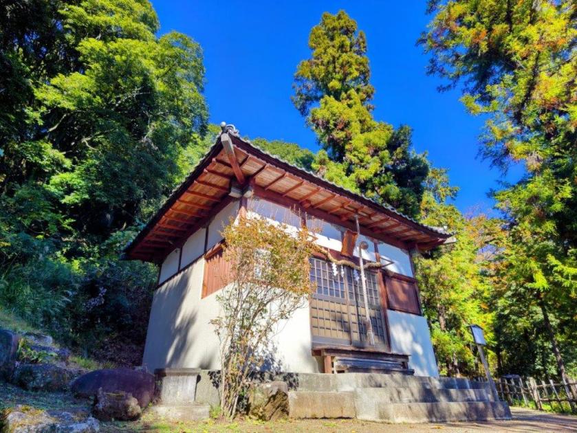
Start of the Hike near Suwa Shrine (left) Tall Pines on Mt Komatsu (right)

Exposed Rocks above Kinsu-toge (left) Autumn Colours near Chiyoda Lake (right)
It was a cloudless, blue-sky day as I stepped off the limited express in Kofu station at 10am. I boarded a local bus, the driver even kindly confirmed my destination, and after a short ride, I got off at a stop still within the confines of the city. A few minutes of walking brought me to the foot of the mountains, and after a short climb, I arrived at Hizakutsu-suwa Shrine (膝屈諏訪神社). It was just after 11am as I passed under the stone shinto gate next to an impressive yellow gingko-tree.


Trail below Mt Shiro (left) Trail past Mt Hosenji (right)


Path for Mt Yumura (left) Flagstones for Yumura Castle Ruins (right)
Turning around, I was rewarded with a view of snow-capped Fuji. I made my way to the white shrine building surrounded by tall cedars, and after taking a few minutes to adjust my gear, set off along a level trail at the far end of the shrine grounds. I soon emerged from the trees onto a sports field, and after crossing a busy road, followed a residential street up the mountain side to a staircase below the trail entrance. This section has no signposts and I had to rely entirely on my phone GPS.
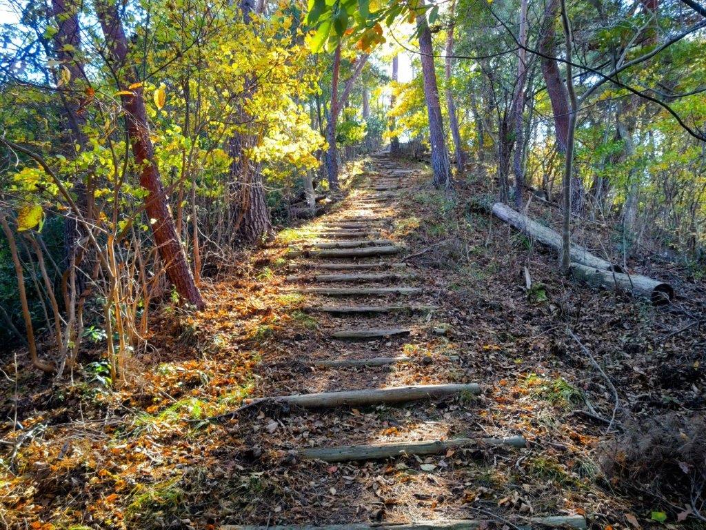
Log Steps Leading to the Top of Mt Komatsu

Walking the Takeda no Mori Promenade
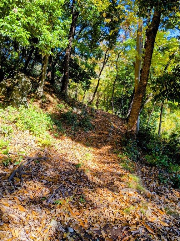
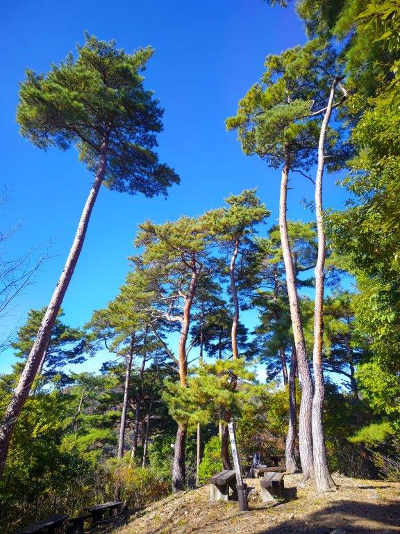
I was surprised to see that the trail was partly overgrown, a sign that it was little used in this season; I was even more surprised to notice spiders again, a sign of their resilience to cold weather. Once the path started to climb, the trail became better defined; I saw the first signpost of the day upon reaching a wide path along the top ridge. I turned right, and after climbing a series of log steps, arrived at the top of Mt Komatsu (小松山 こまつやま komatsu-yama), the promised view mostly blocked by vegetation.

Heading up to Kinsu-toge

The exposed rocks of Mt Awayuki
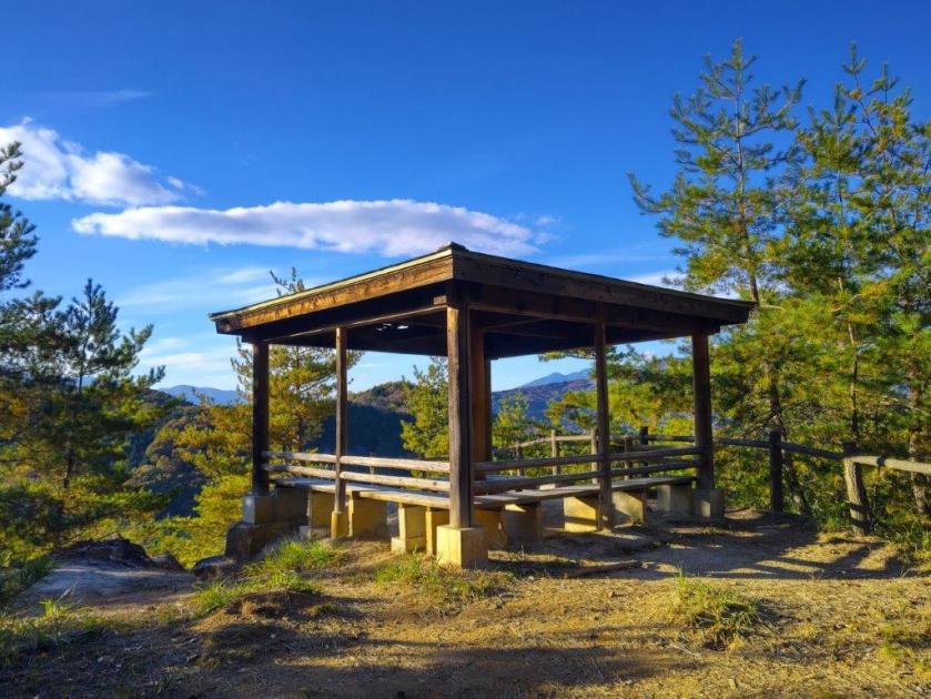
I was tempted to take a break at one of the sunny summit picnic tables but since it was barely noon, I decided to press on. Even though the mountain name means “little pine”, it was home to some very tall red pines, one of the 100 famous forests of Yamanashi. I went back down the steps and followed the ridge northwards, soon merging with the Takeda Forest Promenade (武田の森遊歩道 takeda-no-mori-yuhodo named after Takeda Shingen, a famous feudal lord from the Sengoku era), an ancient road connecting Wada and Iwado passes; I had already walked the latter part on my Mt Yogai hike. I strolled along the wide, level path as it followed the mountain side eastwards through the forest.
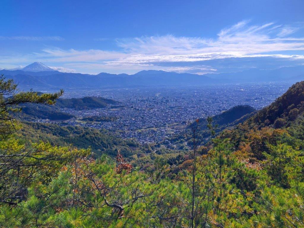
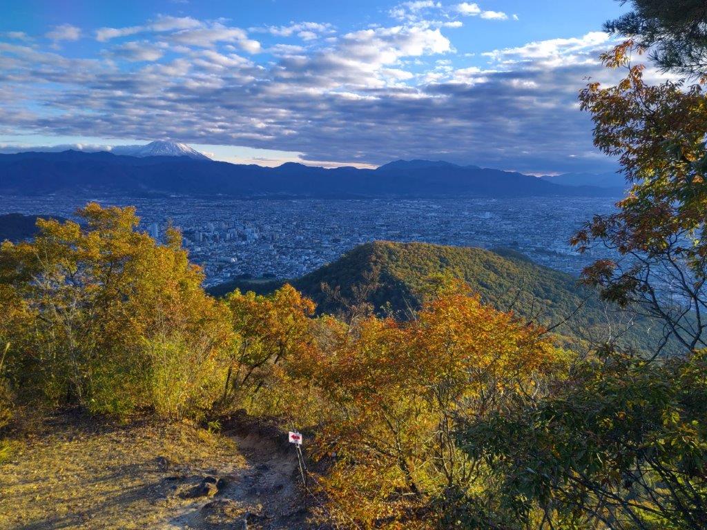
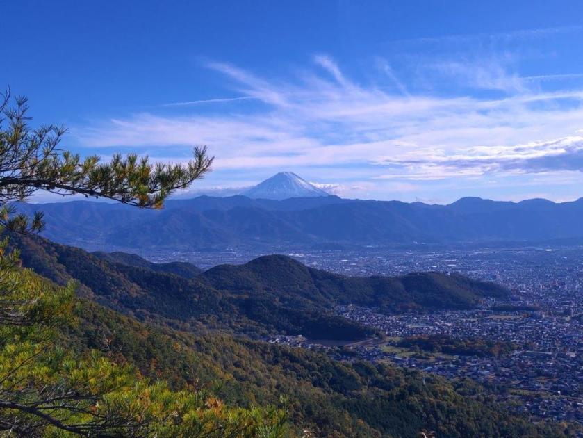
First view of the day near Kinsu-toge

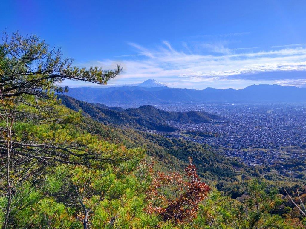
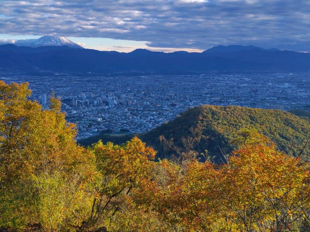
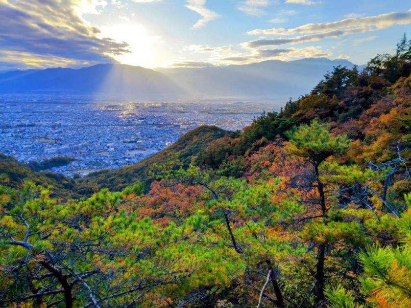
Mt Fuji, the Misaka Mountains and the Kofu Basin
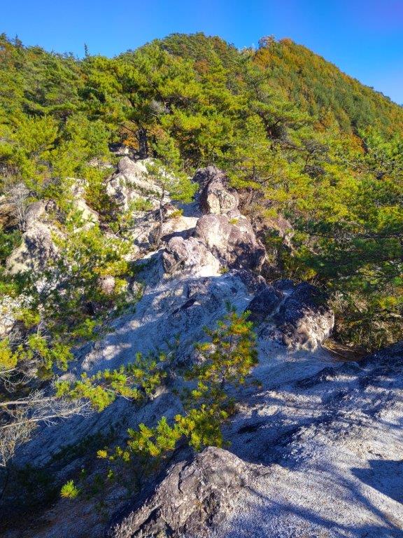
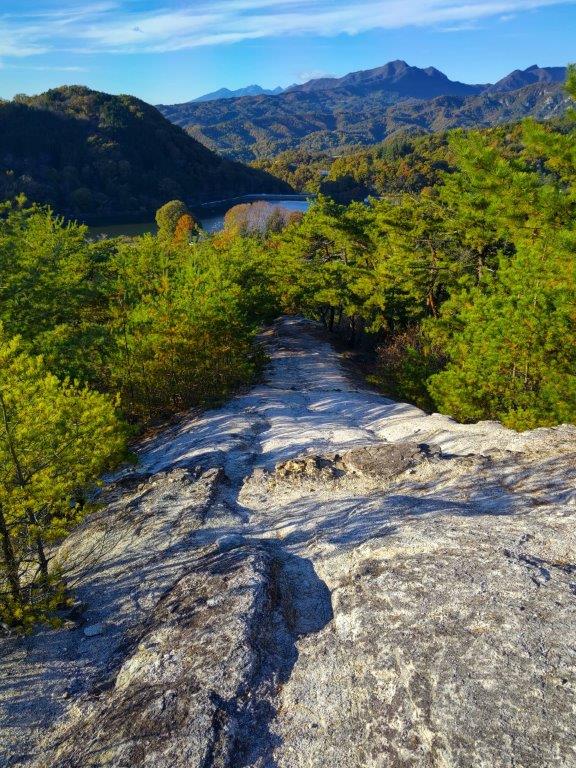
From time to time, I waved a stick to clear the stubborn spider webs that were too low to duck under, their occupants groggily moving out of the way. Shortly before 1pm, I left the promenade and turned left onto a wide path leading up the mountain side, the webs now thankfully gone. I soon reached Kinsu Pass (679m 金子峠) where I had a view of Mt Fuji between a gap in the trees. I now rejoined a hiking trail, and continued eastwards, soon arriving at a group of white-coloured rocks, called “Exposed Rocks of Mt Awayuki” (702m 淡雪山の露岩 あわゆきやまのつゆいわ), similar to the scenery one can find at the nearby Shosenkyo. It was also the highest point of today’s hike.

Mt Kaikoma from the Exposed Rocks
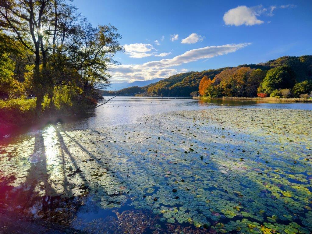
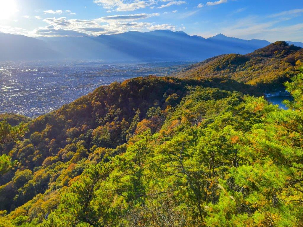
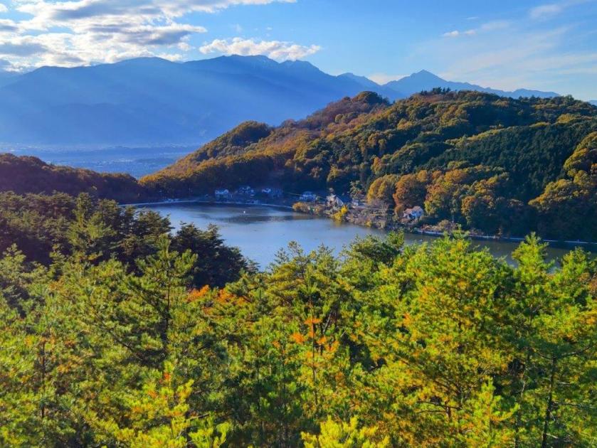
Afternoon Light at Chiyoda Lake
I felt lucky to have such a spot all to myself. Above the pines on the south side, I had a fantastic view of Mt Fuji and the Kofu basin. To the west, I could see Mt Kaikoma, also known for its white rocks, and the long summit ridge of Mt Houou. After taking a few minutes to explore and take photos, I selected a suitable rock to sit on for a lunch break. A little after 2pm, I headed back to Kinsu Pass, and followed the ridge westwards. Here the trail became faint and I had to rely on my phone GPS and the occasional pink ribbon. After a short descent, I reached a proper trail which soon turned into a road through a residential area; at 3pm, I arrived at the edge of Chiyoda lake.
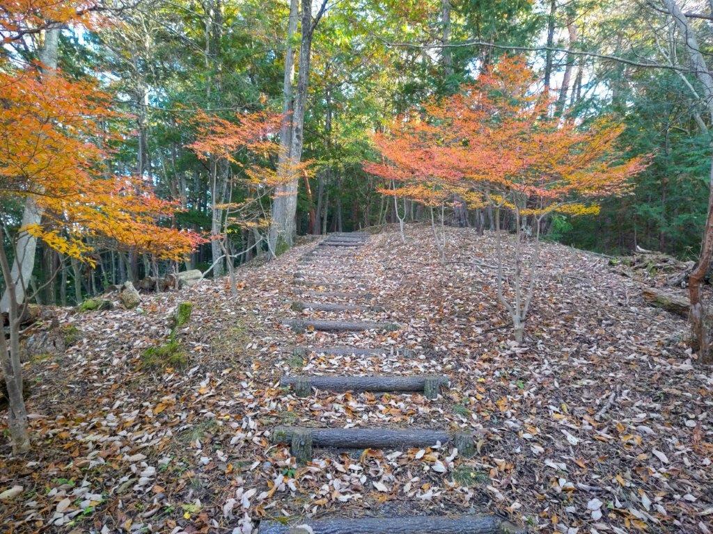
Autumn Colours on the way to the Mt Shiro Viewpoint

Chiyoda Lake from the Mt Shiro Viewpoint
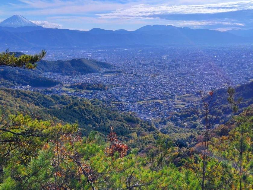
I was dazzled by the reflection of sunlight on the blue water surface and green water plants. I headed up log steps surrounded by red and orange leaves, happy to be back on a hiking trail. After a short climb, I reached an open shelter at the Shiroyama Viewpoint (白山展望台). Directly below was Chiyoda lake; to the west, I could the see the outline of Mt Houu against the fast sinking sun; looking north, I spotted Mt Kaya and the Kurofuji volcanic group, with the white rocks of Shosenkyo in the foreground and the peaks of Yatsugatake in the background. I still had a little way to go to the next summit, so after a short break, I set off again. The up and down trail was easy to follow, and at 3h30, I reached the Hachioji shrine (八王子神社) at the top of Mt Shiroyama (白山 しろやま), meaning “white mountain”.
View of Kofu from the top of Mt Shiro
Dark Clouds and Yellow Leaves from Mt Shiro
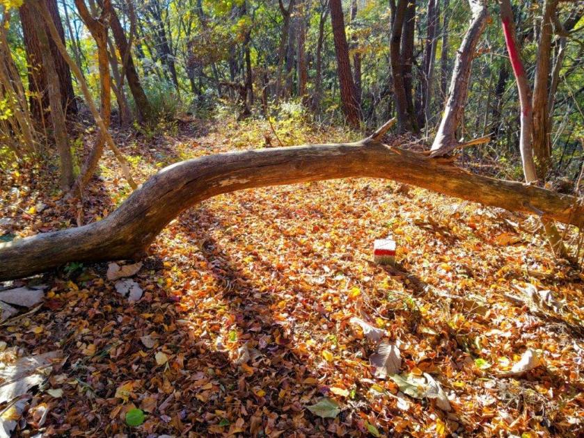
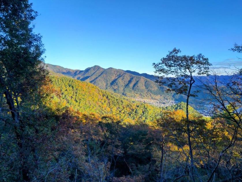
I was stunned by the view of fleecy clouds spreading from the snowy slopes of Mt Fuji, casting shade over Kofu city’s urban sprawl; luckily, the light still reached the surrounding slopes, lighting them up in gold. I quickly admired the view of the South Alps on the other side of the shrine, before moving on, picking up the pace as I wanted to get down before dark. I descended a steep, sandy trail, the rocky outcroppings and gnarly pines along the way feeling quite typical of the Chichibu-Tama-Kai national park. I was delayed by two more superb viewpoints, the setting sun creating a striking contrast of light and shade, before reaching a level trail, now in the shade. At 4pm, I passed the minor summit of Mt Hosenji (539m 法泉寺山 ほうせんじやま), completely within the trees.

The Tip of Mt Fuji hidden by the Clouds
The South Alps from the Top of Mt Shiro
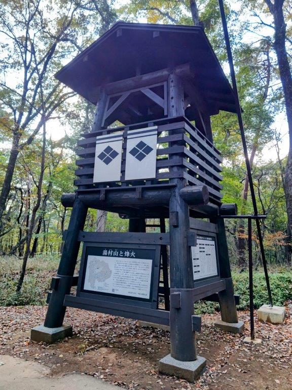
I was suddenly walking on flagstones (“ishidatami), a reminder that today’s last summit was also the location of Yumura castle (湯村城), although only some stone foundations remain today; I had to be careful not to miss my step, especially since the visibility was starting to fade. After a short descent, I reached a fire beacon (“noroshi“), a recent reconstruction of one of the many that used to exist during the Edo period, creating an ancient communication system. One final effort brought me to the open shelter at the top of Mt Yumura (湯村山 ゆむらやま yumura-yama), meaning “hot spring village”.

Sun Setting behind Mt Houou
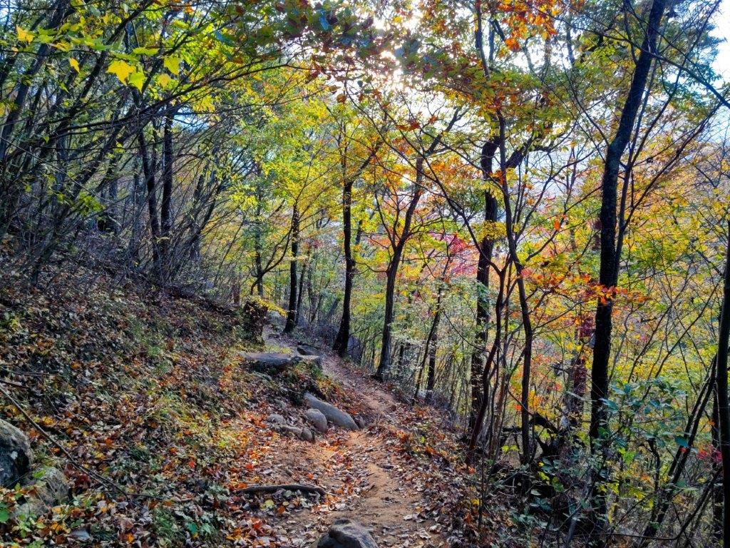
Trail between Mt Shiro and Mt Yumura
I had one last view of Mt Fuji, its top half truncated by a layer of grey clouds. It was 4h30, so I sped back to the fire beacon and headed down a switchback trail on the west side, occasionally taking the well-worn short cuts between the bends. I was relieved to reach Yumura Onsen (湯村温泉) before it was completely dark, arriving at Yumura Hotel just before 5pm. After a refreshing hot spring bath, I caught a bus for Kofu station, where I boarded the limited express for the 90-minute ride back to Shinjuku.

Easy to Follow Trail below Mt Shiro

Last View of the day from Mt Yumura
This hike ended up taking 6 hours, a bit longer than planned, mainly because of the superb views along the way. The section around Mt Shiro was especially stunning, and I’d like a chance to redo in lighter conditions. It deserves to be better known, and it’s a mystery why I saw no other hikers the whole day. In the future, I’d also like to climb Mt Kata (片山) on the other side of Chiyoda lake and also explore more of the Takeda Forest Promenade towards Yogai Onsen. Before that, I definitely want to revisit the white rocks of nearby Shosenkyo.
Watch a Video of the Mt Shiro Hike
Watch the Video of the Hike on YouTube


See a Slideshow of more Pictures of the Hike
