

I wanted to see Mt Fuji on my first hike of the year. I had already climbed this peak, just over 10 years ago. Back then, I had made a long loop, along a hard to follow trail on the south side. I was inspired to redo this mountain thanks to a JR East hiking map showing a shorter loop hike: up the same way, but down a different trail on the east side, and passing by a giant cedar tree. I would take the Chuo limited express to Ostuki, and then continue by bus to the trailhead. I would have to leave relatively early to catch the sole morning bus. For the return, I could catch the only mid-afternoon bus back, or walk downhill to Sasago station, a couple of kilometers away, and a short ride on the local Chuo line to Otsuki. The weather was supposed to be sunny all day, meaning Fuji would be clearly visible. The temperatures would be lower than on my December trips, and I hoped it wouldn’t get too cold above 1000 meters. I was looking forward to my first hike and Fuji views of 2024.
Hiking in the Misaka Mountains 御坂山地
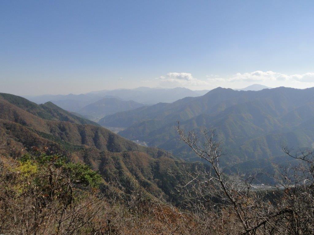
Hiking along the Chuo Line 中央線

Descent from the Summit (left) Ridge Trail to Sasago Pass (right)
Walking the Ridge Trail (left) Steps for Sasago Pass (right)
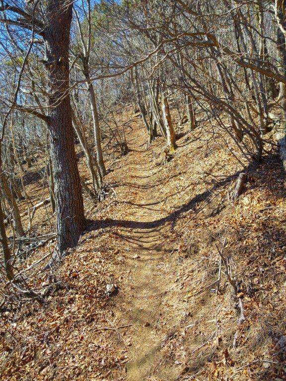
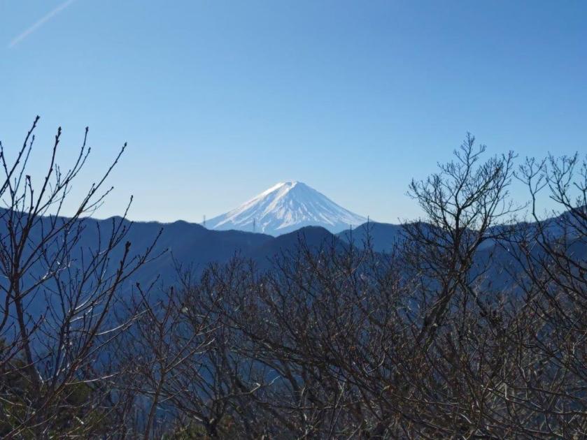
It was still very cold after I got off the bus just after 9am, near the entrance of Sasago tunnel. I found a sunny bench opposite the start of the trail and slowly got ready. A little after 9h30, I set off up a valley, walking in the shade of the cedars. At 10am, I reached an electric pylon out of the trees and with a view southeast towards Mt Tsurugatoya. I continued east, up a ridgeline within a valley enclosed on three sides. At 11am, I spotted the white top of Mt Fuji above the southern side. Shortly after, I was blasted by a biting cold wind blowing over the eastern ridgeline from the Kofu basin. Through the trees, I also had a glimpse of the South Alps, the highest peaks capped in snow. I found a sheltered spot and bundled up. At 1130, I reached an open space near a reflector.

Back into the Sun just below the Electric Pylon
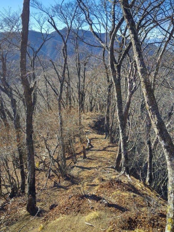
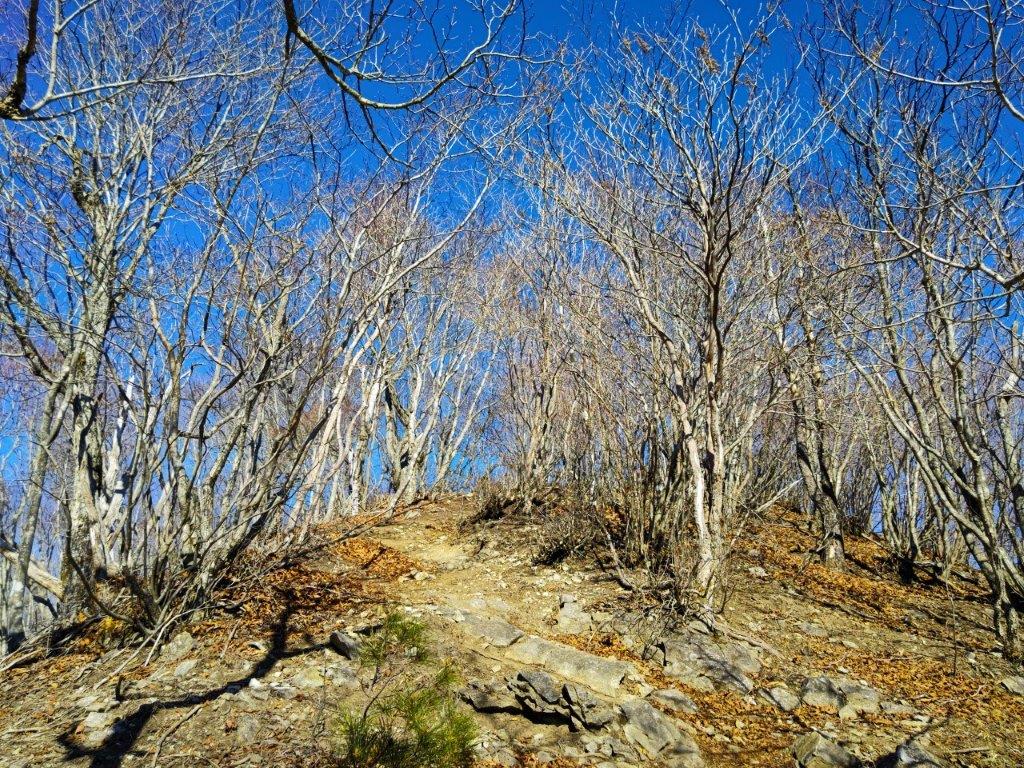
Following the Ridgeline to the Summit
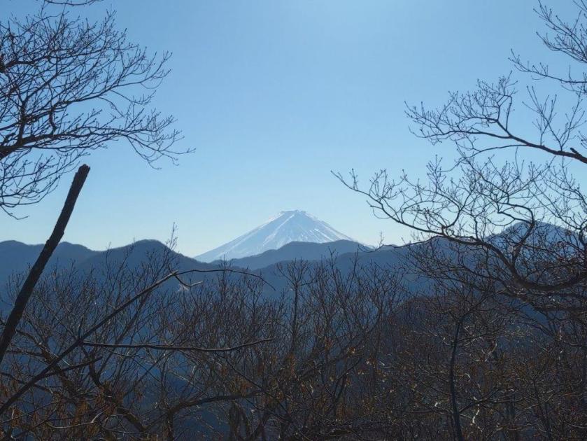
Turning around I had the best view of the day: directly south was the white cone of Mt Fuji, shining in the midday sun; to the southeast, I could see Mt Imakura, the 4th highest peak of the Doshi mountains, as well as Mt Omuro in the Tanzawa mountains. A few more minutes of climbing brought me to the summit of Mt Sasago-Gangaharasuri (笹子雁ヶ腹摺山 ささごがんがはらすりやま sasagogangaharasuriyama), a Yamanashi 100-famous mountain and one of the 12 beautiful views of Mt Fuji (秀麗富嶽十二景). Through the bare trees on the southwest side, I spotted Mt Houou, Mt Kita and Mt Aino, some of the main peaks of the South Alps, before they were engulfed by the clouds.
Last Stretch before the Summit
Checking out the Trail for Mt Komezawa
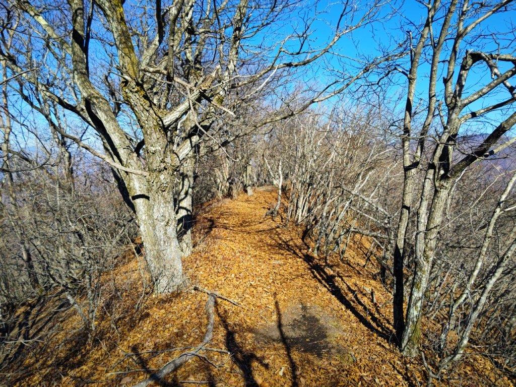
I was surprised to see traces of snow on the path leading northwards towards Mt Komezawa, in the opposite direction of my hike. I sat down on a bench near the summit marker, facing the sun and Mt Fuji, for an early lunch; about half a kilometer below was the busy Sasago Tunnel. The wind had died down but it was still chilly, and around noon, I set off again, down a steep path, heading west along the narrow ridge separating the Kofu and Otsuki valleys. The path soon became level. After passing a second pylon, I arrived at a fork in the trail, where I took the the “ridge route” on the right. According to my map, it would join up with the “new route” on the left, shortly before Sasago pass.

Following the Ridgeline to Sasago Pass
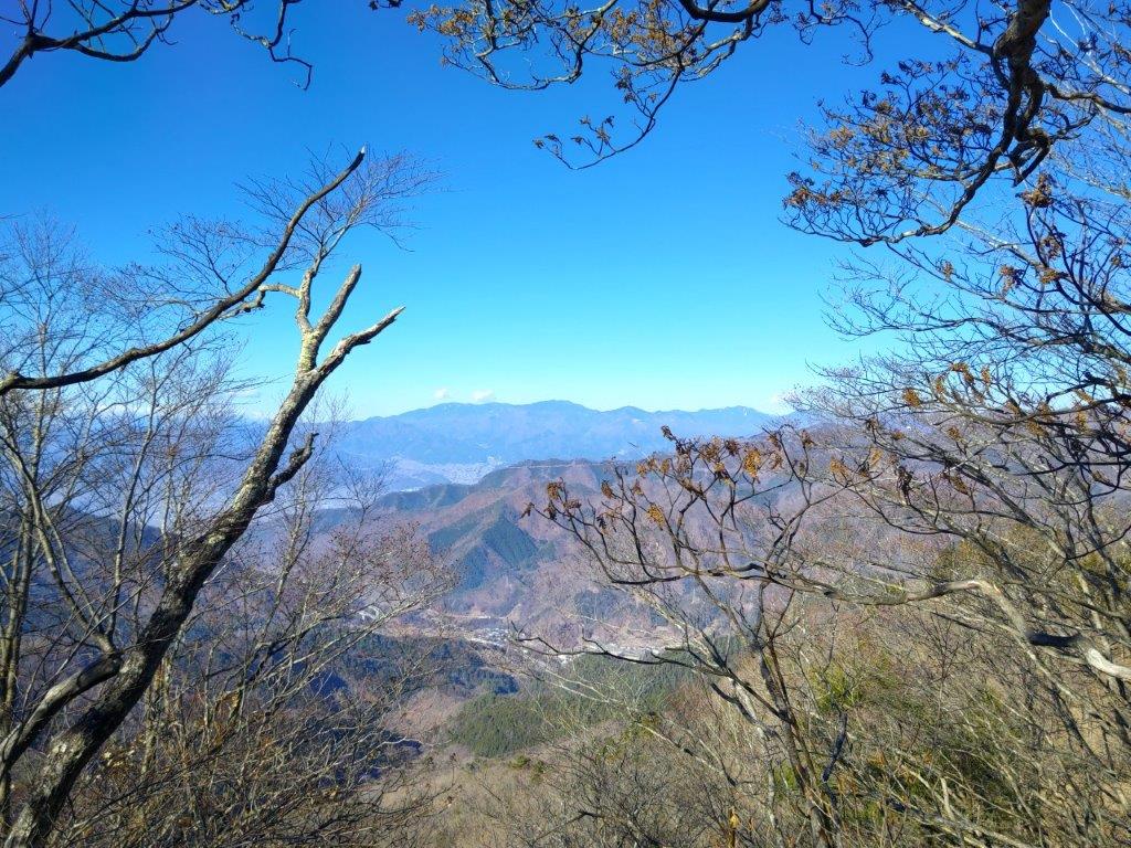
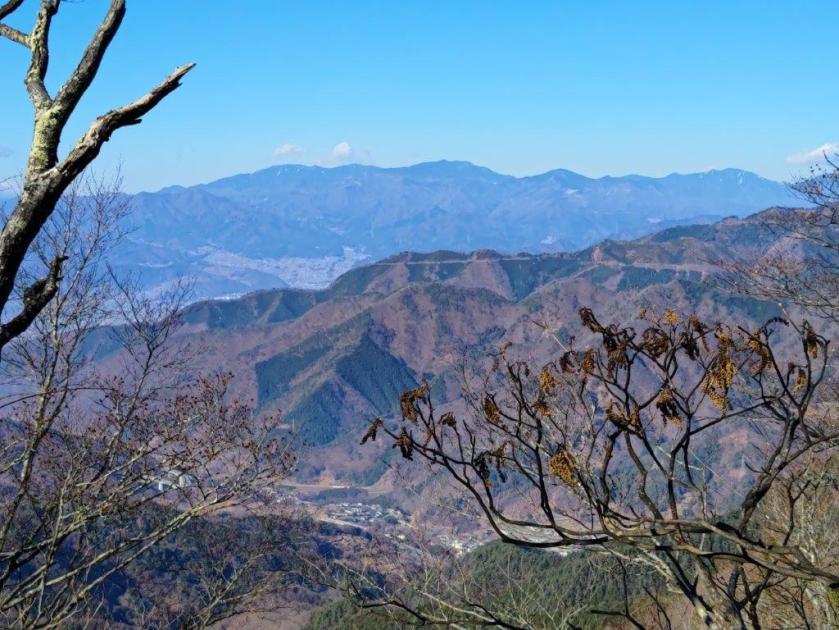
View Northwest of the Okuchichibu Mountains
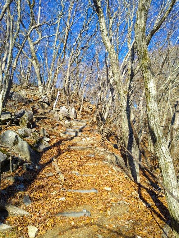
I was glad with my choice since I was rewarded by views of Mt Koshu-Takao, Mt Konara, Mt Daibosatsurei, and Mt Okuratakamaru to my right, and glimpses of Mt Fuji to my left. Since I was well on schedule, I took my time peering at the views between the leafless trees. Soon after the two routes merged, I arrived at the third pylon of the day, beyond which the trail headed down a series of steps ending at Sasago Pass (笹子峠) completely in the trees. It was nearly 2pm, and the sun had just dipped behind the ridge rising steeply on the opposite side. I turned left down a shaded valley, and soon reached a road at the end of the old Sasago tunnel (Sasago-zuido 笹子隧道). I followed the road for a short while before getting back on the hiking trail. I soon arrived at Yatate-no-Sugi (矢立の杉), a giant cedar tree, and one of the 100 famous trees of Yamanashi.
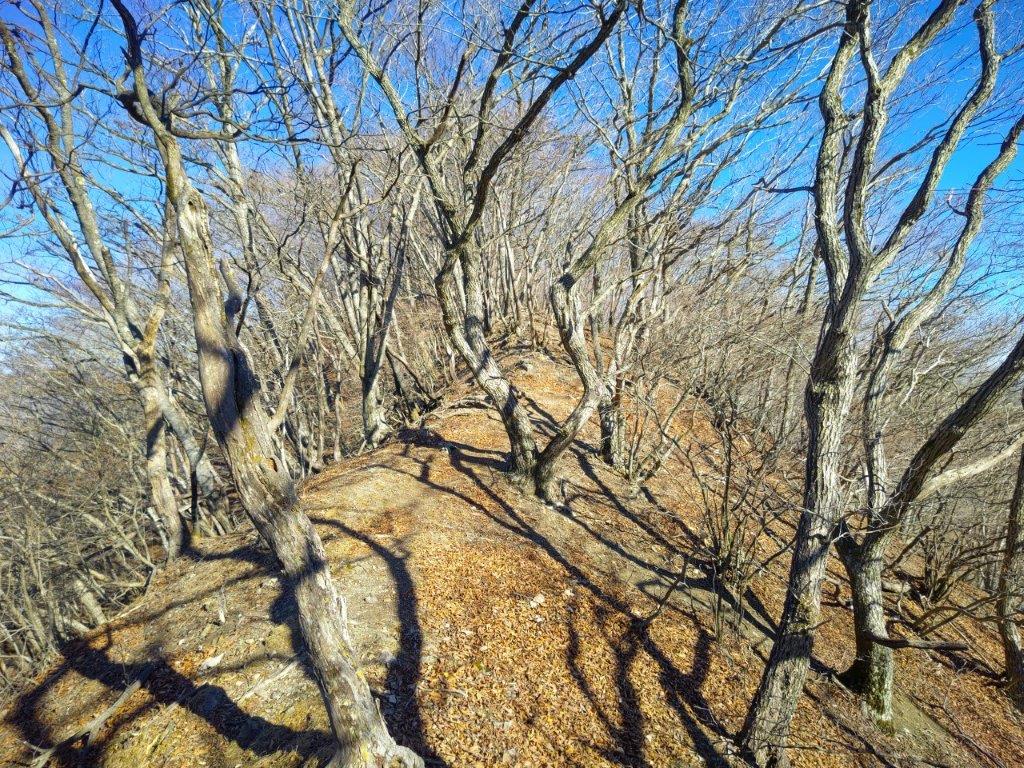
Leafless Trees along the Ridge Trail

Heading Down from Sasago Pass
I spent a few minutes gazing at the thousand-year-old tree, nearly 30 meters high, its crown lost from sight, before leaving the viewing platform. After crossing Sasago River on a couple of wooden bridges, the trail widened and hugged the steep mountain side; the valley was bathed in sun again and the rushing river could be heard below on the right. After another short road section, I rejoined the trail again, this time the river on my left side. At 3pm, I reached a gate, beyond which was the main road and the bus stop. It was too early for the bus so I speed walked back to the Sasago station so that I could get the 3h30 train for Otsuki. There, I transferred to the limited express for the comfortable one-hour ride back to Shinjuku.

Wooden Bridge Crossing over Sasago River

Wide Trail in the Sun above Sasago River
Although the whole hike took six me hours, I did it at a fairly leisurely pace, hoping to match my arrival time with the return bus, but ended up an hour too early. In warmer weather it might be possible to take longer breaks but this is definitely a hike that should be done in the winter months; otherwise the views will be blocked by the leaves. The hike can be extended north or south along the ridgeline, but there are big up and downs on both sides, requiring more time and energy. I saw only one other hiker and he told me he had seen a bear run away, up the steep slope on the other side of Sasago river, barely seconds before I caught up with him. It seems like this bear had been spotted before and may the reason for the absence of other hikers, so a bear bell or other noise-emitting device would also be a good idea.
Watch the Video of the Hike on Youtube


See a Slideshow of More Pictures of the Hike
