
Read this Blog Post on Hiking Around Tokyo
I had hiked this mountain in November 2015, one of the hikes from my mountains of Saitama guidebook. Since then, I’d found out it was part of the “Minano Alps”. At the time, I had only hiked two thirds of it. Looking at my map, I saw I could redo it via a different set of trails; only the central part would overlap. I would start at Temple #34 on the Kannon Temple Circuit and follow the Kanto Fureai no Michi. Past the summit, I would leave the Fureai no Michi, and descend a ridgeline extending southwest, ending a short distance from Minano station.
Get a map of the Mt Happu hike
This map was developed for Japanwilds with the Hokkaido Cartographer
Find Japan Hiking Maps on Japanwilds
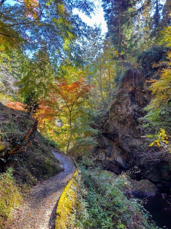

Path to Kegon Falls (left) / Steps for Suisen-ji Temple (right)
Since it was a relatively short hike, I could combine it with a visit to a waterfall, a short distance from the temple. To get there, I would take the Laview Limited Express to Yokoze station, where I’d change to the local Chichibu line. At Minano station, I’d catch a bus and get off at near the falls. At the end of the hike, I could walk back to Minano station. If time allowed, I’d drop by a local onsen before heading back. The weather was supposed to be sunny, with temperatures slightly above average for the season. On my last visit, I didn’t see many autumn leaves, so I hoped that this time around, I’d get to see plenty.
Hiking on the Kanto Fureai no Michi 関東ふれあいの道
Hiking in Chichibu 秩父


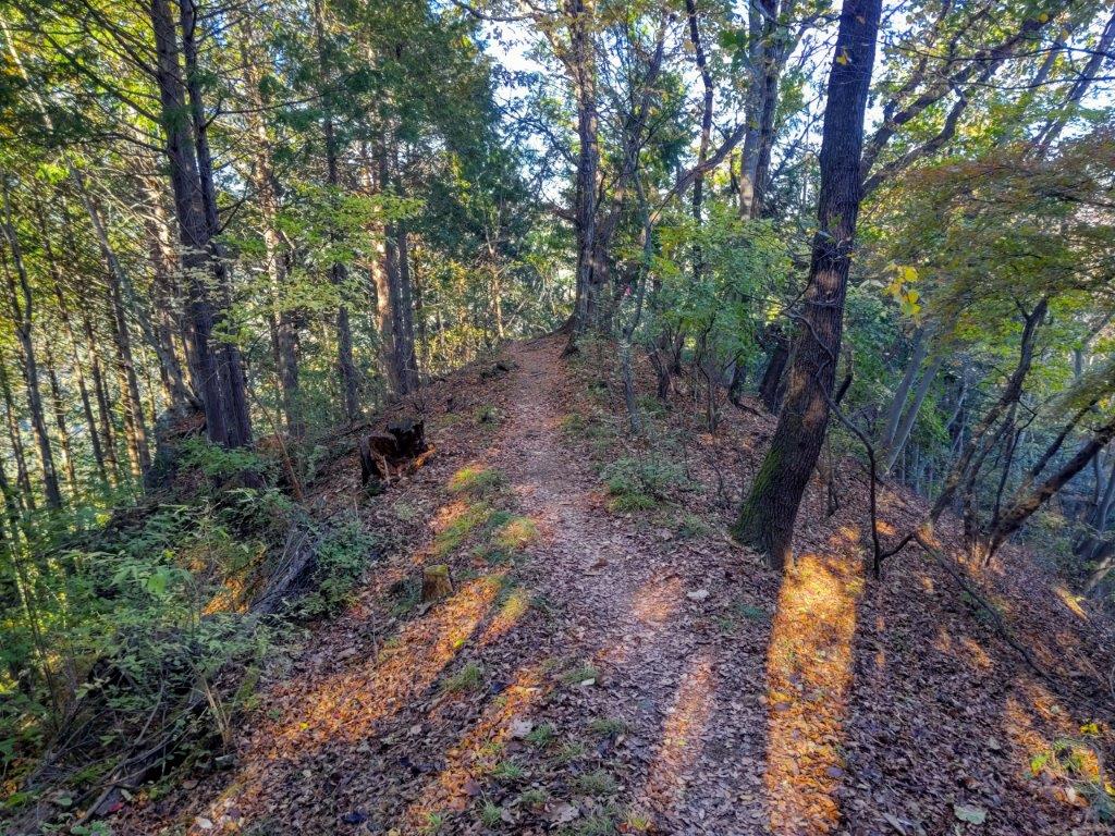
Following the Fureai no Michi up to the Ridgeline
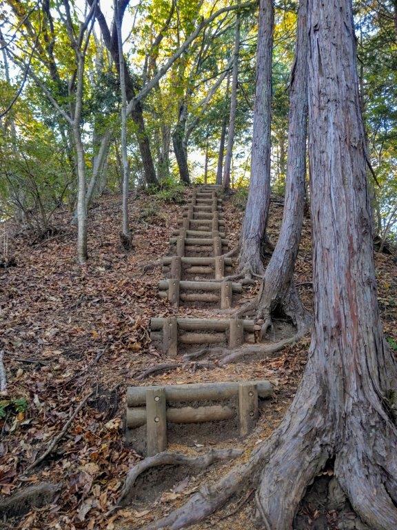

Series of Steps (left) and Tree-Framed View (right) on the Descent
It was a blue-sky day as I stepped off the train at Minano station, a little past 10am. Although the micro-bus was full, everyone had a seat. After a 30-minute ride, I followed a paved road to the nearby entrance of the short path leading to Chichibu Kegon no Taki (秩父華厳の滝). At 10 meters high, it wasn’t the most spectacular waterfall I’d seen recently, but the Autumn foliage made it worthwhile. I made a short loop to see some more autumn colours and then walked down the road for 15 minutes to Suisen-ji Temple (水潜寺). I was the only visitor enjoying the serene atmosphere. It was nearly noon and high time for me to start my hike.

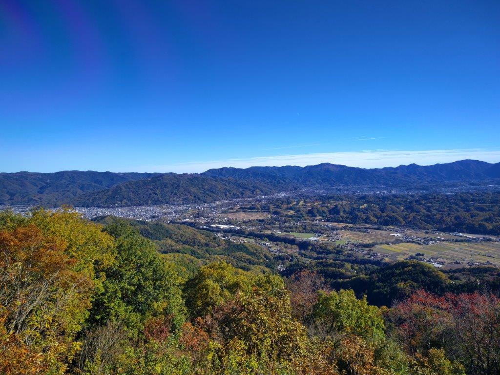
Mt Mino (front) Higashi-Chichibu (back)
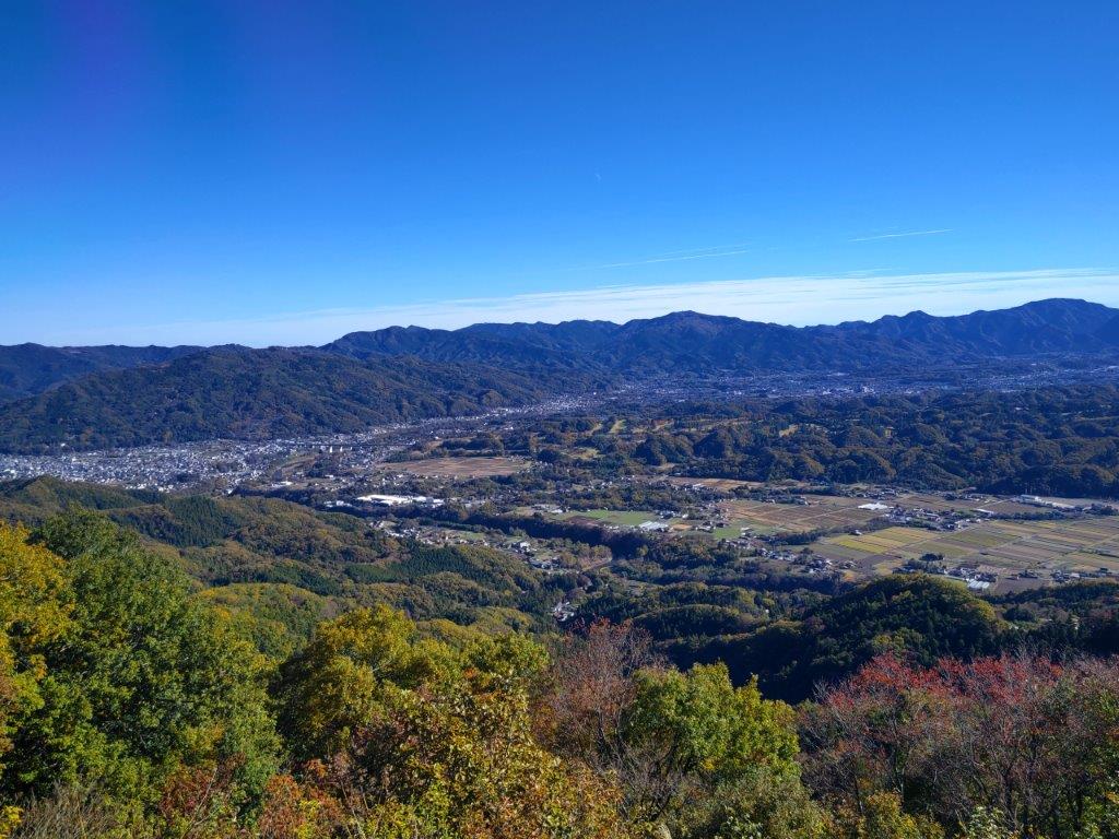
In the Center, Mt Maruyama
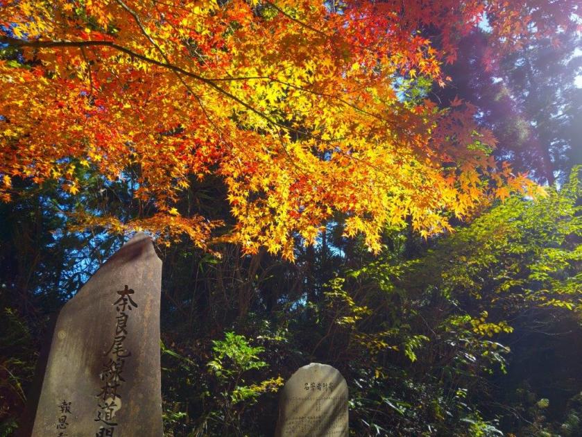
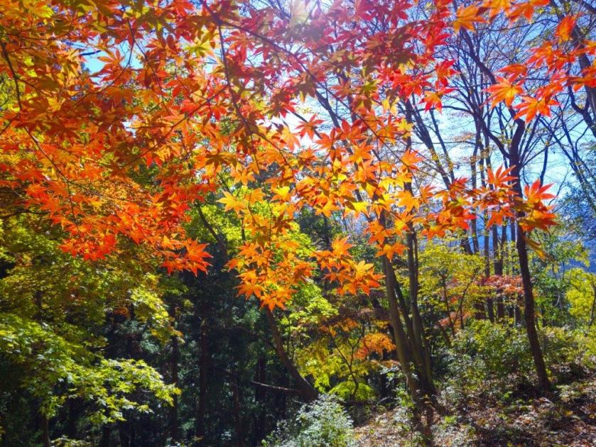
I walked up the mountain side under the cool shade of the cedars. I was following the Kanto Fureai no Michi (関東ふれあいの道), and as usual, the trail was well-maintained and well-signposted. The trail became a series of switchbacks to tackle the steep section below the ridgetop. At Fudatate Pass (札立峠), I turned left, continuing along the Fureai no Michi. To the right is the “Nyokin” ridge route (如金峰コース) which I had taken on my last visit. After passing a beautiful Japanese maple (“momiji), I had to climb a little more to reach the top of Mt Happu (破風山 はっぷさん happusan), which could be translated as “Ripping Wind”.
Mt Buko (left) The Oku-Chichibu Mountains (right)

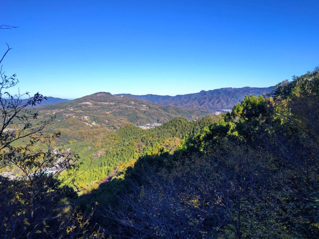
Mt Jomine from the Summit of Mt Happu
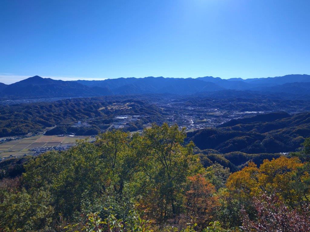
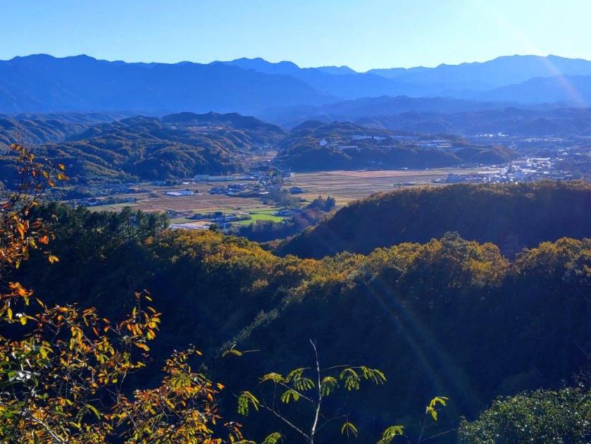
I was amazed to have the summit all to myself, completely free of trees on the south side. From east to west, I could see Mt Mino, Mt Dodaira, Mt Maruyama, Mt Buko and Mt Ryokami. However, just moments later a large group arrived. I retreated to the north side, from where I could see the top of Mt Jomine above the trees. It was 1pm so I sat down for lunch. I was surprised how warm it felt in the sun, even though it was the middle of November. Half an hour later, I set off again. The trail started to descend quickly, and a little after 2pm, I reached a fork. I went right, following the “Maehara Ridge” Route (前原尾根コース), leaving the Fureai no Michi as it descended into the valley.

Looking North from the Top of Mt Happu
Walking along the Fureai no Michi
I followed the trail as it went up and down, seemingly without end. I felt like I was truly hiking the “Minano Alps” (皆野アルプス), even though I was lower than the main ridge. At the top of a big rock, called Nantai-Ogami (男体拝), I had a view of Mt Hodo; in the distance, I could see snow-capped Mt Nantai. Past a short rock section, equipped with rope for safety, was a steep slope leading me lower and lower. Half an hour later, I reached a couple of rocky outcrops with good views north and south. Just before 3pm, I passed the minor summit of Mt Maehara (前原山 347m), and after one more steep slope, I emerged at the base of the mountain at Ofuchi (大淵登山口). It was still early so I walked to Bon no Yu, and after a refreshing bath, took a taxi to Minano station. By 5pm, I was at Seibu-Chichibu Station where I boarded the Laview for the 80 minute ride to Ikebukuro.
Mt Hodo from Nantai-Ogami

View from a Rocky Outcrop on the Maehara Ridge Route
At just over 3 hours this is a relatively short hike so I was glad I was able to stretch the time a little with a visit to a waterfall, a temple and an onsen. I was also glad I’d decided to revisit this mountain. At first glance, it didn’t seem like I could get an interesting hike out of it, but in the end, it was extremely satisfying. The best part was that, although I passed a few people on the higher sections, I saw almost no one on the way down. So it turned out to be a peaceful ramble relatively close to Tokyo, something that can be hard to find.
See a Video of the Mt Happu Hike
Watch the Video of the Hike on Youtube


See a Slideshow of some more Pictures of the Hike
