

I needed a short, easy hike after my three-month summer break; I also needed to get above one thousand meters, free of the spiders and their webs, seemingly everywhere at this time of year. I decided to go to the Saku, a plateau between Asamayama and Yatsugatake; there, I would go up a mountain spotted on my hiking map while researching Golden Week hikes. Although the hike was under two hours, it promised a great view from the top and a hot spring bath at the base.
Read this Blog Post on Hiking Around Tokyo
I would ride the shinkansen from Omiya to Saku-Daira, and from there, take a taxi to Parada, a ski resort turned amusement park in the warmer months; at the end, I would need to walk one hour back to the shinkansen station. It was supposed to be a warm, sunny day, and so I was looking forward to my first hike of the autumn season.
Get a map of the Mt Hirao hike
This map was developed for Japanwilds with the Hokkaido Cartographer
Find Japan Hiking Maps on Japanwilds

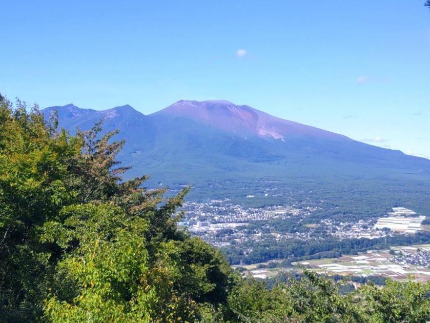
View of Yatsugatake from Hirao Onsen

View of Asamaya from behind the summit of Mt Hirao
It was slightly overcast as I rode the shinkansen from Omiya, but after passing Karuizawa town, blue skies stretched away in all directions. I got off at Saku-Daira station a little before 1030, and there, caught a taxi for the short ride to Hirao Onsen. Perched a little way up the mountain side, I already had a great view of the Saku plateau, and the Yatsugatake range directly ahead. I found a 200 yen locker to store the things I didn’t need for the hike itself, and shortly before 1130, started up the Hirao Forest “Therapy Road”.

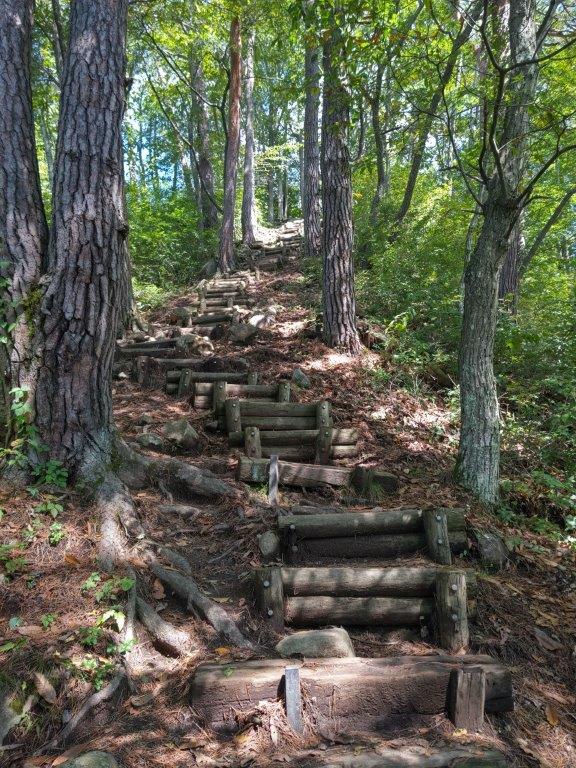
Pines Trees (left) and Log Steps (right) on the Therapy Road


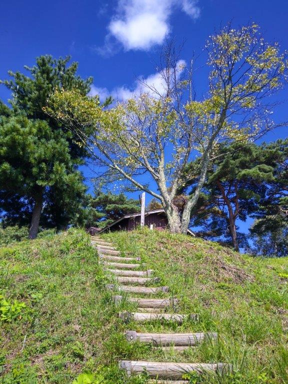
Looking up at Mt Hirao (left) Looking down from Mt Hirao (right)
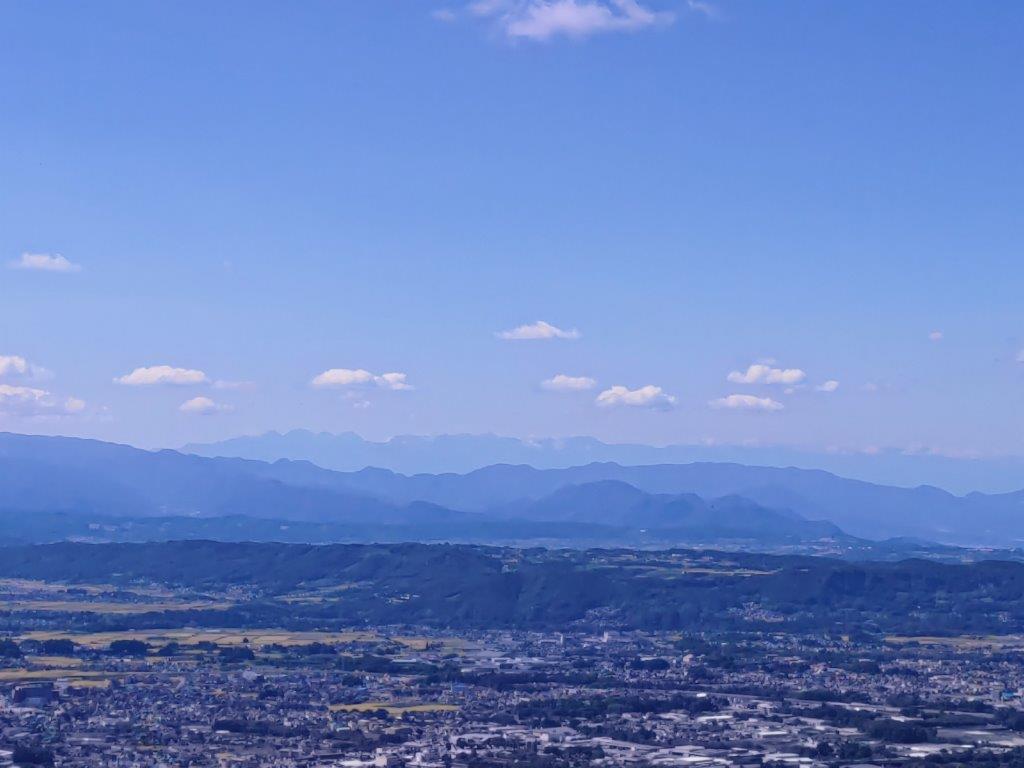
I climbed through beautiful, spider-free forest, up the “Path of Endurance” (忍耐の小径); at the top of a steep log staircase, I reached the top of Mt Hirao, also known as Hirao-Fuji (平尾富士 ひらおふじ hirao-fuji). It was nearly 12h30 so I sat down on one of the several west-facing benches for lunch with a view. To the south, were the mountains of Oku-Chichibu, Mt Ogura visible in the far distance; opposite was a sideview of Yatsugatake, stretching from Mt Aka to Mt Tateshina; further west, I could see the entire range of the North Alps, extending from Mt Yari to Mt Shirouma, free of clouds and snow; on the north side, the crater of Asamayama, as well as the long, flat top of Mt Hanamagari were both visible.

Log Steps near the Top of Hirao Forest

The Summit of Hirao-Fuji
I had never seen so many butterflies flutter around before, flying together in complex patterns. At 1pm, I left my pack on the bench, and went to explore a trail along the southern ridge. After going up and down a small summit completely in the trees, I reached a T-junction where I turned left. After following the slightly descending trail for a short while, I reached a clearing at a forest road. There, I had one of the best views of Mt Asama I’ve ever had, the entire range extending from east to west, completely free of clouds. I then retraced my steps back to Mt Hirao, and after picking up my pack, headed down the mountain.

View of Yatsugatake from the Summit

View of the North Alps from the Summit
I descended through the forest, chestnut burrs thick underfoot, occasionally dropping to the ground with a “plonk”. I first followed the “Path of Nostalgia” (郷愁の小径) and then the “Red Pine Path” (あかまつの小径), before reaching Ryujin-Ike pond (竜神池), a little after 2pm. Along the way, I passed another viewpoint, just off the trail, the landing spot for a pair of chairlifts, not in operation during the summer season. Beyond the “susuki” waving in the autumn breeze, I could see Mt Tateshina wearing its crown of clouds. From the pond, I reconnected with the “Path of Endurance” which I then followed back to Hirao Onsen.

View of the Crater of Mt Asama (left) and Mt Hanamagari (right)

Side view of Mt Asama from the Clearing on the Forest Road
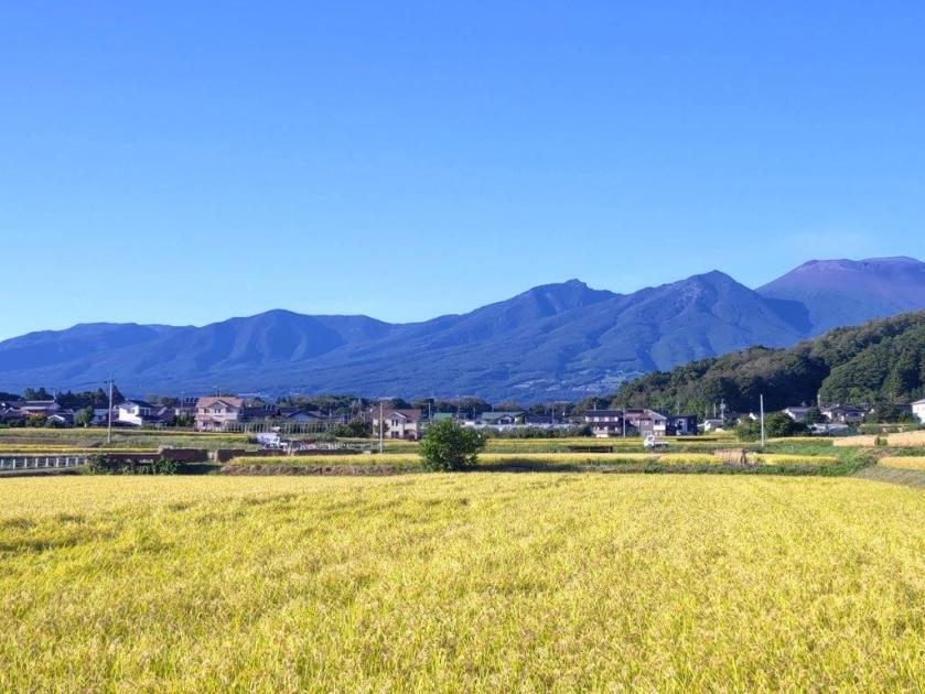
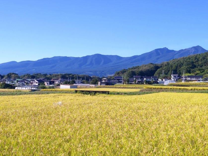
Although it was only 2h30, I wasted no time entering the onsen, also known as “Miharashi no yu“, meaning hot bath with a view; indeed, I immensely enjoyed sitting in the “rotemburo”, or outdoor bath, gazing at the view of the surrounding mountains. At 3h30, I set off again, down a long escalator to the nearby Sakudaira parking area. From there, I followed a road down into the valley, and then walked among the golden fields, ready to be harvested. I was glad I had chosen to walk rather than take a taxi, since I had good views of Asamayama and Mt Hirao along the way. I arrived at Saku-Daira station a little before 5pm, and caught the shinkansen for Tokyo shortly after.
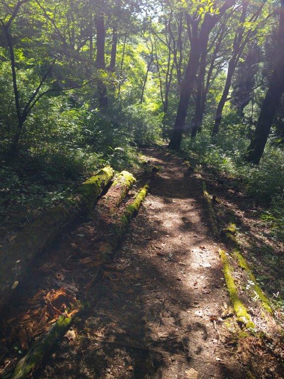
Last Steps of the Endurance Path (right) Walking the Red Pine Path (right)

Golden Fields Ripe for Harvest
Although on paper it seemed a long way to travel for a short hike, it turned out to be very satisfactory and an excellent way to restart hiking after a long break. Ideally, I would have used the Tokyo Wide Pass and combined it with another hike but the opportunity just didn’t present itself. Basically, I was glad I had several viewpoints, the hot spring wasn’t too crowded, and the spiders were nowhere to be seen along the hiking trail. I would like to return one day for a longer hike along some of the forest roads in the area, and during the colder months for a clearer view of the North Alps.
Watch a Video of the Mt Hirao Hike
Watch the Video of the Hike on Youtube


See a Slideshow of More Pictures of the Hike

Those are my stomping grounds. I live in the valley below, basically on the straight line between Hirao and Tateshina.
Hirao is the second closest mountain I live near and sometimes I’ll run up it after work. You actually walked by where I work on your walk to the station.
I’m glad you caught some nice weather.
Thanks for reminding me about the onsen. You reminded me that I have some discount tickets I need to make use of.
Yes I thought it might be in your neck of the woods, although I don’t think you ever mentioned the name of the mountain on your blog. You’re lucky to live in such a beautiful area.
Have you ever explored any of the surrounding forest roads and and unmarked trails? I wonder how easy it is to hike to Happusan from Mt Hirao.
I guess the view from the onsen must be quite spectacular around sunset.