
I had been wanting to climb this mountain for a several years, but couldn’t figure out a way to do it as a day trip by bus; even using a share car to reach the trailhead at the Hayataki car park meant a long hike combined with a long drive. In the end, I decided to approach via the “Mikabo Super Rindo”, a 67km forest road that follows the ridgeline from east to west, and passes just below the summit, on the north side. Looking at my hiking map, I noticed I could return via a logging road road on the south side, and thus do a loop hike; it seemed a bit adventurous, requiring me to reply on my GPS. I would take the Takasaki line to Honjo station, where I would switch to a car, and then drive to Shiozawa Pass; I would return via the same route. The weather was supposed to be cloudy most of the day; since no rain was forecast, I still hoped to get some good views. I was looking forward to doing some more exploring of one of the less accessible hiking areas around Tokyo.

First View of Mt Akaguna from the Hiking Trail

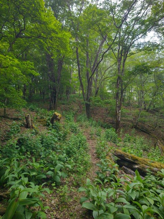
Hiking through Green Forest below the Summit
The weather was definitely cloudy as I got off the train at Honjo station around 9am, dashing any hope of sun. Despite the gloomy skies, I enjoyed the drive through Onishi Town and past Kanna Lake, places I had visited on previous hikes. I passed the trail entrances for Mt Mikabo and Mt Tetemiezu, reflecting on how the weather had also been poor on those two hikes. After Kanna Town, I turned right, onto a smaller road leading up the mountain, and parked my car at Shiozawa Pass (塩沢峠), near the junction with the Mikabo Super Rindo (御荷鉾スーパー林道).

The Mikabo Super Forest Road near Mt Akaguna

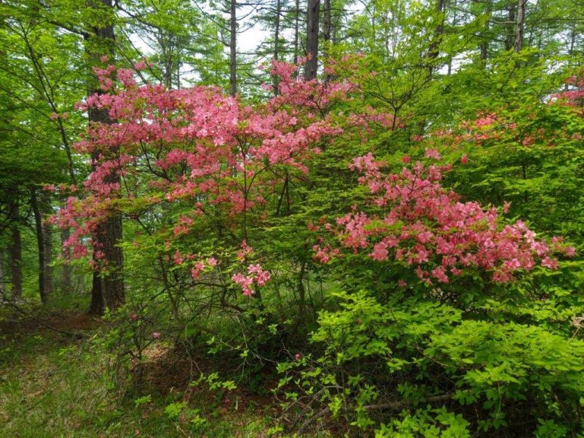
Green Path and Pink Flowers
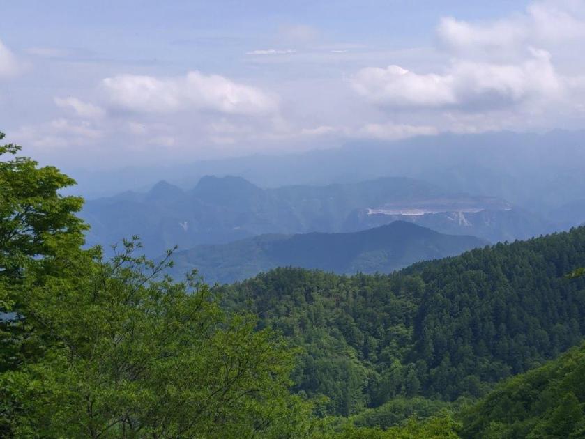
I enjoyed the wide view across the valley on the south side: I could see the rounded top of Mt Tetemiezu and the twin peaks of Mt Futago, both on the border of Gunma and Saitama; behind Mt Futago, the summit ridge of Mt Ryokami was hidden in the clouds. I set off at 11h30, and and soon reached the turnoff for the “super-rindo” on the left side. I was glad I had opted to leave my car at the pass; although I could have parked closer to the summit, this gravel road was better suited to walking, bicycling or motorcycling. At noon, I arrived at the trail entrance on the left, as well as an open shelter with a viewpoint.

Light Green Above (left) Light Green Below (right)
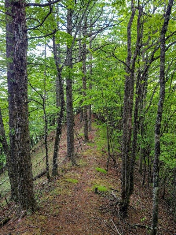

Following a Narrow Ridge (left) Walking among the Birches (right)
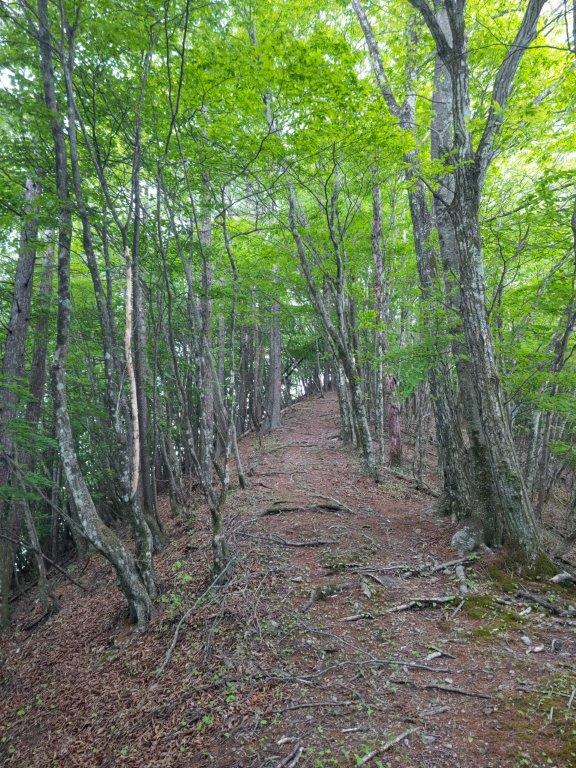
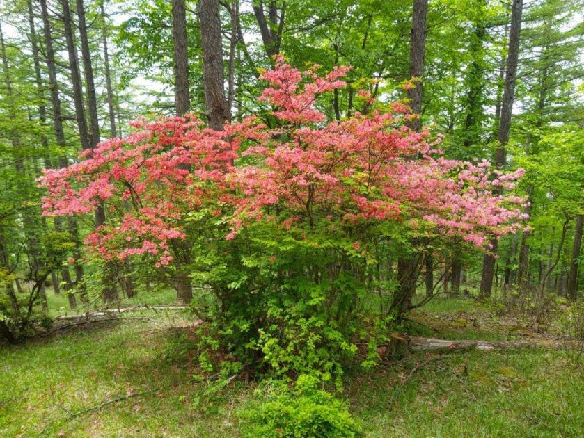
The view of the Kanto Plain to the east was completely in the clouds; I could only imagine what it looked like on a clear day. I followed the up and down ridge trail westwards, through light green forest; occasionally the vroom of a motorcycle interrupted the background noise of buzzing insects, a reminder of the nearby forest road, mostly hidden by the trees. At the top of a grassy slope, I stumbled upon a cluster of bright red azalea (“tsutsuji“), always a nice surprise, even though I had seen hundreds the previous week.

View of the Top of Mt Akaguna from the Forest Road
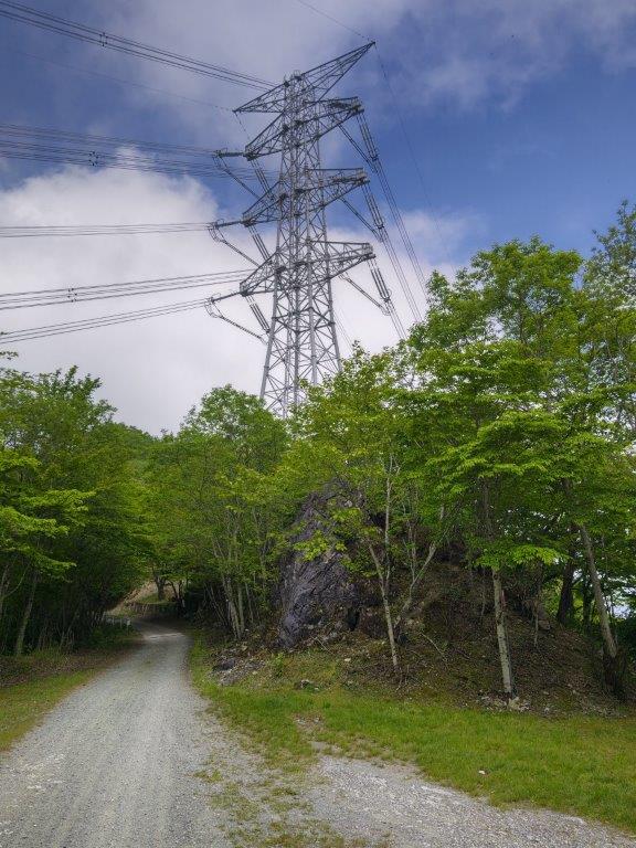
Pylon next to the Forest Road (left) Surrounded by Green (right)
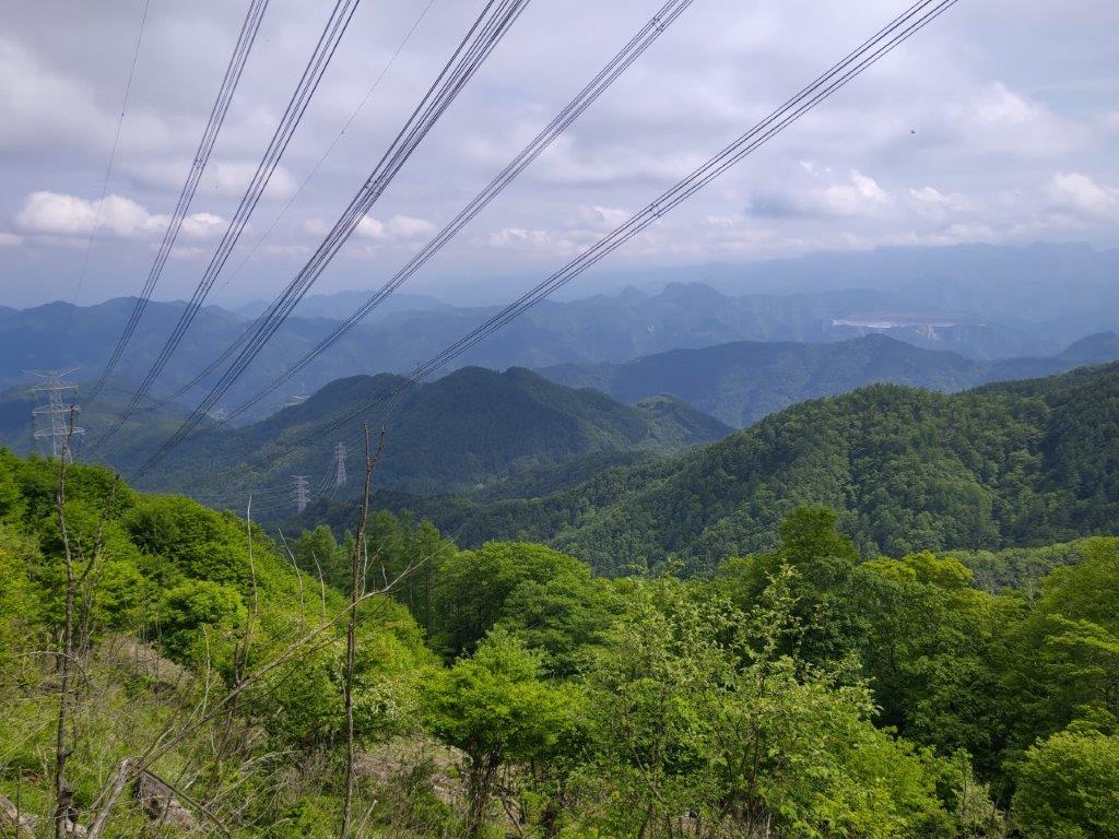
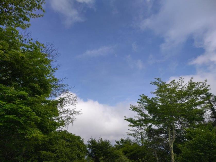
I reached the best viewpoint of the day just before 1pm, as I passed through an area clear of trees on the south side. The clouds had thinned and the sun was now shining on the rolling, forested mountains; Mt Ryokami’s ragged ridgetop was now visible; a power line stretched down into the valley, suspended between giant pylons, creating a dramatic effect from where I stood; directly ahead, at the end of a long ridge, was the tree-covered top of Mt Akaguna. Past a pylon, the trail merged with the forest road, but after a short distance, headed up the ridgeline again, along the East Route (東コース).

Power Line Diving into the Valley

Ridgeline Leading to the Summit of Mt Akaguna
This was by far the nicest section of today’s hike, the trail alternating between level and gently climbing portions, giving me ample time to take in the surrounding scenery. After a steep section, the trail merged with the North Route (北コース); a few minutes later, I reached the summit of Mt Akaguna (赤久縄山 あかぐなやま akaguna-yama), a Gunma and a Kanto 100 famous mountain. It was about 1h30, so I sat on a low bench for some lunch; although there was no view, looking up, I could see a huge patch of blue sky. At 2pm, I headed back down the West Route, and then followed the Forest Road till the start of the alternate trail back to Shiozawa Pass.

The Usual Hiking Trail is along this Ridge

Walking through a Green Wonderland
It was a challenge to find the main logging road after leaving the Super-Rindo, even with using the GPS on my phone, as many minor offshoots crisscrossed the mountain side. I was relieved when I finally reached one with a signpost for Shiozawa Pass, a little before 3pm. After an easy, slightly downhill stroll, I was back at my parked car, less than half an hour later. As it was still early, I drove a short way to the start of the trail of Mt Odoke (オドケ山). It took 30 minutes to complete the loop hike; although the summit was in the trees, I was impressed by the fancy new, bright red signposts. At 4pm, I set off for the return drive, arriving back at Honjo station just before 6pm.

Walking back along the Mikabo Super Forest Road

One of the many Logging Roads in the Area
I was glad to be able to check this mountain off my to-climb list after so many years, even though I had to settle for a 3h30 hike, about half the time it would have taken from the trailhead at the base; maybe one day I’ll return to do the whole hike, although it would require an overnight stay. I’d also like to explore more of the Mikabo Super Forest Road, on foot or by bicycle, as there are many viewpoints along the way. Hopefully I can do this on a blue sky day.
Watch a Video of the Mt Akaguna Hike


See a Slideshow of More Photos of Mt Akaguna
