Mt Ozaku (879m) & Mt Gassan (890m), Kanuma City, Tochigi Prefecture, Sunday, April 17, 2022 [Map Available]

I had been wanting to climb the first peak for several years, one of the few remaining from my list of the Kanto hundred famous. I kept on postponing it, since the hike went up and down rocky sections fitted with ladders and chains, and thus required dry weather and a good level of fitness. The stars lined up in mid-April, and I decided to grab the small window of opportunity. To get there, I would need to take a taxi to the start of the trail, since the morning bus left too early for the train from Tokyo. After the short loop hike described in my mountains of Tochigi guidebook, I would have ample time to catch the early afternoon bus back. I was looking forward to visiting one of my favourite hiking spots and experiencing what seemed like an exciting trail.

Get a Map of the Mt Ozaku Hike

This map was developed for Japanwilds with the Hokkaido Cartographer

Find more Japan Hiking Maps on Avenza

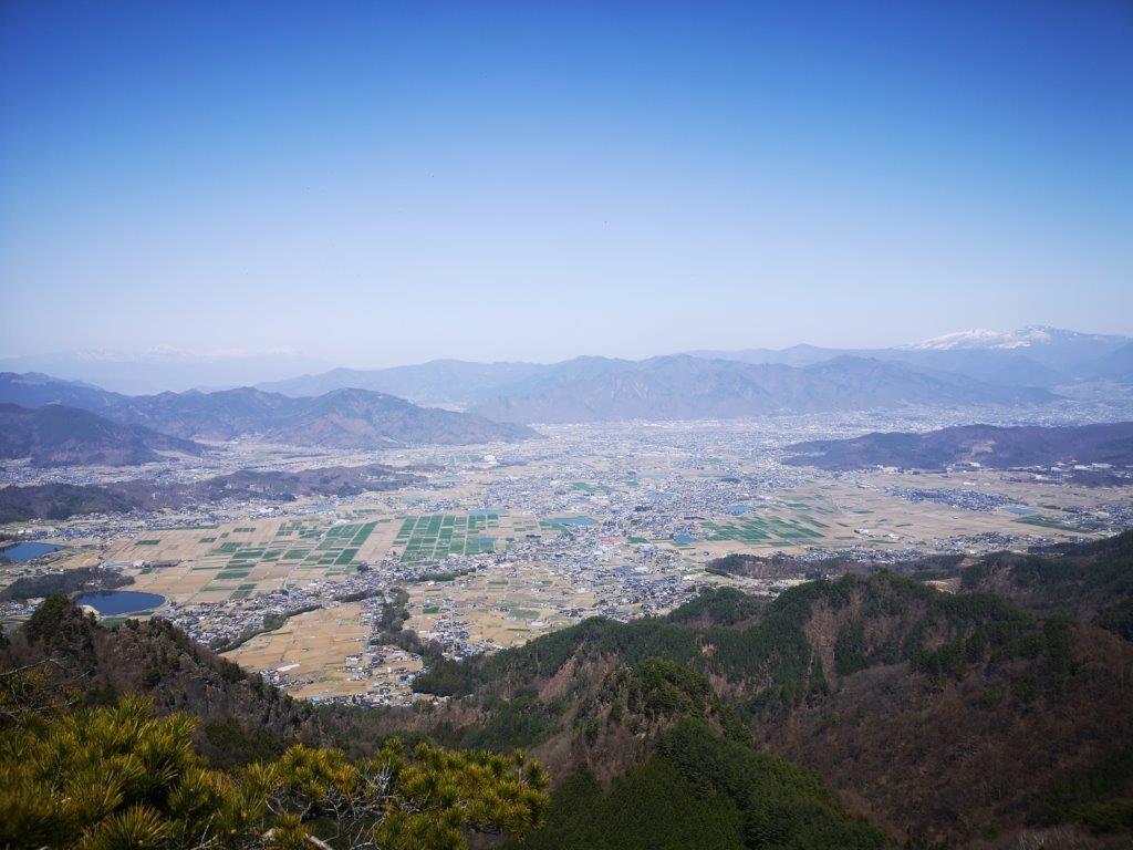
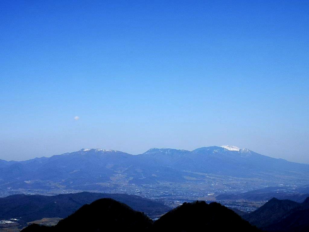
Looking at Gassan from Ozaku-yama

The sky was disappointingly grey as I left Tokyo on the Nikko line limited express, although patches of blue started to appear as I approached Shin-Kanuma station at 9am, giving me reason to hope; however, the clouds reasserted themselves during the twenty minute taxi ride to the entrance of the Kasosan Shrine (加蘇山神社). I followed a small road for about 15 minutes to the shrine itself, perched on top of a long flight of stone steps. I spotted the trail on the left, past a small wooden gate topped with tuffs of green moss, with towering cedar trees on each side.

Steps leading to Kasosan Shrine

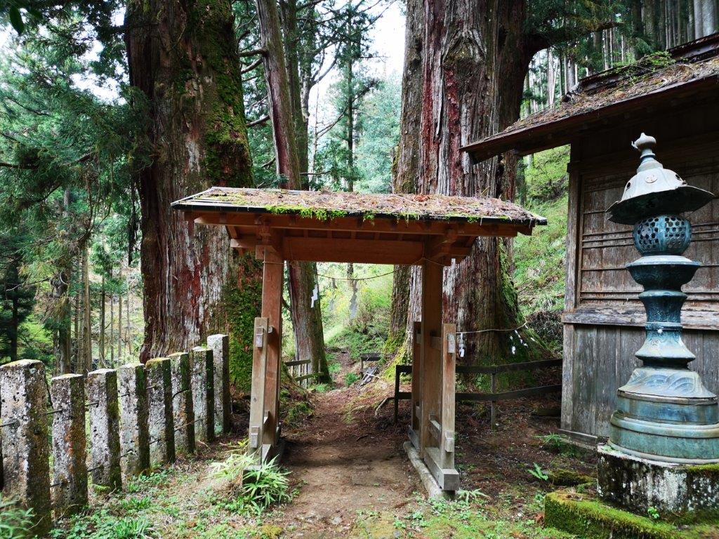
The start of the trail

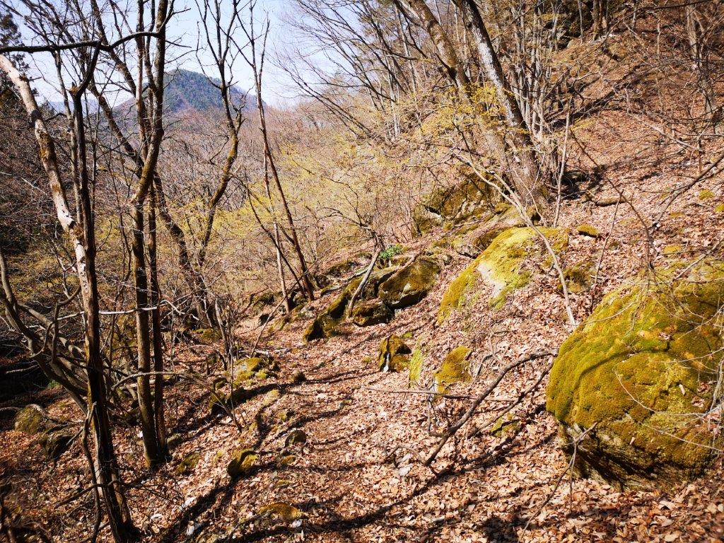
I walked along a level path surrounded by the new green of spring, here and there yellow Japanese buttercups adding touches of yellow. I passed the small “kiyotaki” waterfall (清滝), and after some gentle climbing, reached a small rest house, next to the slightly bigger “ryugataki” waterfall (竜ヶ滝). A little further, the trail split in two: I took the left branch as it included the trickier sections best tackled on the ascent; later on, I would descend via the right branch. The path suddenly became steep and rocky, and required more careful walking. I arrived at a second rest house just before 11am where I took a break.

Kiyotaki waterfall and Japanese buttercups

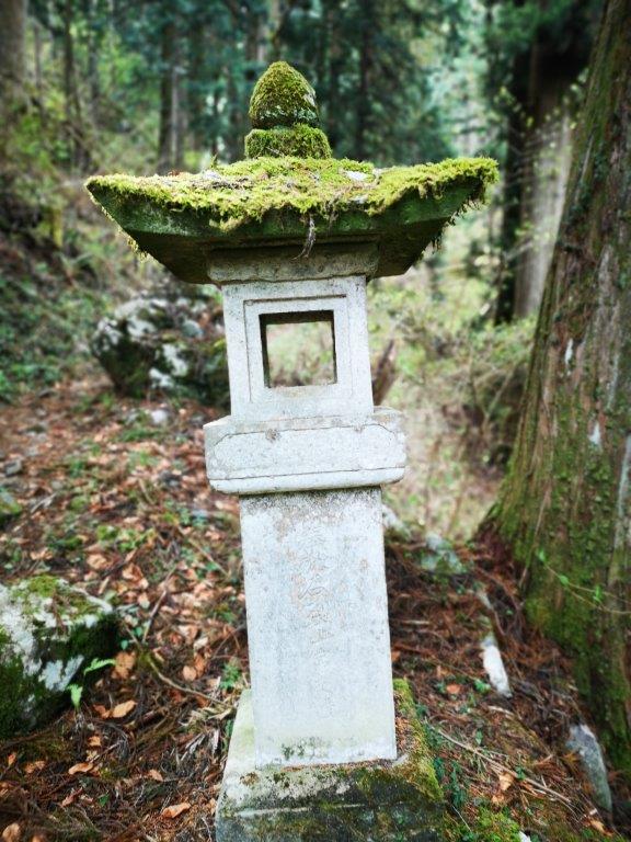
Ryugataki waterfall (left) stone lantern along the trail (right)

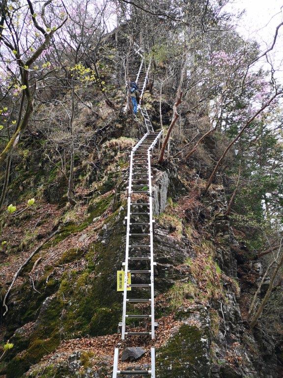
Before me rose a long rocky face fitted with a pair of parallel chains. Even though I had seen pictures beforehand, it seemed amazing that a path led straight up. After securing my pockets and tightening the straps of my bag, I proceeded with caution, as the surface, still damp from the morning dew, was slippery. At the end of the chained section, a long steel ladder led to a oku-no-miya (奥ノ宮), a tiny, off-trail shrine, hidden under a rocky crop. After a quick investigation, I continued along the main trail, as it cut around the rocky face to the south, wisely avoiding the direct approach.

Rocky section fitted with chains on the way up

A more dangerous section fitted with ladders

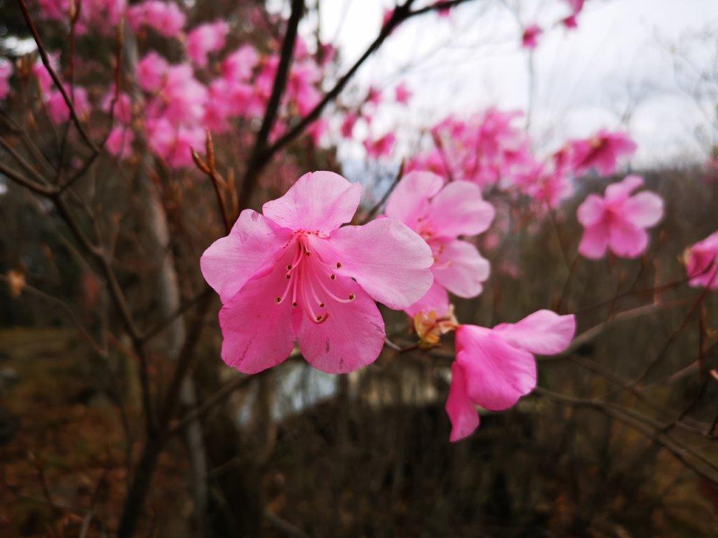
The chains and ladders soon reappeared, and there was even a short bridge along a narrow ridge with steep drops on each side. All this equipment seemed new and securely fastened, and for a while, I could enjoy the thrilling aspect of walking along the side of a rocky cliff, the thick vegetation masking the views and providing a false sense of security. Here and there, I could see pink rhododendron (“shakunage“), the flowers being in bloom precisely at this time of the year. At 11h3o, I reached the ridge top with a sense of relief and a few minutes later, I was standing on top of Higashi Kennomine (東剣ノ峰) where I had a view of today’s first summit directly north.

Shakunake near the top (left); ladder between east and west kennomine (right)

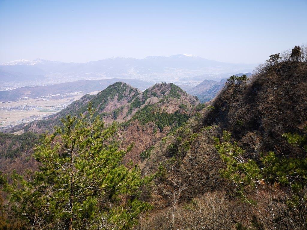
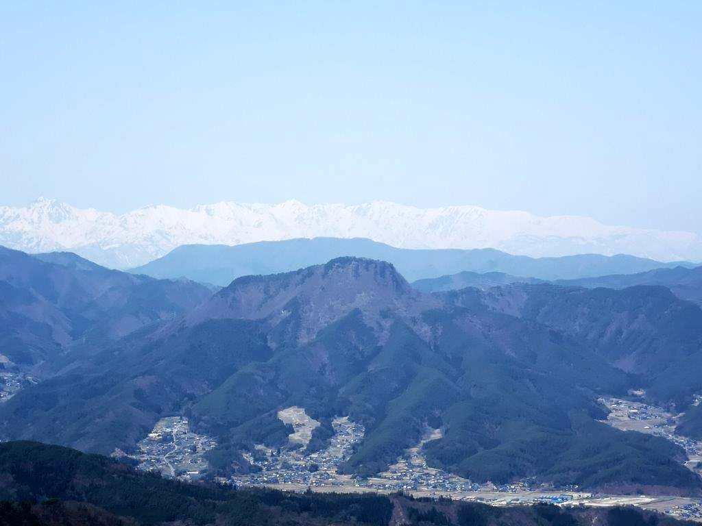
View to the west near the summit of Mt Ozaku

The next section was the scariest of the entire route: a long descent via a steep ladder. I moved slowly but steadily, always making sure to keep three points of contact at all times. At the base, after a short climb, I reached Nishi Kennomine (西剣ノ峰). There was a view on the east side, but today, all I could see was white. I continued down the other side and was faced with another series of ladders, less steep this time, at the bottom of which was yet another climb. Hoping this would be the last one, I charged off and in no time reached the top of Mt Ozaku (石裂山 おざくやま ozaku-yama meaning “split stone”), a Kanto 100-famous mountain. The only view was through a gap in the trees on the north side, through which I could see today’s next peak. The narrow summit was occupied by a large group, so I retreated to another spot with a view west, just a couple of minutes away.

Heading down a steep and rocky ridge

Lower down, walking alongside a rocky face

It felt chilly, almost as if winter was making an encore. I sat down for a quick lunch before resuming my hike. At 1pm, I reached the summit of Mt Gassan (or Tsukiyama 月山, meaning “moon mountain”). It had a lichen-covered shinto gate, a bunch of shakunage flowers and an old thermometer attached to the summit sign, the mercury level showing just below the 10° mark. After a short break, I descended a steep rocky ridge, then turned right onto a switchback path through cedar trees. I reached another chain-fitted rocky bit, at the back of the large group I met on the summit. They graciously let me pass ahead of them; I had to be doubly careful not to make a false move in front of an audience.

A lonely Kamoshika enjoying the spring leaves

A rare sight, especially at such a low altitude

I was now walking through an impressive canyon, a rock face on my right and a small stream on my left. Eventually, it widened into a valley, the new green of spring reappearing at the lower altitude. Out of the corner of my eye, I spotted movement high on the opposite slope – a solitary “kamoshika” or Japanese serow, munching on the new leaves; I hadn’t seen one since Mt Kushigata, three years ago. After observing this rare and magical sight for a while, I moved on quickly; I was still on schedule, but couldn’t afford to miss the only bus of the afternoon. On the opposite side of the valley, I noticed scores of fallen trees, probably due to the powerful typhoons of recent years; looking up through the gap in the forest, I saw blue sky, at last.

Walking back to the trail entrance

Better weather at the end of the day

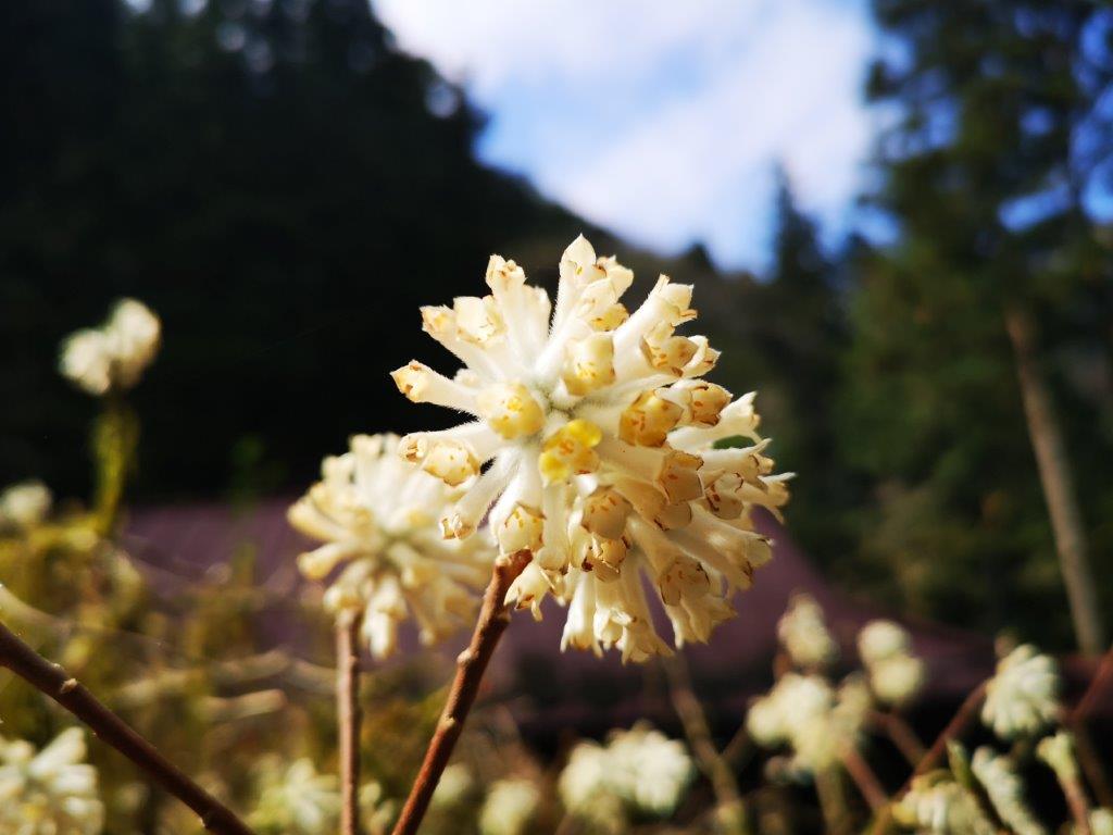
I carefully stepped on green moss-covered rocks to cross the stream I had been following, reaching the junction and the rest house I had passed earlier in the day. It was now 2pm and only half an hour to go, so I could complete the hike at a relaxed pace. I checked out a small pool of water next to the path and discovered dozens of tadpoles in the shallow water, also a rare sight, since I hadn’t seen any since 2019. I also saw some “mitsumata” flowers, last seen on Mt Ashitaka the previous year. I arrived safely back at the bus stop under blue skies, the day’s forecast finally coming true. At 3pm, I got on the small bus for Shin-Kanuma station, where I transferred to the limited express for the 90-minute ride to Tokyo.

See the sights of Mt Ozaku and Mt Gassan

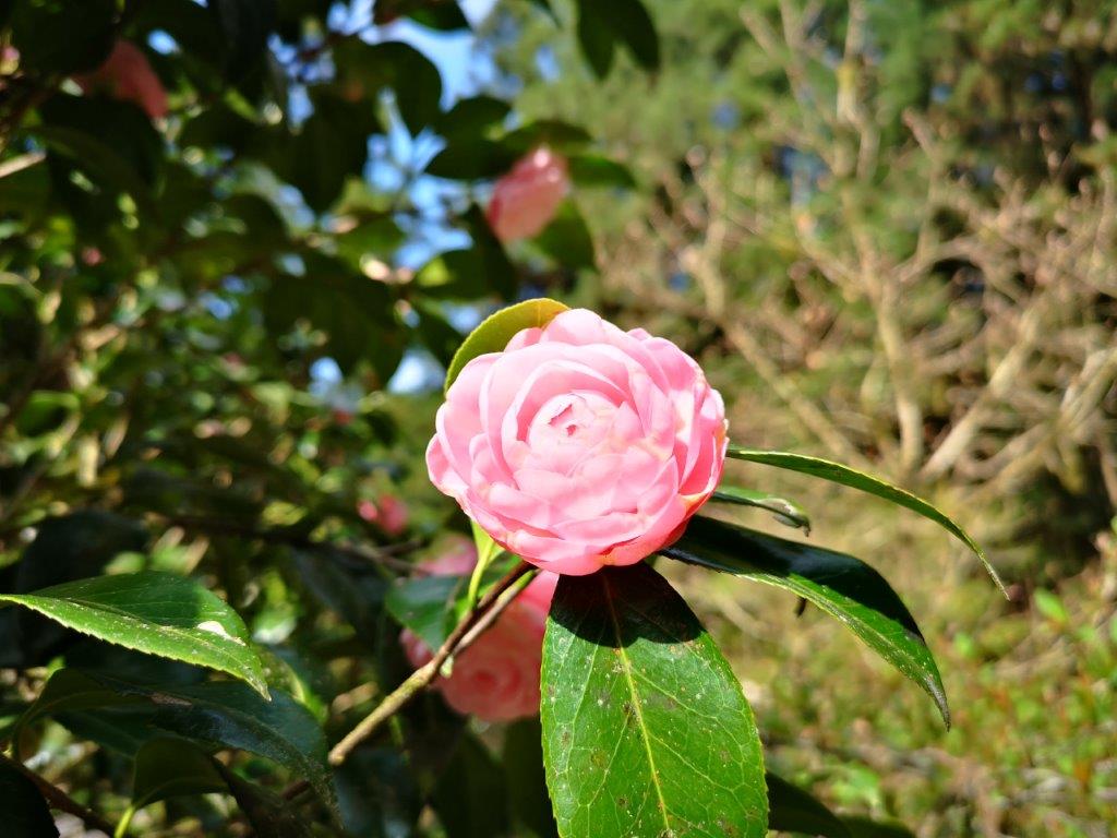
The flowers of Tochigi in the spring

Mt Tokko (1266m), Ueda City, Nagano Prefecture, Sunday, April 10, 2022

My last hike to the Ueda area had been less than 6 months ago, but I wanted to enjoy the views of Nagano again during the last clear days of early spring. I would climb a mountain south of Bessho Onsen, a famous hot spring resort, easily accessible from Tokyo by Shinkansen and local train; from the station, I could catch a local bus to the start of the trail. My guidebook recommended a five-hour loop hike combining two of the three trails on the mountain. On top of blue skies all day, the weather was supposed to be unseasonably warm, meaning that I could dress lightly. I was looking forward to getting views of the snow-covered North Alps, as well as enjoying a relaxing hot spring bath at the end.

View north from Daruma-iwa

Mt Tokko during plum blossom season

I didn’t see a single cloud in the sky on the 70-minute shinkansen ride to Ueda, where I switched to the Bessho line. Half an hour later, I got off at the charming Bessho Onsen station (別所温泉), the last stop on the line. Fresh off the platform, I was greeted by two ladies dressed in kimonos, who kindly directed me to the bus stop behind the station, marked by a bright red sign. A ten-minute ride on a light blue bus brought me to Chuuzenji Temple (中禅寺) at the foot of today’s mountain, and a ten-minute walk up a paved road led me to a fence with a gate, and the entrance of today’s hike.

Some sun filtering through the cedar trees on the way up

View east of Azuma-yama and Asama-yama

I spent a few minutes studying a beautiful and detailed hand-drawn map of the path to the top, displayed in front of the fence, before passing through it and heading into shady cool cedar forest. Although it was only 10h30, I was already feeling quite warm. I followed to a small stream and soon reached Fudo waterfall (不動滝). I left the stream behind, and after passing through a patch of camphor trees still bare of needles, made my way up a steep switchback path, some sections lined with rope to assist the unsteady hiker.

Mt Asama without its characteristic plume of smoke

The Japanese North Alps still in their winter coat

At 11h30, I had my first views of through the leafless trees; it felt odd to be in short sleeves surrounded by a winter landscape. A few minutes later, I reached the top of the ridge where I turned left. Pine trees were growing here and there and the air was filled with birdsong. After a short scramble, I arrived at Daruma Rock (だるま岩), an oval shaped rock, protruding from the mountain side like a pimple. Hidden behind was a rocky platform with a wide view of the valley. In the distance, I could see the white peaks of the North Alps, Togakushi highland, Mt Azuma, and Mt Asama, for once without its distinctive plume of smoke.

Mt Komayumi with the North Alps in the background

A solitary pine tree at the summit with Mt Tateshina on the far right

After enjoying the wide views, the best of the day, I set off again. I soon arrived at a junction, where I turned left, and after one last climb, reached the top of Mt Tokko (独鈷山 とっこさん tokko-san) just after noon. To the north, I had similar views as before; to the south, I could now see Mt Tateshina and the Utsukushi-ga-hara plateau. Even though I was over 1000 meters high, it still felt too hot to sit in the sun. Fortunately, a lone pine tree provided some shade, so I sat down for lunch. At 1pm, I made my way back to the junction, and followed the Miyazawa trail (宮沢コース) for a few meters, before taking the right branch for the Sawayamaike trail (沢山池コース).

Following the Sawayamaike Trail

Looking out on the southern side of Mt Tokko

This trail was surprisingly hard to follow; I frequently had to stop to look for strips of pink ribbons indicating the way. Occasionally, I passed white signposts stuck to trees, reassuring me that the narrow ridge I was following was indeed a hiking path. I had no views and saw no one as I followed the undulating ridge westwards. At 2pm, I turned right, down a narrow valley through which flowed a small stream. The path was still faint and in rather bad condition, forcing me to step carefully and continue to hunt for signs of the route.

Walking along the valley near the end of the hike

View of Joshinetsu-kogen from Shitakuike

About an hour later, I reached a deserted road at the end of the trail, which I then followed to the right. I was soon walking through the Nagano countryside in early spring mode, plum trees in full bloom. To my right, I had a side view of Mt Tokko, and I could appreciate the ridge I had followed after lunch. I stopped by Shitakuike pond (舌喰池) to admire the view of the mountains of Joshinetsu highland. Since it was only a couple of kilometers back to the station, I decided to walk, and was rewarded with seeing Japanese pheasants hunting for food next to the road (see video). I was back at the station with enough time for a hot bath at the modern Aisome no Yu (あいそめの湯) before my 4h30 train back to Ueda, where I caught the high-speed train for Tokyo.

See the sights and hear the sounds of Mt Tokko

Akigawa Hills Trail (highest point 270m) & Takiyama Park, Hachioji City, Tokyo Prefecture, Friday, April 8, 2022

Cherry blossom season ended had ended early in Tokyo this year. I decided to search for the last blossoms in the western part of the city. I would start by walking along the hills south of the Akigawa river, from Akigawa station to Musashi-Masuko station on the Itsukichi line. Then, I would make my way to a nearby prefectural park, famous for its cherry blossom trees. At the end, I would catch a bus for Hachioji station. The weather forecast was good with temperatures ideal for an afternoon stroll. I was looking forward to doing some hiking inside the city and seeing the last sakura of the season.

Hiking in the Akikawa Hills Natural Park 都立秋川丘陵自然公園

Hiking in the Takiyama Natural Park 都立滝山自然公園

First part of the Akigawa Hills Trail

It was a beautiful spring day as I stepped off the train at Akigawa station. It was a little after noon, so I stopped by nearby Kiryu-an for an excellent soba noodle lunch. After, I stopped at the nearby Chiyotsuru museum (千代鶴資料館), a famous brand by Nakamura, a local sake brewery (中村酒造). I could see some sake making equipment and also taste some freshly brewed sake.

Sign marking the start of the trail

Reaching the ridge top (left) cherry blossom trees (right)

At 2pm, I reached the trail entrance of the Akigawa Hills Route (秋川丘陵コース), next to the Ken-O expressway. I found myself immersed in nature as soon as I started walking along the trail; I was astounded by the sudden change in scenery. In no time, I reached the top of the ridge, where I turned left. The trail went up and down gently; occasionally I had views of the city to the right; looking up, I could spot cherry blossom trees here and there.

A bamboo forest tunnel

Some open spaces near the end of the trail

At 2h30, the trail went down the other side of the ridge and followed a small river valley for a short while. Eventually, I was walking again on the ridge; the trees had been cleared along some sections, offering good views north and south. Soon the path descended and after reaching a road, turned north alongside a golf course. At 3h30, I arrived at Yamada ridge, taking me accross the Akigawa river, after which it as a short walk back to Masuko station.

A view of western Tokyo from Takiyama park

Late afternoon stroll along the Takiyama trail

Since it was getting late, I took a taxi to the entrance of Takiyama Park (滝山公園). There were few people at this late hour. I found the cherry blossom trees, still in full bloom, as well as a good view of western Tokyo, where the Tamagawa and Akigawa merge. I walked southeast along the Takiyama trail and reached a road and a bus stop at 6pm, just before nightfall. After getting off at Hachioji station, I took the Chuo line limited express for the short ride back to Shinjuku station.

See a cherry blossom storm or “sakura-fubuki”