My last hike to the Ueda area had been less than 6 months ago, but I wanted to enjoy the views of Nagano again during the last clear days of early spring. I would climb a mountain south of Bessho Onsen, a famous hot spring resort, easily accessible from Tokyo by Shinkansen and local train; from the station, I could catch a local bus to the start of the trail. My guidebook recommended a five-hour loop hike combining two of the three trails on the mountain. On top of blue skies all day, the weather was supposed to be unseasonably warm, meaning that I could dress lightly. I was looking forward to getting views of the snow-covered North Alps, as well as enjoying a relaxing hot spring bath at the end.
View north from Daruma-iwa

Mt Tokko during plum blossom season
I didn’t see a single cloud in the sky on the 70-minute shinkansen ride to Ueda, where I switched to the Bessho line. Half an hour later, I got off at the charming Bessho Onsen station (別所温泉), the last stop on the line. Fresh off the platform, I was greeted by two ladies dressed in kimonos, who kindly directed me to the bus stop behind the station, marked by a bright red sign. A ten-minute ride on a light blue bus brought me to Chuuzenji Temple (中禅寺) at the foot of today’s mountain, and a ten-minute walk up a paved road led me to a fence with a gate, and the entrance of today’s hike.

Some sun filtering through the cedar trees on the way up
View east of Azuma-yama and Asama-yama
I spent a few minutes studying a beautiful and detailed hand-drawn map of the path to the top, displayed in front of the fence, before passing through it and heading into shady cool cedar forest. Although it was only 10h30, I was already feeling quite warm. I followed to a small stream and soon reached Fudo waterfall (不動滝). I left the stream behind, and after passing through a patch of camphor trees still bare of needles, made my way up a steep switchback path, some sections lined with rope to assist the unsteady hiker.
Mt Asama without its characteristic plume of smoke

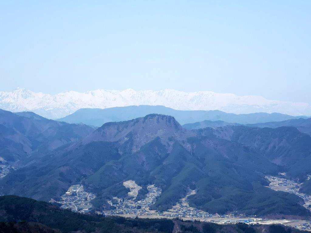
The Japanese North Alps still in their winter coat
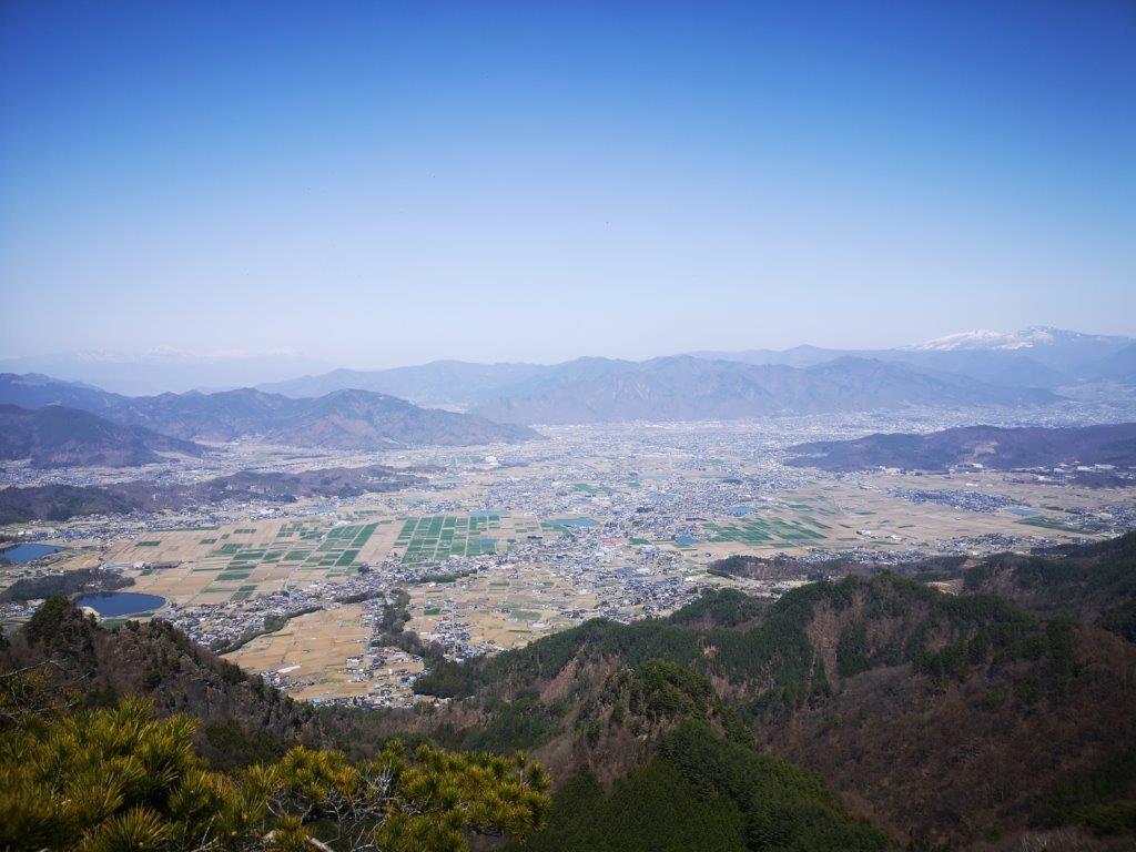
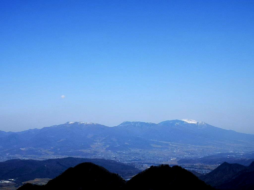
At 11h30, I had my first views of through the leafless trees; it felt odd to be in short sleeves surrounded by a winter landscape. A few minutes later, I reached the top of the ridge where I turned left. Pine trees were growing here and there and the air was filled with birdsong. After a short scramble, I arrived at Daruma Rock (だるま岩), an oval shaped rock, protruding from the mountain side like a pimple. Hidden behind was a rocky platform with a wide view of the valley. In the distance, I could see the white peaks of the North Alps, Togakushi highland, Mt Azuma, and Mt Asama, for once without its distinctive plume of smoke.
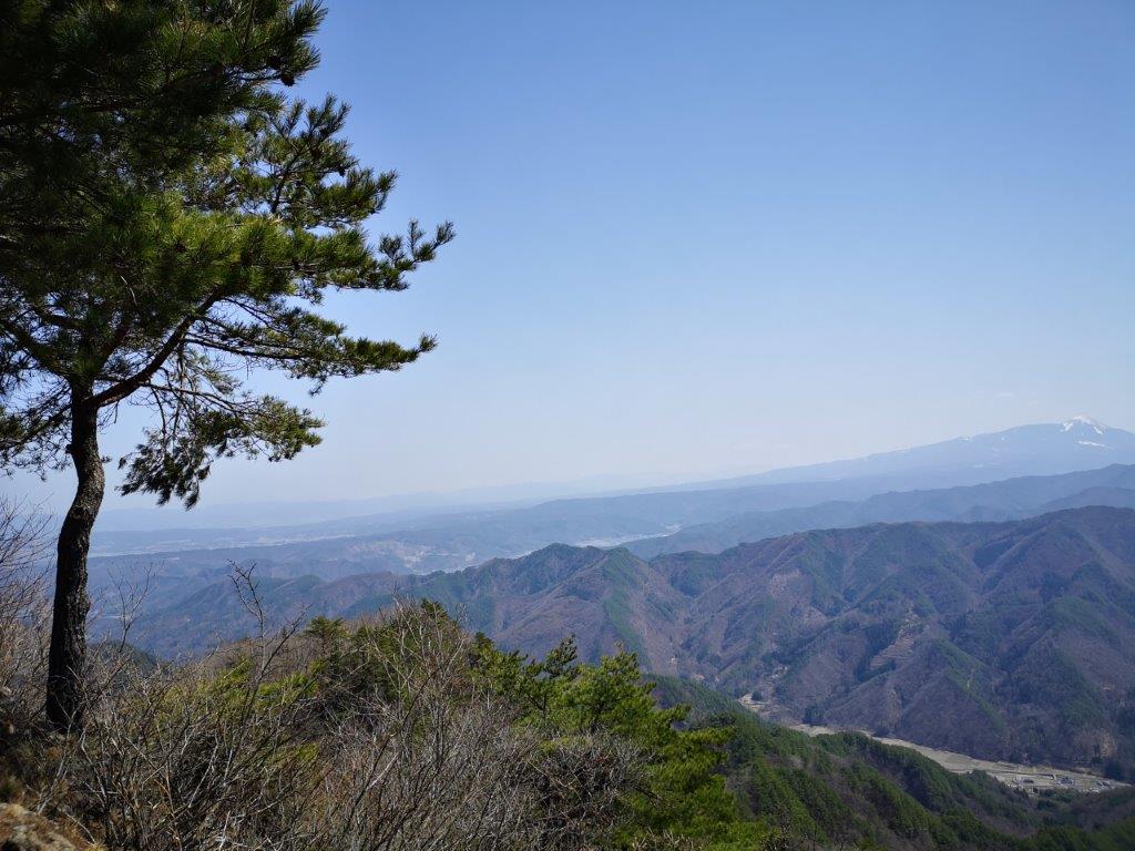
Mt Komayumi with the North Alps in the background
A solitary pine tree at the summit with Mt Tateshina on the far right
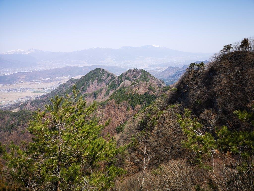
After enjoying the wide views, the best of the day, I set off again. I soon arrived at a junction, where I turned left, and after one last climb, reached the top of Mt Tokko (独鈷山 とっこさん tokko-san) just after noon. To the north, I had similar views as before; to the south, I could now see Mt Tateshina and the Utsukushi-ga-hara plateau. Even though I was over 1000 meters high, it still felt too hot to sit in the sun. Fortunately, a lone pine tree provided some shade, so I sat down for lunch. At 1pm, I made my way back to the junction, and followed the Miyazawa trail (宮沢コース) for a few meters, before taking the right branch for the Sawayamaike trail (沢山池コース).

Following the Sawayamaike Trail

Looking out on the southern side of Mt Tokko
This trail was surprisingly hard to follow; I frequently had to stop to look for strips of pink ribbons indicating the way. Occasionally, I passed white signposts stuck to trees, reassuring me that the narrow ridge I was following was indeed a hiking path. I had no views and saw no one as I followed the undulating ridge westwards. At 2pm, I turned right, down a narrow valley through which flowed a small stream. The path was still faint and in rather bad condition, forcing me to step carefully and continue to hunt for signs of the route.
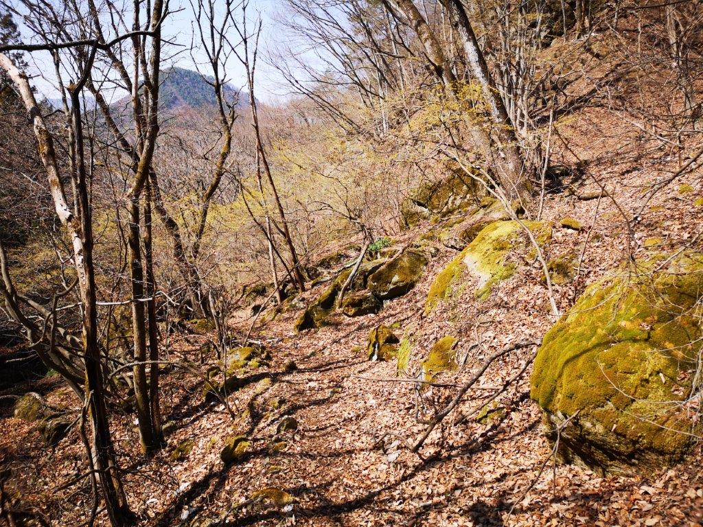
Walking along the valley near the end of the hike

View of Joshinetsu-kogen from Shitakuike
About an hour later, I reached a deserted road at the end of the trail, which I then followed to the right. I was soon walking through the Nagano countryside in early spring mode, plum trees in full bloom. To my right, I had a side view of Mt Tokko, and I could appreciate the ridge I had followed after lunch. I stopped by Shitakuike pond (舌喰池) to admire the view of the mountains of Joshinetsu highland. Since it was only a couple of kilometers back to the station, I decided to walk, and was rewarded with seeing Japanese pheasants hunting for food next to the road (see video). I was back at the station with enough time for a hot bath at the modern Aisome no Yu (あいそめの湯) before my 4h30 train back to Ueda, where I caught the high-speed train for Tokyo.
See the sights and hear the sounds of Mt Tokko