Karikomi Lake, Nikko City, Tochigi Prefecture, Sunday, July 21, 2019

The very long rainy season had put a premature end to the first half of the 2019 hiking season…but I was determined to get one more hike in before the hot and busy (for me) summer arrived – my next chance would probably not be till September. Since I was a little out of shape, I chose a short and easy one in Nikko, hoping that the overcast skies, and voting for the national elections, would keep the crowds away. I was looking forward to visiting the Oku-Nikko area since I hadn’t been there since my climb of Mt Nyoho two years ago.

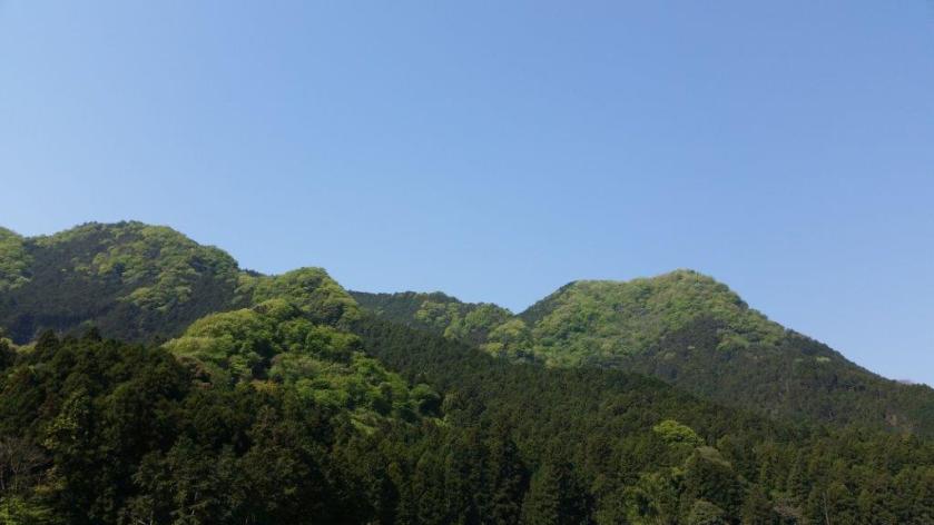
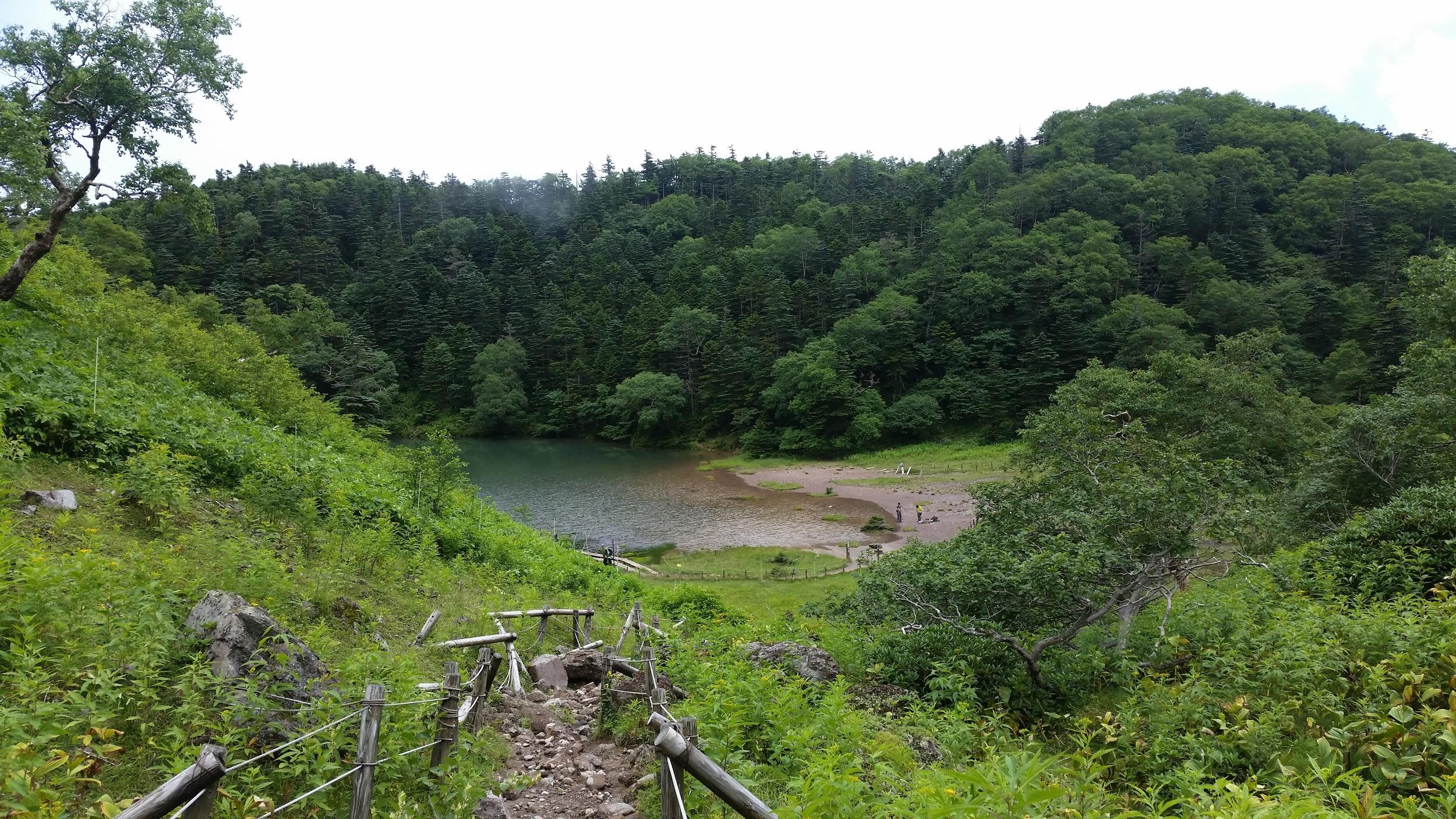
Lake Karikomi and Mt Taro in the background

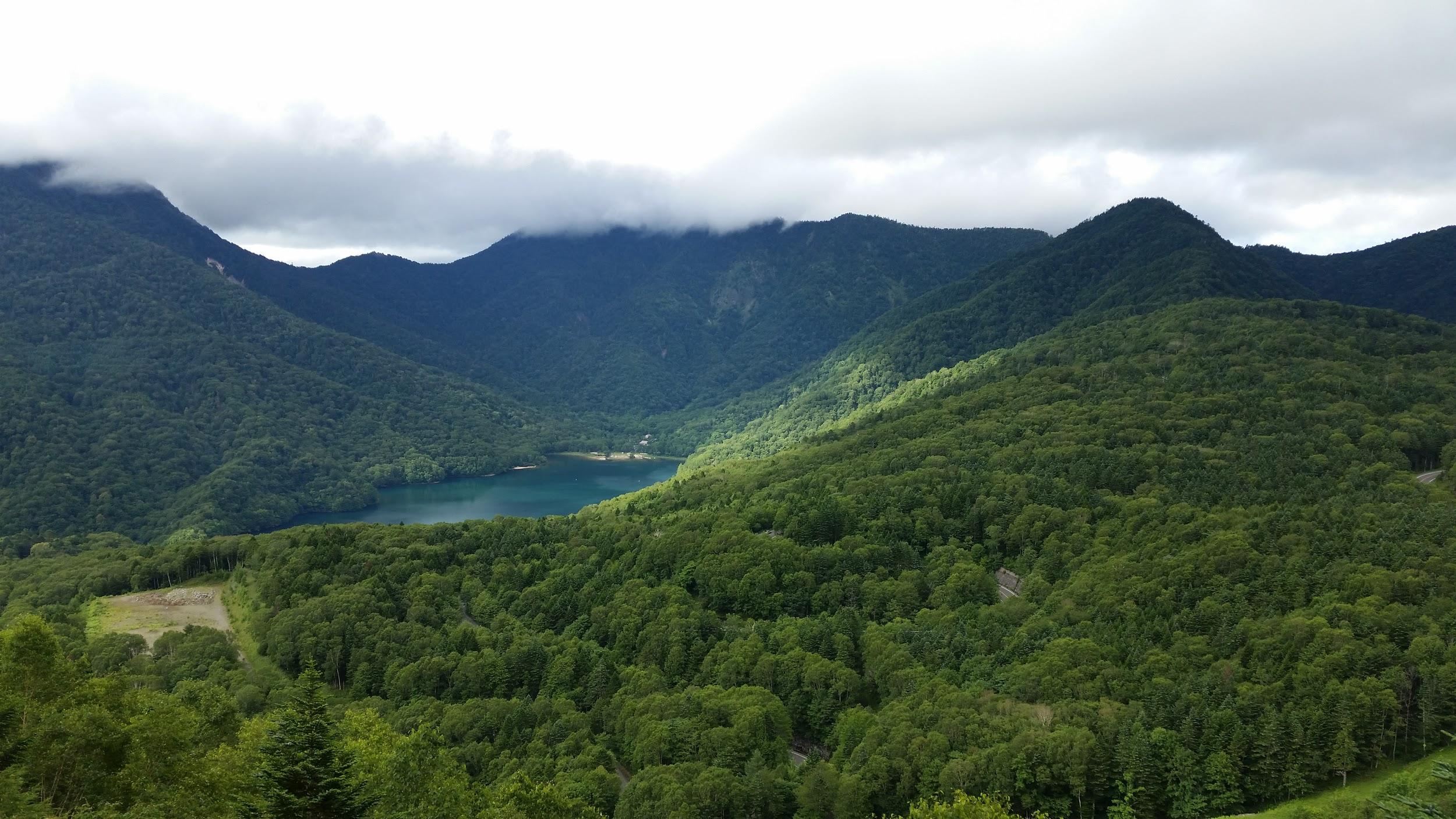
I took advantage of the more expensive, but direct Tobu Nikko line train – being able to sit and sleep during the 2 hour trip was definitely worth the express surcharge. In Nikko there was a light drizzle. I didn’t fancy walking in the rain but I couldn’t turn back now. Going up “Irozaka slope”, the bus was enveloped in thick mist. Fortunately, once we emerged at Chuzenji lake, we were above the mist and I could see the lake and mountain sides – the sky overhead was overcast and the peaks were in the cloud though.

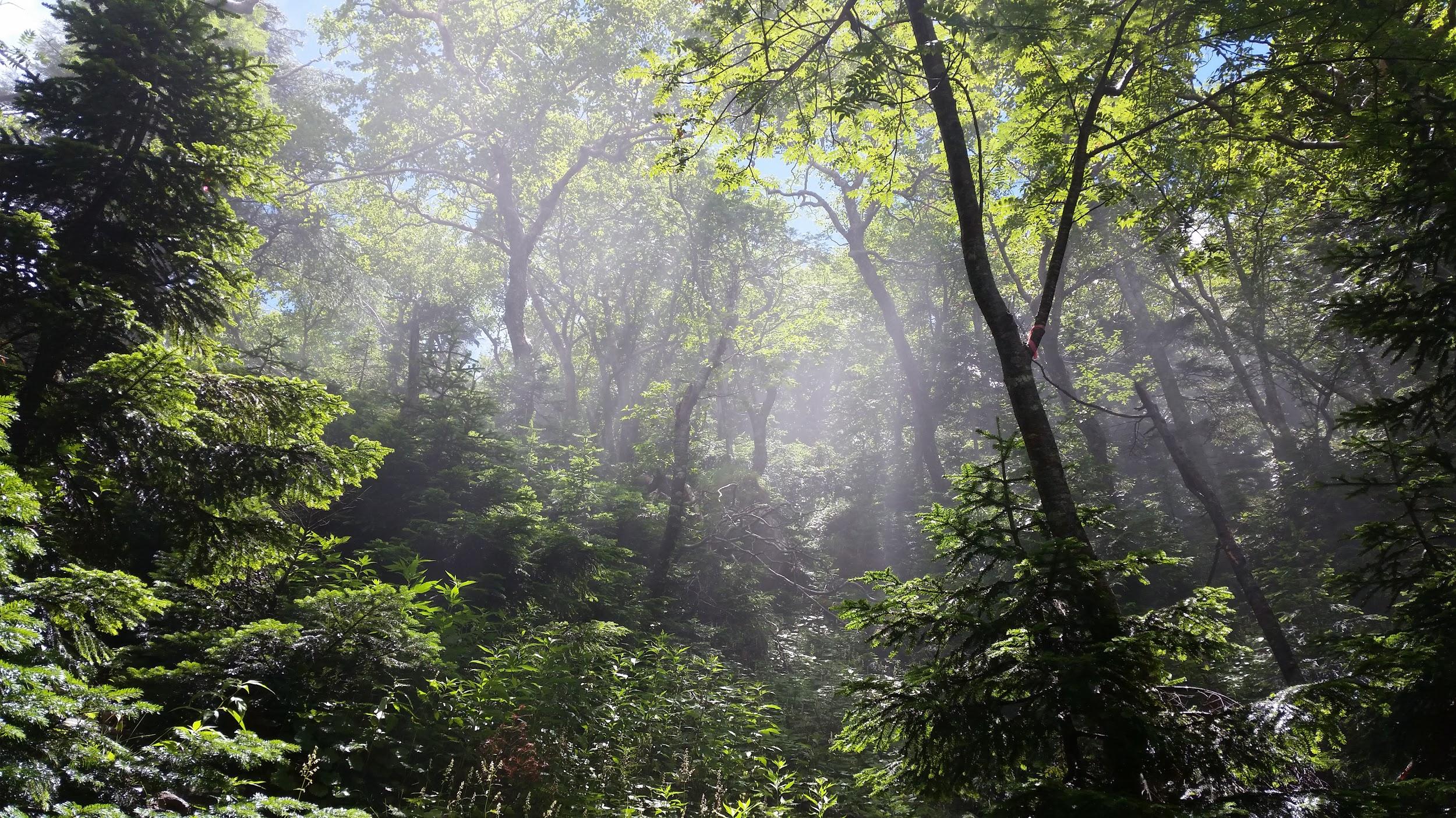
Today’s hike was through green mossy forest

I got off at the very last stop, Yumoto-onsen. This small, somewhat run-down, onsen town town seemed totally deserted, 11am on a Sunday morning. Was the town in decline or was my timing bad, I wondered to myself. I made my way to the start of the hiking path behind the town, also the source of it’s hot springs. There is a wooden observation path, and two small pools of bubbling water – not the most exciting tourist attraction but it’s always cool to see hot water coming out of the ground.

See the hot spring water bubbling up and hear the birds chirping near Karikomi lake

The path climbed for a few minutes, then crossed a road, before heading along the side of small forested valley. Despite being at 1500m, the air felt unpleasantly heavy – very different from my previous hike 2 weeks earlier, and one thousand meters lower. It took me less than an hour to reach a pass, where I took a short break. Afterwards, the hiking was mostly level and along a broad easy-to-walk path. I took off my bear bell so that I could enjoy the intense chirping of birds.

A signpost in the forest

After some descending along wooden staircases through a thick moss covered forest, I arrived at Karikomi Lake (刈込湖) just before one o’clock. After checking out the view and having a quick lunch, I set off along the path through beautiful forest, passing another small lake, and finally arriving in a wide grassy valley. Since I needed to catch the 3pm bus from the Astoria Hotel I couldn’t linger and I powered up the mountainside opposite and over another pass, with Mt Taro on my left, a 300 famous mountain that I have yet to climb.

A grassy field suddenly appeared

A hidden valley in the middle of the Nikko National Park

From there it was a quick and easy thirty minute descent to the hotel – I had to overtake a very big group of elementary school children on the way. I made the bus but had to forego the onsen, otherwise I would miss the last express train back, and that would mean getting to Tokyo really late. By the way, this place would have snagged fourth place on my list of places to go when it’s hot and humid, except that the traveling time is too long for a daytrip – seven hours for only four hours of hiking.

On the shore of Karikomi Lake

Mt Mitsumine (605m), Tochigi City, Tochigi Prefecture, Sunday April 22, 2018

Mt Mitsumine (三峰山 meaning “3 peaks”, also known as Mt Ontake 御嶽山) is tucked away among the many mountains north of Tochigi city, and it only came to my attention thanks to its inclusion in the Tochigi hundred famous mountains. At first glance, I thought it could only be reached by car, but further research using Google Maps showed that the trail entrance was just a short walk from a Tochigi city bus stop near the Hoshino Archaeological site​. I chose a warm, blue-sky Spring day to explore this sacred mountain.

Get a Map of the Mt Mitsumine Hike on Avenza

This map was developed for Japanwilds with the Hokkaido Cartographer

Find Japan Hiking Maps on Japanwilds

View of Mt Mitsumine from the base of Mt Yagura

The hiking trail, also used by pilgrims, starts directly behind Ontake shrine up a staircase lined with “toro” or lanterns. In this season, “tsutsuji“or azalea were in full bloom adding patches of pink to the new green scenery. Further up the path, I saw many”Reijin-hi” (霊神碑), or miniature stone Shinto shrines, contributing to the mystic feel to the climb. The mountain is connected to the Ontake Faith, centered on Mt Ontake in the Hida mountains; Kobo-daishi also spent time at this mountain. At the top of some weather-worn stone steps, I reached a bench with a partial view – the perfect spot for an early lunch break.

View of Mt Mitsumine from the Bus Stop

After some more ascending, I reached a fork in the path: a short way to the right was “oku no in” (奥の院) marked by a stone “tori“, or Shinto gate; past it, were 3 dignified statues, the gods of creation in Japanese mythology, and a narrow view through a gap in the vegetation. Retracing my steps, I resumed my climb, soon reaching the flat top part of the mountain. Plodding through the featureless forest, it was hard to determine the location of the three peaks, let alone the highest one.

Watch a Short Video of the Mitsumine Summit View

I finally arrived at the official summit marker, oddly enough not the real top, but a spot on the western side and free of trees. I could see ridgeline after ridgeline disappear into haze, no particular peak standing out; apparently in the winter, one can see the Oku-Nikko mountains. Directly below was a gigantic construction field, as this side of the mountain is being constantly mined, similar to Mt Buko. After admiring the view, I used a more direct route down the east side to get back to the bus stop for the return trip to Tochigi station.

See a Slideshow of more Pictures of the Hike

Nikko-Shirane Ropeway & Goshiki-Numa Lake, Katashina Town, Gunma Prefecture

I did this hike with my mother who was visiting Japan for a couple of weeks. Since it was quite far from Tokyo, we spent the night at the Takasaki Dormy Inn Hotel, and the next morning, I drove to the Nikko-Shirane Ropeway. Even though it was a weekday, I was surprised by how few people there were, especially since it was the middle of the summer holidays. The place is mainly a ski resort in the winter so perhaps people aren’t aware that it also runs from June to October. I love ropeways and I keep on discovering new ones – it’s amazing how many there are in Japan!

Sun shining through the forest

At the top of the ropeway, inside Nikko National Park and nearly 2000m high, the visibility wasn’t the best, and the views were a little disappointing. At least it was cooler than down in the valley. The hike started out on a fairly level trail through beautiful forest. After an hour or so, we had to climb steeply for a short while to reach the edge of a pond. Here I was able to look up towards the top of Mt Nikko-Shirane. I had been hoping to get my revenge, since it was in clouds when I climbed it several years ago. However, the top was in the clouds again, and another ascent seemed pointless.

Midaga Pond near the top of Mt Nikko-Shirane

We continued a little further and reached the edge of a crater with at the bottom, the beautiful Goshiki-Numa lake 五色沼 (which means five-colour lake). Since we had enough time, I decided we could descend to the shore of the lake and climb back up again. Unfortunately the descent was steep and rocky, and we regretted it a bit.

The Goshiki-numa lake, inside Tochigi prefecture

After enjoying the peace and quiet of the lake, we made our way back up to the edge of the crater via a different path, and then walked back the way we had come. At the pond, we passed a group of noisy school children who had come up a different path. We headed back down the steep path to the forest below, and at the bottom we took another trail that looped back to the top of the ropeway.

View of Maru-numa lake from the ropeway

Check out the views of Nikko-Shirane

On the drive back to Takasaki we stopped at the very impressive Fukiware Waterfalls 吹割の滝 where we could walk along the river and the falls for a short way.

Where is all the water going?

Check out one of the famous waterfalls in Japan