
I wanted to do one last hike before my summer break. I decided to head up to Tohoku, northeast Japan, hoping it would be cooler than the Kanto area. I had been wanting to climb this 200 famous mountain since my last visit to Iwate five years ago. It promised 360° views from the summit on a clear day and some beautiful forest on the way up and down. Looking at my map, I saw I could take the most direct route up, and if time allowed, take a slightly longer route on the descent.
To get to the start of the hike, I’d ride the Tohoku shinkansen to Morioka, and then change to the local Iwate Galaxy Railway for the short ride to Koma station. There, I’d call a taxi to get to the parking near the trailhead. Since the shinkansen was reserved seating only, I purchased an e-ticket for my mobile Suica in advance. The weather was supposed to be sunny with temperatures around 30° at the base and 20° at the top. I was looking forward to the views and hoped the tree shade would keep me cool on the way up.


Cedars at the Start of the Hike (left) Log Steps Halfway up (right)
Rocky Path near the Top (left) Larches at the end of the Hike (right)
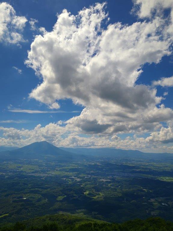
After a 2-hour lightning speed trip under mostly sunny skies, I arrived in Morioka just after 11am. It felt quite warm as I waited on the platform for the excitingly named Galaxy Railway (銀河鉄道) train. The ride to Koma station (好摩駅) itself was quite normal except for the enchanting flute theme that announced each station. After a 10-minute wait under the boiling sun for my taxi, and a 20-minute ride through the charming Iwate countryside, I reached the large but mostly empty parking lot near the Ipponsugi-enchi Campground (一本杉園地キャンプ場), a little after noon.
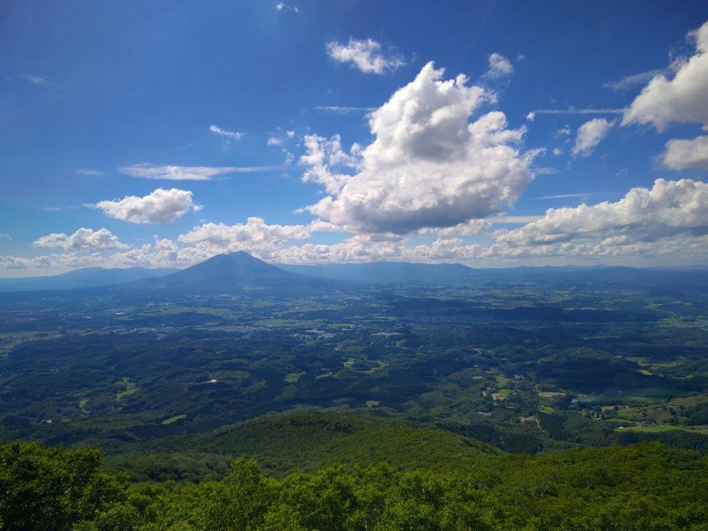
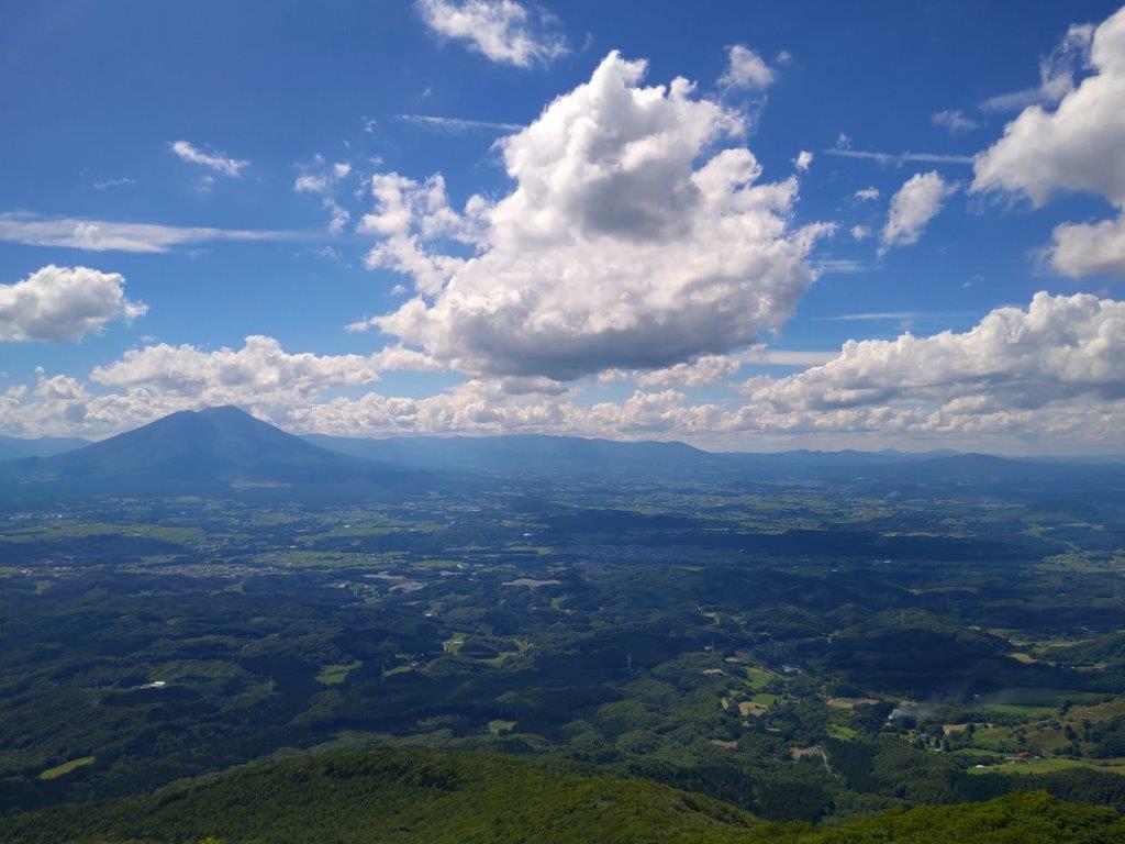
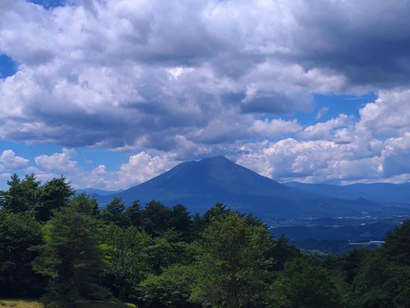
Impressive Clouds above Mt Iwate from Koma Station
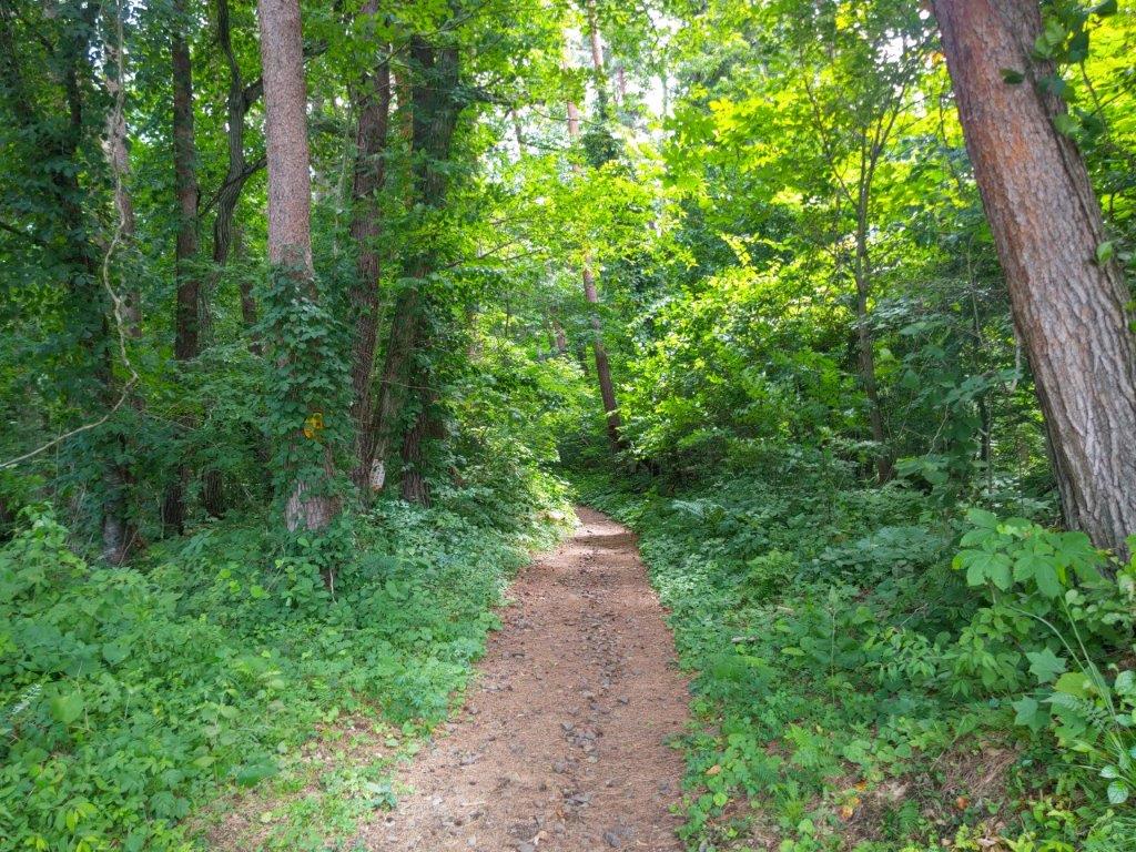
Start of the Ipponsugi Trail
After getting ready, I walked up a grassy slope to some benches at the edge of the forest, the start of the Ipponsugi Trail (一本杉コース). Turning around, I had a startling view of Mt Iwate under dark menacing clouds. After passing an intersection with a forest road, I found myself walking along a narrow dirt path between tall cedars at 1230, happy to be in their shade. As the path started to climb gently, I reached a sign for Ipponsugi (一本杉) a solitary giant cedar, a few meters off the trail. After admiring this giant of nature, I continued on my way.

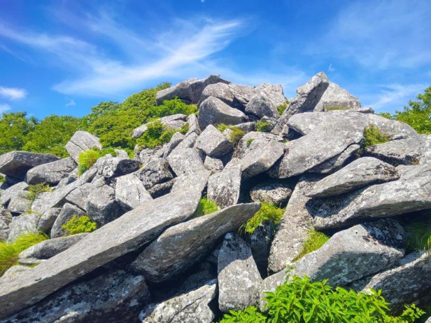
Rocky Section near the Top of the Trail

View of Mt Iwate near the Top of Mt Himekami
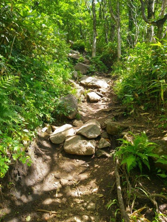
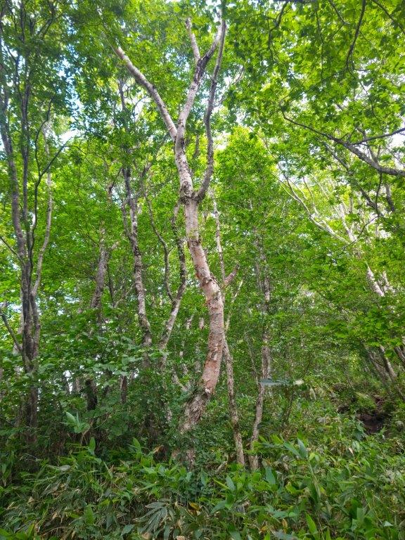
I soon arrived at the start of a series of steep log steps, a tough slog on what was turning out to be quite a hot day. I took my first break a little before 1pm at the 5th station (五合目), a level area half way to the top in distance, but only one third in elevation gain. The next section, covered in roots and rocks, was harder and more slippery to walk, and I was grateful when the steps reappeared further along. I spotted the occasional pale white trunks of birches (シラカンバ 白樺), a common mountain tree in northern Japan. Half an hour later, I reached another level area at the 7th station (七合目) where I settled on a large rock for the second break of the climb.
Huge Cloud Floating through the Sky
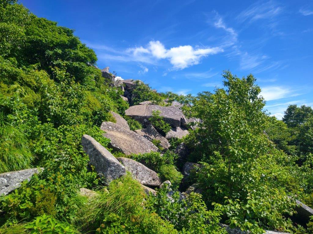
Boulder Hopping Section Close to the Summit
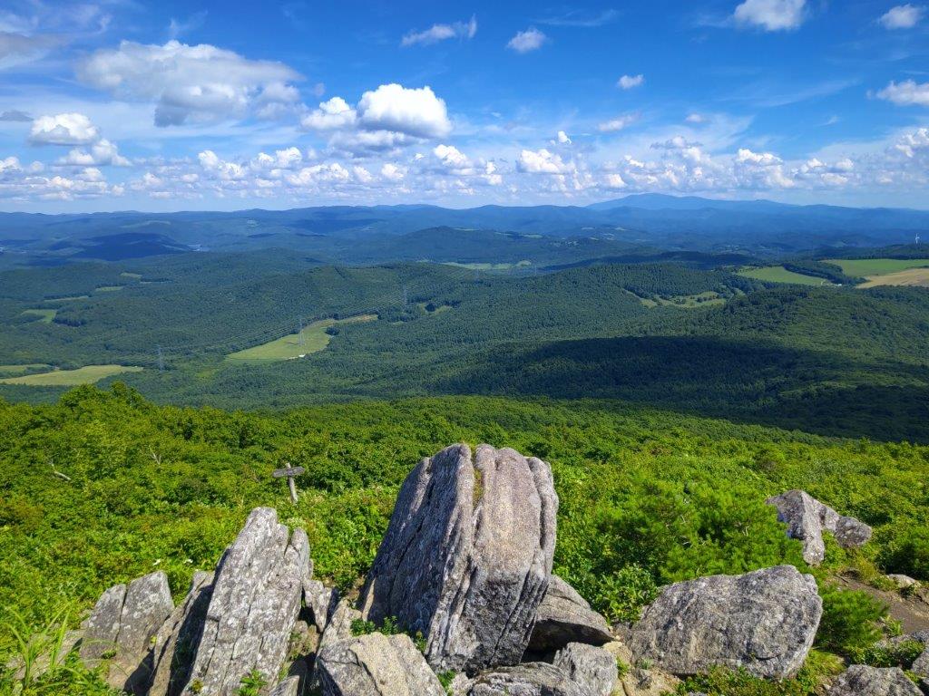
For the first time of the day, I felt a breeze blow through the trees, helping me to cool off before the final summit push. The rocks on the trail became bigger and bigger, forcing me to use my hands to haul myself over the largest ones. I suddenly emerged from the vegetation, blue sky with wisps of white cloud overhead. Standing on a flat rock, I had a wide view of Mt Iwate and Mt Hachimantai to the west. Just beyond, the trail split into two: the left fork went directly to the summit through the forest; however, I choose the panoramic right fork, hopping boulder to boulder, till it merged with the Jonai Trail (城内コース) on the southwest side.
View Northeast from the Top of the Ipponsugi Trail

View of Mt Iwate and Mt Hachimantai from Mt Himekami
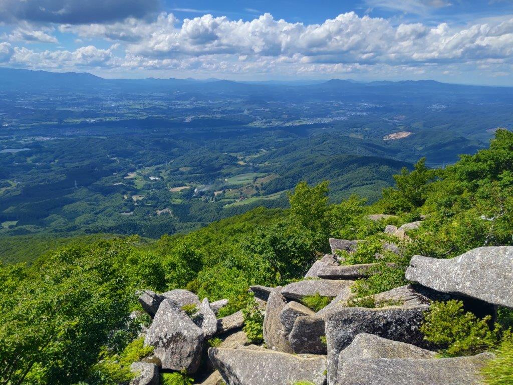
It had been a while since I had done such an adventurous trail and I had to watch out for the gaps between the flat slabs of rock. Once I was safely back on a proper trail, it took just a couple of minutes to reach the summit of Mt Himekami (姫神山 ひめかみさん himekami-san), meaning “princess god”. The view was stunning in all directions although I could only confidently identify Mt Hayachine to the south. Since it was past 2pm, I found a good rock to sit on for a late lunch with a view.
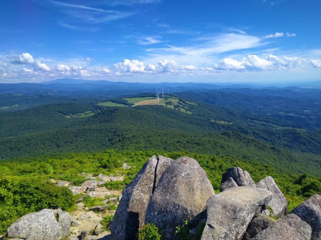
View South of Wind Turbines and Mt Hayachine (left)
View Southeast from Mt Himekami
I wanted to stay longer to admire the stunning view, as well as enjoy the spectacular clouds floating through the sky, but I had to allow enough time to catch my shinkansen for the return (also reserved). At 3pm, I dived back into the forest, down the Kowasaka Trail (こわ坂コース) on the northwest side. The first section headed down quite steeply, with ropes attached to the side for safety, but fortunately rock-free. I saw perhaps a dozen people on the ascent but passed no one on the descent. I enjoyed the solitude, making just a little noise in case a bear was lurking in the woods.

View East from the Top of Mt Himekami

Last View of Mt Iwate before Heading down
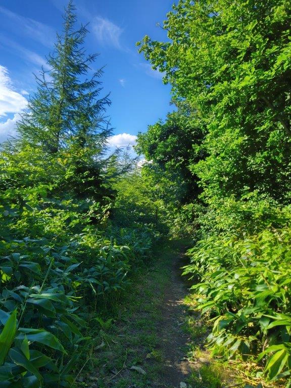
The surrounding forest was just as beautiful on this side, and lower down, I found myself walking through larches, a nice change from the cedars and birches. At 4pm, I reached the trail entrance where I turned left onto a paved road. The final section is one reason people avoid the Kowasaka trail (the other being it is less well-maintained), but it’s only a fifteen-minute walk back to the start of the Ipponsugi trail entrance. Along the way I was startled by a snake on the road; a closer inspection revealed that it was dead, perhaps hit by a car, but it was in perfect condition and extremely lifelike even in death.

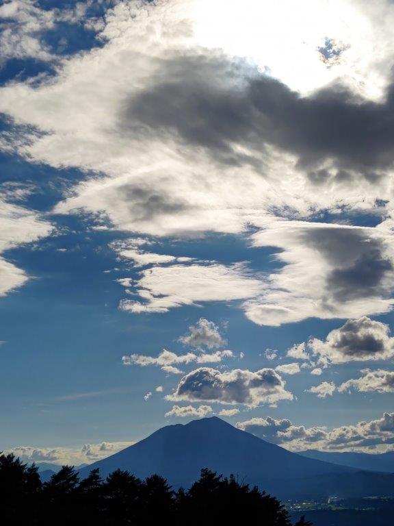
Mt Iwate against the Late Afternoon Sun

The Prince God of Mt Himekani?
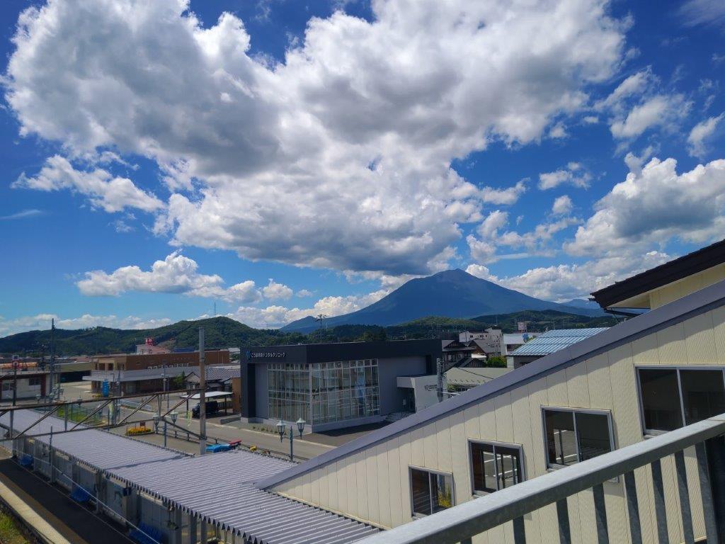
I was delighted to come upon a tube channeling ice cold water close to the end of the hike. After dousing my face and head several times, I called this morning’s taxi company, asking them to pick me up. I got dropped off at Koma station a little before 5pm, and half an hour later, was at Morioka Station with one hour to spare before my train back to Tokyo. After sampling some local Japanese sake from Kikizakeya, I boarded the shinkansen for the comfortable 2-hour ride back home.
Watch a Video of the Hike


See More Pictures of the Hike
