

I wanted to do another hike in Higashi-Chichibu, as my previous hike there a few months ago had reminded me of what a great place it was for hiking. Looking at my map, I saw I could traverse from eastern to central Chichibu, passing by a peak climbed some years ago. The middle part of my planned hike followed the Kanto Fureai no Michi, as well as the Outer Chichibu 7 Peaks Traverse Hiking Trail, meaning the trail would be easy to follow. It had snowed heavily a few days before, but looking online, it seemed that most of the snow had already melted in the subsequent warm weather.
For subscribers, read this Post on Hiking Around Tokyo for a better viewing experience and the latest updates
To get to the start of the hike, I’d ride the Tobu-Tojo express train from Ikebukuro to Ogawamachi, and from there, board the Higashi-chichibu Village line bus for the half an hour trip to Kaiya in Higashi-Chichibu. For the return, I could catch a bus from Sadamine in Chichibu itself for the thirty-minute ride to Seibu-Chichibu station, where I could get a hot bath at Matsuri-no-yu and taste some local nihonshu from their “sake server” before catching the Laview Limited Express for Tokyo. The weather was supposed to be sunny and warm for the season and so I was looking forward to an early spring hike in the Chichibu mountains north of Tokyo.
Find Japan Hiking Maps on Japanwilds and subscribe to our newsletter


Trail past the Summit (left) After Sadamine Pass (right)
Hiking the Outer Chichibu 7 Peaks Traverse Hiking Trail
外秩父七峰縦走ハイキングコース
Hiking the Kanto Fureai no Michi 関東ふれあいの道

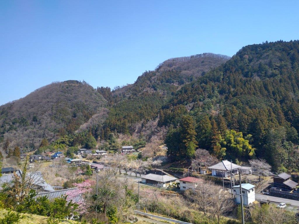
View of Higashi-Chichibu from above Kaiya
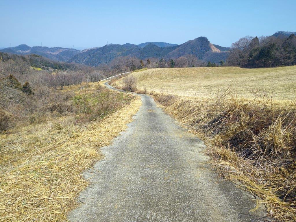
Looking back at the Road for Kayunita Pass
The first part of the hike took me from the base of the valley to the open shelter at the Kayunita Pass (粥仁田峠), where I turned left, onto the Fureai no Michi the Outer Chichibu 7 Peaks Traverse. I started out at 11am and arrived at the pass just before 1230 during which time I saw only one other hiker, wearing a traditional Japanese straw hat or “amigasa”. He was walking behind me and occasionally picked up pieces of trash, so I assumed he was a member of the “Kaiya Genki Club”, the name shown on the many new-looking signposts I had seen along the way.

These Fields will Turn Green in the Summer
View East Between Kayunita Pass and Mt Ogiri
This first part was entirely along deserted country lanes through open fields, meaning I had wide sweeping views of the Higashi-Chichibu valley every time I stopped and turned around. On the southeast side, I could see Mt Kasa and Mt Dodaira, climbed in November last year; on the northeast side was Mt Kannokura. Most of the surrounding vegetation was still in winter mode which felt a bit strange considering that the temperature was above 20°. On the same day I saw cherry blossom trees that had already reached full bloom and patches of leftover snow, sometimes even at the same spot.

Walking the Outer Chichibu 7 Peaks Traverse Hiking Trail
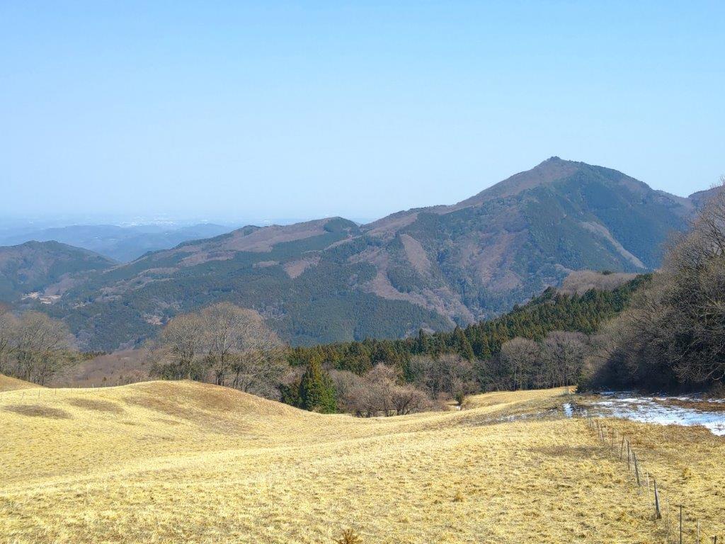
View of Chichibu Highland Farm from Mt Ogiri
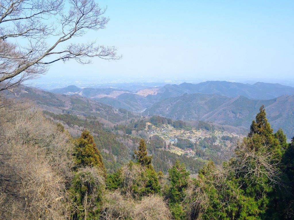
The next part from the Kayunita pass to the summit, up a proper hiking trail, took half an hour. It was mostly in the forest although I had a view of Higashi-Chichibu through a gap in the trees mid-way. The guy in the “amigasa” caught up with me at the summit but it turned out that he was just another hiker. The view was a bit hazy and better appreciated with the naked eye than in photos. Straight ahead, northwards, I could see Chichibu Highland Farm, Mt Misuzu and the Nagatoro Alps. To the west was the outline of Mt Ryokami and the Oku-Chichibu mountains: and on the south side was the easily recognisable pyramid summit of Mt Buko. Mt Ogiri (大霧山 おおぎりやま meaning big fog) is a 100 famous mountain of Kanto, hard to believe since I had the summit to myself (the straw hat guy left after a short break).

Level Section Past the Summit

View East of Mt Kasa and Mt Dodaira
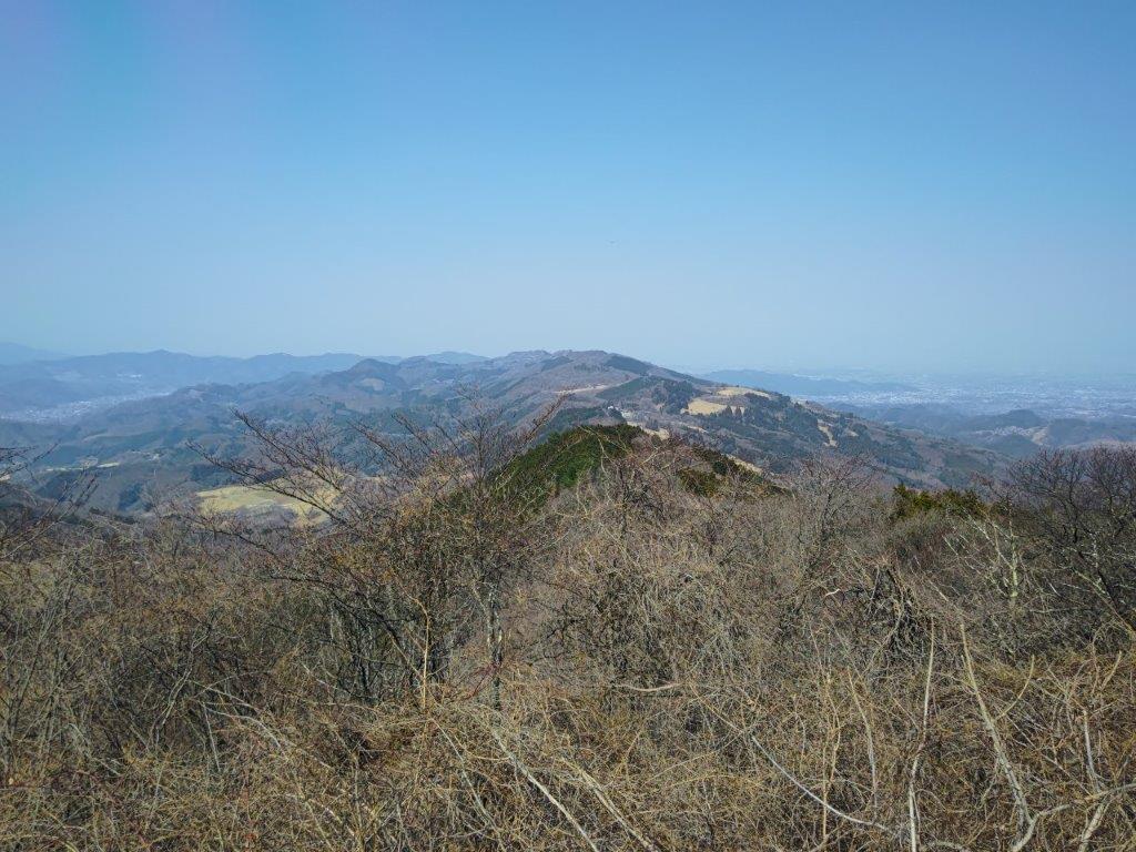
I sat on one of the benches for a half hour lunch break. During that time, using the detailed “View Guide” (展望案内), I tried to identify many of the mountains that could be seen on a day with perfect visibility. At 1h30, I set off again, and reached the Old Sadamine Pass (旧定峰峠) less than an hour later. This up and down section was also mostly in the trees, except for a view of Mt Kasa and Mt Dodaira beyond a field on the left side. The ground was dry and free of mud despite the heavy snow just a few days ago, allowing me to walk at a good pace. I was also glad to be in the shade of the trees, shielding me from the sun on an unseasonably warm spring day.
Leftover Snow on a Warm Spring Day

Approaching the Sadamine Pass
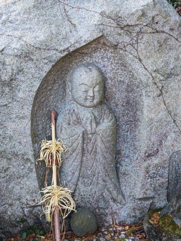
At the Old Sadamine Pass, a crossway surrounded by tall cedars, I turned right, heading down the valley towards Sadamine, leaving the Fureai no Michi and 7 Peaks Traverse which both continued straight along the ridgeline. A signboard recounted the Legend of Daidarabotchi, including the origin of Mt Ogiri:
Long ago, there was a giant named Daidabo who lived in the Musashi Plain. One day, on his way to Mt. Haguro, he straddled the Chichibu Mountains, sitting on Sadamine Pass, and putting his straw hat on top of Mt Kasa. He stretched out his legs toward the nearby Yokogawa Rive and, placing his bowl of cooked rice gruel on Kayunita Pass, enjoyed his lunch. After he finished eating, he placed his chopsticks (made from two logs) into the ground and stood up, accidentally leaving a large rock behind that had been supporting his lower back. He then took a sip of water from the Arakawa River and blew it out—this is said to have formed Mt. Ōgiri. To this day, the footprints left behind by the giant remain in the form of wetlands and marshes in the upper reaches of the Yokogawa River and in the mountains around Shiraiwa.

End of the Hike in Sadamine on the Chichibu Side

View Towards Maruyama from Sadamine
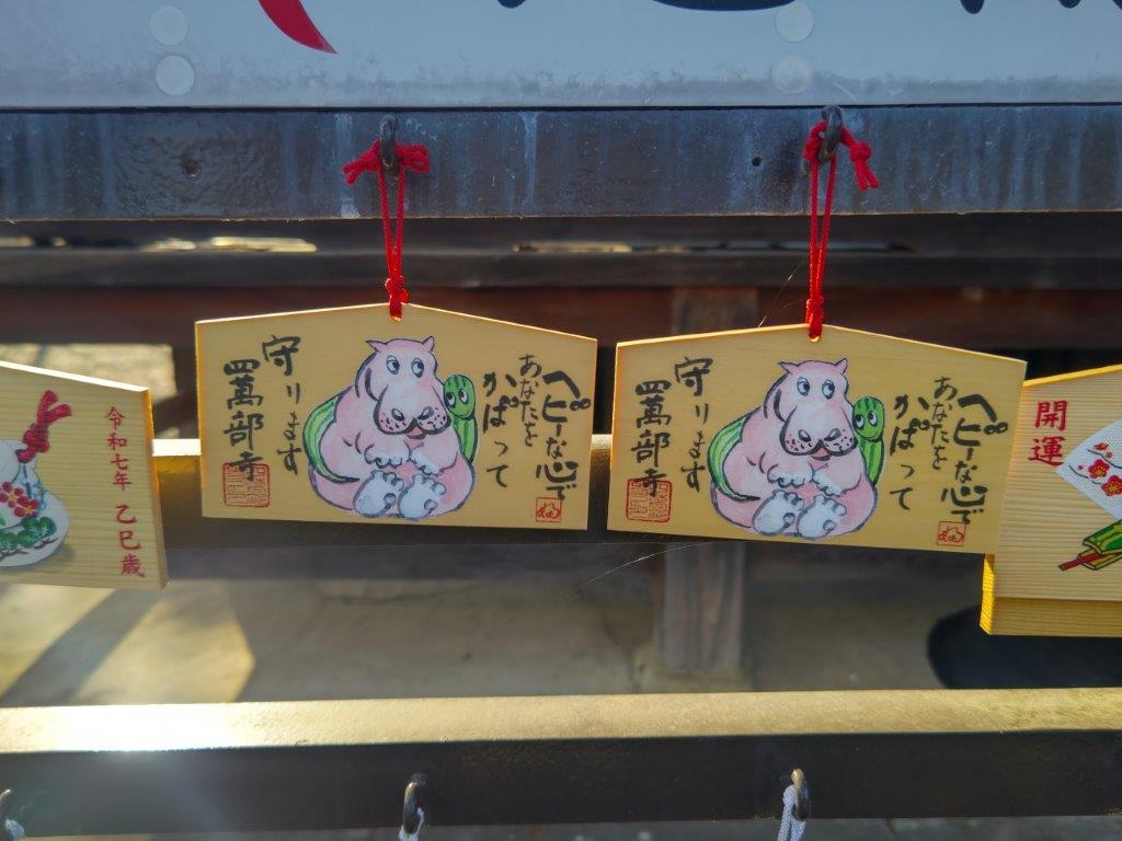
The last part of the hike was a straightforward descent through forest. At 3pm, I popped back onto a road near Sadamine. It was another 30 minute walk back to the road and a bus stop. Since I was ahead of schedule, rather than waiting under the afternoon sun, I decided to visit the nearby Shimabuji Temple (四萬部寺), #1 on the Kannon Temple Circuit. By 4h30, I was on the bus for Seibu-Chichibu station. Surprisingly the food court and souvenir shops were not crowded, possibly because March is still out of season for the area. Shortly after 6pm, I was comfortably seated on the Laview Limited express for the 90 minute ride back to Ikebukuro.
Watch a Video of the Mt Ogiri Hike
Watch the Video of the Hike on YouTube


See a Slideshow of More Pictures of the Hike
