

I wanted to do another hike in the Tanzawa mountains, winter being the best time to explore the area. Looking through my guidebook, I found a couple of nearby mountains I had yet to climb, along a river valley north of Matsuda station. The summit of the first peak was out of the trees; the second was in the forest, but with a viewpoint below it on the east side. Combining the two, I expected the hike to take about 4 hours, meaning I could leave mid-morning and take advantage of the “Mt Fuji Romancecar”, the only limited express train to stop in Matsuda.
For subscribers, read this Post on Hiking Around Tokyo for a better viewing experience and the latest updates
Hiking in the Tanzawa-Oyama Quasi-National Park
丹沢大山国定公園
To get to the start of the hike, I’d ride the Odakyu “Fuji-san” limited express from Shinjuku to Matsuda station, and from there, ride a Fujikyu bus to the last stop on the line. For the return, I’d catch the same bus several stops before the end of the line, and then ride the “Fuji-san” back to Tokyo. Apparently Mt Fuji can be seen from both summits, and since the weather was supposed to be sunny all day, I was looking forward to getting a second chance at my first Fuji sighting of 2025.
Find Japan Hiking Maps on Japanwilds

Paved road between Yadoriki and the Wildlife Gate
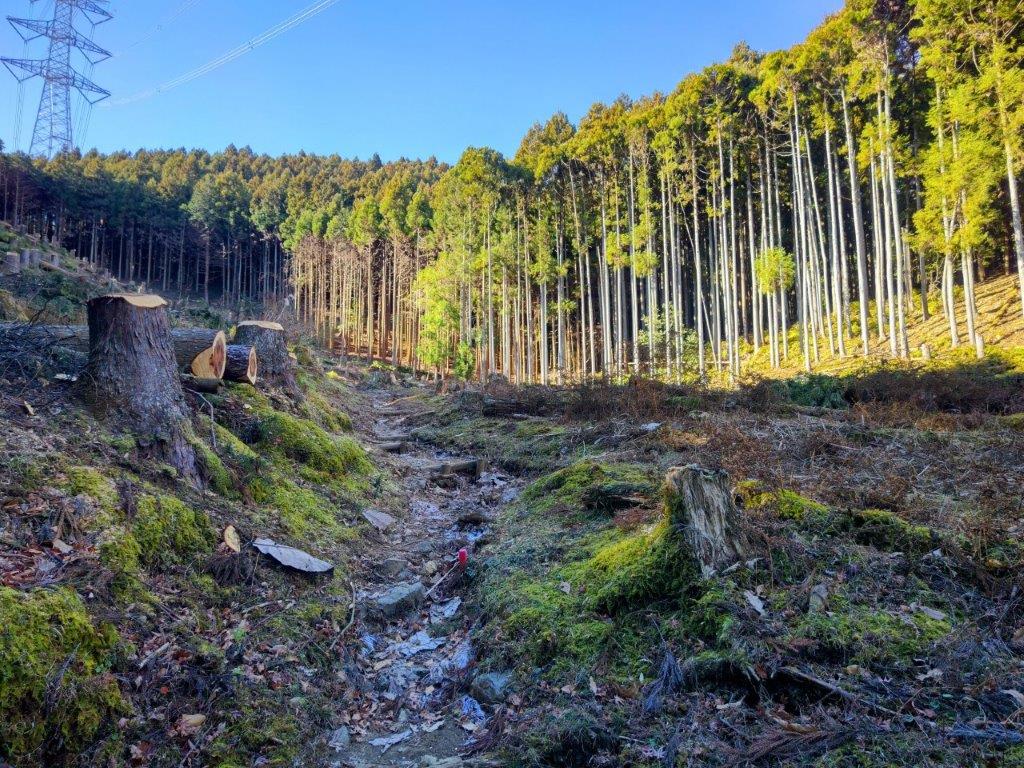
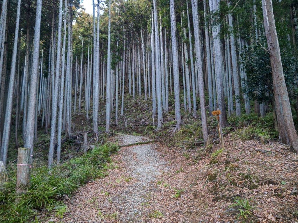
Powerline Clearing on the Way to Mt Shidango
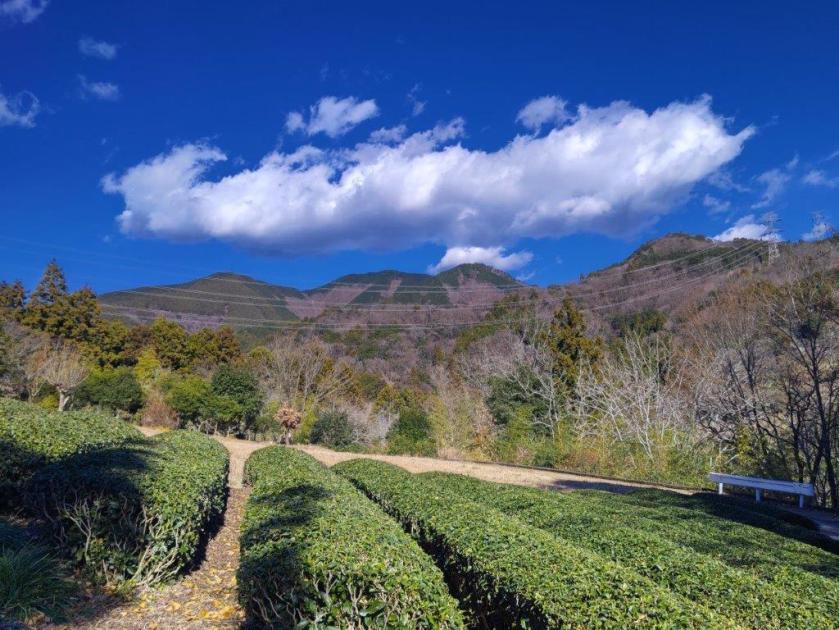
It was a relaxing ride under light blue skies to Matsuda station. After getting off the train just before noon, I made my way to a bus stop in front of the nearby Shin-Matsuda station. I was surprised to find myself at the back of a line of teenagers, on their way to play a football match in the same place I was headed. Half an hour later, we all got off the bus in Yadoriki (寄). Leaving them to their ball game, I crossed a bridge over the Nakatsu River and followed signs for today’s mountain, past tea fields and up a steep road ending at a wildlife gate at the edge of the forest; beyond it was the start of the hiking trail.
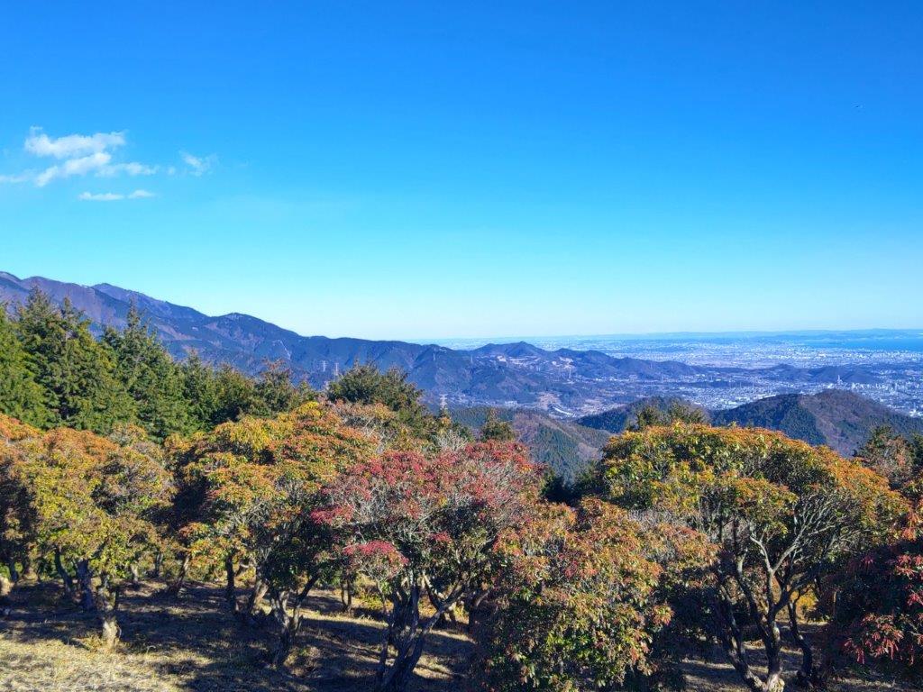
View of Mt Kobo from Mt Shidango
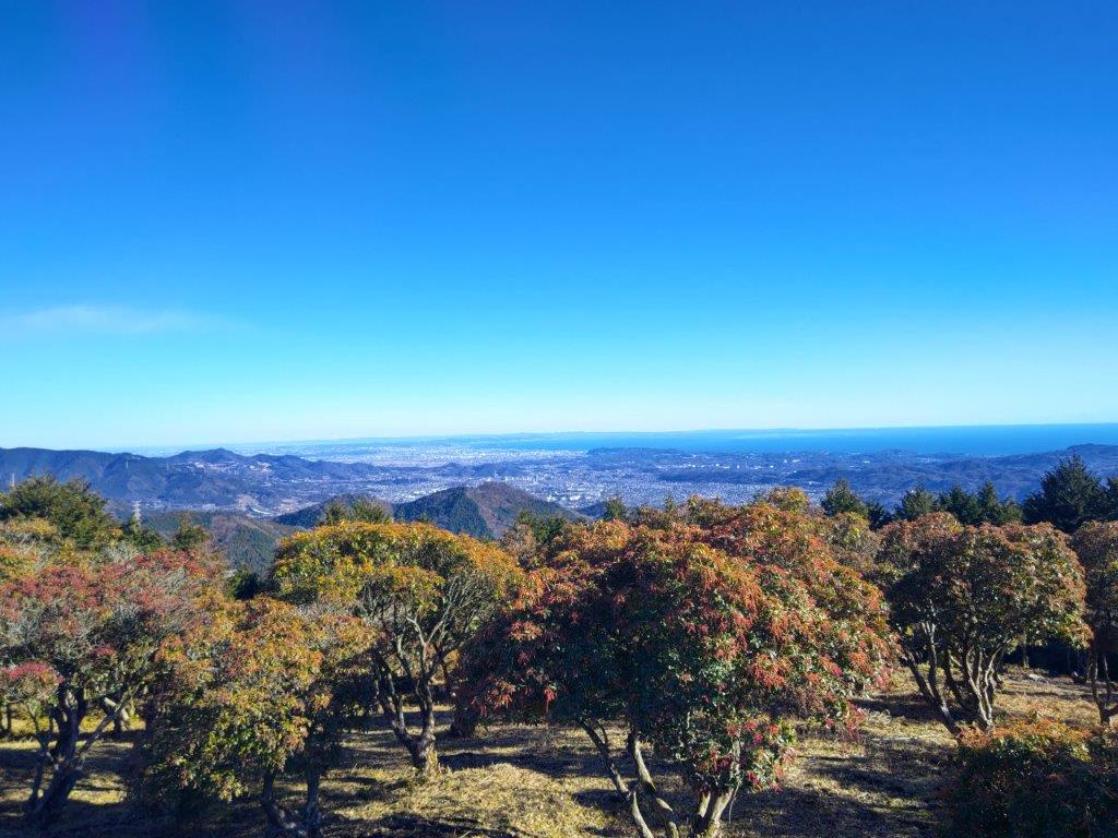
View of Shonan Bay from Mt Shidango
I was glad to be walking through the forest, the cool shade contrasting sharply with the warm sun from moments before; walking up a series of log steps, I soon warmed up again. I soon reached a clearing allowing for the passage of a power line. Beyond it, I resumed my walk under the dark cedars. One hour after setting off, the path suddenly went straight up the mountain side, gnarly tree roots forming natural steps, and just before 2pm, I broke through the trees to reach a small shrine, also the top of Mt Shidango (シダンゴ山 しだんごやま shidango-yama), named after a hermit (“sennin“) called Shidagon who lived on this mountain top about 1300 years ago.

View of Mt Shidango on the Way to Mt Take
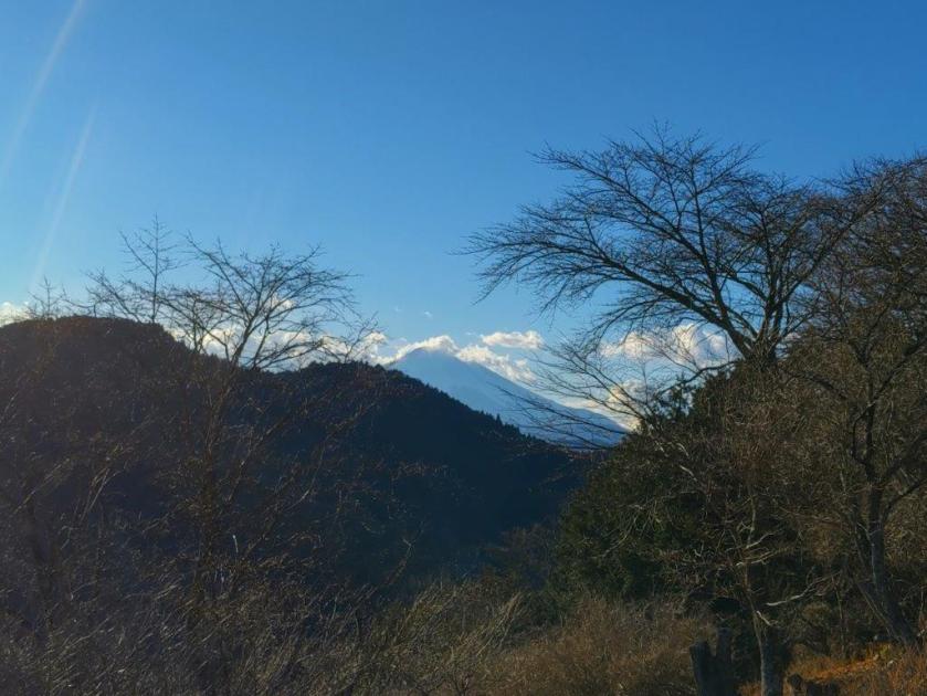
Fuji Viewing Platform below Mt Take
I was surprised to be the only person on the summit, since other nearby peaks usually have a lot of traffic. On the east side was the long ridgeline starting from Mt Oyama and ending at Mt Kobo, where I’d been one week ago. Directly ahead to the south was Sagami Bay. In between, I could make out the Miura Peninsula, and beyond it in the far distance, the Boso peninsula. On the west side, sandwiched between the next mountain and puffy clouds, I could see the white snows of Mt Fuji. The flat summit had a seating platform so I settled down for a late lunch with a view. At 2h30, I set off down some log steps, again under the cedars, heading westwards, and soon reached a paved road closed to traffic and hugging the mountain side. Here, ignoring a metal staircase heading straight up the opposite slope, I turned left along the road.

Mt Tono & Mt Oyama from near Mt Take

Walking through a Thicket of “Aburachan”
It was nice to walk on a level road for a short while, with views occasionally popping up on the east side through gaps in the vegetation. At 3pm, I reached the start of the trail for today’s second mountain. From this point, all signposts were in double, old wooden ones and newer metallic ones, provided by a local association. I appreciated how they felt the need to have sturdier and more functional signs while at the same time keeping the more fragile original ones. From this point, I also saw many warnings about leeches, as well as small salt containers (attached to most signposts) for their disposal (actively encouraged). I followed a path southwards and soon reached an electric pylon at the base of a steep slope.

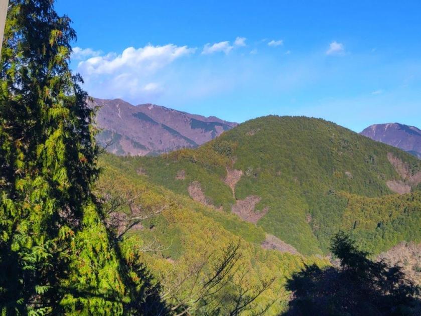
The Tanzawa Mountains from the Mt Take Observation Platform

Mt Shidango (front), Mt Hiru (left), Mt Nabewari (middle), Mt Tono (right)
I took a few minutes to enjoy the unexpected view provided by the passage of the powerline. On the east side was Mt Fuji again, perfectly aligned with the next pylon; on the west side was the rounded green top of Mt Shidango. Behind, I could see Mt Tono to its left, and Sannoto to its right; in the far distance, I could just make out the pointy summit of Mt Oyama. After a little more climbing, I reached the top of Mt Take (タケ山 たけやま take-yama), another peak without Chinese characters. It was completely in the forest, one ray of sunlight fortuitously lighting up the summit marker (the wooden one). I soon moved on and reached blue skies at the edge of the forest.

Mt Tono (left) & Sannoto (right)

Sannoto (left), Mt Oyama & Mt Kobo (right)
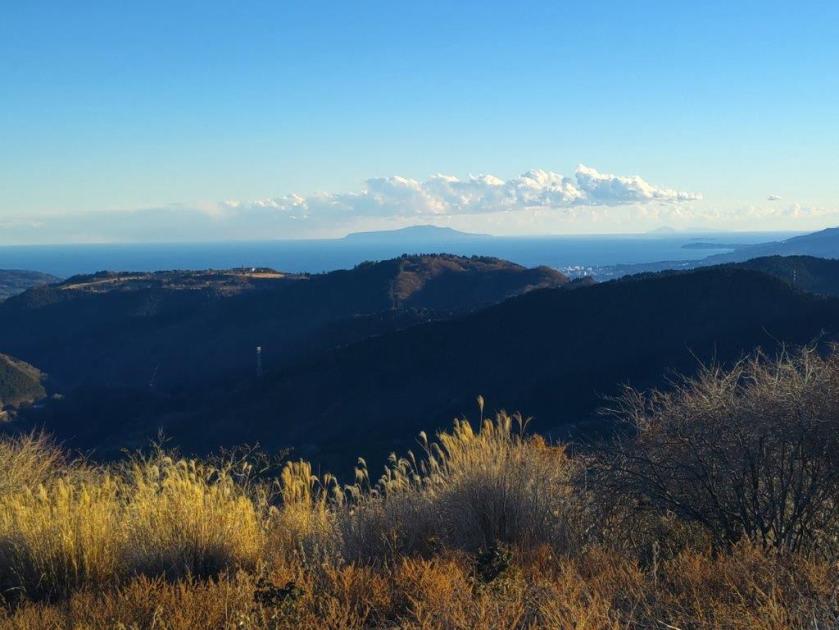
Looking up, I could see the full moon, already high in the sky. Walking a little further, I reached a wide viewpoint on the east side: the Mt Take Fuji Viewing Platform (タケ山富士見台). Looking excitedly to my right, the east side, I could see Mt Fuji now mostly free of clouds but against the sun at this time of the day. To its left, I could see the Hakone mountains, reaching all the way to Sagami Bay. On the west side, I had an excellent view of Sannoto and Mt Odake. To the south, under huge puffy clouds, was Oshima island; beyond, in the far distance, I could make out Toshima and Nijima islands. I took a short break on a bench to enjoy the view, as well as the late afternoon sun, before continuing on my way.

Hadano & Isehara Cities

Descending through “Aburachan” Shrubs
I was now walking inside a thicket of bare shrubs, affectionately called “Aburachan” in Japanese (February spicebush in English). The trail was vanishingly faint under a carpet of dead leaves but fortunately I soon popped into another clearing with another wide view on the east side: the Mt Take Observation Platform (タケ山展望台), where I had the best view of the day. On the west side, I had a spectacular vista of the Tanzawa mountains, from Mt Hiru, its highest point, all the way to Mt Oyama, with the full moon hanging above; Mt Nabewari was also visible, directly behind Mt Shidango. Further south, Hadano and Isehara cities spread out on each side of Mt Kobo. As before, the Shonan Bay, Oshima island and the Hakone mountains could be seen on the south side, only Mt Fuji now missing from the panorama.

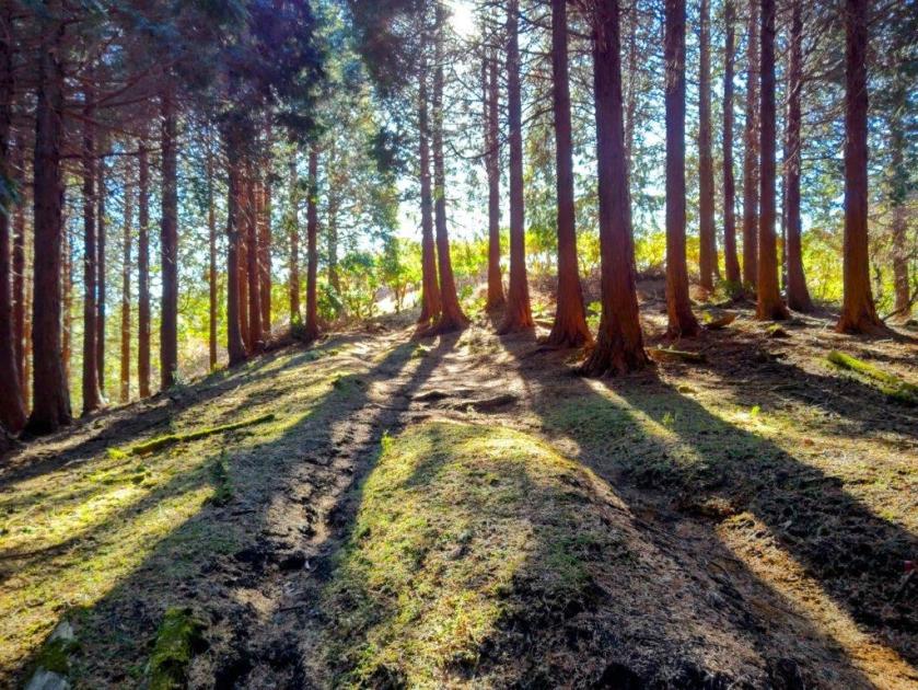
Descending under the Cedars
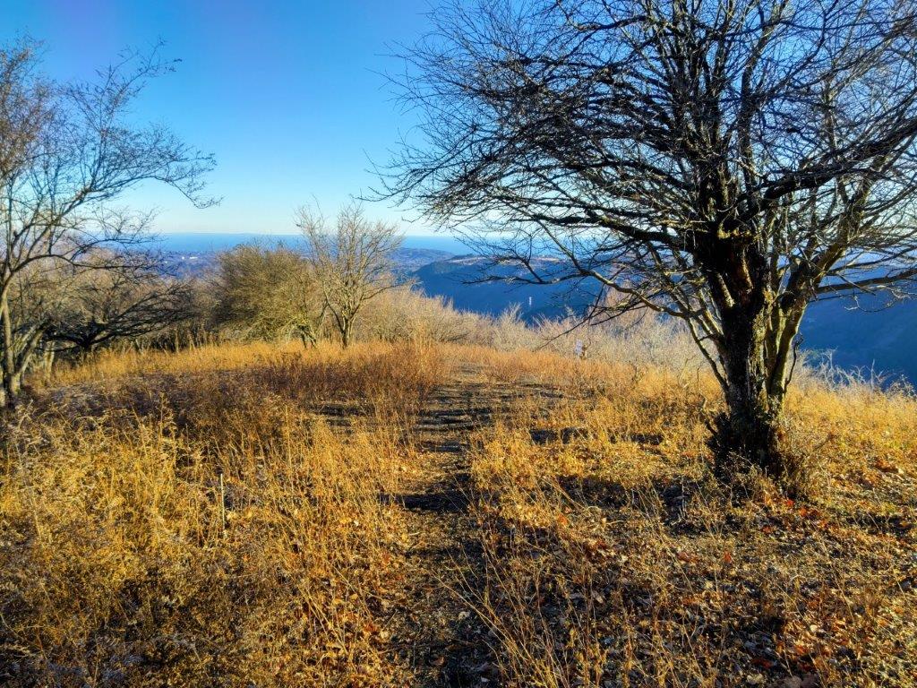
End of the Mt Take Trail
I was once again the only person to enjoy this glorious view, partly because it’s on a local trail but also partly due to the late time of the day. It was nearly 4pm so I set off at a quick pace down a switchback trail, first through another “Aburachan” thicket, coloured orange in the late afternoon light, then through a dark forest of tall cedars. Half an hour later, I reached a small park at the end of the trail, here and there “suisen” (daffodils) in full bloom. From this point, I followed a road along a terraced river. At the confluence with the Nakatsu river, I turned left, and after crossing a bridge, with one last view of a pink-tinged ridgeline on the north side, reached a wooden bus shelter. When the bus arrived, I was reunited with the soccer team from before; luckily I was able to sit, and a little after 5pm, was back at Matsuda station. There, I boarded the Romancecar limited express for the 80-minute ride back to Shinjuku.
Watch a Video of the Mt Shidango Hike
Watch the Video of the Hike on YouTube


See a Slideshow of More Pictures of the Hike
