

Like for the last outing of 2024, I needed a straightforward hike close to Tokyo to ensure a smooth start to the new year. I decided to head to the Tanzawa foothills, notorious for its leeches in the warmer months, but pest-free at this time of the year. I had already walked from the top of the Oyama cable car to Mt Takatori, as well as from Mt Kobo to Tsurumaki Onsen. This time, I’d explore the southern ridgeline between Mt Takatori and Mt Kobo. I knew I could get a good view of Mt Fuji past Mt Kobo, and also finish the hike at Manyu no Yu, two reasons for making this the first hike of 2025.
For subscribers, read this Post on Hiking Around Tokyo for a better viewing experience and the latest updates
Hiking in the Tanzawa Mountains 丹沢山地
To get to the start of the hike, I’d ride the local Odakyu line to Isehara station, and then board a local bus for a stop near a city park, a short distance from the trail Entrance. For the return, I could walk from the hot spring to Hadano station, and there, board the Odakyu Limited Express for Shinjuku. The weather was supposed to be sunny in the morning, turning cloudy in the afternoon, putting a question mark on my new year rendezvous with Mt Fuji. Still, I was looking forward to exploring new trails in a familiar area.
Find Japan Hiking Maps on Japanwilds


Steps for Mt To (left) Road for Mt Hijiri (right)


Leaving Mt Hijiri (left) Steps up Mt Takatori (right)
It felt quite cold as I stepped off the bus in the midst of a residential neighbourhood of Isehara city, a little before 10am. Thankfully, the sun was high enough to warm me up while I made my way to Tonoyama Park (塔の山公園), a wooded area surrounding a small mountain. After a short climb up a wide path, I reached some benches from where I already had a view of the flat coastal area reaching to Shonan Bay. After a late breakfast I set off at 1030, and soon after, reached the top of Mt To (塔ノ山 とうのやま tonoyama 202m, meaning “Mt Tower”), from where I had a view of summit of Mt Ooyama on the north side.

Trail past Mt Nenbutsu (left) Trail for Zenba Pass (right)

Steps past Mt Gongen (left) Steps past Mt Sengen (right)
I continued along the ridgeline, heading down through leafless trees, and soon arrived at a road on the north side of the mountain. I turned right, heading south, past the main park entrance, then turned left, following a sign for Hokokuji Temple, and shortly after, came upon a signpost for today’s next mountain. After a few more turns along back roads, I reached the Mt Hijiri trail entrance (聖峰登山口), another paved road but this one closed to vehicles. After passing through a wildlife gate, I continued straight, ignoring the shortcut on the left side, and a little before noon, reached the top of Mt Hijiri (聖峰 ひじりみね hijiri-mine meaning “sacred peak”), also the site of a small Buddhist temple.
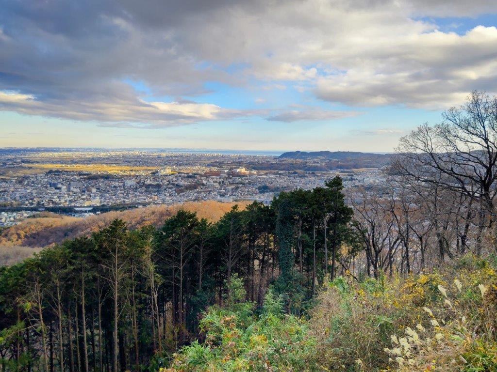
View East from Hijiri-mine of the Miura and Boso Peninsulas

View South from Hijiri-mine of Shonan Bay and Shonan-daira
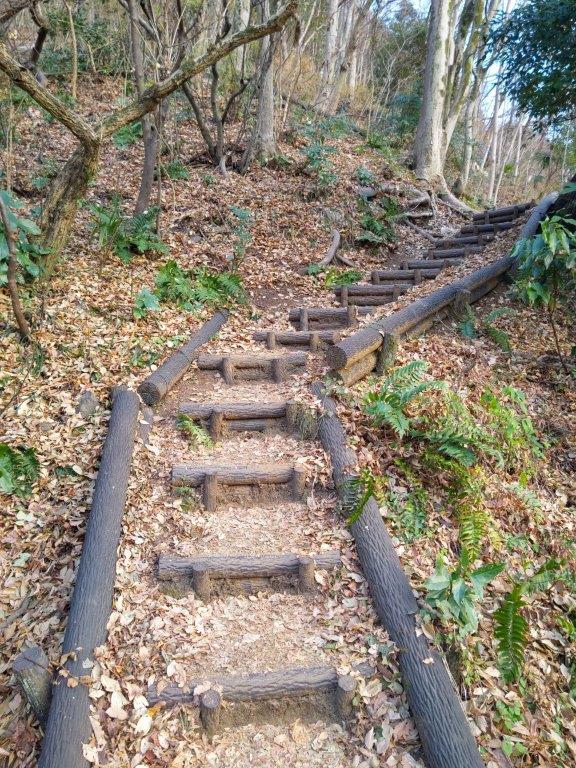
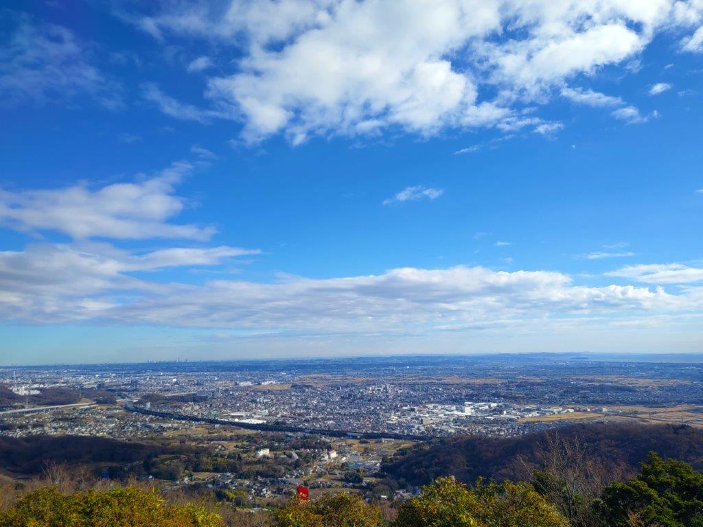
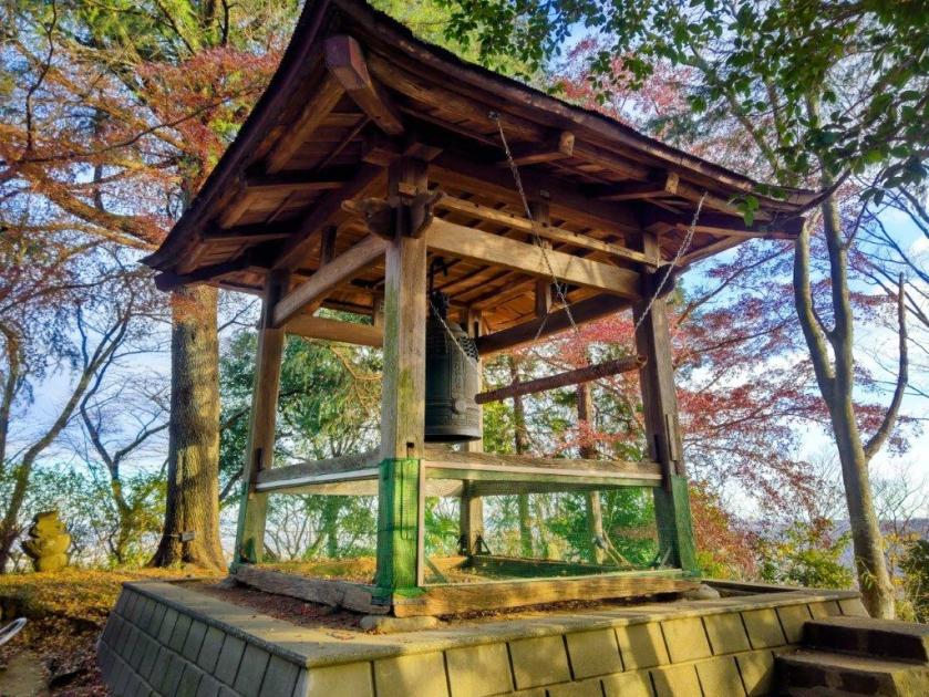
I was delighted to have such a wide view on my first hike of the year. Looking north, I could see the skyscrapers of Yokohama and central Tokyo; eastwards, I could make out the low rounded mountains of the Miura and Boso peninsulas; to the south was the level-topped Shonan-daira with Shonan Bay in the background. While I was admiring the view, a pickup truck pulled up, and a man went to open the temple building, called Hijiri-mine Fudoson (聖峰不動尊), giving myself, and two other people who happened to be there, a chance to peer at the Buddhist altar inside; we even got to touch a small snake statue (2025 is the year of the snake); finally, we each received a paper stamped with its “goshuin“, a red seal proving one’s visit to the place. After carefully placing it inside my pack, I set off again, along a level trail through tall cedars, and soon reached a series of log steps where the ridgeline rose steeply.
Steps Leading to Mt Takatori

View South from below Mt Takatori
I broke a sweat for the first time of the day, only pausing briefly to take in a view that had appeared through a gap in the trees. Looking south, I could see the ridge I’d be following on the next part of the hike; curving northwards was the ridge I’d just ascended, green cedars crowning the top of Mt Hijiri. I reached a junction where the two ridges merged; I turned right, and after a little more climbing, reached the top of Mt Takatori (高取山 たかとりやま takatori-yama), also the site of an NTT relay tower. It was surrounded by trees except on the north side, where Mt Oyama’s pyramidal summit fit snuggly between two tree trunks. I retraced my steps to the junction and continued along the south ridge.

View towards Mt Hijiri and its “green crown”

Framed View of Mt Oyama from Mt Takatori
I was surprised by how steep and rocky the trail suddenly became, forcing me to slow my pace. I was relieved when the trail soon became more or less level again, and one hour after leaving Mt Takatori, I arrived at Mt Nenbutsu (念仏山 357m) where there was bench and a view on the south side. The name is a Buddhist term meaning visualizing a Buddha. By now, the clouds had covered the southern half of the sky forcing me to imagine most of the view as well. Since it was nearly 2pm, I had a late lunch break before continuing my way.

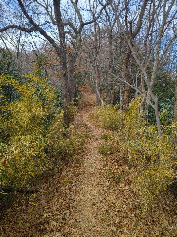
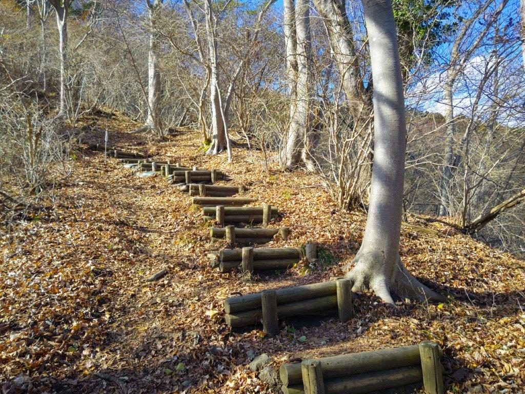
Trail between Mt Nenbutsu and Mt Kobo

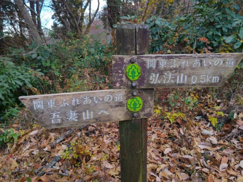
View of the Tanzawa Mountains from the Fureai no Michi Junction
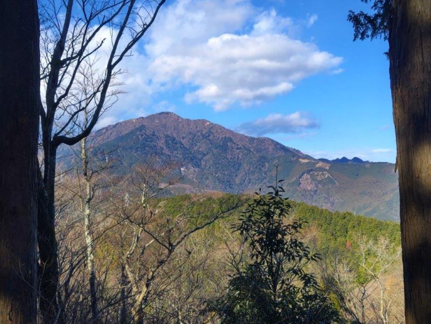
This was probably the nicest part of the hike, an easy to follow and slightly descending trail through an evergreen forest. At 2h30, I reached Zenba Pass (善場峠), and a little further, I emerged onto a road with a view of the Tanzawa mountains to the north, seemingly still free of snow. I crossed the road and headed up a trail on the other side, now inside Koboyama Park (弘法山公園) and also on the Kanto Fureai no Michi. After a short climb, I reached the top of Mt Kobo (弘法山 こうぼうやま koubou-yama), named after Kobo-daishi who is said to have trained in this place (he is also connected to Mt Mitsumine). Since my last visit in April 2016, a viewing platform had been erected on the east side. Like from Mt Hijiri, I had a view of the Shonan coastline, the Miura Peninsula and Shona-daira, but it looked quite different under a cloudy afternoon sky.

Final Steps before the Top of Mt Kobo

Viewing Platform on the East Side of Mt Kobo
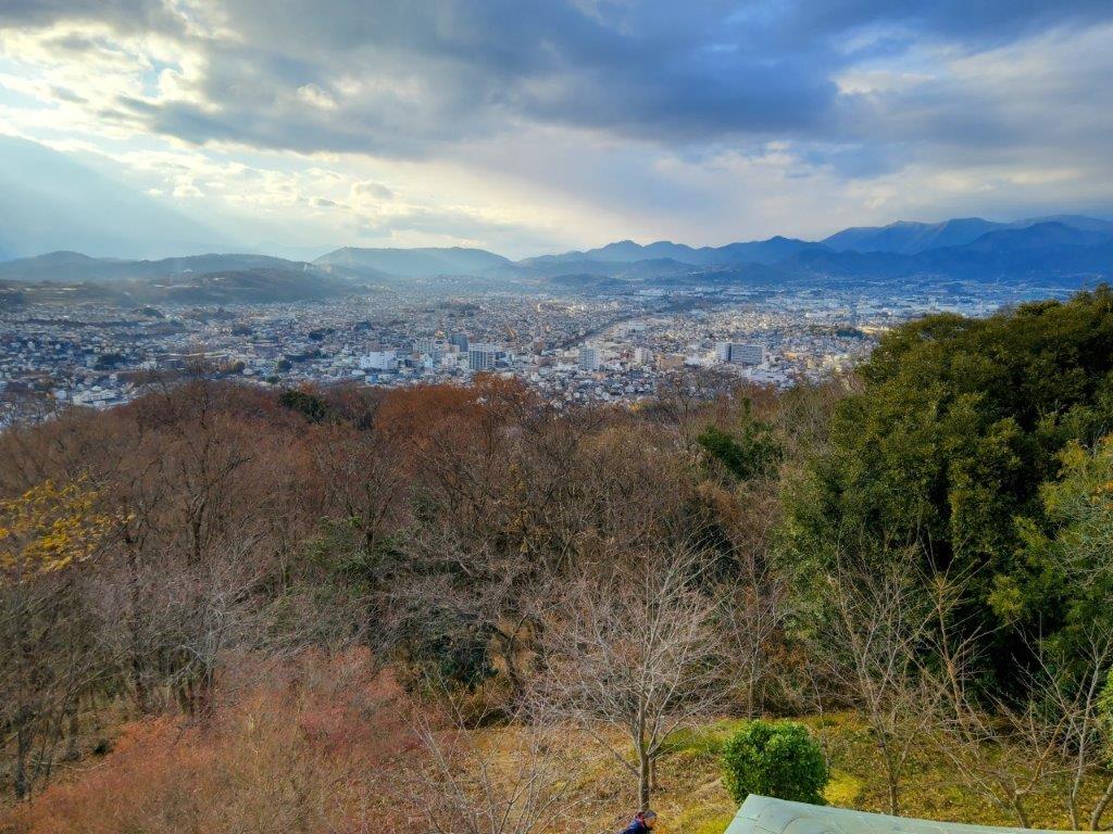
I admired the constantly changing patchwork of light and dark patches in the landscape below. On the south side, the bell tower sitting directly in the sun’s path lit golden. I now followed Babamichi road (馬場道) meaning “riding ground”, indeed wide enough for riding a horse, to the next summit, Mt Gongen (権現山 ごんげんやま 243m), a flat, grassy area with an observation tower on the east side. From its top, I hoped to finally have a glimpse of Mt Fuji, but those hopes were dashed by the thick, dark clouds massed on the south side. A ray of sunlight managed to squeeze through, illuminating the urban sprawl of Hadano City, providing the proverbial silver lining. On the east side, I could look down on the Soga Hills, a range of low hills stretching from Matsuda town to Kozu station on the Shonan Coast.

Patches of Light and Dark from Mt Kobo
Shonan Coast and Shonan-daira from Mt Kobo
I was surprised to see a few snowflakes fall gently and thought perhaps a snowstorm was on its way; fortunately, there was no follow-up, bits of blue sky still appearing overhead. At 3h30, I headed down steep steps on the south side, leaving the Fureai no Michi as it headed east to connect with my last year’s hike to Mt Takatori. After crossing a road, I passed by Mt Sengen (浅間山 せんげんやま 196m). It was more of a shoulder that a summit but what it lacked in prominence was made up by the prominence of its beautiful wood-carved summit marker. On my last visit, the scenery was white from the cherry blossom trees covering the “shoulder”; today it was bathed in yellow from the late afternoon sun.

View of the Soga Hills from Mt Gongen
View from Mt Gongen of Mt Hadano under a Ray of Sun
The final descent of the day was surprisingly pleasant: a switchback trail delightfully easy on tired knees, late afternoon sun shining through evergreen trees, and no one but me on the mountain. Just before 4pm, I reached the trail entrance and a busy road where I turned left. On Kobo bridge across the Kaname River, I had one last look at Mt Kobo, firmly under blue skies now, before heading to the nearby Man-no-yu Hot Spring. I reflected on how most of today’s mountains names are common mountain names in Japan and how unusual it was to find all along one ridgeline. After a satisfying hot spring soak, I walked the final 15 minutes to Hadano station, where I caught the Romance Car limited express for the one hour trip back to Shinjuku.
Watch a Video of the Mt Hijiri to Mt Kobo Hike
Watch the Video of the Hike on YouTube


See a Slideshow of More Pictures of the Hike
