

I had hiked Mt Happu about a year ago but wanted to return to explore some more trails on this up and down ridge, also known as the Minano Alps. Its relatively easy access and low elevation made it the perfect place for an outing during the cold, short days at the end of December. Finally, I was eager to try out our Japanwilds Happu-san Hiking Map, published in March 2024, by making sure to download the free map in Avenza before heading out.
For subscribers, read this Post on Hiking Around Tokyo for a better viewing experience and the latest updates
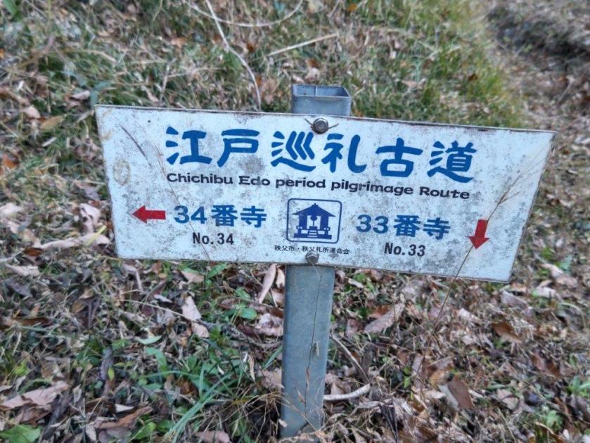
To get to the start of the hike, I’d ride a bus from Minano station and get off on the north side, just past Mangan no Yu. I’d follow the Kanto Fureai no Michi to the summit, then continue to Fudatachi Pass, and from there, follow the Edo Old Pilgrimage Trail down the south side. At the base of the mountain, it was a one-hour walk through the countryside to Seoto no Yu. After a hot bath, I could use their free shuttle bus to get back to Minano station.
Hiking the Minano Alps 皆野アルプス
Hiking in Chichibu 秩父
If time allowed and the weather was clear, I’d do a round-trip to one of the viewpoints along the ridge beyond Fudatachi Pass; I could also do another round-trip to Temple #33 on the Kannon Temple Circuit, about ten minutes on foot from the hot spring at the end of the hike. The weather was supposed to be sunny but cold for the season. I was looking forward to exploring new trails on a well-trodden mountain.
Get a map of the Mt Happu hike
Find Japan Hiking Maps on Japanwilds

Trail before Saru Rock (left) Trail between Mt Happu & Fudatachi Pass (right)
It was a beautiful, sunny day as I rode the Laview Limited Express from Ikebukuro. After transferring to the local Chichibu line in Yokote, I got off at Minano station around 10am. The sun had mischievously vanished behind thick clouds rolling in from the surrounding mountains; I checked the updated forecast for the day, and it seemed the sun would return in the early afternoon. I walked to the nearby bus stop and also noticed that the departure time had been pushed back slightly since last year, meaning I had to wait a little longer out in the cold.

Walking along Nyokin Ridge (left) Walking the Old Pilgrimage Road (right)
I felt a little warmer after getting off the heated bus at Futto Iriguchi (風戸入口). I was the sole passenger and, considering the gloomy weather conditions, I wondered if I might be the only person on the mountain today. At 11am, I started up the Kanto Fureai no Michi, behind an “Onsen Stand“; this is like a petrol station, but instead of petrol, people pay a small fee to fill plastic containers with hot spring water for home use; while I was getting ready a couple cars pulled up, so it seemed a more popular activity than hiking on a cold day. After barely a few minutes, the trail ended at the road bend, which I followed up and through a village. I opened the Avenza app on my smartphone and loaded the Happu-san Hiking map, a blue dot tracking my progress along a green line showing the trail.

Start of the Trail Near Futto
Looking up, I was delighted to see patches of blue in the sky, a hopeful sign for the rest of the day. I passed an ancient “kura“, or storehouse, encircled by vegetation, slender bamboo on one side and evergreen trees on the other, the bright green contrasting with the deep blue sky; gusts of wind rustled through the leaves, contributing to the this enchanting sight, as well as pushing the remaining clouds further away. At 1130, I reached an open shelter with a view of Mt Hodo to the north. Here, the hiking trail resumed, clearly indicated by the familiar wooden Kanto Fureai no Michi (関東ふれあいの道) signposts. At the top of some log steps, I entered the forest.
View North from the Summit of Mt Happu
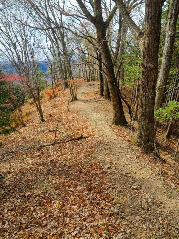
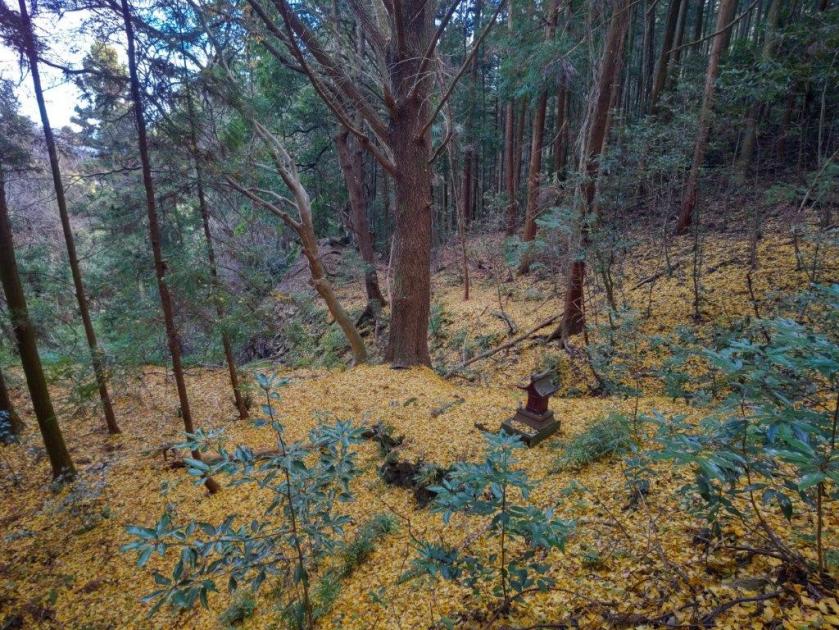
I was surprised to see a carpet of golden leaves covering the path ahead and the nearby forest floor. Looking left, I spotted a tall, leafless ginko with a small shrine at its foot: what a magnificent sight it must have been earlier in the month. Autumn was still hanging on in Tokyo but here in the mountains winter had arrived. After a short climb through the forest, I arrived at the Kasato junction (another reading of “Futto”) and turned right along the main ridgeline of the Minano Alps, now following last year’s hike, but in reverse. At noon, I arrived at Saru-iwa (猿岩 meaning “monkey rock”), a huge yellow-coloured rock protruding dramatically from the narrow ridge.

View of the Chichibu Basin from Nyokin Ridge
I was glad to see it properly this time as I had somehow missed it on my last visit, possibly because it was hidden by the foliage which had now fallen; it was also clearly labeled on the Japanwilds Hiking Map, so I was sure to see it, foliage or not. Apparently, the rock resembles the face of a monkey looking up, but before I had time to turn my own face up to confirm this, a big group suddenly arrived from the other direction, and I quickly departed (the face can be discerned in the slideshow picture at the end of this blog post). Shortly after, I arrived at the top of Mt Happu (破風山 はっぷさん happu-san), my third time to stand on the top.
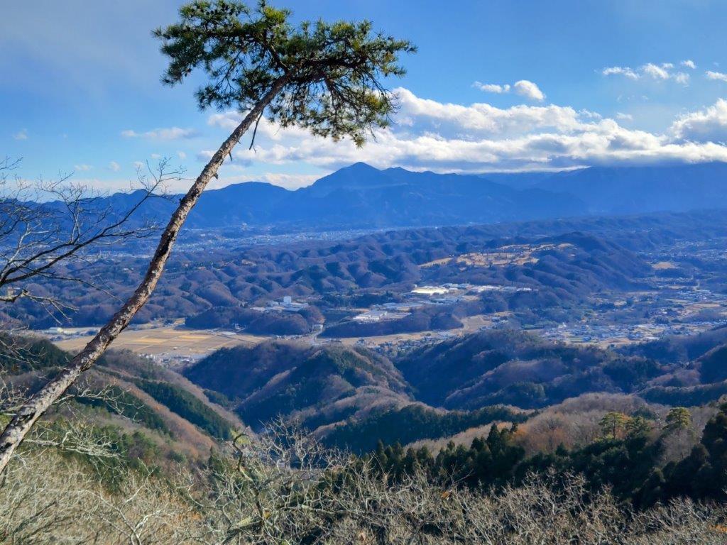
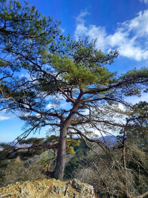
Pine Tree and Mt Buko below the Top of Mt Omae
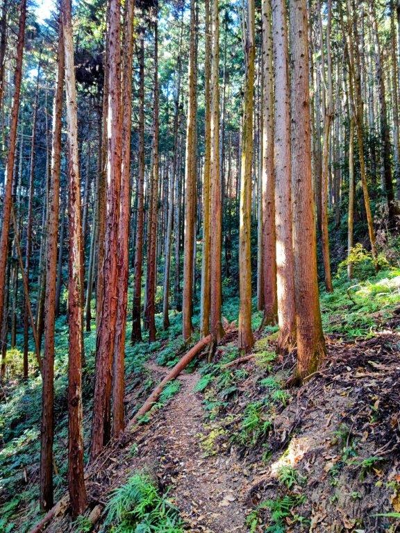
The breathtaking view of the Chichibu basin and the Oku-Chichibu mountains on the south side was dulled by the lingering, low grey clouds, while the more muted view on the north side was nearly clear of clouds. As more people arrived, I set off without a break, down the steeper trail on the east side. At 1230, I reached Fudatachi Pass, earlier than expected, so I pushed ahead along the ridge, feeling optimistic as the weather was slowly but surely improving. After some easy walking through the forest, now off the Kanto Fureai no michi, I reached Nyokin Ridge.

View of the Oku-Chichibu Mountains from the Musashi Observatory
From this point, I found myself scrambling over some rocky sections, chains attached for safety; I also had to navigate a narrow ledge with drops on both sides, lined with a rope to prevent any mishaps. I was surprised how quickly I had to change my walking style from carefree rambling to a cautious advance. I still made good time and soon reached the Musashi Viewpoint, on top of a prominent rock with a couple of twisted pine trees, like two hairs on a bald head. By now, the clouds on the south had mostly retreated, with most of the basin bathed in sunlight.

View North of the Nagatoro Alps from Musashi Observatory
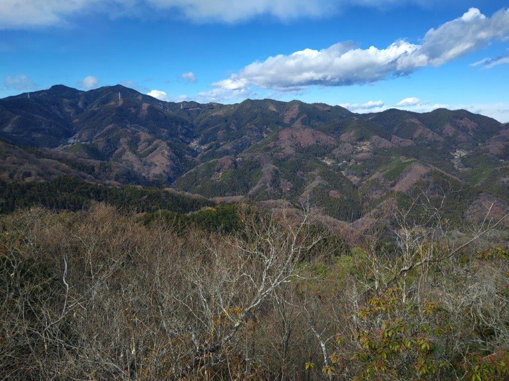
The view had considerably improved in the space of one hour, although the triangular peak of Mt Buko was still the only easily recognizable mountain. Blue skies continued to rule on the north side, and I could see Mt Hodo, with the Nagatoro Alps behind, and even further behind were the Hachioji Hills (no relation to Hachioji city), beyond a narrow neck of the Kanto Plain. I decided to continue a little further, and after a short climb, arrived at Mt Omae (大前山 おおまえやま oomae-yama), also the location of a small statue. It was surrounded by trees but a few meters away, on the south side, was a ledge with a view.
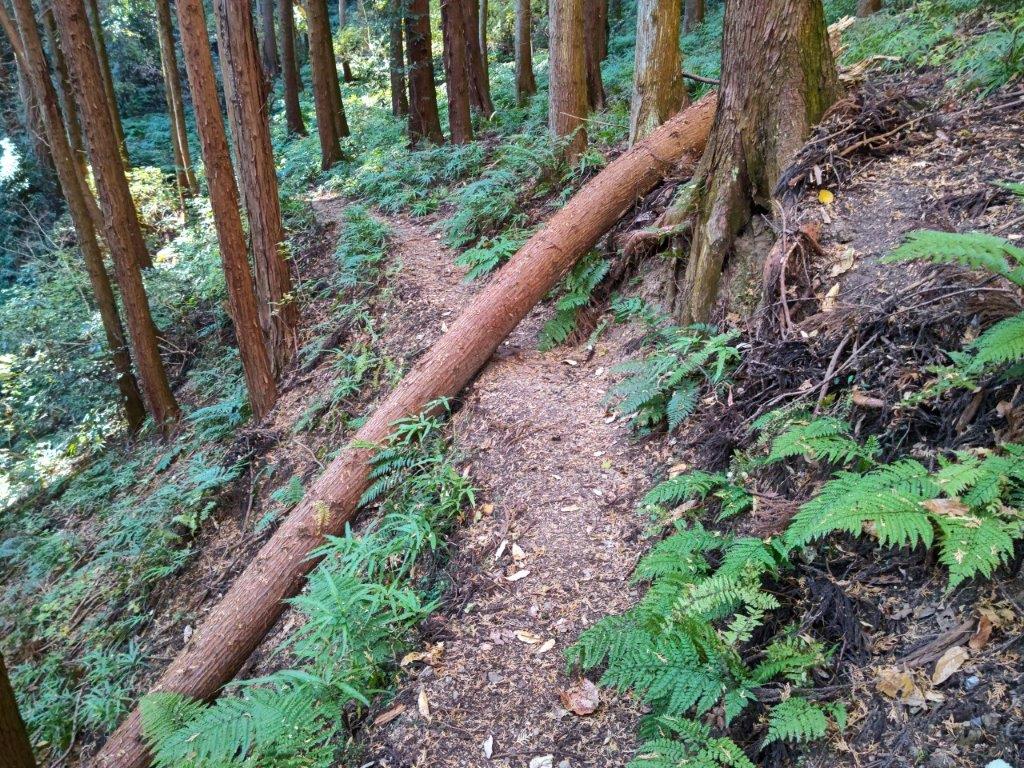
Fallen Tree along the Old Pilgrimage Road
I kept my distance from the edge as the mountain side dropped away steeply, offering a remarkable bird’s eye view of the wrinkled terrain far below. Since it was past 1pm, I found a tree root that could double as a seat and settled down for lunch with a view. Looking to my right, I could see Mt Tengu, the highest peak of the Minano Alps: it looked deceptively close but I knew from previous experience that the next valley would take time and energy, the ridge really starting to deserve its Alps nickname, and the views wouldn’t be worth it.
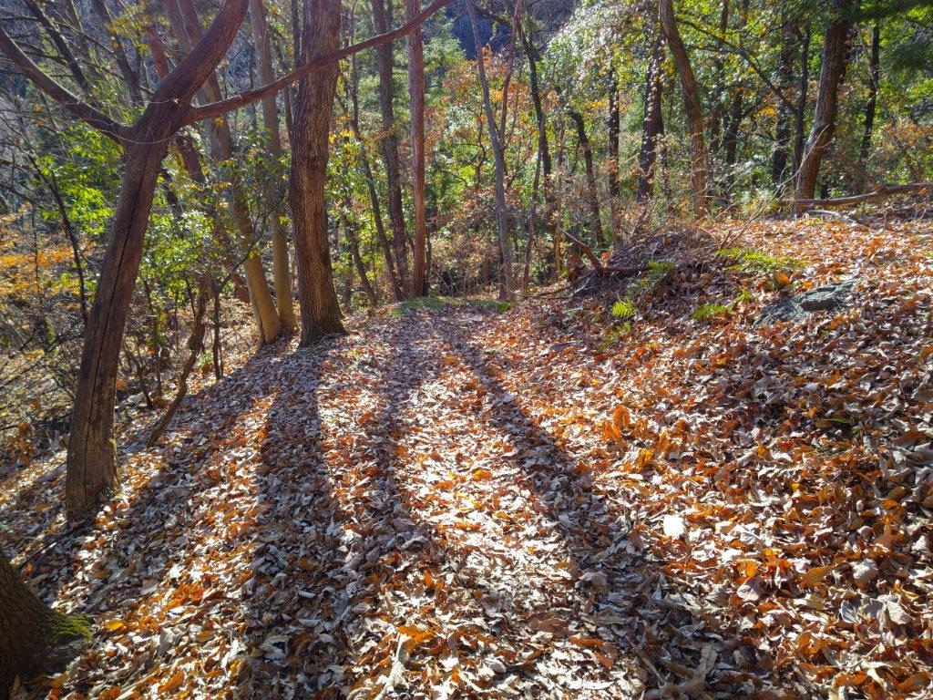
Fallen Leaves and Afternoon Sun on the Old Pilgrimage Road
I made my way back at a swift pace, taking care when traversing Nyoho ridge, arriving back at the crossroads at Fudatachi Pass at 2pm; there, I turned right onto a narrow but well-defined trail. I was now following signs for Fudasho #33 Kikusui-ji Temple (札所33番 菊水時), along the Edo Old Pilgrimage road (江戸巡礼古道), heading eastwards and hugging the mountainside. Judging from my lunch spot perch, I expected a steep gradient but so far I was enjoying a gentle, almost level descent. I was making good time, except for some maneuvering around a couple of fallen trees; on the other hand, the fallen leaves, rather than being a nuisance, shone brightly under the sun, as the sky was back to its morning blueness.
Watch a Video of the Mt Happu Hike
Watch the Video of the Hike on YouTube
The path abruptly ended at a road, which I followed for a short while before rejoining the trail on the right side. At 3pm, I popped onto another road, leading me to a temple and a main road at the base of the mountain. Following the signs for Temple #33, as well as Google Maps since I was now off the Japanwilds Hiking Map, I turned right and followed back lanes past the “Michi no Eki” Ryusei Kaikan, till I found myself beside the Akahira river. The sun had already sunk below the rim of the Chichibu Basin, and so I had to save my visit to Temple #33 for another time. I reached Seoto no Yu just before 4pm, my 2nd time to this charming hot spring. At 5pm, I was the only person to board the free shuttle, the last of the day, and less than a hour later, I was at Seibu-Chichibu station, sampling some local sake from their convenient self-serving sake machine (“sake server”) while waiting to board the Laview Limited Express for the comfortable ride back to Ikebukuro.


See a Slideshow of More Pictures of the Hike
