

I wanted to do a hike in Shizuoka, last visited one year ago, to take advantage of the warmer ocean climate and the Mt Fuji winter views. While researching my December 2022 trip to Shimoda, I’d noticed a ropeway on Suruga Bay, opposite the Izu peninsula. Further investigation showed that the top station was located on Nihondaira, a low plateau with several short hiking trails, including a section of the Tokai Nature Trail, the Shizuoka Bypass Route. Looking at my map, I saw I could do a station to station hike long enough to justify the cost of the trip. From the station, I would walk up to the observation deck at the highest point, and after a short roundtrip to a nearby minor peak, return via a different route; although, to my regret, I’d have to skip the ropeway. I would ride the shinkansen to Shizuoka station; a couple of short transfers would get me to Kitsunegasaki station, near the start of the hike. Before heading back to Shizuoka station from the Kusanagi JR station, I could drop by the nearby Kusanagi no Yu for a hot spring bath. The weather was supposed to be sunny and cold, as well as a little windy. I was looking forward to exploring a new hiking spot and getting some good views of Mt Fuji from a new direction.
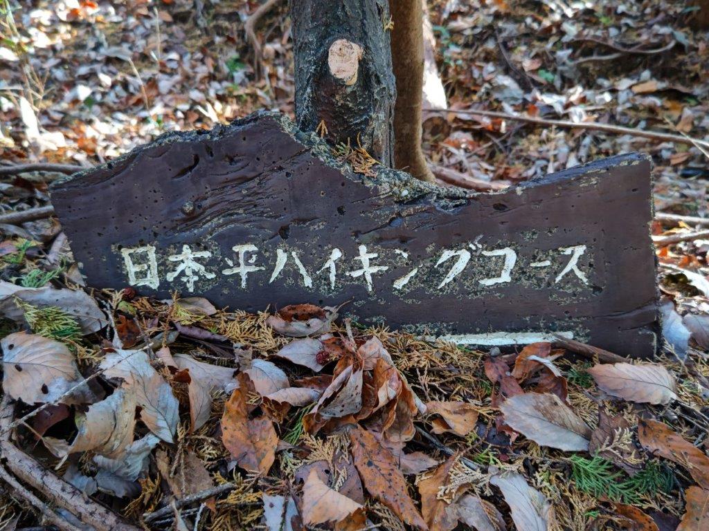
Hiking the Tokai Nature Trail 東海自然歩道
Read this Blog Post on Hiking Around Tokyo
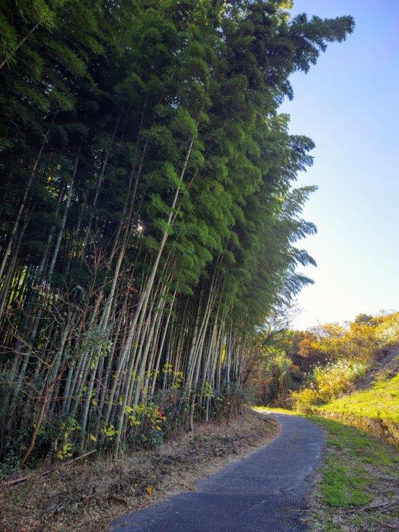
Country lane (left) leading to the Tokai Nature Trail (right)

Walking down from Mt Udo (left) and from Nihondaira (right)
It was a blue-sky day and Mt Fuji was clearly visible as I rode the shinkansen from Tokyo station. After getting off at Kitsune-ga-saki station, it still felt quite cold, so I retreated to a nearby 7/11 to buy some food and water for the day. At 1030, I finally set off along a narrow road, next to a small river, passing several unmanned vegetable stands, a common sight in rural Japan. After walking through some tea fields, I arrived at the entrance of Shimizu Funakoshi Zutsumi Park (清水船越堤公園) just after 11am. After checking out the view of Mt Fuji from inside the park, I continued along the road, and finally reached the Mabase Route (馬走コース on the Tokai Nature Trail just before noon.


Hiking along the Nihondaira Alps
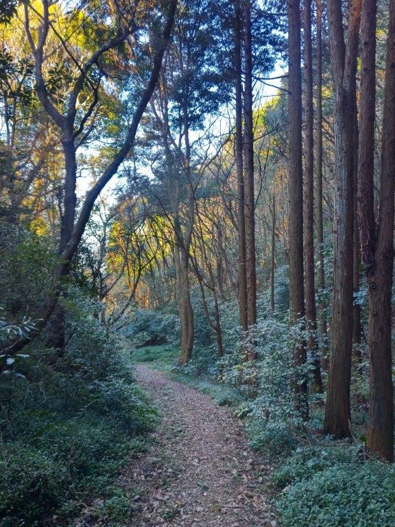
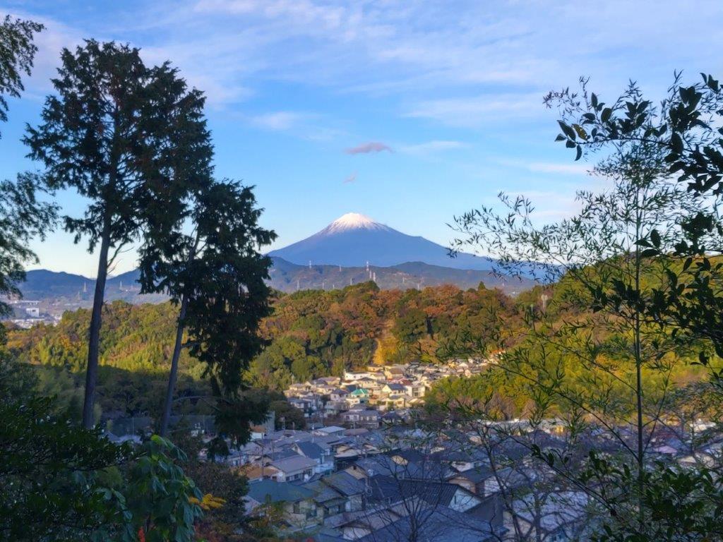
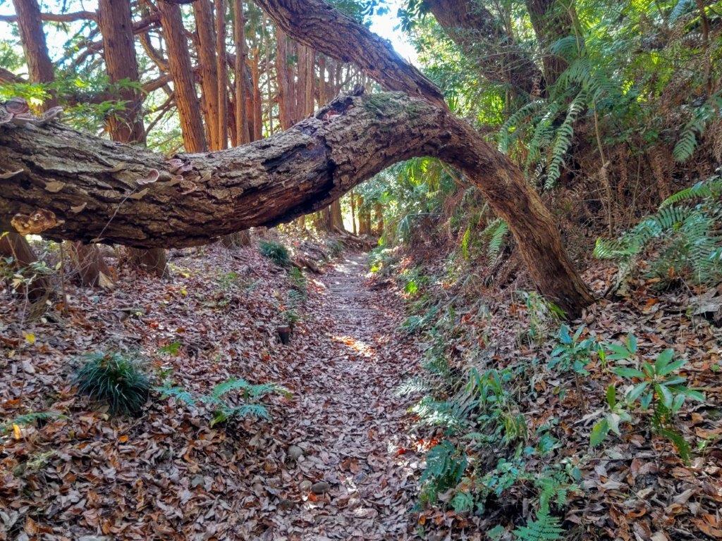
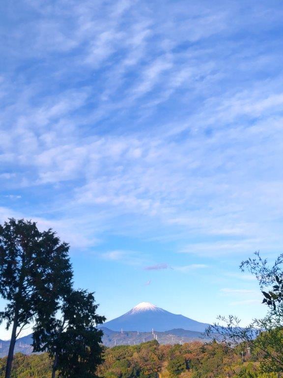
The trail weaved left and right, up and down, along a narrow forested ridge; the treetops swayed in the breeze, occasionally letting through the sunshine. Half an hour later, I reached Mabase Fork and the end of the hiking trail. There, I turned left and walked up a straight road leading to the highest point of the Nihondaira (日本平), also a sightseeing spot with a hotel, souvenirs shops and restaurants. After quickly checking out the eastern observation deck, I made my way to Yume Terrace (夢テラス), one of the most beautifully designed observation towers I’ve ever visited, its wooden deck curving east to west on the north side.

Walking through the Shizuoka Countryside
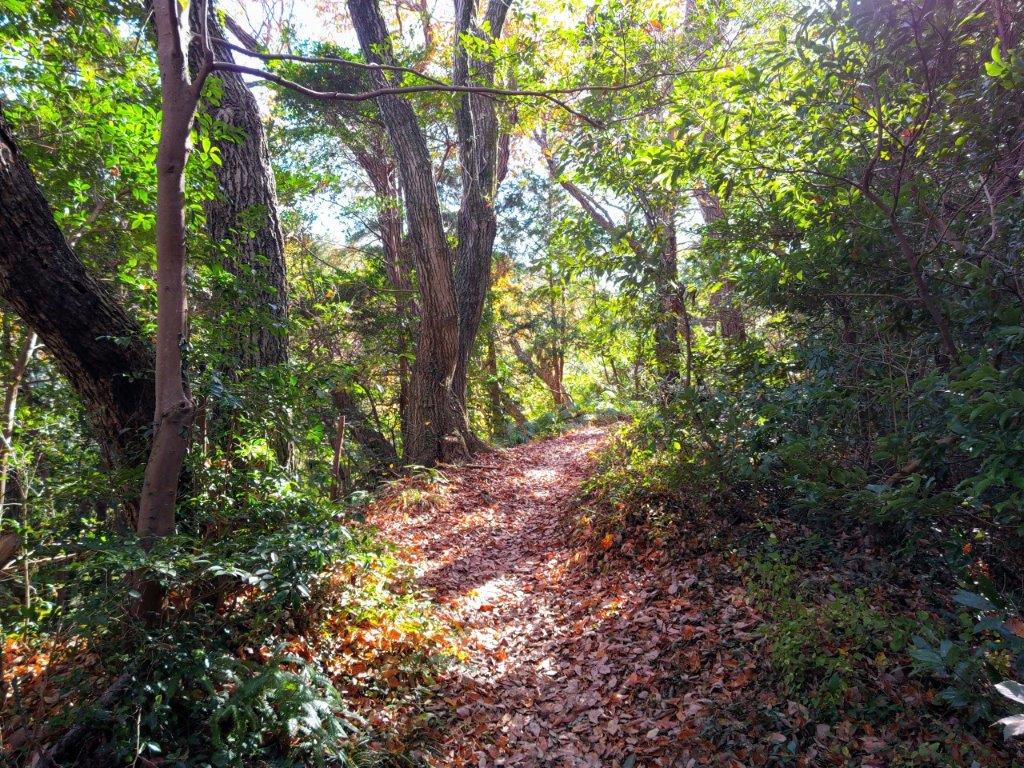
Walking along the Shizuoka Tokai Nature Trail
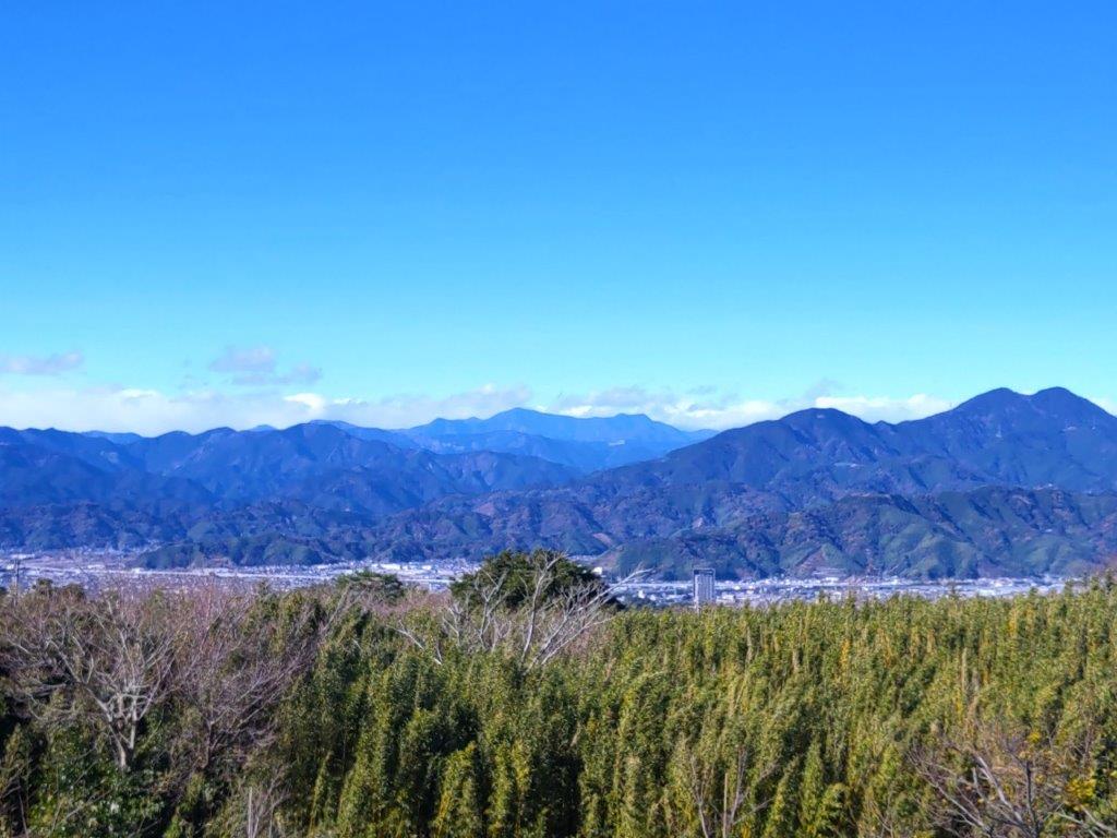
I had a stunning view of snowcapped Mt Fuji, rising above Mt Hamaishi. To its right, past Suruga Bay, I could see Mt Ashitaka, Mt Hakone and the Izu peninsula; to its left, beyond Shizuoka city, I could observe the southern edge of the Minami Alps, Mt Daimugen visible in the distance; on the opposite side was Mt Takakusa and the Pacific Ocean, sparkling in the sun. Since it was 1h30, I sat down on a bench for lunch with a view. The wind was blowing quite a bit, so I soon set off for today’s only peak. I walked down a short section of the Shimizu-Nihondaira road, being careful of the traffic, till I reached a trail on the right. After a short climb, the path at times rather faint, I reached the top of Mt Udo (有度山 うどやま udoyama), just one meter higher than the top of the Nihondaira Plateau.

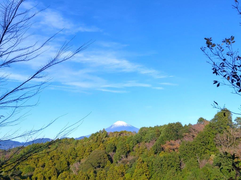
View of Mt Fuji from Yume Terrace at the top of Nihondaira

View of the Izu Peninsula from the top of Mt Udo
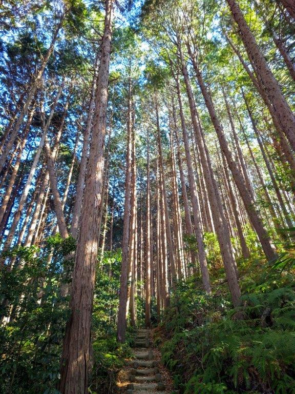
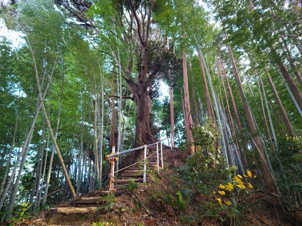
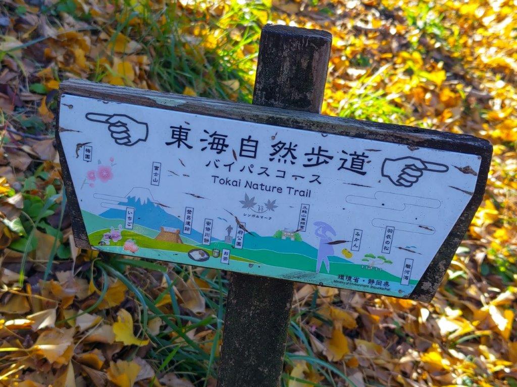
I was stunned by the blue colours of the sea below, visible from a gap in the trees on the southeast side. It was shaded light blue in the nearby shallows and dark blue further out in the bay; the tiny waves were topped with white foam on this windy day. On the other side of the bay was the outline of the western coast of Izu Peninsula, an area of scenic beauty relatively close to Tokyo. After a short break, I retraced my steps to Mabase fork. There, I left the Tokai Nature Trail and continued straight, first down some wooden steps through the cedars, then down stones ones alongside a golf course, reaching Kusanagi fork and a paved road at 3pm. I crossed the road, continuing on the hiking path, and at the top of small rise, turned right, following a trail signposted for the Kusanagi Museum (美術館), not featured on any of the map signboards (the official Kusanagi Route continues straight and merges with a paved road after a short while).

Start of the Nihondaira Alps

Looking back at the Nihondaira Plateau
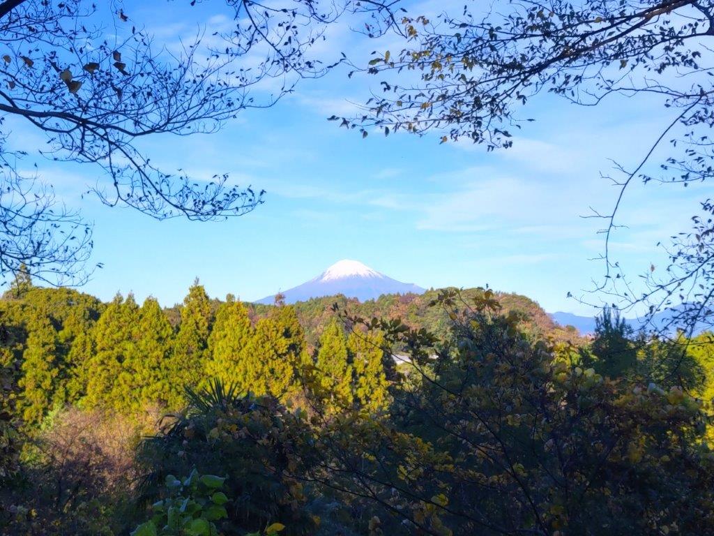
Very soon, I reached a view point of Mt Fuji, its snowy summit poking above a green ridgeline. After a short descent, I found myself walking northwards, along a forested ridge squeezed between two roads. The trail went up and down, a kind of “Nihondaira Alps”, although I couldn’t find any reference to this name. Eventually, I reached the edge of the city, rows of houses crowding in on the east side. I was now walking through a bamboo forest, the densely packed stalks blocking the late afternoon light. I eventually arrived at a fork: left for the museum and right for the University of Shizuoka. I took the right branch, since it was the most direct route to the station, leaving the museum for another day. By 4pm, I was back at the station, and after a refreshing hot bath, I caught a train for Shizuoka station, where I boarded the shinkansen for the one-hour ride back to Tokyo.
Hiking Trail at the Edge of the City
Near the End of the Nihondaira Alps
This hike took about 5 hours, excluding breaks, just the right length for a day hike. The view from the top of Nihondaira was blocked by trees on the southeast side, so it was worth making the roundtrip to Mt Udo to complete the view. The highlight of the hike was the hilly trail between Kusanagi fork and Shizuoka University: it was well-maintained and signposted, with several views of Mt Fuji along the way, even though it doesn’t appear on any maps. I’d like to return one day to explore more trails in the area, and perhaps hike the “Nihondaira Alps” in reverse.
Watch a video of the Nihondaira Hike
Watch the Video of the Hike on Youtube


Watch a Slideshow of more Pictures of the Hike
