I hadn’t been to Shizuoka since March, so I felt I should make at least one more trip before the year end, especially since the clear December skies would be ideal for seeing Mt Fuji and the Pacific ocean. I found a suitable hike in my guidebook, through a small mountainous area next to the sea and south of Mt Hamaishi and Satta Pass. I could get to the start of the trail by riding the shinkansen to Shizuoka station, and then change to the Tokaido line for a few stops; finally a bus would get me to the base of the mountains. Afterwards, I could catch another bus directly back to Shizuoka station: thanks to the bullet train, this hike could be done as a daytrip. The weather was supposed to be good, although windy, and I was looking forward to exploring a new area and getting some views of snow-capped Fuji.

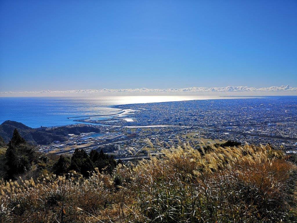
Looking back at Yaizu city on the way up

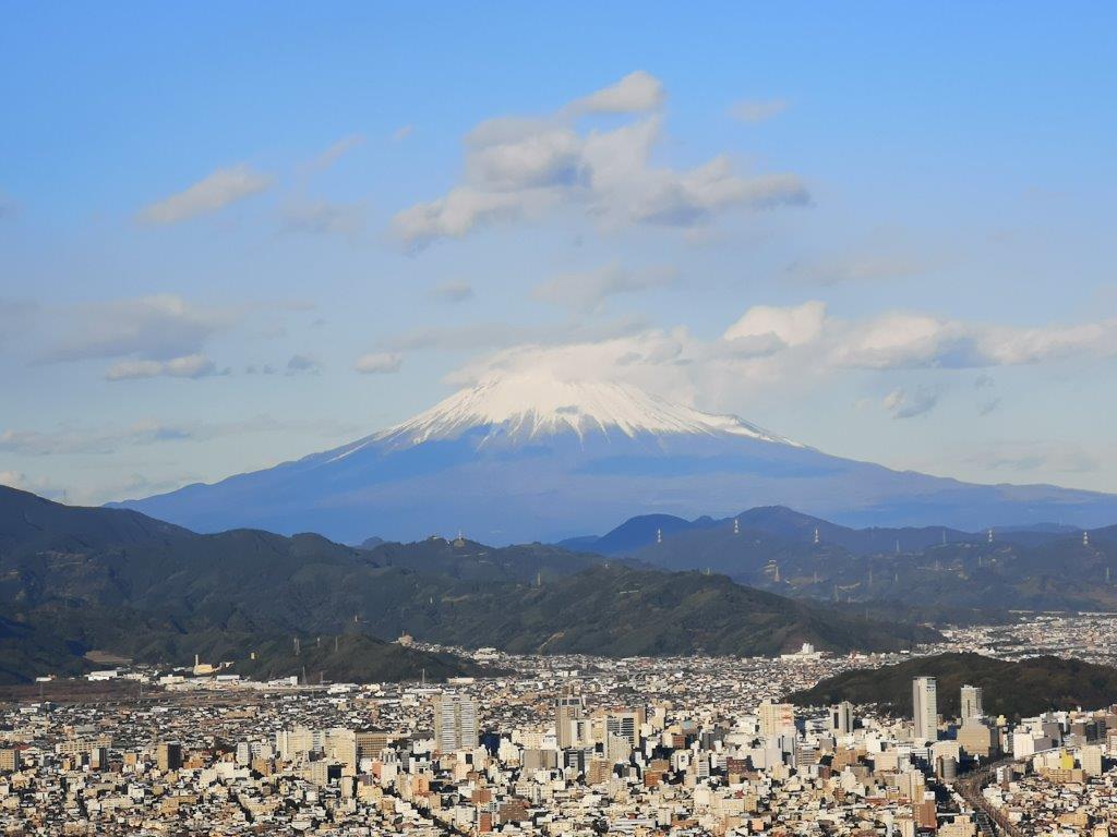
View of Shizuoka city and Mt Fuji from the Korean Rock
I arrived at Yaizu station a little after 9am on a cold but cloudless day. I was pity I had no time to use the hot spring footbath outside the station before the bus arrived. At 10 am, I got off at the entrance for Rinsoin Temple (林叟院), the start of two trails up the mountain. I chose the “Sakamoto B trail” (坂本Bコース), since it went up the sunny mountain side, whereas the A trail followed a paved road along the valley bottom. The breeze was blowing, but thanks to the sun and the low altitude, it didn’t feel too cold; I was surprised, however, to see some autumn leaves still hanging on to the branches.

Hiking under the winter sun on the way up
Yellow Suzuki and blue Suruga
Less than an hour later, I had my first views of the day: directly below was Yaizu city, filling the wide, flat coastal area; beyond was Suruga bay, sparkling under the winter sun; looking west, I could see the foothills of the South Alps across the bay; finally, turning eastwards, I could make out the outline of Izu peninsula. The path headed straight up through low vegetation, quickly gaining more altitude and repeatedly crossing a switchback road. Shortly after merging with another, more popular trail, I reached the top of Mt Takakusa (高草山 たかくさやま takakusa-yama meaning “tall grass”), a 100 famous mountain of Shizuoka.

The tail end of the South Alps
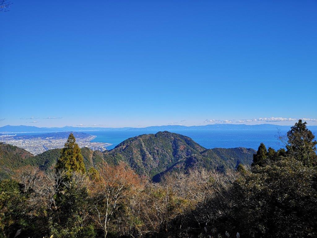
Mt Hanazawa (foreground) and the Izu peninsula
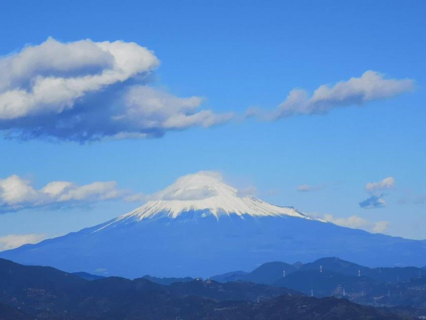
The view was half-blocked by the trees covering most of the summit, but at least Mt Fuji was visible to the north, a cloud parked on its head. Since it was noon, I sat on a bench for an early lunch. Half an hour later, I set off again down a narrow path heading north. I saw almost no one and enjoyed the solitude of the surrounding forest. Through gaps in the trees, I could see the ocean speckled with the white foamy tips of the breaking waves. After several ups and downs, I arrived at Kurakake pass (鞍掛峠), where I crossed a road and continued along the trail on the other side.


A narrow but easy to walk trail through the forest
Looking back at Mt Takakusa (on the left)
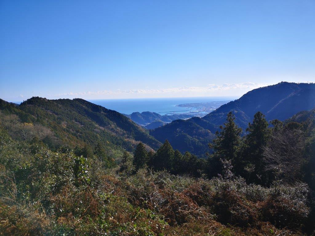
I was now on a path steadily rising through a thick forest. I passed many people and assumed I would soon be arriving at the highlight of the hike. It took half an hour to reach the edge of the forest with a view of what I had hiked so far. Soon after, I arrived at the wide flat summit of Mankanho (満観峰 まんかんほう). The name means “satisfying view”, and indeed, I had no complaints: I could see Shizuoka city spreading out at the foot of Mt Fuji, with the Minobu mountains on the left, and Mt Ashitaka on the right; on the opposite side, I could see the southernmost part of the South Alps, many of its peaks new to me. It was now 1h30, so I found an empty bench and had the rest of my lunch.

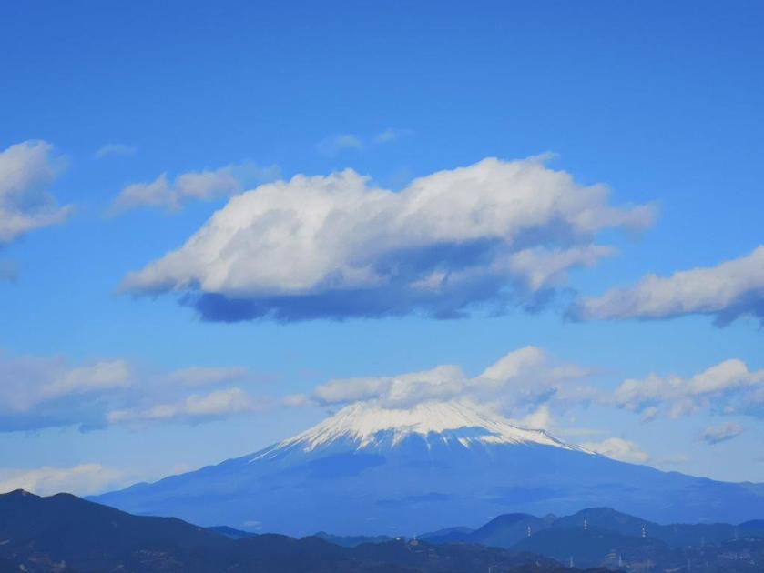
View of Mt Fuji from Mankanho

View of the South Alps from Mankanho
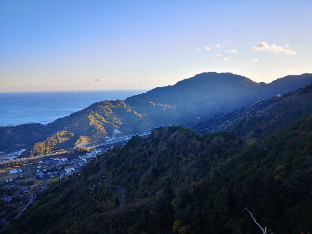
I was the last person to leave the summit at 2pm, following a path northwards back into the forest. After a short while, I reached the top of Mariko-Fuji (450m 丸子富士), a minor peak, cone-shaped like its namesake. It was entirely in the trees, but had a well-used visitor’s book, so I left a short message before continuing. Soon after, I arrived at “koyodai” (紅葉台 meaning “autumn colours pedestal”), a rocky prominence in the forest with a single maple tree on top, its bright orange leaves swaying in the wind. Next, I passed by a tiny tea field, probably producing some special kind of tea due needing this remote location. At 3h30, I was finally standing on top of the Korean Rock (韓国岩), a natural platform jutting out from the mountainside.

The final view of the day from the Korean Rock
Looking back at Mt Hanazawa
I had a close-up view of Shizuoka city with Mt Fuji rising above. The sun was sinking below the ridgeline behind me, and half the city was already in the shade; I had to hurry if I wanted to make it down before dark. Almost immediately, I encountered an unexpected fork in the trail. I decided to go left on the “Zelkova route” (けやきコース) descending in a steep zigzag. At the top of some fields, I had my final view of the day; although the low-lying city was now completely in the shadows, the surrounding mountains were still bathed in soft yellow light. A few minutes later I reached a temple and the end of the hiking trail. After a short bus ride to Shizuoka station, I jumped onto one of the frequent bullet trains for the one-hour ride back to Tokyo.
See what it feels like to hike Mt Takakusa