
I was looking for a new hike in the Oku-Musashi area (meaning “Deep Tokyo” but actually in Saitama). I decided to explore a ridgeline west of Mt Warabi and south of Mt Izu, following the “Kanto Fureai no Michi” for most of the way, and including a minor peak and a couple of temples along the way. Since it was a short hike, with frequent buses to the start of the hike and frequent trains from the end, I could leave later than usual. The forecast announced cloudy with some sun around lunchtime; temperatures were predicted to be cool for the season – perfect for some low altitude hiking at the end of spring. I was looking forward to walking through beautiful nature close to Tokyo just before the start of the rainy season.
Hiking the Fureai no Michi ふれあいの道

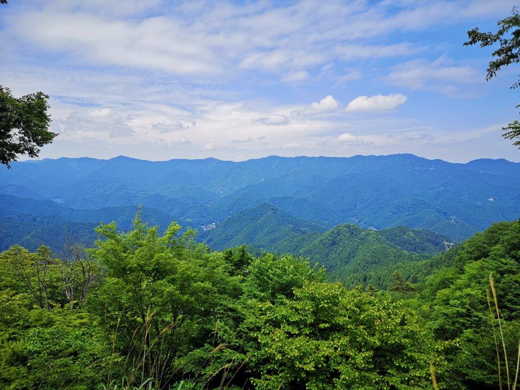
View of the Oku-Musashi mountains from Nenogongen Tenryu-ji Temple

Mt Buko at the very end of the valley
I arrived at Hanno station around 10h30 under grey skies and transferred to a Seibu bus, full of hikers headed for Mt Bonomine. I got off at the following stop and at 11am I was walking up the mountain side through a dark forest. Twenty minutes later I reached a clearing with a view northwards: at the end of the valley I could make out Mt Komochi and Mt Buko. After fifteen more minutes I reached a pass, from where it was a pleasant stroll on a level path to the moss-covered Taka-dera temple (高寺 490m).
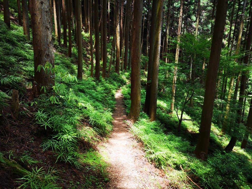
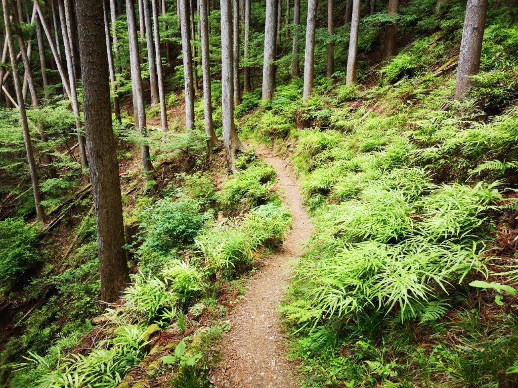
Pleasant walking through the hills of Saitama Prefecture
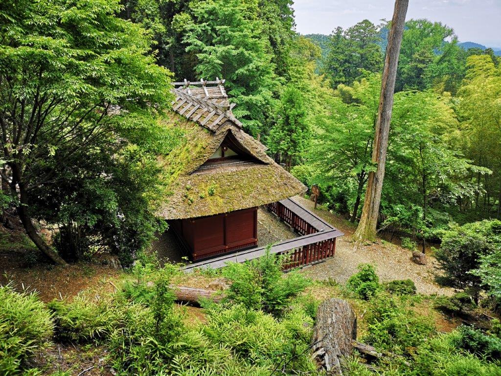
The moss-covered roof of Taka-dera visible through the trees
I was intrigued by a pair of wooden totem poles representing buffalo-headed humans playing flutes: I had never seen anything like it before. I continued along the easy to follow and easy to walk Fureai no Michi trail. The path rose slightly before becoming level again. At 12h30 I reached another pass. Here the trail left the mountain side and followed the ridgeline. I climbed a path crisscrossed with roots and then walked down a log staircase. At 1pm, I was at the top of Mt Atago (愛宕山), completely surrounded by trees and slightly off the main trail.
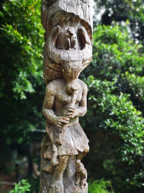

Totem pole of Taka-dera (left) and guardian demon of Tenryu-ji (right)
Easy hiking along the mountain side
A little further, I reached an amazing viewpoint of the valley, through which the Seibu-Chichibu line passes. There was even an unoccupied bench, and the clouds had started to melt away, so I decided to stop for lunch. To the north, I could see the observatory at the top of Mt Maru and Dodaira; opposite was the Oku-Musashi Green line; looking south I thought I could spot Mt Hiwada. After a peaceful lunch, I continued to Nenogongen Tenryu-ji Temple (子ノ権現天龍寺 520m) just a few minutes away. There was another viewpoint above the temple and next to the bell, with the Kanto plain spreading eastwards.

The perfect place for a lunch break

Looking east towards the Kanto plain
I walked out of the temple complex past two guardian demons and a huge cedar tree and after a short trot on the road, reached the trail for Nishi-Agano station. I descended through beautiful forest and then followed a small babbling brook at the bottom of the valley. At 3pm, I reached some houses and a paved road; it took another thirty minutes through pleasant countryside to reach the station. I was just on time for the local train, which I rode for a short while before switching to the Laview Limited express at 4pm for the short and comfortable ride back to Tokyo.
Enjoy the sights and sounds of the Saitama section of the Fureai no Michi


2 thoughts on “Mt Atago (653m), Hanno City, Saitama Prefecture [Fureai no Michi]”