Mt Iyo and Mt Tomi are two peaks with amazing views belonging to the Mineoka Mountain Range in south Boso. They first came to my attention while I was hiking the Kanto Hundred Famous Mountains, and since they were relatively near each other, I decided to combine them as a day trip from Tokyo. Both mountains are featured in my Mountains of Chiba guidebook and thus I followed the accompanying hike descriptions.
Mt Atago (left), Mt Karasuba (center) & Mt Goten (right)
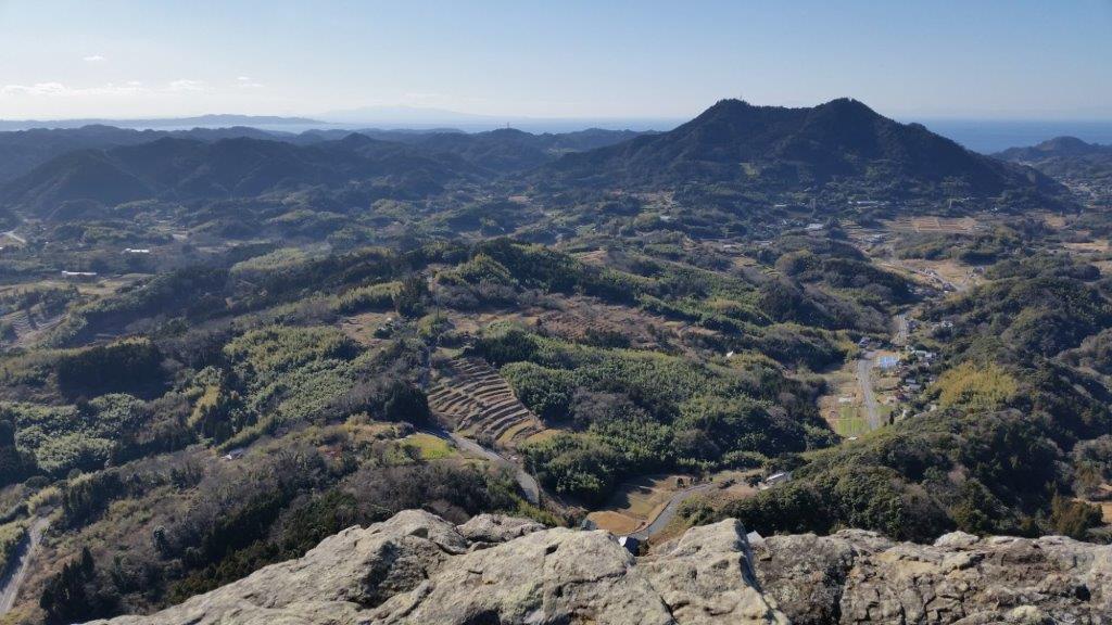
Mt Tomi from the Top of Mt Iyo
Both trail entrances are a short bus ride on the Minamiboso city bus Tomi line (南房総市営路線バス富山線) from Iwai station (岩井駅), itself a stop on the JR Sazanami limited express, a couple of hours from either Tokyo or Shinjuku station. It’s important to note that advance phone reservation is required for the Mt Iyo trailhead. Since buses are infrequent making it tough to combine both using public transport, I decided to go by car via the Tokyo Bay Aqua line between Kawasaki and Kisarazu Cities. On the way there (and back), I could also check out the view of Tokyo Bay and Mt Fuji from the Umihotaru Rest Area (meaning Sea Firefly) at the halfway point of the line.
Mt Saga (left), Mt Kano (center back) & Mt Hitobone (right)
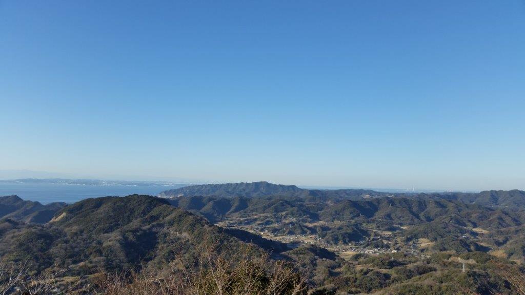
Tokyo Bay and Mt Nokogiri from Mt Tomi
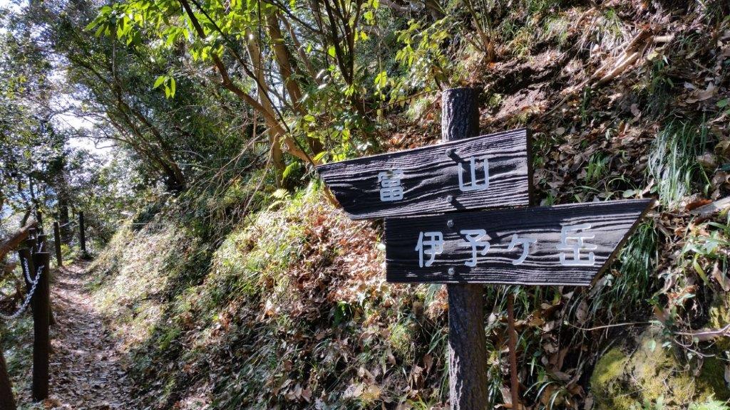
Mt Iyo (伊予ヶ岳 いよがたけ iyogatake)
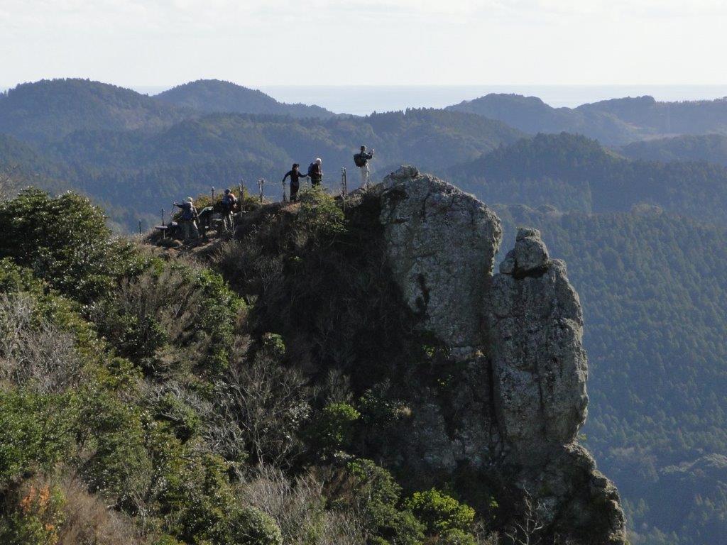
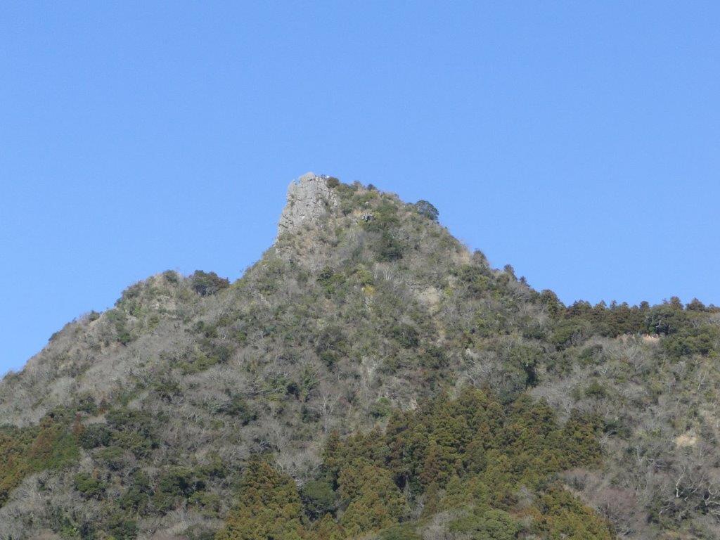
Mt Iyo is a rare rocky summit on the Boso peninsula and is the only one with the character “岳” (“take” meaning “high mountain”) in its name. The hike is a 2-hour loop from the Tenjingo (天神郷) bus stop and parking area near Heguri Ten Shrine (平群天神社), including a short round-trip between the north and south peaks. The narrow south peak (南峰) has a spectacular 360° view that includes Mt Atago, Mt Karasuba, Mt Goten, Mt Tomi, Mt Nokogiri, Oshima Island, as well as Mt Fuji; from the north peak (北峰) one can appreciate the precipitous south summit protruding from the mountainside.
Mt Iyo South Summit from Below
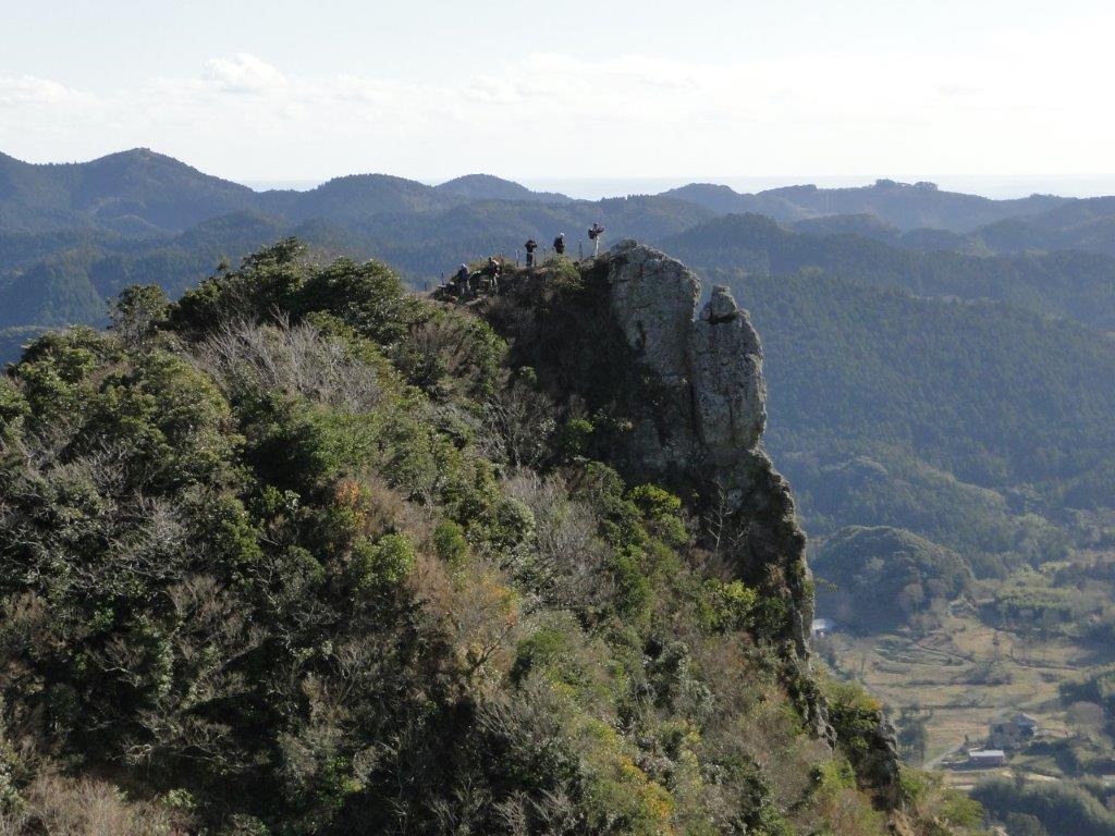
The Precipitous South Summit of Mt Iyo
The higher sections of the Mt Iyo trail include steep, rocky sections fitted with rope and chains for safety. This hike is rated intermediate level, despite the low-elevation and short hiking time; surefootedness, upper body strength and a head for heights are recommended. The lower trail sections inside the forest follow well-maintained and easy to walk paths, including a short section along a paved road.
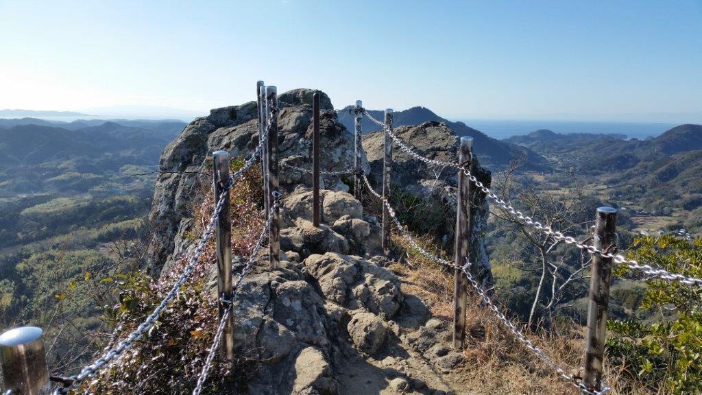
Safety Chains on the South Summit of Mt Iyo
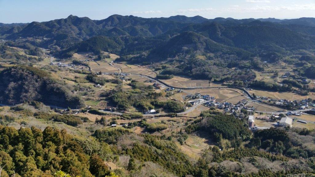
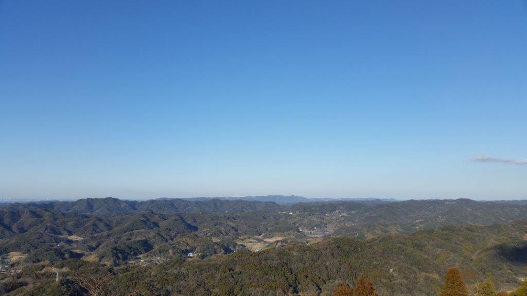
View of Minamiboso from Mt Tomi
Mt Tomi (富山 とみさん tomi-san)
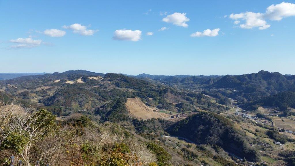
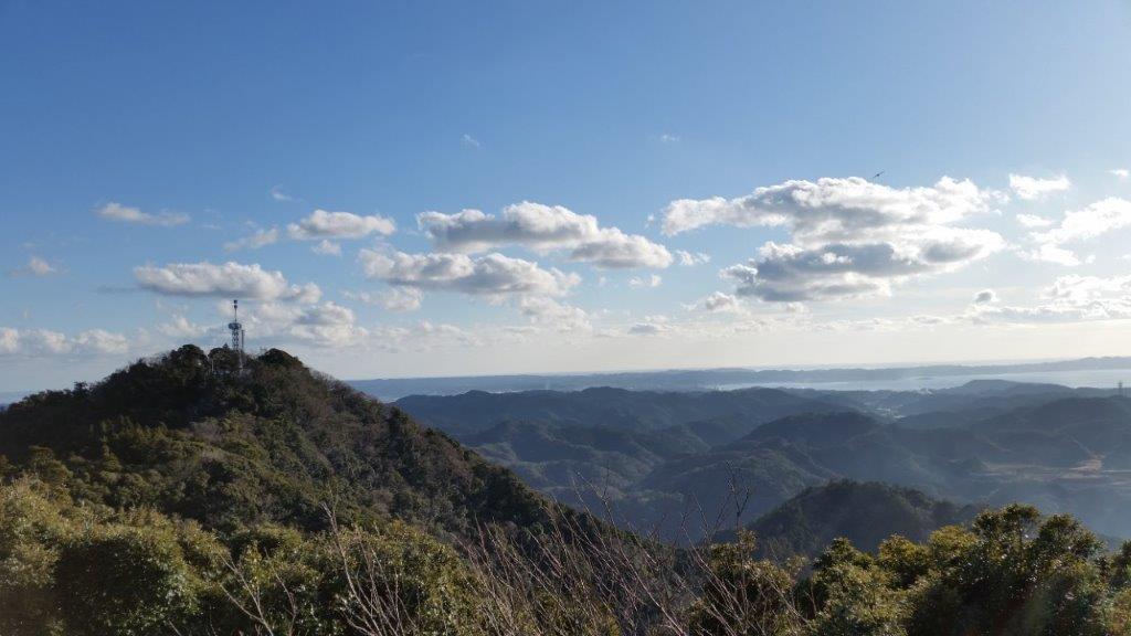
Mt Tomi is a standalone peak closer to the coastline and the 7th highest mountain of the Boso Peninsula; it’s situated inside the Tomisan Prefectural Natural Park (県立富山自然公園). The trailhead can be reached from the bus stop at the Furari Road Station (道の駅 富楽里); for the return, one can walk through the countryside back to Iwai station. This hike is a 3-hour loop along well-maintained trails, the steeper sections fitted with log steps. The highlight is the wooden observation deck on the north summit (北峰), a short roundtrip from the main trail, with a wide view on the east side of Mt Nokogiri, Mt Kano & Mt Hitobone; Tokyo Bay, the Miura peninsula, Oshima island, and Mt Fuji are also visible. Although Mt Tomi consists of two peaks, the south peak is off the trail and within the forest.
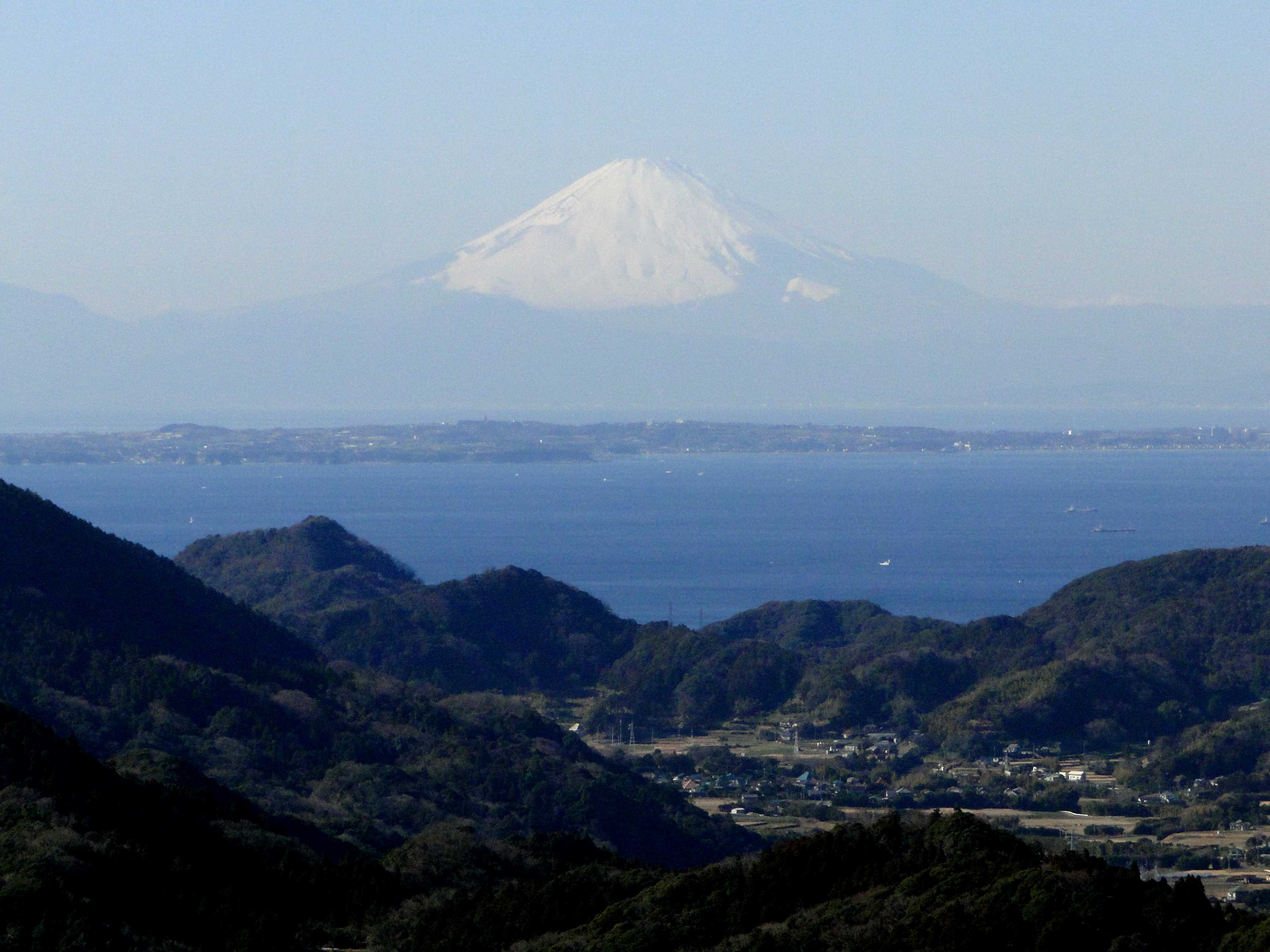
Mt Fuji from Mt Iyo
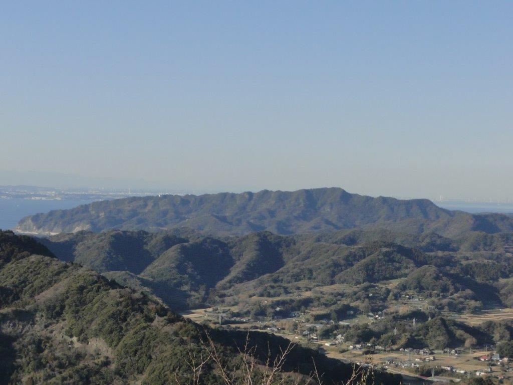
Mt Nokogiri from Mt Tomi
To make the best of the panoramic views, it’s best to attempt both hikes during the cold, clear days of winter, although each can be comfortably done between October and June; both hikes are unsuitable during the hot and humid months of summer. After a late start at Mt Iyo at noon, I was back at the car before 2pm. I then drove to the Fusehime-roketsu Parking Lot (伏姫籠穴駐車場), and headed up Mt Tomi around 2h30. I walked fairly quickly and was back at my car at about 4pm. On the way back, I was able to enjoy the sunset, as well as the night view of Tokyo City from the Umihotaru in the middle of Tokyo Bay.
Watch a Video of the Hike