Mt Ogusu (241m), Yokotsuka City, Kanagawa Prefecture

I had climbed this mountain once before in 2014, hiking up and down the western side. This time, I wanted to cross over to the other side; I would go up the trail I had descended the previous time, as it is the better of the two. Hopefully, the trail on the other side would be just as nice. Since trains and buses run frequently this close to Tokyo, access would be straightforward. The weather was supposed to be good again, and I was also hoping for a glimpse of Mt Fuji across Sagami bay.

The peaks of Mt Hodai and Mt Miura-Fuji near the heel of the Miura peninsula

I rode the Shonan-Shinjuku line directly to the seaside resort of Zushi, where I caught one of the frequent buses heading south along the western coast of the Miura peninsula. I could already see Mt Fuji from the bus; after getting off, I backtracked for a few minutes to “Bonten no Hana” (梵天の鼻 meaning the Brahma’s nose), a rocky promontory from where I snapped some pictures of Japan’s most famous mountain. On its right, I could see the Tanzawa mountains, and to the left, the Hakone mountains.

Mt Fuji from the Brahma’s nose

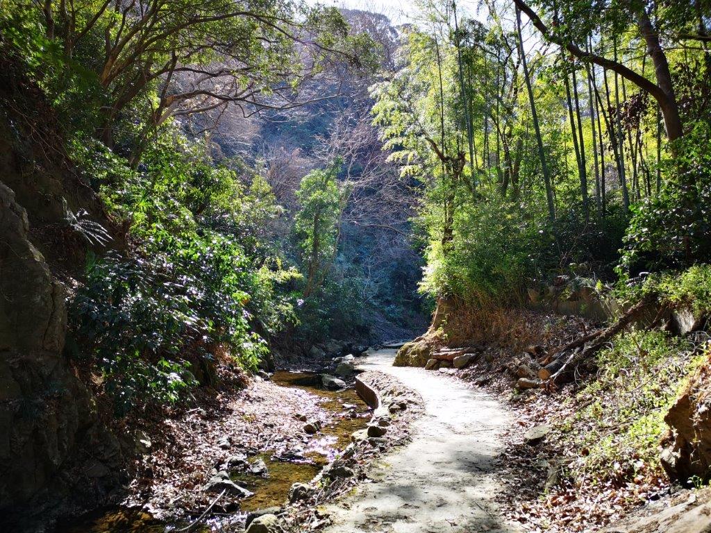
Sun along the Maeda River Promenade

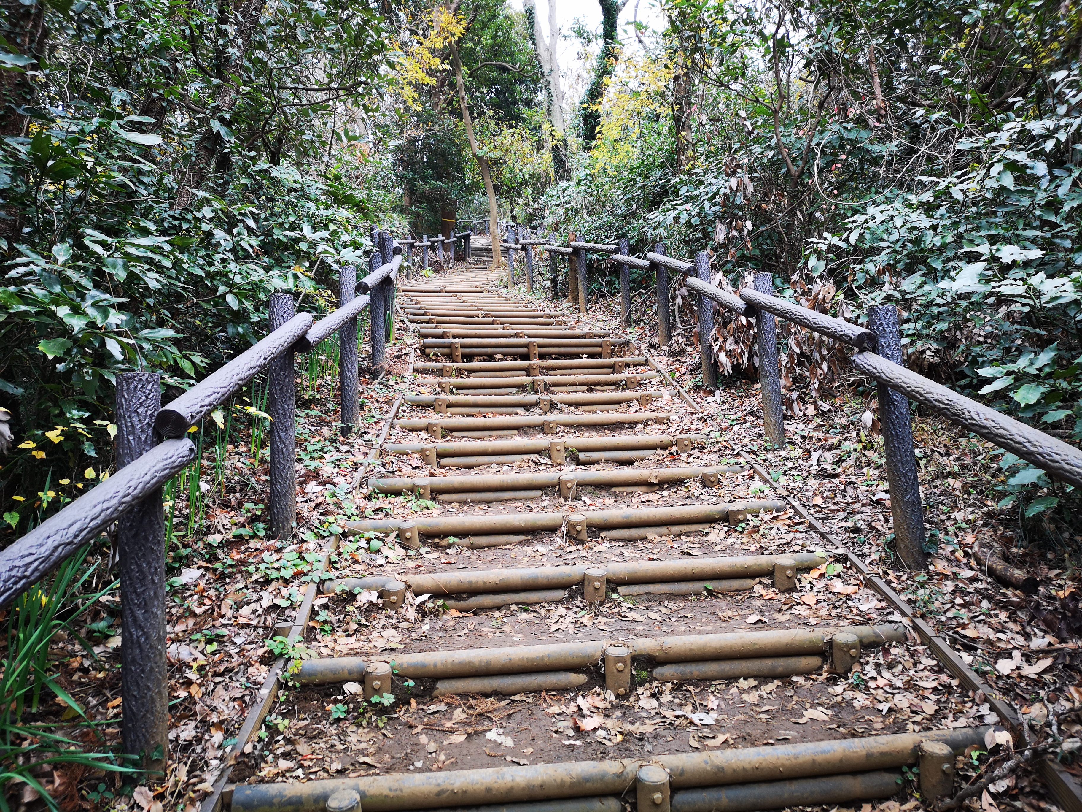
Before starting my hike, I had an early lunch at nearby Soba Okeya, so I only reached the Maeda River Promenade entrance (前田川遊歩道 maedagawa-yuhodo) at 1pm (also part of the Fureai no michi). It was a small river but enjoyable to walk along in the sunny winter weather, and I shared the trail with many locals. Twenty minutes later I reached the end of the promenade and the start of the hiking trail. First, it followed a long curving log staircase up the mountain side, then alternated between flat and climbing sections. The surrounding forest reminded me of hiking in Kamakura.

Start of the hiking trail up Mt Ogusu

One of the level sections of the trail

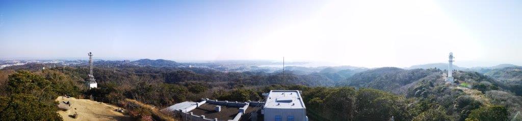
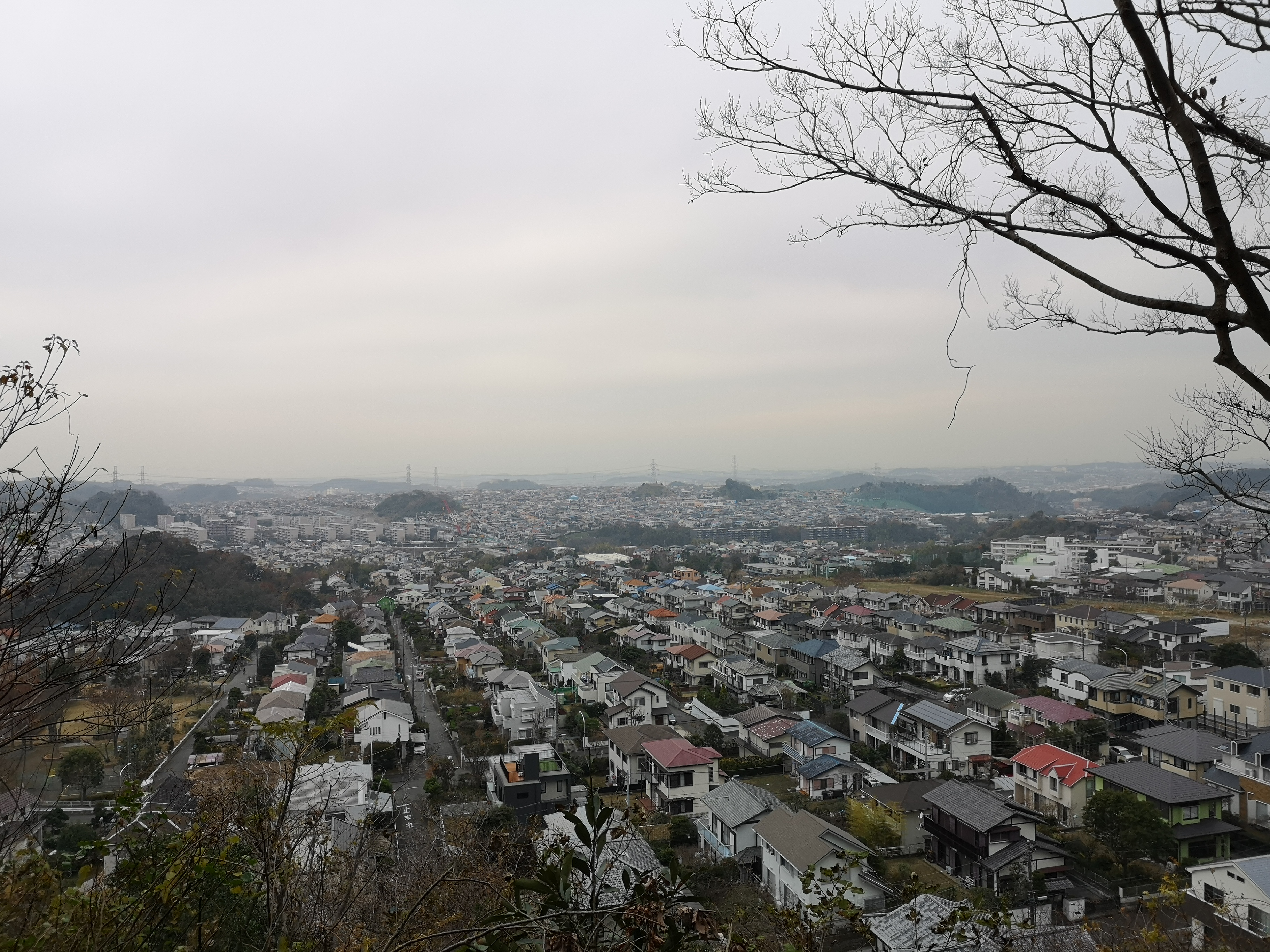
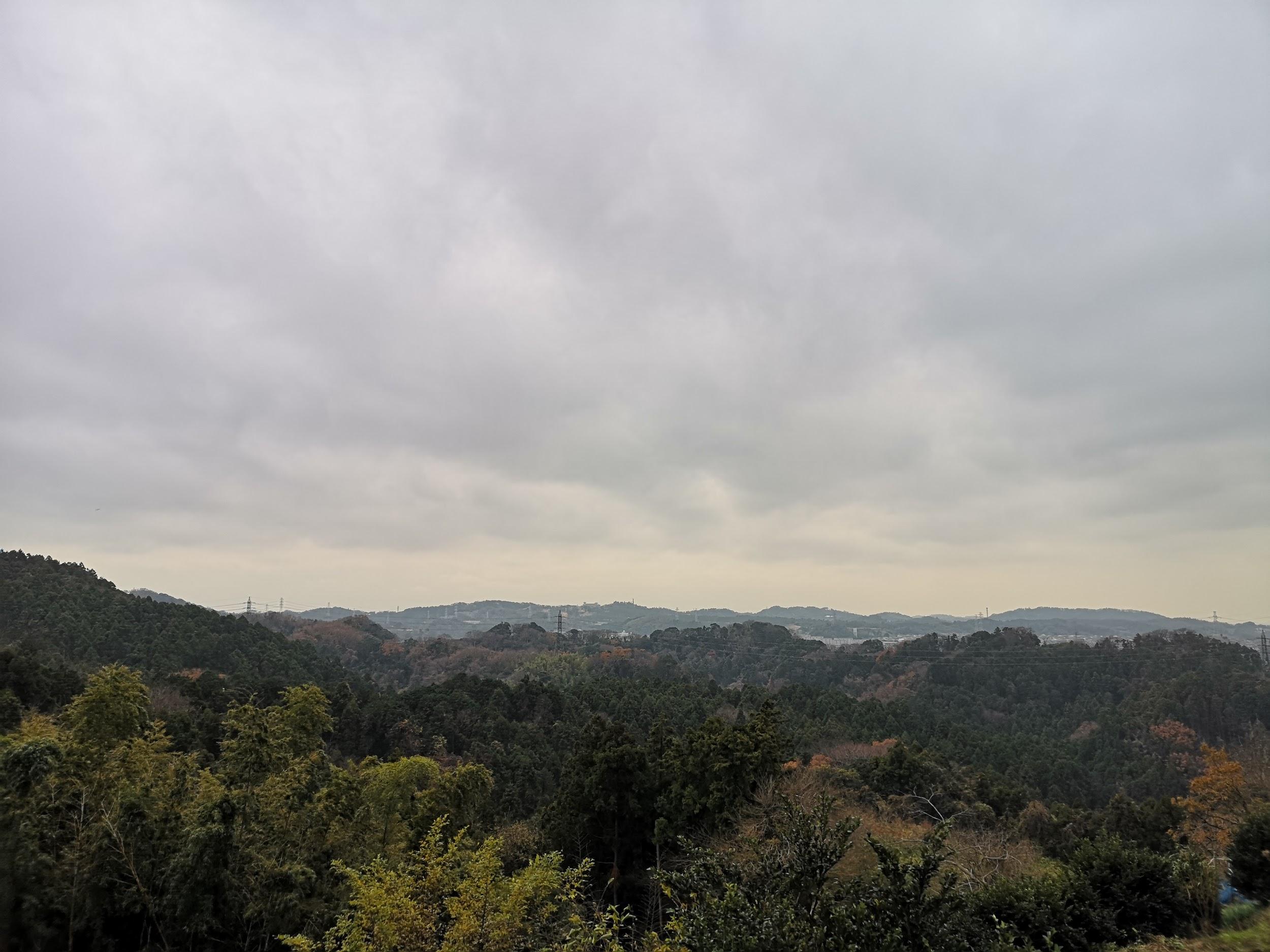
One hour later, I arrived at a tall white tower; it looked quite spectacular against the blue sky. From the top, I had good views of the entire Miura peninsula; directly west, Mt Fuji was still faintly visible; looking north, I could see the hills of the Miura Alps with the skyscrapers of Yokohama in the background. However this wasn’t the summit yet. It took another ten minutes to reach the the top of Mt Ogusu (大楠山 おおぐすやま oogusu-yama), the highest point of the Miura peninsula, and a hundred famous mountain of Kanto.

The white tower on the way to the summit

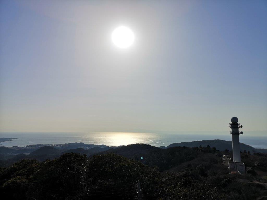
View towards Sagami bay from Mt Ogusu

There was another tower here, just as tall as the previous one but made of metal. From the top, I had an excellent view to the south of the flat boot-shaped extremity of the Miura peninsula. Westwards was Yokotsuka city and its port. Directly above, a black kite bird (“tobi” in Japanese) was circling in the sky. It was already past 3pm and time to head down. At first, I walked down a steep staircase at the bottom of which I turned sharply left and hugged the mountain side. At one point, I passed next to a golf course and through a tunnel made of a protective netting similar to the one near Miyazawa Lake.

The southern part of the Miura peninsula

The Miura Alps with Yokohama behind

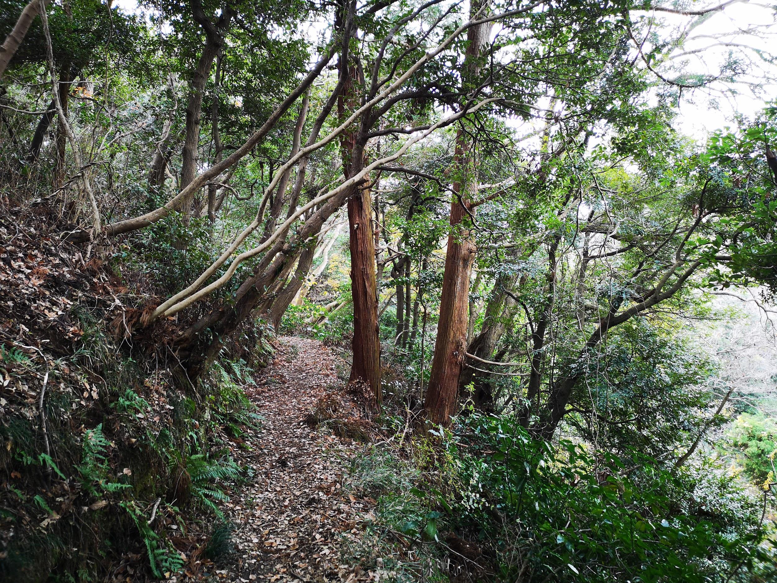
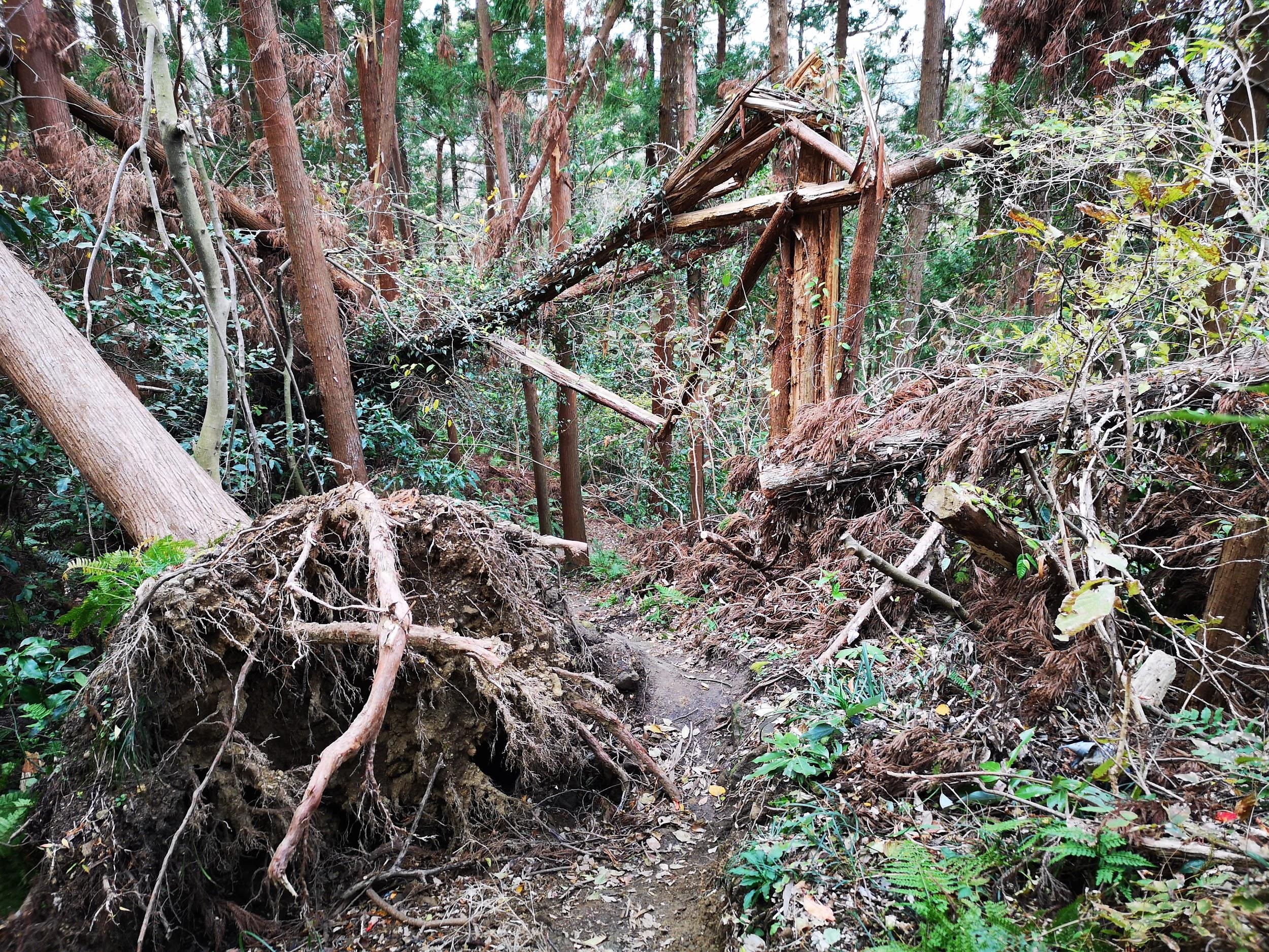
Just past the golf course, I reached a fork in the trail. As I was confirming the way in my hiking book, I suddenly turned around, and saw a cat watching me from the path; halfway up a mountain was certainly an odd place for a cat to be. The trail now descended to the bottom of the valley through the forest. I was near the center of the Miura peninsula, and it was easy to forget that I was only 20 kilometers away from Yokohama. There were no other hikers here and I could enjoy the tranquility of nature. As when I had hiked the Rokoku pass, I was occasionally spooked by the many squirrels scampering up and down the tree branches (could be the reason for the cat).

Pleasant hiking on the Miura peninsula

Few hikers but a well-maintained trail

At 4pm, I reached the stream at the bottom of the valley. After crossing two small concrete bridges, I was back on a countryside road. A few minutes later, I was walking through the suburbs of Yokotsuka city; I spotted a few more cats, as well as many daffodils which flower at this time of the year. Thirty minutes later, I reached a bus stop on a busy road which cuts through the center of the peninsula. After a short ride, I was back at Zushi station where I boarded the Shonan-Shinjuku line for the one hour train ride back to Tokyo.

See the view from the highest point of the Miura peninsula

Mt Kinubari (122m) & Mt Omaru (157m), Kamakura and Yokohama Cities, Kanagawa Prefecture, Saturday, December 21, 2019

IMG_20191221_115651

Kamakura area is a great place for hiking, especially during the colder months. The trails are easy to walk, the surrounding nature is lush even in winter, and it’s just one hour from Tokyo by train. My previous visit was in February last year, when I hiked the Miura Alps. Since then, typhoon Hagibis had wrecked several of the trails in the area, and I was concerned whether I could complete my hike as planned. Fortunately, the path I had chosen was open from start to finish. On the other hand, the very popular Ten-en hiking trail 天園ハイキングコース, which I had done a few years earlier, was closed due to fallen trees. It’s supposed to reopen in June.

The Ten-en hiking trail is closed…

Since most hiking trails around Kamakura are quite short, I had to cobble together 3 of them to get a full day of hiking (about 6 hours). I arrived at Kamakura station around 10am, and walked to Hokokuji Temple 報国寺. It’s also possible to get there by bus. There is a beautiful bamboo forest inside, but I skipped it since I had been there before and it was getting late. I found the entrance of the hiking trail a few meters further up the street. It was already 11am and I was finally ready to start hiking!

A well-hidden hiking trail…

Almost immediately, I went from a suburban neighbourhood to thick forest – the transition always amazes me. After a short climb, the path became level for a while, before reaching a park bordering a suburban community on the border between Zushi and Kamakura cities. Even though it was a Saturday, the park was nearly deserted, probably due to the overcast weather, despite the sunny forecast.

Surrounded by nature only ten minutes from the start of the trail

The hiking trail resumed at the end of the park. After some up-and-down over a couple of minor peaks, I reached the top of Mt Kinubari 衣張山 just before noon. It’s a low mountain, but since it’s right next to the ocean, the view was quite spectacular. I could see the Miura Peninsula stretching away to the South, and Kamakura City opposite Sagami Bay to the West.

Miura Peninsula near the top of Mt Kinubari

Shortly after, a group of a about a dozens hikers arrived. They were on some kind of guided tour – I had encountered the same thing when hiking the Miura Alps. It seems like guided hikes are quite popular in the Kamakura / Zushi area. I finished my early lunch and took off quickly. The trail heading down was short and enjoyable, but there were many fallen trees lower down. It’s not often that I see multiple fallen trees blocking the trail…in succession. Hopefully the trail will get cleared up in the future.

Evidence of the destructive power of typhoons on the way down

The trail soon ended a short way from my starting point of Hokokuji Temple. From there, I walked along roads to the start of a minor trail leading to the Ten-en hiking trail, which I would cross but not follow. Kamakura is pleasant and laid-back, and thus a nice city to stroll through – there are plenty of sights to check out. On the way, I decided I had enough time to pay a short visit to Sugimoto-dera Temple. According to the sign at the entrance, it was founded in the 8th century and is the oldest temple in Kamakura. It was a quick visit (costs 200 yen) but I was able to get some nice views and pictures. After that, I walked past Kamakura-gu shrine, turned left at Tsugen Bridge, then continued past Yofukuji ruins without visiting either since it was getting late. After 1pm, I was hiking on a trail and surrounded by nature again. It’s possible to skip Mt Kinubari and walk directly from Kamakura station (about 30 min)

View from the highest reaches of Sugimoto temple

First, the path followed a dramatic narrow gorge along a small stream, then climbed through some nice forest that still had some red and orange. Some steps brought me to the highest point: the intersection with the now-closed Ten-en hiking trail. It was 1h30, and I could hear many people talking and having lunch at the rest area just above, so I skipped it and continued in the direction of Kanazawa-Hakkei station 金沢八景 (not the final destination), through a short but beautiful bamboo forest. The trail was mostly level and thus easy to walk. It’s probably one of the flattest hikes I’ve ever done in the Kanto area. There was a fallen tree here and there, but it wasn’t too troublesome to get around. I was amazed that there were so few people hiking this great trail, but then it was a cold cloudy winter day.

Some minor obstacles on the way…

IMG_20191221_151658

…but mostly easy hiking

The path was now running alongside and above a huge cemetery. Later on, it passed above another suburban community. I could get occasional glimpses of both through the trees. On a clear sunny day I suppose you could see all the way to Yokohama city to the North. There were good information boards (with English) along the way, showing the extent of the local hiking trails: they connect several community woods, a nature sanctuary, and even a small zoo. There is also a pond in the middle of the forest, but trails leading to it were currently closed due to typhoon damage. I will certainly return in the future to hike more in the area since it’s so close to Tokyo. I couldn’t decide what was more amazing: that the city had penetrated nature so deeply, or whether nature had survived the invasion of the city.

Hiking a narrow green ridge…

IMG_20191221_145914

…at the edge of the city

I was now following the signs for Kanazawa Bunko 金沢文庫 (not the final destination either). At 2h30, I reached the Sekiyaoku viewpoint 関谷奥見晴台. There were some benches but not much of a view on this grey day. I had the rest of my lunch and moved on. At last, I was following signs for Konandai station 港南台, the end point of my hike. A little before 3pm, I reached the turn-off for a long staircase leading to the top of Mt Omaru 大丸山, the highest point of Yokohama city. There was a view to the South of Tokyo Bay and the Eastern end of the Miura Alps.

IMG_20191221_144517

Staircase to the top – one of the few climbs on the hike

I was starting to feel cold and since the sun was showing no sign of appearing, I didn’t linger. It took me another hour to reach Isshindo Plaza いっしんどう広場, a wide area where several trails intersect. Apparently you can see Mt Fuji from the West side in good weather. However the hiking trail wasn’t finished yet. It took me another fifteen minutes along a dirt trail through the countryside to get back to the busy city roads. There were some good views of the hills of Kamakura to the East. I finally reached Konandai station on the Negishi line station around 4h30, a short train ride from Yokohama and central Tokyo.

Looking back towards Kamakura on a gloomy day

IMG_20191221_115619

NEXT UP: Mt Yaeyama in Yamanashi