Located near the heart of the Boso peninsula, this intermediate-level loop hike perfect for the cooler days of Winter and early Spring. Along the way, one can get views of the Pacific Ocean, Tokyo Bay, the Miura Peninsula, Mt Atago, Mt Kano, Mt Iyo and Mt Tomi; the area is also known for its many flowers, especially daffodils (“suisen“) in January and cherry blossoms in April, as well as its terraced rice paddies (“senmaida“).
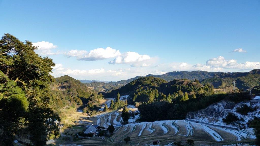
Terraced Fields on the East Side
If going by public transport, buses run infrequently between Sakuma Dam and Hotta station on the JR Uchibo so it’s important to confirm the timetable beforehand; depending on the season, one can take advantage of the Sazanami limited express from Shinjuku. If time allows, one can drop by at Waraku no yu for a hot bath before heading back.
Mt Tsumori from the Start of the Hike
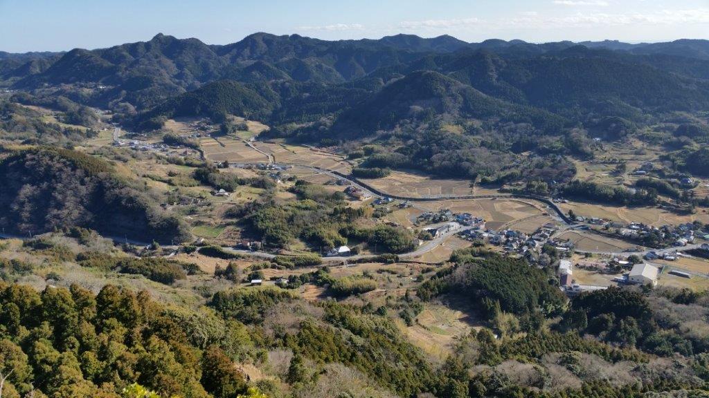
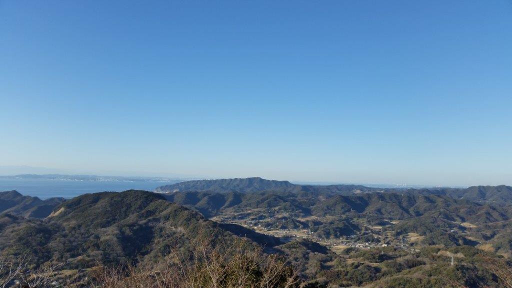
The climb from the base to the top of Mt Tsumori (津森山 つもりやま tsumori-yama) was pleasant and the views eastwards towards Kamogawa town, the Pacific Ocean and Mt Atago were unexpectedly beautiful; closer by, rice terraces covered the mountain side.
Mt Atago from Mt Tsumori
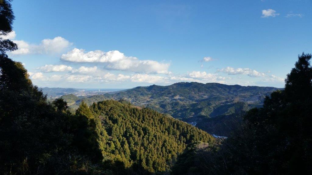
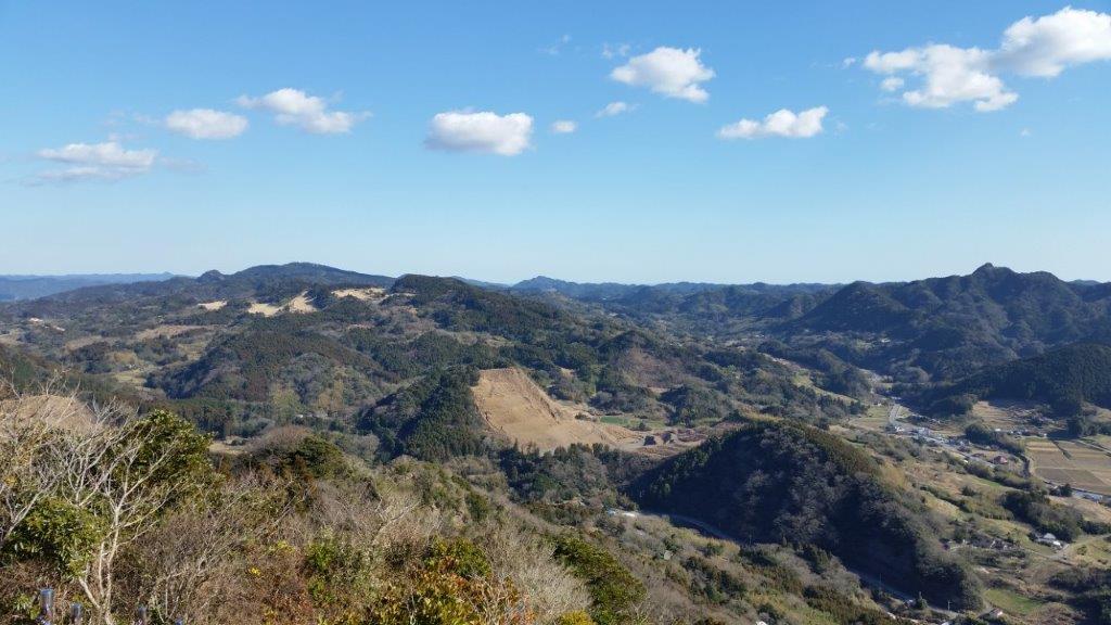
After a short break at the summit, I made my way along a mix of hiking paths and roads to the frighteningly named Mt Hitobone (人骨山 ひとぼねやま hitobone-yama meaning “person’s bone”). Here the views were mostly of the hills towards the South and the West, with the outline of Mt Fuji visible against the late afternoon sun.
View of the Boso Mountains
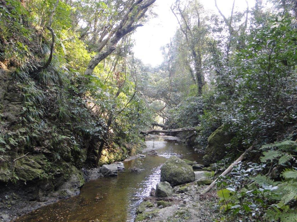
After another break, I headed down and followed an adventurous trail through a marshland at the bottom of the valley – it was quite atmospheric in the late afternoon light. Eventually I emerged onto a road and arrived at lake Sakuma just as the sun was setting.
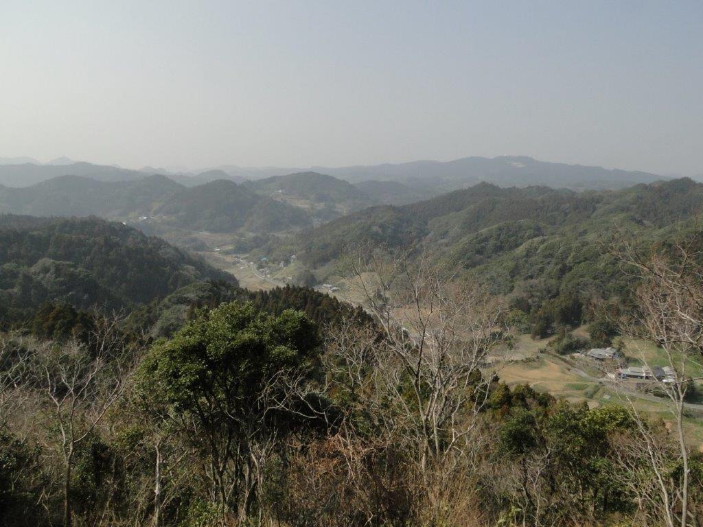
A hike on a hidden mountain in the middle of the Boso peninsula, I even had trouble finding it again on the map while writing this post. This time, I took a bus from Kisarazu station, then hiked along a small road, through a hamlet with many cats, and finally reached the start of the trail: log steps heading up the side of the hill. At the top, I admired the views of Mt Kano to the North, before continuing southwards. The views of central Chiba aren’t really all that amazing, but I find the sight of green rolling hills in all directions very impressive.
Rock Tunnel near the Takago Kannon
Walking the Hachirozuka Trail
It was a fairly easy hike with occasional views; the rocky top of Mt Takago (高宕山 たかごやま takagoyama), a Kanto 100 famous mountain, is the highest point in the area, with a sea of trees spreading in nearly every direction. At one point, hungry for more views, I extended the hike by doing a short there and back along a lonely ridge. After returning to the main trail, I made my way down, running and walking since it was getting late, and ended up at a bus stop in the middle of the countryside, not far from Lake Mishima, after a very satisfying seven-hour hike.
This is a good hike to do in the winter since Chiba usually gets less snow and the temperatures are milder. It’s also relatively short so it can be combined with another mountain in the area, like Mt Tomi. I’d recommend using a car for this hike since there is no suitable bus to the trailhead. There is also a convenient parking lot near the start of the trail, in front of Koshoji Temple 高照寺.
First views of Minamiboso at the start of the hike
It takes about an hour to get to the top of Mt Goten 御殿山. Following the ridgeline, the trail goes past Mt Takatori 鷹取山, and ends at Mt Dainichi 大日山 one hour away. Although the trail is mostly through the forest, there are good views of Mt Tomi and Tokyo Bay from each peak. One might even see Mt Fuji on a very clear day. Although the path continues Southwards down to a road, there is no public transport, so the return is back the same way. It should take a little less than 2 hours to get back to the parking area along the up and down trail.
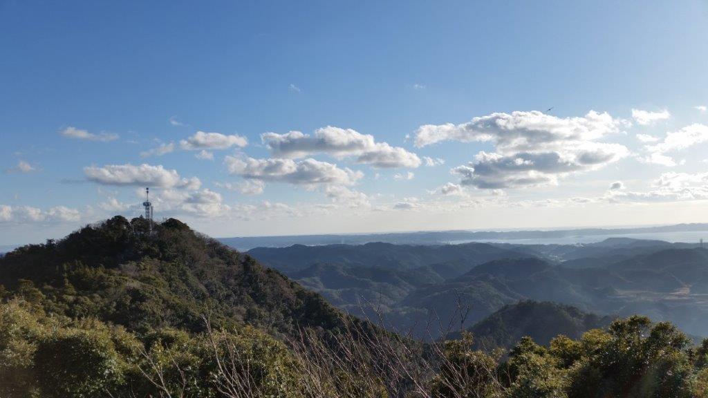
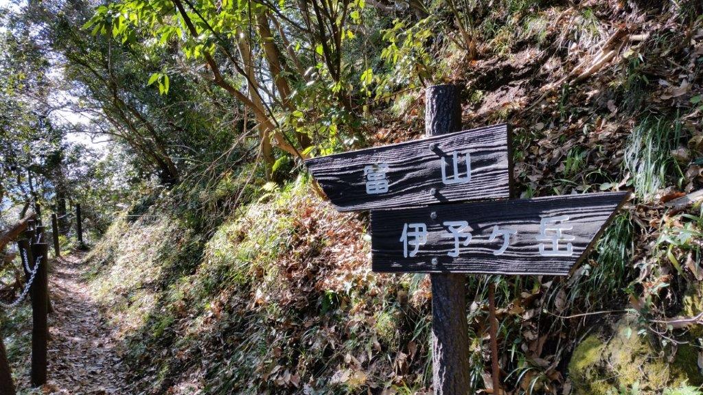
Mt Iyo and Mt Tomi are two peaks with amazing views belonging to the Mineoka Mountain Range in south Boso. They first came to my attention while I was hiking the Kanto Hundred Famous Mountains, and since they were relatively near each other, I decided to combine them as a day trip from Tokyo. Both mountains are featured in my Mountains of Chiba guidebook and thus I followed the accompanying hike descriptions.
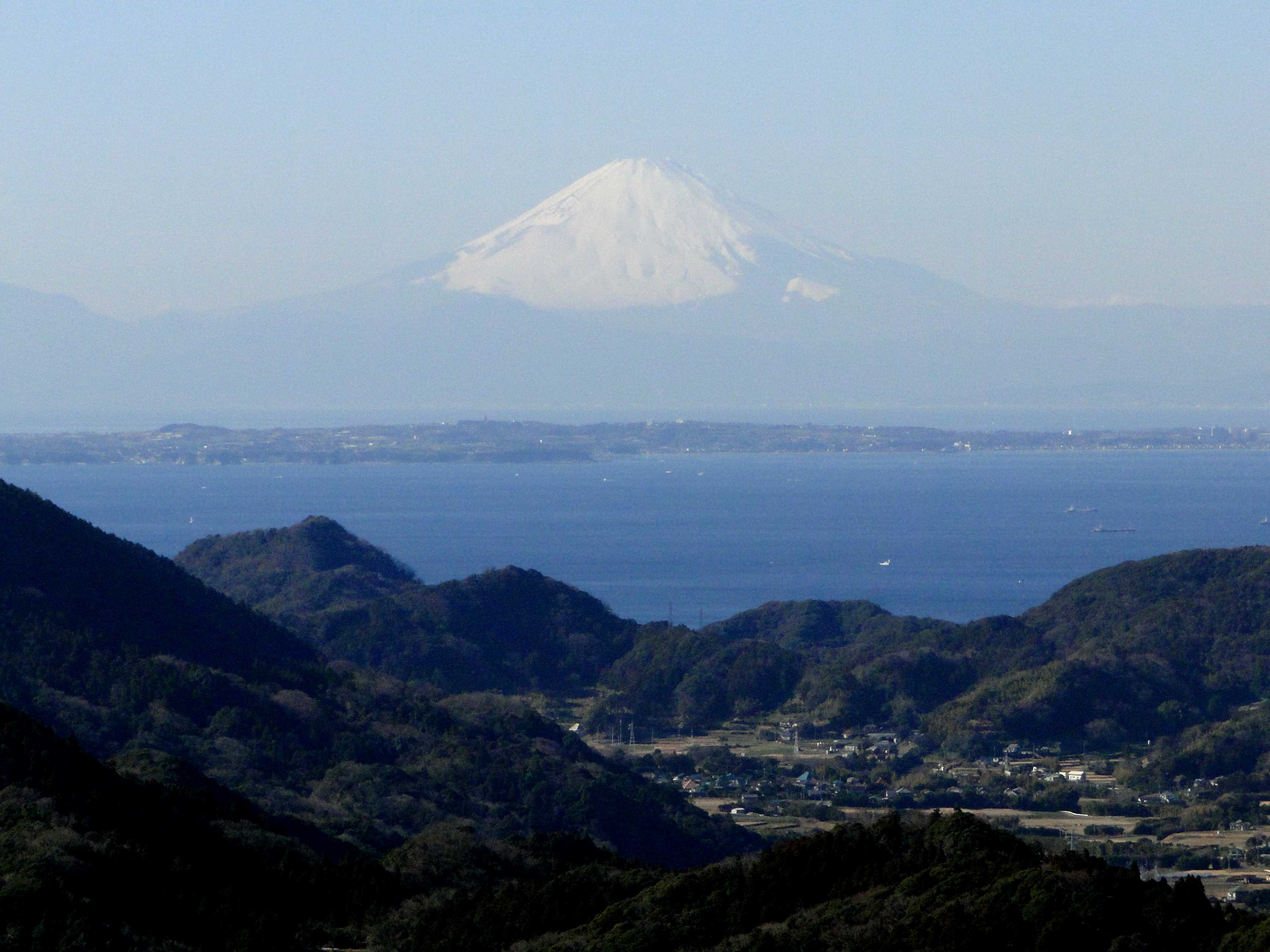
Both trail entrances are a short bus ride on the Minamiboso city bus Tomi line (南房総市営路線バス富山線) from Iwai station (岩井駅), itself a stop on the JR Sazanami limited express, a couple of hours from either Tokyo or Shinjuku station. It’s important to note that advance phone reservation is required for the Mt Iyo trailhead. Since buses are infrequent making it tough to combine both using public transport, I decided to go by car via the Tokyo Bay Aqua line between Kawasaki and Kisarazu Cities. On the way there (and back), I could also check out the view of Tokyo Bay and Mt Fuji from the Umihotaru Rest Area (meaning Sea Firefly) at the halfway point of the line.
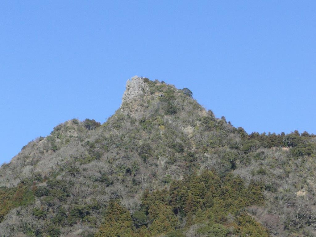
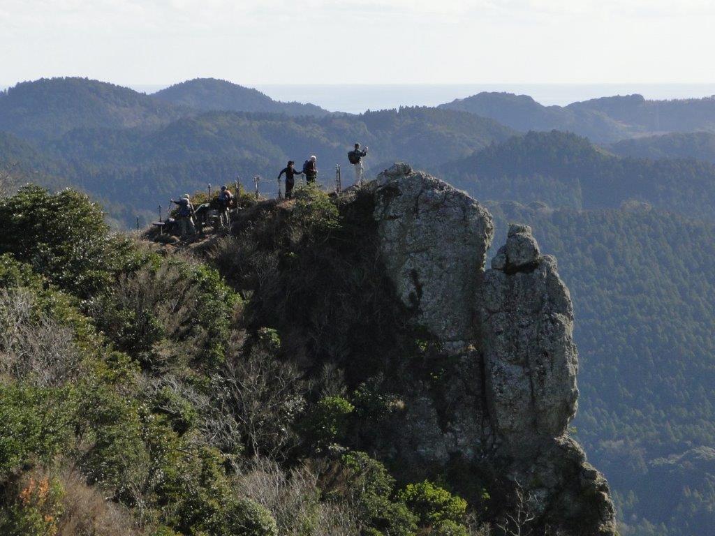
Mt Iyo is a rare rocky summit on the Boso peninsula and is the only one with the character “岳” (“take” meaning “high mountain”) in its name. The hike is a 2-hour loop from the Tenjingo (天神郷) bus stop and parking area near Heguri Ten Shrine (平群天神社), including a short round-trip between the north and south peaks. The narrow south peak (南峰) has a spectacular 360° view that includes Mt Atago, Mt Karasuba, Mt Goten, Mt Tomi, Mt Nokogiri, Oshima Island, as well as Mt Fuji; from the north peak (北峰) one can appreciate the precipitous south summit protruding from the mountainside.
Mt Iyo South Summit from Below
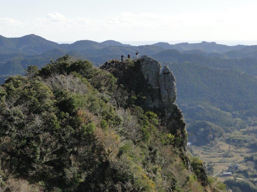
The Precipitous South Summit of Mt Iyo
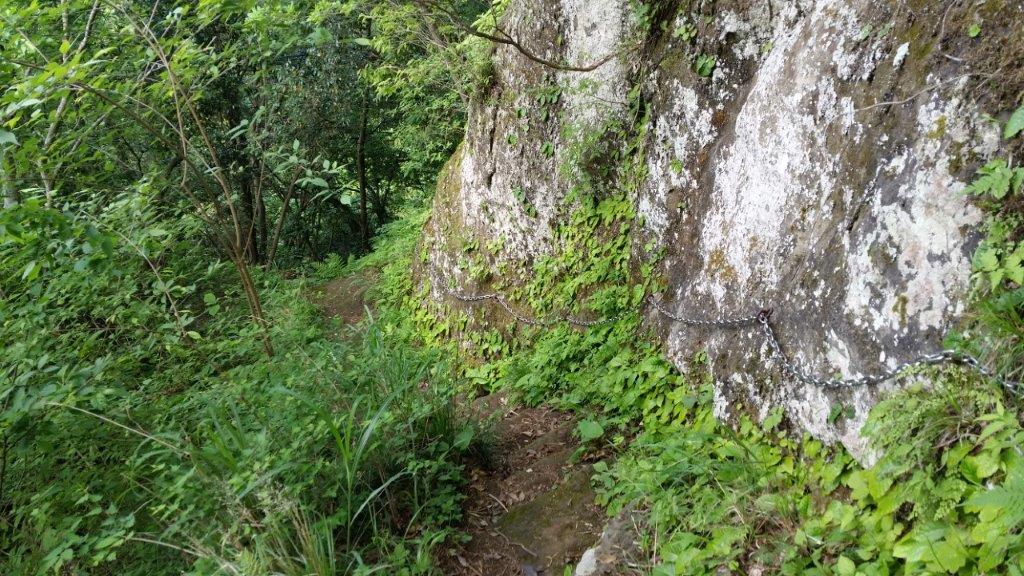
The higher sections of the Mt Iyo trail include steep, rocky sections fitted with rope and chains for safety. This hike is rated intermediate level, despite the low-elevation and short hiking time; surefootedness, upper body strength and a head for heights are recommended. The lower trail sections inside the forest follow well-maintained and easy to walk paths, including a short section along a paved road.
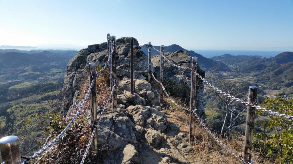
Safety Chains on the South Summit of Mt Iyo
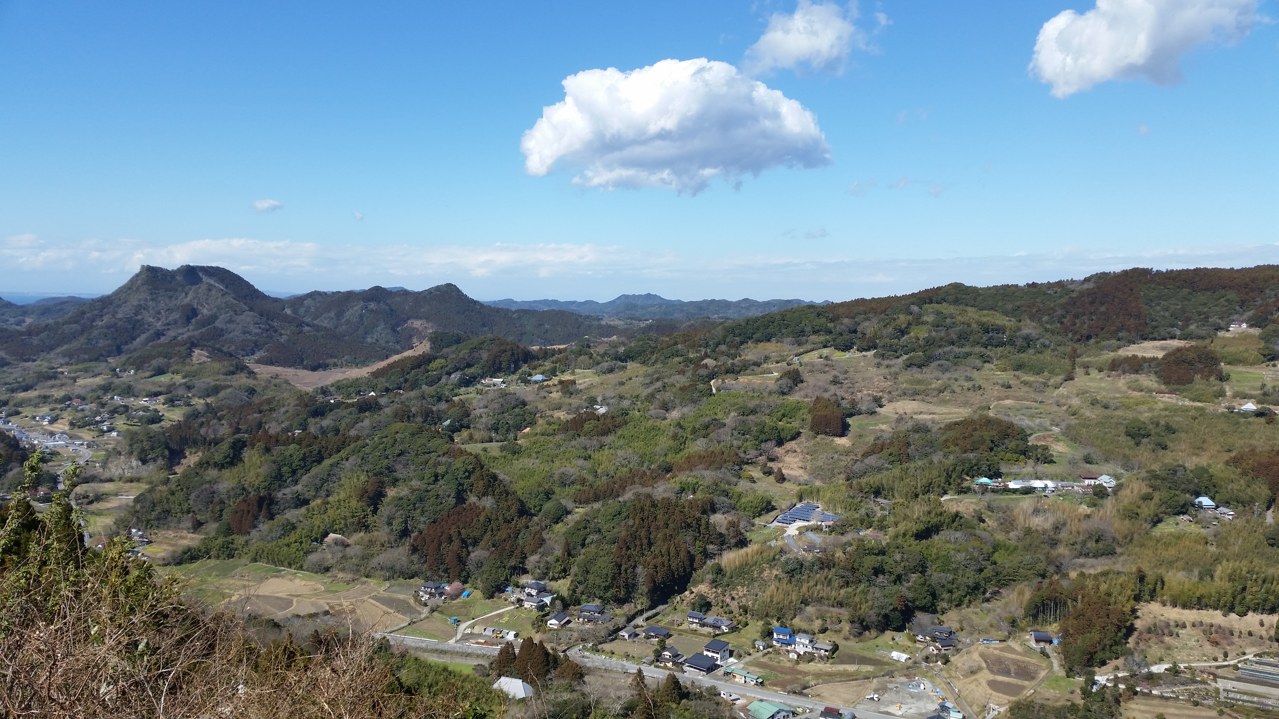
View of Minamiboso from Mt Tomi
Mt Tomi (富山 とみさん tomi-san)
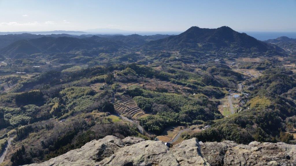
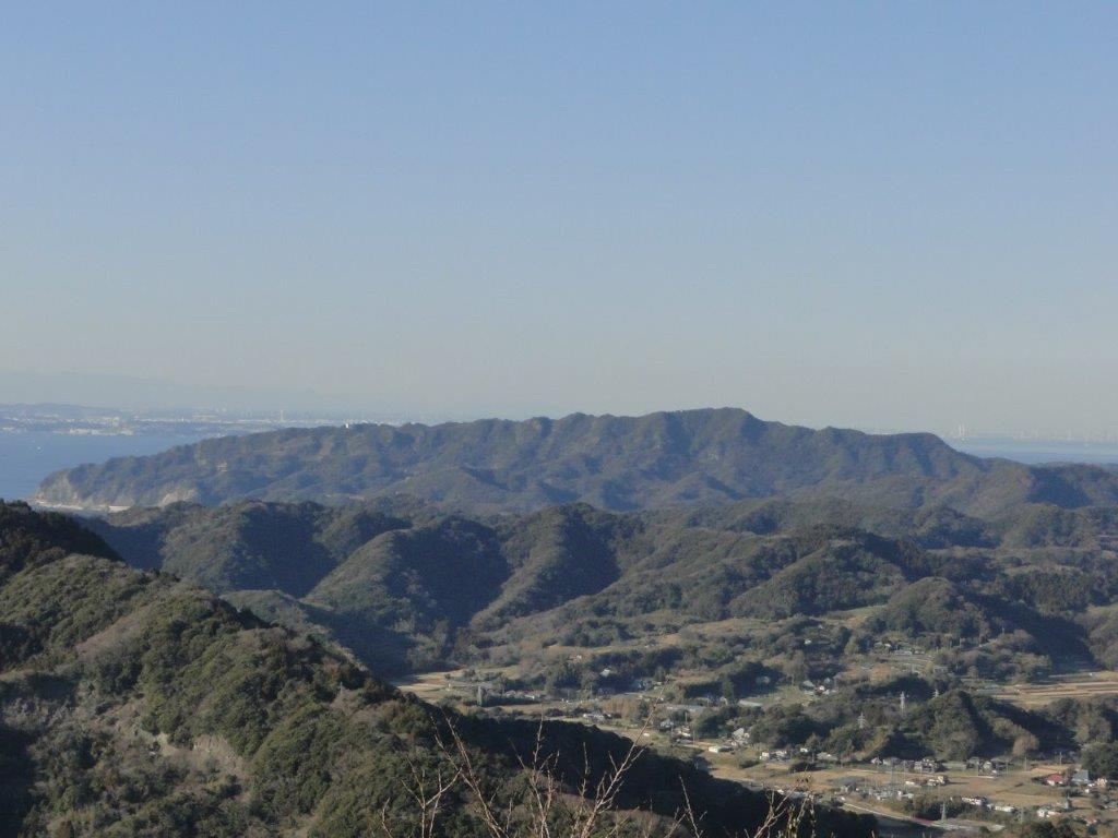
Mt Tomi is a standalone peak closer to the coastline and the 7th highest mountain of the Boso Peninsula; it’s situated inside the Tomisan Prefectural Natural Park (県立富山自然公園). The trailhead can be reached from the bus stop at the Furari Road Station (道の駅 富楽里); for the return, one can walk through the countryside back to Iwai station. This hike is a 3-hour loop along well-maintained trails, the steeper sections fitted with log steps. The highlight is the wooden observation deck on the north summit (北峰), a short roundtrip from the main trail, with a wide view on the east side of Mt Nokogiri, Mt Kano & Mt Hitobone; Tokyo Bay, the Miura peninsula, Oshima island, and Mt Fuji are also visible. Although Mt Tomi consists of two peaks, the south peak is off the trail and within the forest.
Mt Fuji from Mt Iyo
Mt Nokogiri from Mt Tomi
To make the best of the panoramic views, it’s best to attempt both hikes during the cold, clear days of winter, although each can be comfortably done between October and June; both hikes are unsuitable during the hot and humid months of summer. After a late start at Mt Iyo at noon, I was back at the car before 2pm. I then drove to the Fusehime-roketsu Parking Lot (伏姫籠穴駐車場), and headed up Mt Tomi around 2h30. I walked fairly quickly and was back at my car at about 4pm. On the way back, I was able to enjoy the sunset, as well as the night view of Tokyo City from the Umihotaru in the middle of Tokyo Bay.
Located on the Pacific side of the southern part of the Boso Peninsula, this loop hike is perfect for the colder winter months. On a clear day, it’s possible to see all the way to Mt Fuji from the top of karasubayama (烏場山), one of the many viewpoints along the way.
Hiking on the Boso Peninsula房総半島
View North from near the top of Mt Karasuba
Hiking along the Bride Route
Despite its low elevation, this 5-hour up and down route is best attempted by fit, experienced hikers, as there are no escape routes along the way. It’s recommended to do it in a clockwise direction, starting with the “hanayome” or bride route (花嫁コース), continuing with the “hanamuko” or bridegroom route (花婿コース), and ending with the “kurotaki” or black waterfall Route (黒滝コース) which passes by Kurotaki waterfall.
Hiking along the Bridegroom Route
Hiking along the Kurotaki Route
The start of the hike can be conveniently accessed on foot from Wadaura Station on the Uchibo local line, a little over 2 hours from Tokyo, thanks to the comfortable Wakashio limited express that runs between Tokyo and Awa-Kamogawa stations.
Mt Nokogiri (鋸山 のこぎりやま nokogiriyama), literally “Saw Mountain”, due to its jagged summit, is a popular sightseeing spot situated on the Tokyo side of the Boso peninsula. In the Edo period, it used to be a quarry, which explains its smooth cliffs below the top ridge. It can be reached from Hama-Kanaya station on the Sazanami limited express (about 2 hours from Shinjuku), or by using the Tokyo Bay ferry from Kurihama on the Miura peninsula, Kanagawa prefecture (40 minutes each way).
View south of Minami-Boso from the top of the ropeway
View of the Kanaya ferry port
Most visitors prefer to take the Nokogiriyama ropeway up, and then make the roundtrip along the ridgeline to the observatory at Jigoku Nozomi (地獄のぞみ), meaning ” A peak into hell”, a ledge of rock overhanging a cliff. Looking west, one can gaze upon Tokyo bay and Mt Fuji in the distance. Although an entrance fee is required, it also gives access to Nihon-ji temple (日本寺) and the Nihon-ji Daibustu (日本寺大仏), both worthwhile sights on the south side of the mountain.
A peak into hell, the highlight of a visit to Mt Nokogiri
Kannon carved into the cliffside
For those wanting more exercice, it’s possible to walk down to the base of the ropeway on the north side via the Kangetsudai trail (観月台コース), also part of the Kanto Fureai no Michi. On the way, you’ll pass by the impressive Haykushaku-Kannon (百尺観音), carved into the cliffside. For a longer hike, it’s possible to start from Hota station and approach via the Ura-Nokogiri trail (裏鋸コース, the Nokogiri back trail), leading around the back of the mountain and over its highest point. Whichever option you choose, Mt Nokogiri makes a fun and interesting daytrip from Tokyo.


![Mt Takago (330m), Kimitsu City, Chiba Prefecture, Sunday, May 15, 2016 [Map Available]](https://hikingtokyo.com/wp-content/uploads/2023/11/20160515_140745.jpg?w=1024)


You must be logged in to post a comment.