

I passed by Mt Onita about four years ago, at the end of a long traverse from Okutama. At the time, I’d noticed another trail heading down from the top and thought I could return one day and use it for a short loop hike on the same mountain. Looking at Google Maps, I saw that this trail went by another peak, the summit of which had recently been cleared of trees on the east side and thus opening up a view. As an added bonus, it was also part of the Oku-musashi long trail.
For subscribers, read this Post on Hiking Around Tokyo for a better viewing experience and the latest updates
Hiking in Oku-musashi 奥武蔵
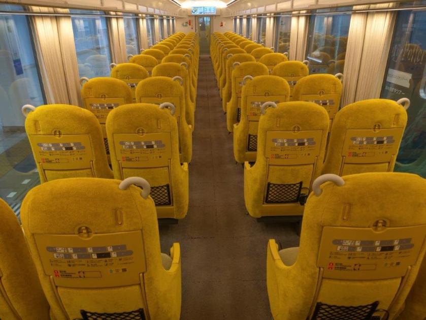
The weather forecast called for clouds and warm temperatures for most of the weekend so I decided it was a good time for some more exploring of the nearby Oku-musashi hills. To get there, I would ride the Laview Limited express to Hanno, and then, board a local bus for the thirty-minute ride to the trailhead; for the return, I’d catch the same bus, three stops up the line. I was looking forward to checking out some new trails in a familiar area.
Find Japan Hiking Maps on Japanwilds and subscribe to our newsletter

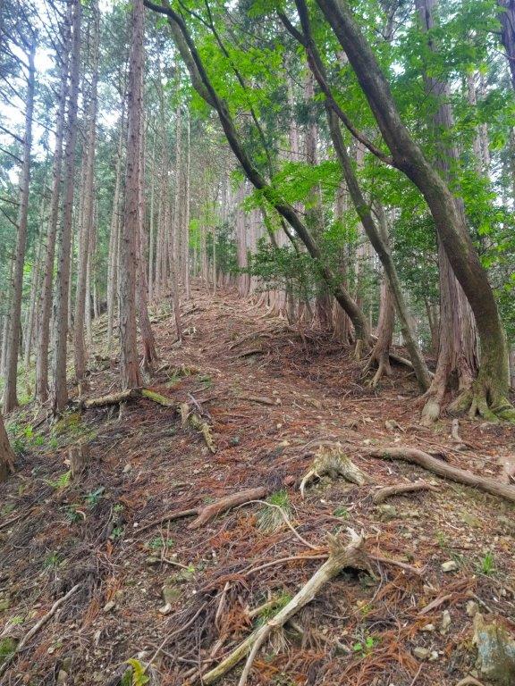
Start of the Hike (left) Heading up the Ridge (right)


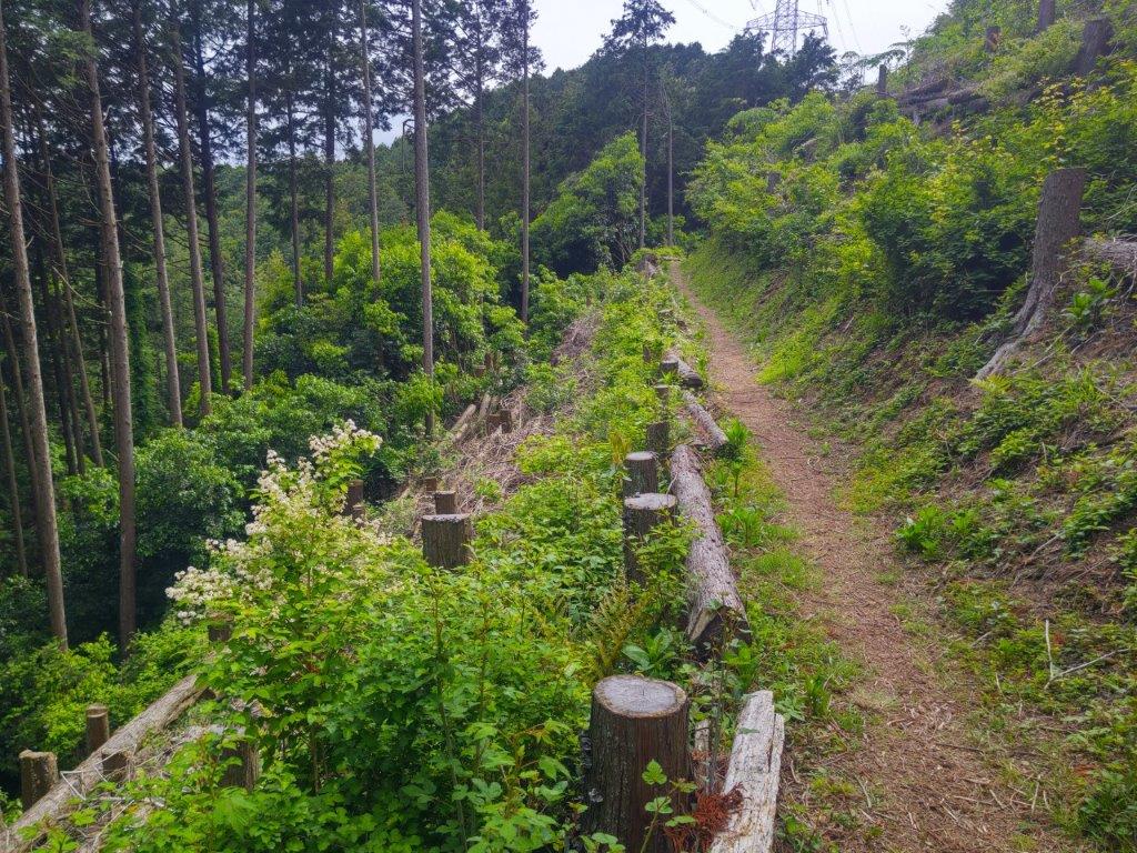
Level (left) and Downhill (right) sections past Mt Onita
It was a grey, overcast day as I rode the limited express to Hanno, more like June weather than the beginning of May. I got off the nearly empty bus at noon, and after crossing a bridge over the Iruma river, headed up a trail on the left side, past a weather worn sign warning of a bear sighting ten years ago . I felt excited to be back in nature as I followed a footpath through an open grassy space surrounded by talls cedars, all signs and sounds of civilisation instantly gone.


Level Section Before (left) and After (right) Mt Atago
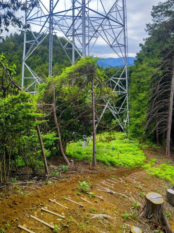

Open (left) and Forest (right) Sections on the way to the Power Station
My enthusiasm was quickly dampened as all signs of the trail completely vanished under rampant bamboo grass; when I had descended this way in the winter, the trail had been easy to follow. After a slight detour and some help from my phone GPS, I was soon back on an easy to follow trail. A little later, I started to climb a steep and root-riddled ridge through mixed forest. I had rushed down this section in semi-darkness back in 2021 so it felt like it was first time to walk this trail.

Open Grassy Space at the Start of the Hike

Climbing a Steep and Root-riddled Ridge
It was surprisingly humid for this time of the year; I regretted not bringing a change of clothes for the return as I started to feel that sticky sensation one usually gets in the rainy season. One hour after setting off, I was standing on the top of Mt Onita (大仁田山 おおにたやま oonita-yama) for the second time. The view was less impressive than I had remembered: only a narrow section of central Tokyo around the Sky Tree could be seen between two tree trunks. I continued without a break, hoping for a better view at the next summit, now leaving the route followed on my previous hike.

View South near Ibotori Jizo
View East from the Top of Mt Atago
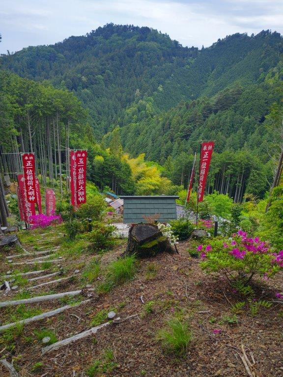
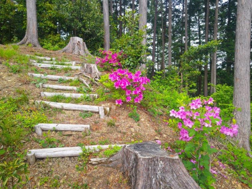
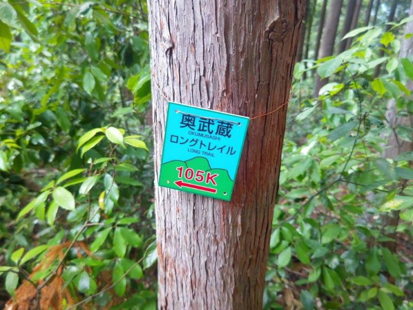
Almost at once, I got disoriented by the twisting nature of the hilly terrain, compounded by local trails and signposts for places not shown on my map. I was surprised by how much geographical complexity could be packed in such a tiny wooded area. I was equally surprised by the variety of signs competing for my attention, ranging from the beautiful Oku-musashi Long Trail ones to some crude homemade efforts. Relying on my GPS again, I eventually got back on track. At 2pm, I reached a crossroads at Ibotori Jizo (いぼとり地蔵). Although my route turned left, I decided to check out the trail going straight. Very soon, I reached a view on the south side at the top of some log steps.
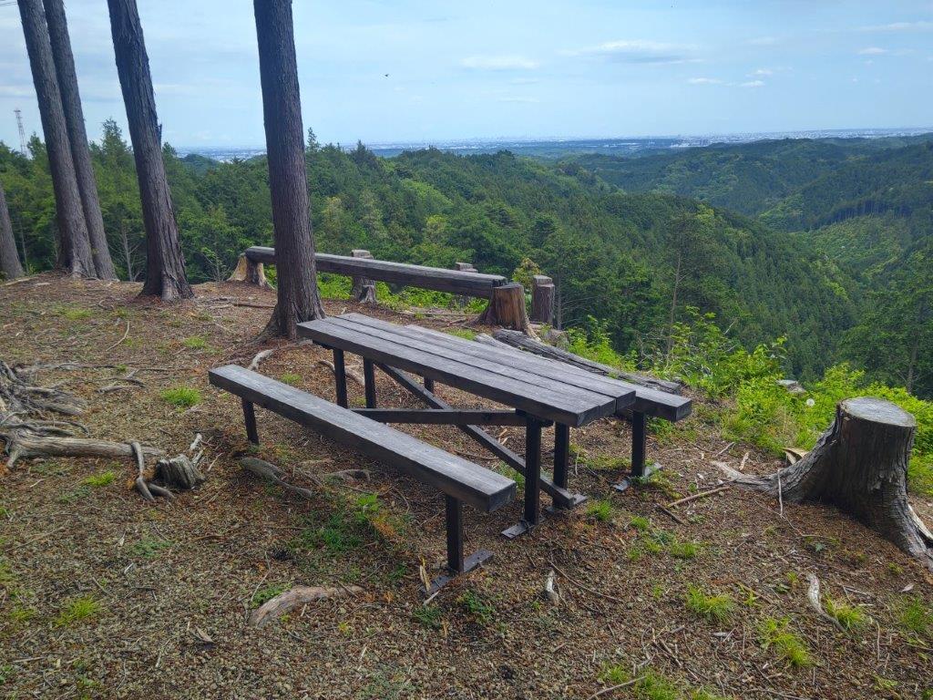
Summit Table on Mt Atago
Path around the Top of Mt Atago
I could see the undulating ridgeline extending east from Mt Honita, part of the Nariki Ridge Hiking Trail (成木ハイキングコース) which I hope to do one day. Closer by, I could see the red banners for the small red Inari shrine situated a few meters below. After enjoying this unexpected view and observing a butterfly suck up nectar of some purple Azalea (“tsutsuji”), I headed back to the crossroads and turned right along a level path. I soon arrived at a fork where I headed up a steep unmarked track on the left, ignoring the other branch hugging the mountain side. After a short climb, I reached the top of Mt Atago (愛宕山 あたごやま atago-yama), a common mountain name in Japan.
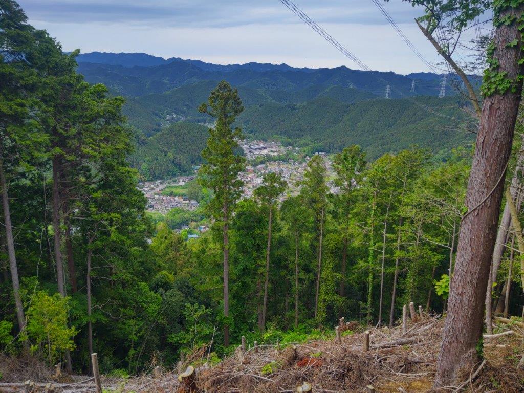
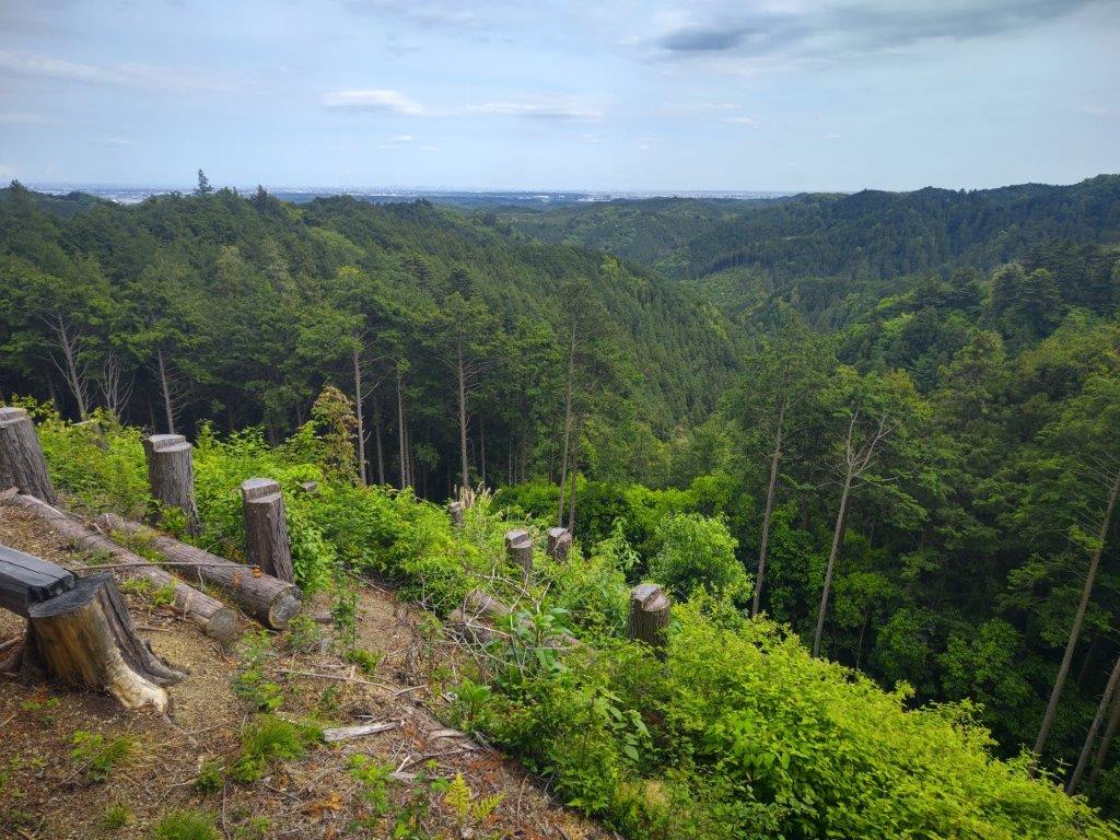
Looking Down at the Iruma River Valley
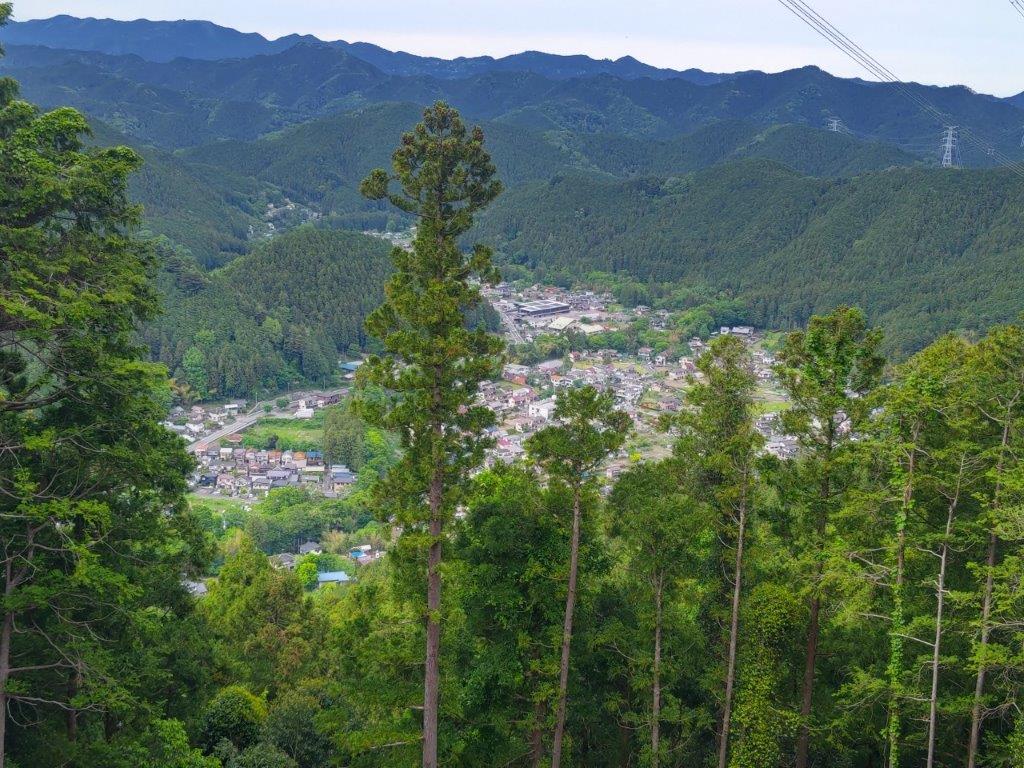
Oku-musashi Mountains in the Background
I was glad to have the top to myself although at this precise moment I heard voices float up from below, followed shortly after by the apparition of a couple of hikers, the first and only other hikers I saw all day. They didn’t dwell and a little later I was by myself again. Directly ahead, I could see the Kanto Plain and the tall buildings of Tokyo, flanked by the green hills of Oku-musashi on each side. It was past 2pm, so I sat at the summit table and had a late lunch with a view and birdsong in the background. Half an hour later, I set off again. After a short descent, I merged with the level trail left earlier, following my GPS down the mountain, rather than the signs.

River Valley near the End of the Hike

Crossing the Iruma River at the End of the Hike
I made one exception near the end of the hike: since I was ahead of schedule, I made a round-trip along a trail signposted for “Hendenjo” (変電所), a Tepco power station according to Google Maps. I only went as far as a viewpoint of the Iruma River Valley near an electric pylon before turning back. At 3h30, I reached a stream at the valley bottom, and shortly after, emerged from the forest at a spot called Shijuuhachi-magari (48 turns), helpfully indicated by the solidly built Oku-muashai Long Trail post. After a short walk through a residential area, I reached a bridge over the Iruma river, beyond which was the bus stop. Less than an hour later, I was comfortably seated on the practically empty Laview limited express for the forty-minute ride back to Ikebukuro.
Watch a Video of the Hike
Watch the Video of the Hike on YouTube


See a Slideshow of More Pictures of the Hike
