
I had spotted this station to station trail the previous year while searching online maps for new hikes; although mostly in the forest, it had one good viewpoint of the Southern Alps on the west side. Online reports showed that the Autumn leaves had reached their peak in the area, and with the excellent weather forecast for Sunday, sunny with little wind, I decided it was time to make the long trip to this remote corner of Yamanashi prefecture, last visited in 2019.
For subscribers, read this Blog Post on Hiking Around Tokyo for a better viewing experience and the latest updates
To get to the start of the hike, I’d once again ride the Chuo line Limited express to Kofu, and there, transfer to the infrequent Minobu line. I’d arrive around noon, but this was fine since the hike was on the short side and ended at Shimobe Onsen, where I could relax in a hot bath while waiting for the train back to Kofu. Incidentally, Minobu Town is where Yuru Camp mostly takes place, so I was looking forward to revisiting an area I’d become familiar with through the Yuru Camp manga and anime.
Find Japan Hiking Maps on Japanwilds
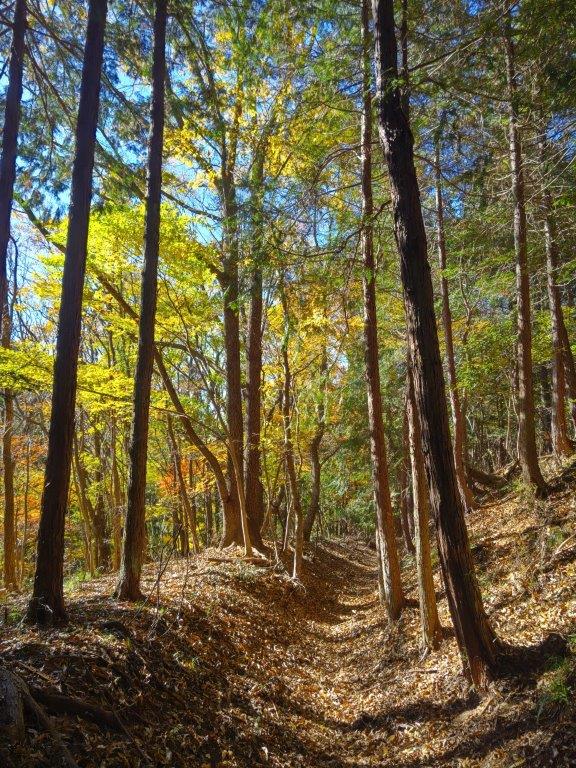

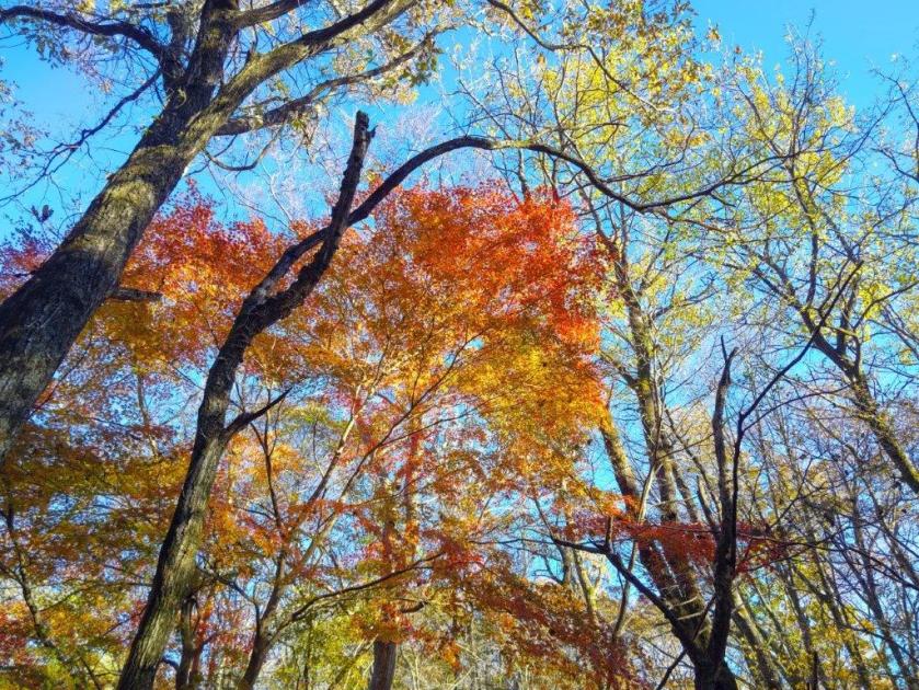
Near the Start of the Hike (left) Past the Mt Goro Viewpoint (right)


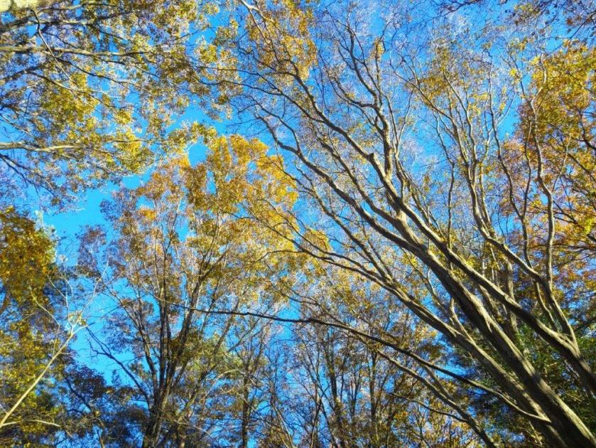
Early Afternoon light (left) Leaning Trees (right)
It was another blue-sky day as I rode the limited express in a straight line westwards, from the Kanto Plain to the Kofu Basin. After transferring to a local train on the Minobu line, it was another one hour ride, this time southwest and then south, the railway following the Kamanashi river, as it squeezes between the Southern Alps and the Misaka Mountains. I was the only passenger to get off at the unmanned Kai-Tokiwa station around noon. I quickly found my bearings and followed a road westwards, to a small graveyard with a Kannon Statue.

View of the Tokiwa Area and Mt Goro from the Kannon Statue

Afternoon Sun and Autumn Leaves
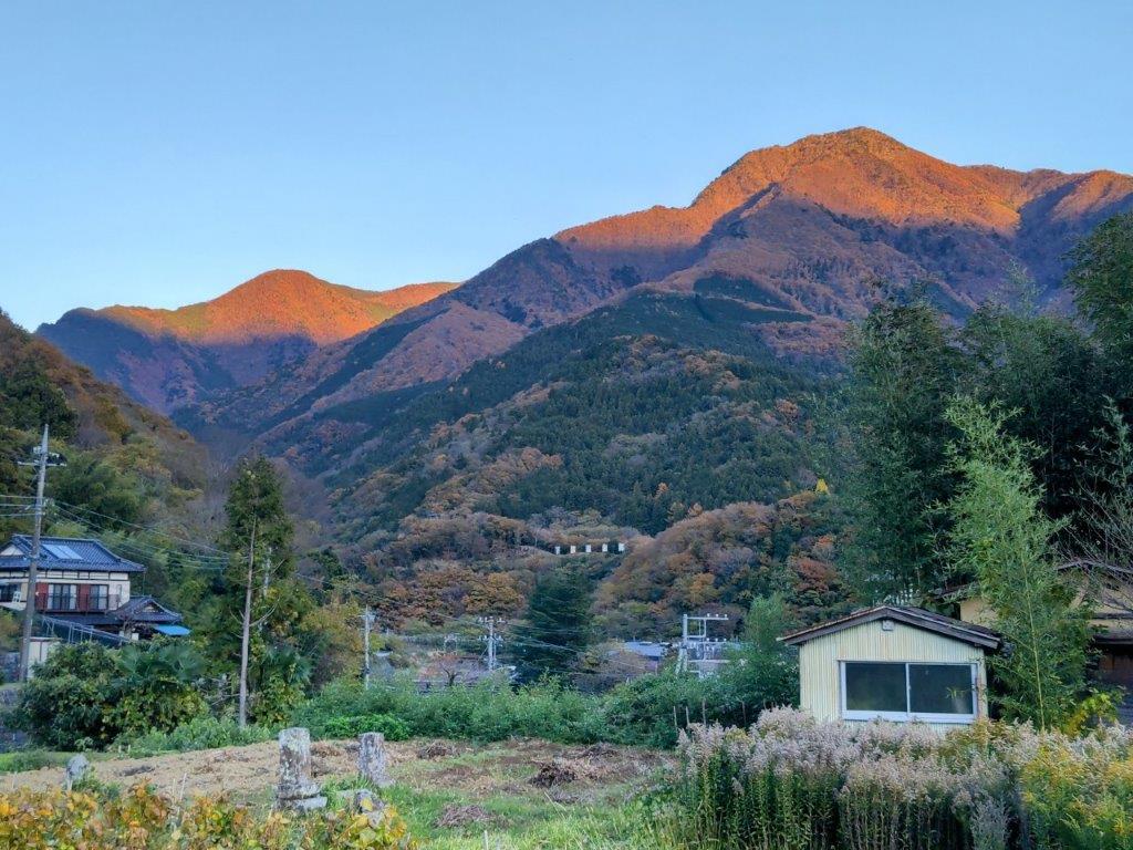
Turning around, I enjoyed the first view of the day: the Tokiwa area with the summit of Mt Goro (五老峰 goroubou) rising behind. I located the start of the hiking trail and headed up the mountain side through the forest. The trail soon leveled and was bathed in the afternoon sun, enhancing the yellow colours of the surrounding Autumn leaves. I wondered why no one else was walking this path as it seemed like the perfect time of the year for this hike. I soon passed Hatouchi Pass (鳩打峠), and at 1pm, arrived at a bench with a view on the east side.

View of Mt Goro past Hatouchi-toge
View of Yatsugatake below the Summit of Mt Daigo
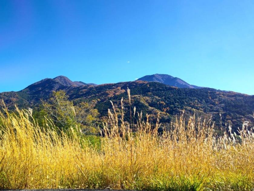
From this higher vantage point, I now had a proper view of Mt Goro. For such a local trail, I was surprised to see how well-maintained it was, with good quality signposts, panels with tree names and even distance markers to the top. I heard deer sounds nearby but never saw any, an indication of how few people pass through. I had another view, southwards this time, of the foothills of the Southern Alps, Yatsugatake, its highest peaks white with snow, and Mt Kaya. After a steep but short climb, I reached the top of Mt Daigo (醍醐山 だいごやま daigo-yama), a Buddhist term meaning nirvana.
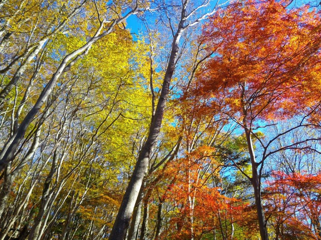
Yellow and Red Leaves near the Summit of Mt Daigo
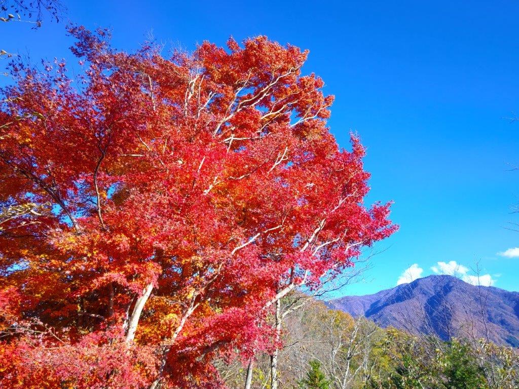
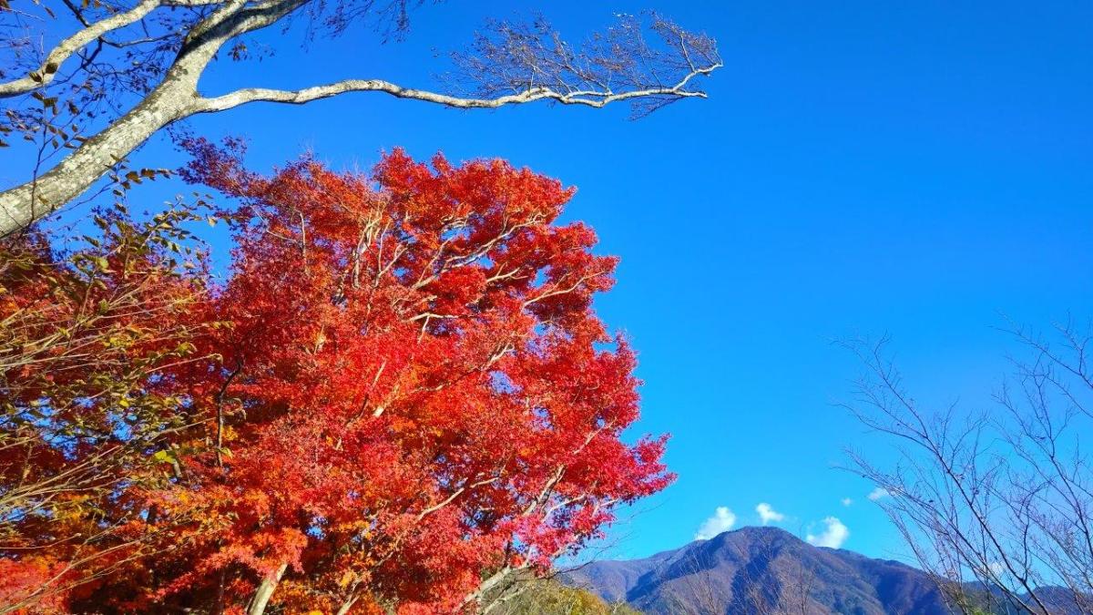
Red Maple & Mt Goro near the Mt Daigo Viewpoint
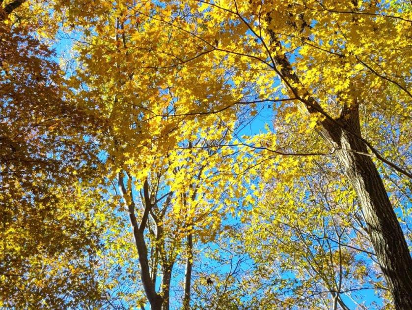
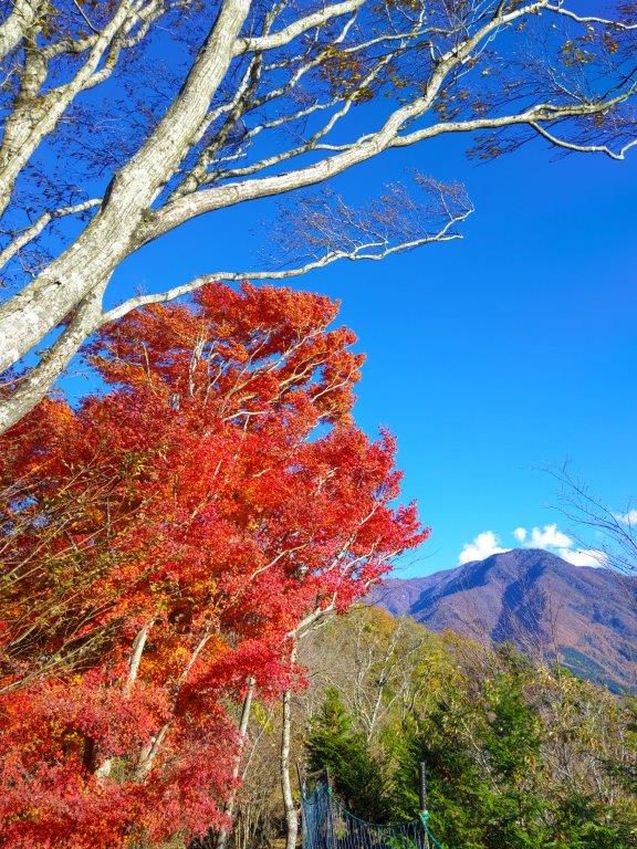
Standing on top of “Mt Nirvana”, I didn’t feel especially enlightened, under the shade of trees with not even a hint of a view. I was delighted by the signboard showing a hand-drawn bird’s-eye view of Mt Daigo (also online, Japanese only). Following the signs for the observatory, I walked downhill in a westward direction, surrounded by stunning autumn leaves, the reds and yellows swaying in the breeze. I reached a narrow ridge, the vegetation shrinking away on both sides and letting the sunlight through. I stopped near a huge “momiji” (Japanese maple) and turned around.

View of Mt Minobu (left) & Mt Shichimen (right) from the Mt Daigo Observatory
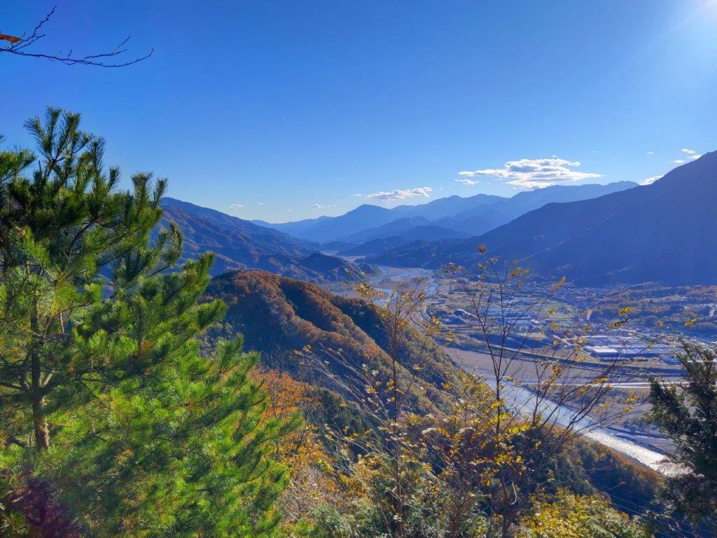
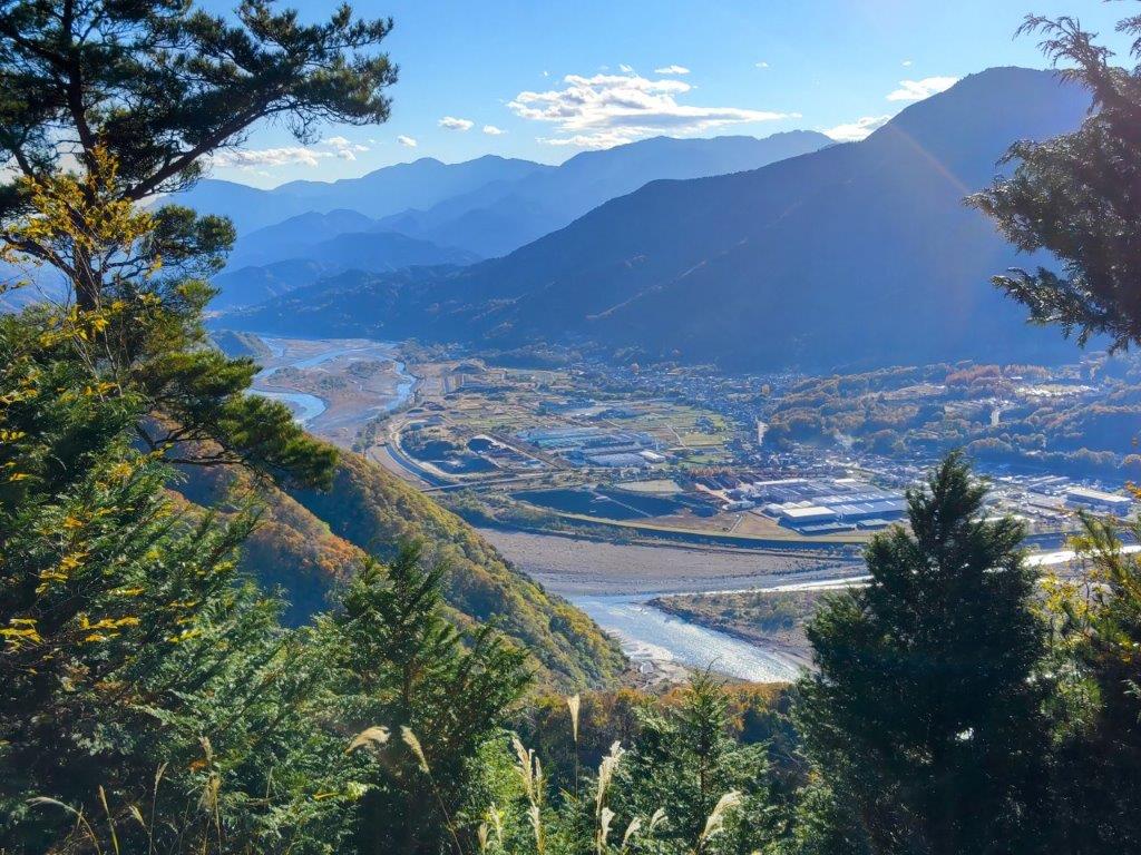
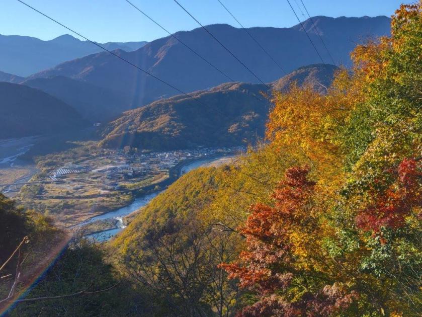
View of the Fuji River Valley from the Mt Daigo Observatory
I had probably the best view of the day, the vivid red leaves sharply contrasting with the light blue sky, the now familiar triangular summit of Mt Goro in the background. I moved further along the ridgeline till I reached a signboard next to a gap in the vegetation on the south side, the Mt Daigo Observatory (醍醐山展望台), in truth more of a viewpoint. Directly ahead was Mt Minobu with the massive bulk of Mt Shichimen lurking behind; on the west side was Mt Zaru, the highest peak in the vicinity; far away to the south, I could just make out the top of Mt Takadokkyo. It was already 2pm, so I settled on a comfortable rock for a lunch break.
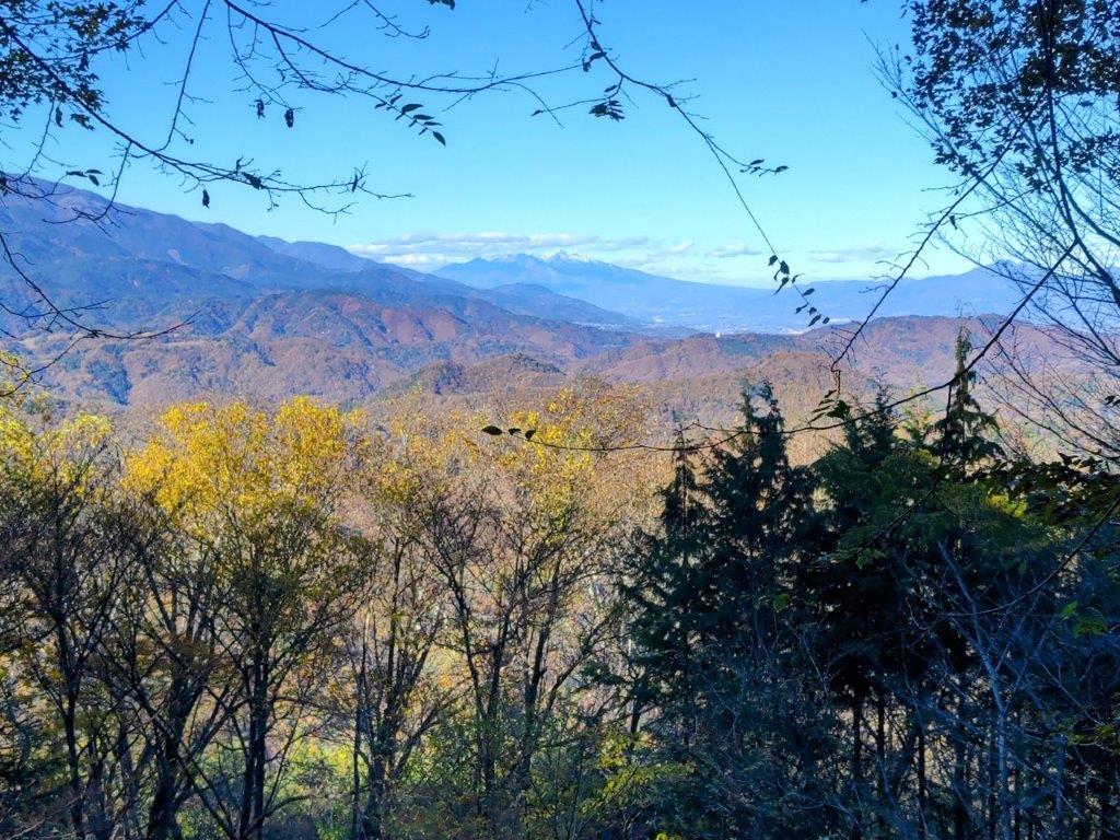
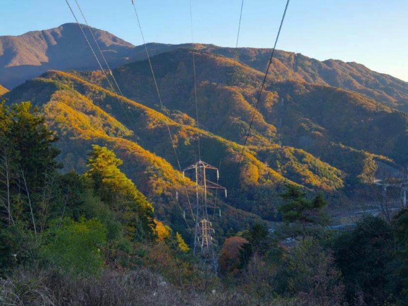
View South of the Japanese Southern Alps

View Northwest of Mt Fujimi from Daigo-toge
I enjoyed the view of the Fuji river sparkling under the sun, as it snaked its way towards Suruga Bay. Sadly, Mt Fuji was missing, so close yet invisible, one of the rare blind spots in the area. I was only halfway through my hike so at 2h30, I set off again, retracing my steps to the summit and heading down a faint path on the south side. The descent turned steep, down log steps half buried in dead leaves, rope attached to adjacent trees for safety. A little after 3pm, I reached the lonely Yama-jinja shrine, its access blocked by the huge trunk of a fallen tree. This was also the junction for the second mountain of the day; I went right, along a path through some bamboos, leading to Daigo Pass (醍醐峠) and the final viewpoint of the day.

Mt Daigo in Orange near Mt Nishi
Looking north, I had an amazing view of the orange-coloured mountain side of Mt Daigo with the dark shape of Mt Fujimi rising like a wall in the background; in the valley below, houses filled the narrow space between the Fuji river and the foothills. To the south was Mt Goro again, small puffy clouds passing over its summit. I dived back into the forest, and soon reached the flat top of Mt Nishi (西山 にしやま nishi-yama), completely in the trees. It was 3h30, just one hour to sunset, so I hurried back to the junction and headed down, past an abandoned house, down a switchback path through a dark forest, along a stream over a couple of wobbly bridges and out through an electric gate. At 4pm, I emerged onto a road where I turned left, soon walking through an inhabited area.
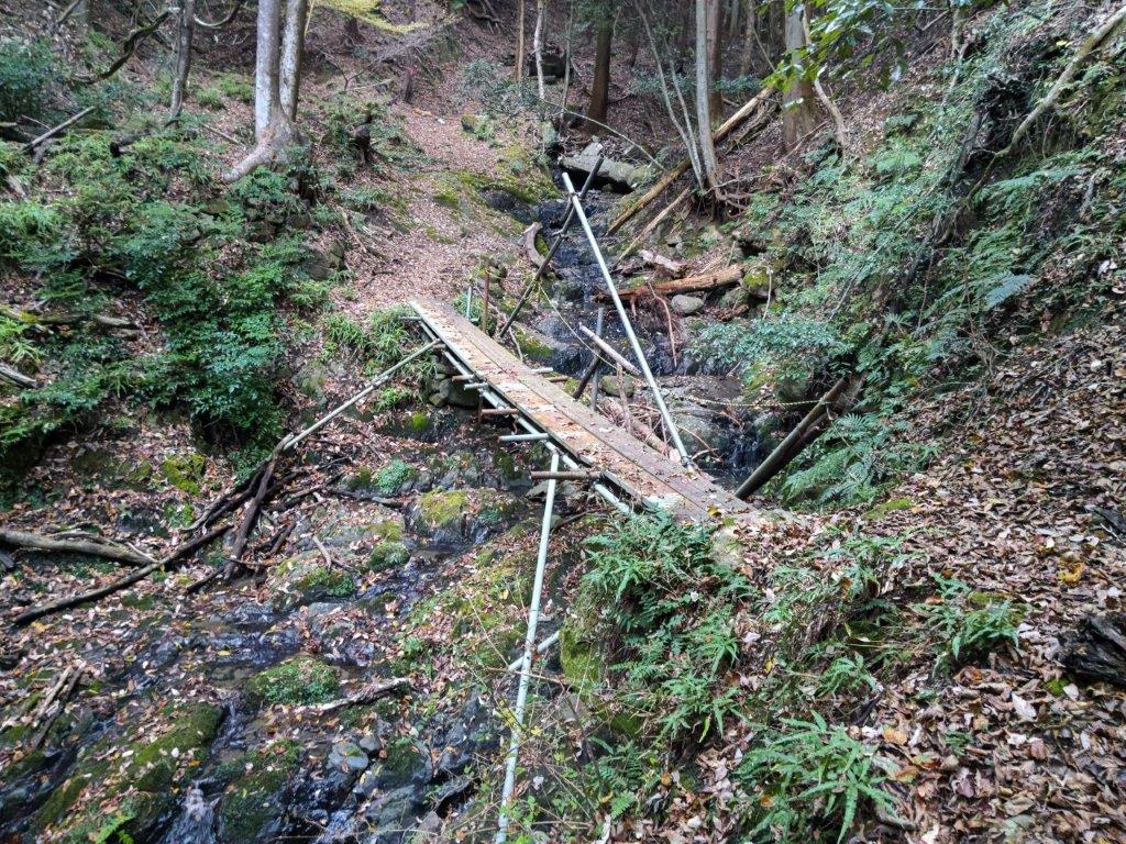
Spooky Bridge near the End of the Hike
Today’s “beacon”, Mt Goro near Shimobe Onsen
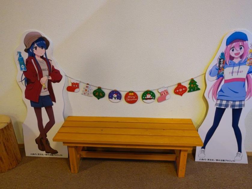
I was now walking straight towards Mt Goro, its tip lit up light red in the last light of the day, looking very much like the beacon that had guided me throughout the day. I turned left onto a main road, and after crossing a bridge over the Fuji river, arrived at Shimobe onsen, where I indulged in a hot spring bath at the modern Shimobe no Yu, just across the tracks from the train station. As I exited the hot spring facility, I was delighted to see life-size cutouts of characters from Yuru Camp. A little after 5pm, I boarded the faster express train for Kofu, and there, transferred to the limited express for the 90-minute ride back to Shinjuku.
Thank you for reading – make sure to check out the Japanwilds website for more hiking blogs and maps
Watch a Video of the Mt Daigo Hike
Watch the Video of the Hike on YouTube


See a Slideshow of More Pictures of the Hike
