

I had last visited the Northern Yatsugatake Mountains 6 years ago. This time, I wanted to check out two small lakes above 2000m and situated between Mt Tengu and Mt Kitayoko; I also wanted to explore the “Moss Path” near Mugikusa Pass. I’d start from the top of the Kita-Yatsugatake ropeway and walk counterclockwise around Mt Shimagare and Mt Chausu, climbed 10 years ago. Back then I stayed overnight at the Shimagare Lodge. However, in October the ropeway operated till 5pm, late enough for a day trip.
Hiking in the Yatsugatake-Chushin Kogen Quasi-National Park 八ヶ岳中信高原国定公園
Hiking on Kita-Yatsugatake 北八ヶ岳
To get to the start of my hike, I’d take the Chuo line limited express to Chino station and then catch an Alpico bus for the 40-minute ride to the ropeway; I’d use the same route for the return. The weather was supposed to be mostly cloudy, but no rain was forecast, maybe even a little sunshine in the late morning. I decided to head out as the next weekend the ropeway would run only till 4pm; also my main purpose was to see the lakes and mossy undergrowth. I was looking forward to what would probably be the last high-altitude hike of the year.
For subscribers, read this Blog Post on Hiking Around Tokyo for a better viewing experience and the latest updates
The hiking trails followed on this hike can be found on the Japanwilds map for Mt Shimagare and Mt Chausu, available for free with the Avenza app
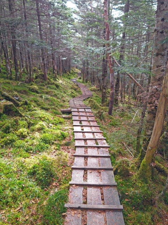
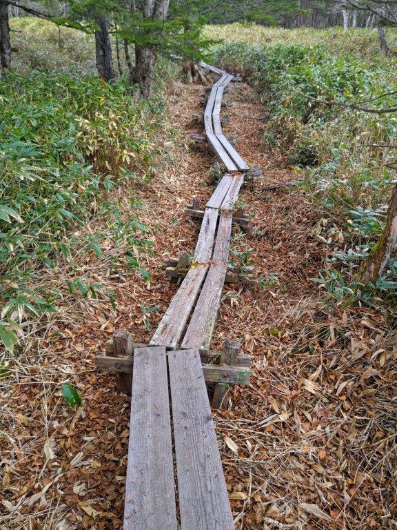
Forest Bathing Observation Deck Route from the Kita-Yatsugatake Ropeway (left) Moss Path in the Yatsugatake Nature Recreation Forest (right)
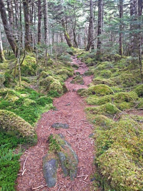

Moss Path in Onodachi Forest (left) Walkway in Kokuyo Forest (right)
The sun was still shining as I rode the limited express to Chino, arriving there a little past 9am. From the bus, I could see the autumn colours around Tateshina lake, and I made a mental note to plan a hike there next year. Shortly after 10am, I was standing inside the full ropeway cabin (fits 100 people) as it rose from 1800m to over 2200m. After getting ready, I took a few minutes to enjoy the view of the South and Central Alps from the outside terrace; directly behind was the rounded top of Mt Shimagare.

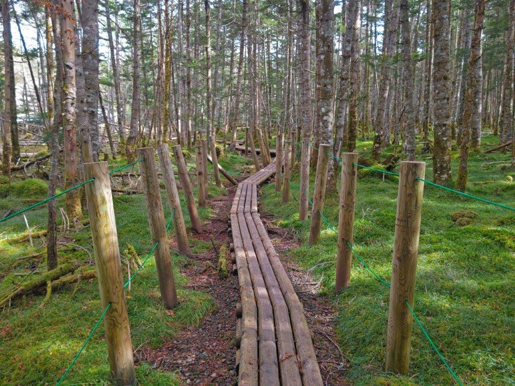
Shirakoma Inner Garden (left) Walkway through Chamizu Forest (right)

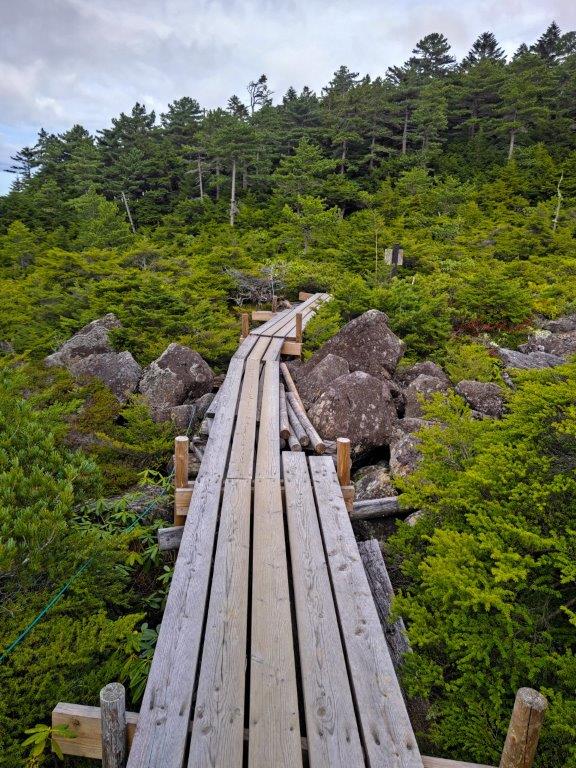
The Ogawara Pass Forest Road (left) Walkway to Ama-ike Pond (right)
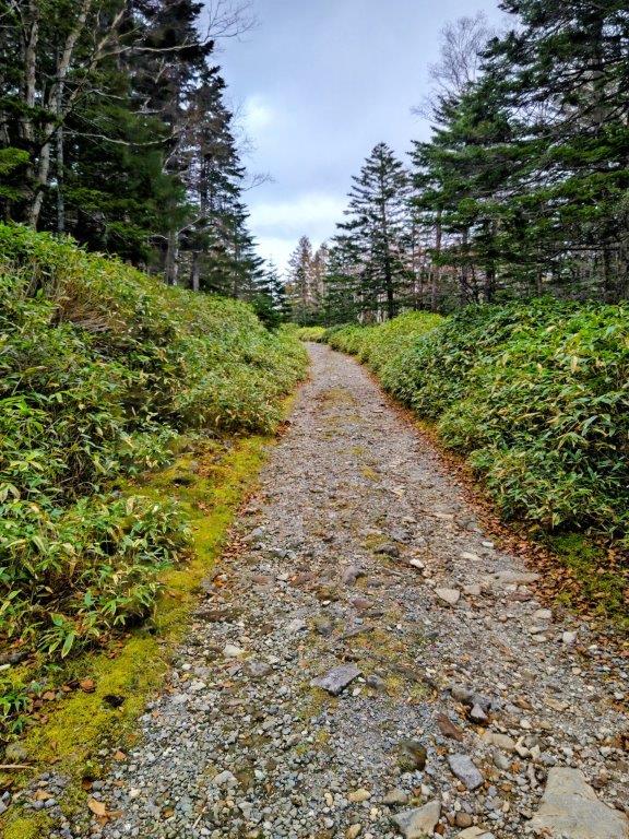
The mists had started to roll in, Mt Kitayoko and Mt Tateshina were already hidden in thick clouds. I set off before the next load of ropeway passengers arrived at 11am, and made my way along the Forest Bathing Observation Deck Route (森林浴展望台コース shinrinnyoku tenbodai kosu). I had done this route before but in reverse. I soon reached an open space where I had a view of the grassy highland of Kirigamine. After 11am, I passed the observation deck, the view partly obscured by trees, and left the wooden walkway for a proper hiking trail.

Walkway to Ama-ike Pond (left) Path for Amaike-toge (right)


Before Amaike-toge (right) After Amaike-toge (left)
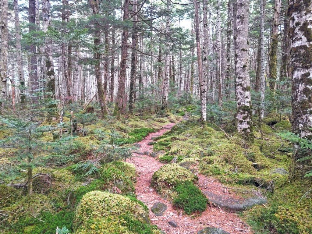
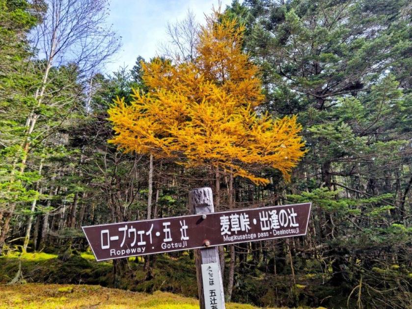
The trail was rockier than I had remembered and my progress was slower than expected. At 1130, just past the Go-Tsuji intersection, I arrived at an open rest place opposite a beautiful bright orange larch, one of the few autumn leaves I saw on today’s hike. Soon after, I entered the Yatsugatake Nature Recreation Forest (八ヶ岳自然休養林 Yatsugatake shizen-kyuyo-rin) and I found myself walking through an enchanting forest with mossy undergrowth, the path now aptly named “Koke no Michi” (苔の道) or the Moss Path. Around this point, today’s hike diverged from the one I had done ten years ago.
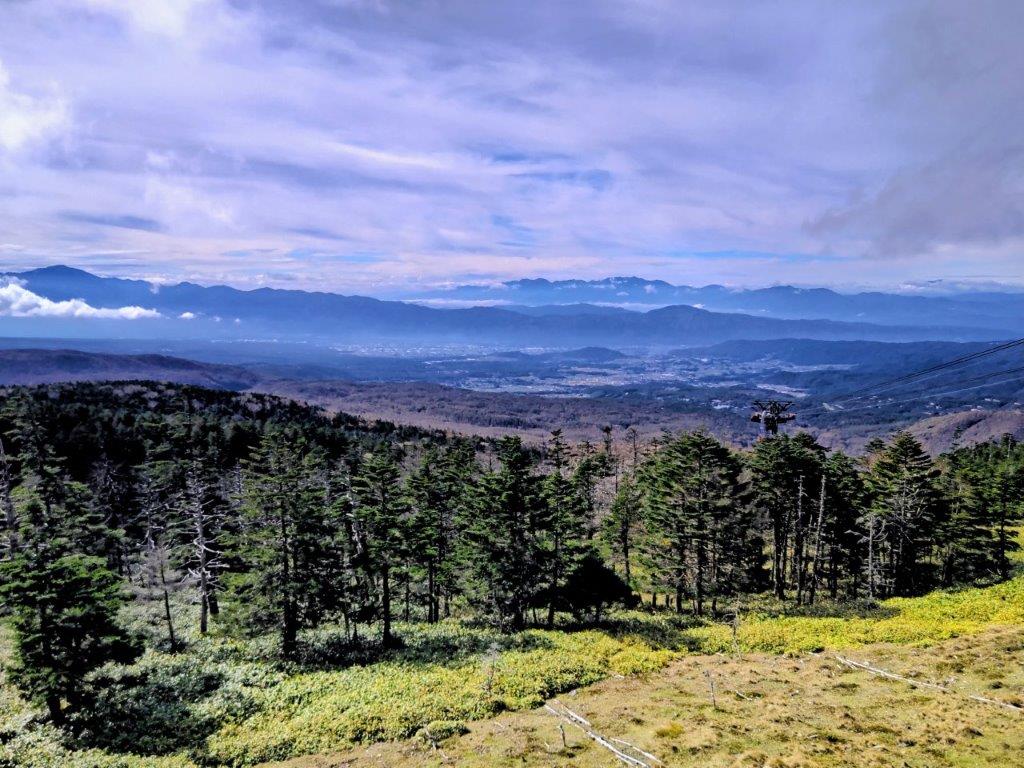
Central Alps from the Top of the Kita-Yatsugatake Ropeway

Start of the Shinrinyoku Tenbodai Route
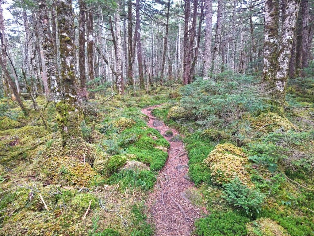
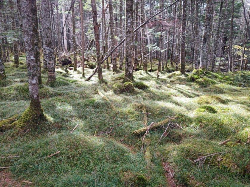
I was amazed by the sheer amount of bright green moss covering everything close to the ground; perhaps there was more than usual due to the higher than average rainfall this year. At noon, I crossed the busy Marchen Road connecting Chino city with Sakuho town, and continued along the Moss Path, now inside the Mist Garden (狭霧園地 sagiri-enchi), although no mist was hanging around at the time. After a short climb, I arrived at Onodachi Forest (斧断ちの森), mostly made up of slender birches.
Walking through the Mist Garden
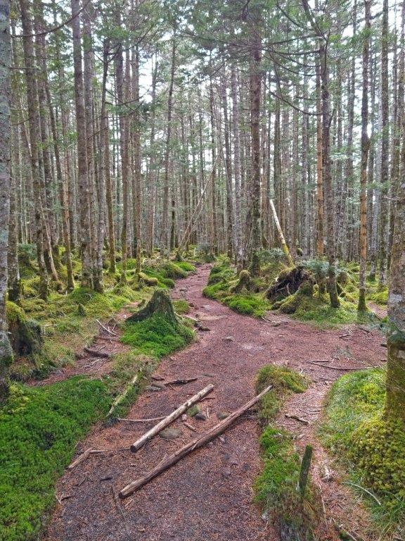
Passing through Onodachi Forest
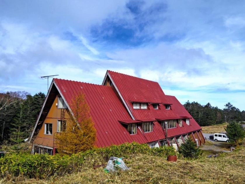
I enjoyed the combined effect of the white birch trunks and light green moss on my solitary stroll through the higher reaches of the Yatsugatake-Chushin Kogen Quasi-National Park (八ヶ岳中信高原国定公園). At 1230, I passed the bright red roof of the Mugikusa Hut; beyond, the top of Mt Chausu was temporarily free of clouds. I turned left onto a side trail leading through Kokuyo Forest (黒曜の森), the name referring to a dark green coloured moss. I then exited the forest and entered the Shirakoma Inner Garden (白駒中庭), blue patches appearing in the sky above, giving me hope for the afternoon.
Following the Moss Path

Entering the Shirakoma Inner Garden
I was thankful for the wooden walkway allowing me an easy passage above a tangle of rocks and creeping pine (這い松). After a short up and down through Shirakoma Forest, I finally arrived at Shirakoma Pond (白駒池). It was past 1pm so I took a lunch break inside a pond-side open shelter. Here, I had rejoined the crowds so I decided to skip a walk around the pond, and quickly headed back to Marchen Road which I followed to Mugikusa Pass. There, I ducked down a small trail on the right, leading through Chamizu Forest (茶水の森), all by myself once again.

Beyond is Shirakoma Forest and Shirakoma Pond

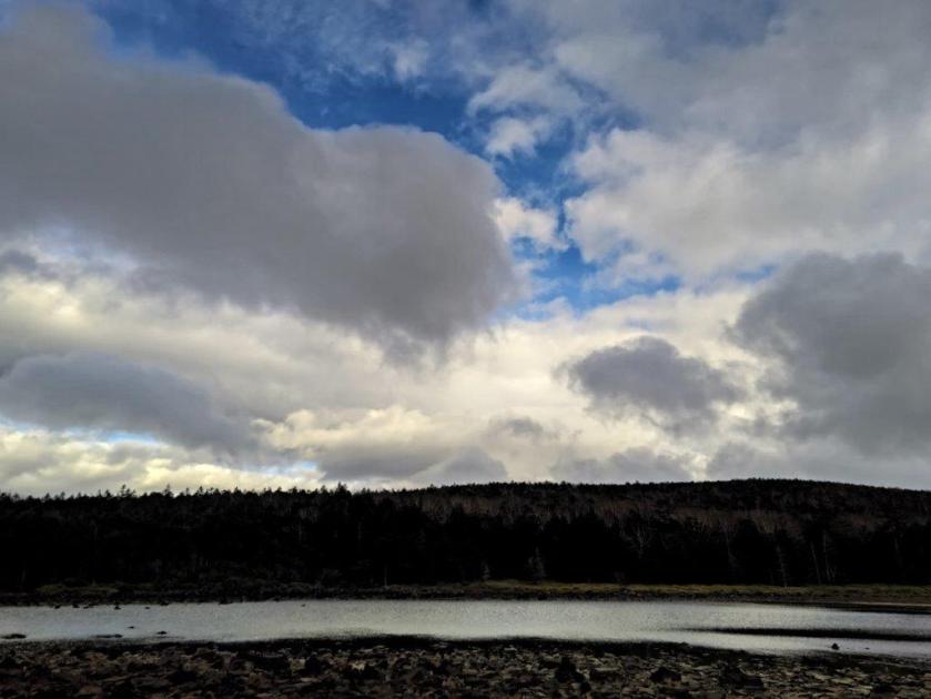
Grey Clouds above Shirakoma-ike Pond
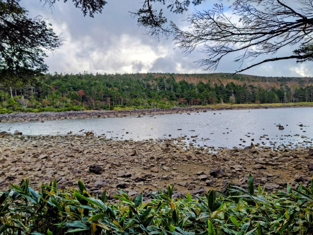
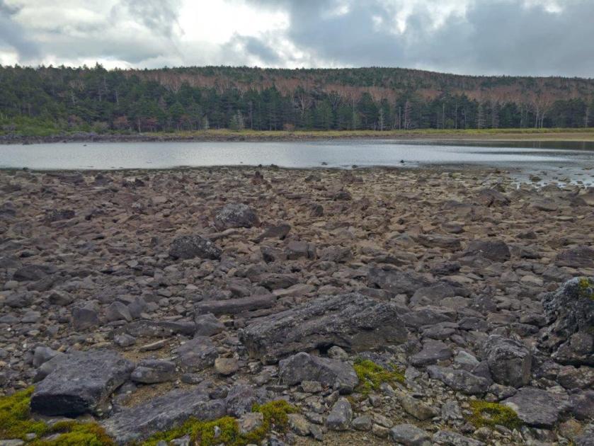
The clouds had wrestled back control of the skies and it started to look like it might rain after all; this was also the most isolated part of the hike through somber and silent forest. I quickened my pace and by 2pm reached the Ogawara Forest Road (大河原林道) although I left it shortly after for yet another walkway. Half an hour later, I reached the far side of Ama Pond (雨池), meaning rain pond. It was smaller than indicated on my map and most likely reaches its full size after heavy rain or the spring snowmelt.

Walkway to Ama-ike Pond

Far Side of Ama-ike Pond
I was startled by a loud barking noise and looking at the opposite shore, I saw deer jump away into the forest; I wasn’t alone after all. I was back on schedule so I decided to walk around this pond. On the other side, I had a better view of the blue pond water; above the trees on the opposite bank, low clouds were blowing by quickly, a sure sign of a change in weather. As I started to climb up through the forest, I suddenly caught sight of a majestic stag with huge antlers; it was standing guard while his doe escaped. I rejoined the forest road but soon turned left up a steep trail through thick forest.
Near Side of Ama-ike Pond
Mist on Amaike-toge
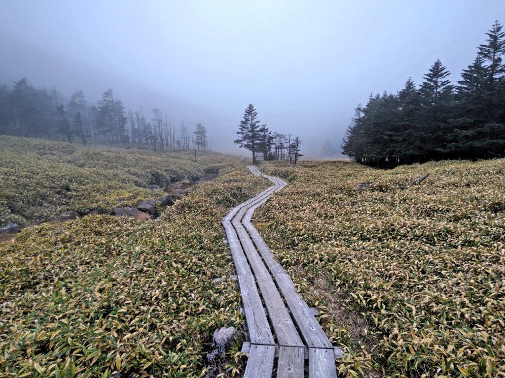
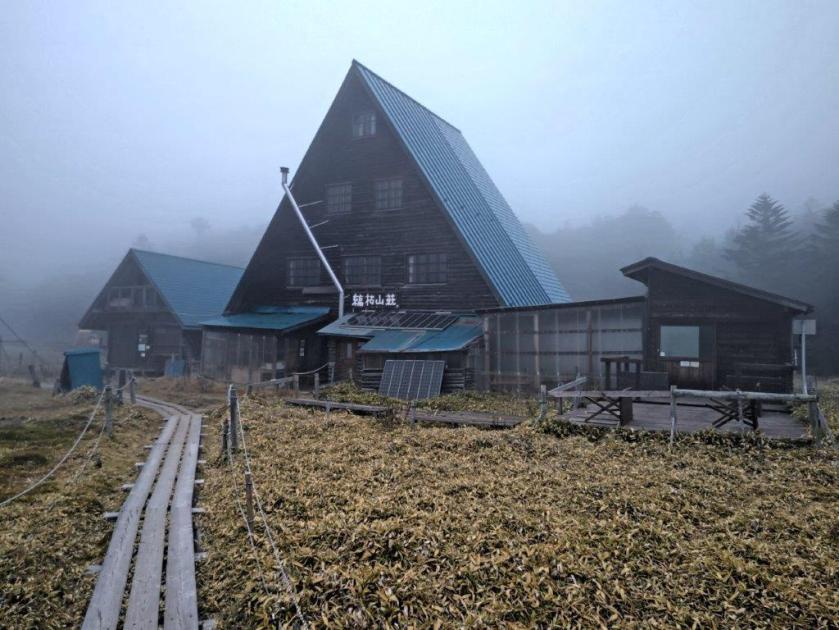
I found myself surrounded by swirling white mist as I emerged from the forest at Amaike Pass (雨池峠). It was now 3h30, leaving me ample time before the last ropeway. I followed the final walkway of the day, down a small valley past Shimagare Lodge where I spent the night ten years ago, merging with my previous hike in the area. At 4pm I was back at the top of the ropeway; half an hour later I was riding a mostly empty bus back to Chino station where I boarded the limited express for the 2-hour trip back to Tokyo.
The hiking trails followed on this hike can be found on the Japanwilds map for Mt Shimagare and Mt Chausu, available for free with the Avenza app
Watch a Video of the Shirakoma and Ama Ponds Hike
Watch the Video of the Hike on YouTube


See a Slideshow of More Pictures of the Hike
