I had visited the forested hills around Sayama Lake earlier in the year, but felt like exploring the area some more; I decided to do a morning hike since the parks sit comfortably within the city. I would start from a prominent hill on the north side, then follow a forest road leading to the south side, a shortcut for the perimeter road I followed in January; from there, I would go up and down some hills in the southwest corner of the park; finally, I would leave the hills on the west side, hopefully reaching a bus stop by noon. It was supposed to be fine spring day, sunny with comfortable temperatures; it had rained hard the day before, so the air would be crisp and clear. As before, I would take the local Seibu line to Kotesashi station, and then a bus along the north side of the lake; I could catch the same bus back from the end of the line. I was looking forward to an easy morning hike through a nature park within Tokyo.
Hiking in the Sayama Natural Park 都立狭山自然公園
May 2024 update: the Nawatake Forest Road is closed till at least 2026 due to fallen trees from typhoons in 2023
View this Blog Post on Hiking Around Tokyo

Trail Leading to Akasaka
Top of Hira Hill
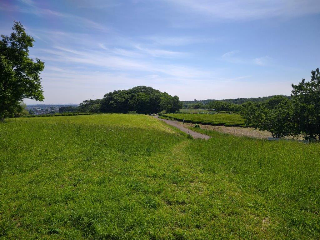
It was still pleasantly cool when I got off the bus at 9am next to a small shrine shrine under some cedars. After passing Kinsenji Temple, I turned left onto a lane leading up a hill, called Hira Hill (比良の丘 ひらのおか 155m), next to Midori no Mori Nature Park. The flat top area is used for farming, and walking among the fields, it felt like I had suddenly been transported to the countryside. It was now 9h30 so I had breakfast at a table under a huge Japanese Bird Cherry, probably a nice place for a picnic during the sakura season.

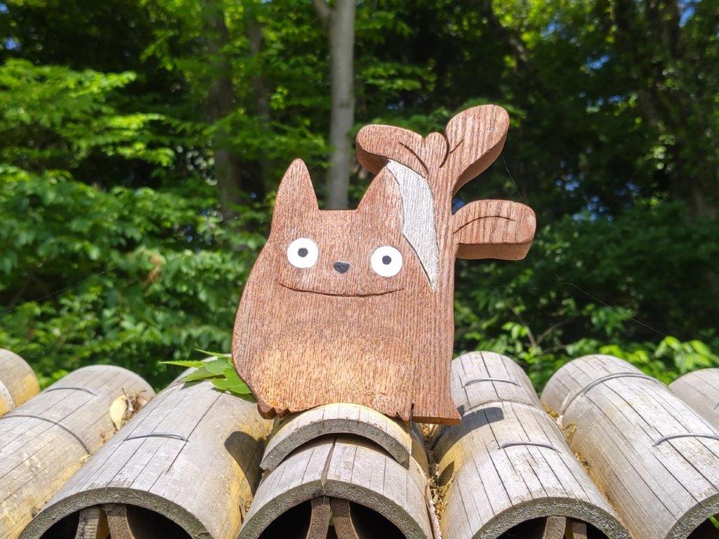
Signboard for Totoro’s Forest

Flower Field at the Top of Hira Hill
I was impressed by the serenity of this spot so close to the city. Nearby was a signboard for Totoro’s Forest #13, # 18 and #49. At the moment, there are 57 off these protected parcels of forestland. To the north, I had a view of the city between two wooded areas; on the south side, Sayama lake was hidden behind a forested ridge. This whole area of hills and forests surrounding the lake is known as the Sayama Hills (狭山丘陵), one of the main features of the Musashino Plateau. I soon set off in the direction of the lake, heading down a faint footpath, and entering the forest, past a bridge across a creek.


Cherry Tree on Hira Hill (left) Forest Path to the Perimeter Road (right)

Walking the Nawatake Forest Road
I was stunned by the beauty of the forest, enhanced by the play of sunlight on the light green leaves, as I made my way up a switchback path. A little before 1oam, I reached the top of the ridge and the Sayama Perimeter road. I turned right, and after a few minutes, arrived at the gated entrance of the Nawatake Forest road on the left side. After passing through the door on the side, I made my way along the gravel path, surrounded by thick forest and silence, punctuated by intermittent birdsong.


A Green Corridor Within the City

South Side of the Sayama Perimeter Road
It felt like I had entered a secret section of the park: I saw few other people, birdwatchers with huge cameras, walking under the shade of trees crowding in on each side. Past Nawatake bridge (縄竹橋), where I had glimpse of the lake on the left, the path headed gently uphill for a while; less than half an hour later, I arrived at another gate, where the forest road rejoined the Perimeter Road. I soon ducked down a path on the right side, and at a parking lot, turned right onto a wooden walkway along Akasaka-yato (赤坂谷戸), a marshy area at the bottom of a valley.

Path Leading to Akasaka

Walking in the Akasaka Valley (left) Walking Down the Western Side (right)
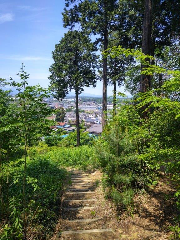
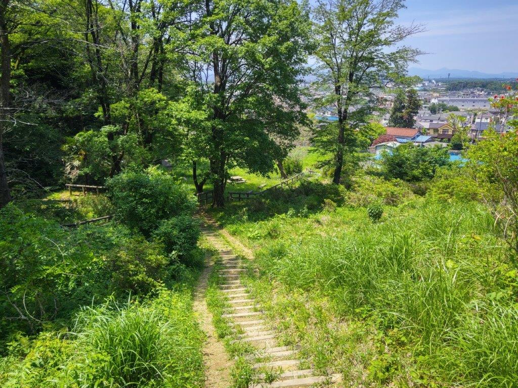
It felt like I was walking through a hidden valley, lush vegetation on both sides. After some ups and downs, I arrived at Satoyama-minka (里山民家), a recreated traditional farmhouse from the Edo era, at the edge of the forest. It was past 11am, and I was behind schedule, so I skipped a visit, and headed up a charming valley, filled with paddy fields, and frogs, judging from the croaking noises. After a short climb through forest, I reached the observatory at the top of Mt Rokudo, merging with my previous hike. Heading west, I passed the triangulation point, and soon turned left onto a path down the hill side.

Viewpoint of the Okutama Mountains
End of the Hike at Takane
I arrived at a viewpoint of the Okutama mountains, the outlook partially obscured by trees, but I could still make out Mt Kawanori in the middle. After descending a log staircase, I reached the Takane residential area at the base of the hill, and after walking along a road for a short while, made it to the bus stop at Miyadera-Nishi just before noon. The hike had taken 3 hours as planned, although I had to speed up the pace at the end. I’d definitely like to return in the autumn to explore more trails, as well as visit the Satoyama Farmhouse.
See a video of the Sayama Hills Hike
See the video of the hike on Youtube