
So let’s see what can be done exactly with the Tokyo Wide pass. As I mentioned in the previous post, riding the shinkansen is the best way to go and first I’ll tackle Takasaki station since it’s a stop on both the Nagano and Niigata Shinkansen lines and has a myriad of hiking options. Just to be clear, the purpose here isn’t to give details on hikes for each place but simply to show all the different areas that can be reached within a day using the pass and inspire you to go and hike there.
Takasaki, the biggest city of Gunma prefecture, sits at the edge of the Kanto plain and is surrounded by mountains on nearly all sides which makes it an attractive hub for hiking. Since it takes less than 50 minutes to reach by shinkansen from Tokyo station this is ideal if you want a late start / early finish or the weather is dodgy. The main drawback is that you’ll need to take a local line to get to the mountains and some of them run infrequently.
Here is an incomplete list of hiking suggestions:
– Mt Akagi 1828m (train to Maebashi, then a 90-minute bus to the visitor centre)
– Mt Haruna 1449m (train to Shibukawa, then two buses to the lake, change at Ikaho)
– Mt Myougi 1104m (train to Matsuida on the Dentetsu main line 電鉄本線)
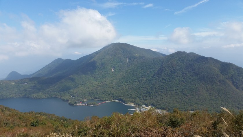
These are the three famous mountains of Gunma, and should be a priority if you haven’t visited the area before. The first two are dormant volcanoes with easy hiking on numerous small peaks around a beautiful crater lake. Most hiking is between 1000 and 1500 meters, and late spring and early autumn are the best times to visit. Both areas get a lot of snow in winter and many visitors in the summer. A hike I did on Mt Akagi can be found here. More details for Akagi and Haruna hikes can also be found on hiking in Japan, a blog by Wes.
Mt Myougi is the lowest mountain of the three but also the most dangerous, and its craggy peak is best enjoyed when viewed from below, by doing this hike. You can access Ura Myougi on foot or by taxi from Yokokawa, the next and final station on the line. Less dangerous than the top ridge, it also has its “exciting” bits (I have climbed neither). More information on things to see and do in these 3 places can be had here.
All 3 would require long day trips or overnight stays if it weren’t for the Tokyo wide pass.
– Nishi joushuu area (one-hour train to Shimonita, then continue by bus or taxi)
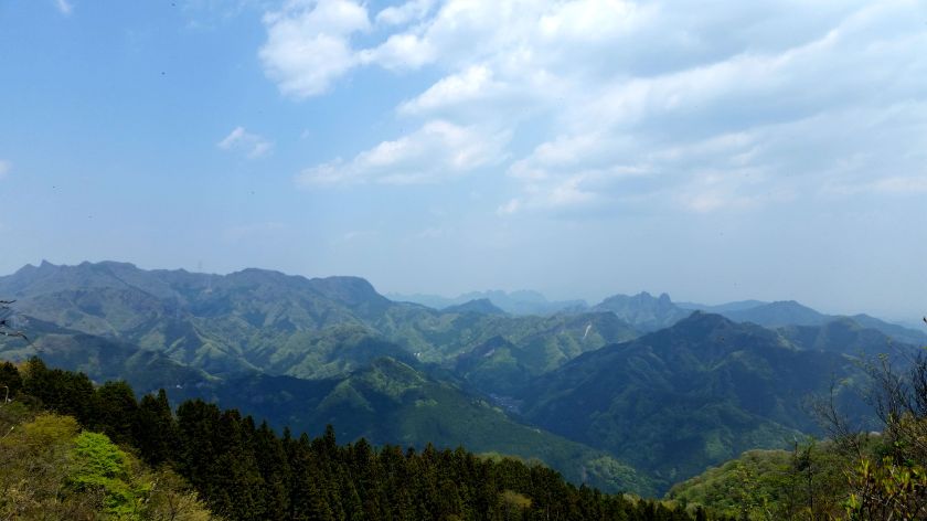
Joushuu is the old name of Gunma prefecture so nishi joushuu (西上州) refers to it’s western area. After the pass made this area fairly easy to access from Tokyo, it has quickly become one of my favourite hiking spots. A fairly remote place with mountain ranges extending in all directions, most of the peaks are on the low side between 500 and 1500m which makes it suitable for Spring and autumn hiking. This site has a list of hikes.
– Agatsuma line (吾妻線)
I’ve only just started exploring the possibilities of this line. So far I have been as far as Onogami 小野上 station, 3 stops beyond Shibukawa, in order to climb Onokoyama 小野子山. Nakanojo 中之条 station a further 3 stops seems to have some potential which I plan to investigate in the future. So far I haven’t been able to find a hiking map for the area which is good or bad depending on how adventurous you are. This is also the usual way to access the famous Kusatsu hot spring (a bus connection exists further down the line), but it’s faster to go there through Karuizawa when using the pass. .
There are a bunch of other local lines heading East towards Tochigi but I haven’t explored those yet so I’ll leave them for a future update. If you have any good hiking suggestions please let me know. Renting a car in Takasaki is also another option if you have a driver’s license that’s valid in Japan. In the next posts I will talk other hiking options on the Nagano and Niigata Shinkansen lines as well as the Tohoku line.
