
I wanted to do a short hike to get back into shape after a three-week break. I settled upon going on a weekday morning, as other commitments and poor weather had prevented me from going the previous weekend. I decided to do a hike up a minor peak on the eastern edge of the Oku-Musashi hills, planned last year and kept in reserve for a cold winter day. Although it shared a name with Japan’s most famous volcano due its conical summit, the climb would be a lot less arduous. I was more interested in the nearby observation deck and its view of the Kanto plain. To round out the hike, I would make a short roundtrip to a nearby waterfall. I would take the Laview limited express to Hanno, and there, ride a bus north towards Hidaka City. I would then make my way to Koma station on the Seibu-Chichibu line, from where I could catch a train for Hanno. The weather forecast was sunny and warmer than the previous days, which was good news since I would be starting earlier in the day. I was looking forward to a morning hike in the forested hills close to Tokyo after a few weeks off.
Hiking in Oku-Musashi 奥武蔵
For subscribers, read this Blog Post on Hiking Around Tokyo for a better viewing experience

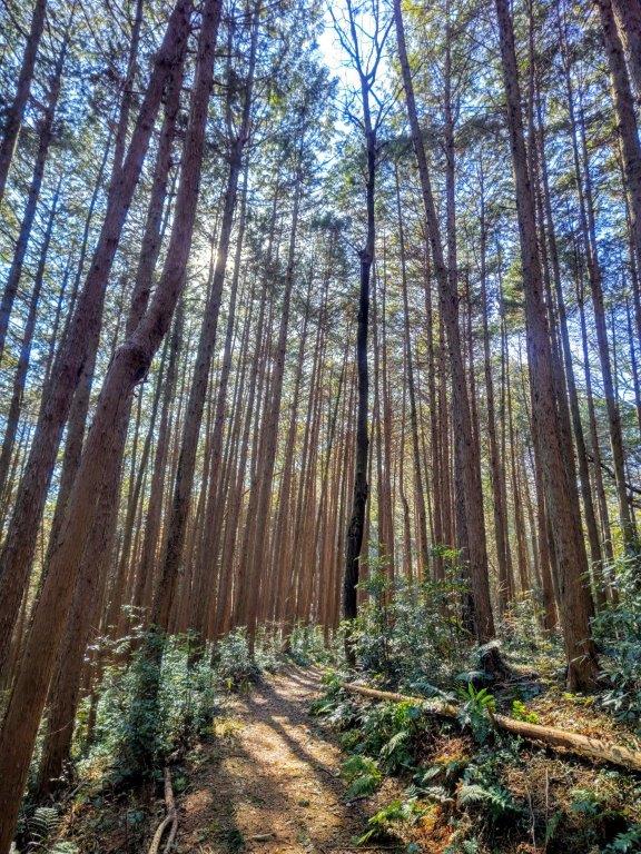
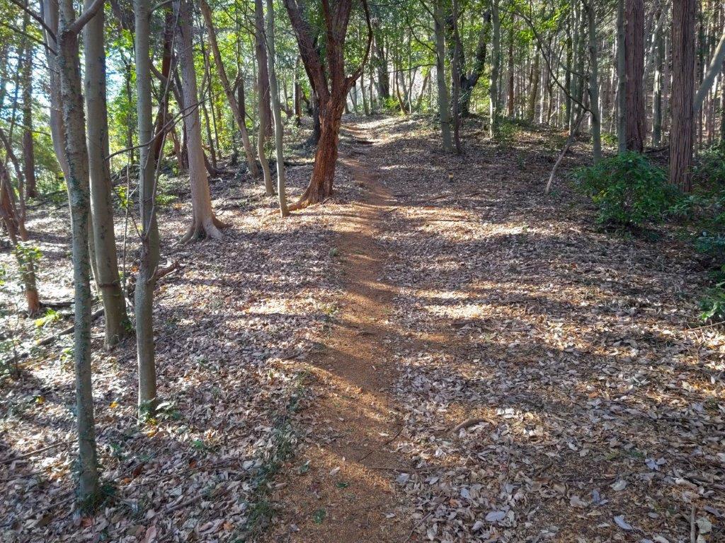
Start of the Hike (left) Trail past Shirogane-Daira (right)


Trail past Takizawa Falls
It was sunny, cold day as I rode the limited express train to Hanno. After a 40-minute bus ride, roughly the same duration as the train ride, I got off at a stop a little after 9am, a few minutes on foot from Ten Shrine (天神社) and the start of the hike. After getting ready and quickly checking out shrine, I set off around 9h30. I headed up a paved road leading past Komagawa Country Club and took a left at a signboard of today’s hiking route, featuring the birds “Kurikka” and “Kurippi”, Hidaka City’s mascots.
Walking up Mt Fuji
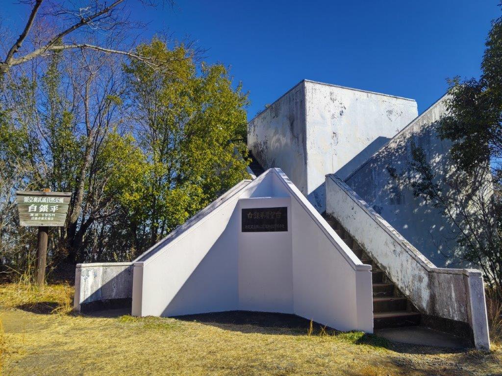
The Shirogane-Daira Observation Deck
I was delighted to be walking in nature, tall pines on both sides, the sun shining down from above; to my right was the Komagawa golf course, a low fence protecting me from stray balls. At 10am, I reached the hiking trail, beyond a stone “torii” (shinto gate). Very soon the path rose steeply, but I had barely broken a sweat when I emerged onto the sunny top of Mt Fuji (富士山 ふじやま fujiyama). Despite being in the sun, the top area was surrounded by trees. As I took a break next to the small summit shrine, a helicopter darted across the sky, probably headed to the nearby Tokorozawa airfield.

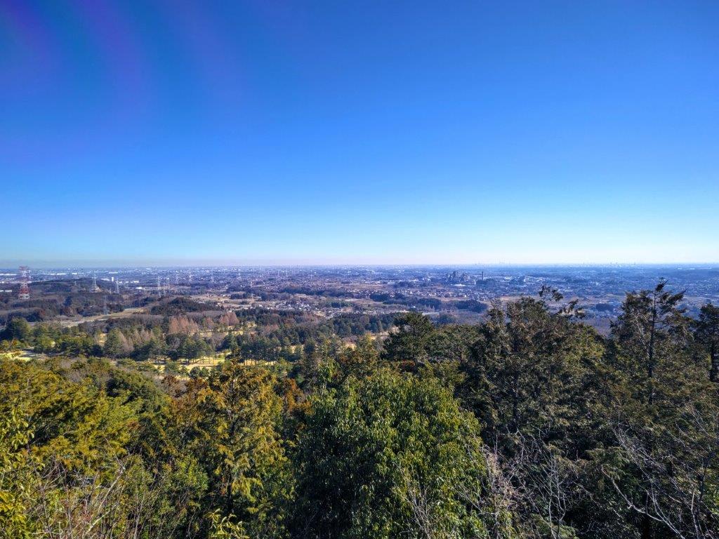
View Northeast of the Kanto Plain from Shirogane-Daira
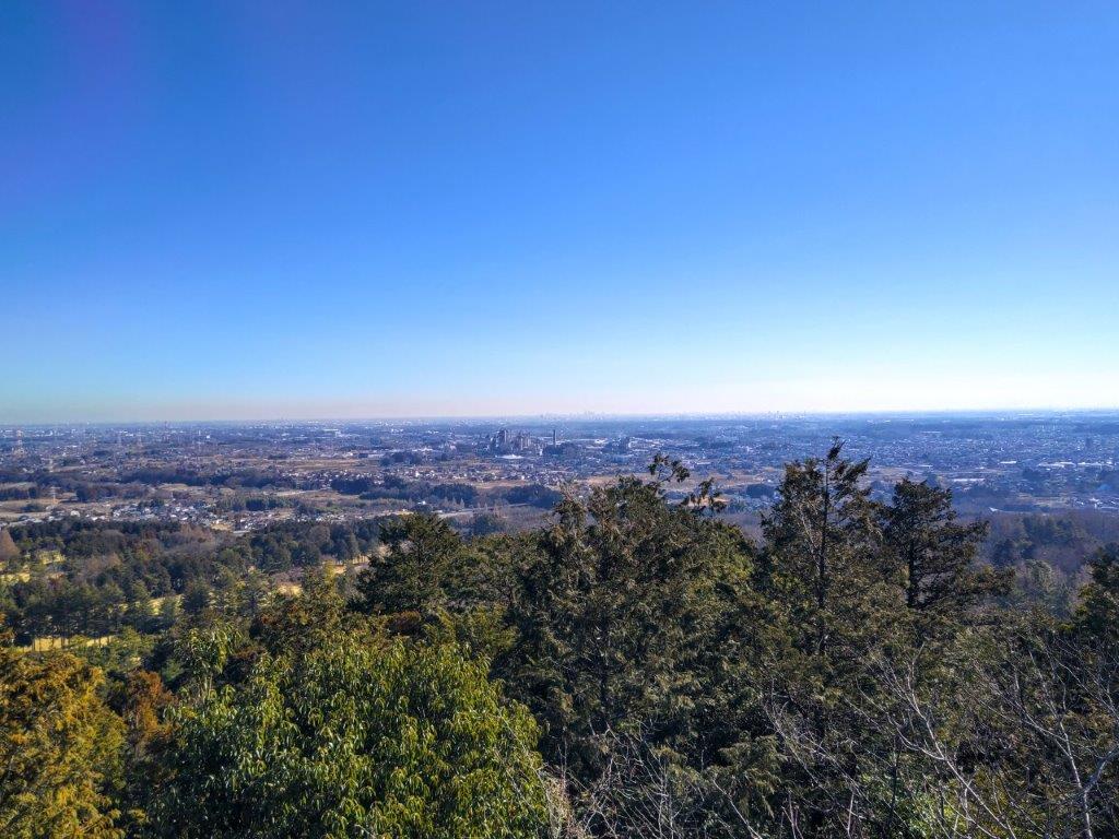
View East of the Kanto Plain from Shirogane-Daira
I set off down a steep series of steps, at the end of which I turned left along a level path, and soon reached the Observation Deck at Shirogane-Daira (白銀平 しろがねだいら), at 10h30. From the top of the white, square structure, I had a view of the Kanto plain on the east side. Apparently Mt Tsukuba, Mt Nantai, Mt Akagi, the Tanzawa mountains and even Mt Fuji are visible, but I couldn’t make them out despite the clear skies. However, I could see the Tokyo skyscrapers, as well as Seibu dome; turning around I could see Mt Hiwada and Mt Monomi above the trees on the west side. After a late breakfast, I retraced my steps and followed a path along the mountain side.

Trail between Shirogane-Daira and Takizawa Falls
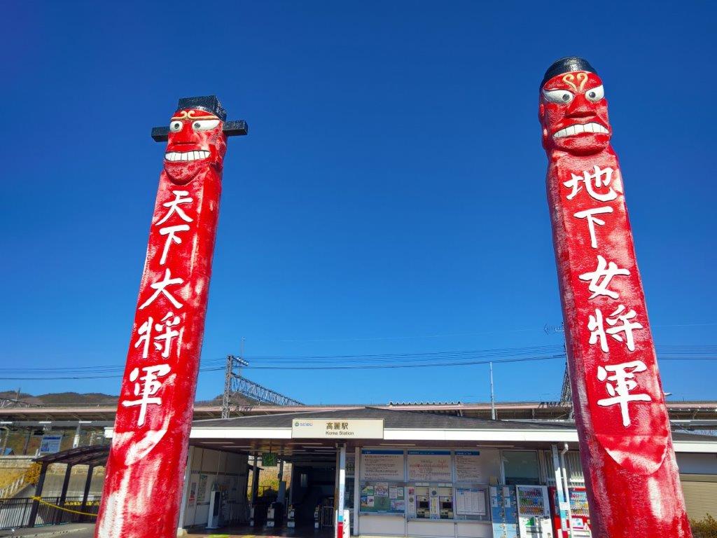
Wooden Carved Pillars outside Koma Station
I was surprised to see such beautiful forest so close to the big city. All too soon, I reached a paved road next to another golf course. I turned right, and shortly after, rejoined the trail on the left, taking me to the turnoff for the Takizawa Falls (滝沢の滝). I had seen more impressive waterfalls, although the dry winter season might be to blame, and quickly headed back to the main trail. After a short up and down along a sunny trail, I popped onto a pleasant countryside lane, ending at a busy road for Koma station, where I arrived shortly after noon. After admiring the two demon pillars guarding the station building, I hopped onto the local train for Hanno, just 2 stops away, and then boarded the express train for Ikebukuro.
Watch the Video of the Hike on Youtube


See a Slideshow of More Pictures of the Hike


