

I wanted to do one last hike before the hot and humid summer. I found a peak I had never climbed before on Mt Akagi, last visited three years ago. It promised good views, but the roundtrip to the summit was on the short side. I saw on my map that I could combine it with the Kanto Fureai no Michi and end at Fudo-daki waterfall. Since it was mostly along a level trail on the south side of the volcano, it seemed ideal for a warm summer day. I would take a bus from Maebashi station for the Akagi Visitor Center and get off at a stop half way up the mountain. For the return, I planned to use the “furusato basu” to get to the nearest train station, an on-demand bus system requiring me to request a pickup before the end of my hike. I had never used such a system before, and if for some reason it didn’t work, I would have to call an expensive taxi instead. The weather was supposed to be overcast in the morning, then sunny in the afternoon, the temperatures comfortable enough for hiking. I wasn’t sure I would get any views this time, but I hoped to have one last satisfying hike before the long summer break.
Hiking on Mt Akagi and the Fureai no Michi
赤城山 ・ 関東ふれあいの道
Read this Blog Post on Hiking Around Tokyo

View Towards Mt Akagi on the Way Back from Mt Nabewari

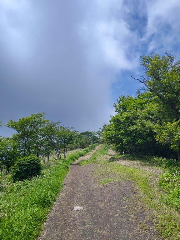
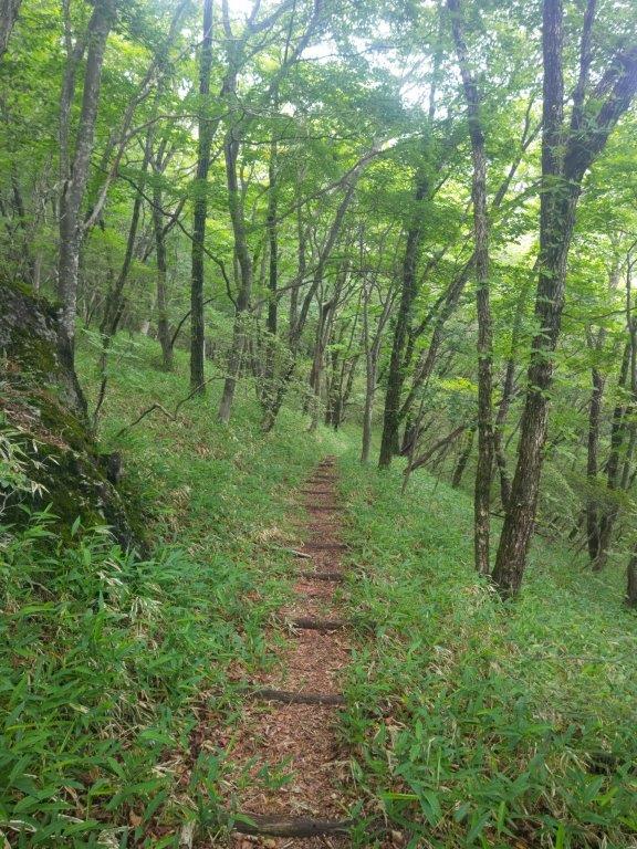
Start of the Ridge Leading to Mt Nabewari
It was a cloudy morning as I got off the train at Maebashi station around 9am. I was surprised how few people boarded the bus for the one hour ride to Akagi mountain, although the parking lot next to the trail entrance was packed with cars. I set off a little before 11am, up a wide, gently sloping trail through the forest; rays of sunshine pierced the clouds, a sign of improving weather. Half an hour later, I reached Arayama Highland (荒山高原). To the south, I had a view of the head of the ridge leading to today’s summit. Many hikers were taking a break, so I quickly moved on. After a short climb, I reached a level path along a bare ridgeline.

Start of the Hike (left) Easy Walking through the Forest (right)

Near the Top of the Ridge (left) Just Before the Summit (right)
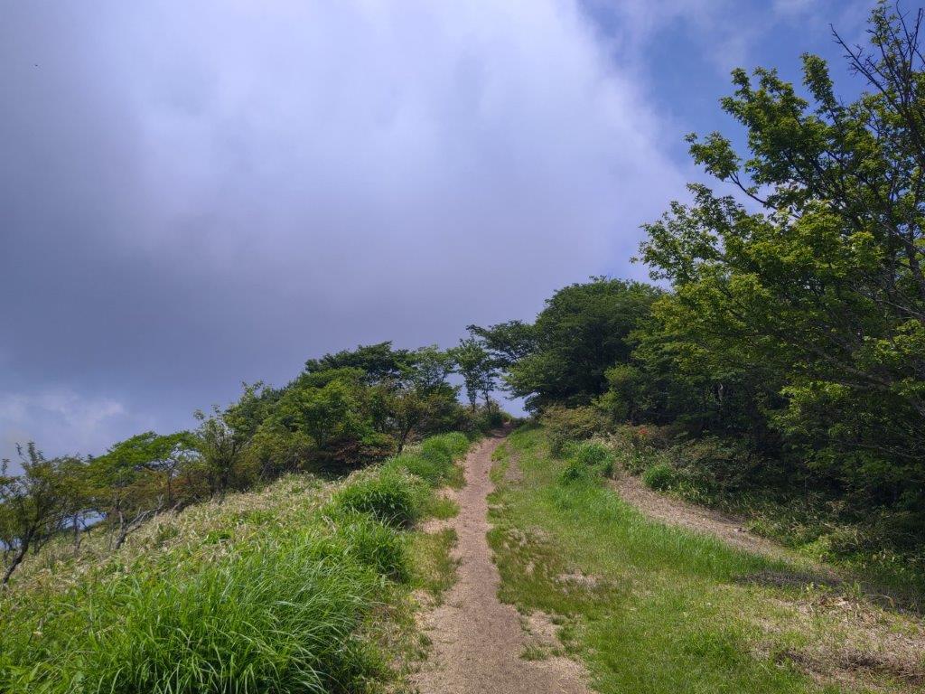
I was amazed to find such an exposed ridgeline at a relatively low altitude, although the surrounding views were hidden by the clouds. After passing two minor summits, Mt Hiokoshi (火起山) and Mt Kamado (竈山), the path reentered the forest and descended for a short while, before reaching another section of the ridgeline out of the trees. At noon, I arrived at the top of Mt Nabewari (鍋割山 なべわりやま nabewari-yama). Looking south, I could barely make out the Kanto plain through the haze; in clear weather, one can see Mt Fuji, Tanzawa, Oku-Chichibu, the South Alps and Yatsugatake. Patches of blue sky above gave me hope for the rest of the day. I sat on a bench for some lunch, before retracing my steps half an hour later.

Jumble of Rocks on the way to Arayama Kogen

Walking the Exposed Ridgeline
I was lucky to get some views on the return on the north side: I could see the long ridgeline on the west side of the volcano, ending at the rounded peak of Mt Suzu. Directly ahead, I could see Mt Ara and Mt Jizo, two other peaks of Mt Akagi (climbed in September 2015), slowly emerging from the mist. On a clear day, it would have been possible to see the North Alps, Mt Asama, Mt Azuma, Mt Kusatsu-Shirane, Mt Naeba, Mt Tanigawa, and Mt Hotaka. At 1pm, I was back at Arayama Kogen, where I joined the “Fureai no Michi”, heading west through the forest. From this point, I saw no other hikers, the sound of voices replaced by the buzzing of insects.
Some Blue Sky Above

On the Right, Mt Suzu
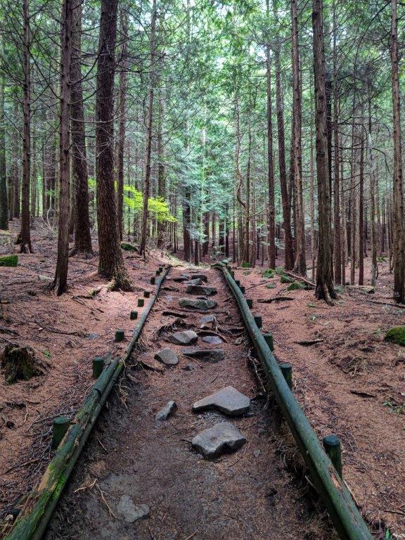
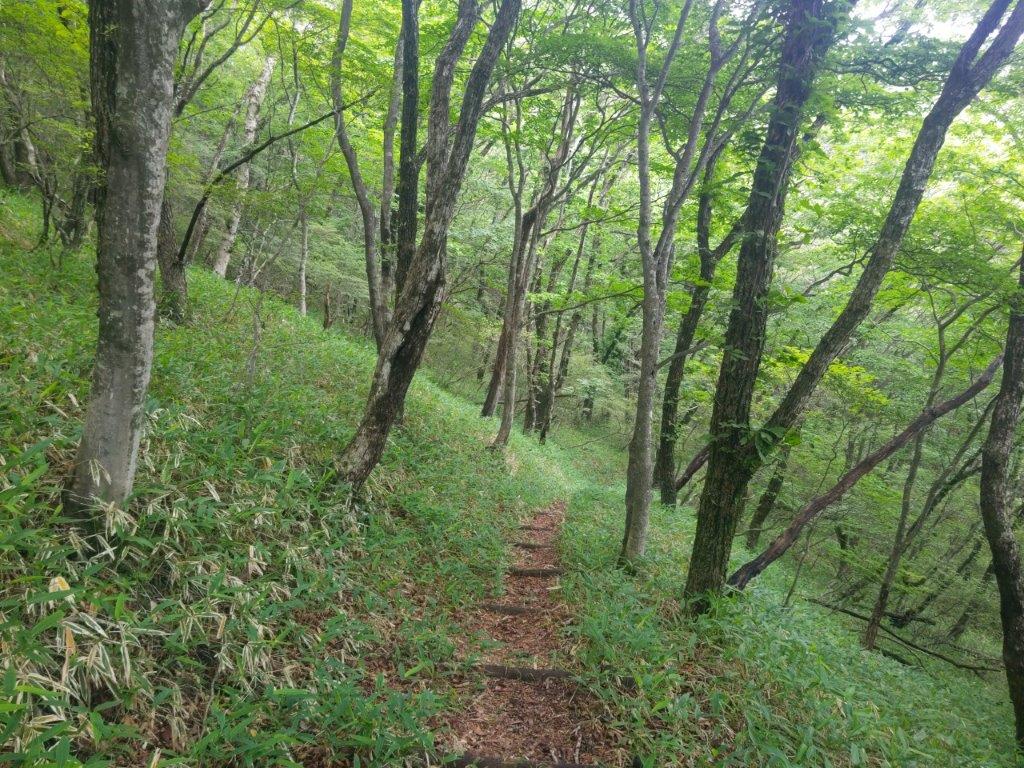
This was by far the best part of today’s hike, as I could totally immerse myself in the surrounding nature. The sun had finally come out but it remained tolerably cool under the tree shade. It took me about three hours of pleasant hiking to reach the trail entrance for Fudo-daki waterfall (不動滝).
At the moment, part 23 of the Gunma Fureai no Michi is closed due to trail collapse, requiring 30 minutes of road walking from Akagi Onsen.
I checked it out myself: it was indeed impassible, but I was rewarded with a close-up encounter with a deer. The short trail to the waterfall followed a rushing river, requiring some surefootedness along a rocky section, equipped with a small ladder for safety.

Heading back to Arayama Highland
Following the Fureai no Michi
I was stunned by how high this waterfall was, as it suddenly appeared past a rocky cliff in a bend in the river; according to a nearby information board, it was 32 meters tall. I got as close as I could to the thundering water, the cold splashing water welcome on this warm summer day. At 4h30 I turned back, and after reaching the road at the trail entrance, turned left. From here, it was about an hour walk down the mountain. As soon as I was back within phone range, I dialed the “furusato bus” number. After several long rings, my call was answered. I requested to be picked up from Nakanosawa Museum, the closest stop to the mountain.

Walking in the shade (left) Staircase at the End of the Fureai no Michi (right)


First view of Fudo-daki Waterfall (left) Close-up view of the Waterfall (right)
I was relieved when my request was accepted without any hesitation. I arrived at the museum just before 5h30, and a few anxious minutes later, a minibus arrived, dot on time. After a short ride through the countryside (total cost 210 yen), I was dropped off at Ogo station on the Jomo railway, a 15 minute train ride from Chuo-Maebashi station, which in turn is a ten minute bus ride from Maebashi station. I was glad I could experience a new form of transport, although on a busier day it would have taken longer to accommodate more passengers. I hope to redo this hike one day on a clear winter day so I can see all the views along the ridgeline and from the summit.
Watch a Video of the Mt Nabewari Hike
Watch the Video of the Hike on Youtube


Thanks for information about the `furusato bus`
And that waterfall looks interesting
Thanks for the comment. Hope you can visit the waterfall one day!
Here is the link for the furusato pamphlet (in Japanese) with how to reserve and the stops:
Click to access furusatomap2022.pdf
I also made a small update to the post since part of the Fureai no Michi trail is currently closed.