

Mt Mitsumine (三峰山 meaning “3 peaks”, also known as Mt Ontake 御嶽山) is tucked away among the many mountains north of Tochigi city, and it only came to my attention thanks to its inclusion in the Tochigi hundred famous mountains. At first glance, I thought it could only be reached by car, but further research using Google Maps showed that the trail entrance was just a short walk from a Tochigi city bus stop near the Hoshino Archaeological site. I chose a warm, blue-sky Spring day to explore this sacred mountain.
Get a Map of the Mt Mitsumine Hike on Avenza
This map was developed for Japanwilds with the Hokkaido Cartographer
Find Japan Hiking Maps on Japanwilds

View of Mt Mitsumine from the base of Mt Yagura
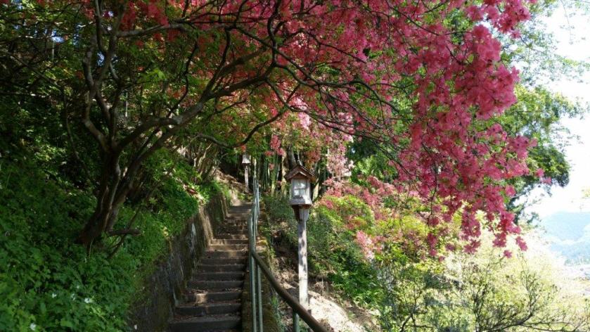
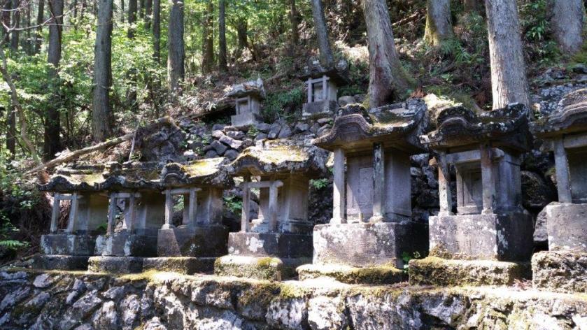
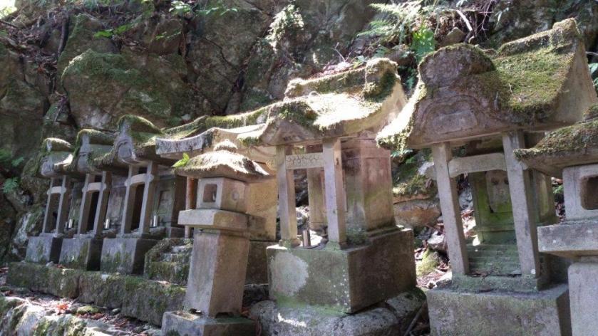
The hiking trail, also used by pilgrims, starts directly behind Ontake shrine up a staircase lined with “toro” or lanterns. In this season, “tsutsuji“or azalea were in full bloom adding patches of pink to the new green scenery. Further up the path, I saw many”Reijin-hi” (霊神碑), or miniature stone Shinto shrines, contributing to the mystic feel to the climb. The mountain is connected to the Ontake Faith, centered on Mt Ontake in the Hida mountains; Kobo-daishi also spent time at this mountain. At the top of some weather-worn stone steps, I reached a bench with a partial view – the perfect spot for an early lunch break.

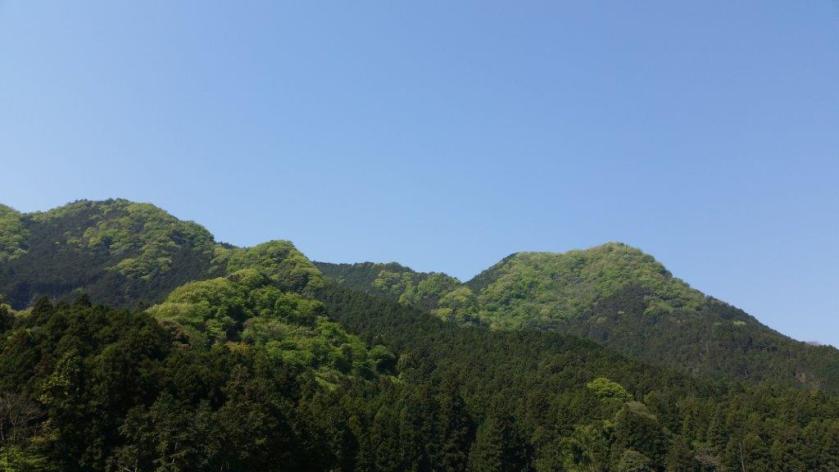
View of Mt Mitsumine from the Bus Stop
After some more ascending, I reached a fork in the path: a short way to the right was “oku no in” (奥の院) marked by a stone “tori“, or Shinto gate; past it, were 3 dignified statues, the gods of creation in Japanese mythology, and a narrow view through a gap in the vegetation. Retracing my steps, I resumed my climb, soon reaching the flat top part of the mountain. Plodding through the featureless forest, it was hard to determine the location of the three peaks, let alone the highest one.
Watch a Short Video of the Mitsumine Summit View
I finally arrived at the official summit marker, oddly enough not the real top, but a spot on the western side and free of trees. I could see ridgeline after ridgeline disappear into haze, no particular peak standing out; apparently in the winter, one can see the Oku-Nikko mountains. Directly below was a gigantic construction field, as this side of the mountain is being constantly mined, similar to Mt Buko. After admiring the view, I used a more direct route down the east side to get back to the bus stop for the return trip to Tochigi station.


See a Slideshow of more Pictures of the Hike
