
I wanted to some more hiking in the low hills of northwest Tokyo before the arrival of the rainy season. I was also looking for something short and easy after a 2-week break. Looking at my map, I saw I could walk from Jiko-ji temple in Tokigawa to Matsuoka Sake Brewery in Ogawa. After checking out the temple, I would head westwards to the highest point of the hike, then descend northeast along a ridge, and finish near the end of my hike on Mt Kannookura one year ago. If I got there before 5pm, I would be able to drop by the small shop inside the brewery and maybe even sample some Japanese sake.
Hiking in Oku-Musashi 奥武蔵
I would ride an express train from Ikebukuro to Ogawamachi, and from there, take a taxi to the parking below the temple. To get back to the station, I could catch a bus from a stop close to the brewery. The weather was supposed to be sunny all day with temperatures under 25 degrees, significantly cooler than the previous few weekends. Most of the route was downhill along a rough trail through the forest; I could expect few views but also few people. I was looking forward to a solitary ramble through the hills of Oku-Musashi.
For subscribers, read this Blog Post on Hiking Around Tokyo for a better viewing experience and the latest updates
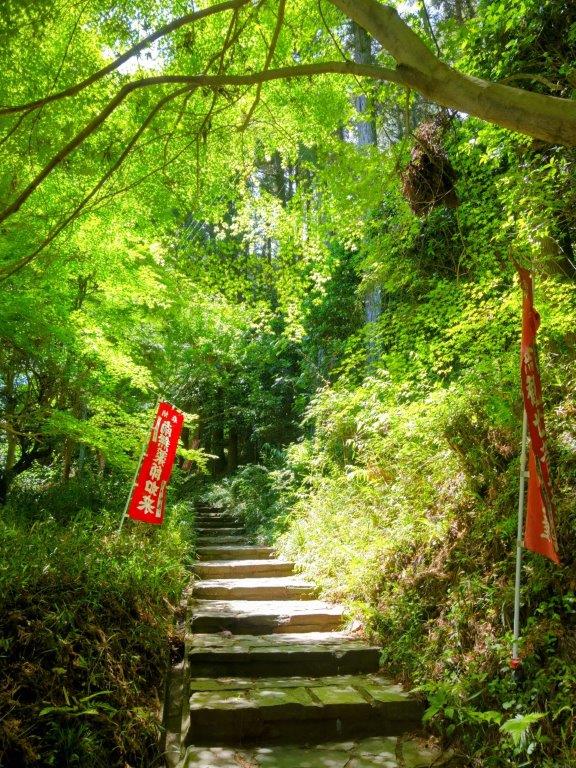

Steps Leading to Jiko Temple (left) Start of the Hiking Path (right)
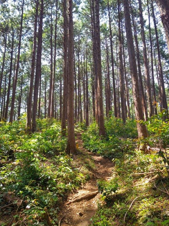

Path before Mt Toki (left) Path before Mt Yasuyo (right)
It was a perfect spring day as I rode the Tobu-Tojo line for the one-hour trip to Ogawamachi Station, arriving there at 11am. After buying some Okara donuts from Shimizuya opposite the station, I hopped into a taxi for the 20-minute ride to Jiko-ji temple (慈光寺), part of the Bando 33 Kannon Pilgrimage. After getting ready, I set off at 1230 and headed up some stone steps surrounded by the new green of spring, soon arriving at Kannon-do (観音堂).


Trail past Mt Kana (left) Descending to the Road Crossing (right)

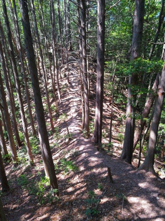
Passing near a Rocky Outcrop (left) Following a Narrow Ridge (right)
After admiring the elaborate wooden carvings of the Kannon temple, I located the start of the trail, leading into the forest behind the building. I was now on the Tokigawa Trekking Route (ときがわトレッキングコース), hiked in 2017, but soon left it, taking an unmarked trail on the right. After a short climb through the cedars, I reached the top of Mt Toki (都幾山 ときさん toki-san). I quickly moved on and after some level walking, arrived at the top of Mt Yasuyo (育代山 やすよやま yasuyo-yama). I continued without a break, and after some more climbing, reached the top of Mt Kana (金嶽 かなたけ kana-take), the highest point of the hike. There, I turned right, heading down the mountain side.

Stone steps through the New Green of Spring
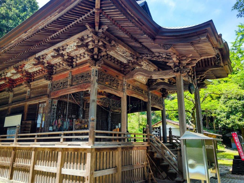
Kannon-do Temple within the Jiko Temple Grounds
I was relieved to be following a clear path through the forest, although I couldn’t spot any signs indicating the way. At 1h30, I arrived at a road crossing, beyond which the trail became faint; fortunately from this point, I could count on pink ribbons to confirm the way, in addition to my phone GPS. As expected, I saw no other hikers on this up and down trail along a narrow ridgeline. At 2h30, I passed under an electric pylon where I had a view of Mt Kasa to the northwest. Soon after, I arrived at the top of Mt Shiho (士峰山 しほうざん shihou-zan), marked by a small shrine. I took a break for lunch, enjoying an Okura donut for dessert. From this point the trail suddenly became harder to walk and follow.

View Southeast from the Electric Pylon
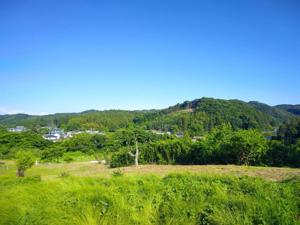
Countryside View at the End of the Hike
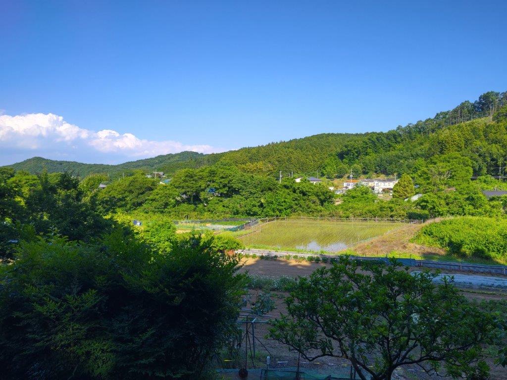
I proceeded with caution, picking the most walkable parts among the rocks and bushes. At 3h30, I passed another minor summit (古寺山 280m). From this point, the trail condition improved, although it had suddenly become quite windy. I started to descend quickly, and half an hour later, emerged onto a small lane. I had finished earlier than expected so I headed over to the nearby Matsuoka Sake Brewery and was able to sample their Mikado Matsu brand from their handy sake server. After buying a bottle for home, I set off for the bus stop, and after a short ride, was back at Ogawamachi station just before 5pm.
Watch the Video of the Hike on YouTube

Enjoyed reading the hiking route for my latest hobby is also taking the walking route. ❤
Thank you for your comment! I recommend checking out some of our maps for some hiking ideas (most of them are available for free):
https://store.avenza.com/search?avenzasfy_products%5BsortBy%5D=avenzasfy_products_publish_date_stmp_v2&avenzasfy_products%5BgeoSearch%5D%5BboundingBox%5D=47.613563336162116%2C147.8345113825402%2C26.037335321385285%2C128.04976199923084&avenzasfy_products%5BrefinementList%5D%5Bvendor%5D%5B0%5D=Japanwilds.org
We are constantly adding new ones so please make sure to check it often.