

I wanted to do a hike using the newly published Miura/Boso hiking map. Looking over the Boso Peninsula section, I discovered a new trail connecting Mt Goten (climbed in winter 2016), and Mt Kyozuka. The latter was mentioned in my mountains of Chiba guidebook, but had been badly battered by the powerful typhoons of 2018. Looking online, it seemed like the mountain had recovered sufficiently and the trails were passable again. Between the two mountains, was a dammed river crossable thanks to a pedestrian bridge.
Hiking on the Boso Peninsula 房総半島
To get to the start of the hike, I would ride the Sazanami limited express from Akihabara to Iwai station, and from there, take a bus to the Mt Goten trailhead*. From the base of Mt Kyozuka, I would ride another bus to Tateyama station. There, rather than catch the limited express back to Tokyo, the connection time being only a couple of minutes, I would take the longer but more picturesque ferry route back. The weather on the peninsula was supposed to be sunny, with temperatures high for the season, but cooler than the mainland. I was looking forward to exploring a new area on the eastern side of the Boso peninsula.
*The bus only runs to the Mt Iyo trailhead, about 30 minutes away on foot, and advance phone reservation is needed for it to continue to the Mt Gozen trailhead .
For subscribers, read this Blog Post on Hiking Around Tokyo for a better viewing experience and the latest updates

End of the Road and Start of the Mt Gozen Hiking Trail

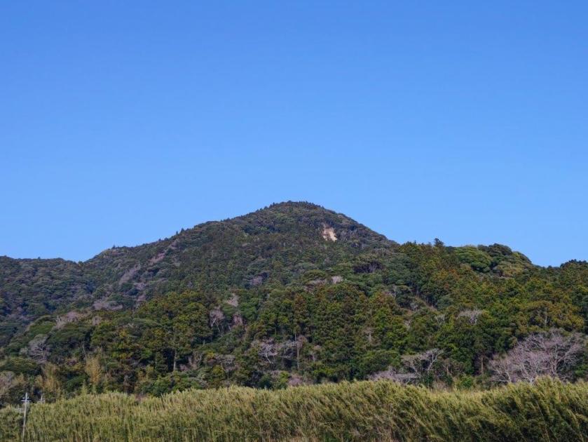
View of Mt Atago from the Mt Gozen Hiking Trail
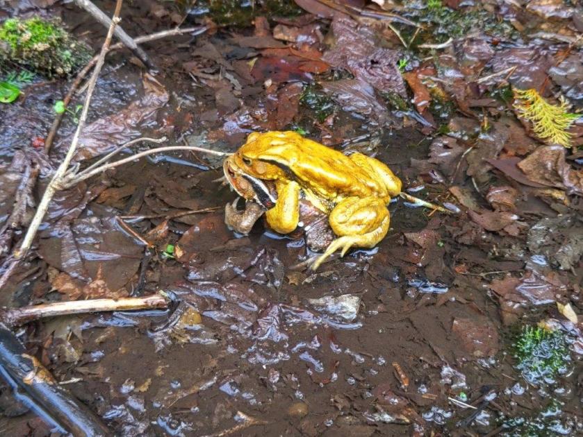
It was a perfect blue sky day as I rode the limited express to Iwai, with views of Tokyo Bay on the right side. A little after 10am, I boarded the microbus for the half an hour ride to the end of the line. After getting off at a parking near Koshoji-Temple, I was greeted with the soothing sound of croaking frogs and bamboo bushes swaying in the wind. Across the road was today’s first peak, looking tantalisingly close. After getting ready, I set off at 11am, continuing a little further along the main road, before taking a side road on the right, an alternative path to the summit. Here and there, I could see white and pink cherry blossom trees in full bloom.
View of Mt Iyo from the Mt Goten Trail

Trail below the Mt Goten Summit
Turning around, I had an impressive view of the valley, as well as Mt Atago, the highest mountain in Chiba. At 11h30, I reached a signboard marking the start of the trail. Although it was clearly marked on my map, it seemed to have fallen in disuse. After some scrambling and path finding, I reached the ridgeline and the main trail to the summit, a little after noon. A few minutes later, I arrived at a steep section leading to the summit. Instead of going up, I followed a level path on the right, around to the other side where some log steps made for a more relaxing ascent. At 1230, I was at the top of Mt Goten (御殿山 ごてんやま goten-yama), a Kanto 100 famous mountain and fifth highest peak in Chiba.
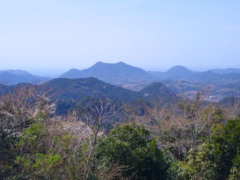
View south from the top of Mt Goten

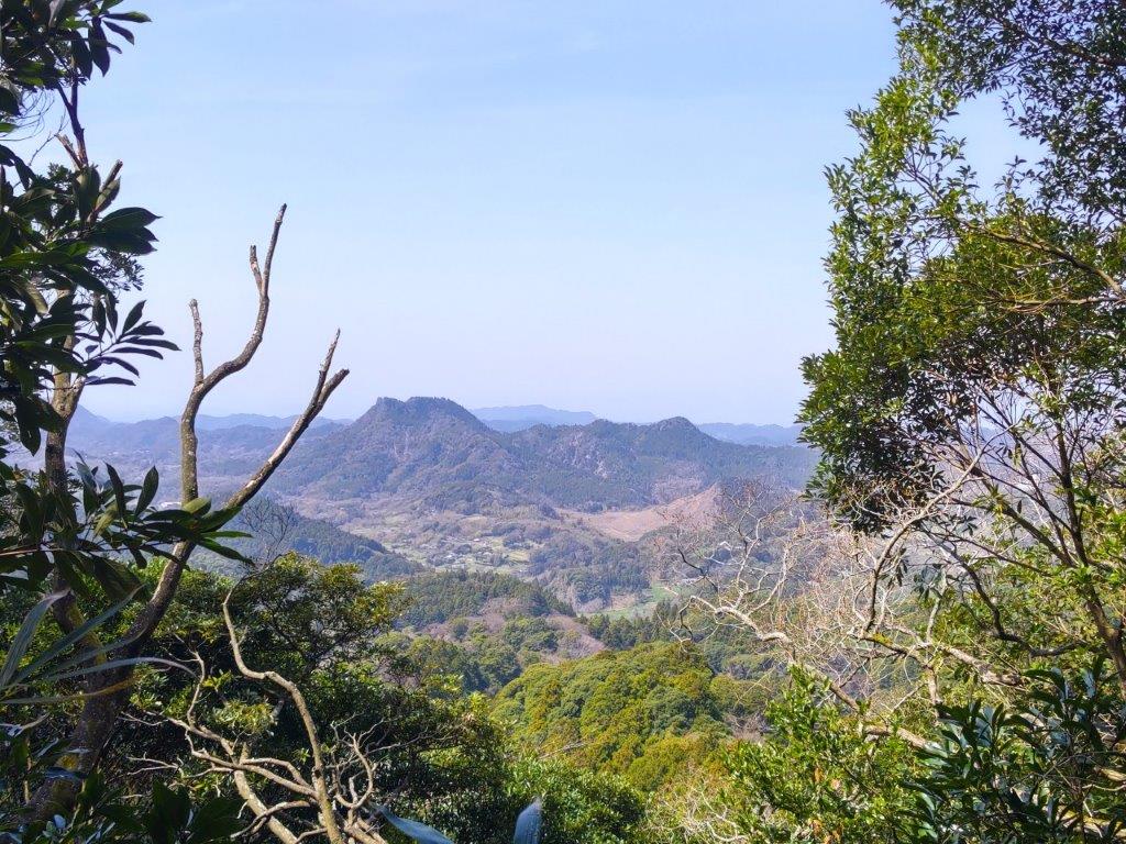
View West of Mt Tomi and Mt Iyo from the top of Mt Goten
I had forgotten how impressive the view was, arguably one of the best on the peninsula. Since the summit is equally far from each coast, both Tokyo Bay and the Pacific Ocean are visible. On the west side, I could see Mt Iyo and Mt Tomi, and behind, the jagged top of Mt Nokogiriyama. All 3 peaks have unique shapes, creating a view worthy of a fantasy world. It was too early for lunch so I headed back down the steps and took a path on the left, leaving the ridgeline. The trail descended steeply and was at times rather faint, although the occasional log step showed I was on the right way; I eventually reached a stream at the bottom of the valley. The hike was starting to feel quite adventurous and I was a little worried I would suddenly reach a dead-end after one of the many twists and turns in the path as it now followed the meandering stream.

Walking under the Fallen Trees

Partially Buried Section
I was relieved to finally reach a forest road, right after crossing the stream. I still had to navigate a couple of obstacles, some fallen trees and a partially buried section, but eventually it became easy to walk. I heard the croaking of frogs again, and this time saw several soaking in the shallow pools along the road side. At 1h30 I reached the end of trail, marked by a domestic cat lounging on a paved road. After a short walk through the countryside, I reached a main road where I turned left. I soon turned left again, onto a smaller road, leading to a short, dark tunnel. A little beyond it, I crossed a bright red footbridge over a dammed river, its muddy waters light brown under the shining sun. On the other side, I headed up the trail for today’s second peak.

Near the end of the Mt Goten Trail

Dammed River between Mt Goten and Mt Kyozuka
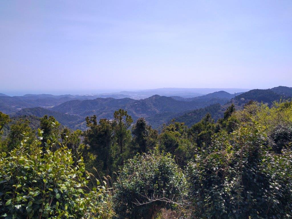
It was delightfully cool in the shade under the trees on what was turning into quite a warm day. At a bend in the path, I came across an ancient mossy stone lantern, making me feel like I had stumbled into a Ghibli movie. After a short steep climb, I found myself surrounded by Japanese stone oaks (“matebashii“), their white tree trunks reaching up like an upside-down mangrove. A little after 2h30, I reached the summit of Mt Kyozuka (経塚山 きょうづかやま kyouzuka-yama). On the east side, I could again see the Pacific ocean, this time much closer. I sat on a log seat for a late lunch; I had somehow fallen behind schedule, the times indicated on the map being a little off, so I quickly moved on, now following a trail heading southwards and downhill. Half an hour later, I emerged onto a road leading through fields to a main road where I turned left, soon arriving at a bus stop.

View of the Pacific Ocean from the Top of Mt Kyozuka

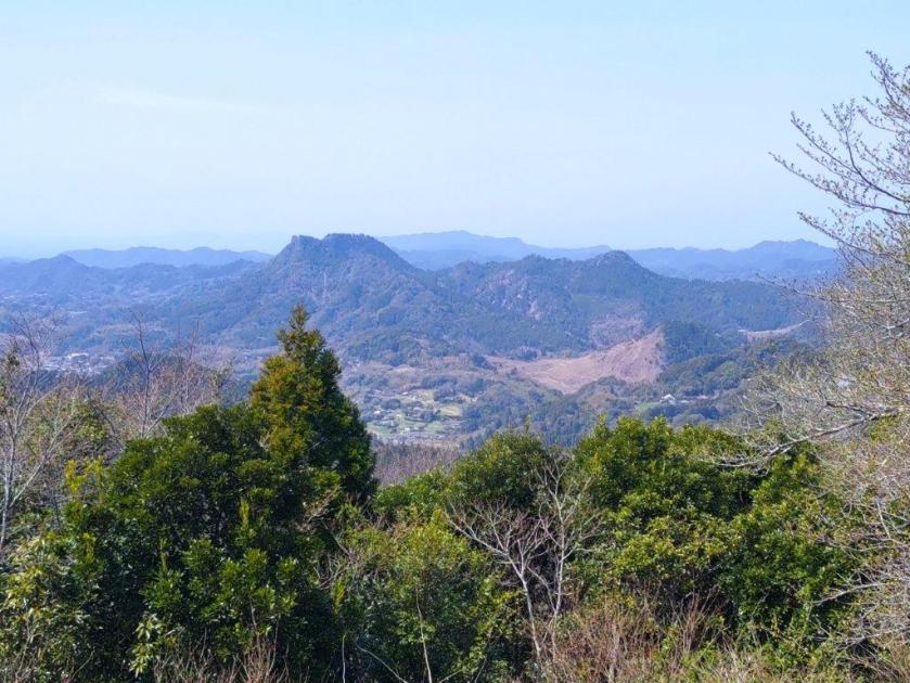
Looking back at Mt Kyozuka from the End of the Hike
From Tateyama station, I rode the local Uchibo line to Hama-Kanaya station, where I switched to the Tokyo Bay Ferry for the forty-minute trip to Kurihama port. Mt Fuji was hidden by the clouds but it was refreshingly cool and pleasant around sunset. On the other side of the bay, it was a short bus ride to Keikyu-Kurihama station, from where it was thirty minutes to Yokohama. There I rode the Shonan-Shinjuku line back to central Tokyo. This hike took a little longer than expected, and although the connection between Mt Gozen and Mt Kyozuka is doable, it requires a GPS device to ensure one doesn’t lose the trail. In the future, I’d like to return to the area by car for some more exploring.
Watch the Video of the Hike on YouTube


See a Slideshow of More Pictures of the Hike
