
I wanted to do a hike with little elevation gain, since I had been out sick for the past two weeks. I decided to continue my hike along the Hanno Alps, from where I had left off two years ago, as well as explore more of the newly created Oku-Musashi Long Trail. Looking at my map, I saw I could follow a couple of new trails allowing me to get on and off the “Alps”. I would take a bus from Hanno station to Nakazawa, at the end of the line, then walk to Maezaka Pass. I would end the hike at Musashi-Yokote-station, on the Seibu-Chichibu line. The weather was supposed to be sunny with temperatures reaching 20° Celsius in the afternoon, a record for the season. I had hiked most of this trail nearly ten years ago, and remembered it was mostly in the trees. I expected few views on the way; since the elevation was relatively low, I hoped to still see some Autumn colours. I was looking forward to exploring some new trails, along a familiar route.
Hiking in Oku-Musashi 奥武蔵
Hiking the Hanno Alps 飯能アルプス
Read this Blog Post on Hiking Around Tokyo

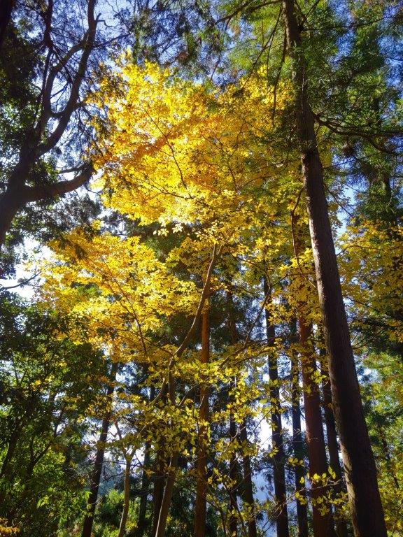
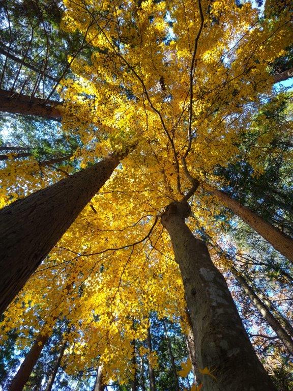
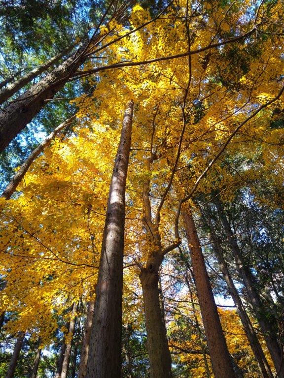
Autumn Leaves Along the Trail
It was a perfect blue sky day as I rode the Laview limited express to Hanno station. There, I skipped a long line of hikers headed for Bonomine, and boarded a mostly empty bus for the short ride to Nakazawa (中沢), at the start of the road leading to Takedera. Morning frost on the road and a biting cold in the shade reminded me that it was nearly the start of Winter. After a short walk up a road, I reached the entrance to the hiking trail at 9h30.
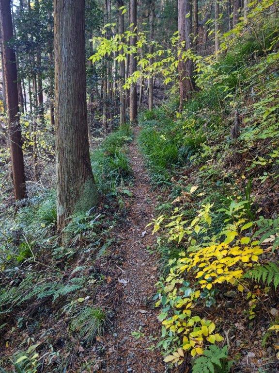
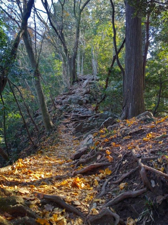
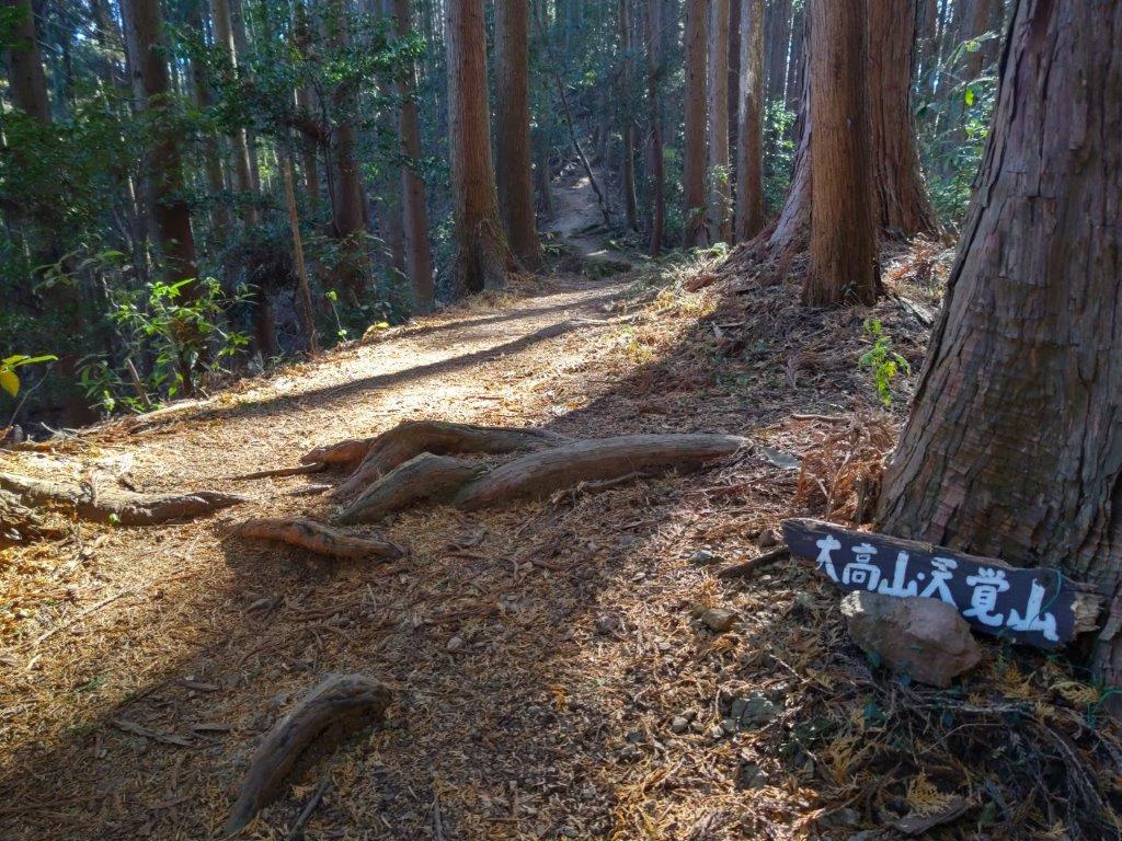
Start of the hike (left) Rocky Section before Mt Otaka (right)

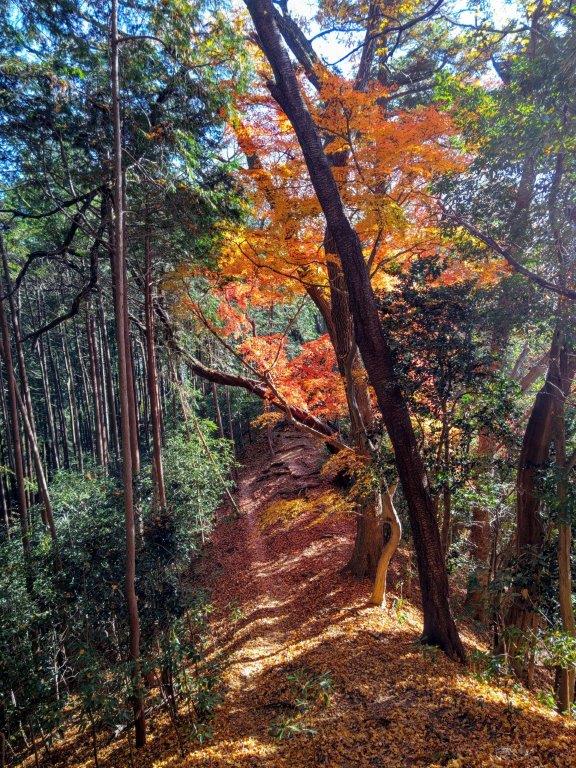
Flat Section past Mt Otaka (left) Maple Tree on the way to Mt Tenkaku (right)
I was happy to be walking again in nature after a two-week break. After a short climb, I reached a level section; I sat down on a log in the sun to enjoy a late breakfast, while listening to the sound of birdsong. The trail then headed down a valley and I soon emerged onto a road, the same one I had followed on my previous visit. At a bend in the road, I rejoined the hiking trail, and at 11am, I arrived at Maezaka Pass (前坂峠). There, I turned right, heading southeast along the Hanno Alps (飯能アルプス) and the Oku-Musashi Long Trail.


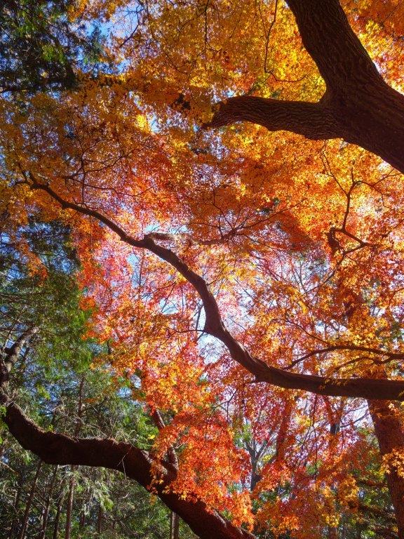
Maple Tree Past Oiwa Rock (left) Fantastic Tree along a Narrow Ridge (right)
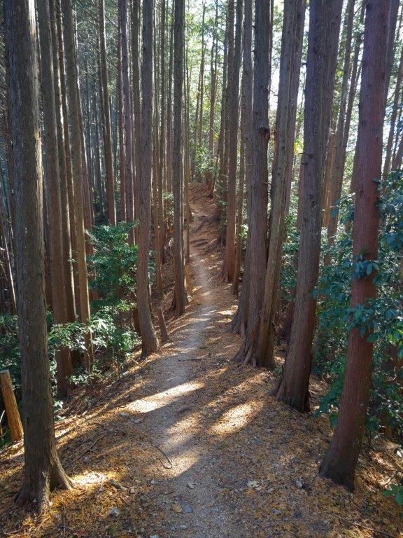

Trail Before Mt Tenkaku (left) Trail for Mt Kamado (right)
I spotted the first Autumn leaves of the day, halfway up a slope: a mix of orange and yellow, on a background of dark green cedar and bright blue sky. Soon after, I reached the summit of Mt Otaka (大高山 おおたかやま ootakayama). After peering at the view on the west side, I set off again. At the base of a steep slope, I passed under a huge Japanese maple, its leaves falling gently in the breeze. At noon, I arrived at Oiwa Rock, a a big boulder in the middle of the forest. After some ups and downs, and the occasional tree sporting its autumn colours, I reached the top of Mt Tenkaku (天覚山 てんかくざん tenkakuzan).
Joining the Hanno Alps at Maezaka Pass

Westward View from Mt Otaka
I was surprised by the wide view on the south side, proof that a refresher had been necessary. Southeast, I could see the Kanto plain, the central Tokyo skyscrapers barely visible in the midday haze; to the right was the outline of the Tanzawa mountains; southwest, slightly hidden by the trees, were the highest peaks of the Okutama mountains. Since it was 1pm, I found a bench in the sun and sat down for lunch. After spending some time basking in the sun, I set off again a little before 2pm. After some descending through Japanese pampas grass, I reached a paved road which I followed for a short while to Azuma Pass (東峠), where I rejoined the hiking trail.
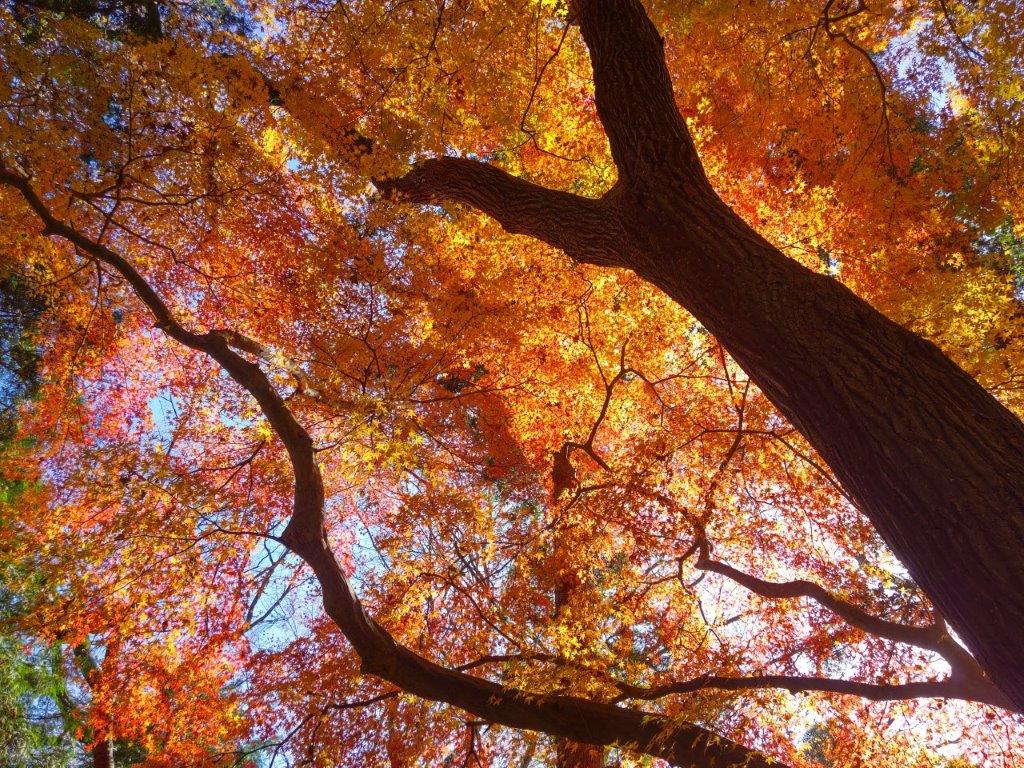
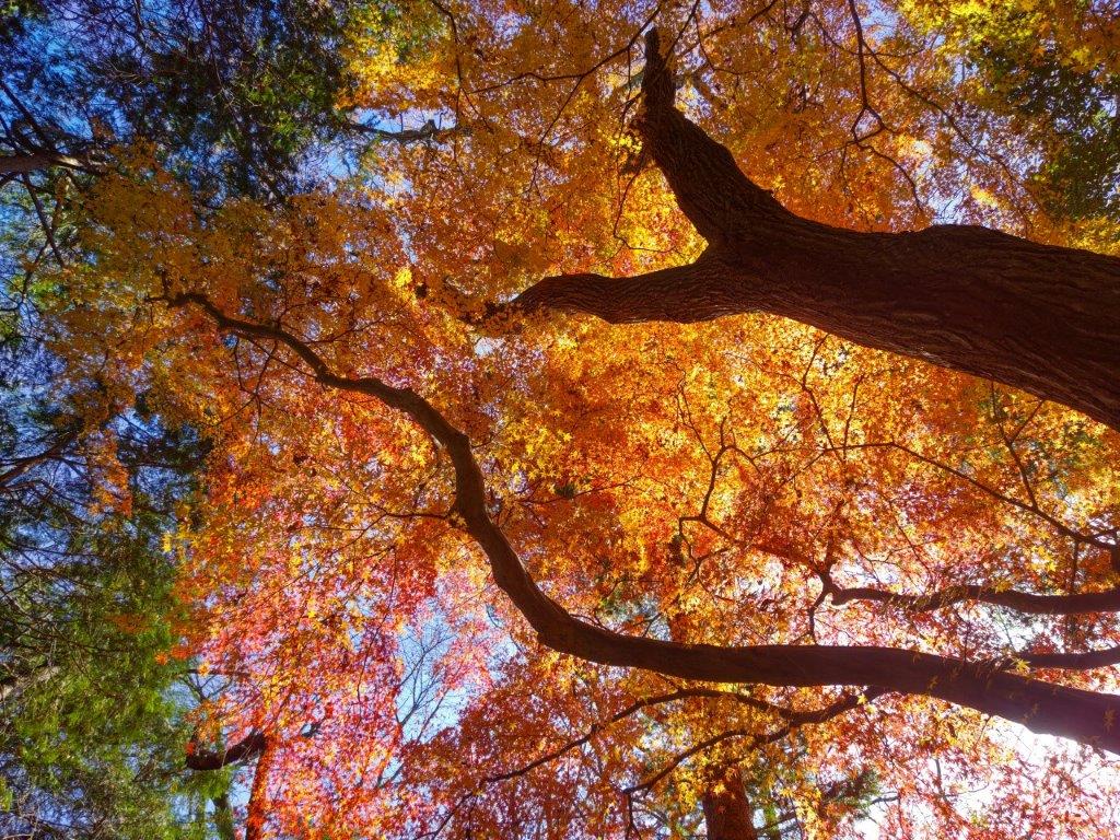
Orange and Red Japanese Maple Overhead

Explosion of Colours Above
The endless ups and downs of the next section made me feel that the “Alps” nickname was well-deserved. Through a break in the trees, I had a good view to the east of Mt Sukari; it was above Fudo-Iwa Rock, which I had to skip as I was running late. At a junction with a bench, I turned left, leaving the last part of the Hanno Alps for another day. At 3pm, I arrived at the last peak of the day, Mt Kamado (釜戸山 かまどやま kamadoyama), with only a narrow view on the south side. I rushed down the mountain side, popping onto a forest road a little before 3h30. After a short walk, I arrived at Musashi-Yokote station where I caught the train for Hanno, 3 stops away. There, I boarded the limited express for the 40-minute ride back to Ikebukuro.
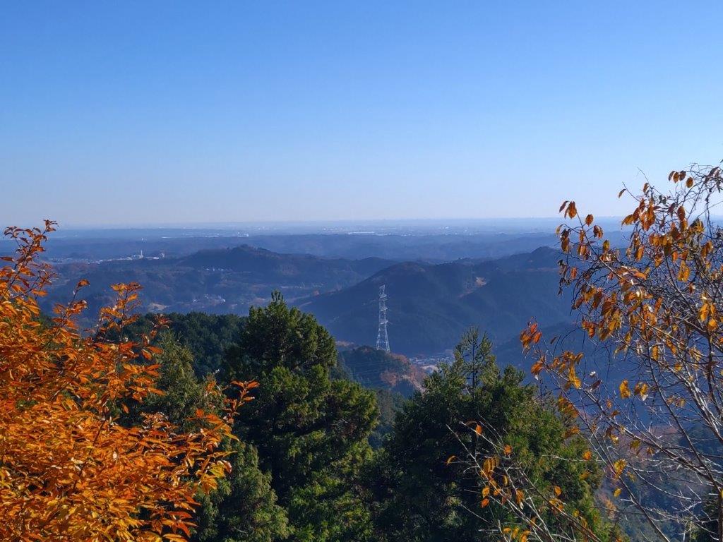
View of the Kanto plain from Mt Tenkaku

View of Mt Sukari from near Fudo-Iwa
The entire hike took me about 6 hours, including a leisurely break on the top of Mt Tenkaku. It was longer than I had planned for, and my knees were aching a little after all the ups and downs (I had neglected to bring my walking stick). Although I did pass several people along the way, there were a lot less hikers than would be expected on an easily accessible trail close to Tokyo; I did however see some families with very young children. I saw no on on the final part along Mt Kamado even though the signage was brand new. I was glad I got to see some beautiful autumn colours on the way, and I hope to one day redo this hike in the Spring.
Watch a Video of the Autumn Colours on the Mt Tenkaku Hike
Watch the Video of the Hike on Youtube


See a Slideshow of more Pictures of the Hike

Beautiful trail with beautiful colours!
Thank you! it was rather strange to hike in a t-shirt surrounded by autumn colours.