
I found this hike in my mountains of Tochigi guidebook. Although easily accessible by bus from Kanuma station, I hadn’t done it before since it was only 3 hours long. However, I had a vacation coming up in the next few days and since I didn’t want to do anything too strenuous, I decided to give it a try. I planned to follow the route in my guidebook, traversing the mountain from east to west. I had done several hikes from Kanuma before, so I was familiar with the area. The weather forecast was typical for December around the Tokyo area: blue skies and mild temperatures.
Get a Map of the Mt Futamata Hike
This map was developed for Japanwilds with the Hokkaido Cartographer
Find more Japan Hiking Maps on Avenza


View eastwards from near the north summit
It was a sunny winter day as I rode the Nikko limited express to Kanuma station, where I boarded a bus for the short ride to the base of today’s mountain. While walking to the parking near the trailhead, I passed a nice-looking cafe called Chiki, still closed at this time, and an unattended jam stand; I couldn’t resist buying a small pot of blueberry jam, made with locally picked berries, inserting the money into a small box attached to the stand.

View southwards from near the north summit
View of the Oku-Nikko mountains from the south summit
A little after 10am, I started up the trail, following a stream, and soon turned right up the Shimozawa trail (下沢コース). A steep switchback path through the forest led to the ruins of Shimozawa castle (下沢城跡 368m) where I had view north of the other side of the valley through a gap in the trees. The path then descended for a while to Fudo rock (不動岩) before heading up again. Around 11h30, I arrived at an area clear of trees around a small white building that served as a TV antenna.

View of Yokone highland from the south summit

The rocky summit of Mt Kogashi from the south summit
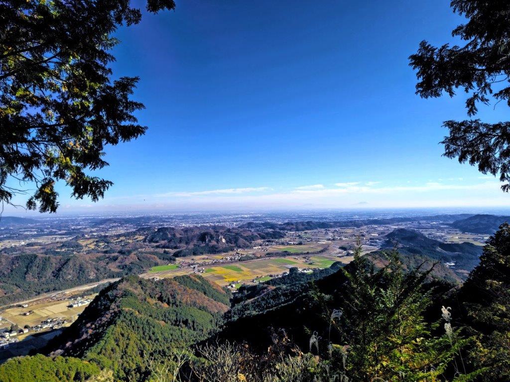
Looking south-east, I could see summit of Mt Tsukuba, poking through the haze on other side of the Kanto plain. A short distance away was the north summit (北峰 kita-mine) of Mt Futamata (二股山 ふたまたやま futamata-yama), a Tochigi 100-famous mountain, from where I had a great view of Mt Kogashi, directly to the east. The path dived down a steep ridge, so I decided to backtrack a few meters, and take a detour path on the west side., soon rejoining the main trail at a saddle between the two summits.

Viewpoint of the Ashio mountains from below the south summit


A newly created trail along the southern ridge
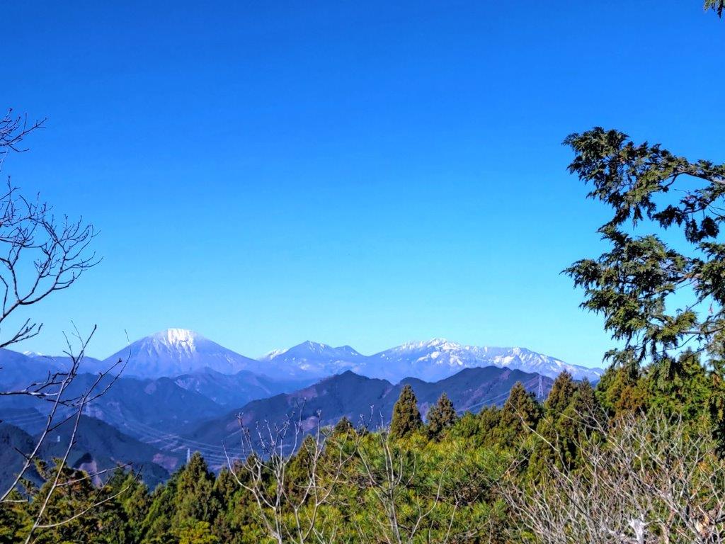
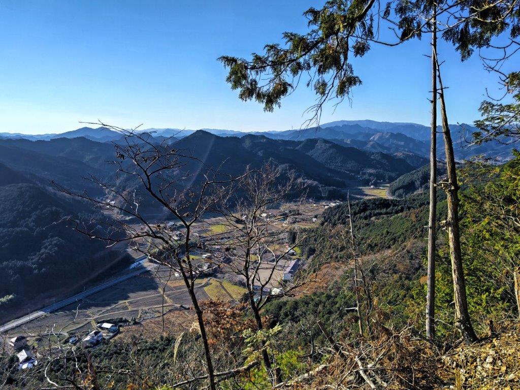
I turned right, up a steep rocky path, and a little after noon, arrived at the south summit (南峰 minami-mine) of Mt Futamata. To the north, I could see the snow-capped peaks of Oku-Nikko: Mt Nantai, Mt Taro and Mt Nyoho; on the west side was Yokone Highland (横根高原). I continued along the trail, heading downhill for a short while till I reached another viewpoint. From here, I could see the Kanto plain spreading to the south, and the Ashio mountains extending westwards.
View through the trees from the new ridge trail

There were several viewpoints on the west side
After a short break, I retraced my steps back to the North summit and followed a trail on the west side. I had planned to descend via the Shimokuga trail (下久我コース) but it was no longer in use. Instead, I followed signs for a new trail leading to Kazono (加園), created in June 2022, and simply called the “Ridge” trail (尾根コース one-kosu). The path was faint, but thanks to the frequent signposts, and my phone GPS, I was able to follow it without hesitation, along the narrow, southern ridgeline.

A quiet view spot above the Arai river valley

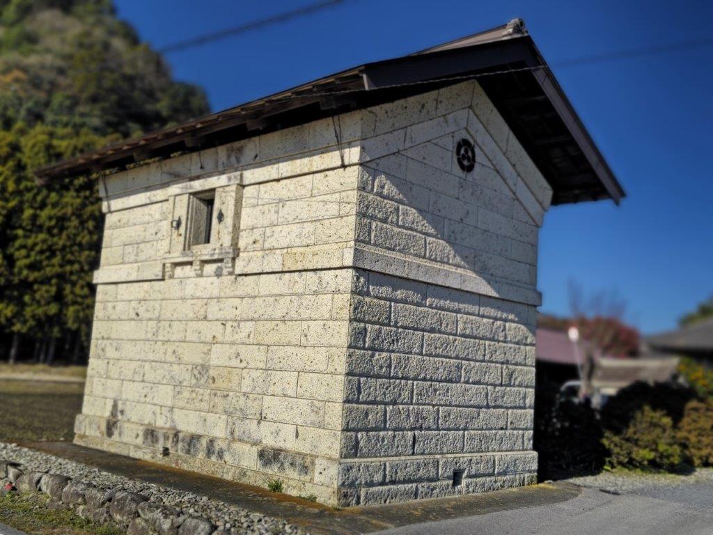
Traditional house at the end of the trail
I was pleased to have stumbled onto a longer hike, adding about 2 hours to the original time; I was the only one on the trail, enjoying the sun through the bare trees, and the occasional views on the west side. Around 2h30, the path turned left, descending in zig zag under towering cedars. Soon after, I was walking along the bottom of a quiet valley, the surrounding forest bathed in the late afternoon sun. A little before 3pm, I arrived at a road, a couple of kilometers south of my original route. After a short wait, I caught a bus back to Kanuma station, where I boarded the Tobu Revaty limited express for the comfortable ride back to Tokyo.
See the views along the Mt Futamata hike